The difference five years makes.

_DSF4759

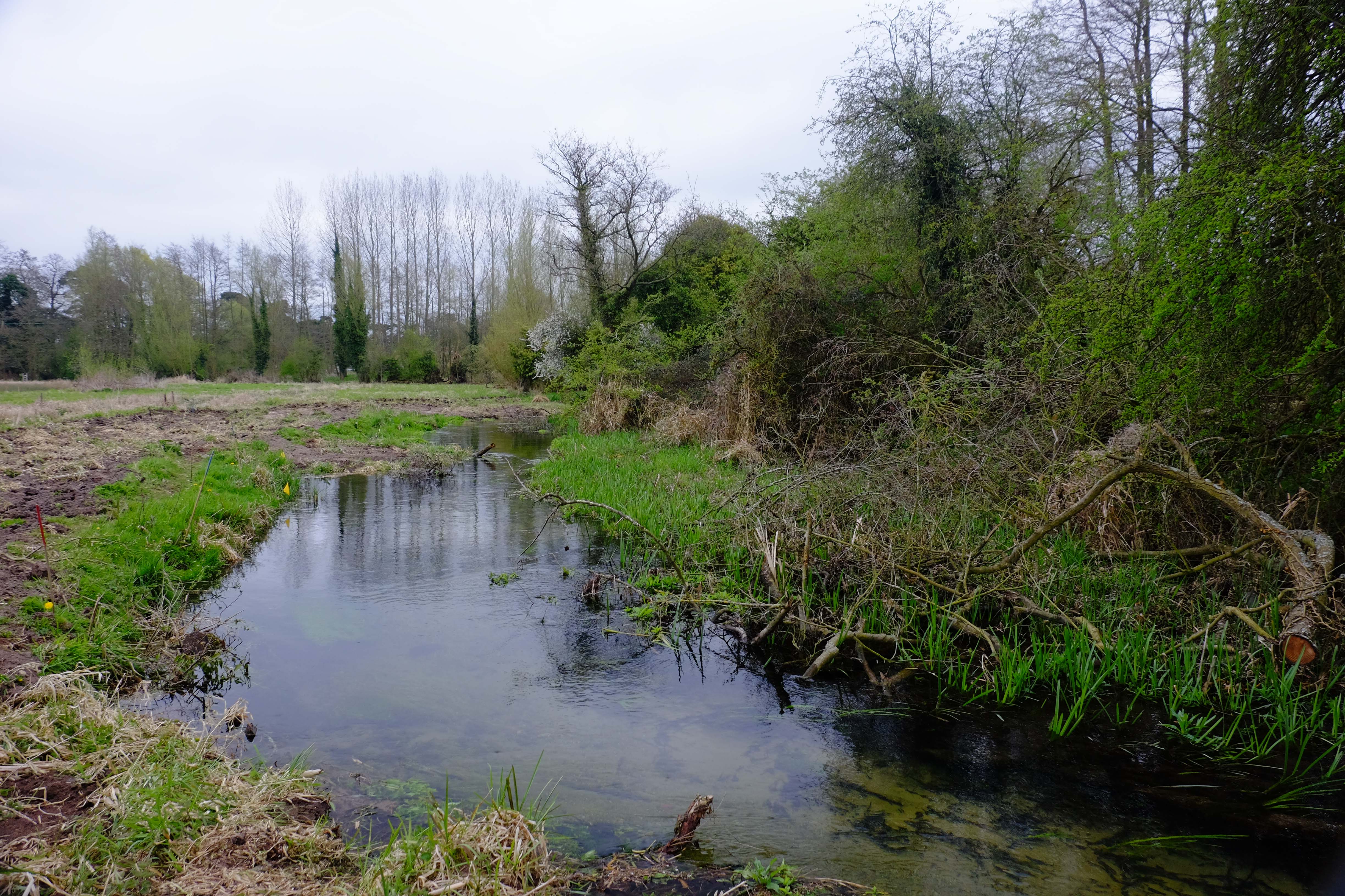
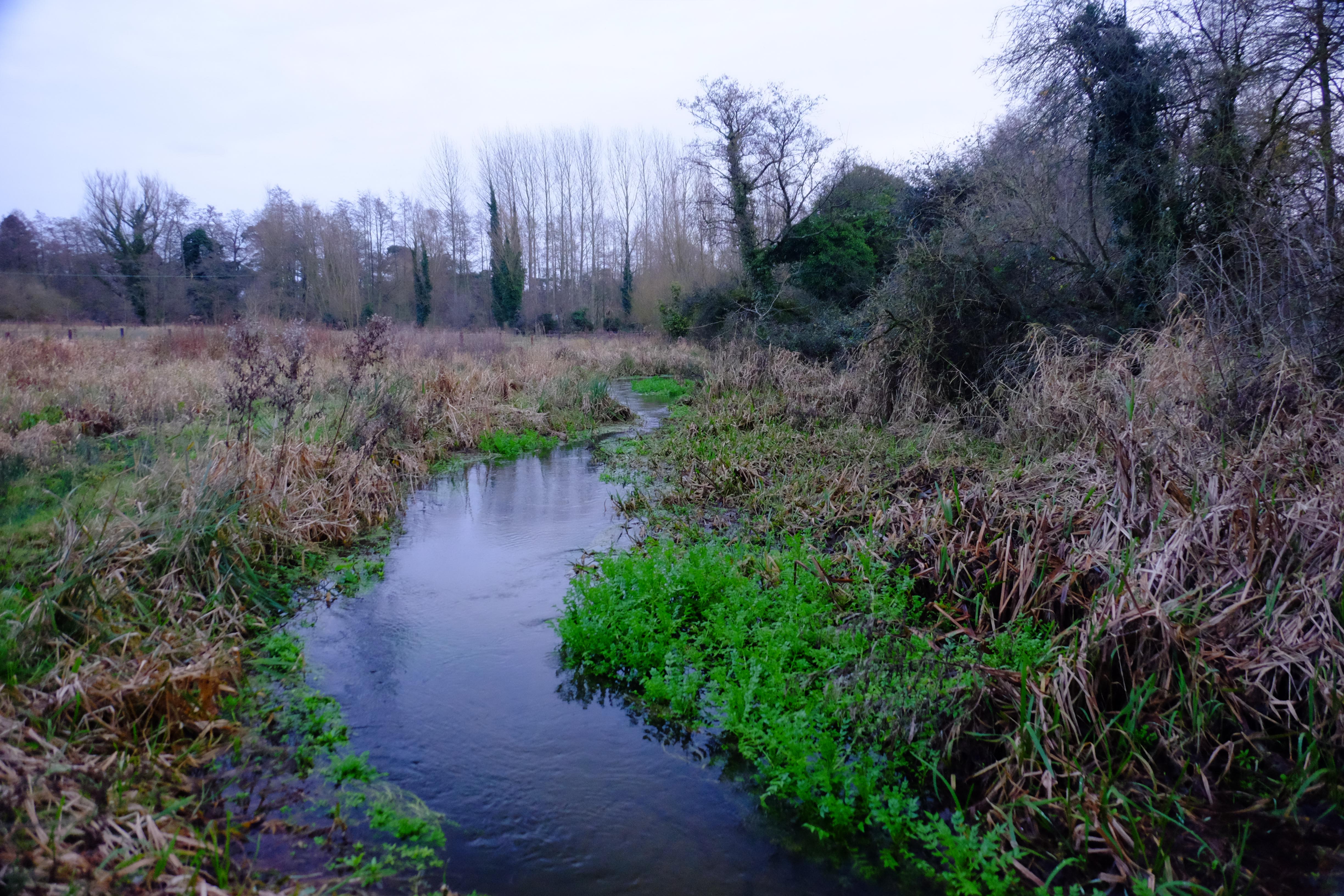
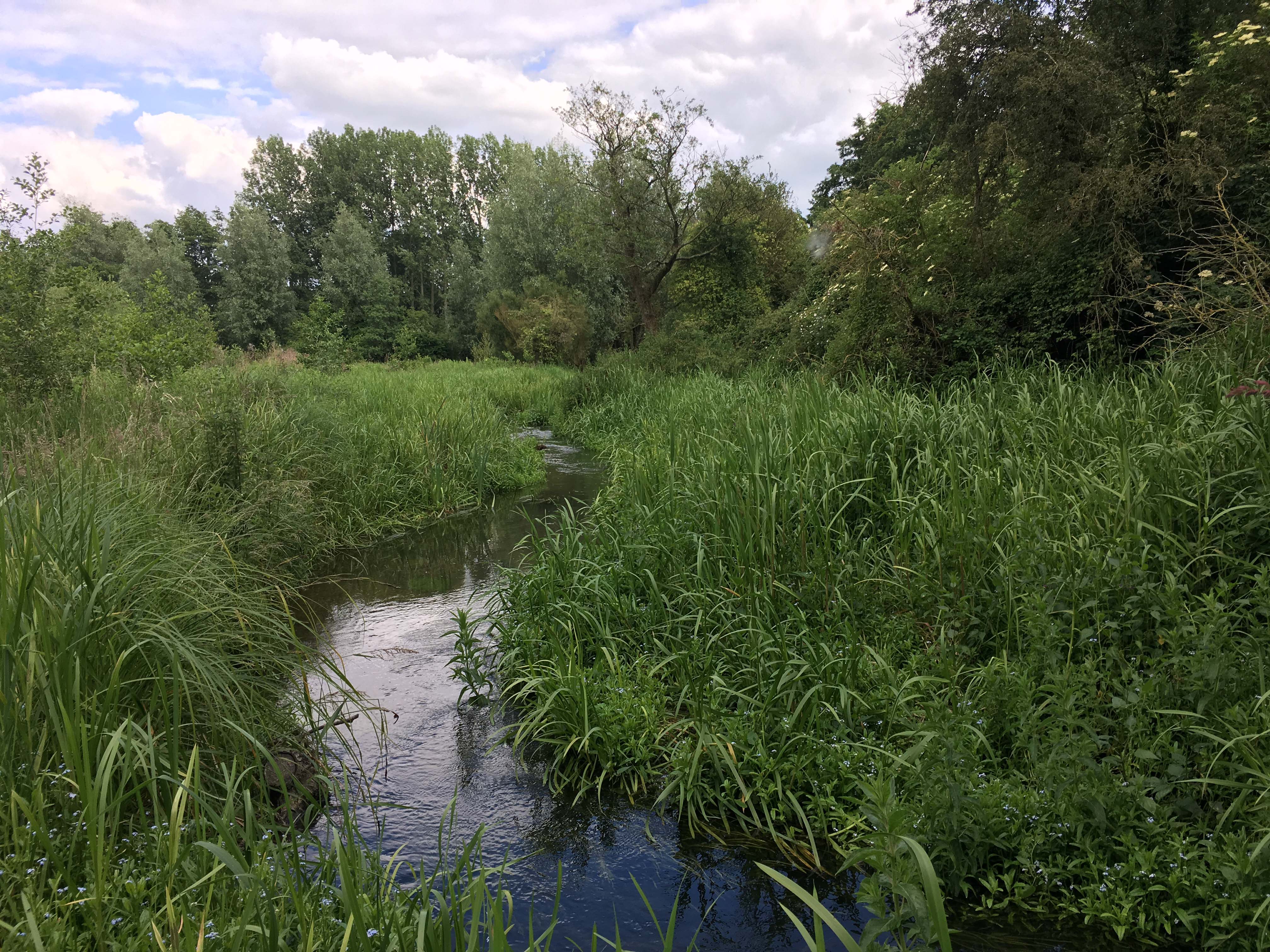
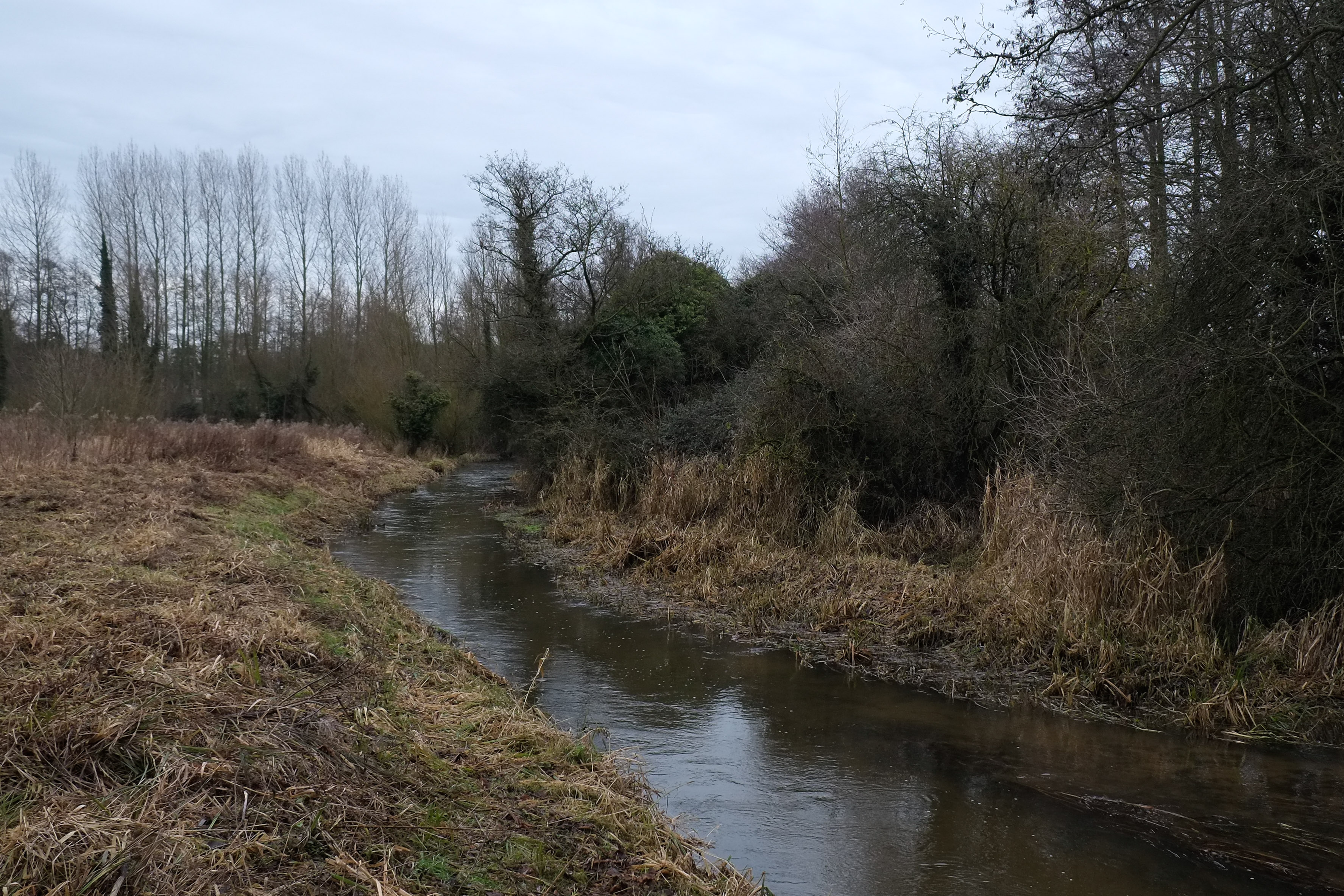
The photograph above of the River Nar near Castle Acre was taken in 2015, just after we had strimmed the banks ahead of rehabilitation works. The issues here were a dredged channel and a steeply domed riverbank piled high with the arisings. The channel is too wide and too deep. There is little hydrological connectivity except on the far bank where a berm has formed within the overwide channel. The ‘dredging’ which was more the result of mechanised weed-management than a concerted dredging effort had taken place annually, and always from the same bank. The programme was haphazard too, in that no clearing was done in inaccessible parts of the river: in the far distance a line of trees had protected the river and here the bed is undamaged. In an ideal world we would have built up the river bed with gravel before doing any other work, but gravel was not easily available here and our budget precluded us from bringing any in. We did fill two short sections in the reach as photographed. Otherwise the work consisted of installing LWD and then re-grading the bank to create a narrow, sinuous channel and a much lower bank profile which the river can – and does – spill over in high flows. The progression of photos below shows the evolution of the work over the following years: 2016, 2017 and 2019.

DSCF7368
DSCF9247
IMG_6457

Newton Common – a new bed to lie on

Now that the project is two years old I thought I’d share a few before and after shots of the work. Newton Common is the next reach of river downstream of Emmanuel’s Common. You can see from the before photos that river here had been canalised and deepened and was as a result pretty much overrun with bur-reed.

I made a long-section survey of the river-bed which revealed the places where the bed had been lowered below the natural fall-line of the river. Each of these was effectively a sump. The resultant siltation was the river’s attempt over time to repair itself: we gave the stream a helping hand with as complete an infill of gravel as we could manage within the budget and the time.

NarNewtonC'n + Hall Meadow2 18:11:16 copy

A bed-level survey revealed the sump-like reaches where the river had been lowered beneath the fall line of the valley. The Newton Common project is marked by points 1 to 29.

NarNewtonC'n + Hall Meadow 18:11:16

DSCF6129

DSCF6575

DSCF0928

DSCF8537

The top image was taken in October 2016: the channel is covered with burr reed. The second image was taken before the project began and shows how deep and wide the dredged channel was. The third image was taken just after the gravel went in, April 2016 and the fourth was taken two years later in April 2019

DSCF6127

DSCF0980

DSCF8534

The top image was taken in October 2016, the middle image during the project and the bottom image in April 2019: note the presence of ranunculus and berula!