XYZ

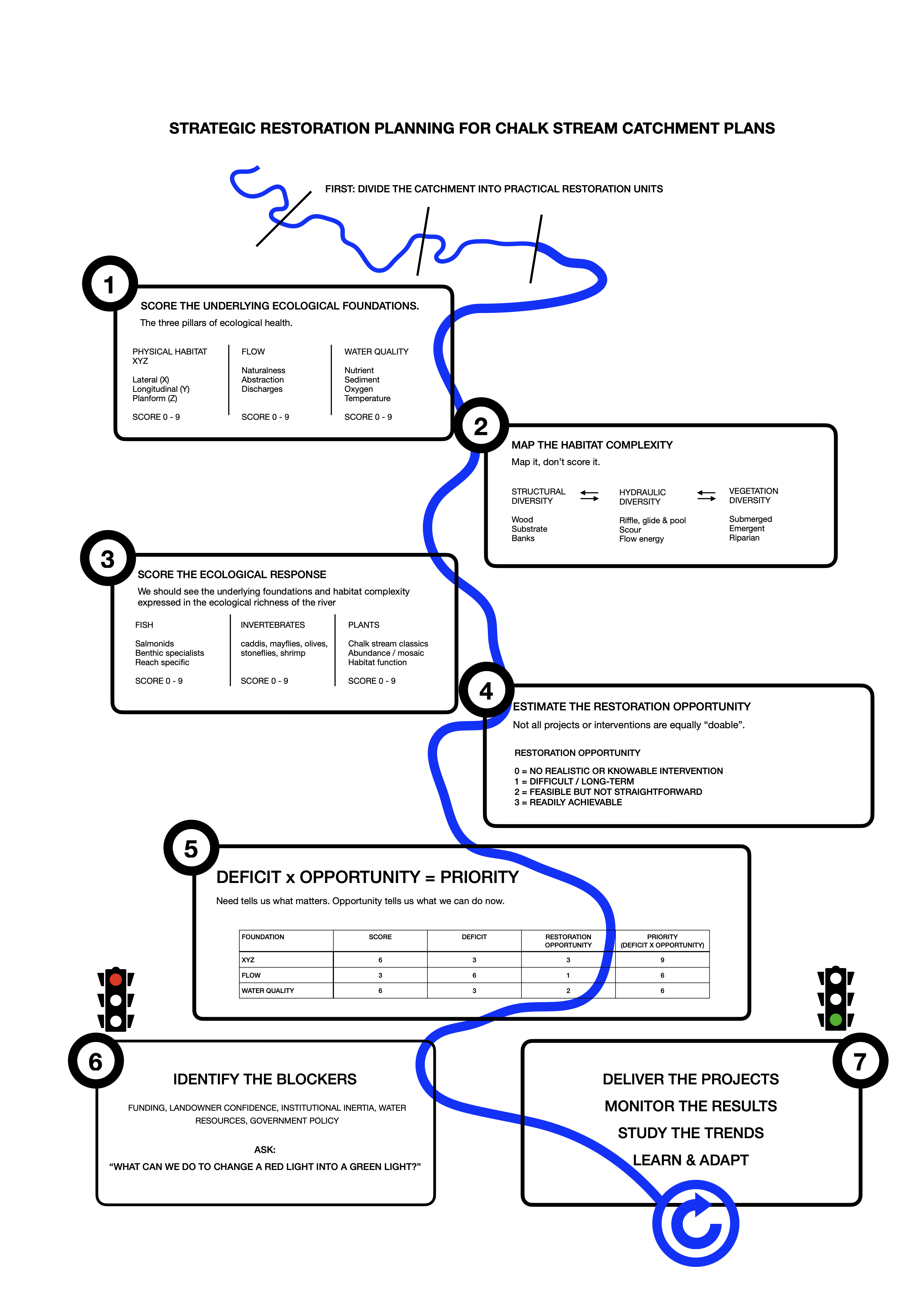
In the last post I outlined a simple way of trying put together a sensibly ordered catchment restoration strategy by scoring the underlying foundations at a reach scale – habitat, flow and water quality – working out where the deficits are, working out the feasibility of addressing each of them, multiplying one by the other and arriving at a strategic order of projects.

A few of the other slides I showed to the Test and Itchen group outlined in broad-brush terms how it might look at a catchment level with a look at the River Anton as an example. I’ll put those slides in the next post.

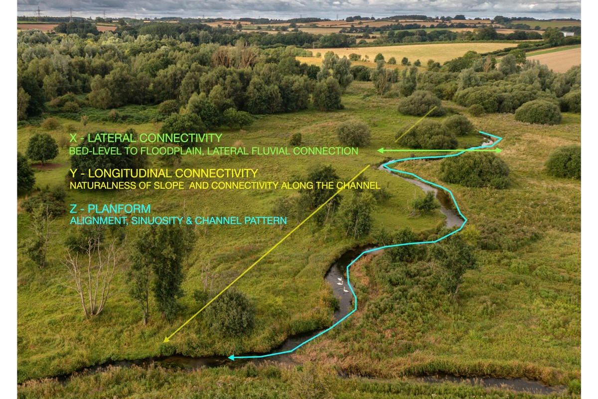
The first thing to look at in a little more detail, however, is the underlying foundation of physical habitat, that can be broken down into three physical dimensions that I call the XYZ. Lateral (X) and longitudinal (Y) connectivity and planform (Z). In my view, these foundational elements are THE most important thing of all, because they very largely determine whether and to what extent a dynamic, varied habitat can form (all the pools, riffles, undercuts etc).

Most chalk streams have been modified in ways that remove or undermine the XYZ.

X

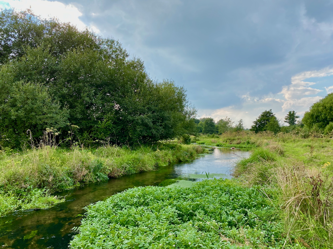
X is the lateral connectivity with the riparian edge and the wider floodplain. A consistent feature of natural (unmodified) spring-creek (groundwater dominated) streams is the close relationship between the stream bed and the floodplain surface. Chalk streams are the same, or should be. Simply put, when you stand on the hypothetical unmodified banks of a spring-fed creek your feet won’t be that much higher than the water surface (summer or winter) and the river bed is not that far down below that water surface either, at least not compared to a surface-fed system with a much wider range between low flows and high flows.

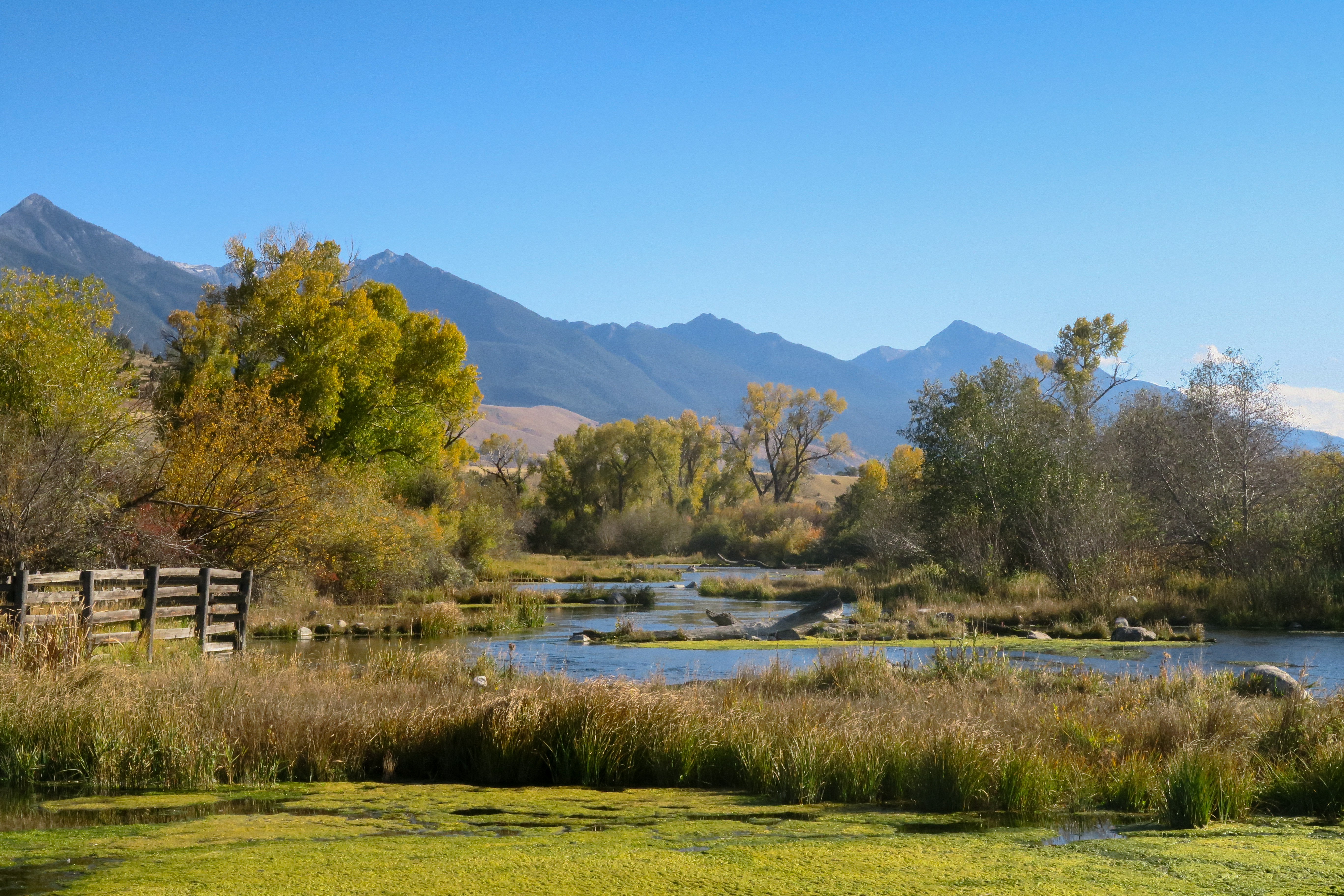
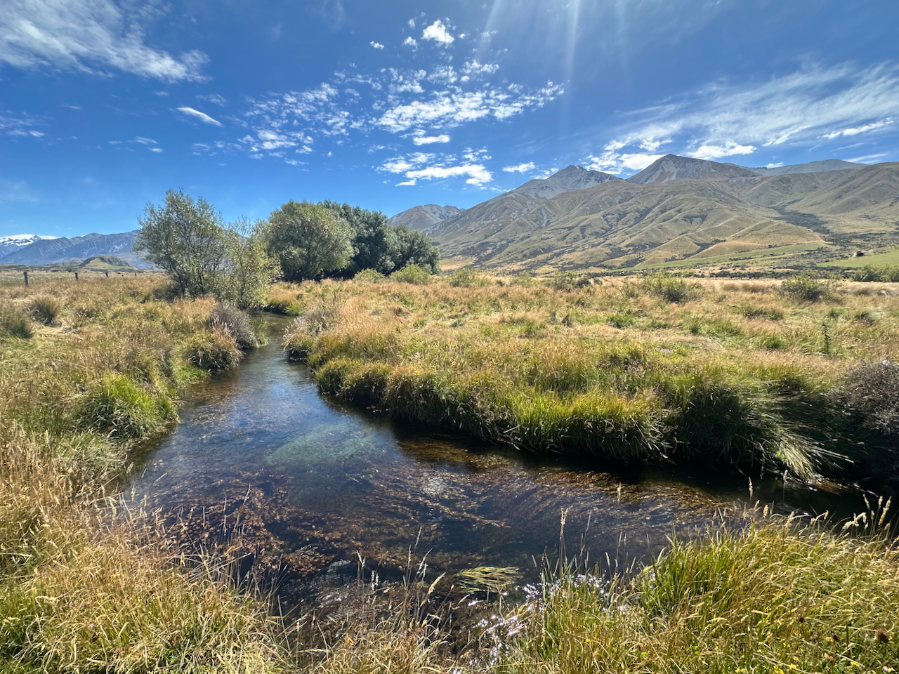
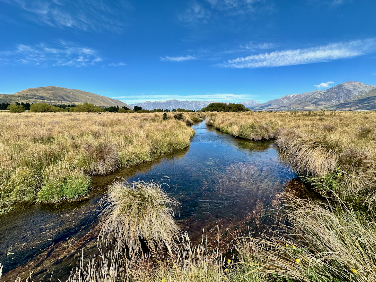
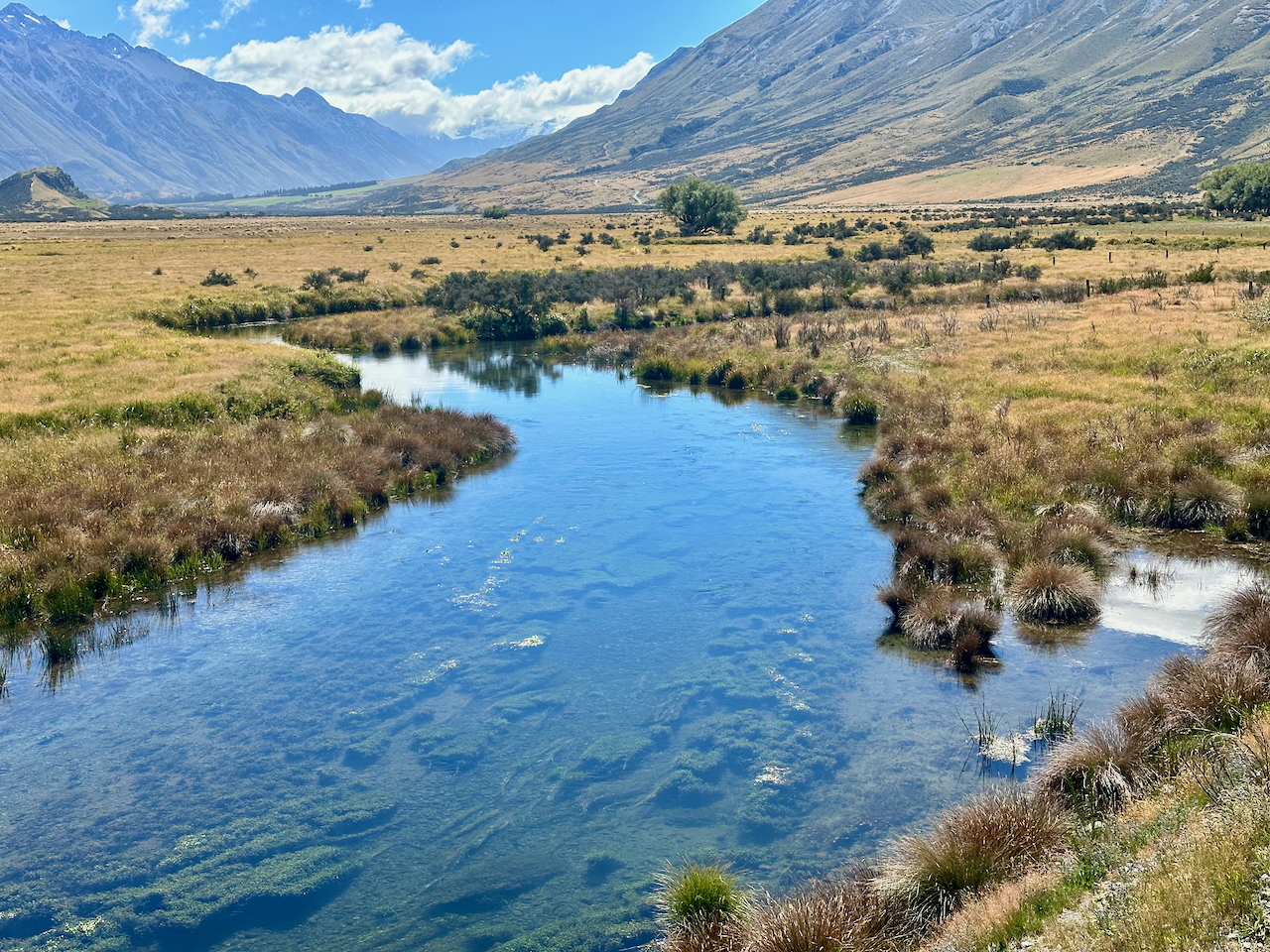
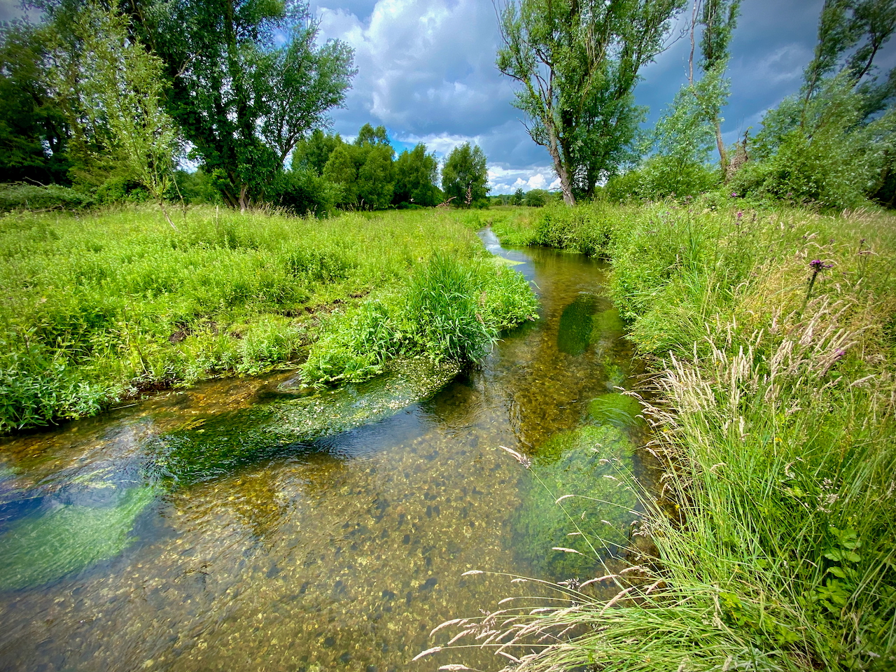
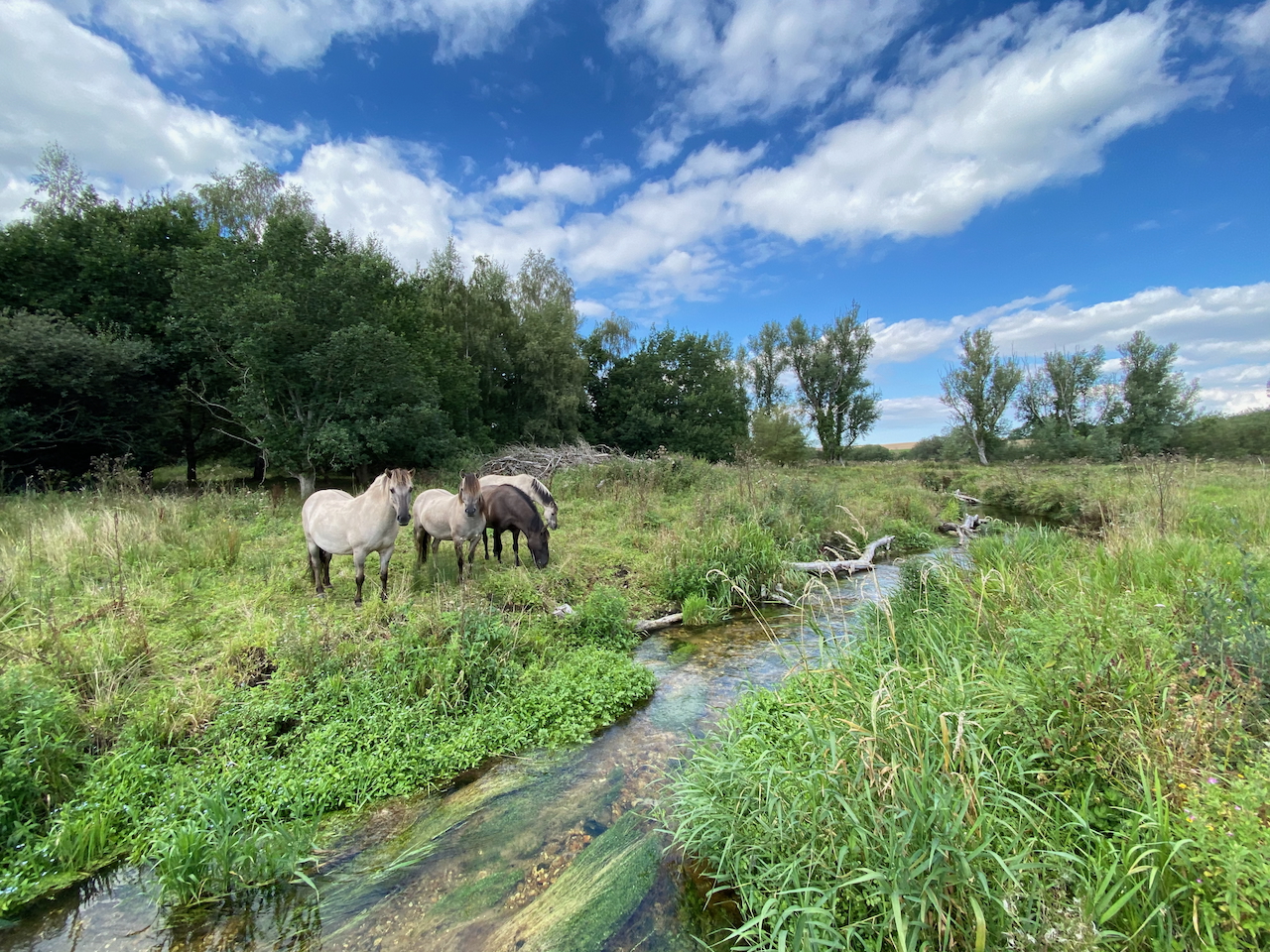
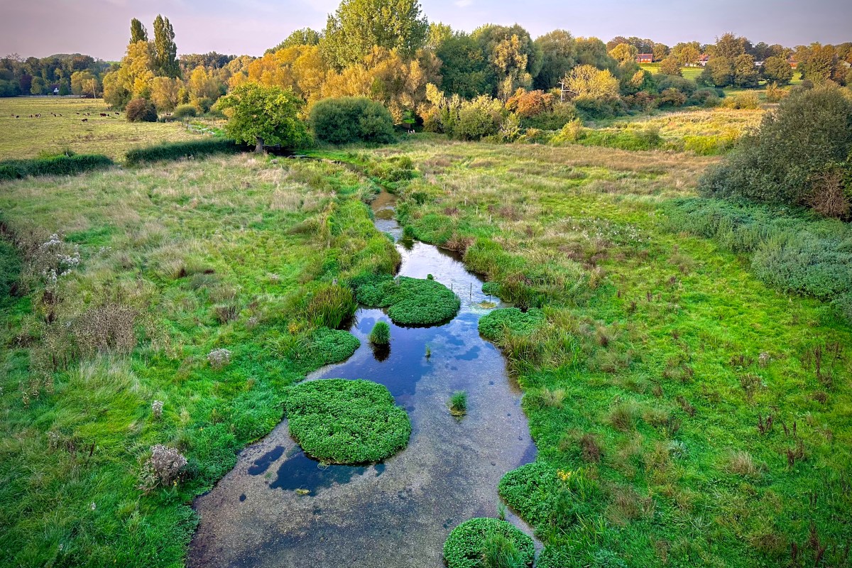
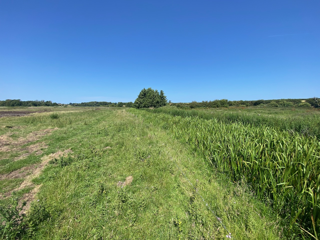
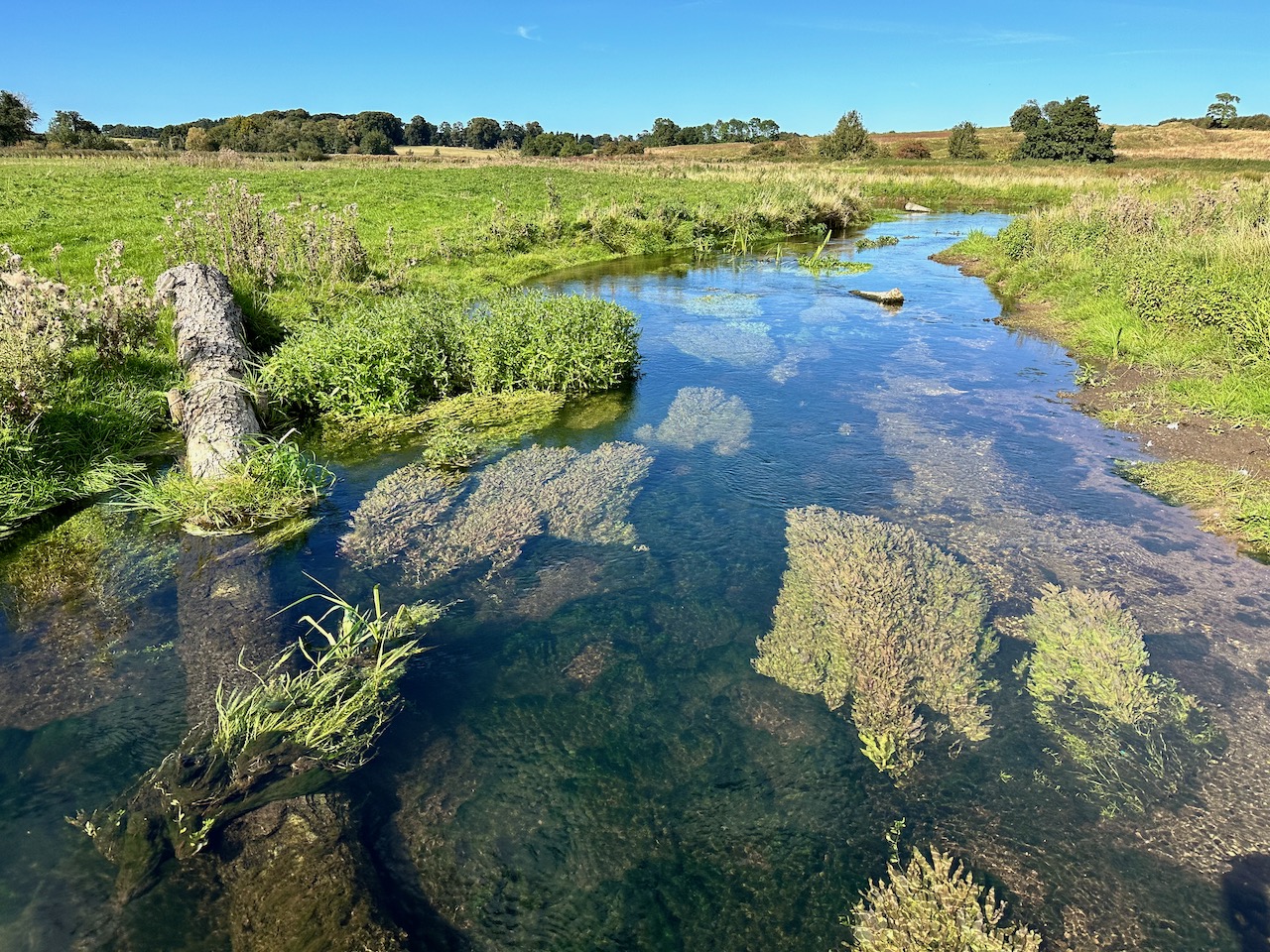
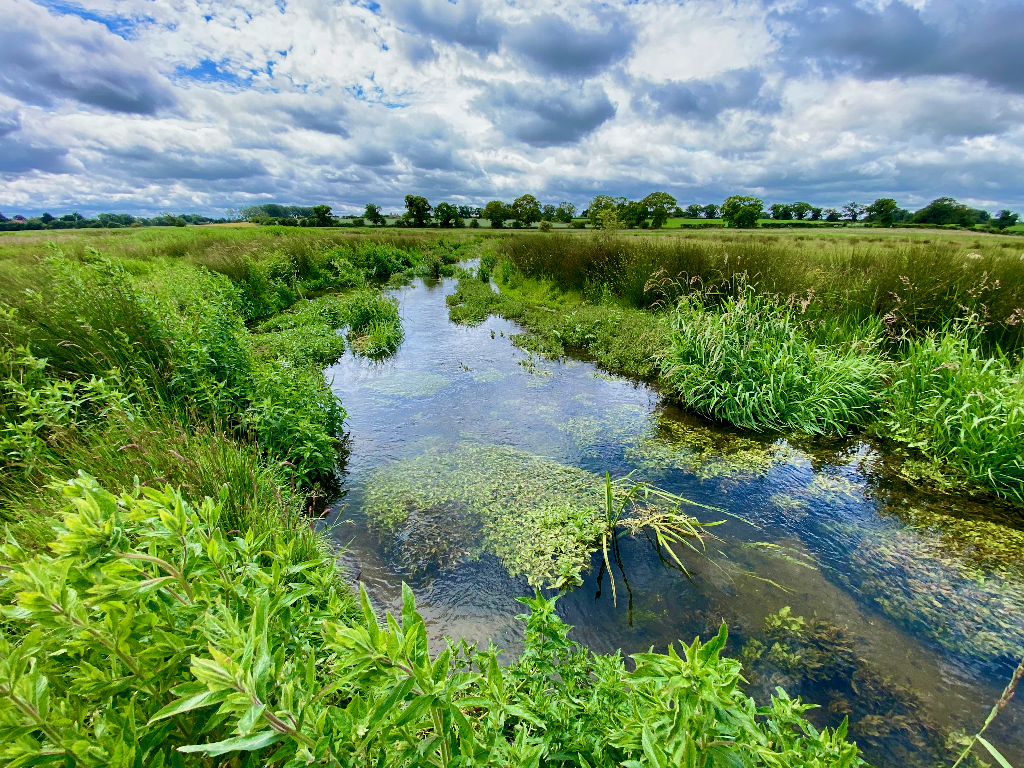
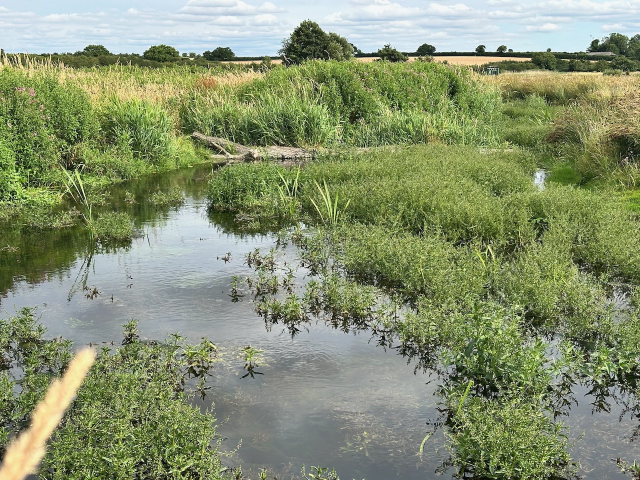
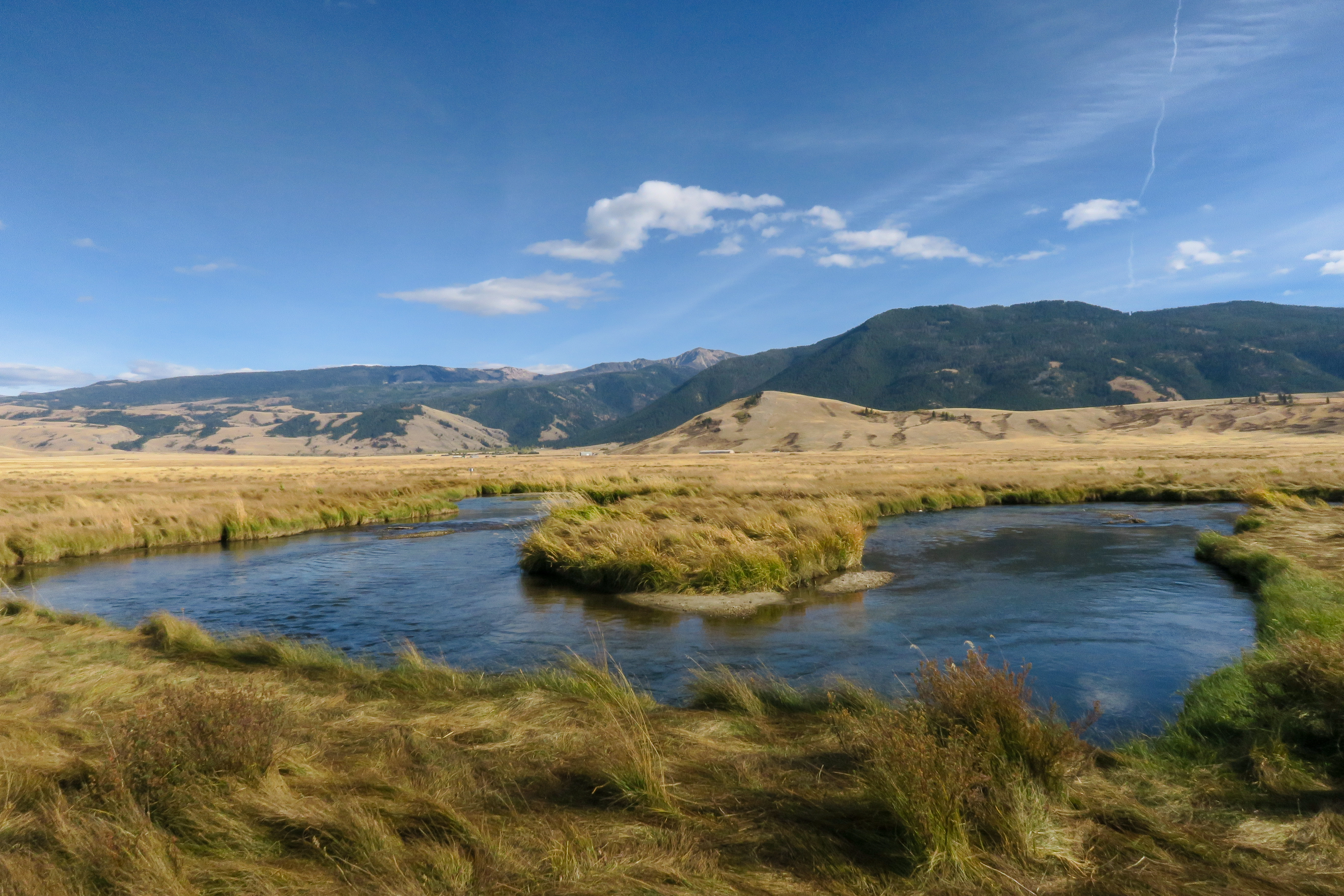
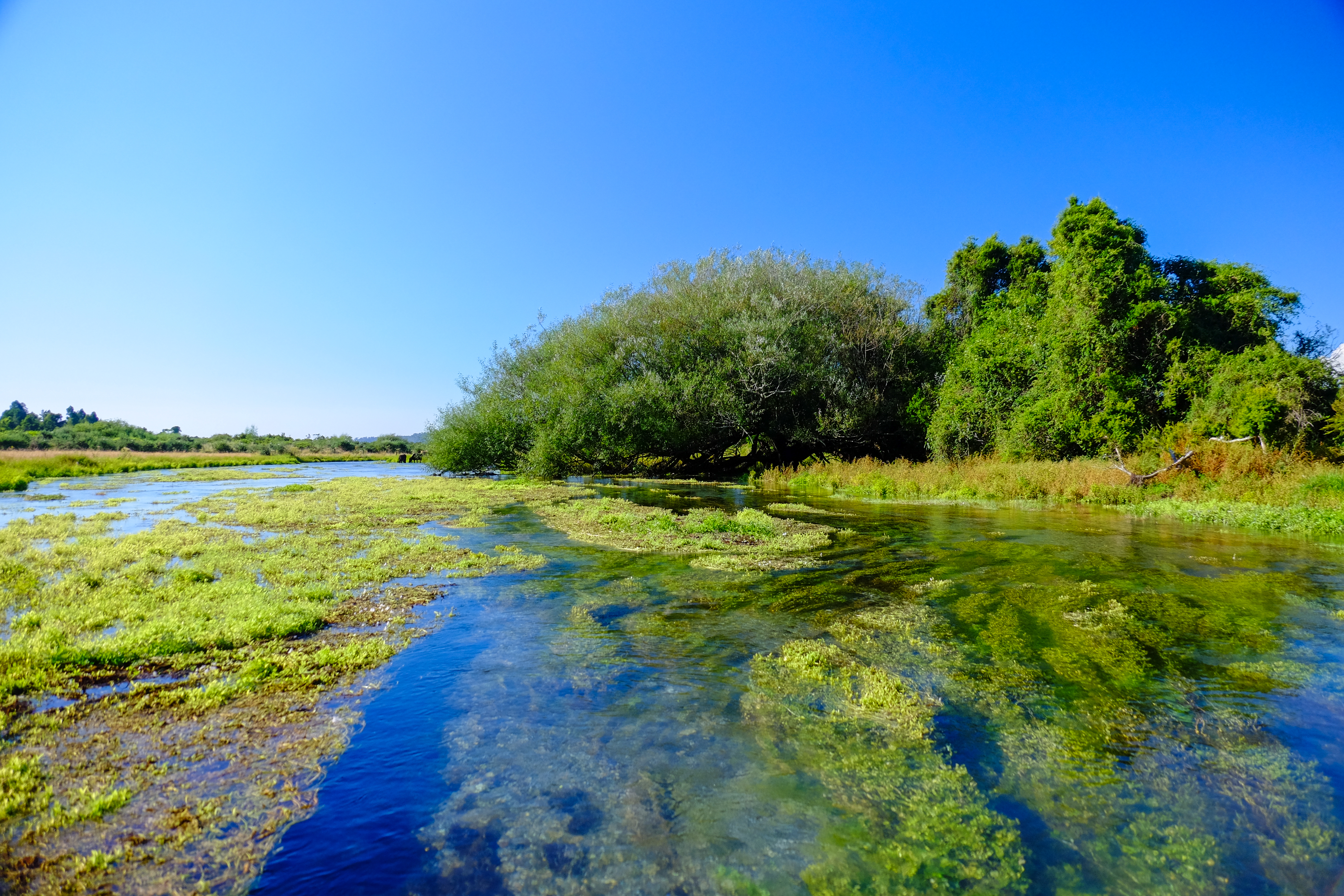
To illustrate what I mean, here are some pictures of relatively unmodified spring-creeks, in Wyoming, Montana and New Zealand. You can see how these streams are flush full and in touch with their floodplains, and that they are free-flowing too: the flushness is not because they’ve been backed up in any way. They tend to be quite wide and shallow (lacking the energy to erode downwards) and they flow from and through a high-water table. Generally speaking chalk streams should look like that, but many to most don’t because they have been diverted and / or dredged.
Y

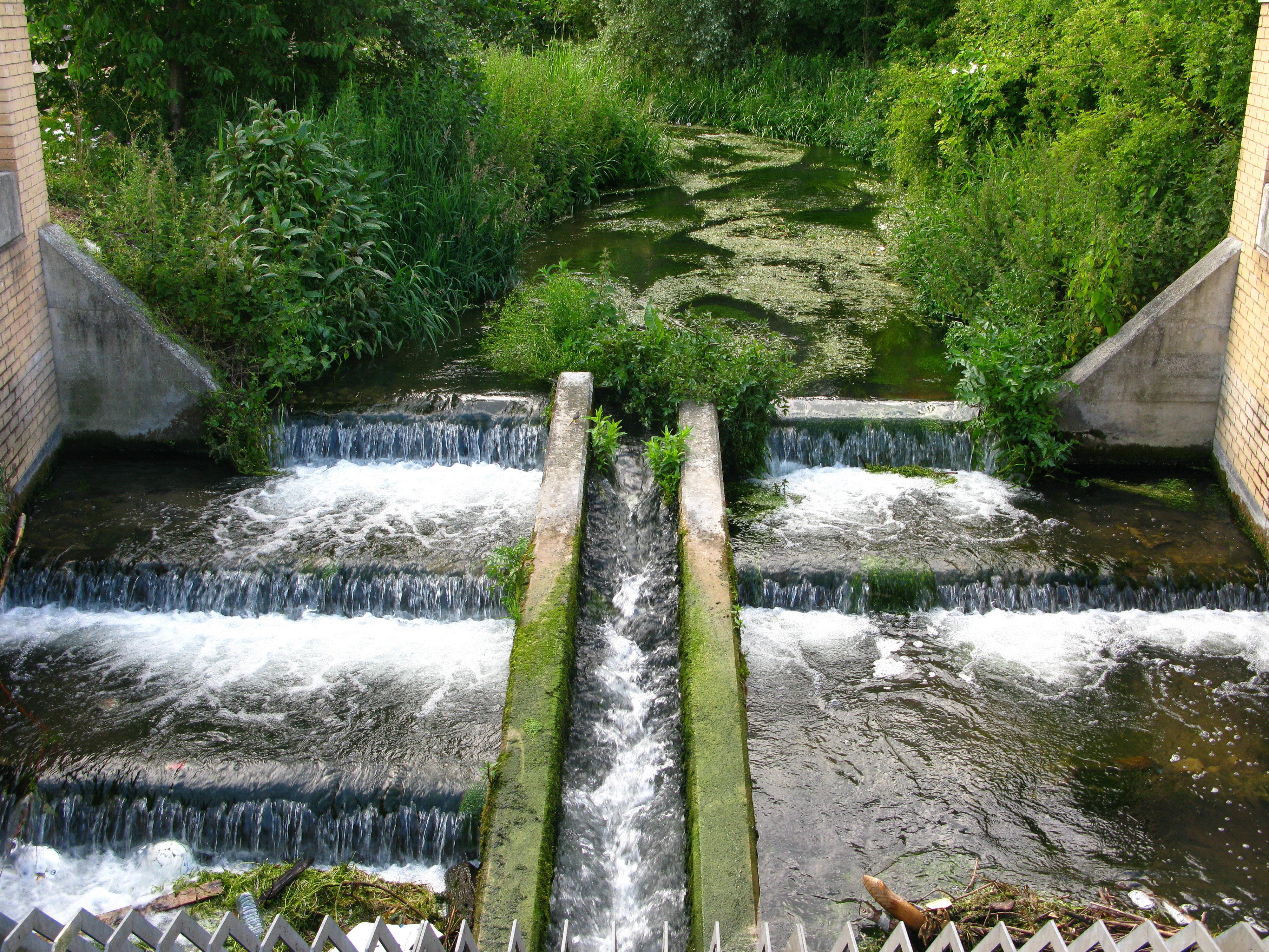
Y is the longitudinal connectivity – along the line of the channel. A natural chalk stream would likely feature hardly any major steps or interruptions in its longitudinal profile. Maybe beaver dams would create some steps, but in a undeveloped floodplain these would cause break-outs of flow around the sides, and one way or another the stream would travel unimpeded by large steps from the source to the sea.

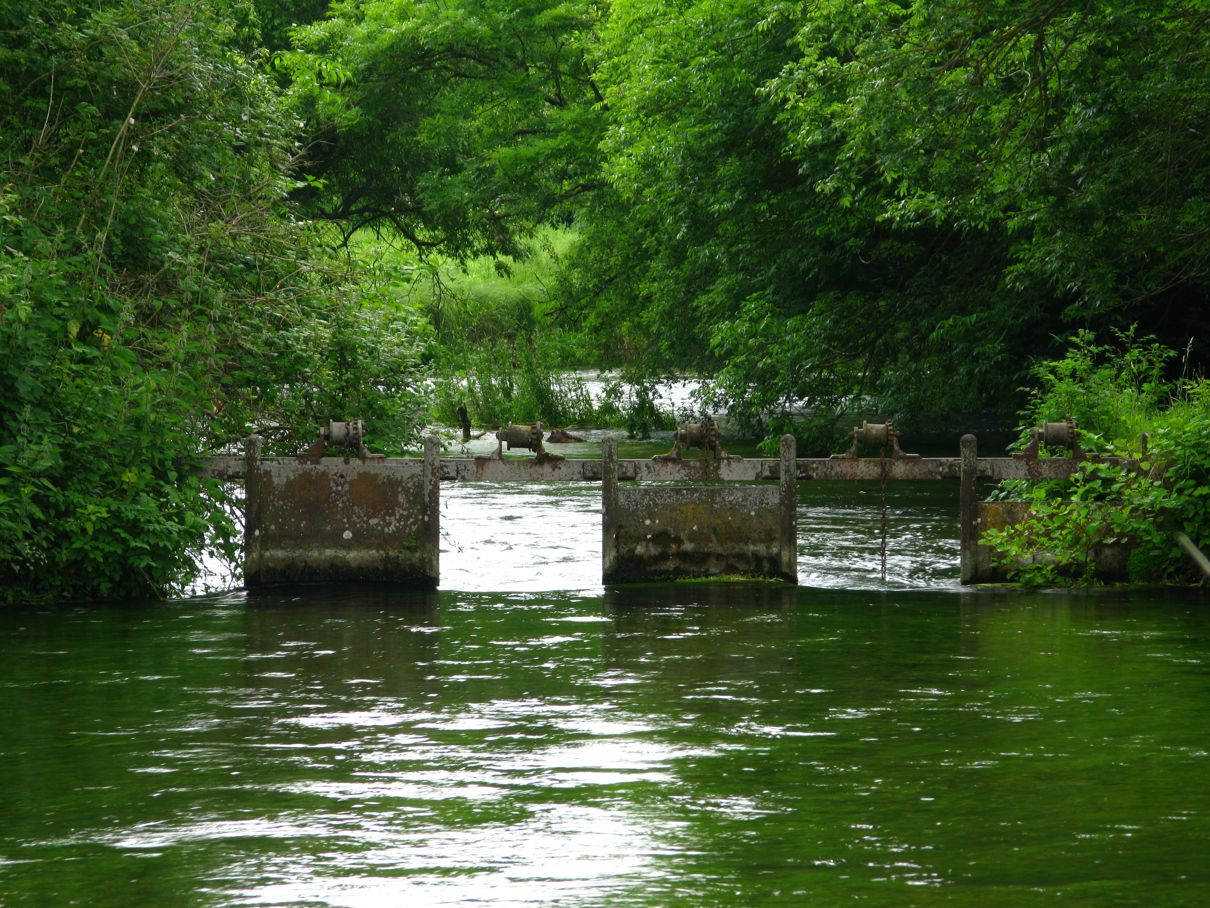
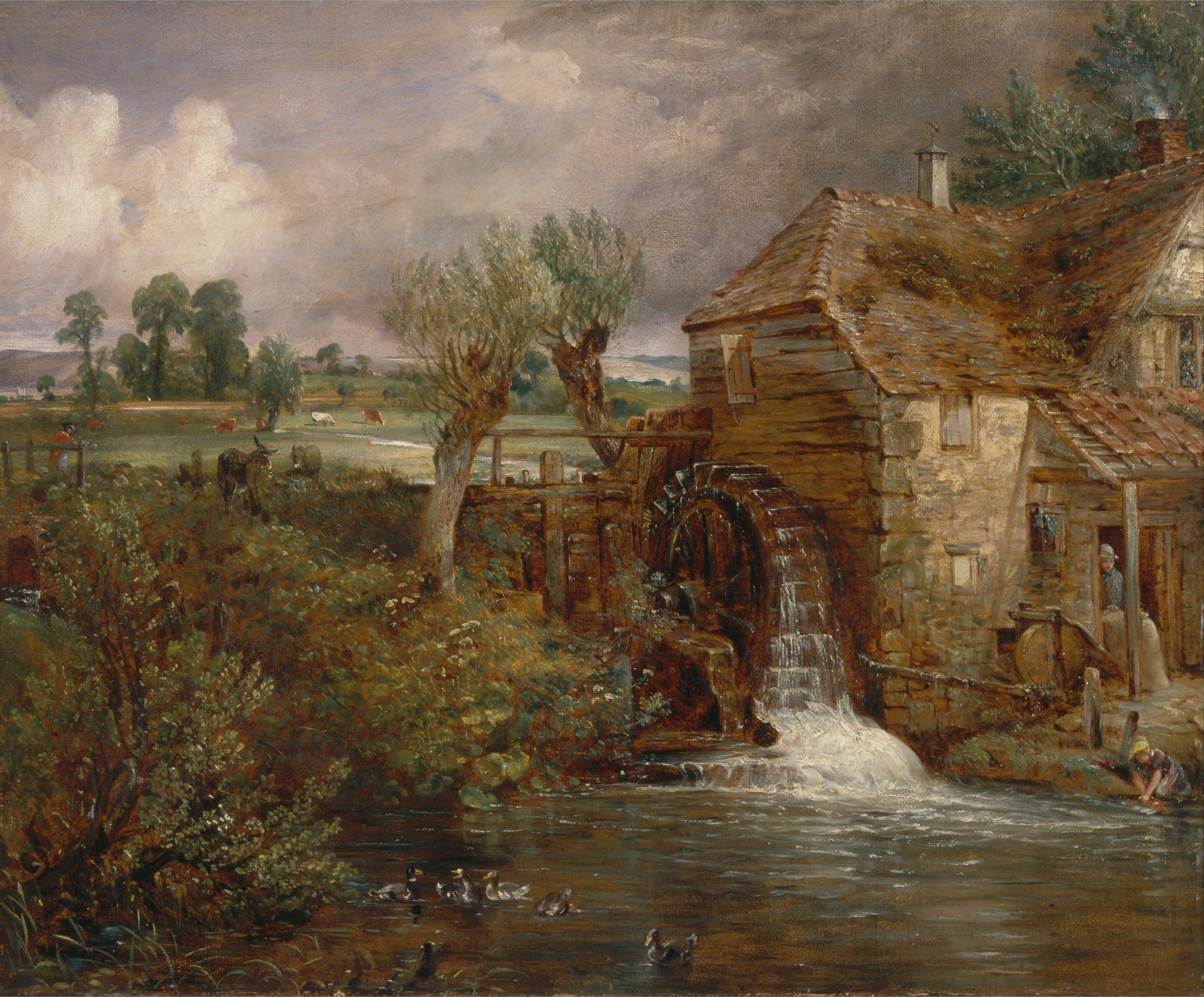
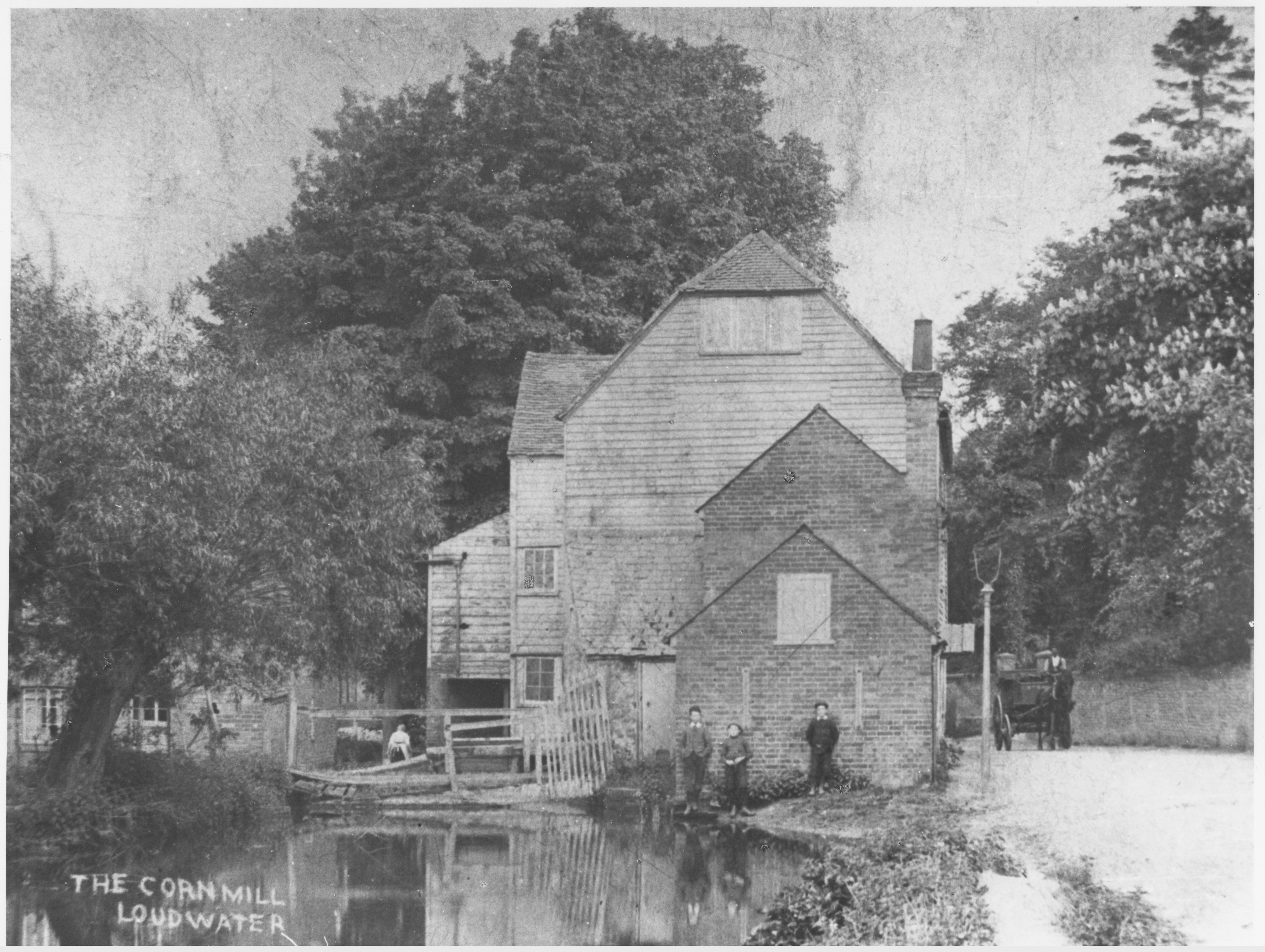
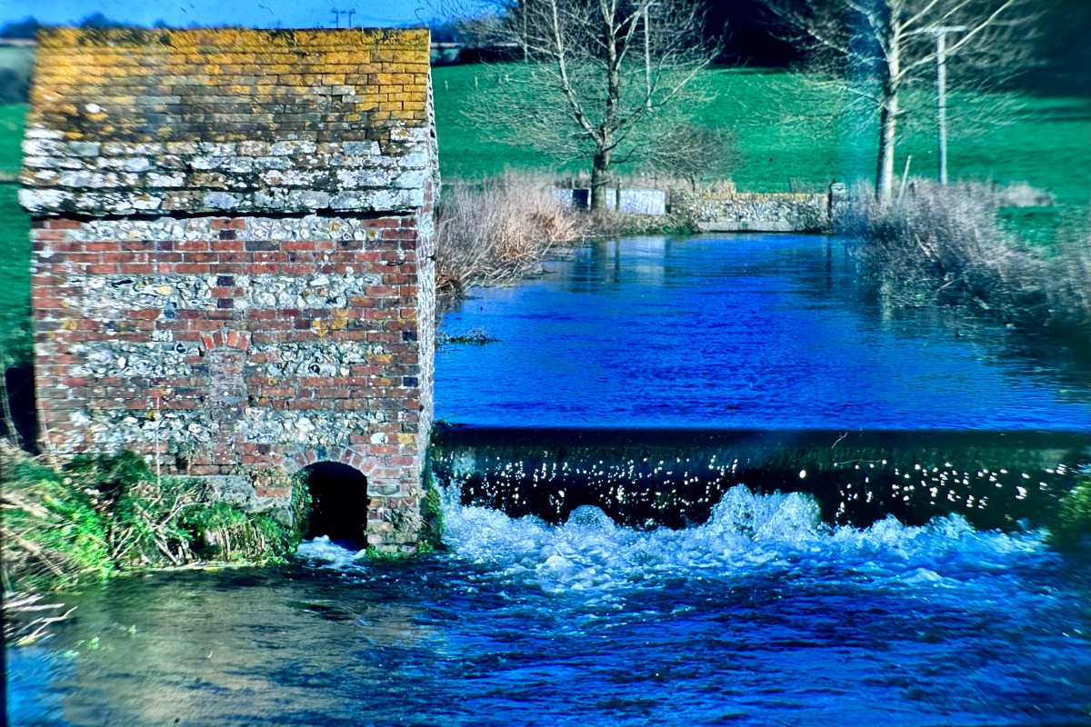
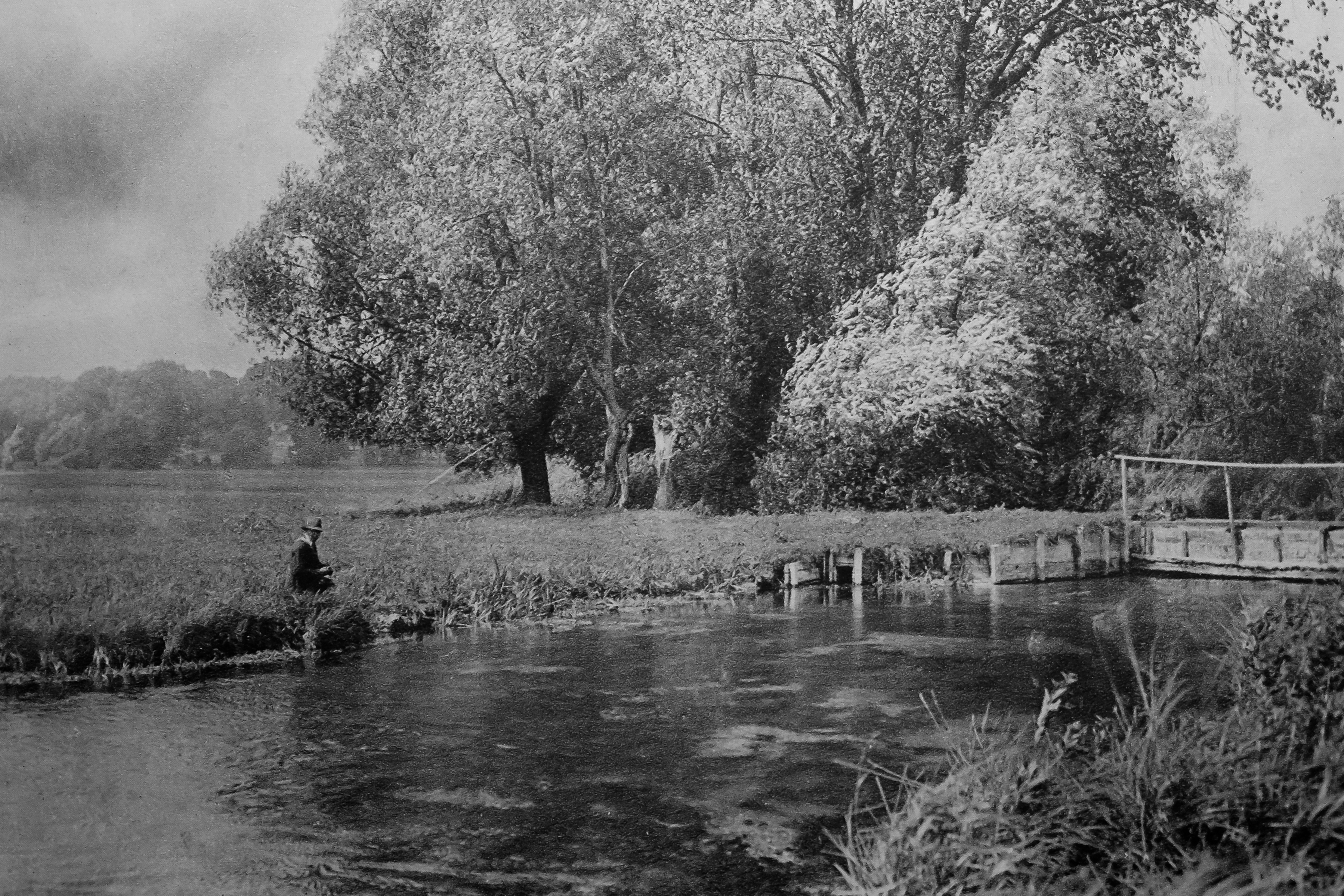
Humans radically changed all that when we invented milling. The Romans will have blocked and impounded some of our chalk streams but we really went to town on them after the 8th century, so much so that by the time William the Conqueror invaded, we had over 5000 watermills in England and most were on lowland streams, including chalk streams, which are very easy to manipulate and dam.

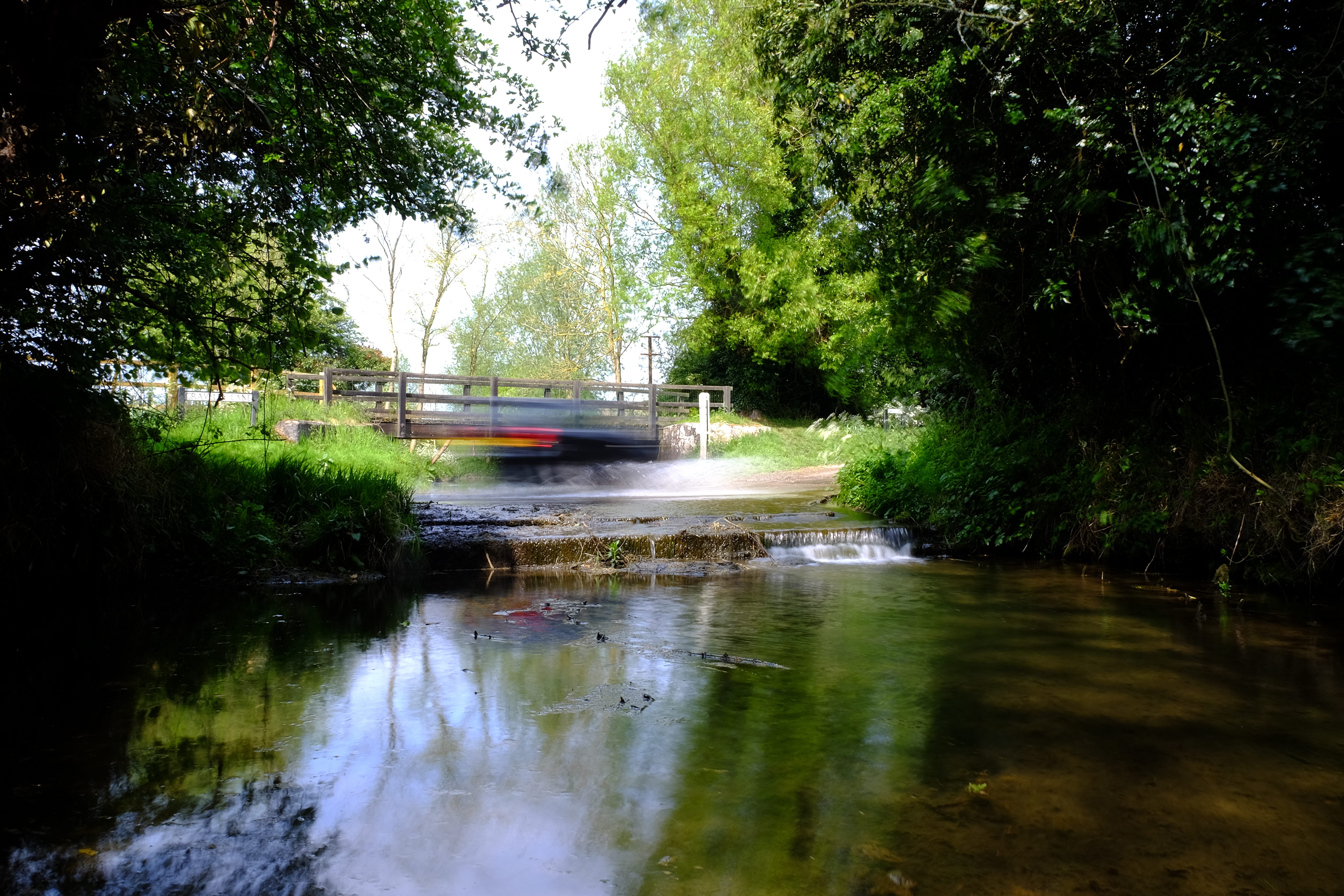
To make a mill work on a lowland stream these early water engineers diverted the channel to the edge of the floodplain and ran it along a much shallower gradient than the natural valley. This built up the head of water required to turn the mill-wheel. If the valley gradient is 1:600, say, it takes 600 meters to build up a meter of head. Many chalk streams had reached mill saturation point by 1066. This is when you can’t fit any more in: the entire stream had been made into a staircase. For example, most of the natural gradient of the River Wensum, in Norfolk, is taken up by mills. This – and the legacy of dredging – is by far the most significant ecological stress on the river, even today.

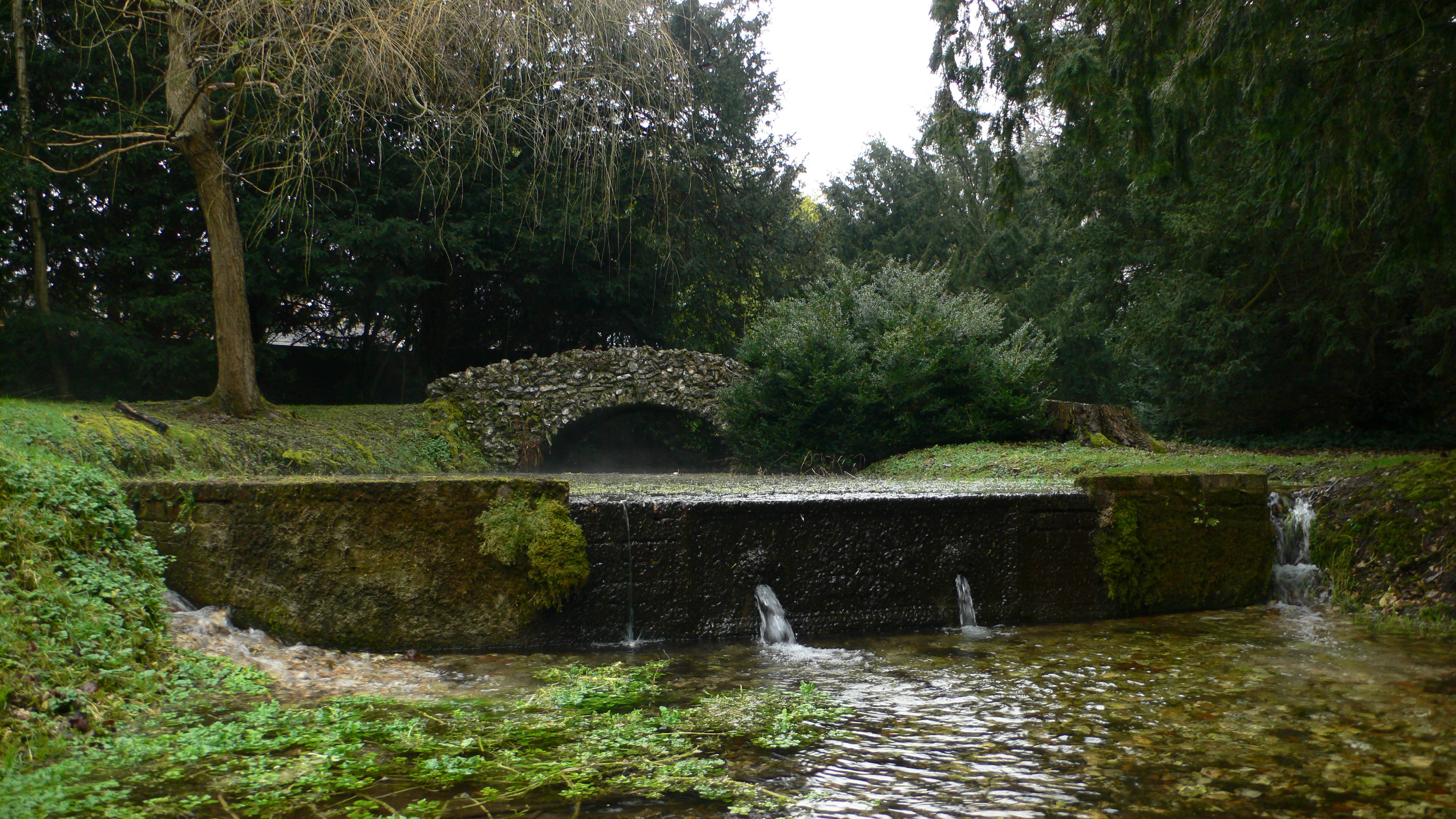
To the mill diversions have been added many other forms of channel manipulation over history: navigational channels, locks, and the intricate system of hatches, carriers and catch-drains of the Jacobean to early Victorian water-meadow revolution. All of these modifications interrupt the natural slope of the stream.
Z

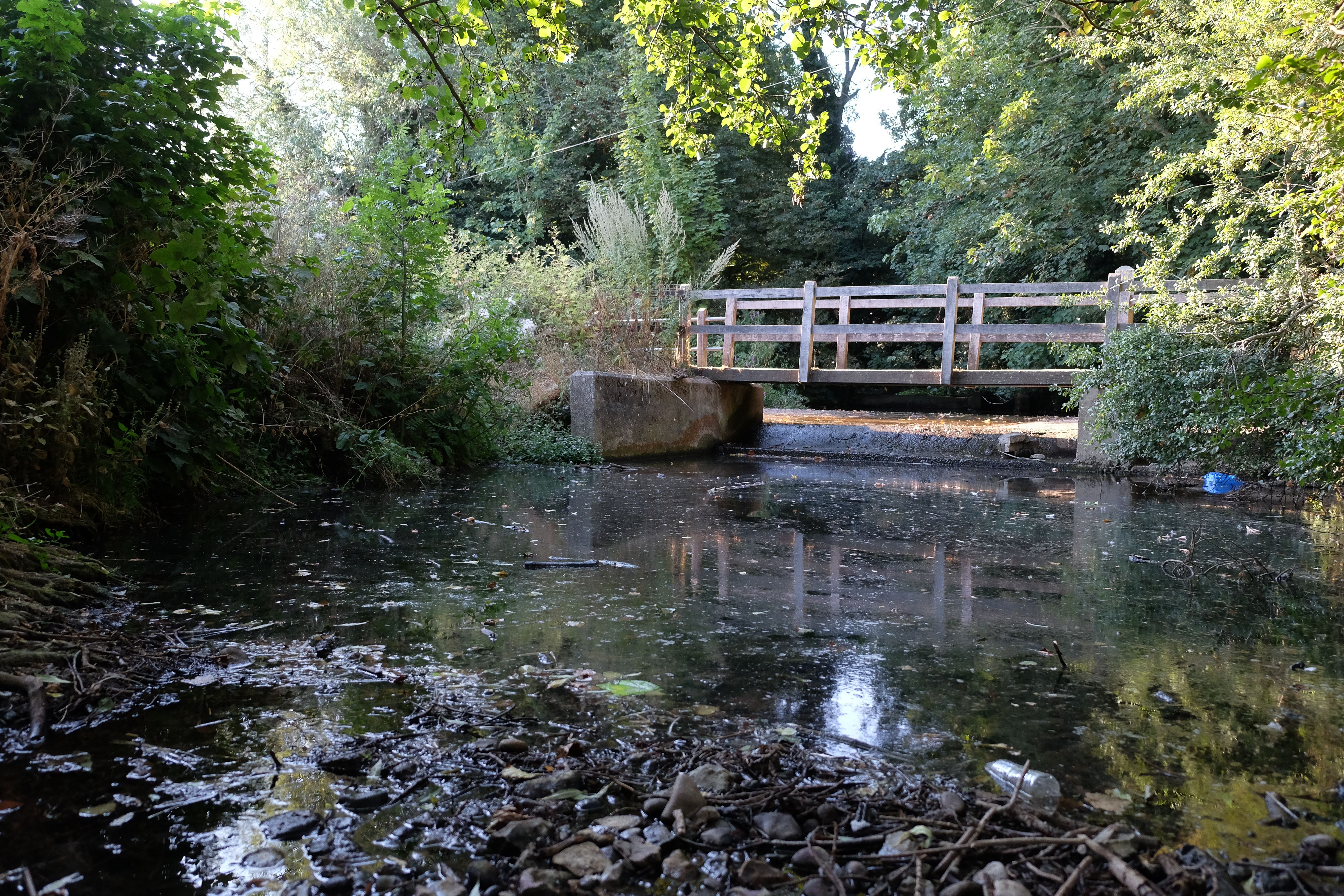
Z is the planform of the river, its shape seen from above. The natural, meandering planform of our chalk streams was radically modified as part and parcel of the many and various ways in which the streams were changed over the centuries, whether they were diverted to make mill leats or watermeadow carriers or ornamental lakes.

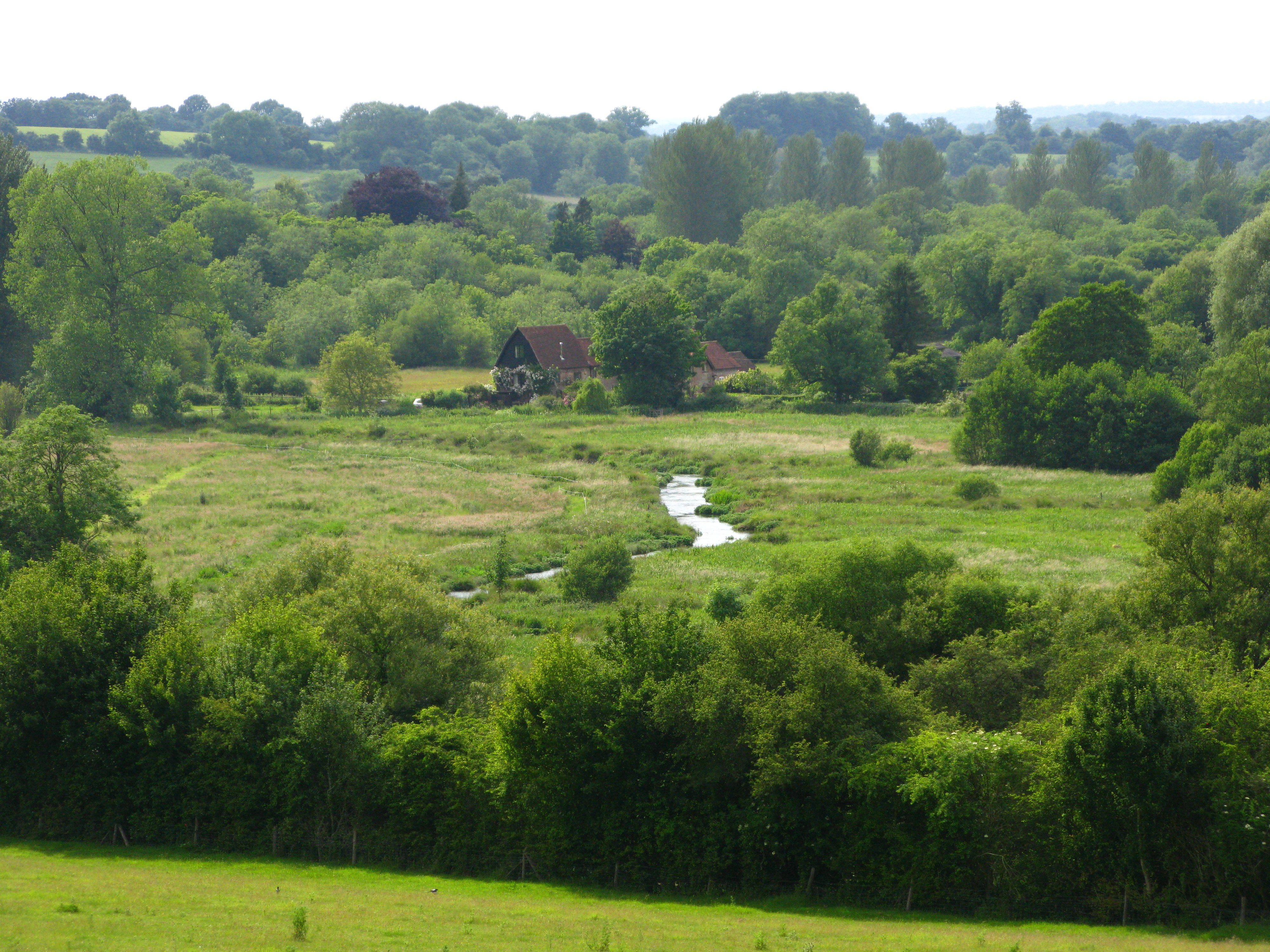
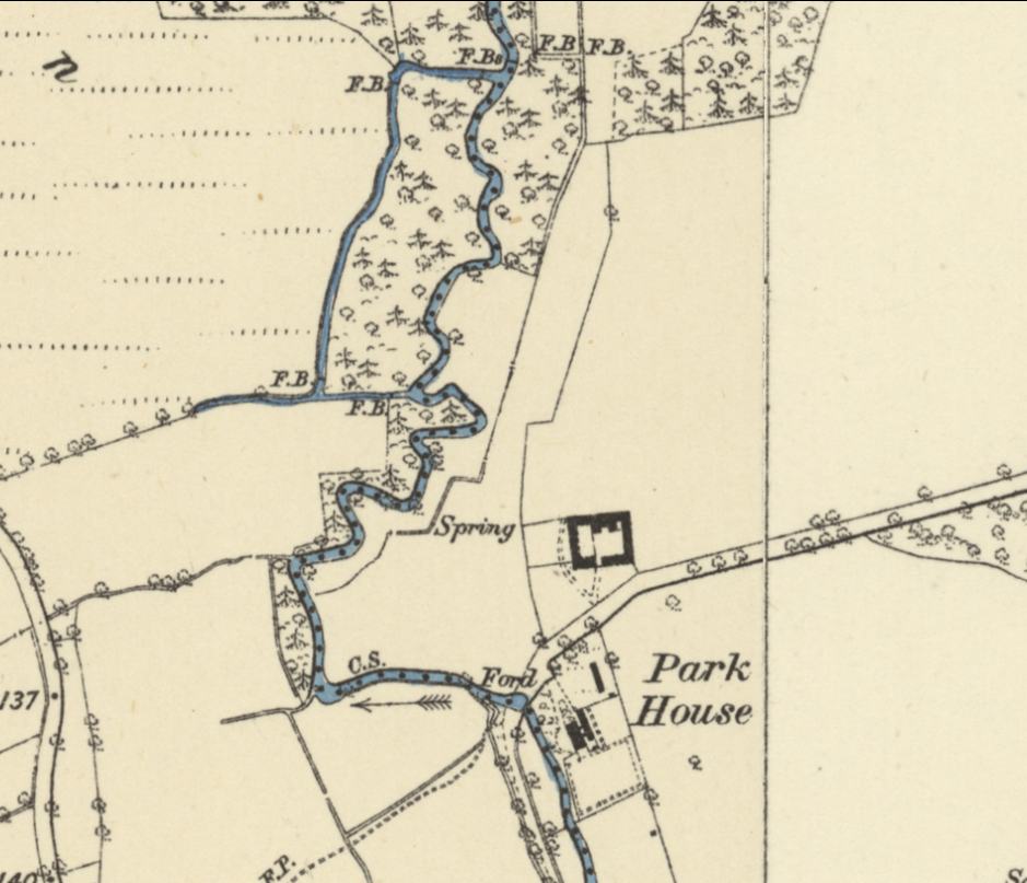
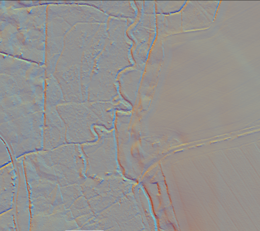
Almost everywhere chalk streams have been moved to the edges of their floodplains. If you look closely at modern stream pathways and the associated ditches and drains in the floodplain, you will see the main modern river running along one edge of the floodplain and then the other, while down the middle of the floodplain run a series of ditches that drain down to the crossing point. This was a widely practiced way of moving the river off the floodplain to make space for grazing and to lower the water-table too. In some settings it’s part of the milling and watermeadow pattern and in others, a feature in its own right.
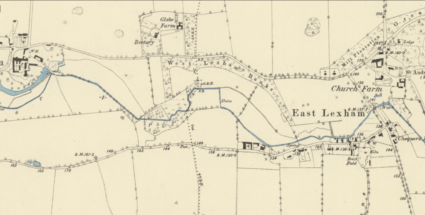
But even when the modern river still more or less occupies the middle of the floodplain (which is rare) you will find that meanders have been straightened out, because for one reason or another the landowners wanted to get the stream out of the way and / or lower the bed of the river and improve drainage.
XYZ and the impacts of changing them

Generally speaking any of the significant ways in which chalk stream channels have been altered (mills, watermeadows, farm drainage, urban development and dredging) will have changed all the X,Y and Z dimensions in one go and the thus damaging impacts are layered and interwoven.

Take milling: to make a mill leat the channel has to be progressively raised above the natural fall-line of the valley. This robs the river of gradient and energy, isolates the river from the floodplain, divorces the channel from the water-table, and erases natural meanders. Essentially it takes a naturally dynamic, heterogenous physical structure where the river supports a mosaic of habitat niches and homogenises it in a more stagnant and imprisoned state, from which a chalk stream cannot escape.

People may wonder what the big difference is between a meandering channel and a straight channel. All the difference in the world! Meandering channels are so much more physically complex: flow spirals around a river bend, sorting sediment and substrate, depositing fines in the insides of the bends, scouring the outsides, crafting the river bed into a complex matrix of glides, pools and riffles. If the river bed and planform are intact, undercut shelves will form on the outsides of meanders at the junction between the more motile bed substrate and the more cohesive floodplain soils. These undercuts are incredibly valuable habitat for fish, especially large salmonids. The loosely triangular river bed section that evolves in a meandering channel maintains water velocities as flows lessen through the summer, whereas the uniform bed of a modified channel does not. The natural meanders therefore support plants like ranunculus and in tandem this promotes a healthy scour of the river bed, keeping fines on the move whilst creating a wide variety of habitat niches for invertebrates, benthic (eg. bullheads and minnows) and rheophilic (eg. trout, and dace) fish.

But I’ve also noticed how grazing animals like ponies interact differently with a meandering channel. The River Nar through Castle Acre was a typical straightened, modified, perched and dredged channel. Like all chalk streams subjected to these modifications it had evolved a monoculture of phragmites and bur reed along the edges (in the worst cases right across the channel) which – because they are silty death traps – grazing animals tend to avoid, nibbling only the edges, which they can reach from the safety of solid ground.

After we restored the meandering channel with river bed much closer to floodplain level, the Konik ponies that graze the common started to graze the point-bars on the insides of the bends in a different way from the more cliff-like edges on the outsides of the bends. The planform created a diversity of grazing pressure which in itself will have been beneficial to biodiversity.

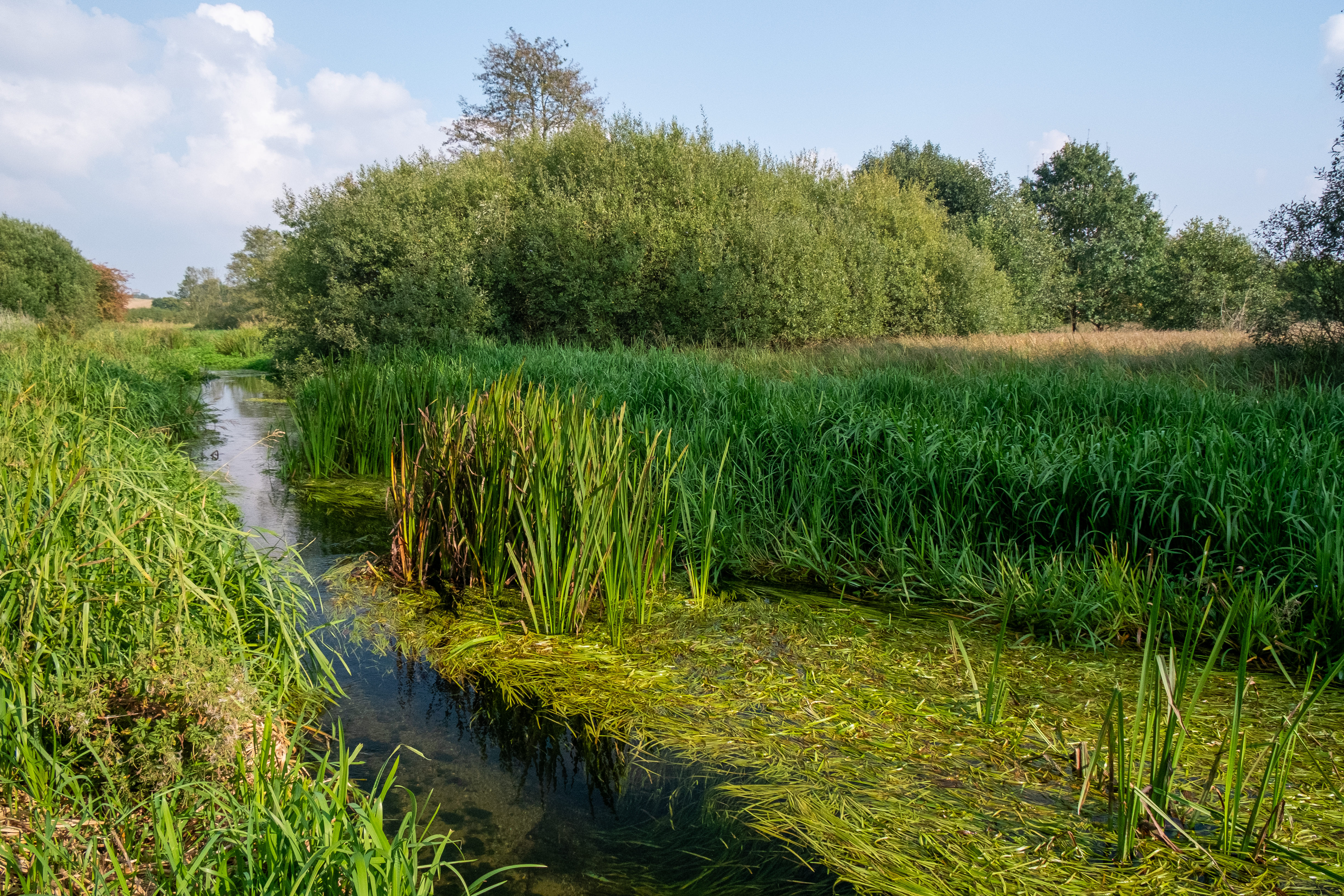
It is obvious, also, that if you take the gradient out of an already low gradient stream and then massively increase the sediment loading – as we have done in the modern landscape – you will turn the stream into a silty grow-bag. When passionate river-kin types rail at the state of a chalk stream, at the gloopy silt, filamentous algae, opaque water and feeble flows, they are railing much more at its physical state than any abstraction or water quality pressure. Not to diminish the impacts of these pressures, which can be over-riding in some settings, but where there is tolerable flow (even if there is some abstraction) and water quality (even if there is some eutrophication and sediment load) the XYZ is by far the most important part of the chalk stream health. It is certainly the the foundational layer and oftentimes the easiest to sort out.
Deficit x opportunity = strategy priority. A tool for planning chalk stream catchment restoration

I’m honoured to have been asked to chair the Test and Itchen Catchment Partnership (Strategic Leadership Group) and help efforts to create a re-booted catchment restoration strategy spearheaded by the Wessex Rivers Trust and Hampshire and Isle of Wight Wildlife Trusts in partnership with all the key stakeholders, landowners, fisheries interests, water company, regulators and local groups.

These two rivers are the jewels in the English chalk stream crown (and I say that as a Norfolk lad) of iconic national and international importance. Collectively the partnership has formulated a restoration vision that is to:

“to restore these rivers to a state where natural processes, ecology and biodiversity are maximised and human impacts minimised: to create rivers and floodplains that are havens for abundant wildlife, that help manage floods, store carbon and intercept sediment, that retain their extraordinary cultural value, and that are resilient to the pressures that lie ahead”

That’s a high ambition and to use a cliché … words are cheap. Turning it into reality is the hard part. What I have learned from trying to do exactly the above (albeit at a smaller scale) on chalk streams in Norfolk is the immense value of a really good plan, one that is simple, doable and relentlessly correlated to reality.

Without a plan there are a zillion rabbit holes one can vanish down. A great deal of money can be spent doing the wrong things well, or doing the right things badly, or fixing an enormously expensive minor issue at the expense of a much more resolvable major issue. And so on.

So, I’ve been working on a methodology for constructing a restoration strategy that is simple, objective, repeatable, that makes use of existing datasets and assessments but reassembles the information in such a way as to clear signals about what to fix, where and in what order. A catchment restoration planning tool, if you like.

I sketched out the idea at the inaugural meeting of the Test and Itchen Strategic Leadership Group last week, to an exacting audience of river restoration experts, ecologists, regulators and various other key decision makers and was very pleasantly surprised by the positive reception.

I’ve set out the concept below: a) as a simple graphic and b) as a longer text explainer. I’d be very happy to incorporate feedback to help make it as useable and useful as possible.

Something’s actually happening, Reg! Abstraction reduction in the Chilterns.

Above: The River Chess in June 2025, a river whose story is a beacon of hope in the long struggle to restore our chalk streams

Chalks Streams First – as regular readers will know – is a radical but pragmatic way to realign abstraction pressure in chalk streams, allowing the streams “first” use of their water, without removing the water from the public supply network. 

The idea was conceived and theoretically tested by John Lawson using the catchments of the Colne and Lea as examples. I joined in with John to help give the idea traction with Ofwat, the EA and eNGOs. There is now a Chalk Streams First coalition of eNGOs who support the concept and variations on the idea have been absorbed into regional planning, albeit few have been fully realised as yet.

Chalk Streams First works by greatly reducing aquifer abstraction in chalk stream headwaters and upper valleys – the cheap and easy way to abstract water – and moving the point of abstraction to the lower, less environmentally sensitve reaches of the same catchments, where it is taken from the surface flow and recirculated, via reservoirs, treatment and network infrastructure to the places formerly supplied by the groundwater abstraction.

Across the full hydrological cycle a large % of the water not taken from the aquifer will manifest as surface flow (known as flow recovery) but that % is much higher in winter (over 100%) than summer (25% to 40%). Hence the need for the reservoir which stores that winter excess and becomes, essentially, a man-made version of the aquifer.

It’s the water resources verison of cakeism. Rivers and taps continue to flow.

There are a number of theoretical variations on this general concept of cakeism: for example, the upper valley groundwater abstraction could feasibly be replaced by lower valley groundwater abstraction where the rises and falls in the water table are much smaller, and the supply more reliable in summer. 

It is this version of the concept that is currently being developed by Affinity Water. Affinity Water’s central region operates largely to the north-west of London and historically has been very much reliant on chalk aquifer abstraction from the chalk hills of Bucks and Herts: the Misbourne, Colne, Lee and Stort units in the map below.

To date, Affinity – which supplies 970 million litres of water per day to almost 4-million people – has reduced its take from chalk groundwater sources by 100 Ml/d by investing in new assets and network reinforcement and increasing imports from Grafham and Ardleigh reservoirs.

Stream by stream these reductions have amounted to:

  • Hughenden Stream – a 100% reduction of 1.6 Ml/d
  • Misbourne – a 50% reduction of 13 Ml/d
  • Upper Chess – a 100% reduction of 6.38 Ml/d
  • Upper Gade – a 31% reduction of 6.4 Ml/d
  • Ver – a 67% reduction of 28 Ml/d
  • Upper Lea – a 27% reduction of 10.2 Ml/d
  • Hiz and Oughton – a 13% reduction of 1.3 Ml/d
  • Mimram – a 50% reduction of 9 Ml/d
  • Beane – a 70% reduction of 16 Ml/d

Of course many of those reductions were from very high totals. For example the Ver’s once total abstraction of 42 Ml/d was well over half the catchment recharge in an average year, meaning the 15 Ml/d still abstracted remains a high % of the stream’s recharge. We (Chalk Streams First) have argued that “sustainable” abstraction should generally amount to no more than 10% of aquifer recharge, ideally less.

However, Affinity hasn’t finished. In AMP8 it will be cracking on with a further 35 Ml/d of reduction from the chalk streams feeding the Colne, including 14 Ml/d of license relocation following the Chalk Streams First principle, which is allowing Affinity to fast-forward these reductions before other strategic resource options (ie reservoirs and transfers) come online.

Planned reductions in AMP9 are also very encouraging, totalling 45 Ml/d.

Affinity deffo deserves credit for pursuing these reductions in the face of severe logistical dificulties and contortions. They inherited a system that was developed in a different era when the resource was thought to be more than abundant. Times have changed. Affinity Water must continue to supply water – its primary statuory duty – whilst finding an environmentally more sensitive way to do it.

The battle aint over, however. The ecological response of the streams will be carefully monitored and the inclination – I’m fairly sure of this – will be to suggest that the response has not been as good as expected. That’s because the economic forces and need to supply water are urgent and are only going one way but also because it is very difficult to tease apart all the environmental stresses on chalk streams and ascribe cause and effect to only one.

The real point is that to get the best value from the investments necessary to reduce and relocate abstraction we MUST also ensure that the water in the streams and aquifers is clean and that physical habitat is restored. Only when all three happen can we expect to see true ecological recovery.

Meanwhile, congrats and chapeau to Affinity Water, for engaging so positively with the chalk stream restoration strategy. The trout will thank you. Maybe one day, the salmon!

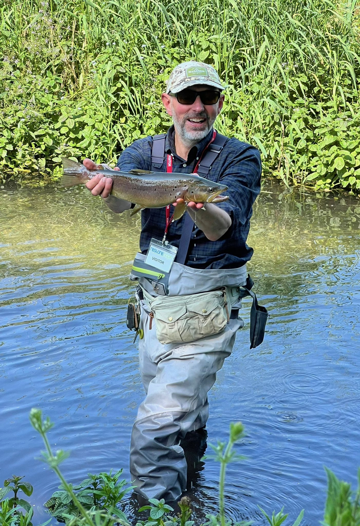
A lovely wild trout (caught by yours truly) from the River Chess.

Update on the River Stiffkey

I’ve been back to the River Stiffkey a few times over the past few weeks to see how the newly created “natural” channel is evolving.

This is a section of a Norfolk chalk streams that curls around the edge of an Iron Age hill-fort. It was radically straightened several hundred years ago and subsequently dredged into a deep culvert.

The Norfolk Rivers Trust and Holkham Estate asked me to design a restored, natural channel to take the river back to where it used to flow. All sorts of good things should follow a project like this: a restored channel will be good for bird-life, for trout and sea trout, for invertebrates and for the diversity of plant species. It should be good for flood management and carbon sequestration too.


This is a simplified overview of the design I produced, about 2km of river from top to bottom (the flow direction is up the page!)

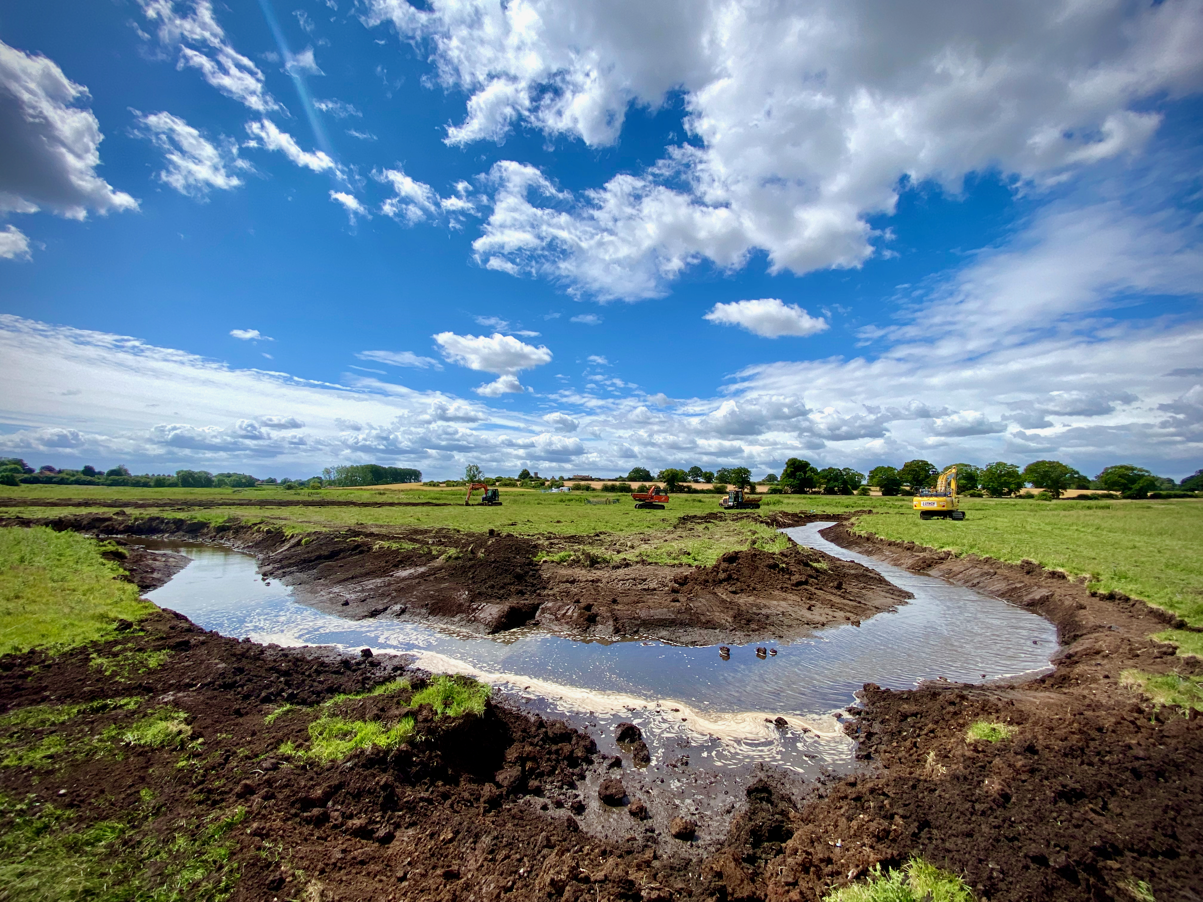
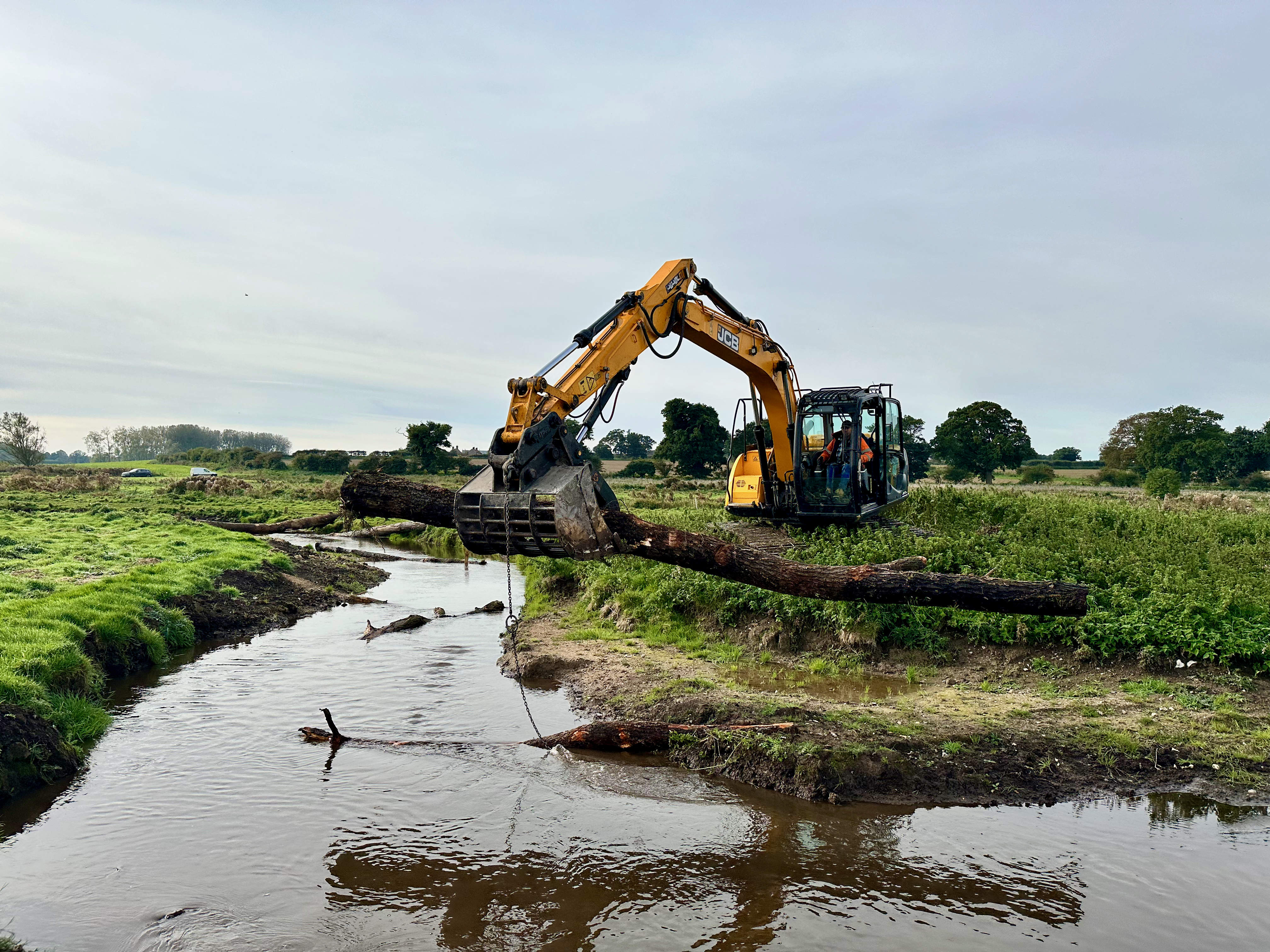
We executed the work in two phases in 2023 and 24. Here the diggers start work:

The excavators at work in 2023.

And here we place out “large woody debris” to give a bit of structure to the new channel:

Adding LWD to the channel.

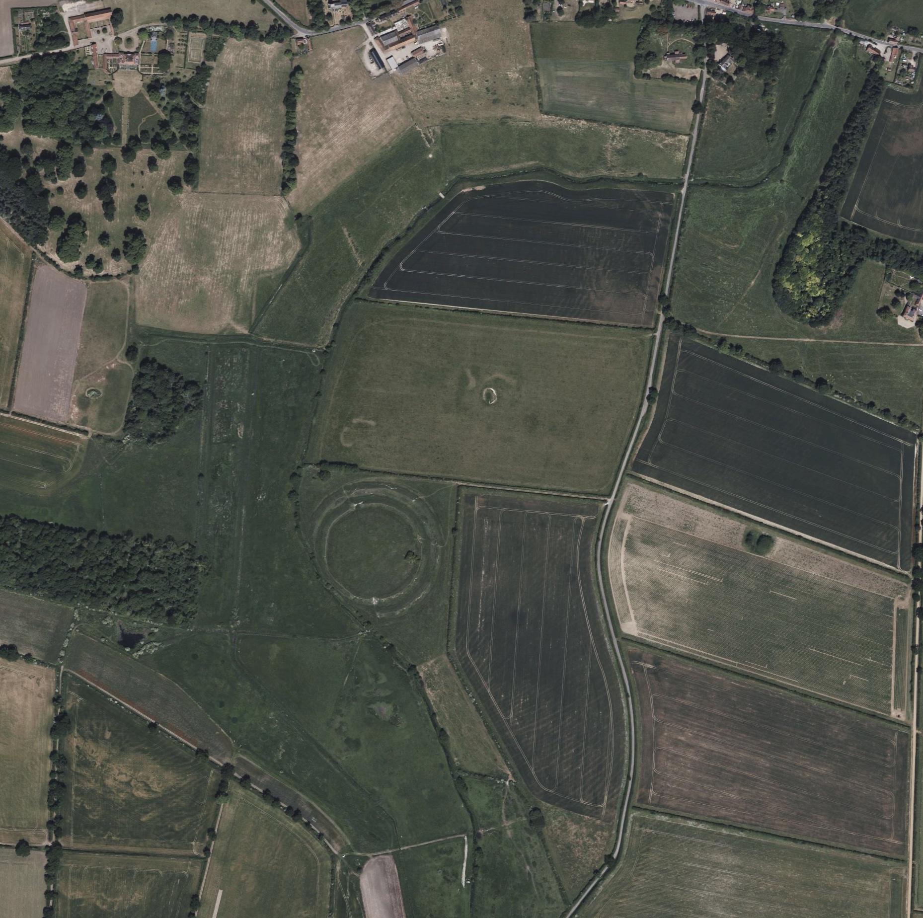
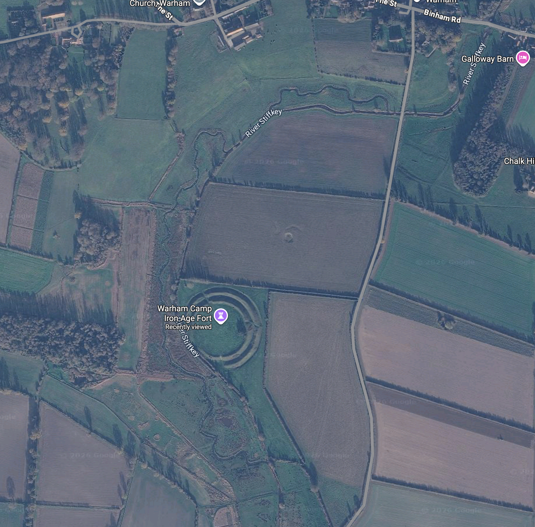
Already the changes are visible on google maps: below is a before and after of the satellite imagery. The keen-eyed will see the clues in the floodplain as to where parts of the natural channel once flowed. And now flow again.

The Stiffkey floodplain around Warham before we started work
The Stiffkey floodplain around Warham after the new channels were finished in 2024

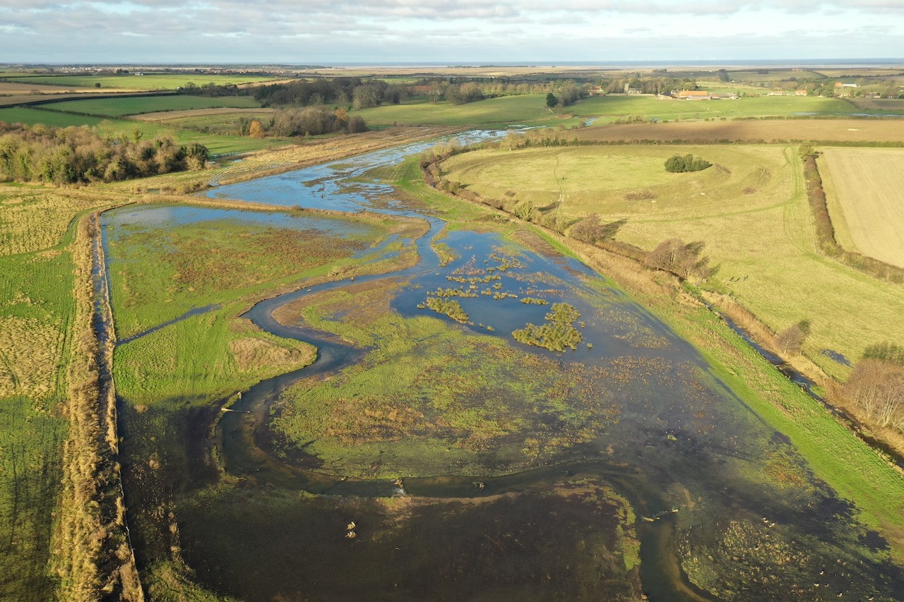
We were lucky in that the winter flows that followed the 2023 phase were very strong and this gave the river a chance to self-adjust. It also showed the river working naturally and that vital relationship between the river and its riparian space: just fantastic for wading birds.

Winter flows and a working floodplain in the spring of 2024.

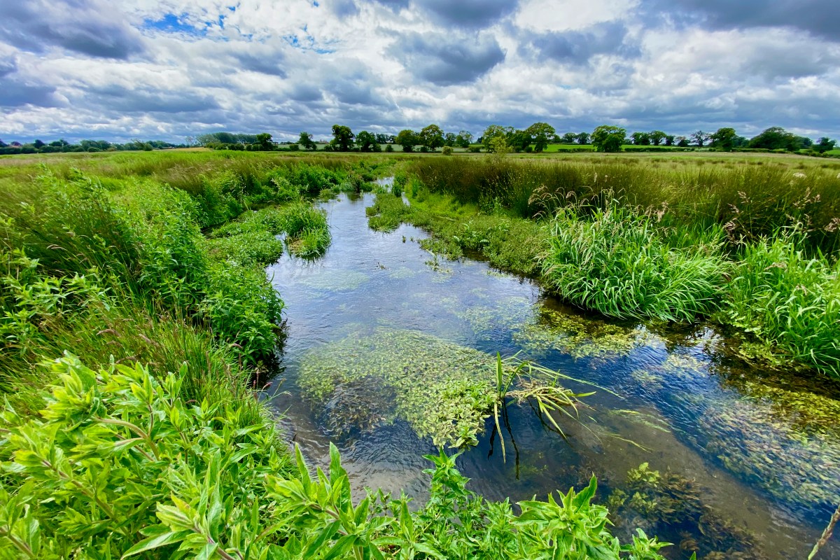
By the summer of 2024 the first phase looked radically different than the weed-choked channel it had replaced:

Summer 2023: the is the ditch-like channel choked with burr-reed that the River Stiffkey had become where it “flowed” past the Warham fort.
September 2024 a year after the channel was excavated. None of these in-stream macrophytes were planted. It’s amazing how quickly habitat develops if you restore the correct physical state.

But these restoration projects must also be seen in terms of longer time-lines and here it is really interesting to see whether trees come back to the site and if so, which species. A mosaic of tree cover and open grassland / fen will be the secret to the long-term resilience of the project. So, it is really encouraging to see some trees springing up and fascinating to discover that they are mostly … hazel.

2025 and now 2026 have seen lower flows and I have been interested to see how the habitat has developed. Unsurprisingly, the riparian vegetation has crept out over the channel but even so, there is no choking of burr-reed, because the bed of the river is a constant gradient: there are no sumps.

This photo was taken in June 26: the river looking verdant and lively in spite of the dry weather.
This photo was taken a few weeks later, as the drought deepened. We desperately need rain, but the habitat is still holding out.

River Wrongs

Pinged to my Instagram feed one day after my last post, here’s a great example of how Paul Powlesland’s exemplar have-a-go river heroism could quickly go wrong when the heroes don’t know what they don’t know.

Here a farmer and local politician speaks on behalf of the residents of Exford arguing that the channel through the town should be stripped clean to prevent flooding. Other posts of his expand on the theme also show very well intentioned concern but a slightly misfiring understanding of what really causes flooding. As do the comments.
Of course rain can skim off Exmoor in a terrible hurry, so I get the concern. But the ability of a channel to handle water in a big flood has much more do with its capacity to convey flow than its capacity to hold volume. The rain comes down so fast that it will fill any volume you give it, if it can’t get away fast enough.

The easiest way to understand this is to think about flood water as traffic: if there’s an accident that closes all but one lane of the southbound M3 on a sunny Bank Holiday, it would make no difference if you turned the M3 into a fifty lane runway upstream of the constriction: the traffic would quickly fill the available space. The problem is the constriction. And of course the amount of traffic, the rate of flow.

In Exford, the constriction is the bridge and – to an important degree in moderate floods – the culverted channel. While the rate of flow is determined by how hard it rains and how quickly that rain skims off Exmoor. Stripping all the vegetation out of the channel in Exford would make a tiny difference in a big flood, but it would make a big difference to the habitat, day to day.

And it’s not just the middle of Exford that the concerned farmer wants to be cleared. Elsewhere he argues that the Environment Agency should be “maintaining” the rivers everywhere, by which he seems to mean old school dredging them and clearing: works that would actually accelerate the rate of flow towards Exford. It’s such a challenge trying to show that traditional ways of “controlling” flooding can often make the flooding worse, if they hurry the rate of flow from hills to the sea. There will always be constrictions, so what you really want to do is slow the rate at which water meets them and flatten the peak off the discharge.

I totally understand the anxiety. I know Exmoor well, especially the River Lyn which infamously flooded with deadly violence in 1952. That flood was caused by Biblical rain – 9 inches in 24 hours – that brought with it landslips, debris and trees: these jammed at the various bridges along the river, backing up the torrential flow, until each one burst in turn, sending waves of water down the steep valley. In Lynmouth itself the culverted river channel filled with debris and broke out into the town.

Events like this are not prevented by regularly stripping bare all the habitat that enables trout and salmon to exist. This farmer cares deeply, but thinks the answer is a long reach excavator. It isn’t. There’s definitely a case for making sure the middle of Exford is not a pinch-point and in an ideal world one might think about that bridge. But if I was a concerned resident of Exford, I’d be looking upstream at the ways in which the river and tributaries have been modified over the years and how we might make the landscape more absorbent and slow the rate of run off.

River Rights & Wrongs

In some ways eco-warrior Paul Powlesland has the sort of zeal we need much more of. He cares enough about an overlooked London river to spend his own money trying to improve it. So, when the Environment Agency wrote to him warning that it was investigating works he’d done on the Alders Brook without a permit, it looked once again like a bureaucracy that had lost its purpose, persecuting someone trying to do the right thing.

I met Paul briefly a couple of years ago after he had given a talk on the Rights of Rivers, for which he is a passionate advocate. Curious about the arguments in favour, I had nevertheless been unconvinced. I couldn’t see what the granting of rights would do to improve a river’s health over and above the application of existing (or improved) environmental laws.

This kerfuffle with the Agency hasn’t done much to sway my scepticism. In fact, it begs the same question I had wanted to ask Paul as he rushed to the train station: “Once a river has rights, who will best speak for it?” A river’s interests aren’t always that obvious and the path to hell is paved with good intentions.

The story of Powlesland’s run-in with Agency has been very widely reported: splashed across The Guardian and The Daily Telegraph, featured in Channel 4 news, retold as far afield as The Times of India and all over social media. The stories all suggest that Powlesland was being threatened with prosecution for removing rubbish from a river, which on the face of it is absurd.

That didn’t quite ring true for me. The good folk of the River Wandle Trust have been taking rubbish out of that south London river for decades, without ever falling foul of the Environment Agency. They have done this work with the cooperation of the local council, who have provided lorries to take away the vast quantities of stuff that other no-so-good folk of south London insist on throwing in there: mattresses, tyres, shopping trolleys. You name it.

Volunteers on the River Wandle have been litter-picking for years without ever falling foul of the Environment Agency.

I couldn’t imagine why on the Earth the Agency would want to harry Powlesland for litter picking, and I suspected that they didn’t. I suspected, in fact, that they had taken exception to something else. The words “silt and weed” in The Guardian headline made me suspicious. The mention in The Daily Telegraph of the use of an excavator hired by Powlesland for £750 made me more suspicious. You don’t need an excavator to pick litter. So, had he actually dredged the river of “silt and weed” in the name of cleaning it up?

Sure enough, when the Agency finally relented and informed Powlesland that they wouldn’t be taking further action the letter alluded to “flood risk activity” consisting of “dredging, raising or taking of any sand, silt, ballast, clay, gravel off the bed or banks of the Alder’s Brook”. Somewhere on the Roding Trust Facebook feed there is a film of a digger slubbing mud out of the channel. Harmless enough, perhaps, but ordinary mortals do need consent for that kind of work, so to just crack on without it and post the evidence …

Clearly, Powlesland is very much motivated to do the right thing. Clearly, he is frustrated by what he sees as petty-fogging bureaucracy standing in his way.         

But so was John Price, a farmer who was jailed for 12 months for taking an excavator into the River Lugg and dredging the bed of that highly protected river. John Price’s crime was far, far worse than Powlesland’s intervention, but the point is … John Price thought he was doing the right thing too. He thought he was protecting the village from flooding. And the media, en masse, portrayed him as a Robin Hood hero. He wasn’t. He badly damaged salmon spawning grounds, and if anything, his tidying up of the River Lugg will have made the flooding worse.

Powlesland’s work on the Alders Brook won’t have done either of those things, but if he dredged silt out of it he may have temporarily stirred up pollutants and caused oxygen depletion downstream. Besides, dredging silt out of the Alders Brook is also a Canute-like exercise.

The Alders Brook is not a tributary of the River Roding, as described in the newspaper reports. It is the natural course of the upper reaches of the tidal River Roding. Further down the valley the same relic natural course was once called The Back Water and is now almost entirely erased. The first edition Ordnance Survey marks the head of the Alders Brook where it leaves the diverted course of the modern River Roding, with the words “Ford. Ordinary Tides flow to this point”.         

The Alders Brook is part of the estuarial River Roding, naturally tidal upstream as far as the ford.

The diversion of the modern river course flowed from there to a paper mill in the village of Great Ilford. No doubt the paper mill is long since obsolete but the modified course and its impact on river morphology remains. The Alders Brook is not a free-flowing stream, rather a part relic of a tidal estuary. Once it would have drained under gravity twice a day, and this would have kept its main channel free of accumulating sediment. But estuaries are, by their nature, muddy places where any interruption to gradient will gather silt and mud. The upper parts the Alders Brook have natural gradient, but the lowermost reach takes a sharp, unnatural turn to the east, and if anything, the river is trying to climb uphill as it rejoins the much diverted and much modified main Roding. It is, therefore, a sump and will always fill with silt.

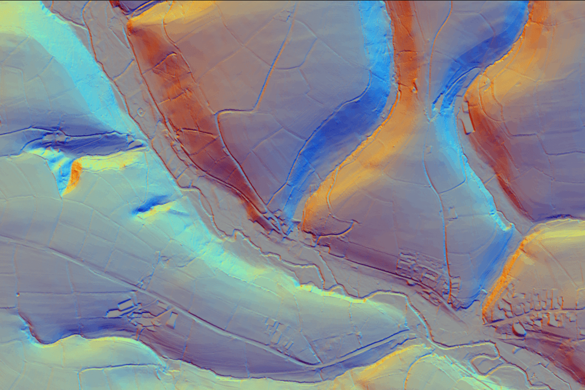
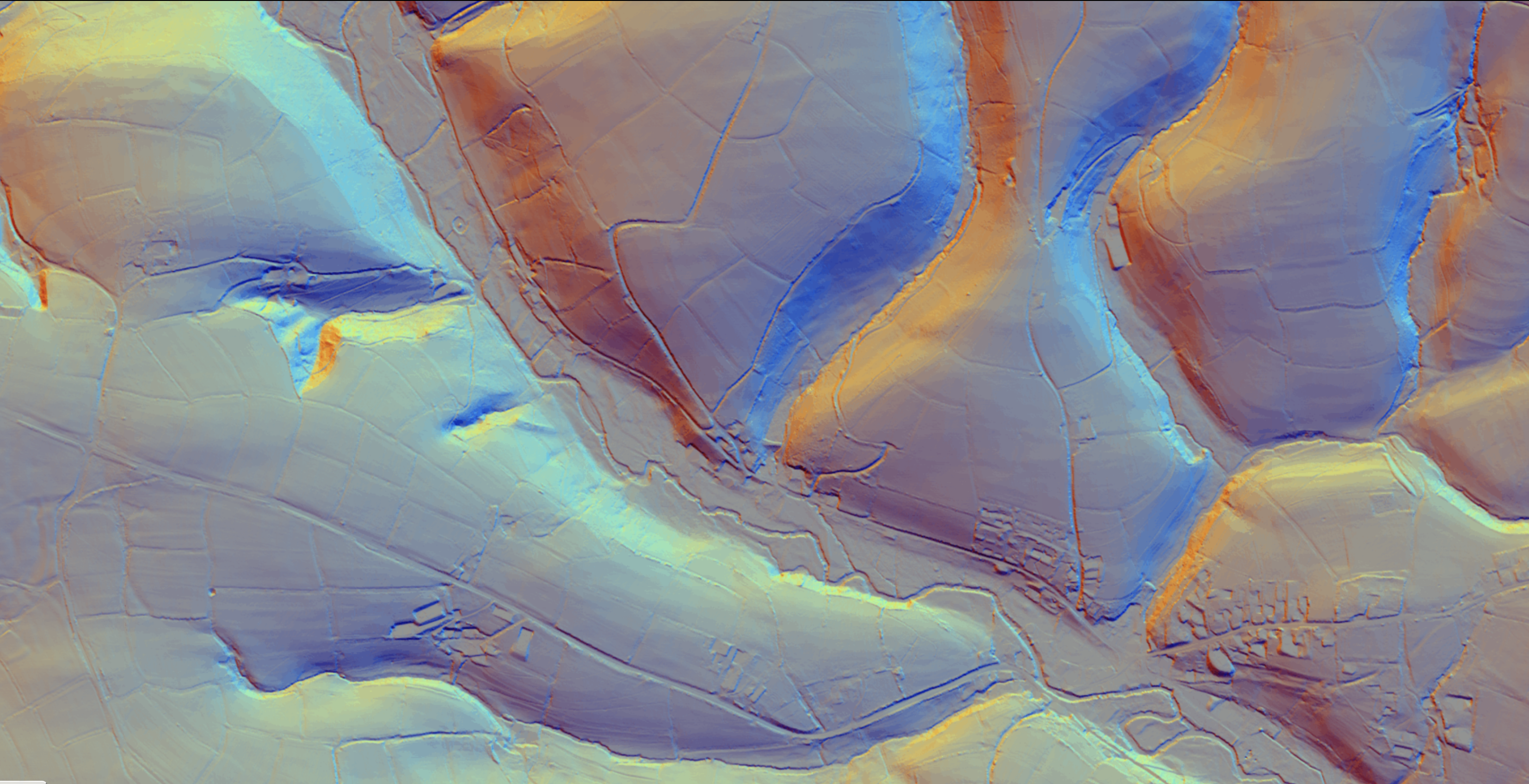
A LiDAR image of the Alders Brook – the thin, meandering line in the centre. Its ability to transport sediment is now severely compromised by a railway line and diversion at the downstream end. The railway and the infrastructure around it form what is, essentially, a dam across the valley floor.

Throughout eastern England, we’ve done stuff like this: we have boxed in estuarial reaches of rivers and reclaimed the land either side of them. Now, they can be miles from the sea with all vestiges of that transient landscape buried under trading estates, retail parks and railway lines, and the expectation is that these meandering courses should behave like rivers. They can’t.

Removing accumulated silt may look like restoration, but unless the free-flowing tidal processes that once maintained the channel are also fully restored—which, in urban east London, is impossible —the exercise becomes one of perpetual maintenance.

None of this is to question Powlesland’s motives, which are clearly driven by a passion to improve his local river. But that doesn’t mean every enthusiastic intervention should simply be waved on through without the troubling business of conforming to the consenting process.

And it does beg a question about river rights. In the few places these have been enacted they’re just too vague to be meaningful: “the right to flow” “the right to be free from pollution”. For all our failures to actually impose environmental laws, these laws protect rivers in terms that are generally much clearer.

Rights would require somebody to speak on behalf of the rights-holder and who is best going to do that when one person’s idea of an improvement may be another person’s idea of environmental damage? A river that looks untidy may actually be a haven for wildlife. A fallen tree might look like obstruction, when it’s actually habitat. Silt looks dirty when it might be the stucture of the channel. Weeds look like neglect when they are vital to the flow, temperature, oxygen and nurient levels.         

Passionate river guardians standing up for vague rights and emboldened to act unilaterally without consent because they feel that right is on their side: that could just as well become an army of John Prices, as an army of Paul Powleslands. We should be careful what we wish for.

The Roding Trust volunteers go out in all weathers and do hard work to make their corner of the planet better. We need their passion, for sure. The Environment Agency were a bit heavy-hoofed in this case, and that didn’t sit well in the context of their reluctance to prosecute much more obvious and damaging environmental offences. Powlesland has described dozens of illegal discharges of raw sewage upstream on the same river: Theydon Bois works, for example, spilled 85 times in 2025. Not all of those can have been in “exceptional weather”.

But right now, if I want to restore a river I have to draw up a plan, back it with evidence and apply for permission. The application procedure is frustratingly slow and sometimes the edicts from the folk granting or denying permission feel baffling, or obstructive. I wish the process could be better and argue that it should be. But on the other hand, if we want the Environment Agency to protect rivers, then we shouldn’t object too hard when it does.

Coda.

So, if the Roding Trust can’t meaningfully restore the estuarial Alders Brook because there’s just too much of London in the way, what could they do to revive it and create a lovely waterscape? I seriously doubt the brook serves any flood relief function nowadays: so, bearing in mind it can’t become free-flowing again and will always be a silt trap, I’d cut off the inflow and outflow and turn it into a meandering still-water. This way, silt would take much, much longer to accrete and could be carefully removed once a decade by suction. It would be clear-watered and full of life and pretty enough— one hopes— to shame even the worst of litterbugs.         

The project would require consent, however.

A once tidal creek that is now a meandering, freshwater pool: an example of the best possible outcome for the modern Alder’s Brook?

Tarrant update 4 – The Environment Agency response – whistling while Rome burns.

The Environment Agency (EA) has finally replied to the River Tarrant Protection Society (RTPS). The reply doesn’t reflect well on the EA.

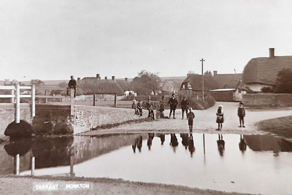
The RTPS is a local group, campaigning for the protection of the River Tarrant, a Dorset chalk stream that historically supported 5 Domesday watermills and even now remains a spawning stream for Atlantic salmon, but which nowadays dries all too frequently because of abstraction. The RTPS has shown that before the 1950s the steam rarely, if ever, dried in its lower reaches. After the onset of groundwater abstraction the lower stream began to dry in extreme droughts – eg 1976, 1989 – catalysing the formation of the protection society.

The situation had been bad for decades. Now it is much worse. In 2018 Wessex Water completed work on an area ring-main, designed to relieve abstraction pressure on chalk streams in the neighbouring and highly protected Avon catchment. As a result, abstraction around the River Tarrant increased, since when the stream has dried in its lower reaches every single year.

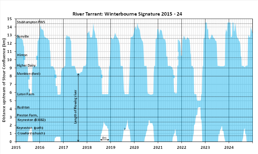
The one year in the past ten when the stream did not dry was 2017, when the local pumps were turned off, and that was in spite of the fact that 2017 was drought year for chalk streams.

The RTPS has compiled a report consisting of historical evidence, ecological evidence, local testimony and modelling that collectively – in the opinion of the RTPS – suggests that abstraction is the cause of this increased drying.

RTPS has asked for a meeting with the EA to discuss their concerns, and for the potential abstraction impacts to be investigated more fully in the next round of AMP investigations. These are hardly unreasonable requests, especially in light of the fact that Atlantic salmon from chalk streams have very recently been shown to be a genetically unique and critically endangered sub-species. In the Stour catchment the salmon are on the very edge of survival.

My past few blogs have detailed the argument and the local EA’s inflexible and partisan approach to the matter. The area office commissioned a comparative and isolated review of the approaches to groundwater modelling taken by the Wessex Water / EA teams and John Lawson, the independent hydrologist working for RTPS. The review concluded that John Lawson’s approach was too simplistic, whilst also admitting that the Wessex model did not actually perform very well in its modelling of the impacts of the Black Lane abstraction.

The local EA didn’t consider any of the other evidence. As you can see below, the EA now considers the matter closed.

[*This being the RTPS response to the EA’s review of John Lawson’s modelling]

I should leave readers to form their own conclusions given the EA’s approach somewhat speaks for itself.

But I can’t help but point out:

The RTPS didn’t ask the EA to “walk away from their groundwater model”, rather RTPS suggested that the model may not be entirely correct. Who really thinks that groundwater models are infallibly accurate?

The RTPS didn’t criticise the independent reviewer, but rather her review and more especially the limited terms of her enquiry which were set by the EA.

These are classic straw man tropes and I am surprised by them given the loss of respect and credibility that will inevitably follow.

As to the alternative explanation that the riverbed “has become more leaky”* perhaps I really should let that speak for itself!

Of course the Tarrant has become more leaky. That’s the point. The question is WHY?

*This may be one for a more detailed rebuttal in another post. The idea that the separation of water table from river bed leads to an absolutely binary transition, is nonsense. Apart from anything else, it is perfectly obvious from the flow data that the water table peels away from the river bed, and that the drying extends by varying distances upstream depending on the water balance.

One thinks of Sisyphus.

Tarrant update 3 – Known knowns, known unknowns and unknown unknowns.

A fascinating comment was recently added to my post The Slow Death of a Chalk Stream. Nick Walton – a hydrogeologist with 50 years experience – wrote: 

Given the above, said Nick, historical evidence, empirical data, local knowledge and some hydrological common sense are worth a lot and shouldn’t be dismissed. 

Those four things are exactly what the River Tarrant Protection Society report contains. The RTPS is saying that when all the evidence is taken in the round the case is strong enough to justify further, detailed and truly independent investigation. 

This shouldn’t be a debate about whether the Wessex Basin Model is more sophisticated than the CSF modelling. It clearly is. 

The issue is whether the confidence placed in the Wessex reports conclusions is justified, given the limitations of the underlying data, the acknowledged uncertainties in conceptual understanding, and the internal inconsistencies in model performance across the Pimperne and Tarrant catchments and beyond to the edge of the Stour. 

Data from an impacted system

All models are limited by the quality of the data that is fed into them — and here the data are limited and impacted. The Wessex model is built on:

  • groundwater level records (largely post-1970),
  • short-term stream flow gauging with spot meters (primarily 2015–2017)
  • short-term targeted pumping and switch-off tests,
  • a system that has been subject to decades of abstraction.

In other words, the model is based on data extracted from a system that is already altered from its natural state. 

Without continuous flow records prior to the 1970s, and without direct measurements of groundwater–surface water interactions before large-scale abstraction, surely historical and qualitative evidence becomes more, not less, important? And yet it is largely excluded from the formal assessment.

Of course, Jane Dottridge wasn’t commissioned to comment on this other evidence. She nevertheless described it as “anecdotal”. I don’t think that’s fair. Anecdotal refers to an account or short narrative that is subjective, unreliable, or hearsay. Mapped Domesday mills are not anecdotal evidence.

Pimperne calibration

As to the models: Jane critiqued the one-dimensional simplicity of the CSF conceptual model. However, in spite of its attempts to capture the more complex reality, there is still uncertainty and assumption in the Wessex model, especially around the Pimperne–Tarrant interfluve. 

Jane does highlight this: “the Pimperne calibration is not very good, with a very smooth modelled recession in contrast to the marked break in slope of the observations. Some of the gauges on the middle Tarrant (Rushton, Preston Farm) also show the same feature” 

But she makes little of it. In the next paragraph Jane writes: “The conclusions appear to be justified based on the evidence presented in the report”

I don’t follow that logic. To recap, the conclusions of the report are:

  • Tarrant: only the abstraction pump in the valley (Stubhampton) is relevant to flows in the Tarrant. The stream is negligibly impacted by this abstraction “along the perennial reach” * and the ecology is not adversely impacted.
  • Pimperne: the abstraction at Black Lane does not impact flows in the Pimperne.

That is a very clear no impact statement given: 

  • The calibration is poor in the Pimperne and the lower Tarrant. 
  • The Black Lane abstraction is a high % of the catchment recharge. 
  • The groundwater boundary is modelled as fixed with no impact on the neighbouring Tarrant.

Surely the mismatch between the strength of no impact conclusions and the poor calibration warrants a furrowed brow. 

* This is a variation on a rhetorical ploy I’ve seen before: if a stream is dry then abstraction is ipso facto not impacting the stream. It’s also evidence of my point about how the impacted state can become the new baseline. The RTPS contends that the lower river is naturally perennial.

Known knowns, known unknowns and unknown unknowns.

The Wessex report presents a conceptual model strategically refined by fieldwork that included stream-bed surveys, weekly observations and spot-flow measurements, new boreholes to investigate the interfluve, switch-off and pumping tests. 

Accordingly, the model was refined to simulate lower transmissivity beneath interfluves, higher transmissivity in valley bottoms and the introduction of “unmapped faults” in the chalk – horizontal flow barriers – to improve calibration.

Surely these iterative refinements highlight, rather than resolve, the uncertainty? The interfluve behaviour was not predicted by earlier model versions, new borehole data required significant reinterpretation of the system and the fault-line is partly imposed through model structure, inferred  – because the river dries – rather than directly observed in the geology.

The cornerstone conclusion ref the Tarrant — that abstractions outside the catchment have no impact — depends on the assumption of limited cross-interfluve connectivity. And yet groundwater catchments are known to shift with hydraulic gradients and Jane’s review confirms that groundwater boundaries can and often do vary over time and with rising and falling groundwater levels. If they do this, they can also vary because of abstraction pressure. 

A central element of the Wessex argument is that switch-off and pumping tests define what they call “zones of influence” of abstractions and that impacts are therefore spatially limited.

This interpretation is not supported by general hydrogeological principles. Why does it pass, unchallenged?

Short-duration tests reveal immediate, local drawdown responses but do not capture longer-term system adjustment. They don’t capture the delayed propagation of pressure changes, the redistribution of groundwater flow paths, or slowly accreting capture from inter-connected water bodies. 

The absence of observed drawdown at a location during a short test simply cannot be taken as evidence of no long-term hydrological impact.

Pick’n’mix

There is also evidence of expedient selectivity in the Wessex report and even Jane points this out. Where the Wessex model performs reasonably well – the Tarrant – it is used to support conclusions. Where it performs poorly – the Pimperne – then alternative methods are used: pump tests and empirical observations.

This pick’n’mix kind of undermines confidence in the whole thing surely? The analytical method is not consistent across the whole piece. 

John’s CSF model may be pilloried for its simplicity, but at least it treats the whole study area in the same way. The Wessex Water approach ought to weaken the Environment Agency’s confidence in the system-wide conclusions, particularly those relating to this cross-catchment impacts we insist are plausible but which Wessex Water hotly denies.

What about 2017?

I’ve already underlined the coincidence between a long-term shut down 2016 to 2017 of the Black Lane pump in the neighbouring Pimperne valley and the fact that the summer of 2017 was the one year in the past ten that the lower Tarrant did not dry. This is such good evidence that the Black Lane pump may well be having an impact on the Tarrant, or the Black Lane and Shapwick pumps in tandem, especially when one remembers that the spring of 2017 was bad for chalk streams. That was the year that I took photographs of drying streams all round London, the Ver, Chess, Misbourne, Beane, Rib, Ash and others.

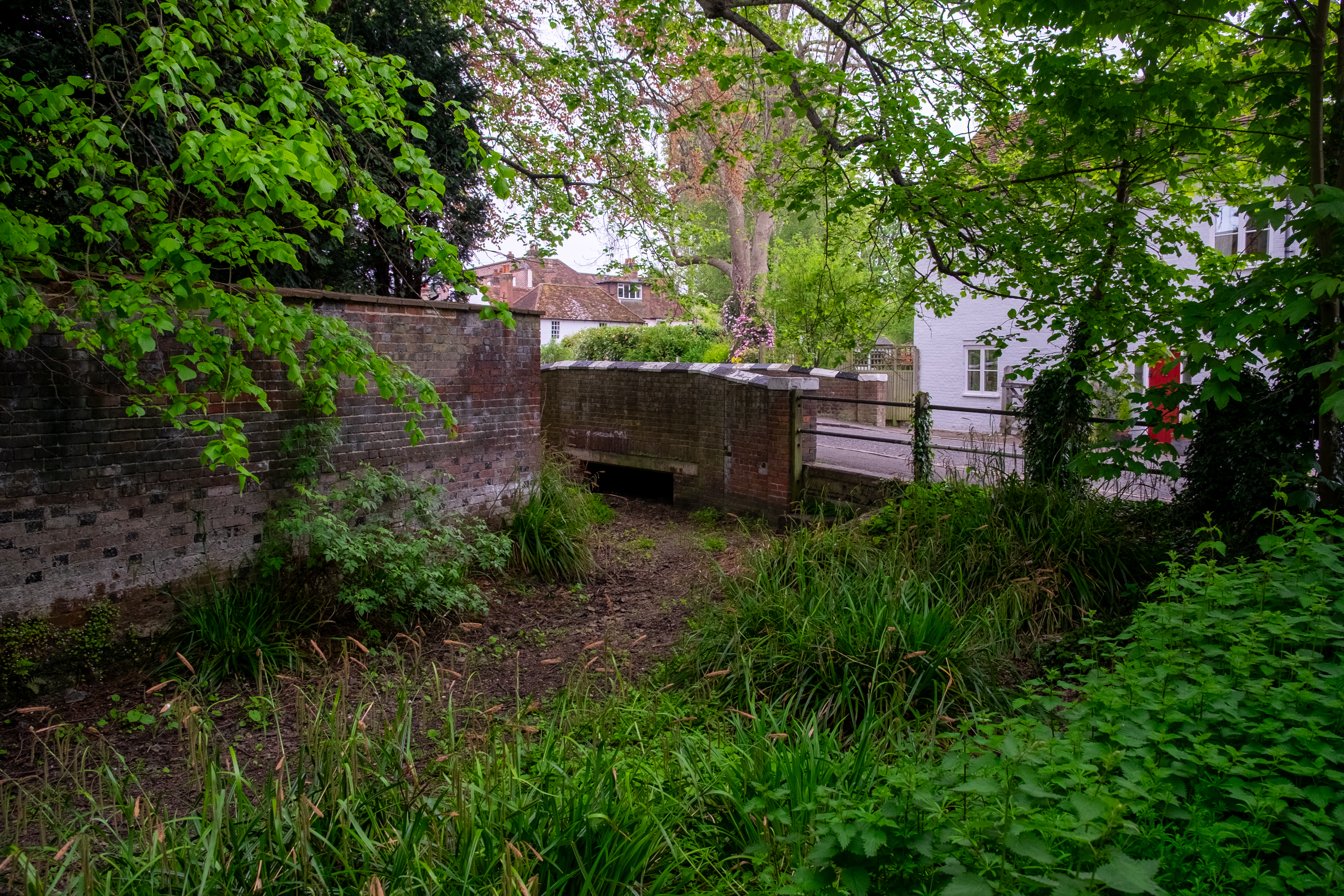
The year the Chess looked like this, the River Tarrant kept flowing.

Wessex Water has an answer: they claim that late summer rain prevented the Tarrant from drying when it was otherwise on course to. I put this to John Lawson and he went away to look at the rainfall figures over a longer time-series, to see if this late summer rain was an anomaly that plausibly did make the difference.

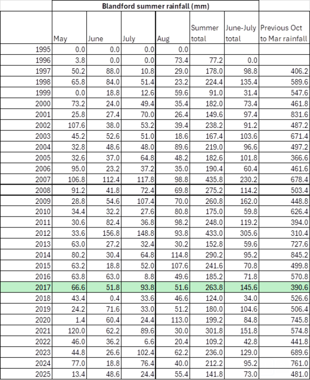
As you can see, the summers of 2015, 2021 and 2023 were similarly wet or wetter than 2017, but the river still dried. Whereas the the preceding October 2016 to March 2017 was unusually dry and that’s what usually determines flows in the following summer.

In summary

There is a mismatch between limited range of data (no consistent, long-term flow gauging), incomplete understanding of the aquifer, poor calibration in the modelling and confidence in the conclusions.

The purpose of highlighting these issues is not to suggest that “we are right and Wessex Water and the Environment Agency are wrong”. Instead it is to demonstrate that:

  • alternative models produce plausible results which do suggest an abstraction impact,
  • key assumptions (e.g. fixed catchment boundaries, limited zones of influence) are not definitively proven,
  • the current evidence base does not support a strong “no impact” conclusion.

Given all the above surely it would be prudent to treat the current findings as provisional rather than definitive and look for a more robust truly independent investigation, with scope not limited to model comparison.

Let’s not forget, this stream is used for spawning by Atlantic salmon. The stream may not be as protected as the Bourne and Wylye, but the salmon is. These fish are genetically unique to chalk streams and the Stour’s population of these fish must be the most endangered stock of all.

Oh and just one more thing …

Underlining the mismatch between what we know and confidence in conclusions, it is worth addicting that recent research into the Chalk aquifer by Andy Farrant and others at the BGS has highlighted the greater-than-previously-recognised role of karstic dissolution features and preferential flow pathways in chalk. These can provide localised areas of enhanced permeability that are not necessarily captured in regional groundwater models. Hydraulic connectivity may well occur along pathways that are not predicted by averaged aquifer properties or detected by limited observation boreholes. This must be relevant where abstraction alters hydraulic gradients, potentially activating or enhancing flow along such pathways?

Sure, this does not demonstrate that such connections exist between the Pimperne and Tarrant catchments, it does underline the uncertainty associated with assuming that lower-transmissivity interfluves act as hard hydraulic boundaries.

Just saying …

Tarrant update 2 – In defence of simplicity

In my last post I questioned why the Environment Agency confined its review of the River Tarrant Protection Society (RTPS) report to a comparison between two modelling approaches.

I argued that the Chalk Streams First (CSF) model—a simple, lumped parameter model—was never intended to replace the more complex 3-D model used by Wessex Water, but rather to highlight uncertainty. Several hydrogeologists, including the independent reviewer, have previously suggested that such approaches can be used in a complementary, tiered way, with monitoring data providing essential context.

In that light, it makes little sense to treat this as a modelling contest in which the limitations of one approach invalidate its findings. Model outputs should be interpreted alongside other lines of evidence.

The independent review compared:

  • the Wessex Water Middle Stour report (the official position), and
  • the RTPS report on low flows and drying

with a focus on hydrogeological data and modelling.

In this post I consider that comparison in the light of Jane Dottridge’s review (attached to my previous post), focusing specifically on the conceptual and methodological validity of the CSF model.

Assessment versus indicator

Jane was asked to comment on the validity of the RTPS findings on abstraction impacts, and to consider the Wessex report by comparison. She concluded that the CSF model does not “provide a more reliable assessment of abstraction impacts than the Wessex model”.

However, the RTPS report did not claim to provide a more reliable assessment, but rather a more reliable indicator. That distinction matters. An assessment implies a definitive evaluation; an indicator signals a relationship or pattern without claiming certainty.

The CSF model was presented as part of a broader evidential framework. Its outputs, taken together with other observations, were used to question the certainty of Wessex Water’s conclusions. Judging it as if it were intended to deliver a standalone assessment risks setting up a straw-man comparison.

The conceptual model

Jane states that the CSF model is highly simplified and suggests first of all that it has no conceptual basis, then later that it lacks a sound conceptual basis. There is some ambiguity here: whether no conceptual model exists, or whether the one used is considered inadequate.

In practice, the CSF model is based on a clearly defined—if simple—conceptual model. It assumes:

  • a fixed groundwater catchment based on topography
  • uniform transmissivity
  • a broadly synchronous rise and fall in groundwater levels
  • a distributed pattern of spring discharge across the valley

These are simplifications of a complex system. In reality, groundwater catchments shift, transmissivity varies, and flow processes are spatially heterogeneous. But the question is not whether the model captures every detail—it does not—but whether it is appropriate for its intended purpose.

There is ample precedent in groundwater science for simplified conceptual models, particularly where the aim is to identify dominant controls or test the plausibility of observed relationships. 

Model complexity should be proportionate to the question being asked.

Empirical relationship between groundwater and flow

The CSF approach is grounded in an empirical observation: that groundwater level and streamflow are closely correlated in chalk streams.

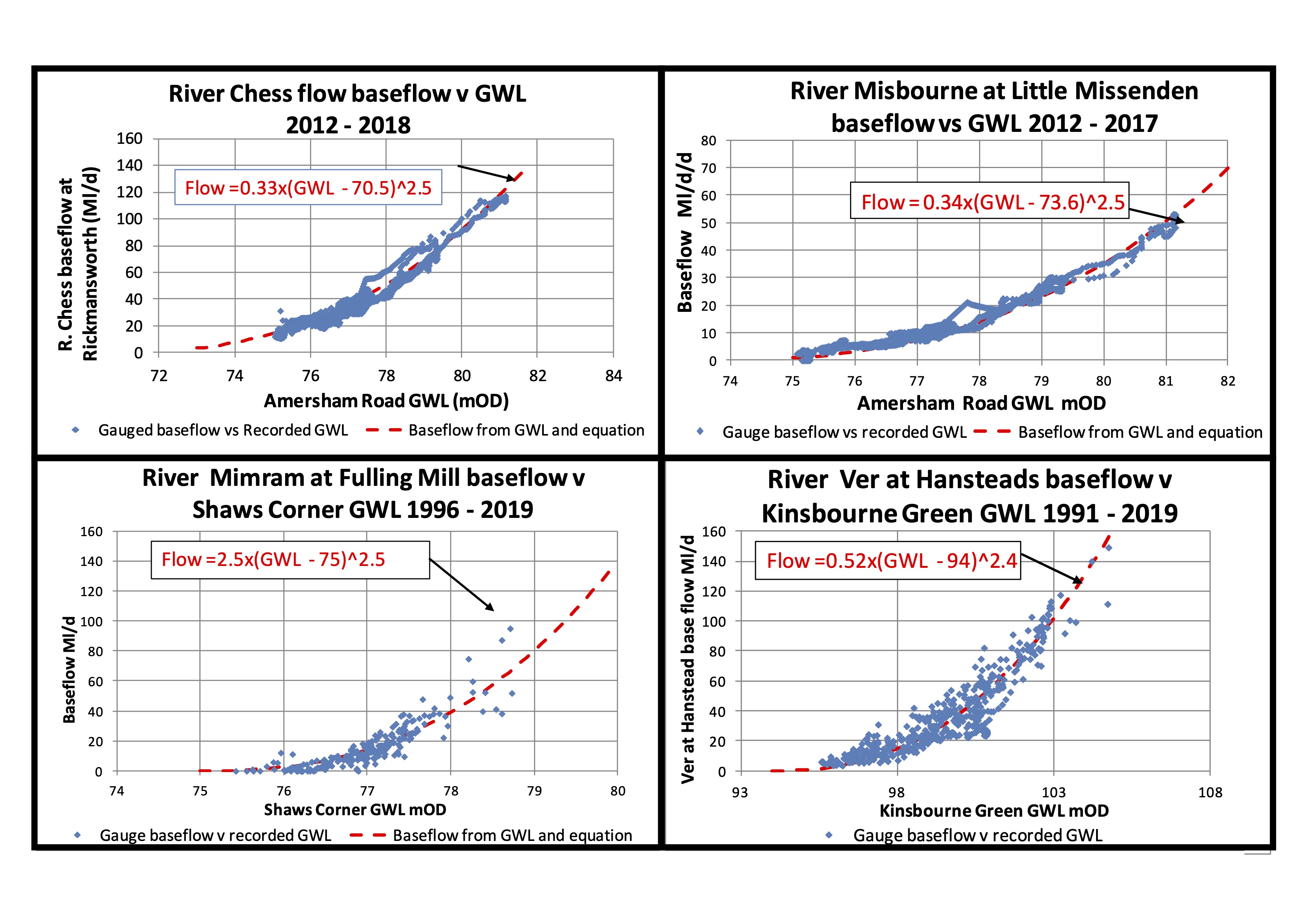
John Lawson has shown – using historical data – that, within relatively tight bounds, when groundwater levels are at a given elevation, streamflows fall within a given range. This close relationship appears to hold across long time series and across multiple different chalk stream catchments. John has looked in detail at the Rivers Kennet, Og, Misbourne, Chess, Ver, Mimram, Beane, Ivel and Darent, with some examples shown below.

Note. 1. baseflows derived from gauged flows using baseflow separation software. 2. Plotted baseflows usually lead GWLs by 2-3 weeks

And, of the course the River Tarrant.

The implication is that groundwater level is the dominant control on flow, with abstraction largely affecting flows indirectly by lowering groundwater levels relative to their natural state.

This is not a theoretical construct imposed on the system, but a pattern observed in the data and then represented mathematically.

The CSF equation and non-linearity

The CSF model expresses this relationship in the form:

Q = a(GWL – b)^c

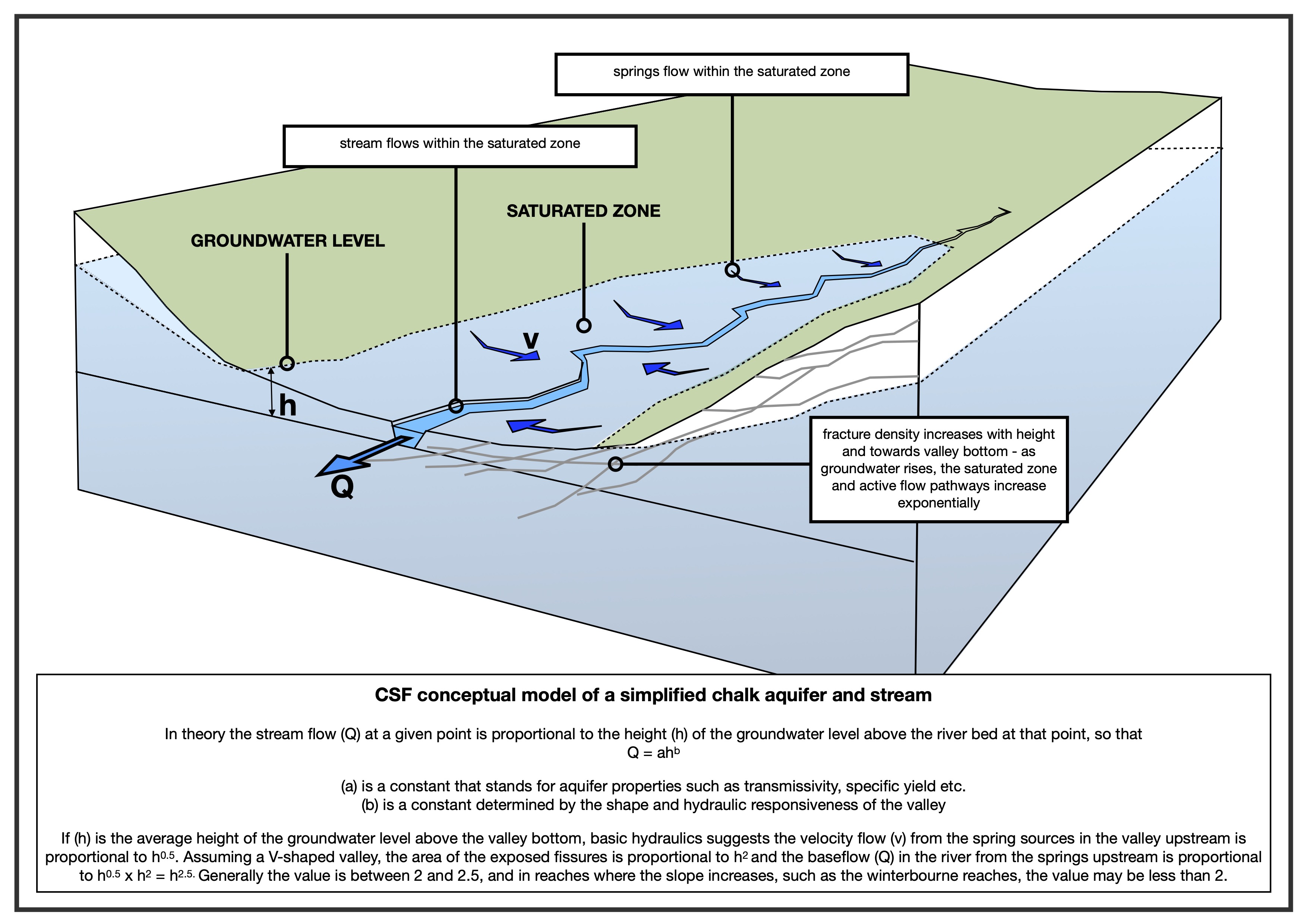
where the constants are calibrated to fit observed data, where the constants are calibrated to fit observed data. Q is flow and (GWL – b), is the height (h) of the groundwater at the observation point over the stream bed at the discharge point.

As shown on the above plots for the Rivers Chess, Misbourne, Mimram and Ver. The relationships between GWLs and baseflows is very strong for “pure” chalk streams with baseflow indices over 90%, like the Chess and Misbourne in the above plots. In rivers like the Darent, with mixed geology including some tertiary deposits, the baseflow indices are below 80% and the relationships show more scatter, but are still plain to see.

A key feature of the relationship is that it is non-linear: increases in groundwater level produce disproportionately larger increases in flow. The model captures this behaviour through the exponent (c), which typically lies between 2 and 2.5 as seen on the plus above.

This non-linearity can be understood heuristically. As groundwater levels rise:

  • the area of saturated ground contributing to spring flow increases, and
  • the hydraulic response of the system becomes more pronounced

Together these effects produce a more-than-linear increase in discharge. While the precise physical mechanisms are debated — ranging from valley geometry to fracture density—the existence of non-linear behaviour is widely observed in the data.

The CSF model does not claim to resolve all underlying processes, but it does provide a consistent way of representing this empirical relationship.

Calibration and transparency

Jane raises concerns about how model parameters — such as subsurface flow and specific yield— are derived.

In the CSF model, these parameters are obtained through calibration: the constants are adjusted until the model reproduces the observed relationship between groundwater levels and streamflows over historic records.

This is a standard empirical approach. The parameters effectively encapsulate the combined influence of aquifer properties such as permeability, transmissivity and storage (a) and valley shape combined with other components of the non-linearity, such as fracture density rising with altitude (b).

The method is described in the RTPS report (page 22), including the treatment of throughflow and specific yield. While simple, it is transparent: the model is designed to reproduce observed system behaviour rather than simulate all underlying processes explicitly.

The key question is therefore not how the parameters are derived in isolation, but whether the calibrated model reproduces reality with sufficient fidelity. On that measure, the fits to historic data are strong.

Is simplicity a weakness?

Prior to the Affinity Water conference in 2022, the CSF model was reviewed by several hydrogeologists. While they noted its simplicity and raised questions about parameter estimation, they did not dismiss the approach. On the contrary, they regarded the results as promising and worthy of further consideration.

Andy Binley wrote: “I must say that the modelling results and analysis of historic data appear convincing to me. You have modelled a substantial set of historic records using a simple lumped approach – the fits to data are impressive and appear to outperform the EA model.”

Jonathan Paul wrote “The reports showcase an interesting, if highly simplified, analytical relationship between groundwater level and river discharge. Initial results look very promising, but greater clarity in how your exponents a and b were obtained would be welcome.”

Jane herself noted in earlier correspondence that the model was “a neat little model” and more satisfactory than some alternatives, albeit highly simplified.

This highlights a tension in the review. The same simplicity that was previously seen as acceptable — within a defined scope — is later treated as a fundamental weakness.

Yet simplified models have a recognised role. They are often used in early-stage assessment, to identify key controls and sense-check more complex analyses. If they can reproduce observed behaviour reliably, they can provide a valuable benchmark against which more elaborate models can be tested.

Conclusion

The CSF model is not a replacement for detailed 3-D modelling, nor does it claim to be. It is a simplified, empirically calibrated tool designed to capture the dominant relationship between groundwater levels and streamflow.

Its conceptual basis is explicit, if simplified. Its parameters are derived transparently through calibration. And its outputs align closely with observed data across multiple catchments.

In that context, the key issue is not whether the model is simple, but whether it is useful. If it consistently reproduces observed behaviour, then it has a legitimate role — particularly in testing the robustness of conclusions drawn from more complex models.

To dismiss it on the basis of its simplicity alone risks overlooking precisely the kind of evidence that can help identify uncertainty in groundwater impact assessments.

Tarrant update 1 – the Environment Agency’s modelling contest

With uncanny timing (following my post Tuesday last week), on Friday the Environment Agency forwarded to the River Tarrant Protection Society the adjudicatory report of their independent expert. (I’ve posted a copy at the foot of the page but have redacted a few personal details)

I received a lot of interested feedback from last week’s post. My intention had partly been to help inform other groups facing similar struggles in other parts of the Chalk, so I was very pleased that I seemed to have done that and to have catalysed a conversation about the uneven, David versus Goliath contests we face.

I’m uneasy about the EA’s approach to this case. Why take so long to respond? Why be so apparently reluctant to engage with the proactive, positive suggestions in the River Tarrant Protection Society (RTPS) report? Why not agree to a meeting? Why set out with an adjudicatory contest between models – which is almost bound to find in favour of the status quo – instead of addressing the full package of evidence?

A quick bit of background. 

Please read my previous post for the fuller picture, but in short:

  • The River Tarrant is a chalk stream in Dorset where locals have long been concerned (50+ years) about the impact of abstraction.
  • It is a breeding stream for critically endangered Atlantic salmon.
  • The lower stream is drying far more frequently now than it did in the past. We don’t know for certain the flow patterns before the era of abstraction but there are no records of lower river drying before the 1950s (by contrast, there are records of natural upper river drying, for example in 1929) and there are five Domesday mill sites on the middle and lower river, which suggests the stream was reliably perennial.
  • As abstraction has increased from the 1970s to today the drying frequency has climbed from about once per decade (1976, 1989, 1995) to every year (2015, 2016, 2018, 2019, 2020, 2021, 2022, 2023, 2024, 2025).
  • In 2018 Wessex Water was obligated to lower public water abstraction in the Bourne and Wylye catchments. To achieve this they constructed a grid to move water north from “under-utilised sources” in the Stour valley. 
  • As part of this process the Environment Agency asked Wessex Water to produce an environmental impacts report into any possible impacts on the chalk streams of the Middle Stour, specifically the River Tarrant, the Pimperne Brook and the North Winterbourne.
  • The review concluded that: 
    • only a single, small and long-running pump impacted flows in the Tarrant and by only a negligible amount.
    • a single, much larger pump had no impact on flows in the Pimperne winterbourne (nor the neighbouring Tarrant)
    • impacts on the North Winterbourne were negligible.
  • The grid went ahead, since when the Tarrant has dried every year.
  • In 2024 the River Tarrant Protection Society sent an independent report authored by John Lawson to the Environment Agency which questioned the Wessex Water assertion that the abstractions were having no impact on either the Tarrant or Pimperne. The report used the results of relatively simple “lumped parameter” modelling to show that there may indeed be an impact, and added a considerable weight of historical and recent empirical evidence to back up its claims
  • In the face of this uncertainty the RTPS has asked for more detailed investigations and has also proposed a scheme of abstraction realignment that would alleviate the drying in the Tarrant. 

The Environment Agency has taken a long time to respond and thus far the terms of reference for their investigation have been very limited. 

Independent review

Jane Dottridge, an expert hydrogeologist with Mott McDonald, was asked to compare the two modelling approaches: Wessex Water’s modelling (developed with the EA) compared with John Lawson’s modelling. To quote Christopher Greenwell, the EA Water Resources Lead, “I wanted to focus on the two modelling approaches first, since this formed one of the most fundamental challenges within the RTPS report … What Jane has done is not simply to consider John Lawson’s alternative approach but also to reassess the approach undertaken by Wessex Water during their investigation of the impacts of the Middle Stour sources.”

The RTPS was not consulted on the scope, terms of reference or the choice of reviewer.

Jane Dottridge previously reviewed the Wessex Water Middle Stour report in 2018. She has stated in her letter / report that she draws on her prior work as external reviewer to the Wessex Basin Model and her knowledge of that model. 

More than that, Jane has encountered John’s work before, in another context. In preparation for a meeting convened by Affinity Water about the River Ivel in 2022, Jane was recommended to me as someone who might take an independent, helpfully critical view of John’s work and modelling approach. She sent some very useful notes of quite a technical nature. Arguably, her in-a-nutshell verdict was summed up in her statement: “My problem with this model is that it is very 1-d and doesn’t report any water balances. But it is a neat little model and much more satisfactory than some of the others I’ve seen recently.”

This we thought fair enough. John’s modelling wasn’t intended to rival, let alone replace the more complex 3-D modelling used by water companies and the Environment Agency. Instead it is proposed as a solid sense check, especially when the claims of water companies seem questionable, a tool for grass-roots organisations that can be used to usefully question unjustified certainties around these oft repeated claims of “no impact”.

In the meeting itself Jane was more critical of John’s modelling than she had been in our correspondence, describing it as a circular argument with a fitted-up recession to make calibration look right and “pop out some numbers”. It took Rob Soley to propose that the lumped parameter model had its value as a “first pass” to identify potential issues. Another hydrogeologist who we had spoken with before the meeting – Andy Binley –  also defended John’s model for what it is, a simple, numerical model calibrated to predict flows, not all the other complexities of an aquifer system. Jane suggested the idea of a tiered approach to modelling – begin with simpler lumped parameter models, progressing to more complex physics-based models if simpler models don’t provide enough certainty. 

Finally she added – and I have related this discussion not only because the roles of different complexities of modelling were not judged as mutually exclusive by Jane, Rob or Andy, but also because of Jane’s final point: she said that “models should be backed up by data and monitoring“.

So, why limit the scope of the review?

Christopher Greenwell stated that he wanted to focus on a review of the modelling approaches since “this formed one of the most fundamental challenges in the RTPS report”. RTPS weren’t given an opportunity to influence this decision, or to argue that John’s modelling outputs were part of a rounded package of evidence that included historic testimony, news reports and empirical observations.

We can see in Jane’s letter that the scope of the review did indeed focus solely on hydrogeology and groundwater modelling and that it excluded ecological, historical and qualitative evidence. This has the effect of narrowing the debate to something more like “which model is better” instead of addressing the more appropriate question: “what does the the sum of the various strands of evidence say about possible or probable abstraction impacts?”

Clearly, hydrogeology is an inexact science, is inherently uncertain. Groundwater systems — especially chalk — are structurally very complex and models of them are really only crude approximations of the living entity, no matter how much refinement is built in. They are dependent on assumptions and do not constitute primary evidence. Good scientific practice, therefore, should integrate the modelling with the other evidence. Which is exactly what the RTPS report did.

The EA’s approach – at least thus far – is a sort of backwards hydrogeology. It excludes archaeology, geomorphology, ecology, historical records, empirical evidence, testimony and conflates modelled output with evidence in the real world.

Besides, the RTPS model was never intended to win a modelling contest. It was intended to demonstrate that an alternative conceptual model can reproduce the observed behaviour of the stream and suggest that therefore the Wessex Water conclusions may be unsafe.

WFD rules

It is also worth pointing out that WFD assessment rules specifically state that decisions should be made on the weight of evidence, not a single line of analysis. If there is credible uncertainty, plausible mechanisms of impact and observational evidence consistent with impact – all very clearly set out in the RTPS report – then a regulator cannot safely conclude “no impact”.

The legitimate role of historical and qualitative evidence

The RTPS report uses various strands of evidence to try and establish:

  • the baseline condition of the stream
  • changes in the flow regime over time
  • the timing of the changes relative to the advent and then increases in abstraction.

For example:

  • The lower river dried rarely, if at all, before 1950 when abstraction began.
  • Between 1970 and 2000 the lower river dried about once per decade.
  • In the last decade, when abstraction has increased yet further, it has dried almost every year.
  • The exception of 2017 coincided with a long-term shutdown of Black Lane pumping station

This is very solid evidential reasoning, layering historical, hydrological, circumstantial and mechanistic evidence. The RTPS report advances a very legitimate scientific hypothesis, of which the modelling is just one part.

Thus far the Environment Agency’s approach:

Places too much reliance on model supremacy. The review as framed thus far implies that a model provides a more reliable basis for conclusions than any other strand of evidence. Models are inherently uncertain.

Fails to apply “weight of evidence”. The EA review evaluates the models but does not integrate them with the unarguable flow-regime changes, the ecological evidence, the historical evidence, the observed anomalies (2017).

Narrows the focus to short-term datasets. Historical evidence, for example Domesday mills and the presence of Atlantic salmon, provide a legitimate long-term context and capture a picture of the system behaviour before any monitoring record. This is really valuable information and should not be ignored. If you exclude these you bias analysis to short-term datasets that are all influenced by abstraction. 

Misunderstands the RTPS objective. The RTPS model is criticised for its simplification of aquifer properties and structure and lack of conceptual detail. However, the RTPS model was not intended to outscore the Wessex Basin mode, rather to challenge and question its unjustified certainties.

Excludes the RTPS from dialogue. The RTPS sent their report 7-months ago and requested a meeting. Thus far the only meaningful engagement has been the receipt of this report.

By turning this into a modelling contest the EA – thus far – appears to have stacked the deck in favour of the status quo. The EA’s approach is at odds with the more inclusive way forward agreed in during the framing of the multi-lateral CaBA chalk streams restoration strategy. Recommendation 11 in the strategy advocated the importance of knowledge and model sharing and said it was important to “include stakeholders in the discussion and decision-making”.

**

In my next post I will take a look at the Wessex Basin Report, the RTPS report and Jane Dottridge’s adjudication and try to show why – even under the terms of the comparison – the RTPS case is strong and should not be dismissed.