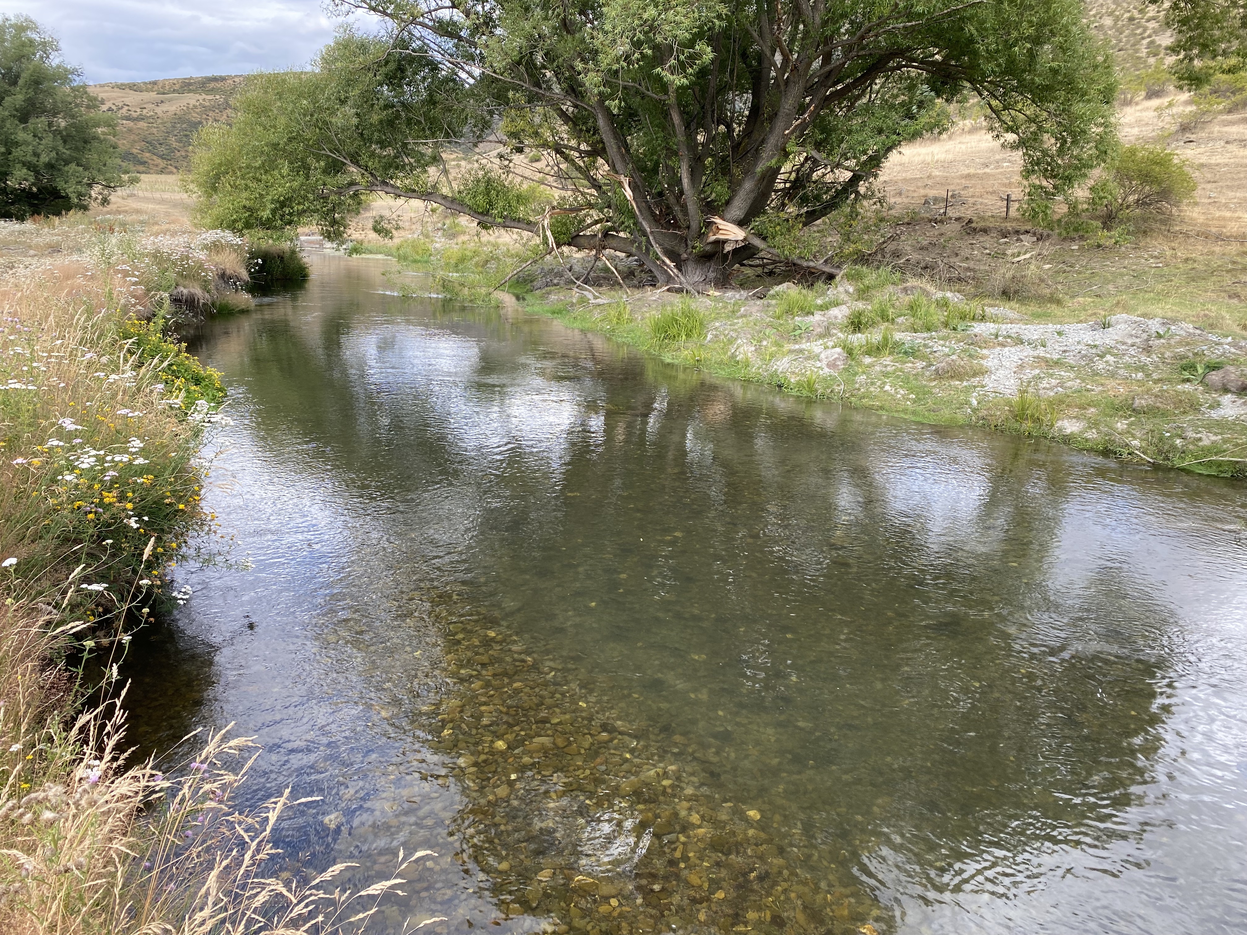
Picture above: The “River” Beane. For much of the time it is not imaginarily dry. It is actually dry.
Just before Christmas I published a long post that few people will have chewed through: my responses to some of the points Rob Soley, technical director at WSP, made in a webinar about abstraction reductions and his view that it is unwise for the UK to “abandon” groundwater abstraction.
Rob has followed up that webinar with a feature in CIWEM magazine entitled “Enormous Cuts to Groundwater Abstraction in England are Unwise”. Rob is an eminent hydrogeologist. His arguments will be taken seriously. Some of what he says I fully agree with, certainly the need to prioritise abstraction reductions so that we get the best ecologic outcomes for the investments.
But as with the webinar, we have to unpick the reasonable arguments from parts that are hyperbolic and alarmist, arguing against the most extreme interpretations of the new ideas. No one is about to turn all these pumps off. There is a reasonable debate now – and not before time – about how to realign water resources and ease the pressure on the environment. As is the nature of debate, there are various points of view. We need to find common ground. Common ground is not the status quo.
The water industry and its army of hydrogeologists must accept that groundwater abstraction has caused and is continuing to cause significant ecological damage to precious habitats in chalk streams around London, into Kent, Cambridgeshire and Bedfordshire. This are where the environmental pressures are at their apex and they are massive.
The NGOs, and river groups need to accept that the public needs water, Water Cos have to supply it, that it has to come from somewhere and that therefore we do need to engage in a pragmatic discussion about compromise and priority.
Rob’s argument is essentially that through a laudable but deluded greenwashing project we are in danger of losing sight of a formerly more rounded definition of “sustainable” water resources, which should include a consideration of fact that we currently enjoy relatively inexpensive and clean chalk groundwater with tolerable ecological impact, versus the costs to society of developing alternative sources (should we do that), the carbon impact of transporting water, and the disappointing ecological outcomes that are likely to follow all that (unnecessary) investment. He characterises this project as the green elephant in the room.
This is a somewhat polarised way of seeing things and I suggest that the problem at the heart of this polarisation is the sheer size of the abstraction reductions which have been put to the regional groups without much attempt, thus far, to really distinguish between them in terms of priority. The deficits were calculated using the EA’s EFI methodology, and applied to every single water-body, without distinguishing between whether the water-body was a vulnerable, headwater chalk stream, or the navigated, impounded and discharge-supported lower reaches of a large, urban river.
This is ringing alarm bells for water companies and their consultants. But Rob is taking arms against a straw man.
At least Chalk Streams First is not arguing for the scale of abstraction reduction Rob takes issue with. But we are arguing for the restoration of flows to streams like the Ivel, Ver, Chess, Beane, Misbourne, Rib, Darent, etc. In our submissions to WRSE and WRE we have argued for a transparent prioritisation process. And indeed the EA has taken note of this and some work is being done in the area.
That work needs to be made urgent now. Otherwise the debate will entrench and become this all or nothing dichotomy in which I am certain the environment will lose out. After all money trumps ecology every single time and if the bill can be characterised as foolhardy and massive, it won’t get paid.
One example: the total deficits for the whole Colne system down to the Thames amount to 270Ml/d. That’s a lot of water. Two Abingdon reservoirs of deployable output. The total deficits on the chalk stream tributaries, however, amount to about 80 Ml/d. Factoring in a reasonable expectation of 50% flow recovery (see my previous post) at low flows, that leaves a net deficit of 40 Ml/d. This can be cheaply provided via the Grand Union Canal transfer.
If you add to this the idea of a groundwater insurance scheme, the net deployable output to London actually goes up.
The lower Colne, which makes up the bulk of that enormous 270 Ml/d deficit, is highly modified, embedded in a stable water-table, much supported by discharges and would benefit from the all the chalk stream flow recovery anyway.
There are intelligent ways to do this, in other words. Ways that are not all or nothing, but consist of pragmatic and measured improvements that are well worth paying for.
Pic above: The River Ver in the drought of 2022. And the million dollar question: how much flow do we get back if we turn off abstraction?
Making Chalk Streams First a reality: how do we overcome the uncertainties?
A few months ago the Chalk Streams First group commissioned a follow-on report from John Lawson, to investigate and collate evidence of flow recoveries following abstraction reductions in the Chilterns and Herts chalk streams. The report is now finished and we will publish it soon.
The blog post below introduces some of the complex discussions in the report. It leads to an important proposal for a type of scheme which traditionally the conservation community has been wary of, but which is well worth considering in the light of the debate over flow recovery.
It could help to address water-supply resilience and ecological restoration and thus allow the full delivery of Chalk Streams First within a few years as opposed to a few decades.
PART 1.
If I was to say “abstraction has a much smaller impact on chalk stream flows at low flows and in times of drought, than it does at high flows and in winter” you’d probably furrow your brow.
Everyone does.
The explanation is actually found in simple physics. But it’s counter-intuitive and so not easily understood, and because of that, not generally known.
But it is really important that we get our heads around the idea, because otherwise we’re in danger of allowing the Chalk Streams First project, and especially the potential pace at which it could be realised, to be derailed. And we’re in danger of missing the clear benefits of a groundwater scheme that could bring all parties together.
With a surface abstraction from a river, it’s easy to see the link between abstraction and flow. The river is flowing at X Ml/d. You insert a pump into the river and pump at a rate of Y Ml/d and the flow d’stream of the pump will become X – Y Ml/d.
As the flow in the stream diminishes through the summer, Y will become a larger and larger proportion of that flow. And vice versa, it will become a smaller and smaller proportion of that flow through the winter. Therefore constant surface water abstraction has a BIGGER impact on low flows than high flows.
And yet most groundwater abstractions – and certainly groundwater abstractions at a catchment scale – seem to have the opposite impact: a smaller impact on low flows than high flows.
How?
The reason is bound up with the fact that once you abstract water from the ground and not directly from the river, the impact on flows is no longer direct either, but occurs via the impact on groundwater level. Thus the impact is bound to the relationship between groundwater level and flow, because it is groundwater level – the head of the groundwater level above the bed of the river – that drives flows into chalk streams.
Just as the rate of flow out of a hole at the bottom of a bucket increases as the level of water in the bucket rises, so the rate of flow from an aquifer into a chalk stream rises as the groundwater level rises. The force that drives the flow is gravity or hydraulic head.
But it’s not just hydraulic head that places a cog in the link between groundwater level and flow. There are the properties of the rock matrix of the aquifer – how much water it holds and where and how quickly that water can move – as well as the topographical shape of the valley. And there’s time too.
All of these combine to create a non-linear relationship between groundwater level and flow. Which means that for each unit rise in groundwater level, you get an exponential increase in flow. The aquifer, its topographic features and time provide gearing, if you like.
So, if a rise in groundwater level from, say, 98 to 99 AOD gives a much greater increase in flow than a rise from 95 to 96 AOD, it stands to reason that a reduction in groundwater level from 99 to 98 AOD, will cause a much greater reduction in flow than a reduction in groundwater level from 96 to 95 AOD.
Same unit rise or fall, but a bigger or smaller net reduction in flow.
Abstraction has an overall lowering effect on groundwater level. Therefore, one can see that the overall effect will have a bigger impact on flow when groundwater levels and flows are high, than when they are low.
The implications of this, when combined with water resource considerations, are significant.
We’ve always said, when pushing the case for Chalk Streams First, that if you switch off abstraction you get, on average, about 80% of the water back as surface flow. We’ve also always said that % flow recovery varies through the year, with over 100% in winter and as low as 30% or so in late summer (when groundwater levels are lower). In very low flows (Q99) this recovery might drop to only 20%.
This is where TIME comes in. The abstraction rate was constant, but because of aquifer gearing, the “less” you get back in the summer, actually comes back as “more” in the winter and you have to take a long view to see that over the full year the amount of water you get back is about 80% of that former abstraction rate (the remaining 20% passes through the aquifer under the ground).
Obviously these figures vary stream to stream.
It is the figure at low flows that is key, because it is low flows and especially 18-month droughts, that threaten water supplies in and around London.
In the current drafts of Affinity Water’s & Thames Water’s water resource management plans, and the WRSE national framework plan, the estimate of flow recovery at low flows is a conservative 17%, where we think the figure should be over 50%.
The critical droughts used for planning purposes are the 1921 and 1933/34 droughts. The WRMPs are built around the basis that flows in these droughts averaged at the 98th percentile. In fact, from the beginning to the ends of these droughts flow averaged the 95th and 89th percentiles respectively, a combined average of the 92nd percentile, at which flow recovery from the Chilterns chalk streams – in our estimation – would be over 50% of the abstraction reduction.
The knock-on effect of planning according to that – in our view – irrationally low figure of 17% is that the lion’s share of the Colne / Lea chalk-stream abstraction reductions have to wait for a very large strategic resource option such as Severn-to-Thames Transfer or Abingdon reservoir. That pushes them back until after 2040.
Can we really wait two more decades – and probably longer – for the full restoration of flows to our beleaguered chalk streams? In our view we could see most of the very much needed abstraction reductions far sooner.
Part 2. The way round this which we could all agree on and act now.
Despite our differences of opinion over flow recovery, we can probably all agree that there is indeed uncertainty over the % flow recovery we will see at low flows.
Therefore, from all points of view it is surely best to investigate ideas that overcome this uncertainty, ideas that might ensure the resilience of public water supply – as that is the issue of greatest concern to Affinity and their primary statutory duty – and also fully re-naturalise flows in the chalk streams, within a reasonable time-frame, not 20+ years.
The original Chalk Streams First idea was designed as a pragmatic solution to the formerly irreconcilable tension between public water supply and the ecological health of chalk streams near London. It always depended on storage because of the differing levels of flow recovery you get through the year. Now, with flow recovery at the very lowest of flows identified by planning constraints as the limiting factor, it is surely worth exploring additional ways to insure against these uncertainties.
Minworth – GUC transfer.
Water transfer from the Minworth sewage outfall via the Grand Union Canal is one such idea that has been universally accepted as worthwhile: it is in the WRSE and WRMP plans and of itself covers off a proportion of the abstraction reductions needed to restore natural flows to the Chilterns and Herts chalk streams. But it isn’t enough.
Licence Relocation
Rolling the groundwater abstractions down the catchment is another such idea: this came from Affinity and is a version of the Chalk Stream First concept. If the abstractions are sited down-catchment, where there is always perennial flow that vastly exceeds the pumping rate, much supported by discharges, then it is likely that stream-side groundwater abstractions will have an almost 1:1 impact in the same way surface abstractions do.
Groundwater Insurance Scheme.
In spite of both ideas above being no-brainers and enjoying universal support, the full-fat version of the Chalk Streams First proposal is presented as dependent on another large strategic scheme, such as Abingdon Reservoir or the Severn-to-Thames transfer. The Chalk Streams First group sees both as potentially important components to help ensure resilient water-supplies, but we would be extremely and justifiably disappointed if the full realisation of Chalk Streams First was made contingent on these either or both of these schemes. It would push the ecological recovery of these chalk streams decades down the line.
Therefore a third idea, tried and tested elsewhere, and worth exploring in the context of the Colne and Lea, would be a version of the West Berkshire Groundwater scheme (WBGWS).
Once it is understood that abstraction at low flows has a much smaller proportional impact at the time*, then it can be understood that something like the WBGWS has the potential to guarantee drought supply with a minimal ecological impact. This guarantee then underwrites the whole Chalk Streams First concept because the limiting low-flow recovery is underwritten.
(*Important to contextualise this “smaller” impact: where abstraction runs at 25 – 50% of recharge, as it does in the chalk streams around London, this “smaller” difference can still be the difference between flow and a dry river).
The West Berkshire Groundwater Scheme (WBGWS) was constructed in the 1970s to augment London’s water supplies during severe droughts – its planned use is about once in 25 years. The scheme abstracts water from boreholes in the chalk aquifer in the upper Lambourn, Pang, Enbourne and Loddon valleys, discharging water into those rivers from where it flows down into the River Thames for later abstraction to fill London’s reservoirs. It contributes about 90 Ml/d to London’s deployable output.
The WBGWS concept could be used in the Colne and Lea chalk tributaries, in combination with current proposal for reduced abstractions for day-to-day supplies. Replacement supplies would be transferred from the London supply system using the Thames to Affinity transfer and the ‘Connect 2050’ pipe network.
Our initial assessment of the WBGWS concept in the Chilterns chalk streams has shown that on the River Ver a reduction of abstraction from the current 28 Ml/d to about 8 Ml/d, combined with WBGWS-type drought support of up to 25 Ml/d, would almost re-naturalise River Ver flows and also give a net increase in London supplies of about 9 Ml/d.
If the concept was adopted in all the Colne and Lea chalk streams, abstraction could be reduced by 150 Ml/d to meet EFIs throughout the catchment. The 50 Ml/d first phase of the GUC transfer is a no-brainer, so only 100 Ml/d of replacement needs to come from the connection to London’s supplies.
If the deployable output recovery of London’s supplies from the 150 Ml/d reduction is the 50+% that we predict, the concept gives a 50-60 Ml/d gain in London’s supplies. If the DO recovery is only 17%, the concept would still allow the 150 Ml/d chalk stream reductions to take place without impacting London’s supplies.
The drought support would only be needed about once in 25 years. Drought flows in the chalk streams would be increased by the WBGWS-type releases and would be slightly less in the following year but importantly, they would still much more than with abstraction at recent levels.
This would remove much of the doubt that currently exists over the amount of flow recovery from abstraction reductions. A net gain in deployable output of 55-60 Ml/d could make this a significant new water resource in its own right.
Why have schemes like this traditionally been seen as a “bad thing” by conservation groups? An incomplete appreciation of the gearing of impact must be one reason. Another may be an ideological aversion to the active management of a natural system. But all aquifers in south east England are managed to a degree: better by far to manage them intelligently to suit all desired outcomes. A cynicism about schemes which are usually proposed by water companies might be another reason!
Let’s put all these aside. Surely we need to engage in serious discussion about this idea?
Chalk Streams First appears to have brought all parties together: Ofwat, the water companies, EA and the NGO’s. But in the current draft plans it’s pace of instigation is still too slow / and the full version is at best uncertain.
The GUC transfer is a must have – so please support that in your responses – but let’s ask for a serious investigation of the groundwater insurance scheme too.
Much credit is due to John Lawson for the many, many hours of investigative work he put into the ideas I have summarised above.
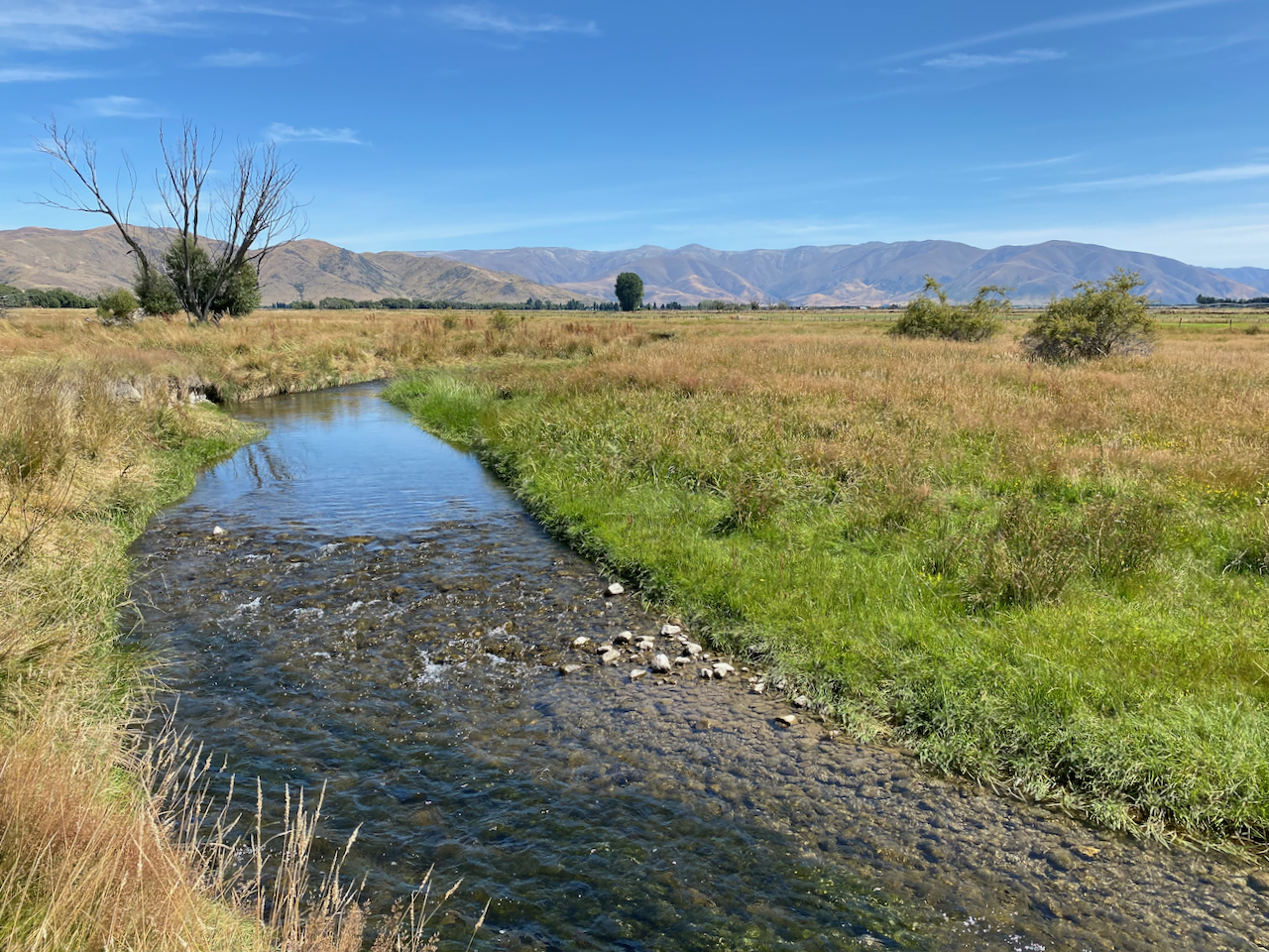
One of the dangers of best-kept secret rivers is that they are more easily trashed. I have long known this, and more than once before have had to open up on the name of a beautiful stream that I enjoy walking and fishing in order to shout loudly how important it is.
I’ve not done this in New Zealand before, however, have not ever felt it was my place to. And I know that Kiwis, fishing guides especially, don’t like the names of their secret spots broadcast far and wide. So, I’ll keep the name of this place quiet for now – if you know it, you’ll know it – at least until I can find out more about the reasons behind what I saw yesterday.
Because yesterday, I felt like giving up. I was totally in the dumps. The struggle to champion the cause of pastoral spring streams (chalk streams being in that group, and at the very apex of pressure caused by humans) feels too much like an uphill one at times.
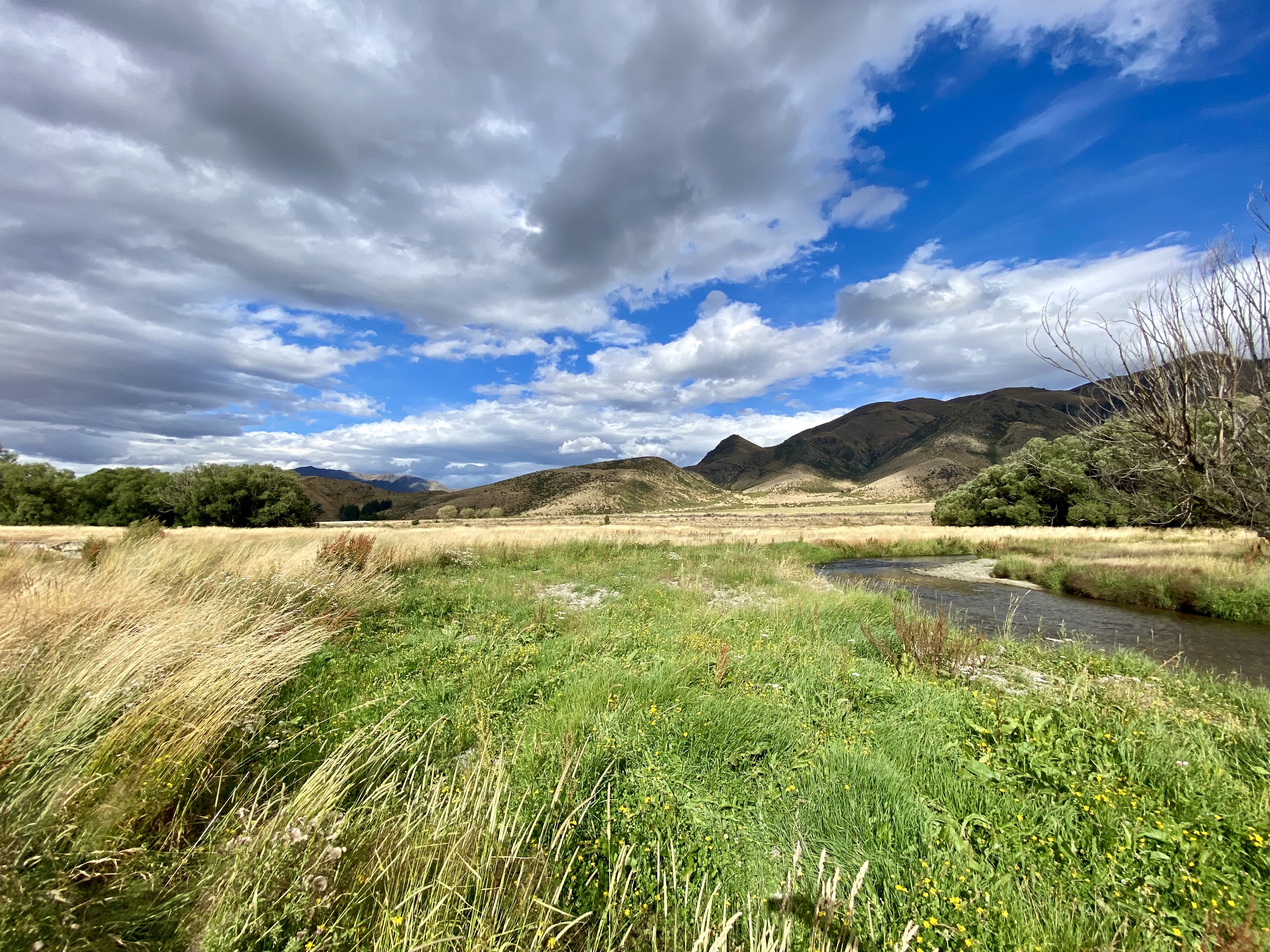
I’m on a tour of New Zealand with Simon Cain – also a passionate river-restorationist who I have known since 1991 – showing him all the unspoilt spring-creeks I have been going on about for so long, the rivers I like to model river restoration ideas on. I told him the stream we were going to look at was one of my favourites: “It’s kind of like the upper Frome,” I said. “Only maybe a 13th century Frome.”
You could pick all sorts of holes in my comparison. There were no mills on this stream. There are no mountains to the side of the Frome. But it painted a picture. And indeed this stream has also worn the impact of farming quite heavily in places, over the years. It is abstracted by pumps. One farmer on it makes no effort whatsoever to fence out the livestock and the riparian edges in that reach are nibbled and puddled bare. The very headwaters, which were once a marsh supporting the base-flow, have been arterially straightened in the past.
But somehow the river was still just lovely. And I have often cited the lowermost farmer – when chatting to other farmers, many of whom are not that happy about the new NZ law compelling the fencing out of livestock (it is causing problems with overgrowth of rank marginal vegetation) – as having managed the riparian strip to perfection ever since I had known the place and long since before the new law: a fence twenty to fifty meters back and very occasional grazing on the stream side. He had presided over a true spring-creek paradise.
Which is why I suspect the farmer here is not to blame. Why, having been apparently perfectly happy for many years with the co-existence of his farming and his spring-fed stream, would he suddenly take a hatchet to the latter and hack it to bits?
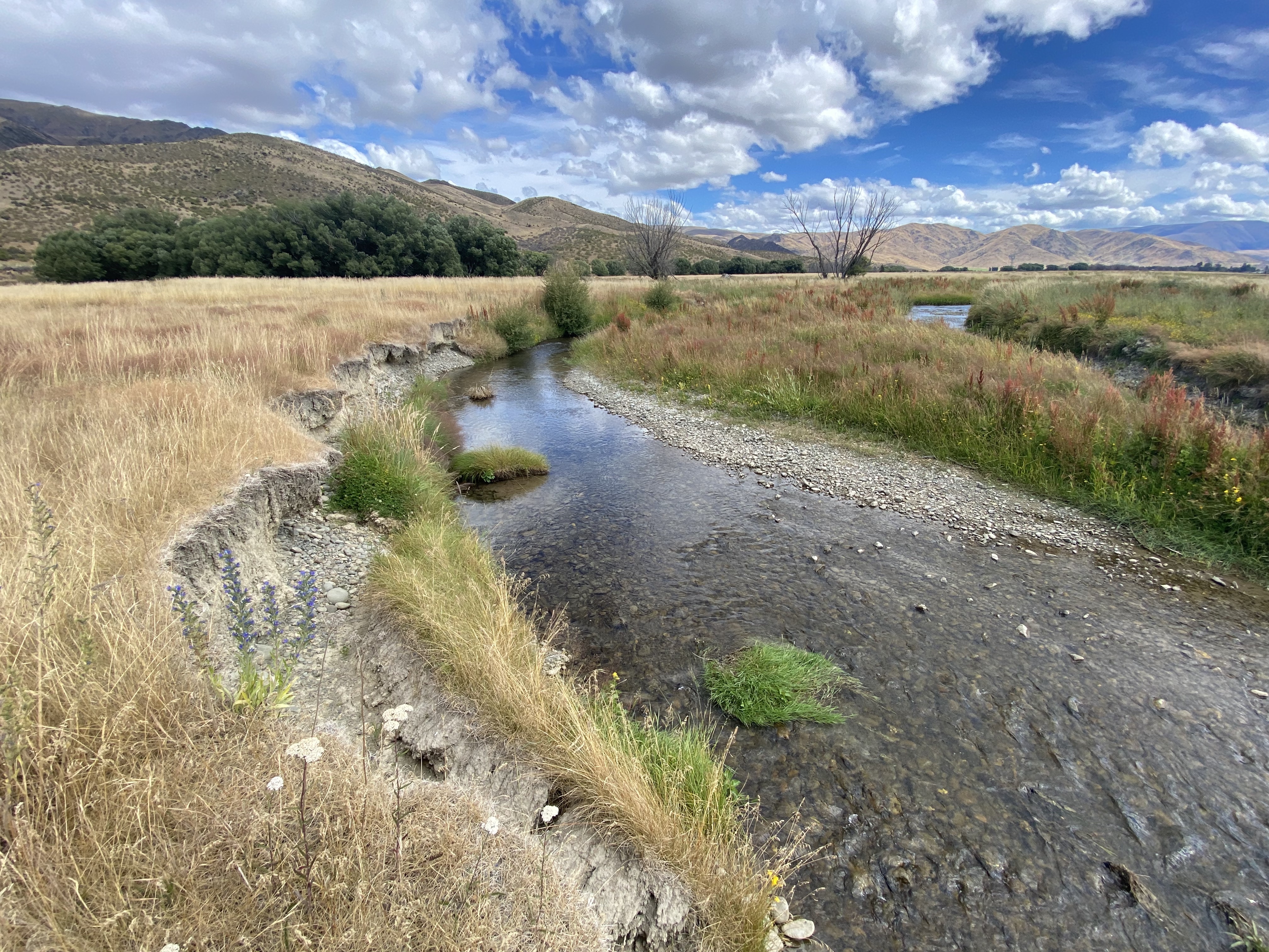
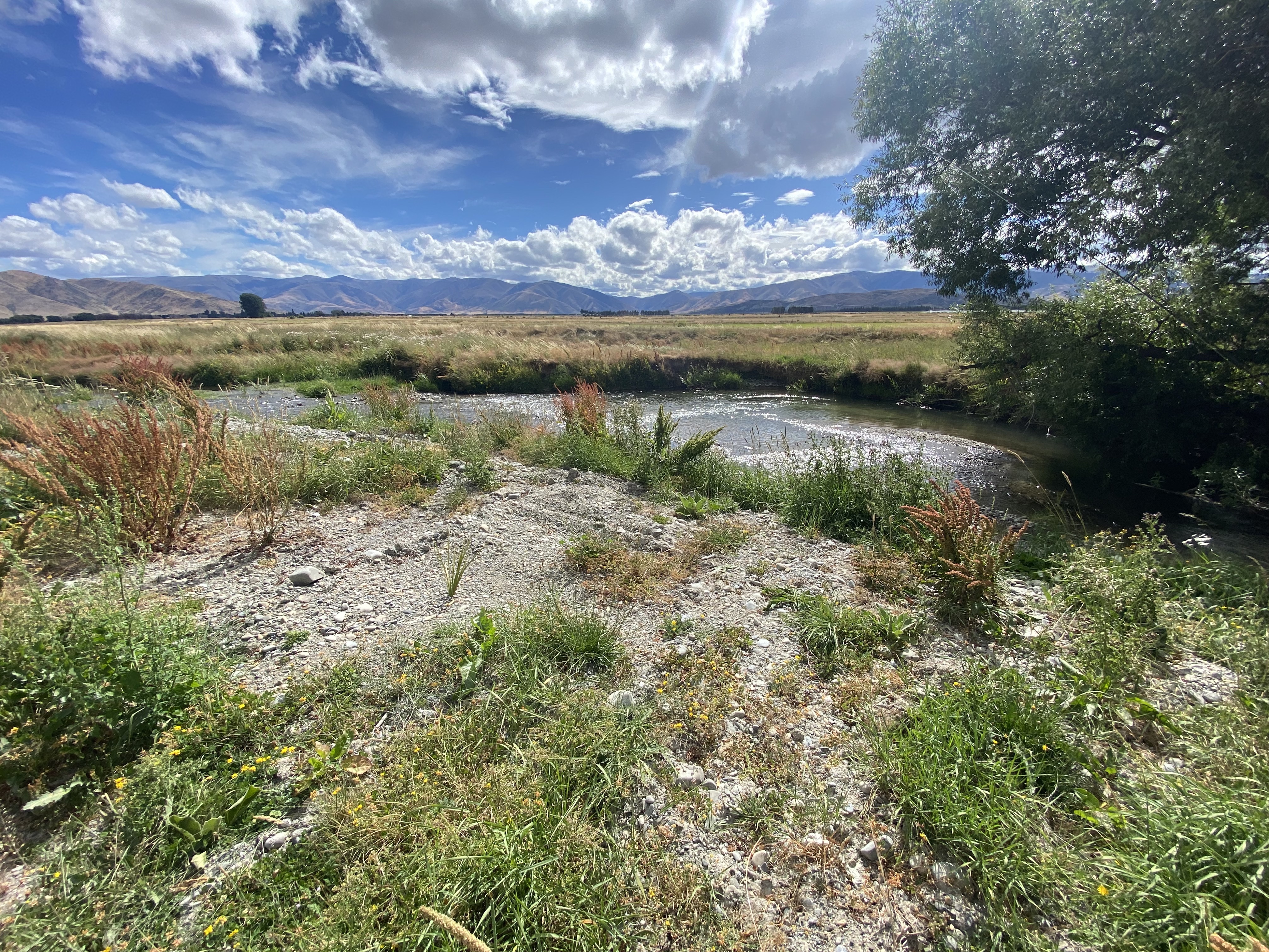
We noticed the silt on the bed as soon as we arrived, noticed spoil on the bank by the first pool: rocks and stones and dusty, ex-riverbed the colour of light earthenware under an unnaturally vivid green flush of nettles and docks and thistles: all the stuff that loves the arrival of river-bed nutrients on top the of the floodplain where they don’t belong.
My thought was a resigned “that’s a shame”. We were near a bridge and I know farmers do get a bit heavy handed with the digger around bridges, in a (usually misguided) effort to create greater conveyance of flow.
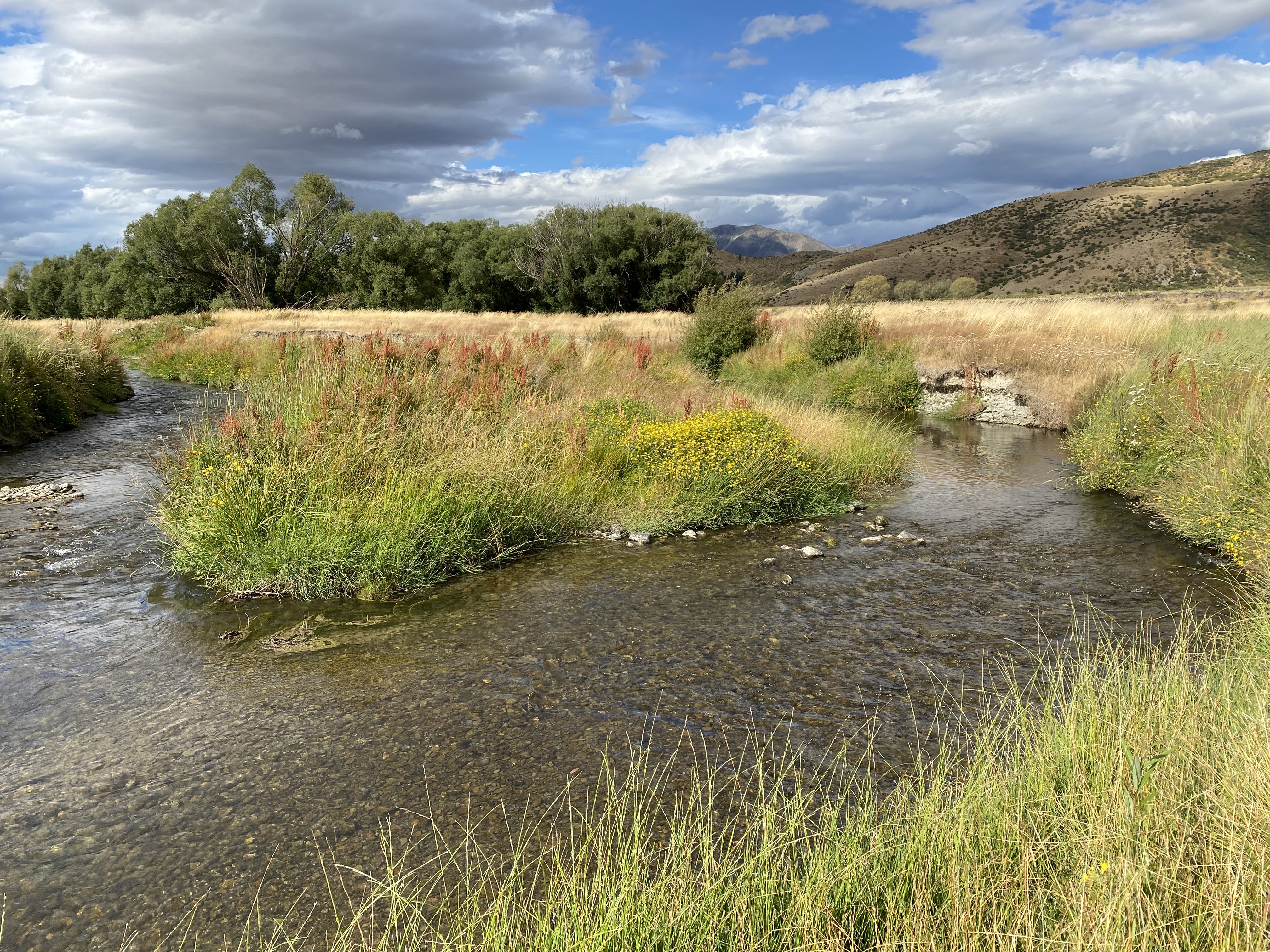
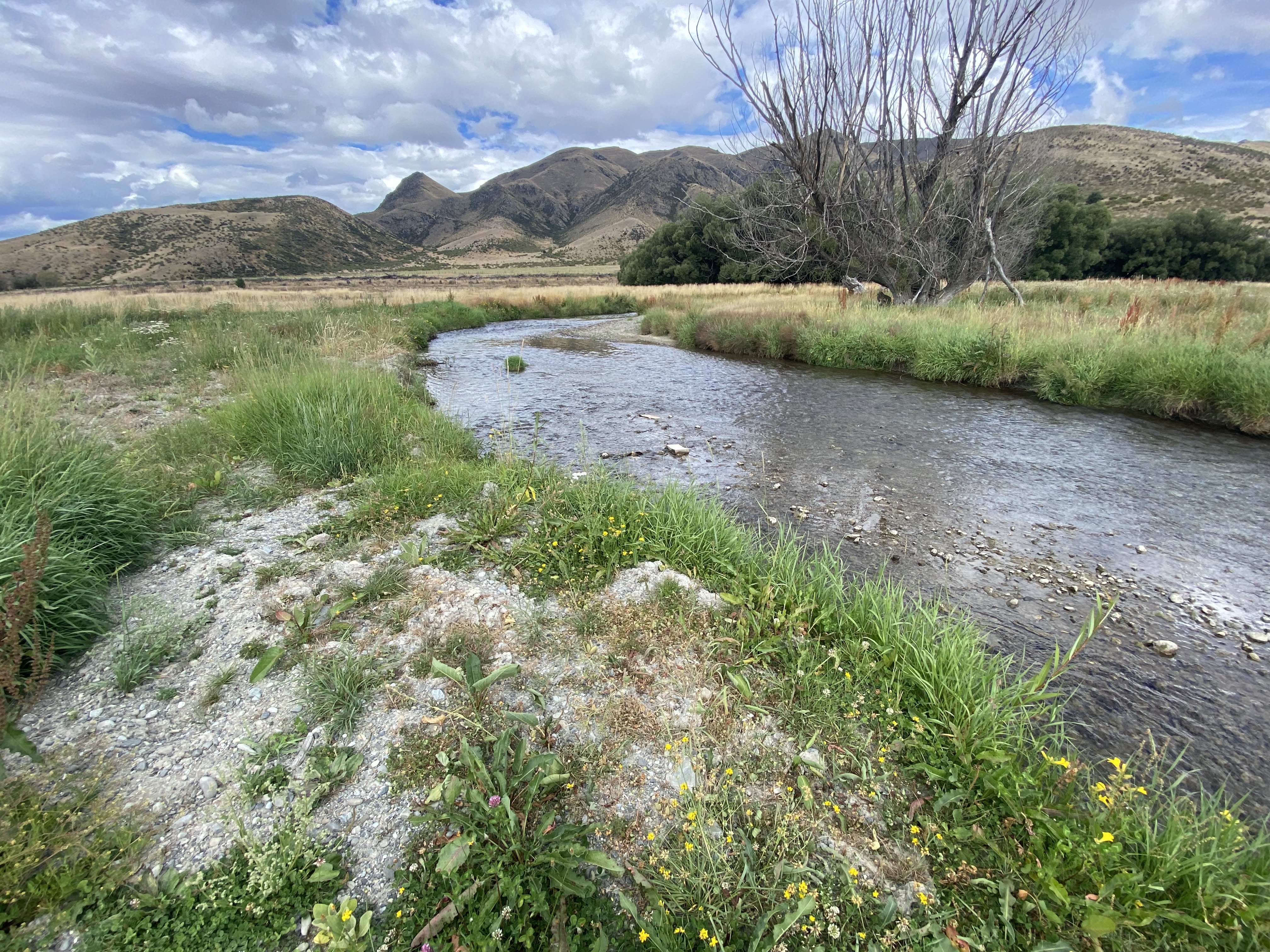
But then around the next bend we saw more of the same, only the digger had really gone to town here, pulling out the bed and inside point-bar, dumping it all up in the side. The work had been done only a few months ago and already the stream was notching its way back upriver. Already the stream – in other words – was demonstrating the utter futility and pointlessness of the works, because it was now eroding really badly, with the banks slumping in and drastically undercut because of the excessively steepened gradient.
This continued for bend after bend. Apparently as far as we could go and further.
I felt too miserable after a mile or so and we turned back.
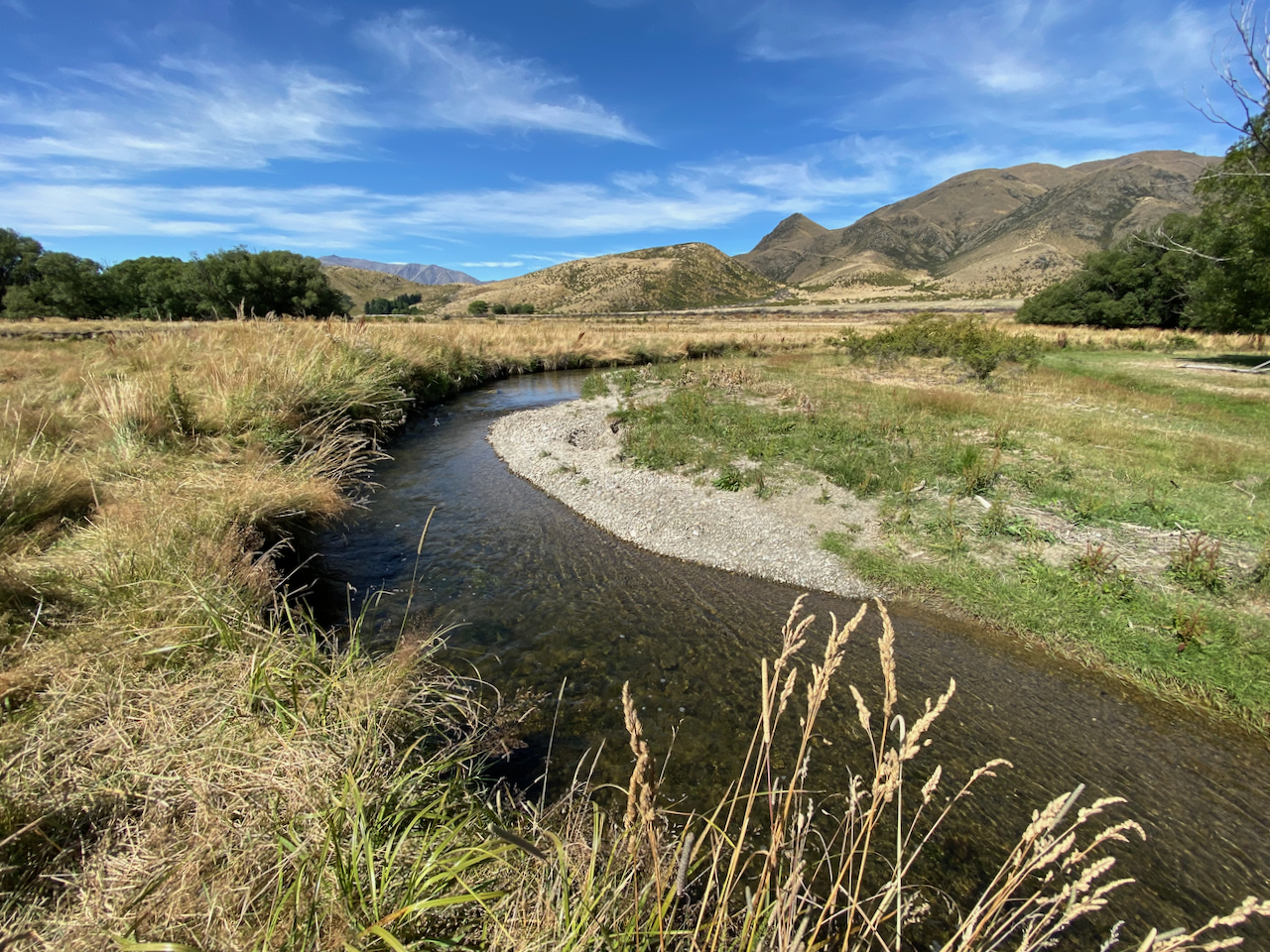
Then I remembered the photos I had taken here in 2020, expressly to capture the morphological features of the stream: the meander shapes, the relationship between the water surface and the flood-plain, the gently undercut banks and point-bars. All of which were now screwed. I hunted back on my phone to February 2020 and tried to line up a few before-and-after images. But I struggled to find the correct alignment between the stream and the hills: at least until I realised that not only had they dragged out the bed of the river, they’d tried to cut the meanders out too.
I was still just about thinking it was the farmer’s work and I was trying to fathom the “why?”. I was thinking: “They’ve had massive floods and done all this in an understandable, but misguided effort to drop the river back inside the banks.”
We slumped back to the car and in an effort to cheer both of us up I said to Simon that we’d drive up the valley to another bit I know. Only when we got there Simon looked out the window and said: “They’ve fucked this too. Look at all the gravel!”
And indeed, “they” had. Whoever “they” are.
By now I was thinking: this is the work of a flood defence department. Our own versions did all of this and more in the UK and Ireland. Only flood defence departments are this dim, careless and – I hate to say this but – entitled. I’ve thought about that last word, whether it is justified here, as the first two surely are. And I think it is, because when you go in and radically alter an ecosystem like a spring creek, it is surely beholden on you to understand what you are doing and carry out the works so that they achieve the desired outcome and not simply wanton destruction?
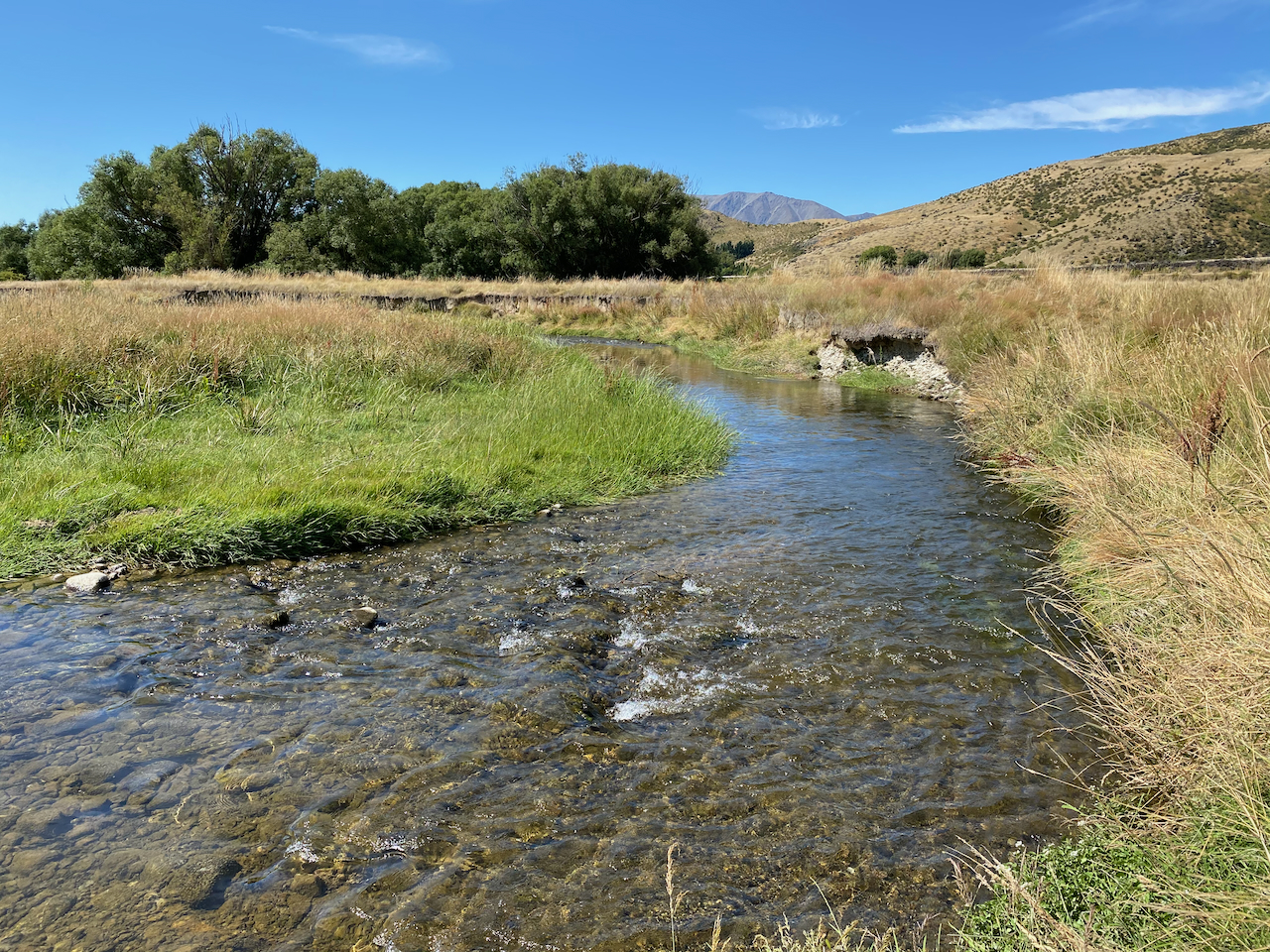
NZ’s spring creeks are globally very special. There just aren’t many rivers like these and most have been messed around with. NZ’s spring creeks have (thus far!) been modified less than most and some not at all. These streams should be seen as a national treasure, not drainage channels.
Later, asking around in town, we discovered that there had indeed been floods. The golf-course had been underwater and so had stream-side houses … miles downriver of the spring-creek vandalism, mind. Riparian property where a river belongs. It all made sense.
Only a flood defence department would steepen the gradient upriver in an attempt to alleviate flooding downriver. Only a flood defence department would make far worse the very problem they were trying to fix.
The river will now try to tear itself apart in order to win back the material it needs to put itself back together. As it does so, the water will travel more quickly, and downstream floods will be more aggressive: they will rise faster and bring with them way more mud, silt and stones.
Rivers flood. The only way to control flooding is to control where it happens. You can’t stop it. Allow it to happen in certain places in an effort to ensure it doesn’t in others. This stream has a two-stage form anyway, with secondary terraces way back from the main channel: you have to let it flood out to these or you will send all the water in even more of a hurry to the very property you are trying to protect.
One optimistic note: this stream will self-heal. Unlike chalk streams, it has the energy and the material to do so. Provided it is left alone. Which is now a very questionable proviso, because the notching and erosion will unleash a process which will appear in the minds of the men who did the work, to justify it in the first place.
And so we struggle on “boats against the current, born back ceaselessly into the past”.
February 2020January 2023: not quite the same spot but note the new channel to straighten the course, the notching, erosion and bank collapse.February 2020January 2020: note the straightening and the height of water against the bank on the r/h of image: maybe 40 cm lower. February 2020January 2023: I had trouble lining this one up, until I realised the bright green bit used to be the river, and they had taken the meander out.