
I’ve written about why dredging doesn’t work. Here’s a post about an alternative approach: a “re-wilding” project on the River Nar which I recently designed for the Norfolk Rivers Trust. For the installation work we worked with Five Rivers.
The River Nar is a chalk-stream, so it doesn’t flood with anything like the ferocity of those rivers now raging in the north of England. Even so, the principles of what we did here apply anywhere.
Back in the Napoleonic era French prisoners-of-war changed the upper River Nar from a meandering wetland, spring-creek into a drainage ditch. They straightened it and entrenched it deep into the land. They did this to drain what was a naturally wet, spring-soaked landscape and turn it into more useful agricultural meadow: to take water away more quickly.


Some time later the valley above the natural head of the river was also drained in much the same way. This time, instead of entrenching a river, the drainers cut a deep furrow into the wet ground in the hollow of the valley and created a few extra miles of running ditch.

Chalk-streams are naturally very equable: because the chalk hills that surround them are absorbent the rivers should not respond that quickly to rain and naturally take much longer to dry or run low when there’s no rain. But this drainage work turned the River Nar into a “flashier” stream, flowing off quickly when it rained and drying up quickly when it didn’t.
This is an example of what we have done to our landscape everywhere. Even relatively impervious catchments (with harder rocks than chalk) like the ones in northern England were once far more absorbent, capable of holding more rain than they can now, meaning that their rivers responded more slowly to high rainfall, with softer rises and falls, and with lower peaks and higher troughs of flow.
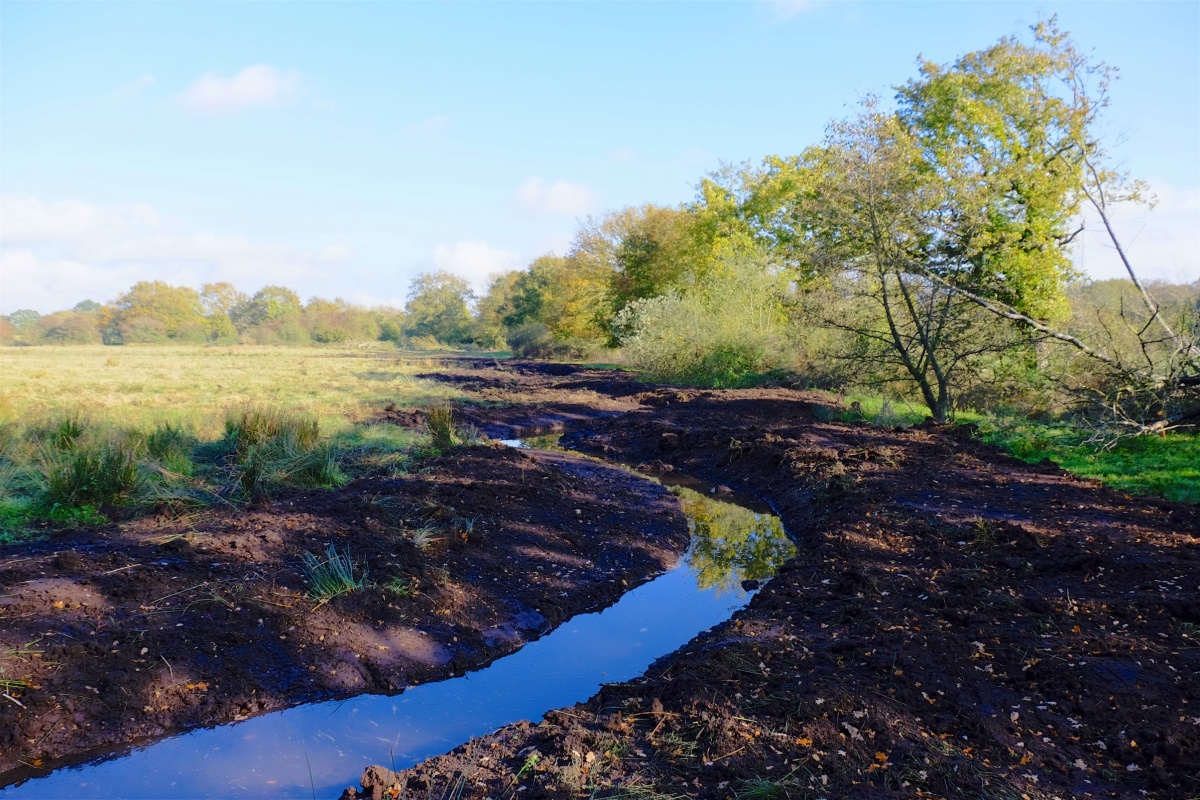
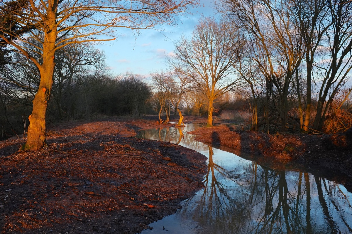
With the Norfolk Rivers Trust and sponsored by WWF UK and the Norfolk Rivers Drainage Board I have been working on a project to ‘re-wild’ parts of the upper River Nar, re-creating the lost, meandering channel, raising the water-table and reuniting the river with its flood-plain.

The photos below cover only a 1.5 km section of the river … but if the water-table is now 1 meter higher than it once was and the flood-plain is a couple of hundred yards wide it doesn’t take a genius to appreciate how the aquifer is now capable of storing much more water.
To say nothing of how the river channel is now about 50% longer and has a channel shape that allows excess flows to spill over the lower banks into a wider high-flow channel and finally – when flows are really high – across the flood-plain itself.
The flood-plain is the natural relief valve for a flooding river. It is empty of water until the time it is needed, it can absorb a massive amount of extra water (thousands of times more volume than a dredged channel) and it drains slowly, taking the dangerous peaks off heavy flows downstream.
The answer to flood management is to re-discover our flood-plains, and incentivise farmers to facilitate a more enlightened approach system of flood-water management.


Nature shows you how to do it,you often only have to stop and look…lets try to work with nature instead of against it,there’s only going to be one winner.
LikeLike