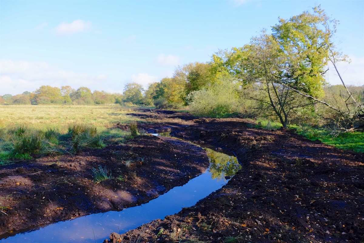
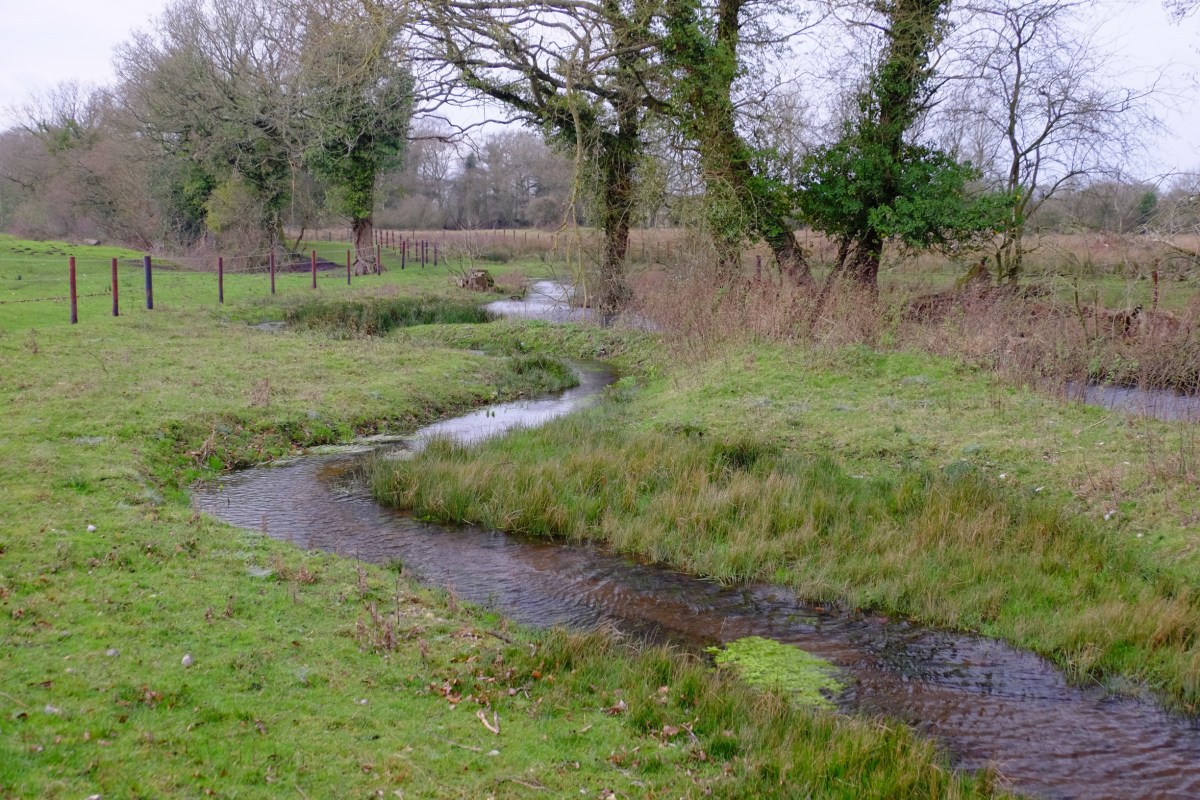
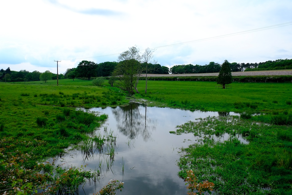
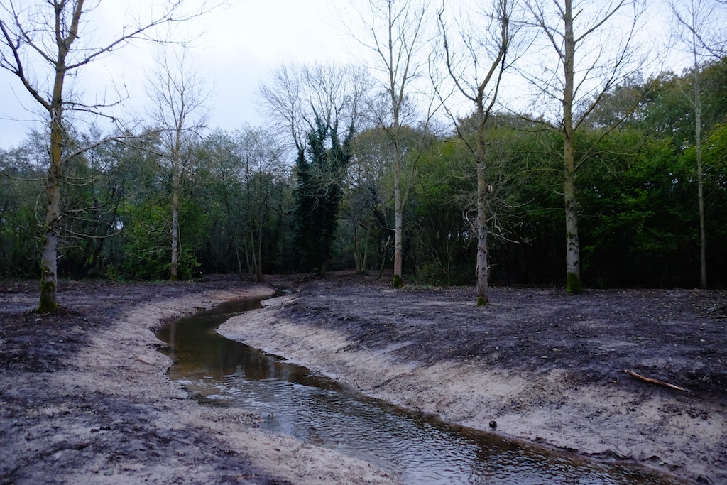
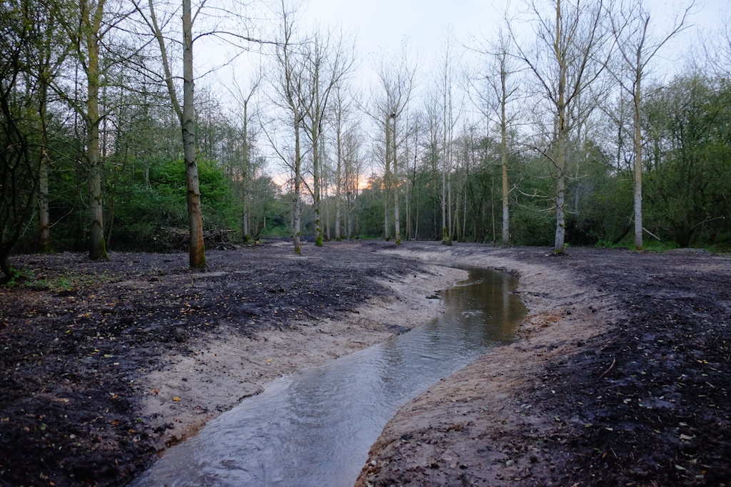
Here are a few pictures of the second phase of our Emmanuel’s Common project in Norfolk.
Just under two years ago we took the River Nar out of an old mill leat and reunited it with about 500 meters of relic meander that had been left, unfilled and unploughed, on the flood-plain. Over an additional 250 meters of that project, we created a replica ‘paleo’ channel based on the cross sections of the natural meander pattern upstream. I wrote all about that project here.
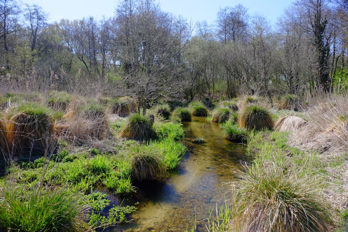
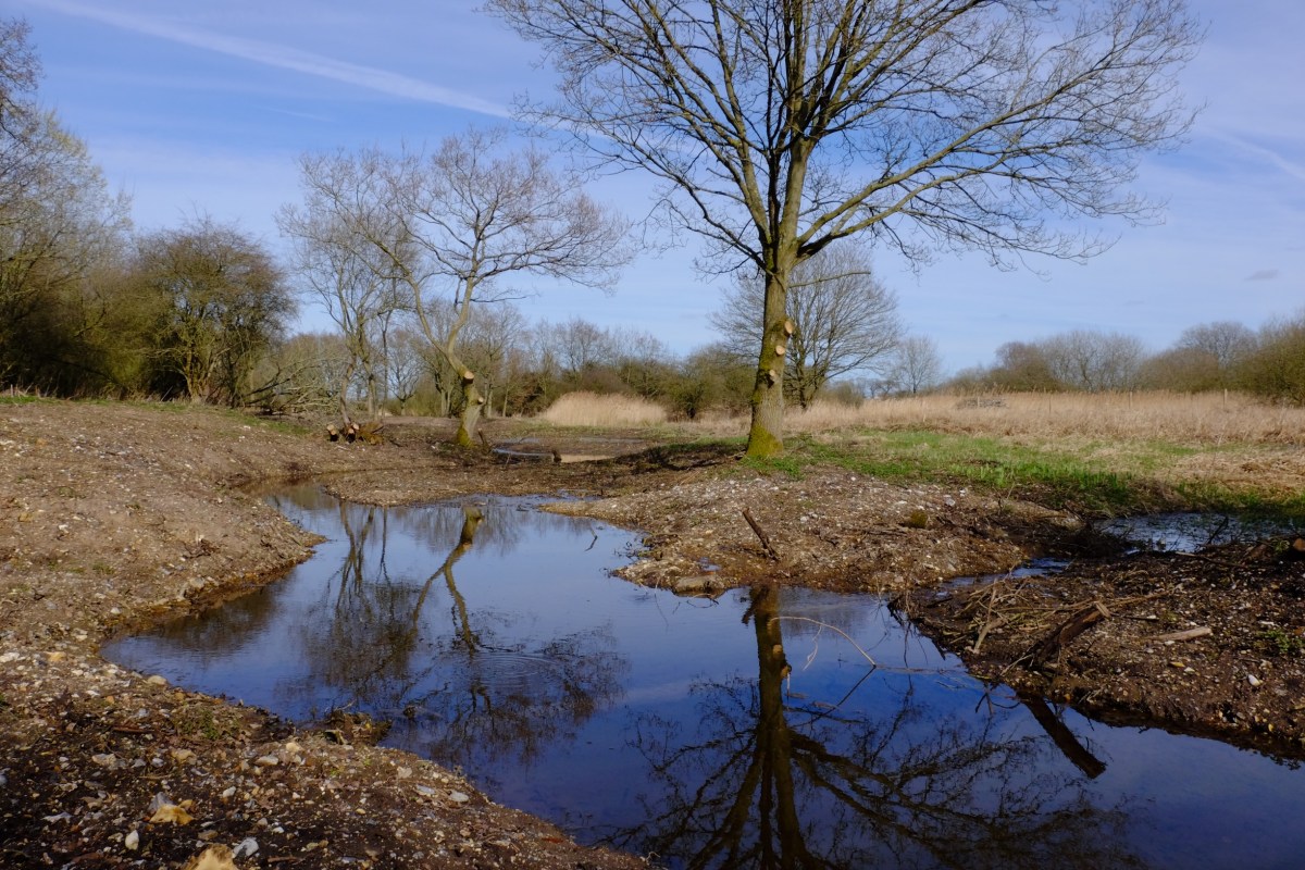
The uncovered natural channel from Phase 1.
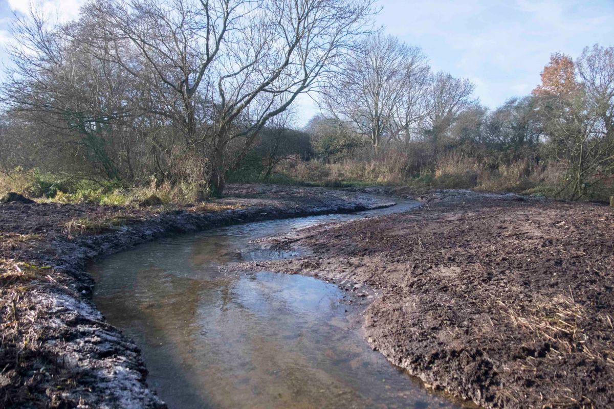
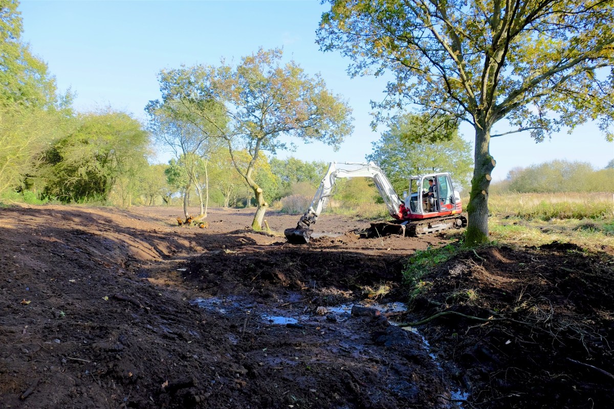
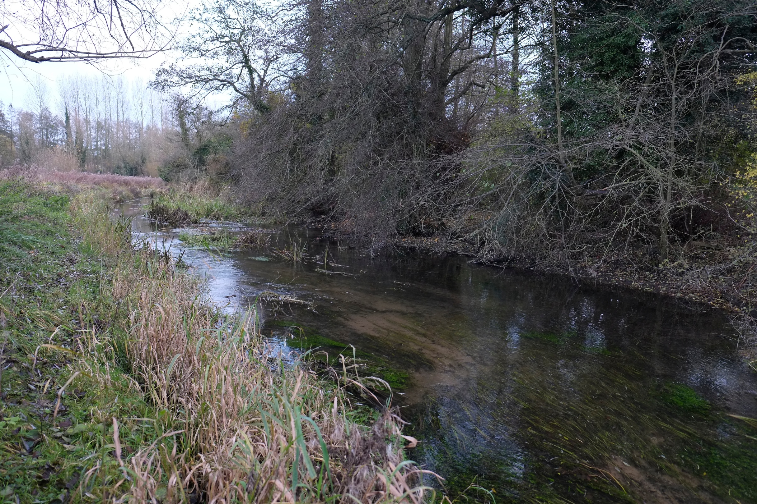
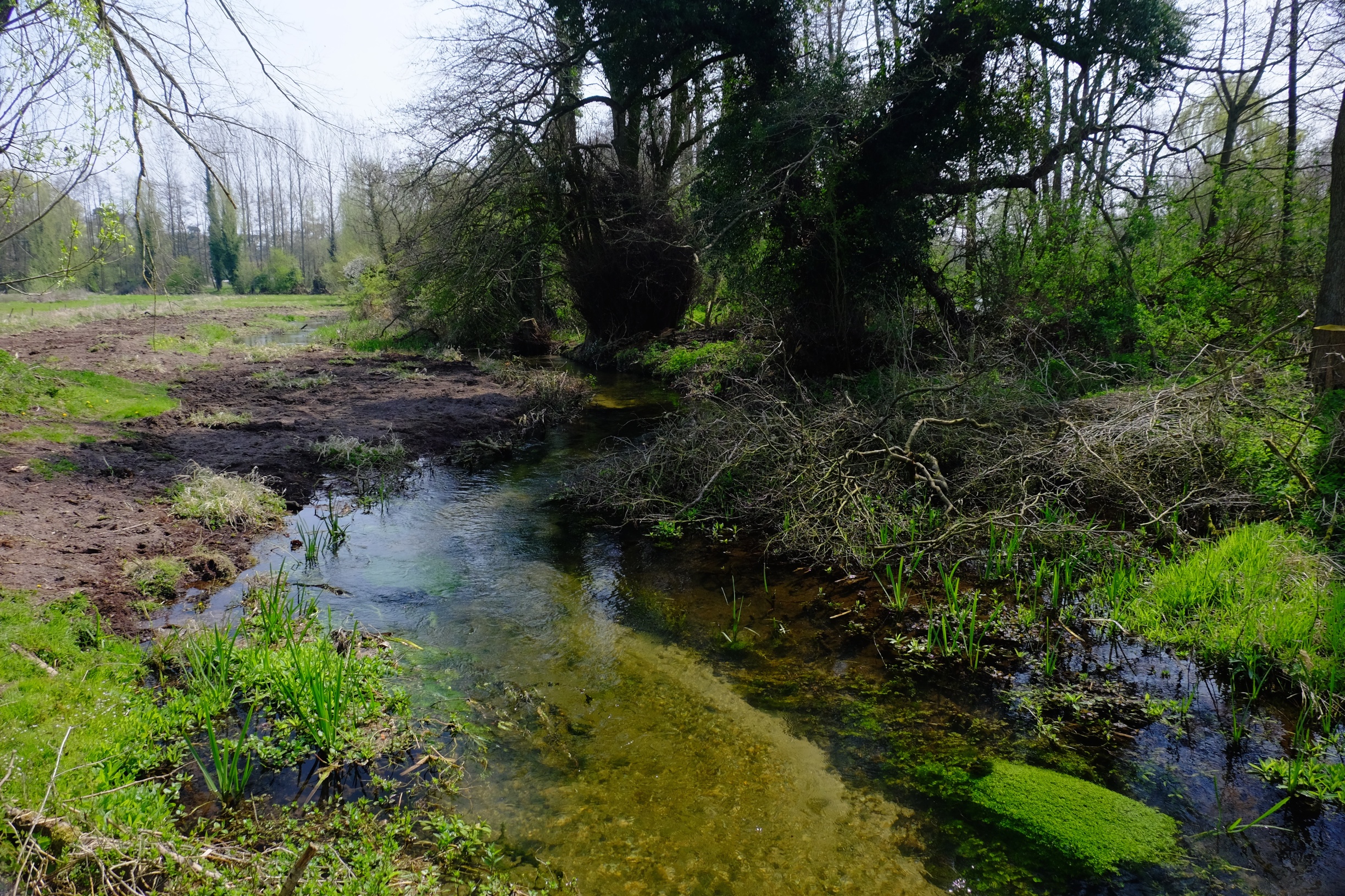
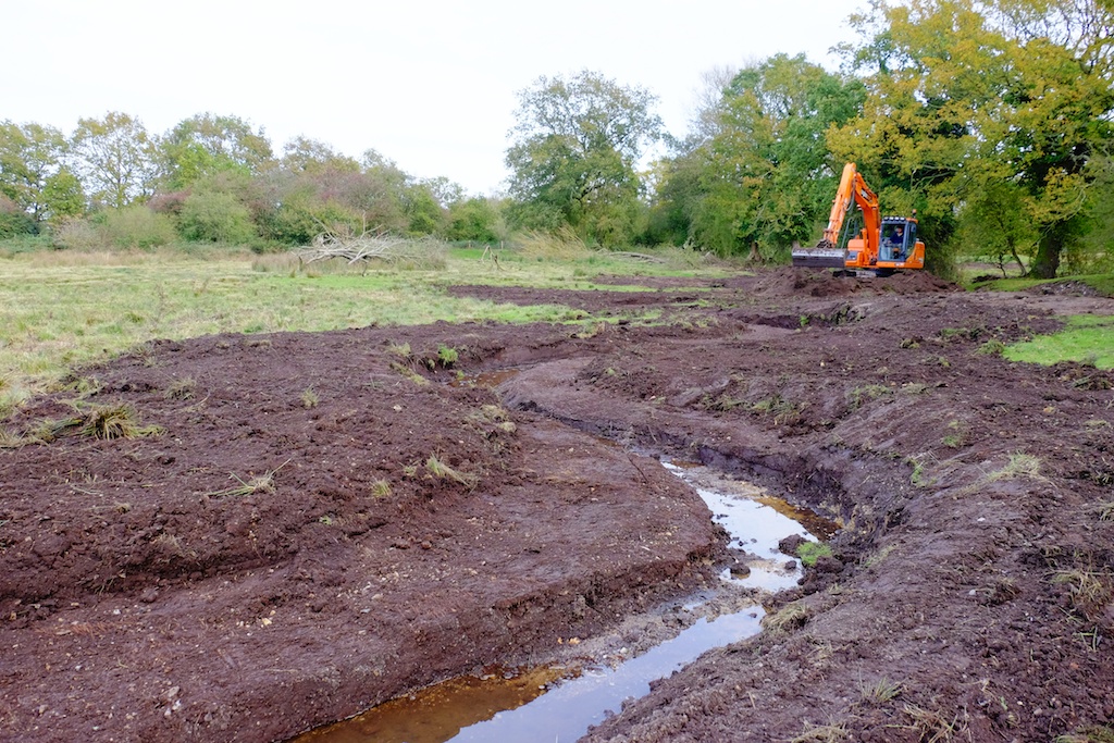
This last three weeks we have been working on the second phase. The first 125 meters formed a continuation of that replica channel, alongside the old channel. In the lower 250 we re-filled the existing river with gravel (dug on site) up to the correct line of bed-level slope. The bed level was set to coincide with the river bed as I had set it at the tail of the first phase and two more undredged crests of gravel downstream.
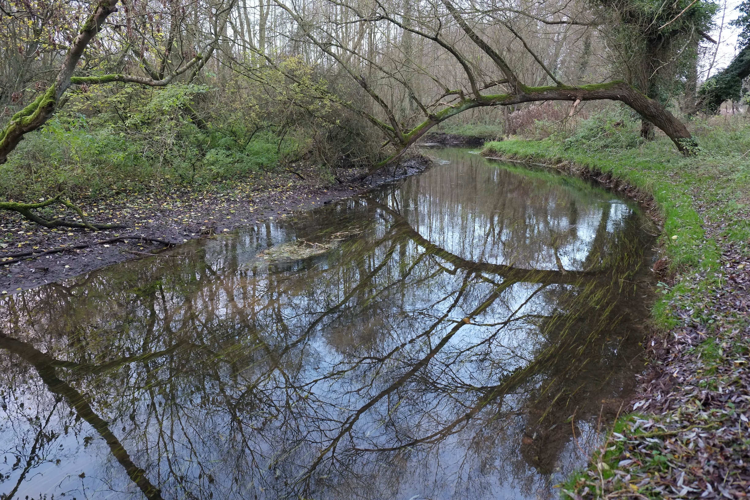
In one spot half-way down some where power lines crossed the channel we had a useful reference section because no dredger had ever gone near it. Interestingly this was the one section of the river that never blocked with weeds. For 50 meters we had clear gravel and patches of starwort, ranunculus etc.. Upstream and downstream were an unbroken jungle of burr reed. Proof if ever it were needed that dredging does the exact opposite of what you think it is going to do!
Under the power lines: never dredged and therefore an open, free-flowing channel.The same place but looking upstream at a dredged reach.
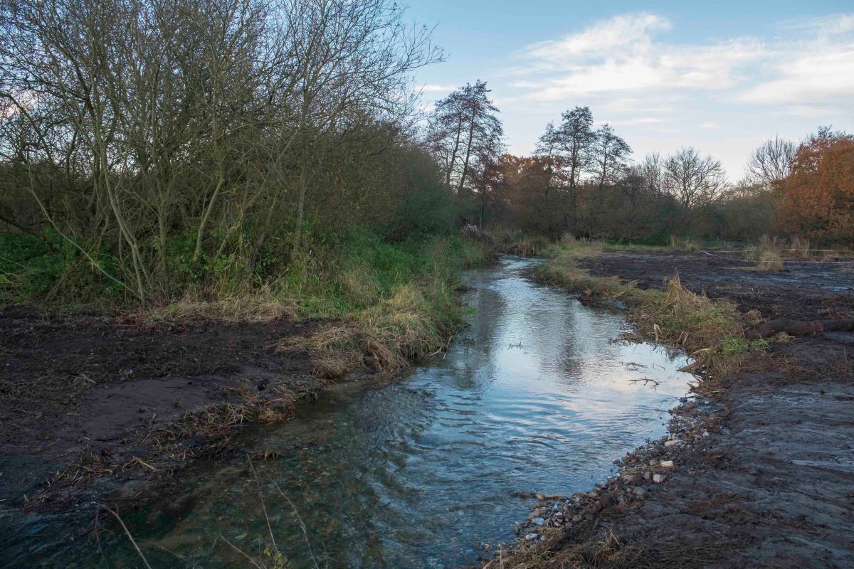
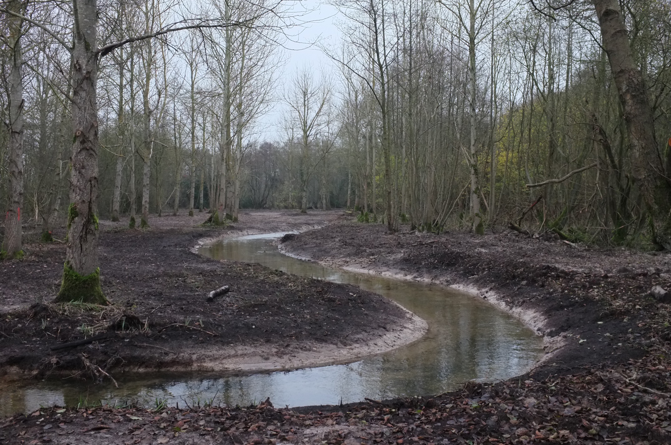
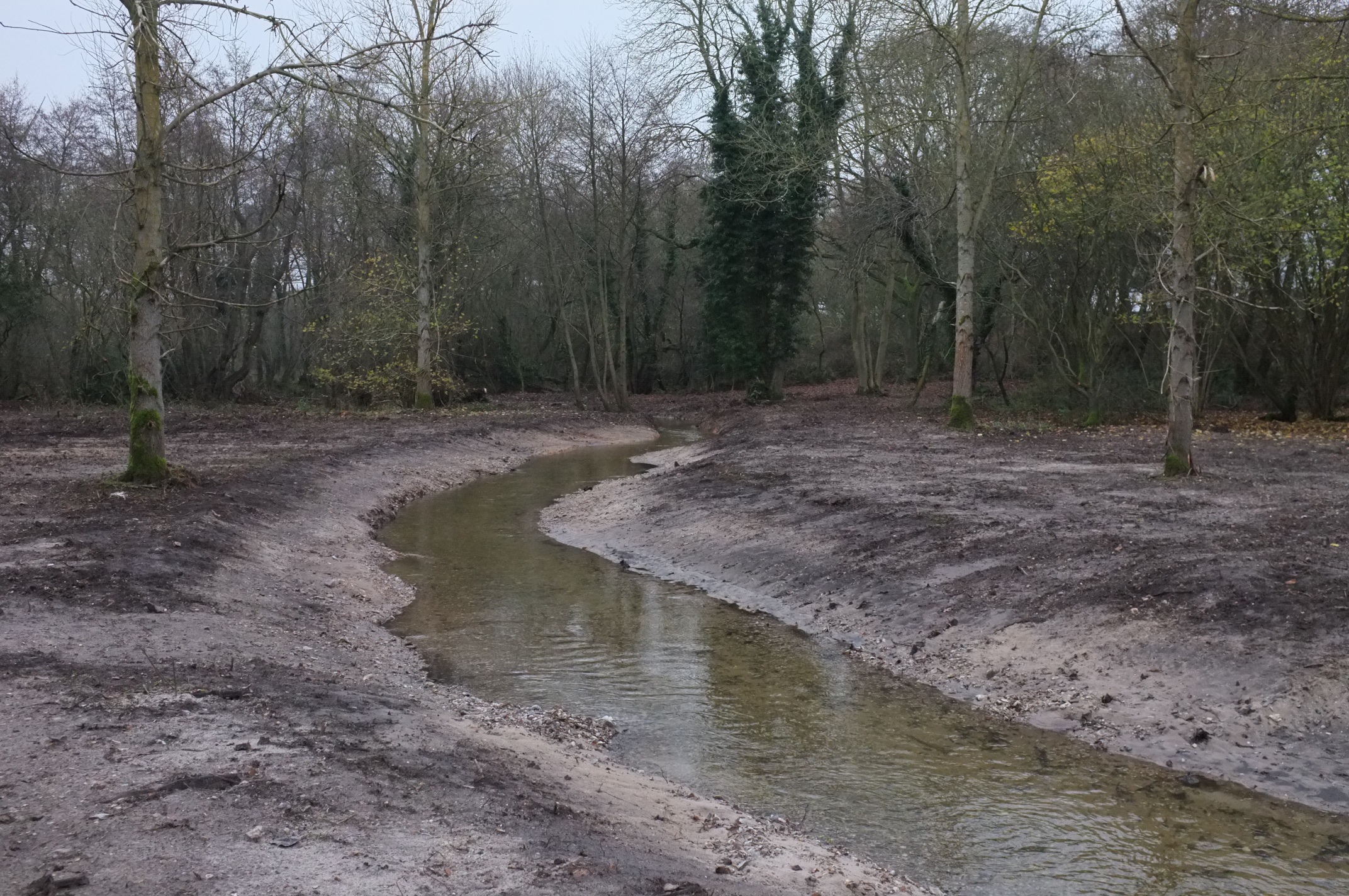
So the new channel came back in to the old just upstream of the undredged natural reach. Beyond the natural reach we brought the channel back up to the natural bed-level by filling in with about 30 to 40 (50 in places) cm of gravel which we took from borrow pits on the flood plain. We took the project down as far as a second undredged crest of natural bed level. I’ll post more pictures in a year’s time.
This reach required 30cm of infill.The same reach looking downstream.Replica ‘paleo’ channel.This reach was severely dredged and required 50 cm of infill.
Having finally uploaded a few recent shots of river restoration projects I’ve put together a small album of before and after photos of our work on the River Nar. I am endlessly amazed by how quickly a river can recover from ‘surgery’ and then respond to a few straightforward interventions.
I’ve written about why dredging doesn’t work. Here’s a post about an alternative approach: a “re-wilding” project on the River Nar which I recently designed for the Norfolk Rivers Trust. For the installation work we worked with Five Rivers.
The River Nar is a chalk-stream, so it doesn’t flood with anything like the ferocity of those rivers now raging in the north of England. Even so, the principles of what we did here apply anywhere.
Back in the Napoleonic era French prisoners-of-war changed the upper River Nar from a meandering wetland, spring-creek into a drainage ditch. They straightened it and entrenched it deep into the land. They did this to drain what was a naturally wet, spring-soaked landscape and turn it into more useful agricultural meadow: to take water away more quickly.
The Napoleonic ditch – arrow straight and entrenched by over a meter into the flood-plain. Flowing hard after rain …… and almost dry after a few weeks without rain: showing that, if you furrow a floodplain with ditches you make it less able to hold water.
Some time later the valley above the natural head of the river was also drained in much the same way. This time, instead of entrenching a river, the drainers cut a deep furrow into the wet ground in the hollow of the valley and created a few extra miles of running ditch.
A headwater ditch, draining the landscape above the river.
Chalk-streams are naturally very equable: because the chalk hills that surround them are absorbent the rivers should not respond that quickly to rain and naturally take much longer to dry or run low when there’s no rain. But this drainage work turned the River Nar into a “flashier” stream, flowing off quickly when it rained and drying up quickly when it didn’t.
This is an example of what we have done to our landscape everywhere. Even relatively impervious catchments (with harder rocks than chalk) like the ones in northern England were once far more absorbent, capable of holding more rain than they can now, meaning that their rivers responded more slowly to high rainfall, with softer rises and falls, and with lower peaks and higher troughs of flow.
With the Norfolk Rivers Trust and sponsored by WWF UK and the Norfolk Rivers Drainage Board I have been working on a project to ‘re-wild’ parts of the upper River Nar, re-creating the lost, meandering channel, raising the water-table and reuniting the river with its flood-plain.
Part of the plan for the re-wilded river: the old ditch is red, the new stream is blue.
The photos below cover only a 1.5 km section of the river … but if the water-table is now 1 meter higher than it once was and the flood-plain is a couple of hundred yards wide it doesn’t take a genius to appreciate how the aquifer is now capable of storing much more water.
To say nothing of how the river channel is now about 50% longer and has a channel shape that allows excess flows to spill over the lower banks into a wider high-flow channel and finally – when flows are really high – across the flood-plain itself.
The flood-plain is the natural relief valve for a flooding river. It is empty of water until the time it is needed, it can absorb a massive amount of extra water (thousands of times more volume than a dredged channel) and it drains slowly, taking the dangerous peaks off heavy flows downstream.
The answer to flood management is to re-discover our flood-plains, and incentivise farmers to facilitate a more enlightened approach system of flood-water management.
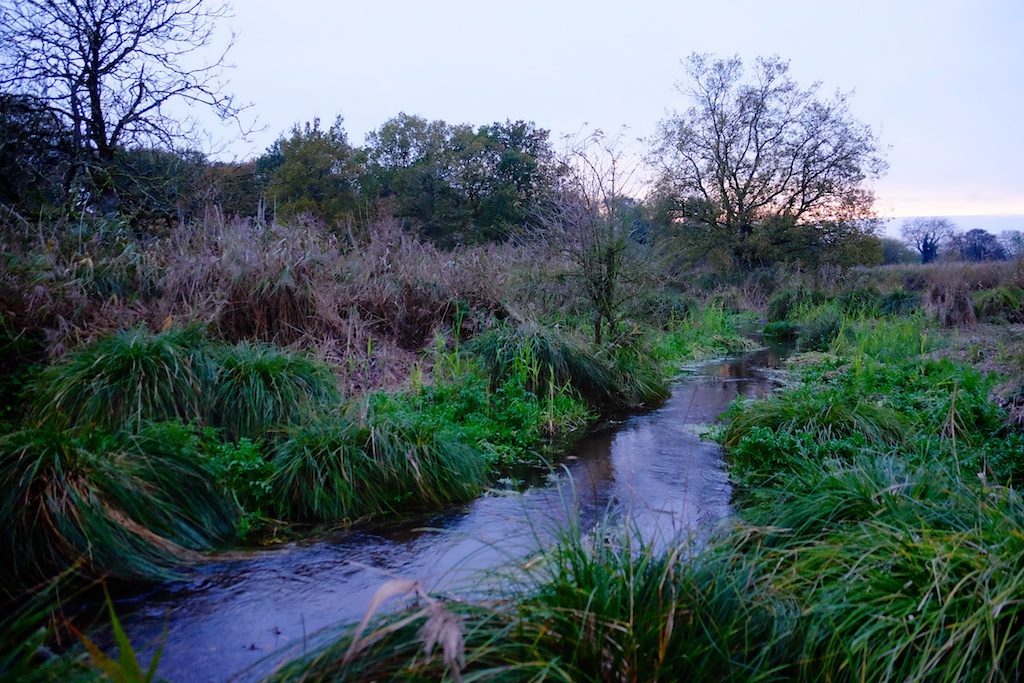
The new “re-wilded” stream is dug.After rain in mid-winter.One year later. Looks like it’s been there for ever. Which it has, apart from a 200 year interlude in a ditch.Late autumn 2014. The old ditch runs along the tree-line to the right.Same view December 2015.After heavy rain winter 2014 – holding water the old ditch sent downstream in a hurry.Winter 2015. The new stream crosses the line of the old ditch, but one meter higher, looking like a stream again and re-united with a functioning flood-plain.
This is a set of before-and-after images from a river recreation project at Emmanuel’s Common on the River Nar.
This is a brand-new river channel cut to connect a restored set of natural meanders (pictured above) with the main river. These pictures are taken more or less one year apart, immediately after the project was finished last winter and on 26th December 2015.
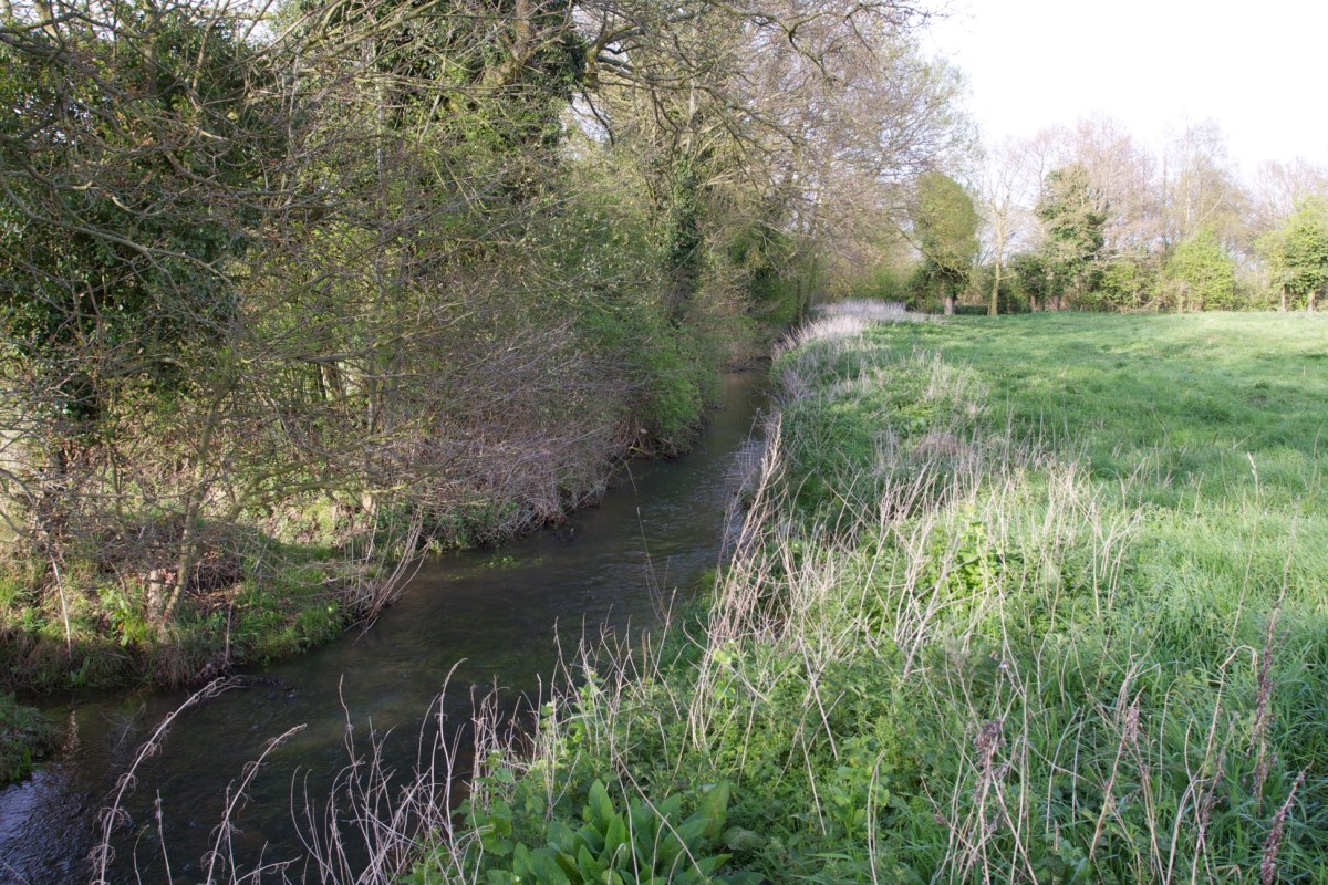
The new channel is full of brown trout and all the in-stream and riparian plants – including good stands of ranunculus and starwort – are self-sown. For more details see the link at the foot of the page.
7km of re-meandering with woody berms, 2km of re-discovering and tracing again the course of the old river, and 500 meters of re-uniting the flow with a long-lost channel and in so doing re-creating a little bit of the post-glacial river all these works have been designed to imitate. The work (in catchment terms) is not over, but it is time for a brew perhaps.
Before.After.
This final phase was a highlight because for a short reach (about 500 meters) we were able to re-shape those hideous levéed banks built up by years of dredging and re-create the flat riverside flood-plain and soft riparian margin that is the life-system of a ‘natural’ chalk-stream. Elsewhere the woody berms are accomplishing the same trick within the confines of a steeper-edged and relatively immovable modified channel. But here we had room to move. There were no gas-pipes, no ancient priories, no invaluable trees, no mill-leats or water-meadows. It was so satisfying to rebuild those meanders and to watch the landscape open up again.
The pictures below tell a better story than words can. Notice the steep, and soullessly straight near-side bank in the earlier images, the trough-like channel that has been dug far too deep and the extent of over-shading in a man-made woodland that had gone feral.
The three phases of the work therefore tackled each of these issues in turn. Selective felling and thinning opened holes in the leaf canopy above. The felled trees were arranged to create berms on one bank or the other, easing the river into the meander pattern that it would otherwise have spent the next few centuries re-creating, and finally the levées were regraded down into the berms along the near-side bank, leaving those on the far bank to work as sediment traps which will accrete over the next few years to become new river banks.
This last phase was a Norfolk Rivers Trust project, sponsored by the Catchment Restoration Fund (now over – will it ever return?) with the works designed and installed by myself and Simon Cain, and the final re-grading efficiently delivered by Jason Lovering. Thanks also to the Helen Mandley, to Tom Moore, our vole monitor (BASEcology), Giles and the IDB, Hannah and Natural England, Jo and Holkham Estate, the Castle Acre Fishing Club.
I recently compiled my best attempt at a complete index of all the English chalk-streams, partly to satisfy my own cataloguing obsession, partly because it was needed for WWF’s new report State of England’s Chalk-Streams 2014.
I’m often asked “What is a chalk-stream?” It is a difficult question to answer quickly. Chalk-streams are created by geology, the geology of England is complex and chalk-streams vary so much in character.
I worked on this index with Dr Haydon Bailey, a geologist with a keen interest in chalk, and we have started to sketch out some geological categorisations that help to shed light on those differences and show that what we have, in reality, is a spectrum of pure chalk-streams and chalk-influenced rivers.
In time I will work this index into a series of catchment-based maps, which will include those geological sub-categorisations on which Haydon and I will do more work.
The index is certainly not complete. Already I have been promised updates for Buckinghamshire! Please send feedback to me at the contact email on this blog and I will include corrections and additions and credit the contributors.
In the meanwhile, I hope this index proves a useful resource for those who are interested in the conservation of English chalk-streams.
To make sense of the lay-out, please read the notes on the lay-out at the head of the index.
England’s chalk-streams: their shocking state is the ecological restoration opportunity of our time.
Last night I was invited to speak at the launch of WWF’s new report: The State of England’s Chalk Streams 2014. The report reveals that over three-quarters of these iconic and globally unique rivers are failing to meet targets for ecological health. This is what I said to the audience at the South Bank Centre:
“I want to talk to you this evening about how the state of England’s chalk-streams – a state this new WWF report correctly describes as shocking – could become the most incredible opportunity for ecological restoration. We have the means and we have the knowledge to rehabilitate this broken ecosystem. All we lack is the will. But will is only a change of mindset. Minds can be changed.
In some ways this ‘shocking state’ is not surprising.
I’ve just spent five years researching a book looking for the reasons why, in 1965, a chalk-stream in Buckinghamshire called the River Wye was buried under the streets of the town it gave life to. The answers were on one level mundane and soulless: the river was buried to widen a road. On another they were as complex and layered as the history of the valley that river flowed through. Geology and industry and slum clearance and town planning stacked up one after the other, until the river’s burial became as inevitable as the construction of a shopping centre above it: a retail cathedral which the Council named Eden.
The world over the struggle between nature and man, between the stream and the street, ends with the incarceration of the stream. It’s not that anyone especially means rivers any harm. It’s just that through an ironic twist of history rivers give birth to and then get in the way of economic expansion. Swap street for field, the principle holds.
English chalk-streams flow through landscape at the epi-centre of Western civilisation: certainly in terms of the depth of its history, the density of its use. In other words, they are a globally unique eco-system in the very hottest part of the fire. Of course they’ve been pushed to the edge of existence. Looked at this way, it is a minor miracle that we have any chalk-streams left at all.
That river was buried to widen a road. It is worth remembering that this is how it happens. No-one is planning or hoping for a world in which there is no room for nature. But the end of the wet and the wild is death by a thousand cuts: none of them is actually mendacious, but all of them are careless.
And yet, this grim fact is also an exciting opportunity. If economic growth almost always leads to ecological destruction, it doesn’t have to. Making room for nature begins with seeing how it matters. So why do chalk-streams matter? Why should we care more? I can try to tell you why I care.
I grew up in London, but every other Friday night through the late 1960s and then the 1970s we drove north to spend the weekends in Norfolk. I had no particular idea then, as I struggled to peer out the car window, that the route we took, around the edge of the Chilterns, across the Hertfordshire downs, up the ridge of the Gog Magog hills all the way to the multi-coloured cliffs of Hunstanton, was more or less entirely across a chalk landscape. But towards the end of the journey, when the evenings were long in summer I would ask my father to slow down over one or other of the bridges which crossed the streams near our house. One was over a river called the Ingol, where it tumbled over a small waterfall beside a bus stop. Another was over an equally small stream called the Babingley. I adored these miniature brooks for a reason I could never have explained. They just spoke to me and I loved to spend a few moments watching them flow.
Now, forty years on, I know that these little brooks were chalk streams. I also know that we would have crossed others on that journey: the Colne outside Heathrow, and then that river’s Chilterns tributaries the Chess, Misbourne, Gade and Ver. Running north up the A1 we would have crossed the Lea and the Mimram and then, riding the ridges of those chalk hills we threaded between the Beane, Oughton and Purwell. Turning east we narrowly missed a few more – the Cat Ditch, the Ivel, the Hiz – before we crossed the Cam and then the Granta. Further on we crossed the Snail and then the Fenland incarnation of the Lark. Then the Little Ouse, the Wissey, the Nar, and finally, nearing home, we crossed the Babingley, the Ingol, the Heacham and smallest of all, the Hun.
Those 24 names represent a good proportion of all the chalk-streams that exist globally: about one-eighth of those in England, whose total of a little over 200 streams – varying in size from the stately River Test in Hampshire, to diminutive little brooks you can almost hop over – make up most of the chalk-streams in the world. There are a number of chalk-streams over the channel in Normandy. But further afield, although there are great swathes of chalk across Kaliningrad, Bulgaria, Czechoslovakia, or the Ukraine, although there is chalk in Texas, Israel, Egypt and Australia, it seems that there just aren’t any rivers like the English chalk-streams. Ours appear to be almost unique.
To understand why you need to think of Europe as … well if you’re into cooking think of a layered cake and if you’re into DIY think of plywood. I’ll go with the cake metaphor …
… the chalk is just one layer, the white sponge say, sandwiched between layers above and below. Now, imagine you tilt the cake so the layers no longer lie flat. Now, squeeze it from each side so the whole cake buckles. Finally take a knife. This knife is made of time and ice and rain and wind. Run the knife across the top of the cake: but don’t be too careful about taking a neat, even slice. The knife, you’ll find, slips more easily through the softer layers, the cream, the fluffy sponge; but it struggles a bit at the toffee and caramel. It all gets a bit messy of course: the cake you have cut away, some of it dissolves, while some of it is spread across the surface elsewhere. This layered, tilted, buckled and untidily sliced cake that you have imagined is the surface of the earth. The layers of rock, the layers of the cake, show at the surface in bands. In places the bands are smeared over with the remnants of other layers. In places they stand clear. The layer of white chalk at the surface in the Chilterns, for example, has been cut away and is long since gone from over Scotland; it lies intact but deep under the surface of eastern France; and in Bulgaria, while it might be more or less at the surface, it is covered with great smears of other stuff.
This is why most chalk-streams are English. Chalk-streams only flow where that soft, soluble white rock protudes at the surface, and more to the point, where it is relatively uncorrupted by the marbled mess of depositions left behind by the knife.
And what is this chalk? It is the fossilised remains of infinitesimally small sea creatures which swarmed millions of years ago in pre-historic seas. Most of Europe was once under the sea. Chalk formed at its edges where countless billions of dead coccoliths rained down to the ocean floor, settling and compressing into a porridgy ooze, which became in time, chalk. It took a while: the chalk accreted at a rate of one millimetre a century, one centimetre every thousand years. And now we have our chalk hills: a great belt of them in England that runs from south-west Dorset, past London, through East Anglia and up into the Yorkshire Wolds. Some of these hills are hundreds of meters thick.
Chalk-streams, like most rivers, begin with rain. But when rain falls on chalk it sinks into the ground through fissures and cracks, or it soaks into the body of the chalk itself, turning the hills into underground oceans of trapped water. A drop of rain might travel five miles or 50 under the earth, it might stay down there five months or five years or five centuries. The subterranean topography that determines exactly where the water goes is immensely complex, almost unknowable.
What we do know is that here and there, in a wet furrow in a meadow, or under the roots of an ancient tree, or in a rook-filled copse on the edge of a hill, that water re-emerges as springs – and that in these special places chalk streams are born.
What flows from the spring is no longer plain rainwater, however. It is chalk-water: cold and clear, and rich in minerals. The steady flow of this cool, fertile water in meandering, gravelly channels creates spectacularly diverse ecosystems. The unspoilt chalk stream is like a watery Garden of Eden: chequered beds of water crowfoot swaying in the marbled currents, constellations of white flowers, vibrant green beards of starwort and clouds of water-parsnip; the banks decked in marsh marigolds, water mint, and flag iris; under the surface brown trout and grayling, young salmon and sea trout, white-clawed crayfish, freshwater shrimp; in and over the plashy meadows, snipe and otters, water voles and mayflies.
But chalk streams are special not just in their geological origins, and the wonderful ecosystems this creates. No river on Earth is as much a product of human as well as natural history. They are such gentle, malleable rivers. They have been harnessed and lived with for thousands of years, shaping and shaped by human history in one of the most used landscapes anywhere in the world. Think of the Roman villas, the mills, the medieval priories and holy houses, the castles, the ornate Palladian parks and gardens, the fisheries, the Georgian water meadows. All these things give chalk streams a distinct beauty that is not the same as the sublime, unpeopled beauty of craggy peaks and spouting waterfalls. Chalk streams are home-spun and life-giving. Chalk streams are pastoral. Chalk streams are living, flowing history.
This intersection of geology and geography, of climatic history and finally human history has created a unique type of river: Edenic, life-giving. Chalk-streams are an English Okavango Delta, an English Great Barrier Reef, an English rainforest. Which ought to mean we should value this heritage as highly as we would any other globally unique eco-system.
Sadly, we don’t. Instead these unique rivers are abused: some to the extent that they have dried up and ceased to be rivers at all. Others are rivers in so much as they have water in them, but in every other way they are changed. Some are buried underground. Most are polluted too. To our shame most of the really debilitating changes have occurred in the last 50 or 60 years. Before that time chalk-streams were certainly much-used river systems, but our relationship with these rivers was to a large degree symbiotic. Since 1946 a fatal combination of dredging, diffuse pollution and water abstraction has made it parasitic.
Today, the range of threats is diverse and most are difficult to overcome in a busy, valuable landscape which also supports farming and industry, people and businesses.
Difficult to overcome, but surely – given the value of these rivers – not impossible?
Remember that river which was buried to widen a road? Now, fifty years after it was lost to the world, the Town Council is planning to unearth it again. The change has come because they believe it is possible and can see reasons enough to want to. The river will bring back the heart of the town. Like the rock that made the river, history took that stream underground and has brought it to the surface again. All it takes is will. A change of mind. A different way of valuing things.
There are two ways to look at this struggle between man and nature, between environmental growth and ecological destruction. Either we sacrifice the places where we live and work and try to pickle the places we don’t: which won’t save them, by the way, because they too will shrink until there’s nothing left.
Or, we learn to make room for nature and create a world where unique eco-systems can exist alongside or even inside functioning, economically viable landscapes. It is that polar choice which makes the sobering state of the English chalk-stream the most tremendous opportunity. If we can make that room here – and I know we can – we set an example for the rest of the world. We create a beacon of hope.
If we can do this in this busiest of landscapes, we can do it anywhere.
If chalk-streams are our burning rainforest, it is up to us to put the fires out.”
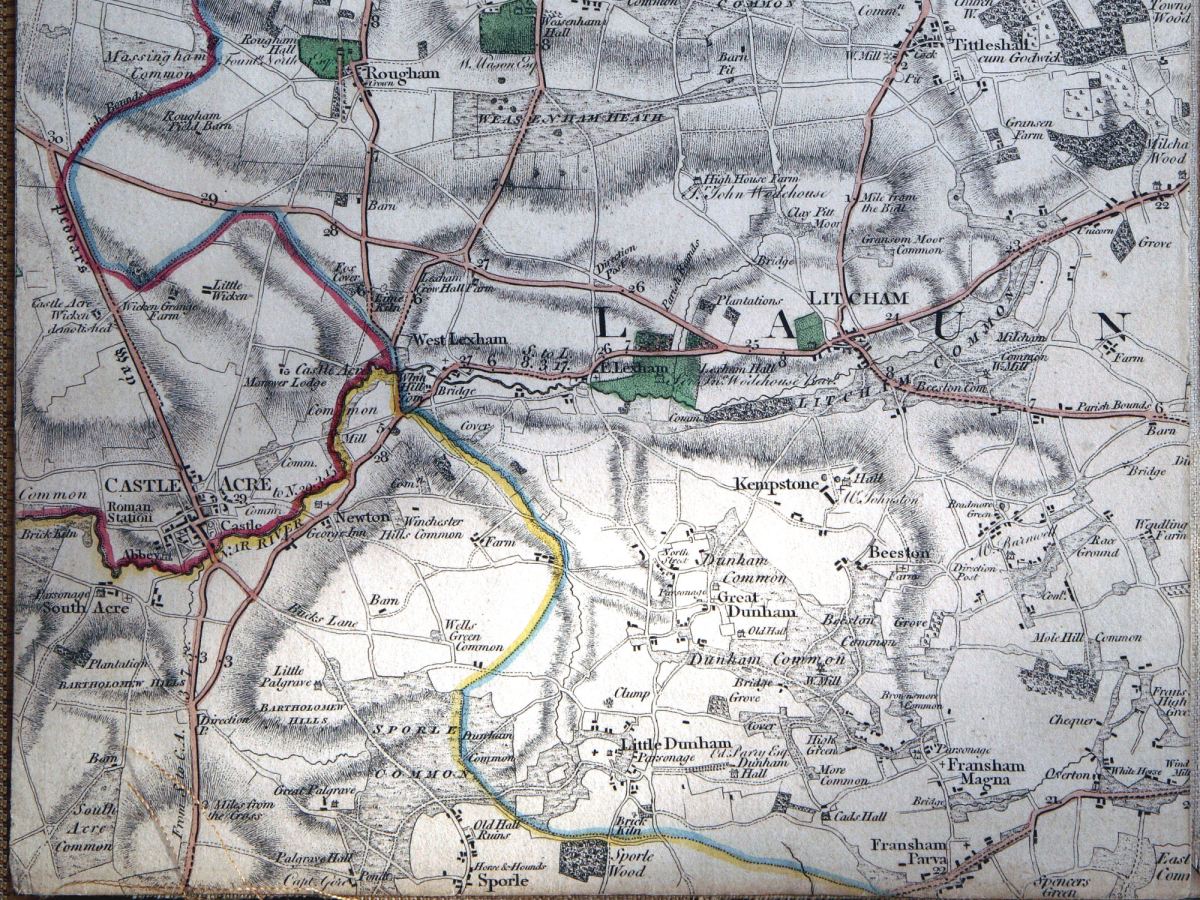
From Faden’s 1797 map of Norfolk showing a meandering upper River Nar
The second in my mini-series on our (Norfolk Rivers Trust) 2014 river restoration projects begins in the headwaters of the River Nar. You have to go back to Faden’s map of Norfolk to find the upper River Nar drawn with a wiggly line. It seems as if the river meandered in 1797, but was dead straight within fifty years, when the first OS series was drawn. The straight channel was progressively made deeper by maintenance dredging through the 20th Century until the upper quarter of this Norfolk chalk-stream had become more of a drainage ditch than a stream.
So, this project, like the one I described in my previous blog, was also aimed at re-meandering a much canalised river, this time in the headwaters. Only here we had no relic channel to restore, and not much in the way of reference reaches to use as a model. The entire upper river has been straightened and only in a very few places can relic meander sequences can be found:
There’s a relic meander in the wood in the centre of the map: only a handful of these exist on the entire upper river.
These, however, give an idea of the meander pattern the river once had. More indicative were the more continuous meanders on the nearby Upper Tat, an almost identical size and type of stream.
Natural meanders on the River Tat
But we had to dig deeper than maps to find out what the river may once have looked like and also where it once flowed. LIDAR (a satellite derived map of land level) revealed a bit more information: in the image below you can see a darker line meandering down the valley, sometimes north, sometimes south of the straight ditched course of the river. This darker area marks the true low point of the valley. The river would have meandered along this course. But in the upper reaches of the project LIDAR asked more questions than it answered. In the triangle of land in the upper right corner of the image the course of the river is invisible. There is only is a low-lying, almost marshy area furrowed with drains. This area is also marked by strange channels on the Faden map.
When I went to explore this patch of land, instead of finding gravel 50 cm below the level of the peat, as we normally do on the Nar, my steel pin sank time and again into the peat without once touching anything solid. I began to suspect that the very upper river was once more a series of marshy ponds than a distinct channel, kind of like the landscape I saw out of a helicopter once when crossing a wilderness landscape in Canada.
Not a chalky landscape, but swap the fir trees for alders, oak and willow and perhaps parts of the upper River Nar looked a little like this: a series of marshy ponds with a stream meandering through them.
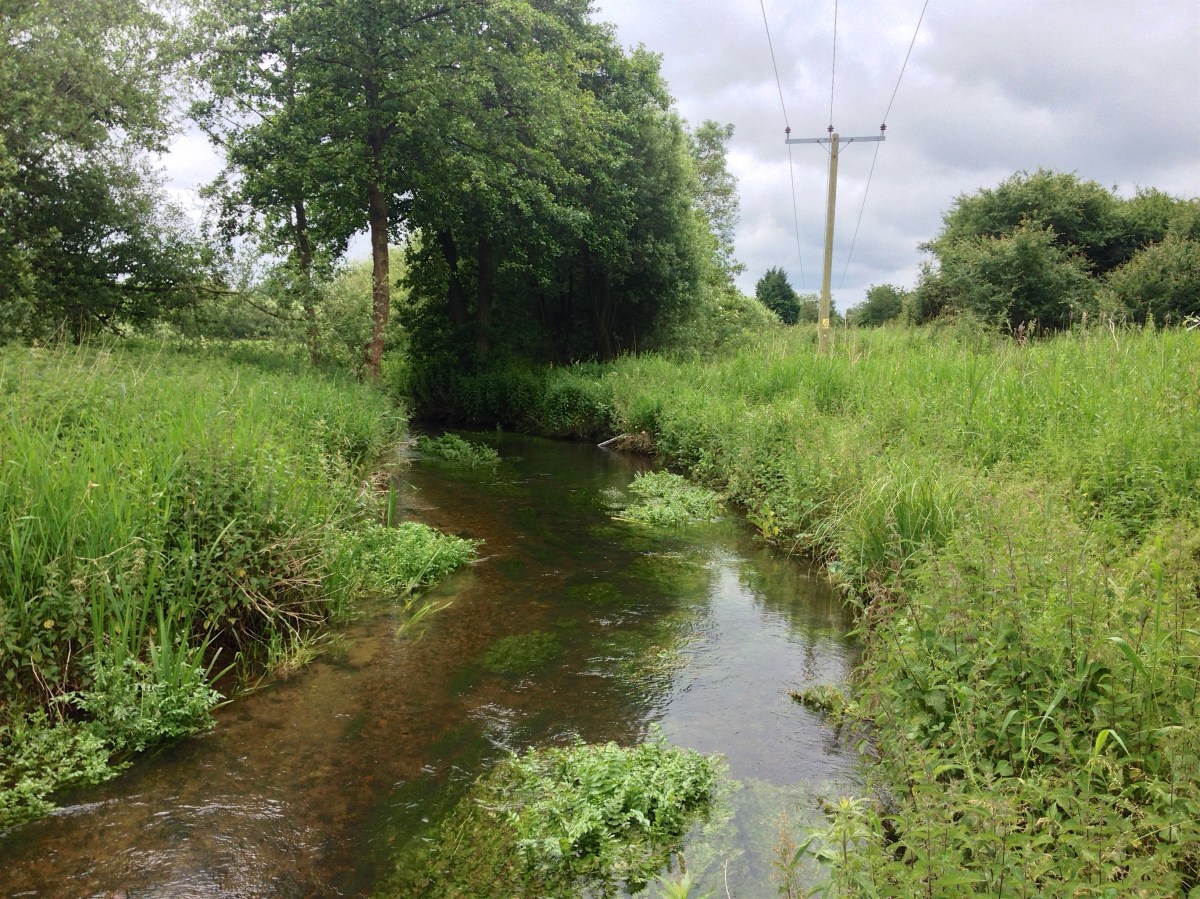
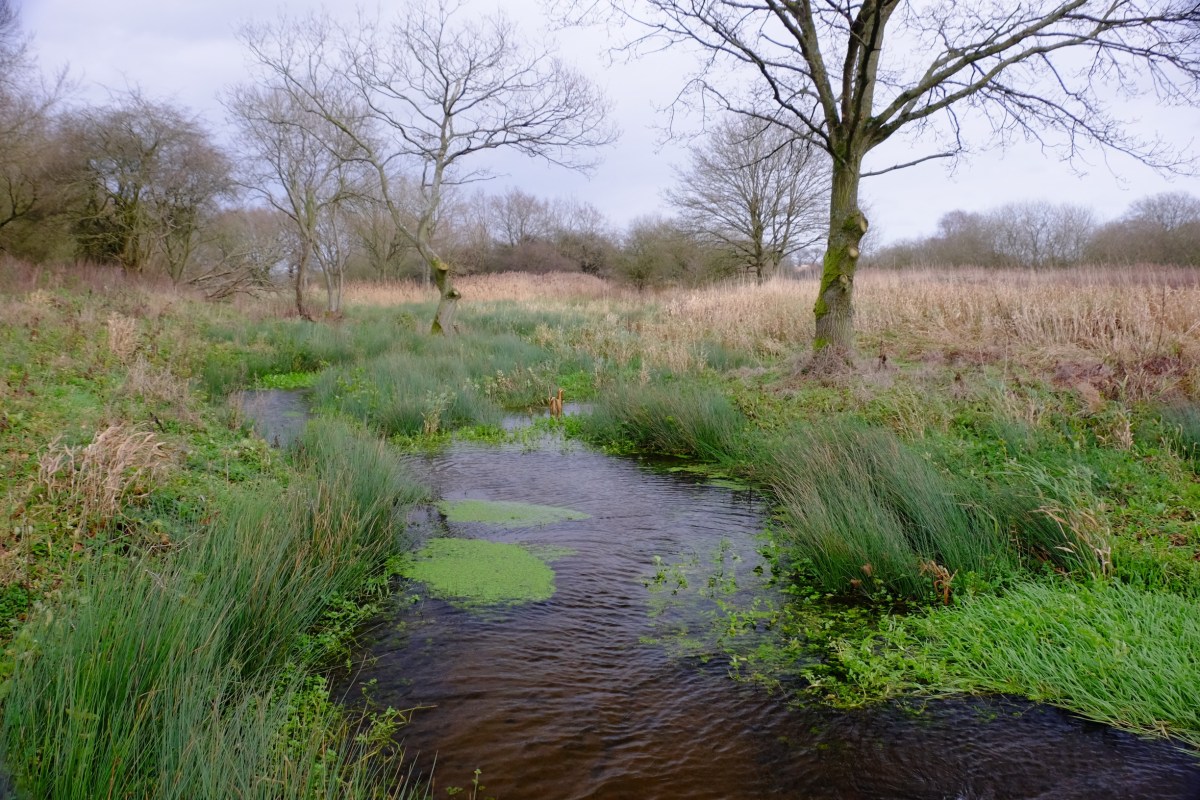
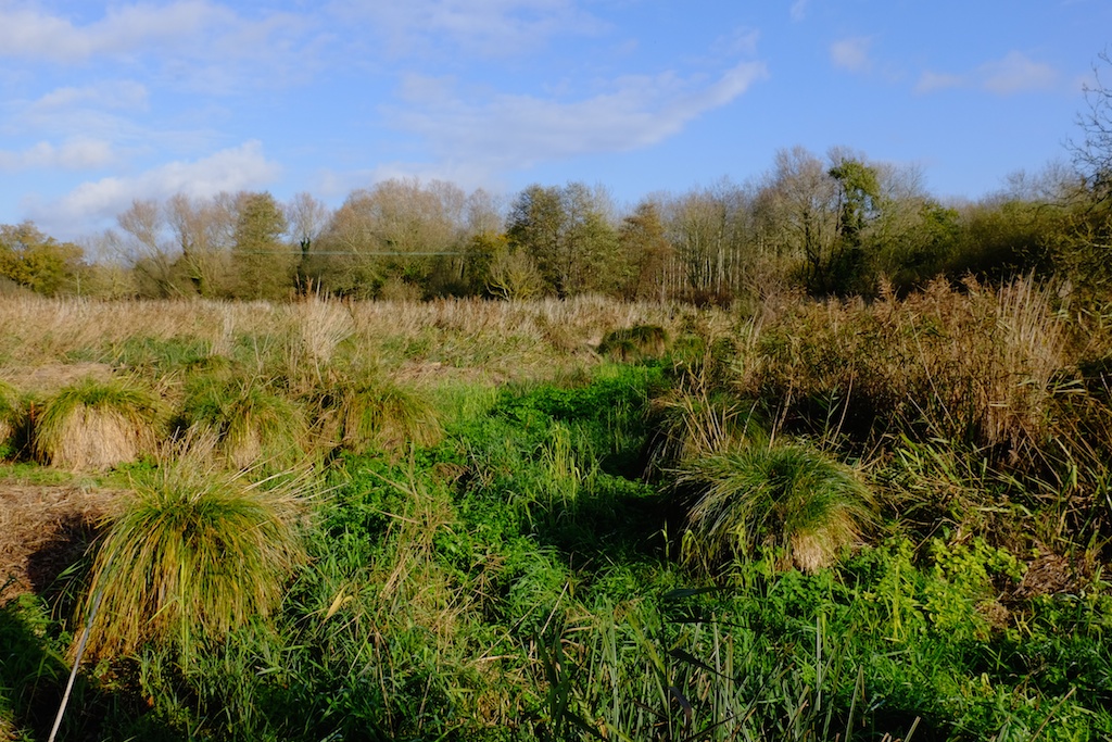
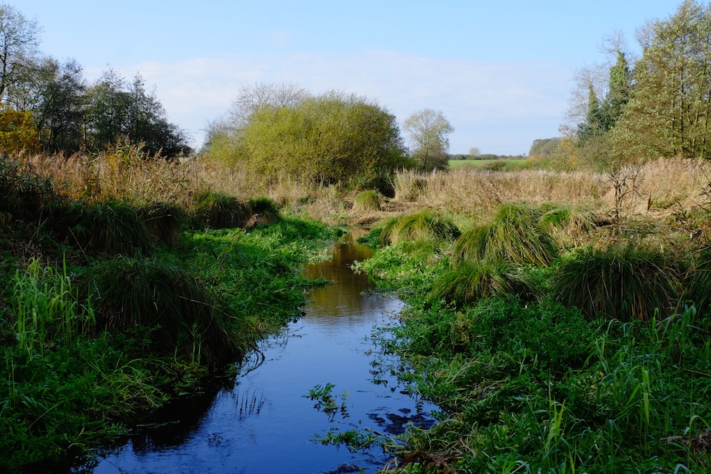
And not unlike some parts of the river as they are today:
The River Nar morphing from a stream to a pond to a stream again
It would have been great to peel back the edges of the ditch and create a similar landscape, but our budget and consenting authority permissions allowed only for the creation of a new channel. We decided to leave that strange corner of the river to become another project sometime in the future.
Instead, basing the meander pattern on those reference sections of the Tat, I started to plan a new meandering channel starting where the gravel came towards the surface of the floodplain … as you can see on the sketches below.
Re-meander Plan1: the direction of flow is from north-east to south-west. The channel starts where the gravel came back towards the surface of the floodplain.Re-meander Plan2: a continuation of the river from Plan1.
Gradient was the real issue: in spite of this reach being the headwaters of the river the landscape is very flat. Our new river had approx. 1 meter of fall in 1000 meters of distance run. In part, this was also because the new meanders made the stream much longer: 1200 meters of stream replaced 800 of ditch; and also because we kept the river bed about 50 to 60 cm below the floodplain when the bed of the ditch was as much as 1.5 meters lower. It would have helped to steal those extra centimeters of fall and return the river seamlessly into the bed of the ditch at the lower end. But that would have been cheating. As it is the lower end of our new channel will flow easily into an extension of this new “natural” channel – should the Government ever fund this scale of landscape restoration again – and in the meanwhile the river returns to the bed level of the ditch through a series of shallow (so fish can get up them) steps which we constructed using buried limbs from a fallen oak tree.
The basic river is now cut and is flowing. The rain has come and the landscape is suddenly sodden and the whole project needs to consolidate and settle. When it has we’ll add gravel to the bed of the channel to create shallow riffles and we’ll deepen some of the pools. We’ll harrow the ground and sow with an appropriate seed-mix. We’ll plant alders and oaks. Within a year I hope the place will be a new kind of watery paradise for the wildlife of the upper Nar: a meandering river with the planform and cross-sections I like to think it once had, in touch with its water-meadows. A better way entirely for a chalk-stream to start its journey to the sea.
Thanks to all those involved: the land-owners and the Common Trustees, the Norfolk Rivers Trust, WWF and Coca Cola, Natural England, Norfolk Rivers Drainage Board, Richard Hey, Tom Moore, Acorn Tree Services and of course Jason Lovering and Jonah from Five Rivers Environmental Consultancy who worked long days for four weeks to get it all done before the rain arrived.
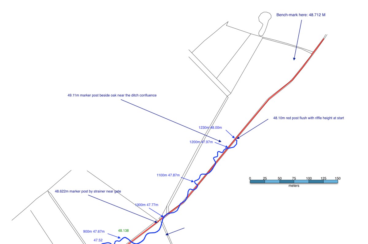
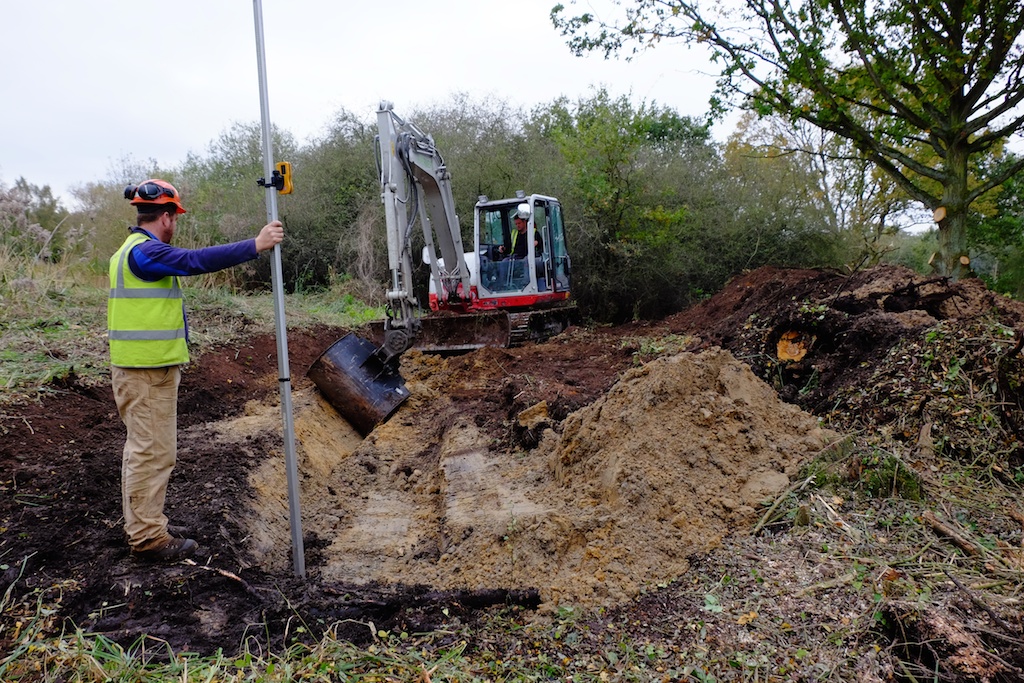
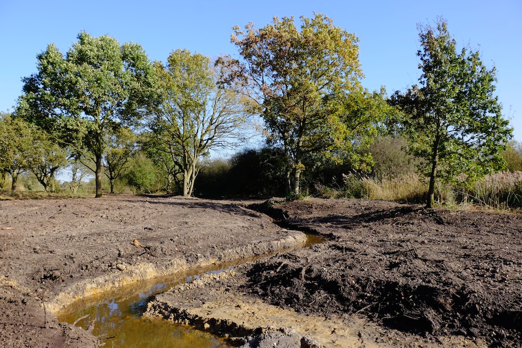
The old ditch which formed, until recently, the headwaters of the River Nar. It was arrow straight and divorced the river from the flood-plain.Another image of the upper River Nar in its 19th Century ditch.It was hard to find reference sections on the old ditch, but Richard Hey showed me how the slightest of bends will create an emergent shelf within a dredged channel, which can then be used to estimate the ‘bank-full’ cross section of the natural river.The project begins: the ditch is to the right (temporarily backed up by the works) the first turn on the new meandering course is to the left. That’s Jason Lovering of Five Rivers at the controls.Setting the level: 48 AOD at the start, 46.5 approx 1200 meters downstream. In the upper reaches the channel is approx. 1m wide and 30 to 40 cm deep. Lower down 1.25 to 1.4m wide and 40 to 50 cm deep.The new channel starting to take shape: the ditch is to the left.Another view of the emerging channel.The line of the ditch is to the left, the old course of the channel runs through this meadow ahead just about discernible in the low ground.The same view a few days later: it looks drastic (and waterless) right now, but should look fabulous in 12 months time!The same view looking back upstreamThe new channel with water in it a few days later.The lower reaches of the new channel, over 1km downstream from the starting point. The grassy tussocks in the meadow were a good indication of where the original channel had once been.The old ditch has now become a series of linear ponds backed up by each crossing point of the restored river channel, and these ponds will become a habitat feature in their own right.
The first in a series of blogs for river restorationists. The reason why nothing has appeared on here for the past four months: I’ve been a bit busy helping the Norfolk Rivers Trust deliver a handful of river restoration projects on the River Nar. This one at a site near Castle Acre will start the series because today is the birthday, or rather the re-incarnation day of a lost river. The aerial photo (1946) below shows a part of the River Nar which was changed from its natural course hundreds of years ago when the mill-leat for the downstream mill was cut: the straight channel flowing down the west (left) side of the image. Look east a few yards however and you’ll see evidence in the ground of the abandoned river. In fact it was left there, unfilled and unchanged from the day it was cut off by the leat until today, the 11th of November 2014.
This relic channel is a true rarity on English chalk-streams. More or less every yard of every river has been modified for one reason or another. To find five hundred yards left more or less as the Ice-Age made them was the rivery equivalent of finding the tomb of Tutankhamun. The relic channel was cut off at its upper end and at the lower end was joined to the mill-leat by another straight, man-made channel. This project then was about re-instating the old channel by creating a short linking channel upstream and a longer more natural one re-connecting back to the meandering part of the main river downstream.
The lower channel accounted for 80% of the project time. The available route passed through a slightly raised part of the flood-plain and in the middle reaches it was a challenge to peel away enough ground to make the correct, naturally shallow cross-section. There was little fall to play with too and the main river to which the new channel returned has been dredged (a future project will be sorting that out) and so tuning the gradient proved very tricky. It was worth the effort though. When the flows finally broke through the new channel worked perfectly, with good velocity and no unintentional impoundments.
Restoring the relic channel was as close to actual river restoration as is possible: like peeling varnish off an old painting. A delicate job if the painting is not to be damaged. In practice we went so lightly that it was quite easy. Helen Mandley supervised with an eagle eye and Wayne on the digger performed with great sensitivity. See the photos below for the fuller picture. Amazingly there was very little sediment in the relic channel. Within an hour the flows had scoured their way to the gravel.
Some will know that Nigel Holmes sadly passed away a few weeks ago: it may well have been Nigel who first identified this as potential restoration project in a report (which he co-authored) commissioned by English Nature about ten years ago. This project has been a team effort over the years and Nigel’s early involvement is a reminder of that. I’m sure he would have been chuffed to see it come to fruition. The delivery team included WWF and Coca Cola as sponsors, the Norfolk Rivers Trust as planners and supervisors (Helen Mandley ran the project, and I was there to help fret about gradients, planforms and cross-sections), the Norfolk Rivers Drainage Board (machinery and delivery – thanks to Adrian, Wayne and Graham), Richard Hey, Holkham Estate, The Castle Acre Fishing Club, Natural England and others.
The red lines mark the new connecting channels. The blue lines mark the “lost” relic channel.The old mill leat. The channel is too wide and straight and has been dredged in places too: which is why it is over-run with burr-reed, while the river tries to establish a more appropriately-sized channel along one edge.This is the ground which the new connecting channel was cut through at the lower end of the project: an old poplar plantation and defunct pheasant pen.The relic channel under the trees. The water in this image is just flood-plain seepage, which amounted to just enough flow to keep the channel viable for the past two centuries. Note the shallow profile of the un-modified banks. The channel is shallow too, only 30 cm deep, with a bed of hard gravel under a thin layer of sediment.The relic channel in the open meadow. Here the old river is almost lost under vegetation, although in practice it was quite easy to uncover it. Note the shallow banks and the fabulous tussocks which the river meanders between. The bed is hard gravel in a shallow channel under a thin layer of sediment.The relic channel revealed. Without touching the bed or banks the weed was peeled aside and folded over onto the edges of the stream.Helen Mandley of the Norfolk Rivers Trust making sure the digger doesn’t damage the bed of the relic channel. The operation was a wetter version of peeling varnish of an old painting: just enough to reveal what’s underneath.The new channel flowing where the pheasant pen used to be. Still something of a moonscape it will be softened in due course by large woody debris and plants in and along the edges of the channel. The important thing was to replicate the dimensions and planform of the relic channel upstream. Establishing half-a-dozen subtle riffles when there was very little fall to play with was quite a challenge, as was creating shallow banks when the floodplain on the available route was slightly higher than ideal.Another view of the new channel.A wonderful moment: the relic channel flowing as the main River Nar for the first time in about two hundred years. It looks happy!The same wonderful moment upstream: the river looks almost pre-historic. This is a very special site now: a reference reach of an unmodified English chalk-stream. Hen’s teeth are more common.
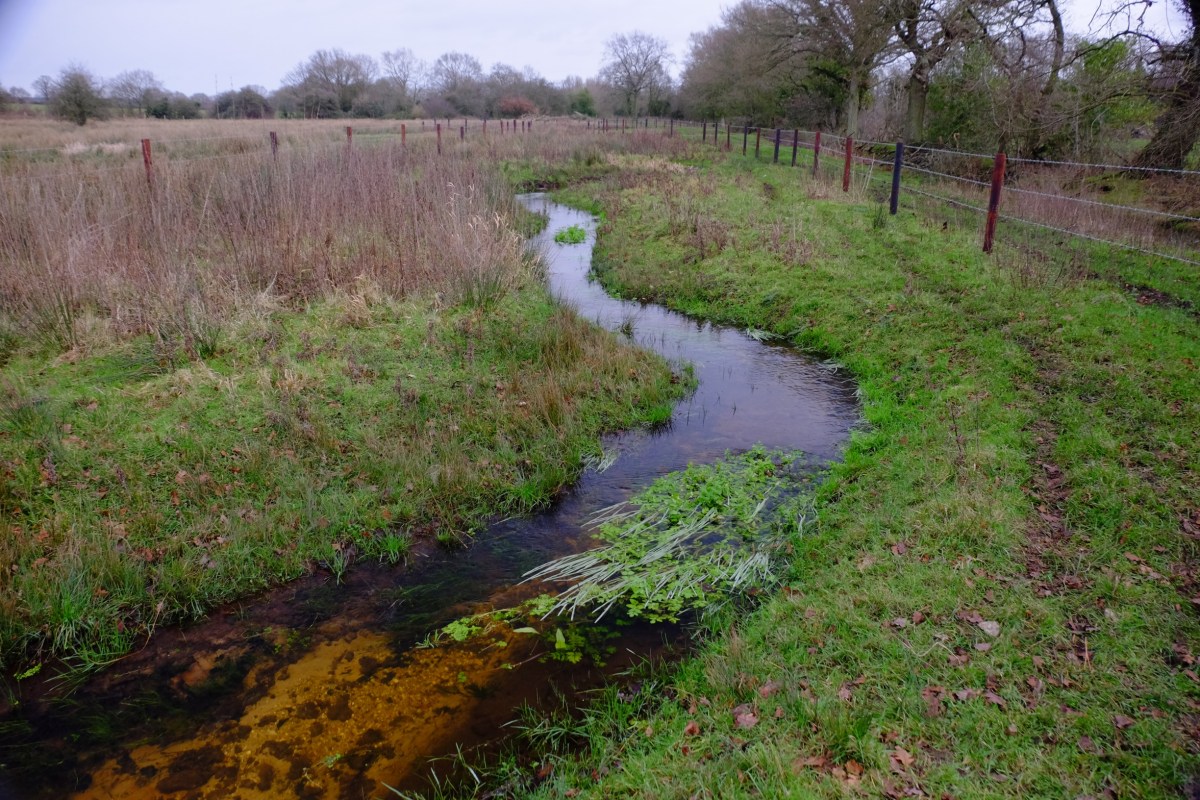
Monday morning 4th August and the next phase in the restoration of a small Norfolk chalk-stream begins. 3.5 km in two months, all being well.
Last year we (the Norfolk Rivers Trust working with Cain BioEngineering) took on a similar length – 3.5 km of straight and over-wide channel and did our best to replicate in two months what would have taken hurricanes and beavers (if we had them) two hundred years. You’ll get the idea from these before and after pictures: we felled trees and used them to rebuild a more natural, meandering channel.
It sounds simple enough. But why bother? Over the centuries chalk streams have been straightened, deepened and widened: for milling, for navigation, to construct water-meadows (a 17th Century technique for boosting farm productivity by flooding the floodplain) or to make them into drains (a 20th century technique for boosting farm productivity by draining the floodplain). The cumulative impact of all this modification has been to change our chalk-streams from the naturally meandering rivers they once were into uniform, over-wide and over deep canals.
Using trees to rebuild the meandering, low-lying riverbanks that a chalk stream should flow within brings a host of improvements to the habitat and eco-system. In the restored channel the water flows more quickly. The swifter flows scour the bed of stream so that there is clean gravel instead of deep mud. The faster flows favour weeds like ranunculus and starwort which help maintain a cleaner river, and provide better habitat for fish and insects. Along the shallow, wet margins reeds and grasses flourish and these also provide habitat for insects, birds and mammals. Selectively felling trees helps too, especially in the sort of semi-commercial forestry that borders a lot of our rivers: the ideal is the dappled sunlight and shade you’d find in a natural, mature flood-plain wood.
Altogether this carefully choreographed imitation of a small hurricane can absolutely transform a chalk stream, as these photographs show. The changes illustrated here have taken less than a year to evolve. In five or ten years the woody banks will have disappeared beneath trapped silt and vegetation and flowing through the middle will be a smaller and much healthier river.