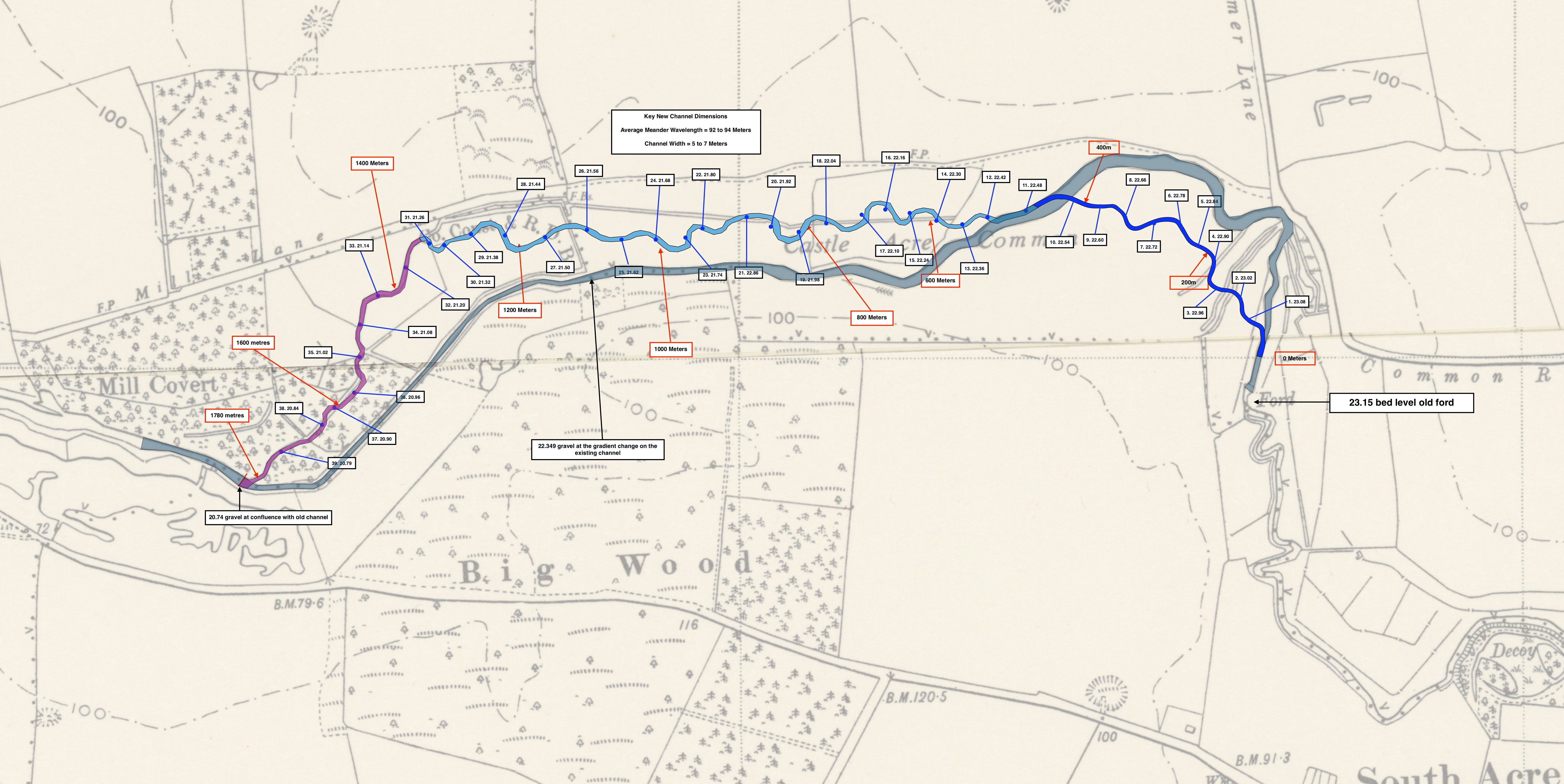
Three phases of a 1.75km re-wilding project – blue, light-blue and purple – in which the River Nar will be taken out of its diverted and impounded course and restored to a meandering channel in the centre of the floodplain.
In early September we will be starting work on the first phase of our most ambitious River Nar project to date, what will become almost 2 km of re-created “natural” chalk-stream: with funds from the Water Environment Grant we are moving the river out of a diverted, impounded and now dredged channel and putting it back where it belongs – in the bottom of the floodplain.
An awful lot of forensic work, sifting through old maps and aerial photos, of thinking, discussions, thinking again, drawing, measuring, and drawing again – not to say form filling and fund-raising – have lead to this. Probably rather more than ever preceded the diversion (several hundred years ago) and the dredging (twenty to fifty years ago). It takes more work to fix something than bust it.
Like most chalk-streams, the River Nar has been diverted along much of its course. The diversions have been driven by putting the river to use in one way or another over the centuries. It was widened and straightened in the early Middle Ages in order to float stone in barges to build the abbeys and castles along its course. It was diverted to feed water to those abbey kitchens, and latrines, and to power mills (some of which are recorded in the Domesday book). And in the late 18th / early 19th centuries it was used to create “floated” water-meadows, an agricultural innovation which trebled the crop of hay that could be taken off the floodplain meadows: the improved crop of hay fed greater numbers of sheep, which were “folded” at night onto arable fields on the surrounding hills, and thus fertilised those hills with the goodness of all that floodplain grass. Quite a neat form of cyclical land-use.
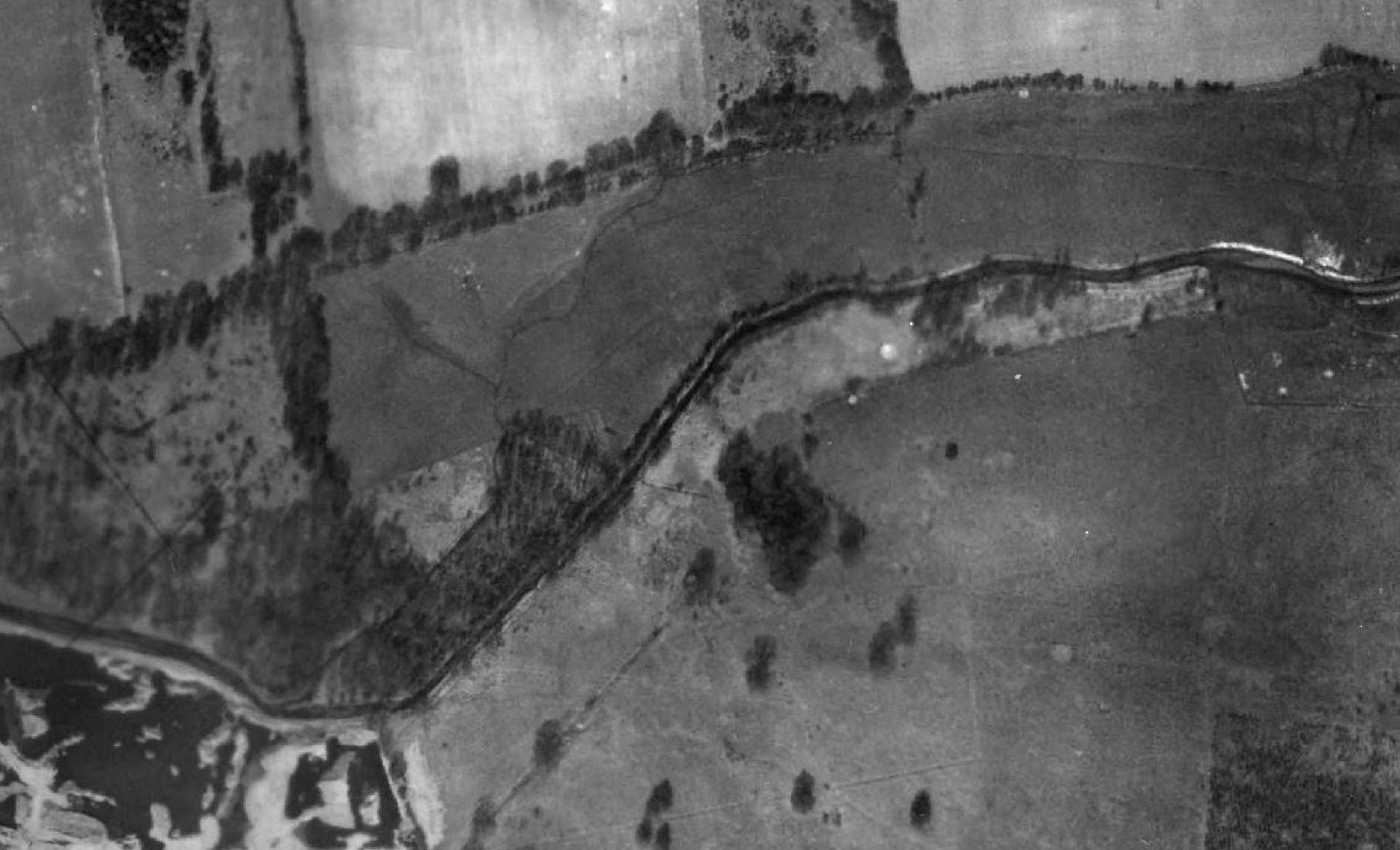
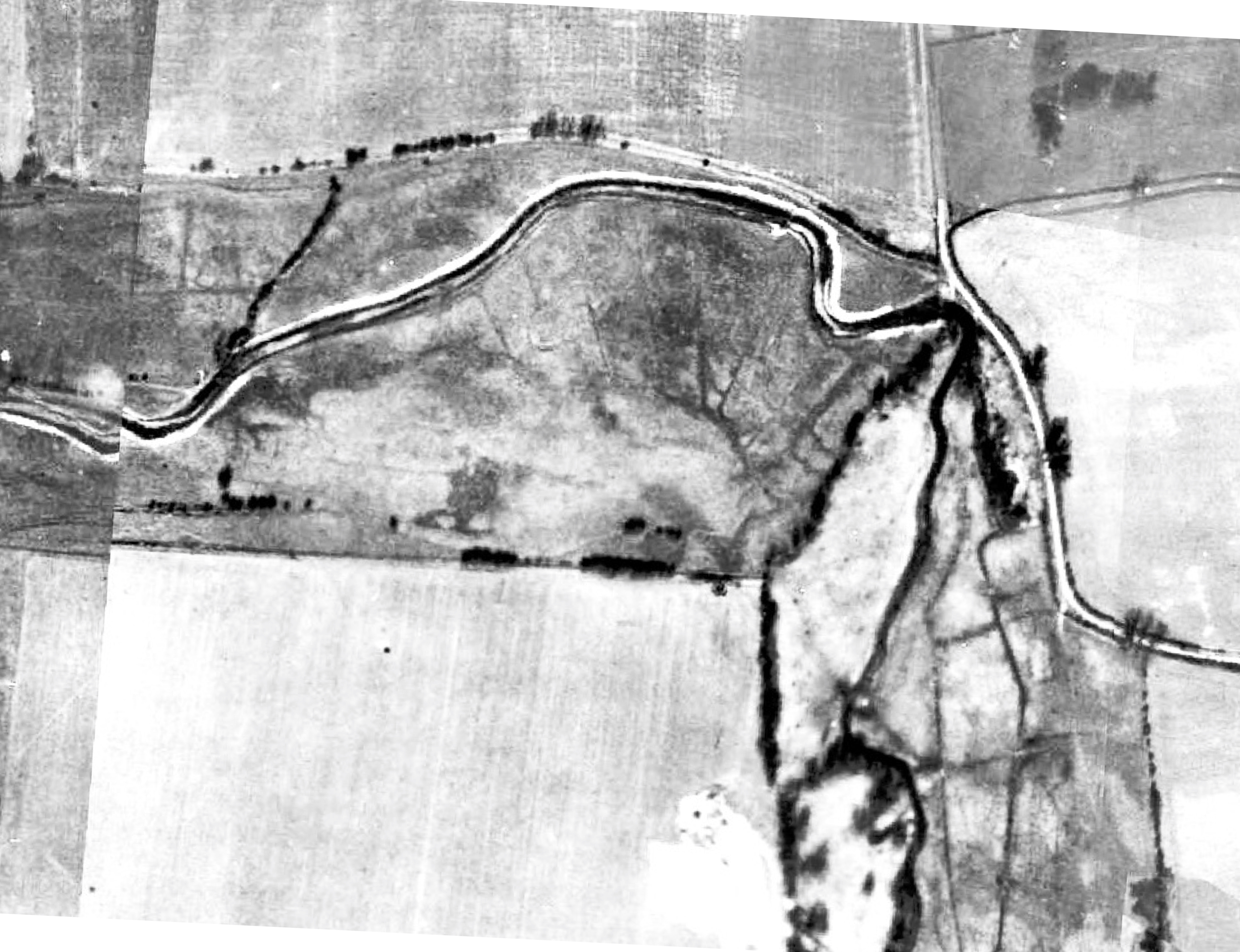
An aerial photo from about 1946 showing the diverted channel (dark and straight) and feint remnants of the original channel to the north.
Whenever you take a river away from its original course and divert it towards and then along the edge of the valley, you inevitably lessen the gradient for the duration of that diversion, you turn a swift-flowing river into a linear pond (hence the word “impound”) and in so doing build up “a head” of potential water-power than can be released at key places, at a mill or across a water-meadow, for example. In a way these functional structures are all part of the rich history of the valley: but they have big consequences for wildlife. The Domesday mills shut salmon and sturgeon out of the River Nar over one thousand years ago, for example. And in more recent decades dredging and the sheer volume of silt that runs in to the river from surrounding farmland and roads, has greatly exacerbated the problems caused by diversions and impoundments.
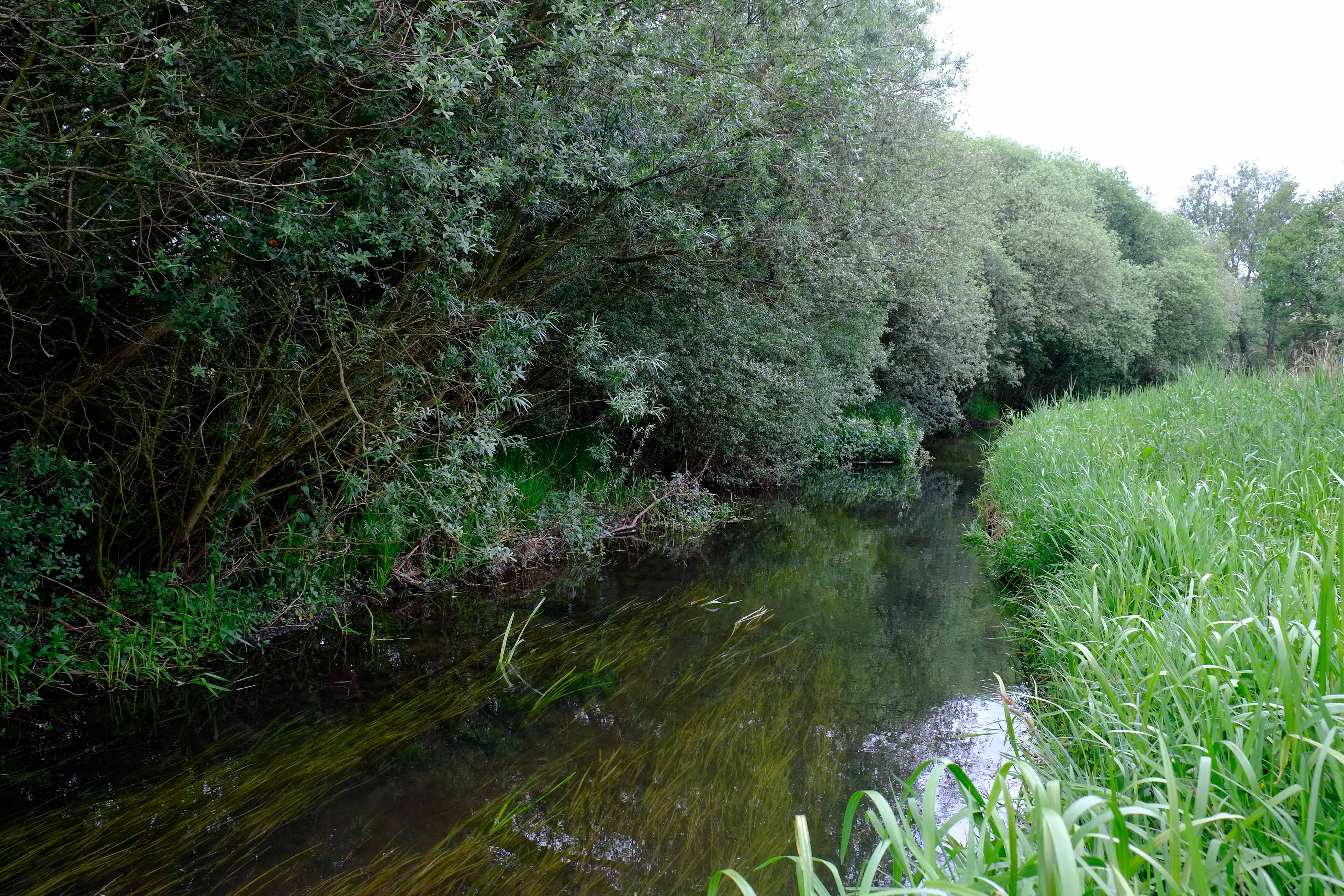
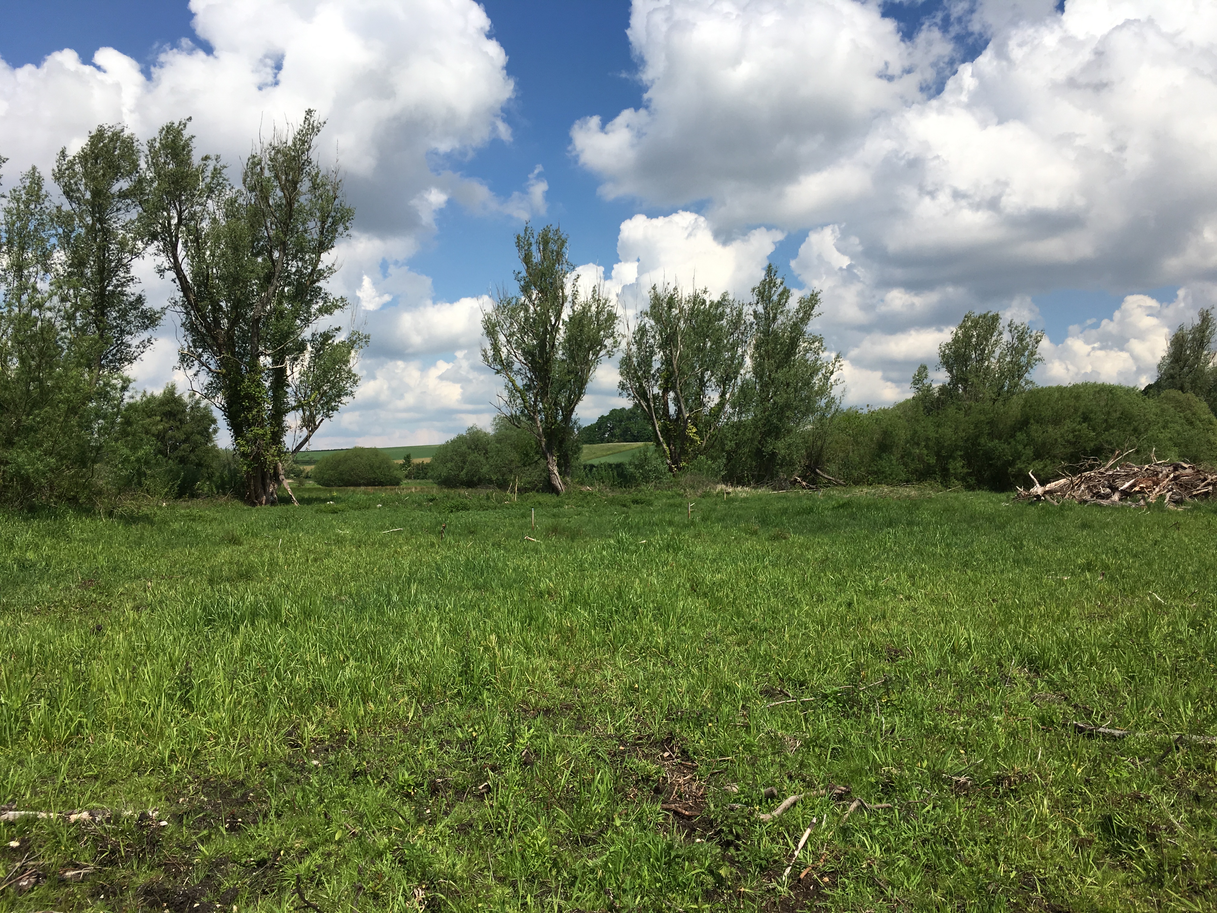
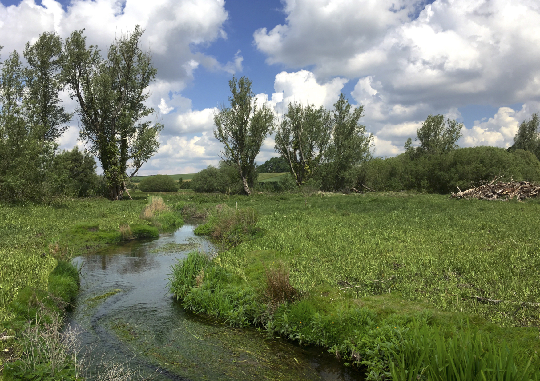
A typical reach of diverted, impounded and dredged channel.
The diverted and impounded and now dredged and silt-filled channels are not nearly so good for fish, or invertebrates, or the plant-life one would normally associate with a free-flowing chalk-stream.
This project, therefore, is an attempt to “re-wild” the river, to give it back its gradient, meanders, deep pools and gravel shallows, and to improve conditions for the fish and the plants and insects which thrive in a natural, free-flowing chalk-stream habitat.
Outline plans of Phase 1.
We are going to cut a new channel – although in fact it’s our best guess at a re-creation of the original channel – which will meander back and forth along the bottom of the floodplain. The gradient that is currently expended over a very short part of the existing channel will be spaced evenly along the entire length of the new channel, creating a swift moving river that falls from one riffle and pool to the next.
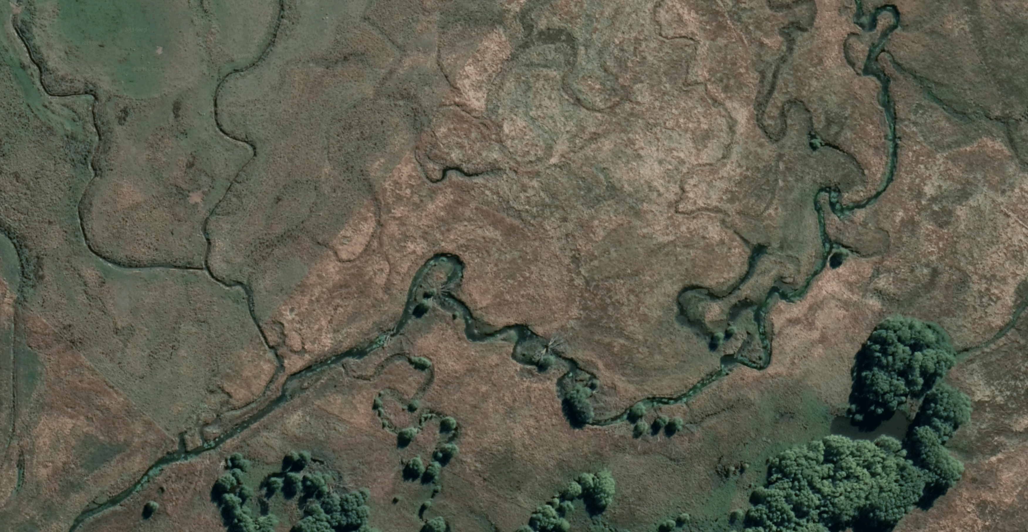
We’ll be cutting the channel with diggers … but in fact cutting a new channel is something natural rivers do all the time: even spring-fed rivers such as the River Nar. Have a look at the aerial image (below) of a spring-fed river in New Zealand, one that has never been straightened or modified and where the floodplain either side is open, uncultivated grassland. There are relic channels and ox-bows all over the place. In places the river runs through several channels side by side.
The River Nar is doing the same thing in one section of our new project site: a breach in the impounded leat is allowing some of the flow to escape through a willow carr and thus find its way back to the remains of the original channel. If we left it alone for a thousand years, it would probably finish the job on its own. This project puts those natural self-repair processes on fast forward.
In planning a project like this, an awful lot of work goes into investigating the history of the river and how it got to be how it is. Old maps and aerial photos suggest that the river here was diverted first to the north and then to the south to create a crude water-meadow or perhaps simply to shift it out of the way of the floodplain meadows.
There is evidence of basic catch-work drains along the pathway of what would have been the original channel, and of smaller drains running perpendicular to the original river. Towards the lower end of the project site the existing channel is suspended higher and higher above the floodplain, held behind a leat-like earth wall, until suddenly the river passes a sill in the river bed and over about 300 yards all the accumulated gradient is released in a headlong rush towards a mill. It is the strangest mill-leat I’ve ever seen, but maybe it worked.
Luckily some of what is almost certainly the original river channel remains in the valley floor towards the lower end of the project site: this grown-in channel meanders along an old parish boundary.
The first phase – 400 meters – will be cut this September. We will cut the channel by digging down through the floodplain peat until we get to gravel. But the heights of each riffle have to very carefully worked out in order to ensure we build a river that has a gravel base and flows downhill! You can’t just excavate until you hit gravel: you have to excavate to a very specific set of heights and try to coincide this with the gravel that is down there. Since you also don’t want to be digging and removing tons of gravel, you have to run the course along a pathway that coincides with where the gravel is at the correct depth under the floodplain. There’s no easy way to do this: one day someone will invent a cheap underground radar. In the meanwhile it’s me walking back and forth with a Trimble levelling device and a metal road-pin which I drive into the ground until I hit gravel. I then try to build a map of the floodplain surface and subsurface, the heights of the gravel under the surface, in order to arrive at the best course for the new river, trying to coincide this with a best estimate of where that original course would have been. It’s easier when there is an old channel, or evidence of one, to follow.
The peat that comes out of the ground will be used either to repair any compression of the floodplain caused by the machinery or it will be taken off the floodplain and used to fill an old gravel pit near the site. Some of the spoil will be used to plug the existing channel at the cut off point downstream as far as some freshwater springs: these will continue to feed water to the existing channel which will then become a fen-like oxbow channel and add diversity to the range of habitats in the valley.
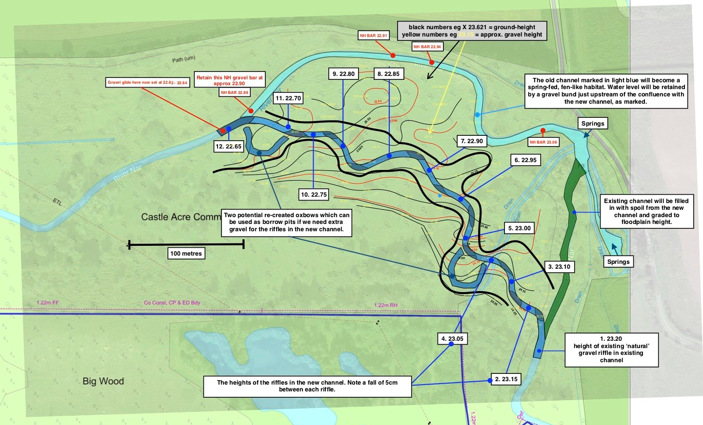
I will post pictures as the project unfolds. In the meanwhile here are some before and after mock-ups of what I hope it will look like: