
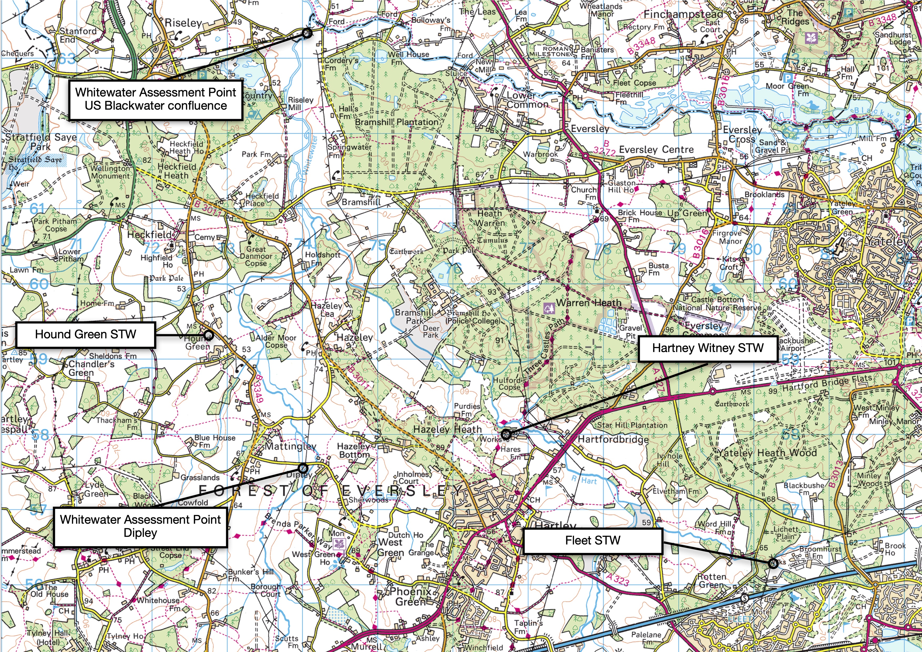
And here is a chart for the Whitewater in Hampshire, a chalk stream rated as Good for Phosphate. But that “Good” is an average. In fact the river is at High status upstream at Dipley and Moderate status downstream at the Devil’s highway just upstream of the Blackwater confluence. In between lie three sewage treatment works (STWs), two of which do strip phosphate, albeit but they are largish works at Hartney Witney and Fleet. The third works at Hounds Green, I’m not so sure, but I suspect it is too small to get phosphate removal.
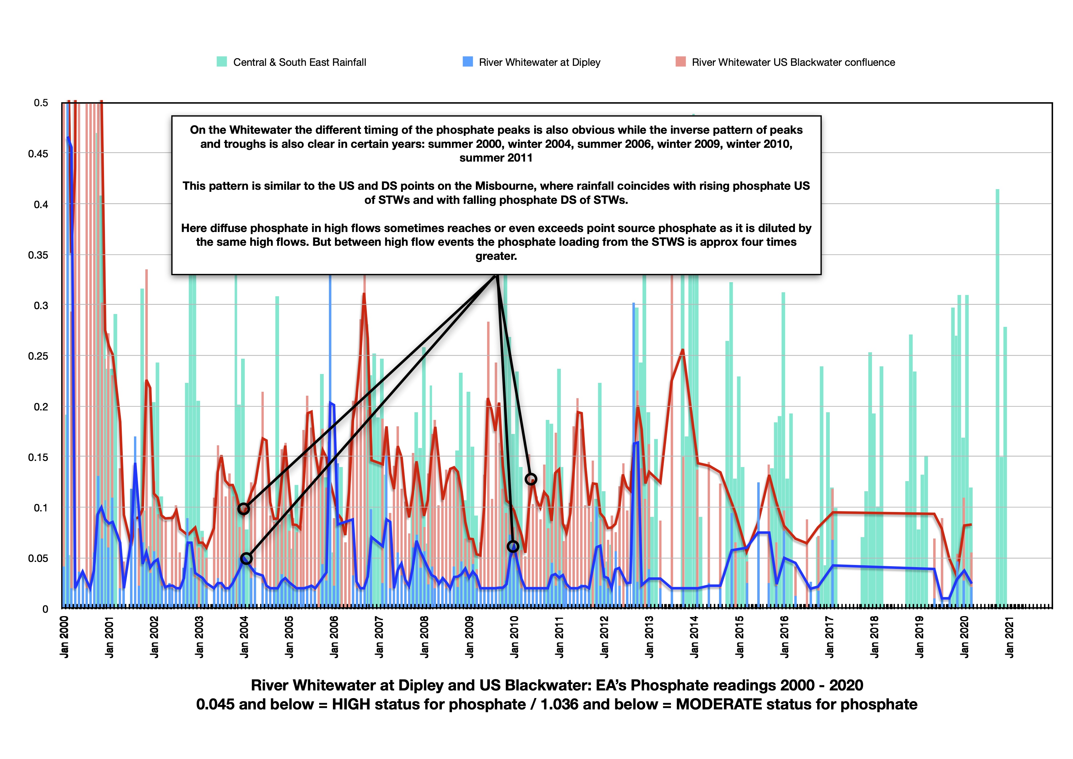
The River Whitewater in Hampshire shows a less extreme but in some ways clearer version of the pattern on the Misbourne … see earlier post. There are numerous small discharges upstreams of Dipley, but no sewage treatment works.
The lower Assessment Point near the Blackwater confluence is impacted by three STWs, Fleet and Hartney Witney via a tributary called the River Hart and also Hound Green.
The phosphate peaks upstream at Dipley tend to coincide with or even follow winter rainfall, while the phosphate peaks downstream quite clearly coincide with late summer and precede autumn / winter rain. The peaks and troughs are in a clear inverse pattern
Note how the peak loading from the diffuse / disparate sources at Dipley matches the downstream readings as the point sources become diluted by the same high flows, but that between high flows the readings downstream are approx four times greater.
