
I don’t suppose anything could underline the importance of looking after chalk streams than the idea that we can lose them altogether.
I get emails now and then, notifying me of rivers I might have missed off the chalk stream map. One highlighted a little stream near Faversham in Kent: it rises only once in a blue moon now and wets a few pavements with its surprising flow. Once it turned several mills and formed a maze of waters … as the 19th century ordnance survey map shows.
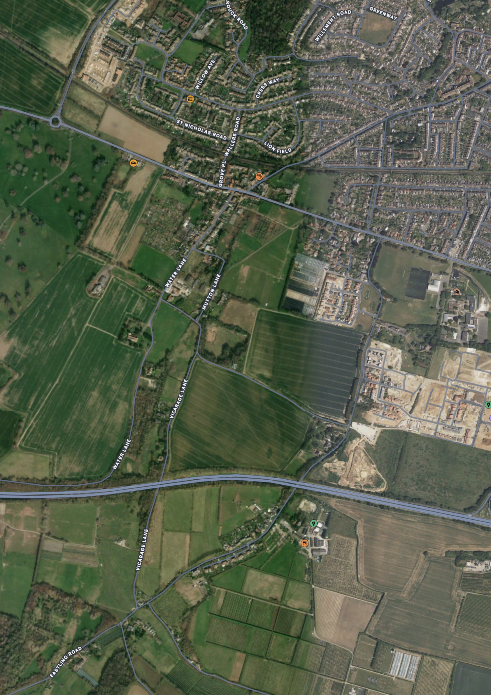
Compare that to the modern satellite image which is devoid of any trace of water. As is, more worryingly, the modern ordnance Survey map.
I have overlaid the 19th watery web over the dry modern landscape to show what we have lost at Ospringe. It’s going into my index, anyway.
PS. I have redone the maps in the light of Matthew’s note below, to show the full length of the lost stream.

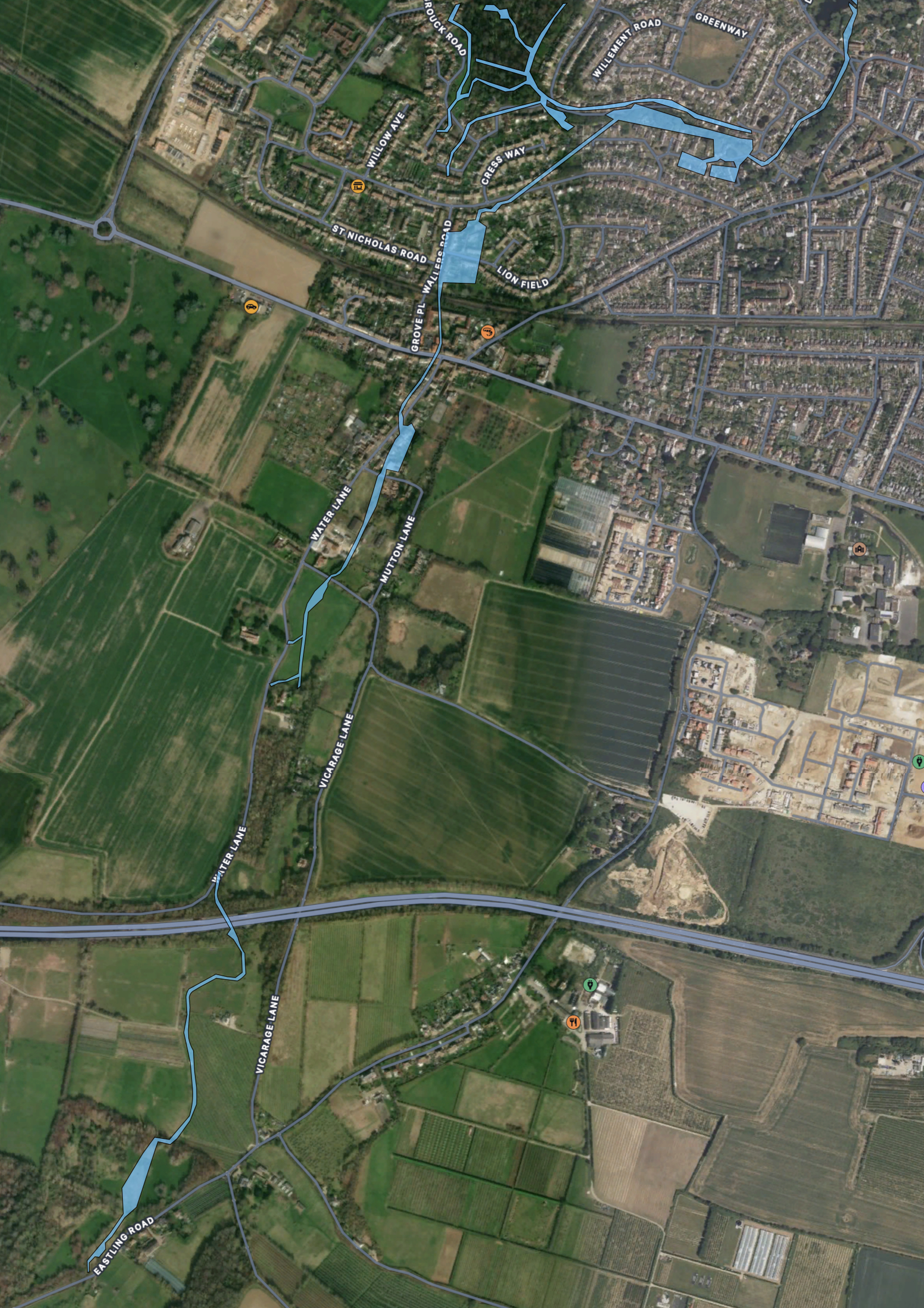

Hi Charles and thanks very much for your post. The watercourse in question is actually the upper section of what is now known as the Westbrook. It used to rise a couple of miles to the south of Ospringe near the village of Painter’s Forstal on the chalk of the North Kent downs, and indeed drove a series of mills between Ospringe and the head of Faversham Creek, including several gunpowder mills. The stream used to flow down Water Lane which runs through the middle of Ospringe but it was culverted in the last century and has pretty much ceased to flow since the late 1950s when a pumping station was installed just south of the village beyond the church. (A lot of locals also blame the M2 motorway, which was built around the same time and cuts across the stream between Ospringe and Painter’s Forstal.)
A local group, the Friends of the Westbrook, has been trying to maintain what’s left of the chalk stream for the past 10 years or so. With funding from the EA, we recently commissioned a study by the South East Rivers Trust (SERT) of the Westbrook and 10 other chalk streams flowing from the aquifer along this stretch of the north Kent coast with a view to getting them all inscribed on the national database. We’ve recently received the final report from SERT and will be compiling a summary shortly for public distribution. SERT confirms the status of the Westbrook as a high-confidence chalk stream but several of the others, while they flow from the chalk aquifer and therefore possess many of the characteristics of chalk streams, would have flowed originally directly into the marshes along the Swale. The watercourses we see today are man-made channels that have only existed since the tidal marshes were drained from the Middle Ages onwards.
LikeLike
Thanks Matthew. I have redrawn the maps to show the full length. Judging by the fact that the stream used to flow down Water Lane I would guess that the upper reaches would have naturally have been a winterbourne: old roads often share the valley floor with winterbourne courses. But there’s a significant fold in the chalk there leading up through dry valleys all the way to the ridgeway and the scarp to the south-west, the other side of which forms the headwaters to the upper Great Stour. Some of the recharge will flow in the that direction, but that’s a lot of landscape for a lost stream and I would guess that the public water borehole you refer to has lowered the water table significantly, so that now the upper reaches flow very rarely, if at all? I’m not sure the motorway will have impacted the water-table as much as groundwater pumping.
I agree with SERT ref the other chalk sources: it would be almost impossible to map every single seepage from what is effectively a massive sponge sitting on top of less permeable layers. There are chalk springs in the meadows just north of my house in Norfolk – they seep chalk aquifer water into a damp meadow and then the salt marsh. A calcareous habitat, but not a chalk stream. My index – which I am about to republish – has in the order of 250+ named streams, but the spring-lines need a different kind of mapping exercise and maybe even designation.
Keep up the good work!
LikeLike
Thank You for this really good article. This is an area that I’m familiar with having grown up and lived in Swale all of my life.
Having had great grandparents who lived in nearby Oare, I heard tales of Water Lane Ospringe and the flooding that would happen in the Winter months.
I have passed the information from the South East Rivers Trust (SERT) covering the “North Kent Chalk Stream Survey 2023” to a Councillor on Swale Borough Council so this information can be added to their records, to which I have received positive feedback.
The SERT report contains a great mention of St. Thomas a Becket’s Spring (Bapchild) which is currently under threat from proposed development, so hopefully this we help protect this important area for years to come.
LikeLike
Thanks very much for this positive feedback and for alerting the Swale Borough Councillor to the SERT report. It would be great to know which Councillor you’re referring to because we need all the allies we can get! For anyone else who’s interested, you can access the SERT report here: https://friendsofthewestbrook.wordpress.com/wp-content/uploads/2023/11/final-no-mark-ups-reduced-size-sert-north-kent-chalk-streams-survey-october-2023.pdf.
LikeLike