Some (hopefully useful) thoughts on the potential for Stage Zero projects in English chalk-streams.
Stage Zero – What is it?
Stage Zero is a new term to describe a very old landscape form: the way rivers used to be before we messed around with them. And we’ve been messing around with them since at least 3000 BC, and the Neolithic phase of deforestation, a landscape change so significant it is discernible in the pollen record and as layers of sedimentary deposits in our floodplains.
Coined by Brian Cluer and Colin Thorne to describe the pre-anthropogenic-disturbance condition of alluvial rivers, Stage Zero modifies Simon and Hupp’s 1986 Channel Evolution Model with the stage that precedes Stage One (for a more fulsome explanation look up the original paper, B Cluer and C. Thorne A stream evolution model integrating habitat and ecosystem benefits).
Essentially, Stage Zero describes a braided river system spread across the full width of the floodplain, its waters by turns flowing, seeping, rushing and gushing through a complex mosaic of wet woodland and grassland, timber jams, beaver dams and oxbows, the water-table fully saturated and the floodplain quite frequently and aptly, flooded.
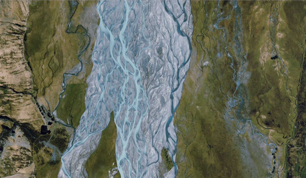
Stage Zero contrasts starkly with the highly modified, single thread, entrenched and artificially impounded river systems of our relatively developed landscapes, strait jackets from which our rivers rarely escape. Nowadays, at least in the UK, Stage Zero valley floors are rare as hen’s teeth, but one can find evidence of what our rivers used to be like: here and there in our landscape, and in old maps too and in satellite images from comparable but less developed landscapes in other parts of the world.
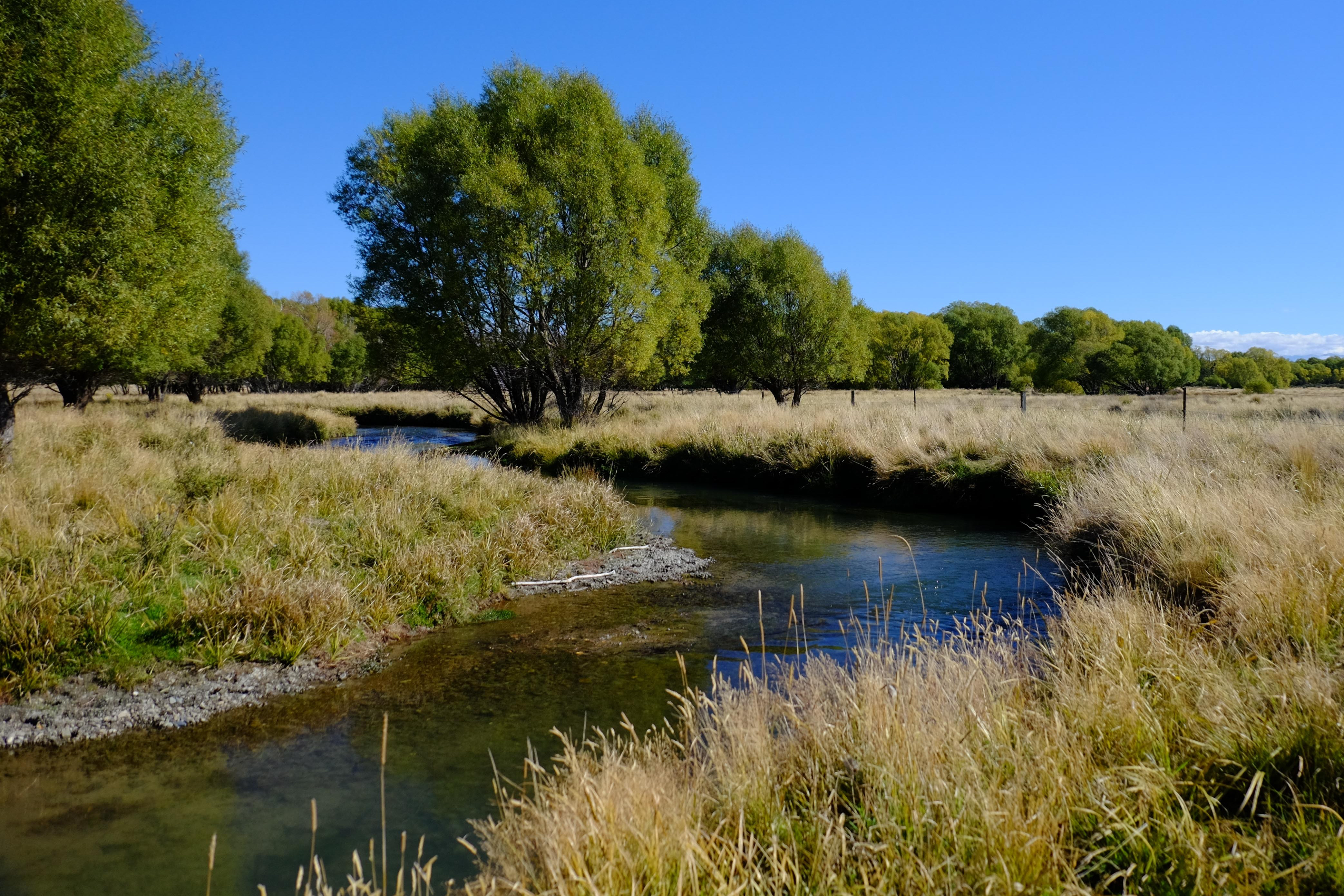
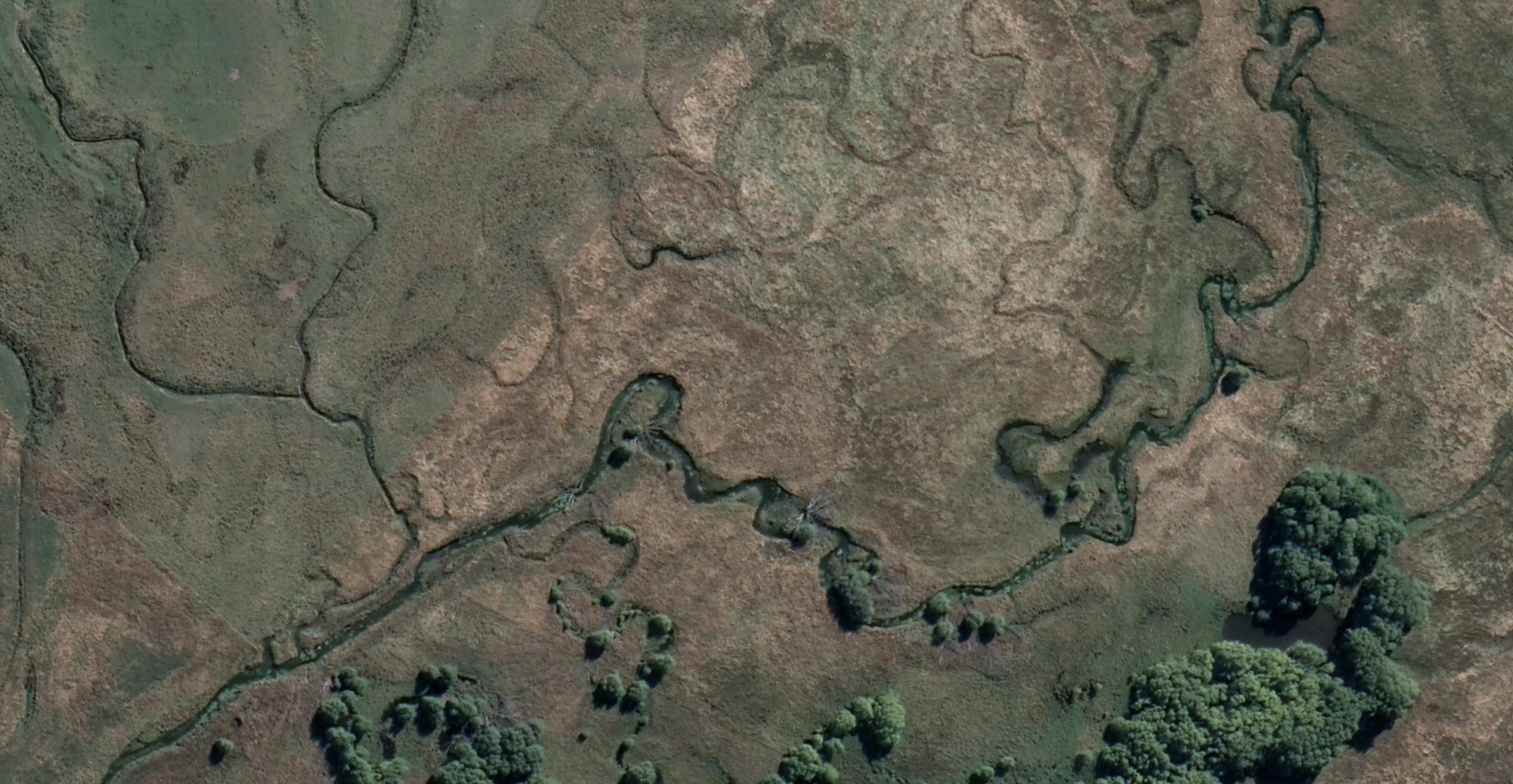
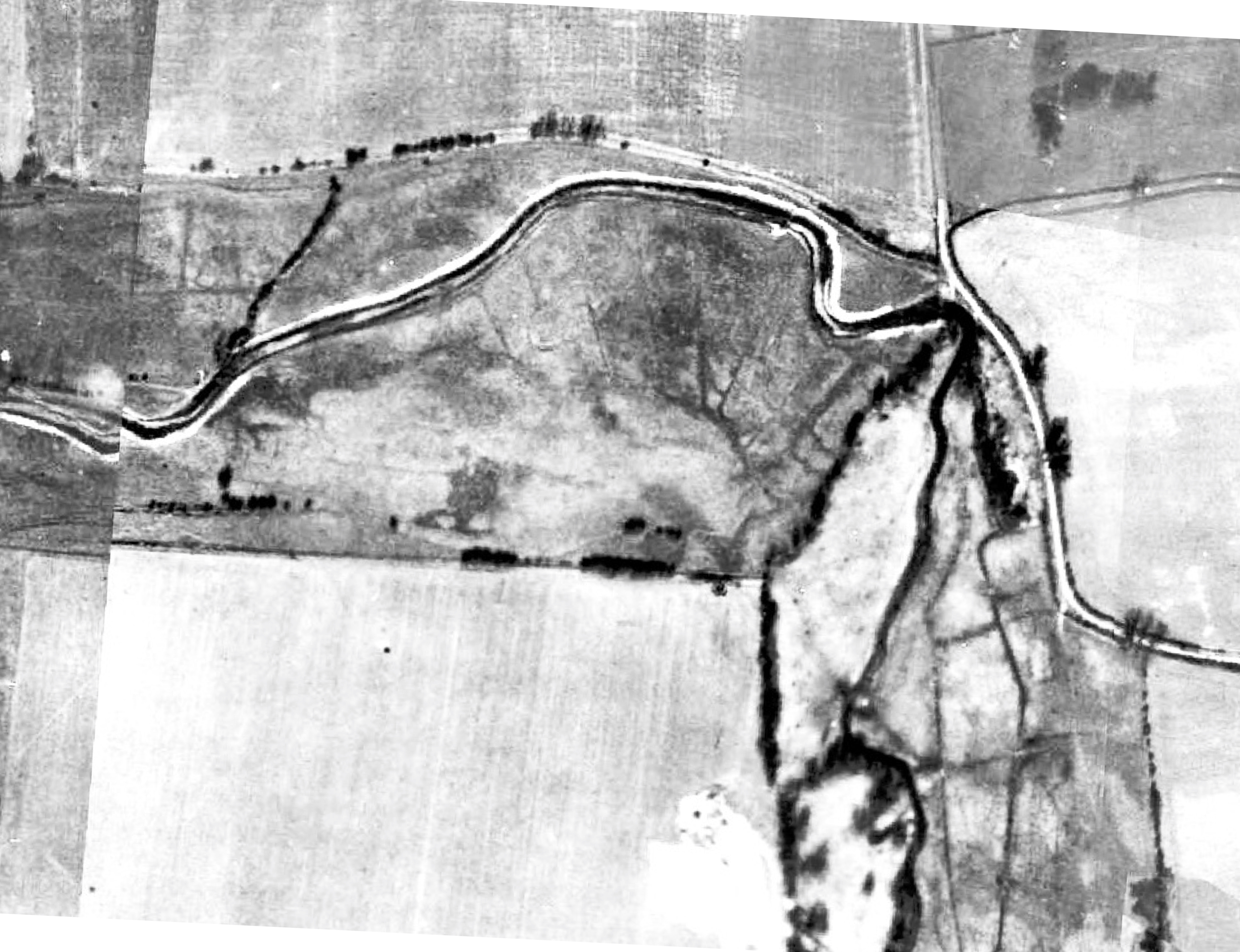
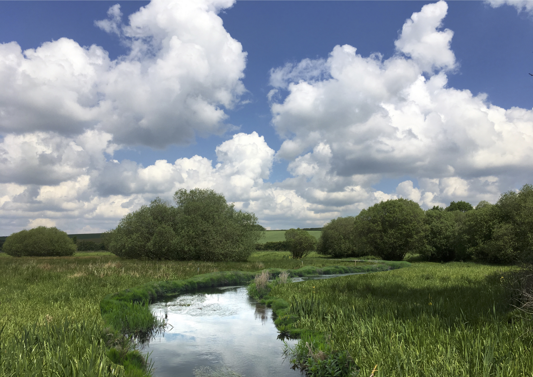
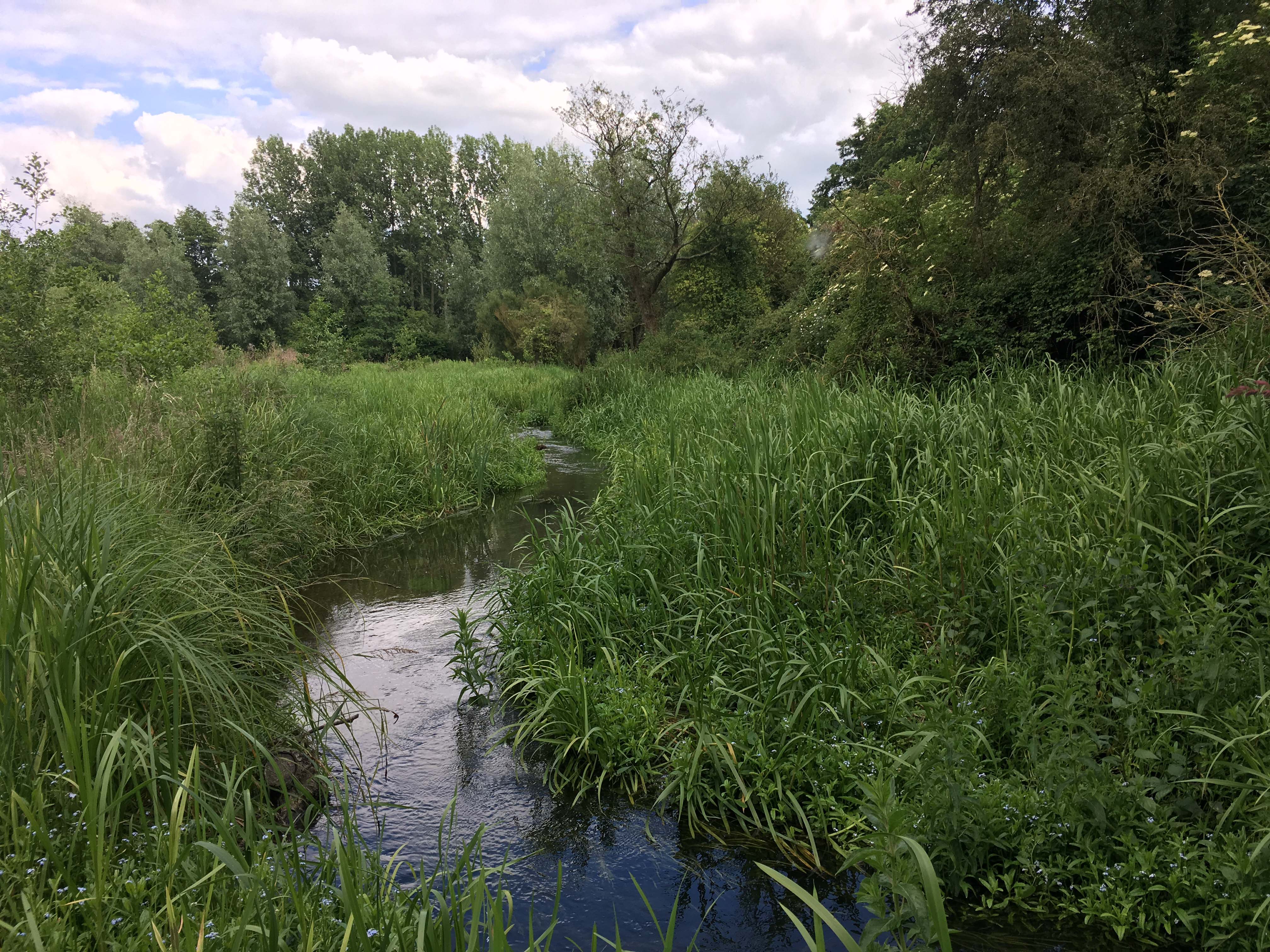
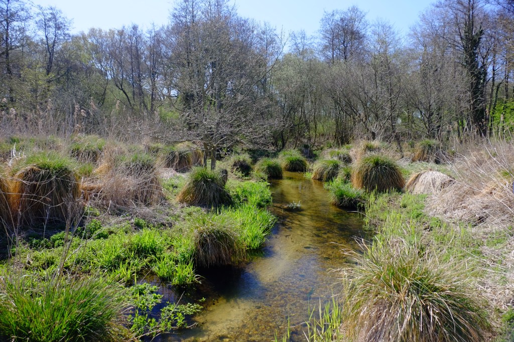
Here, for example, is an aerial image of a spring-fed river I visited and fished on the Chilean / Argentine border back in 2000, a meandering multitude of channels, and oxbows spread across a floodplain of seeping wet grassland and bog: an unbelievably wild and special place.
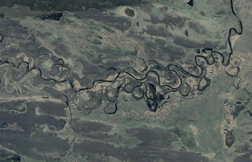
Colin Thorne makes the point in his paper that this type of channel form offers profound possibilities for enhanced bio-diversity and bio-mass and one only has to look at this Book of Kells of a river form, to see that the complex maze of habitats would likely harbour a wealth of aquatic life in its nooks and crannies.
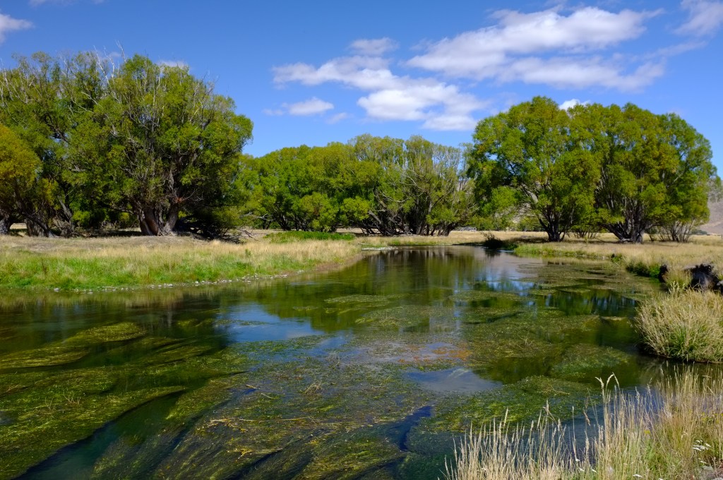
If its (non-indigenous) trout were any manifestation of that ecological richness, I can tell you that this river was rich indeed. But I’ve noted this again and again in the river systems I’ve explored in various parts of the world (often with a fly rod, but always with my eyes open as to what the habitat looks like and why): that the less disturbed the landscape, the richer the river. We’ve kind of lost sight of what rivers should be like back here in the UK. Even the good ones are not exactly running on all cylinders.
But can they ever? In our busy landscape? If the multitudinous channels and saturated floodplain of the proto river form are so indisputably richer than what we have inherited, the obvious and urgent question becomes: can we restore our rivers to this state – or to some acceptable version of it – and if so, where and how?
Stage Zero on an English Chalk-Stream?
Following the publication of Colin’s paper, the instigation of pioneering restoration work on rivers in Oregon, USA, (look up Powers et al, A Process-based approach to restoring depositional river valleys to Stage 0, an anastomising channel network) and the early results of that work in the form of numerous and fat juvenile salmon, there has been a great deal of interest in the possibility of restoring river systems to Stage Zero in the UK. A trial Stage Zero project is in progress at the National Trust Holnicote estate and others are at the planning and scoping stages.
I came across Colin’s research very recently when planning the next phase of our own catchment-based restoration project on the River Nar in Norfolk, a project I have been involved with since 2011. We have moved through various stages of work on the Nar and our projects have incorporated various channel rehabilitation techniques, tailored by site and budget constraints and by what particular problems we were addressing at any given reach.
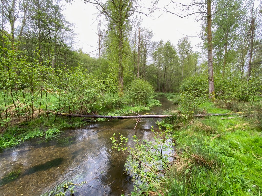
The first few years we were mostly working on those sections of channel that could be improved with cost-effective and simple rehabilitation work within the existing channel. We did a lot with Large Woody Debris (LWD), at least until we reached the places where LWD alone hits its limits of efficacy in addressing the fundamental problem: where the channel is entrenched, dredged and impounded, in others words. We found LWD just doesn’t cut the mustard when the mustard is a hollowed-out river flowing half-a-meter below where it should be, or an impounded river backed up by a mill.
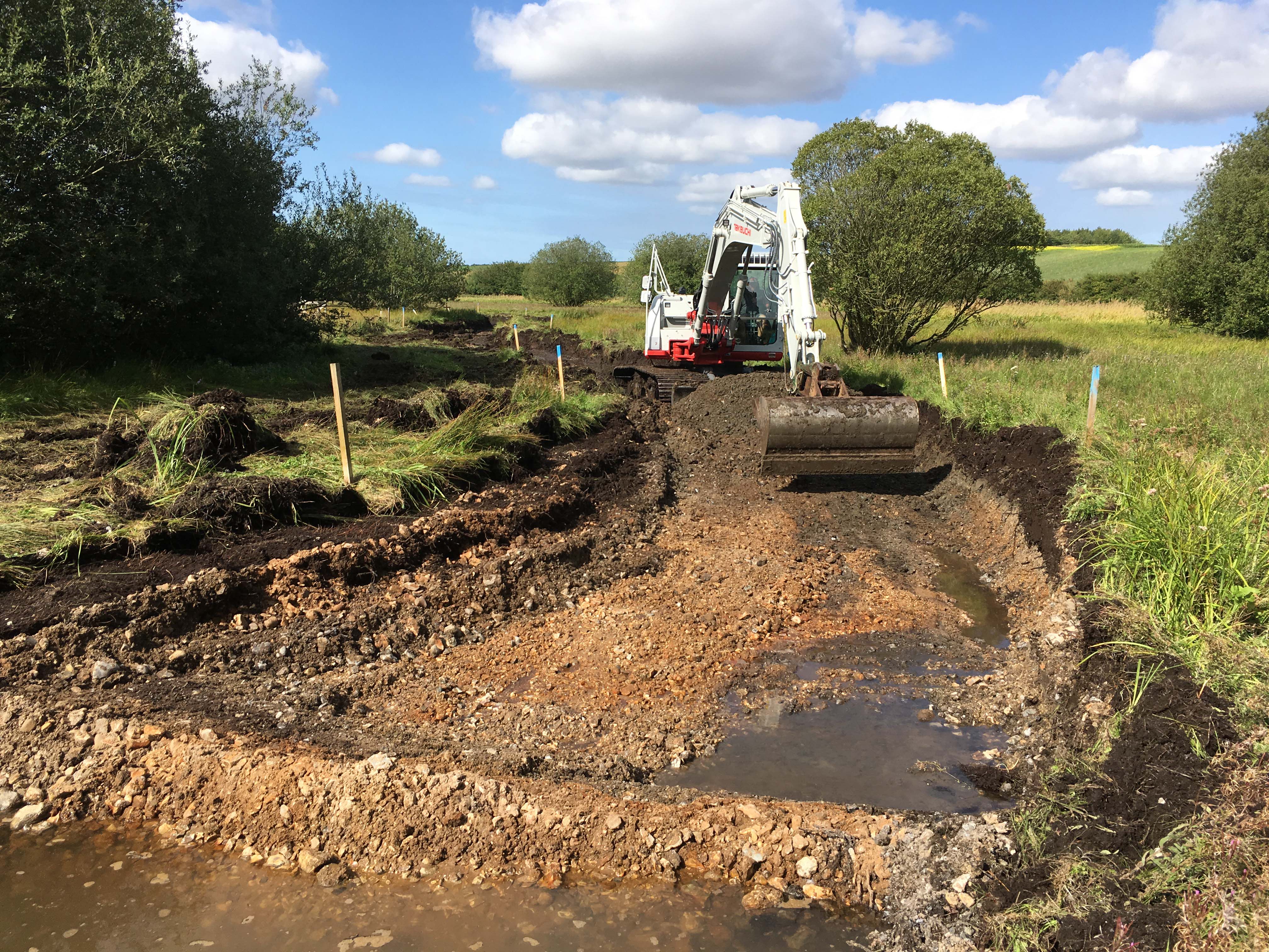
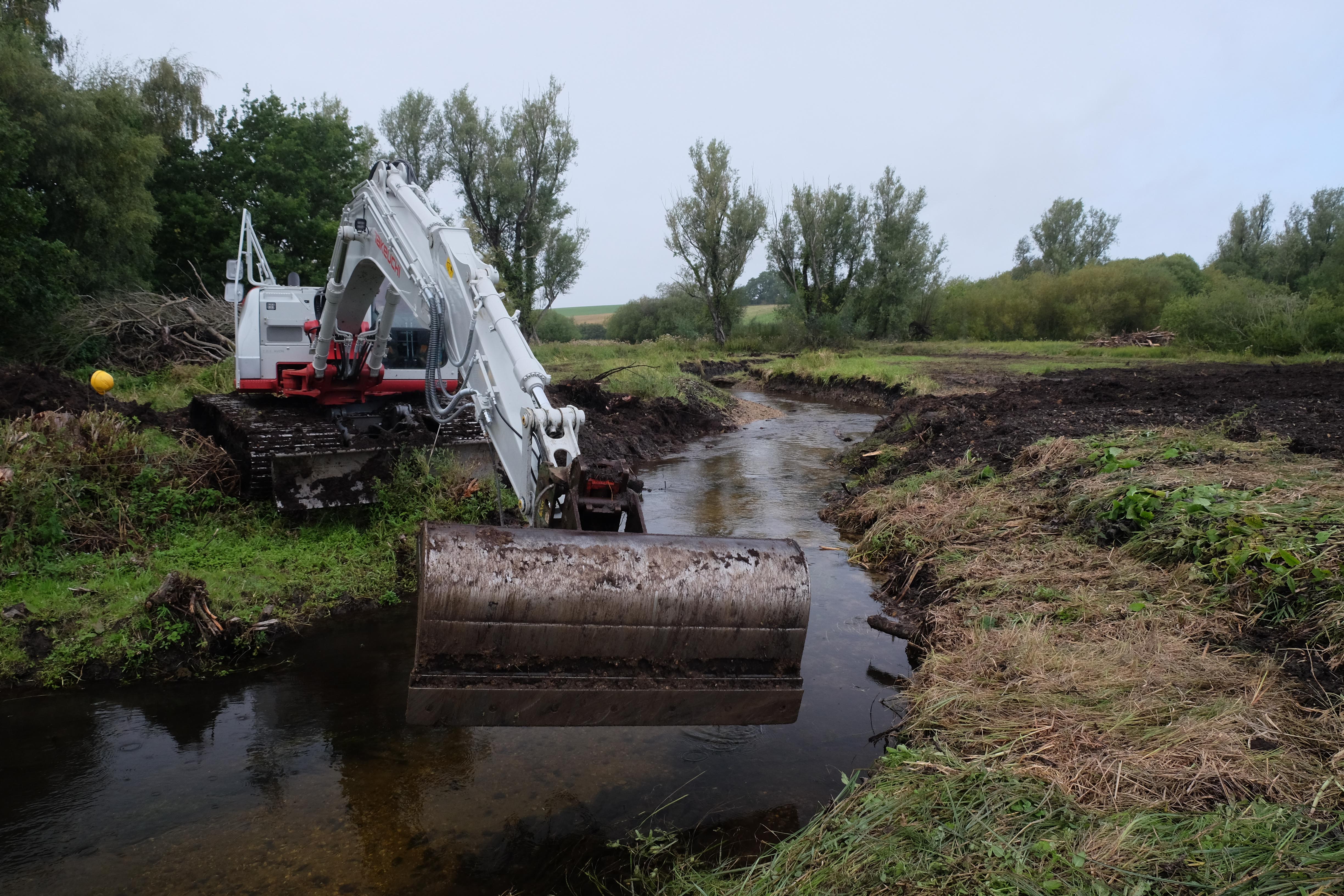
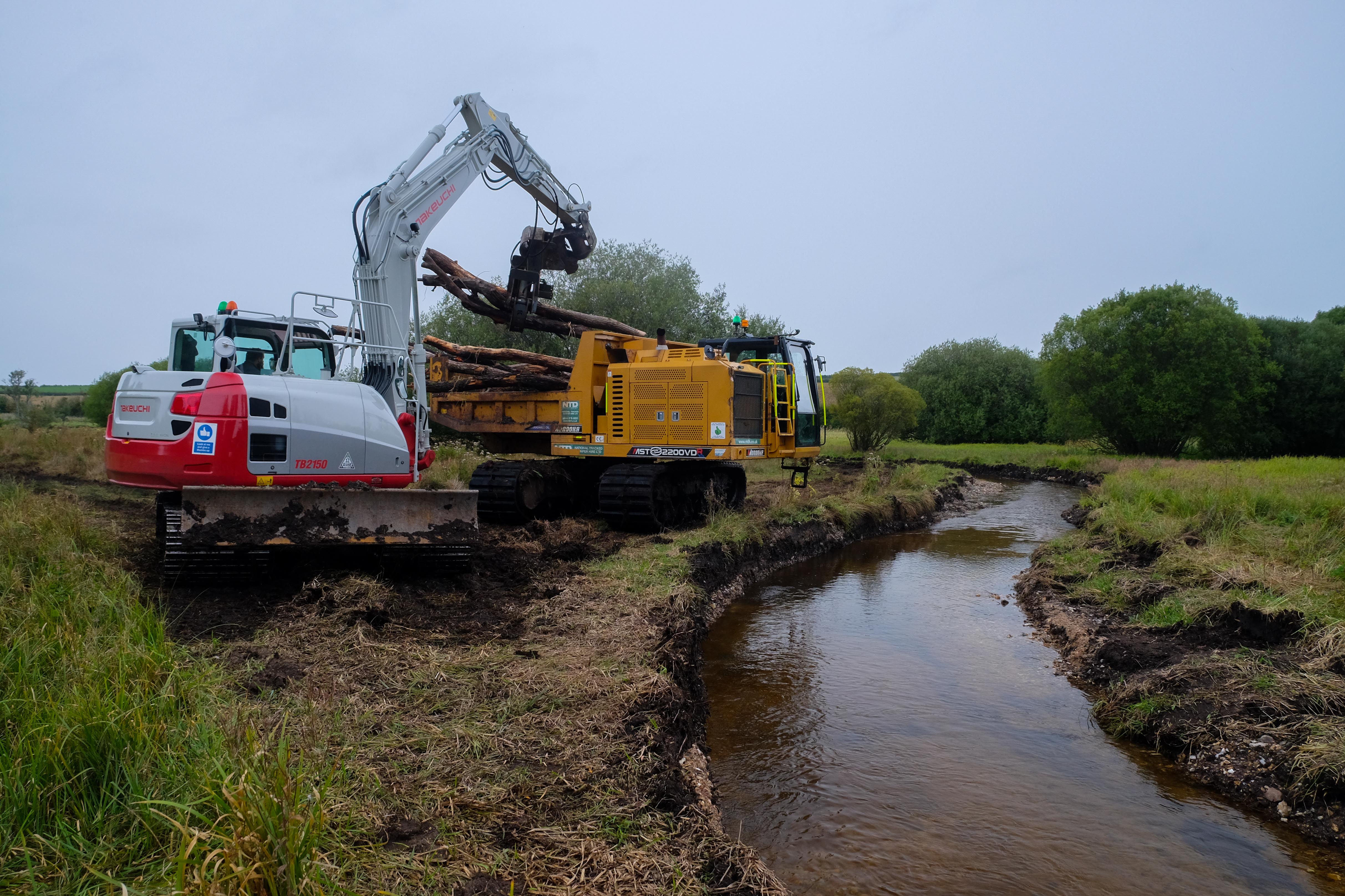
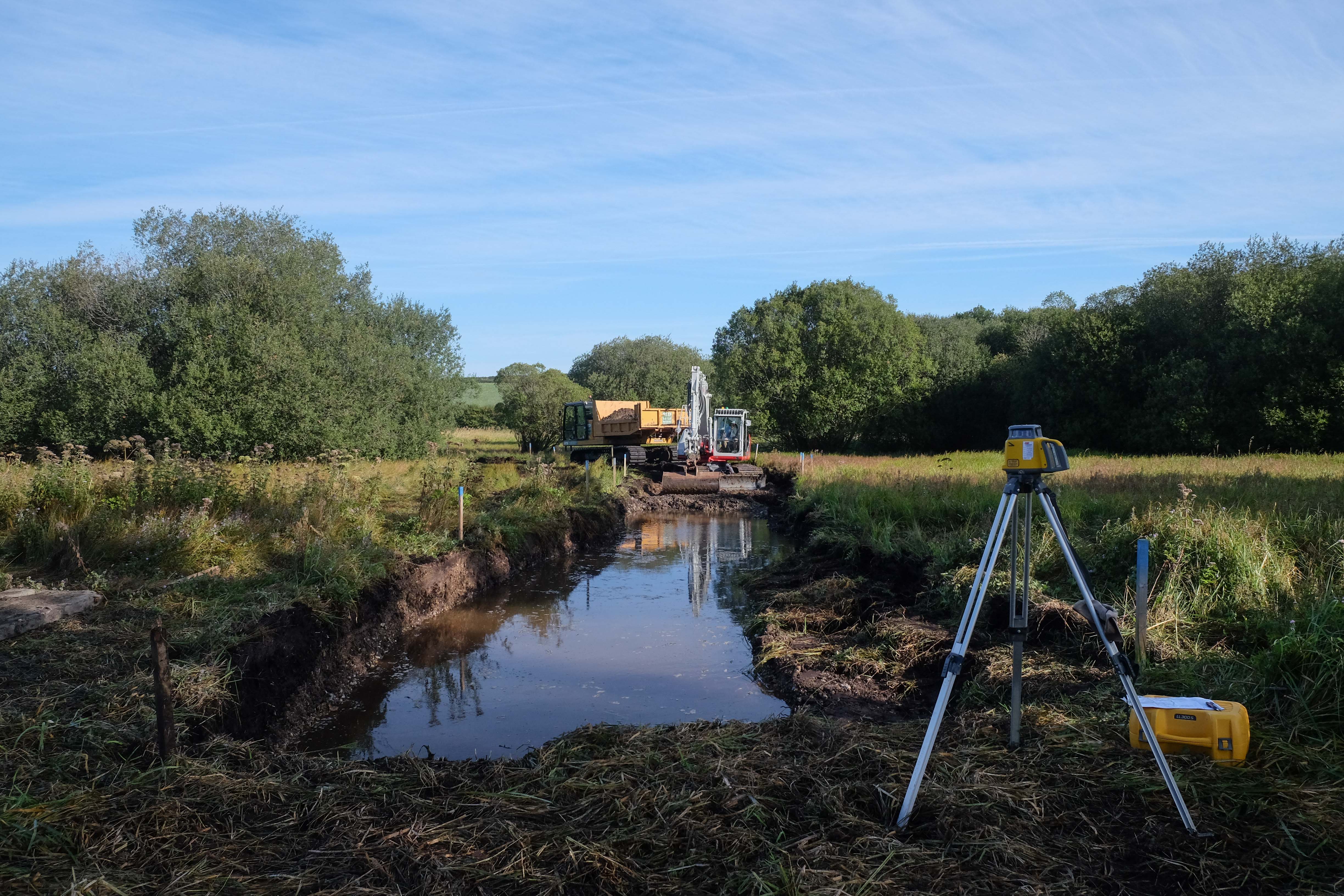
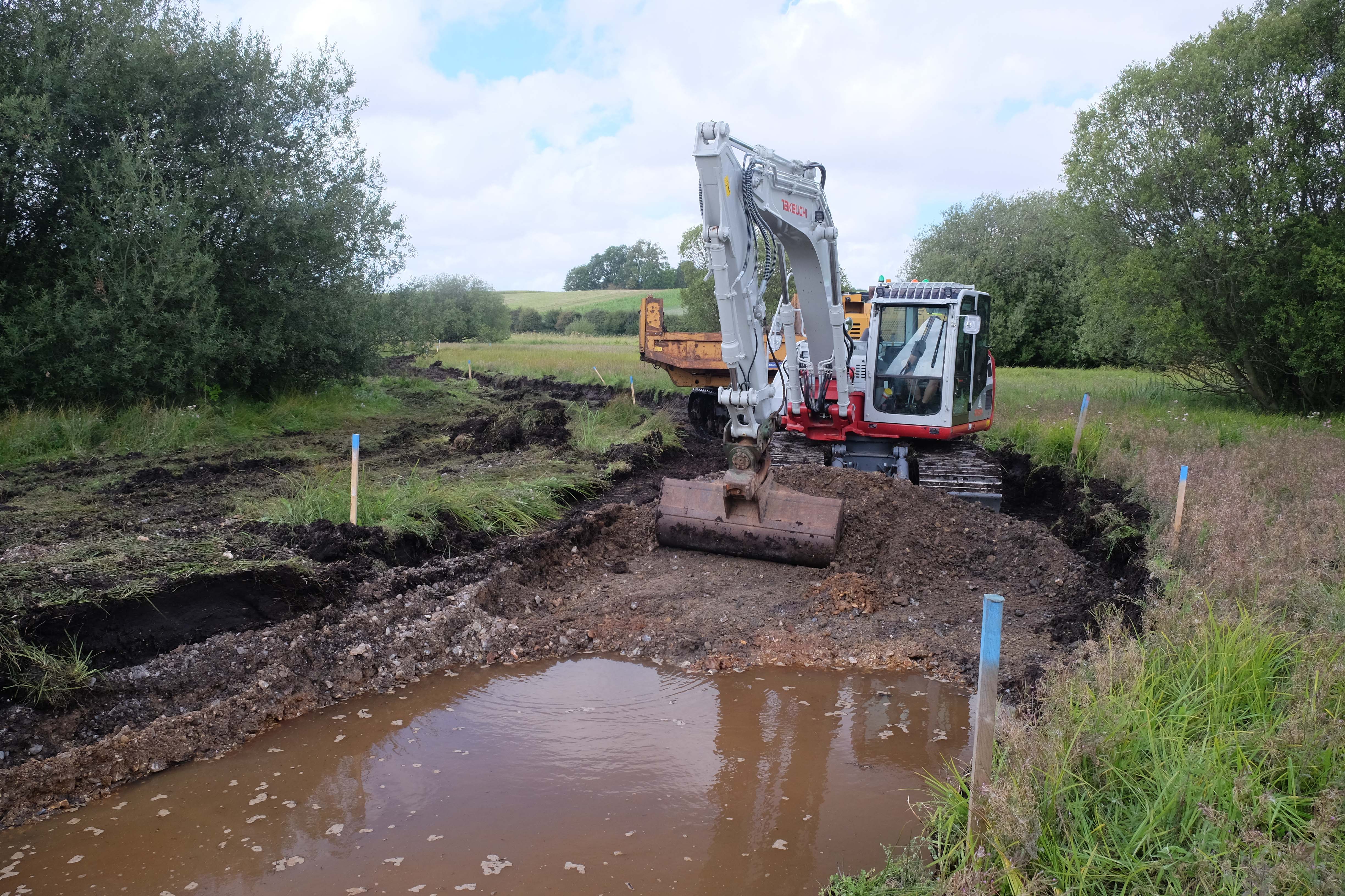
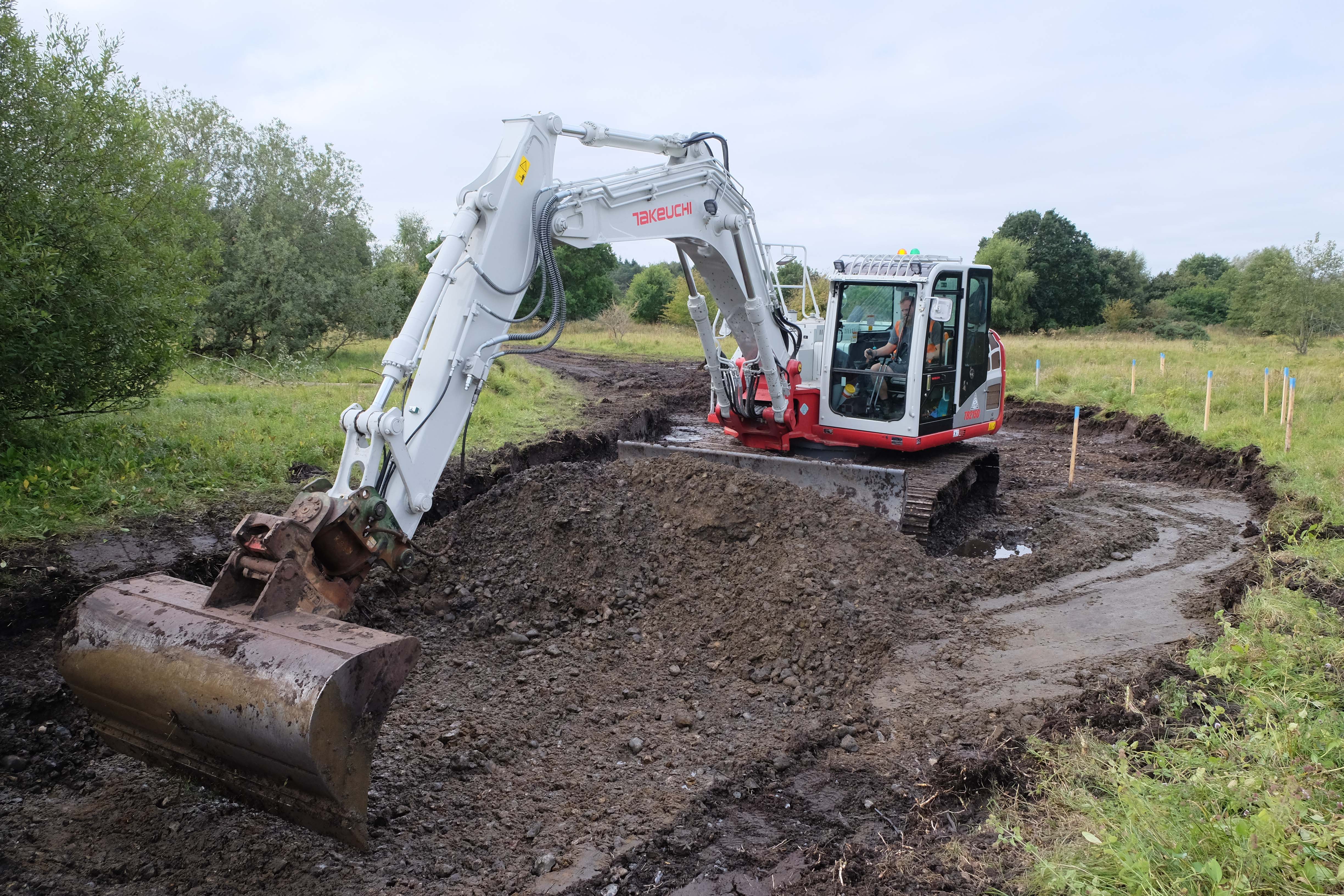
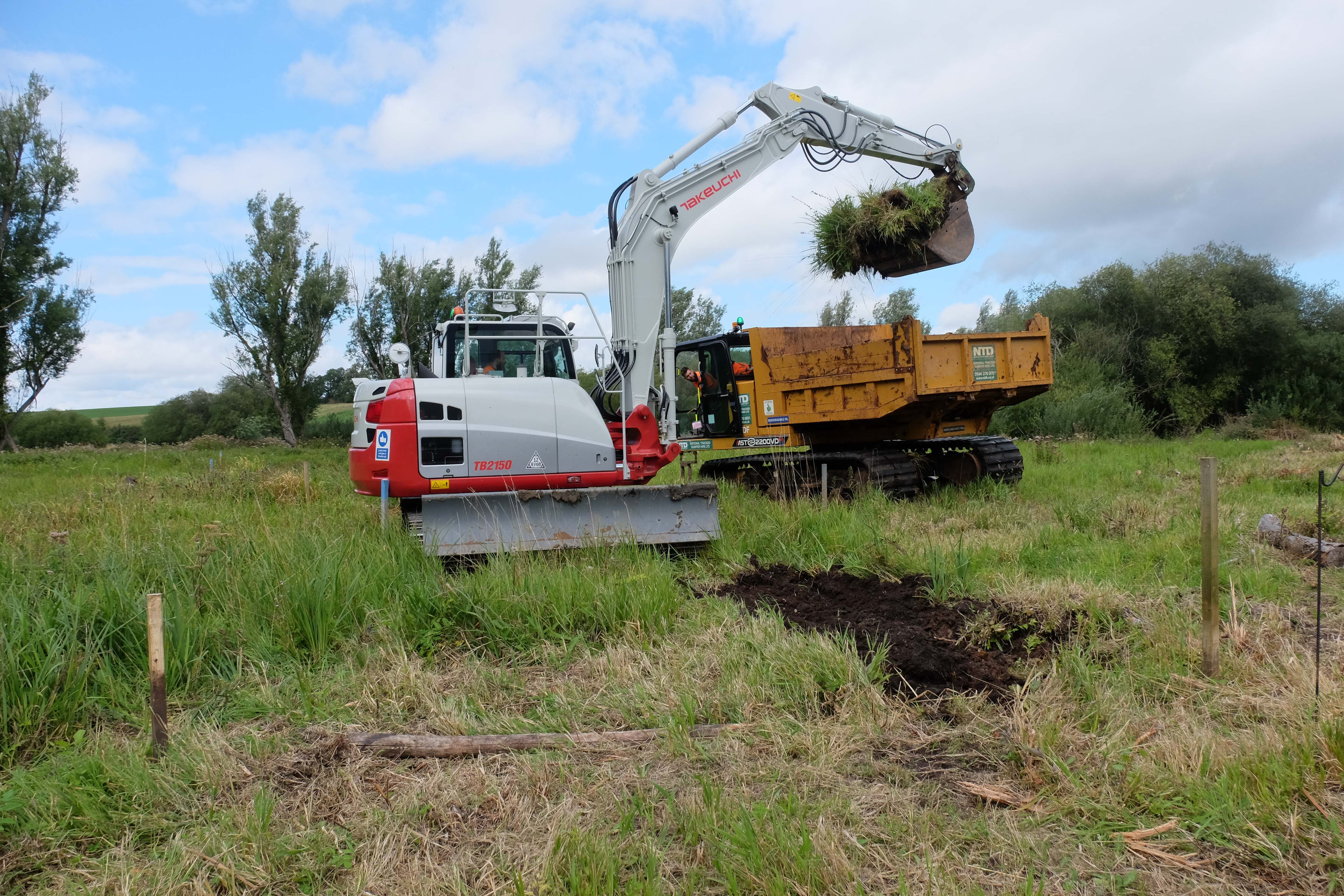
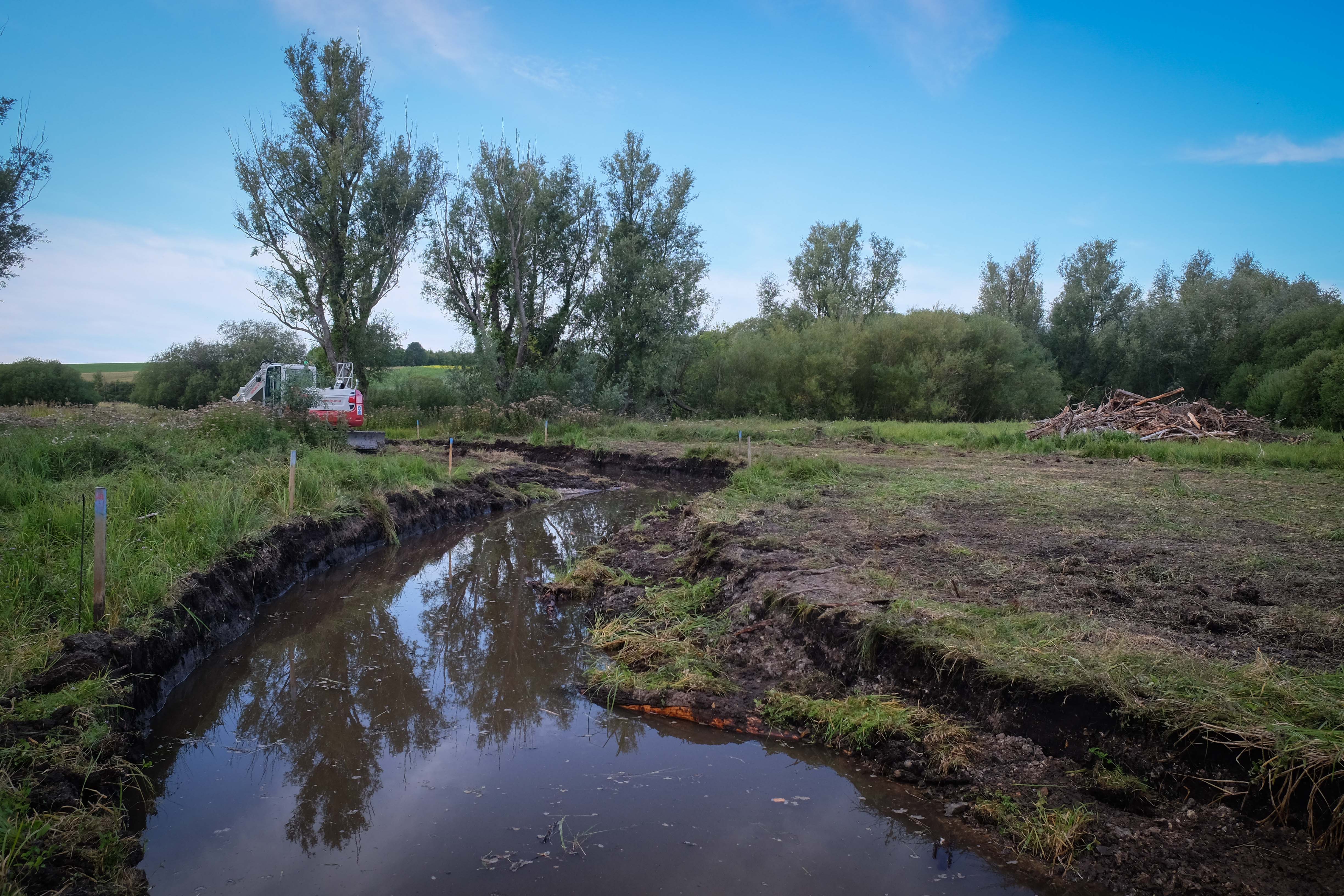
More recently and to tackle these specific issues much of the work has involved various types of channel recreation or recovery, through re-meandering, cutting brand-new channels and bed-level recovery.
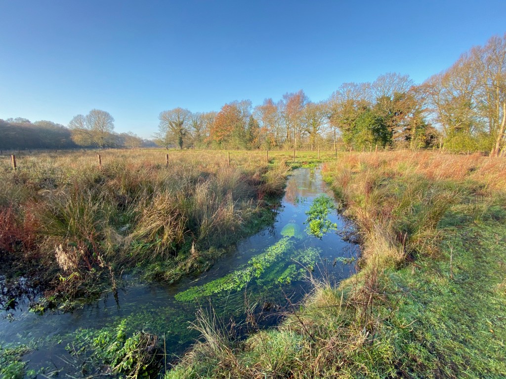
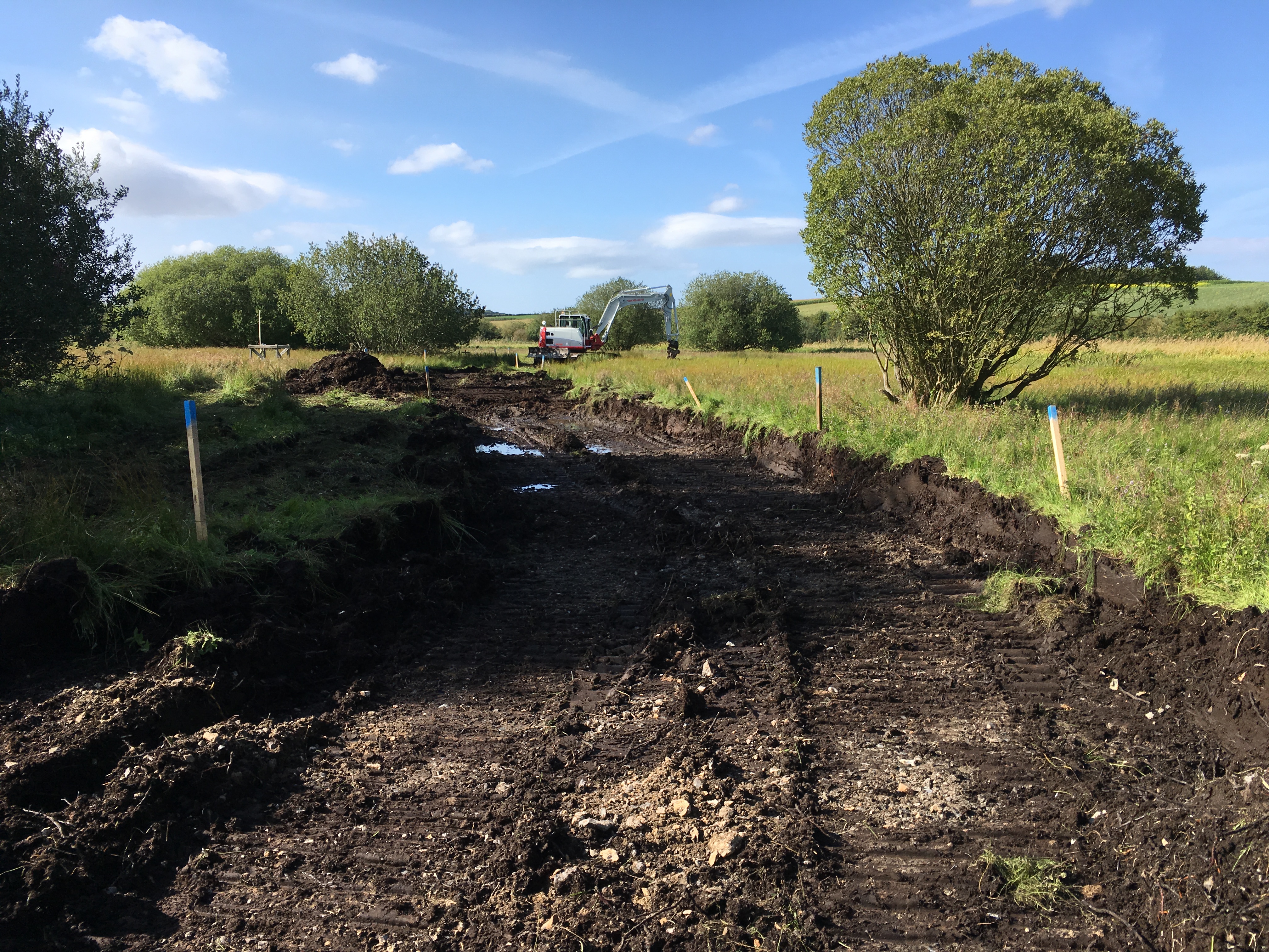
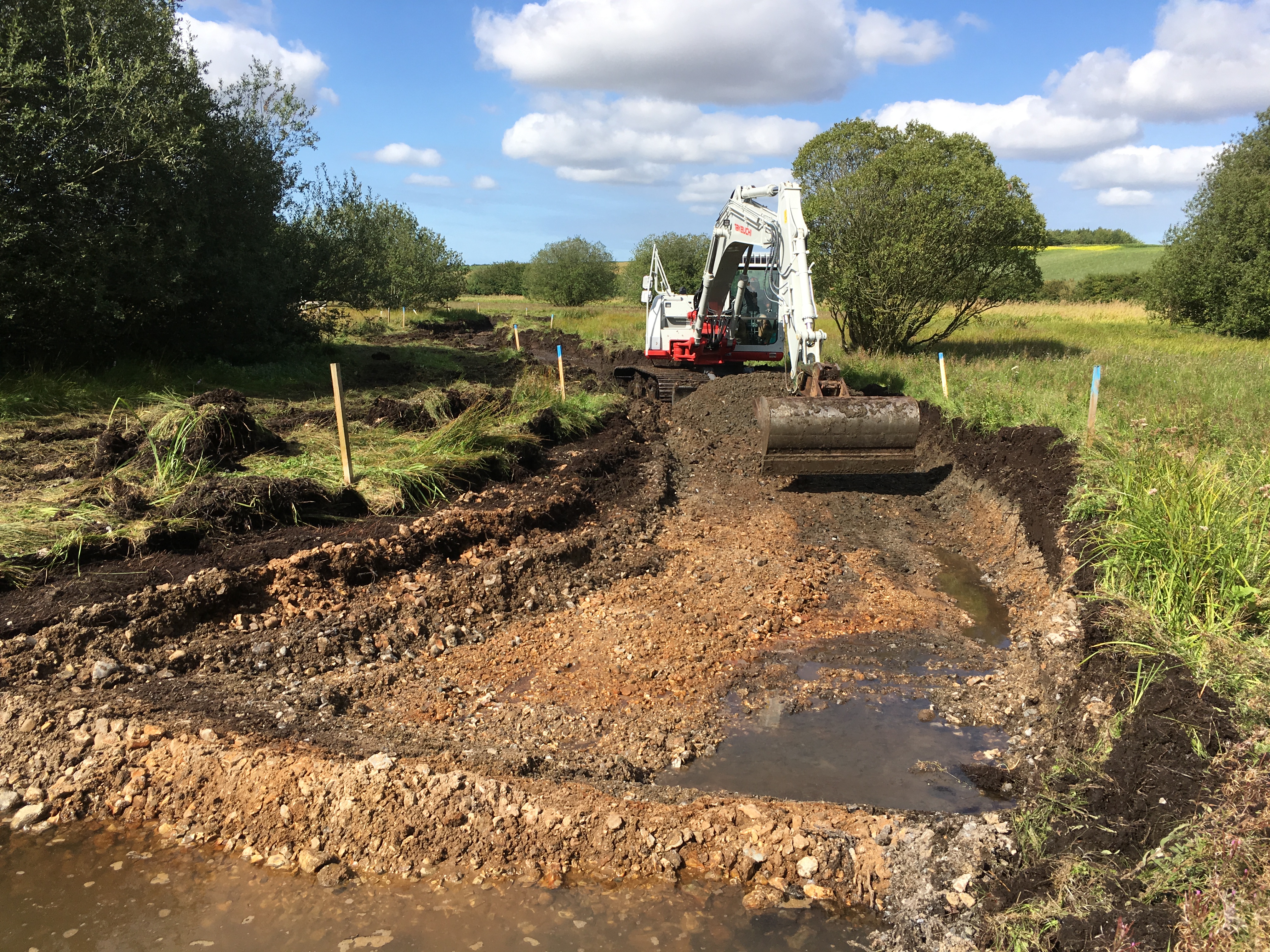
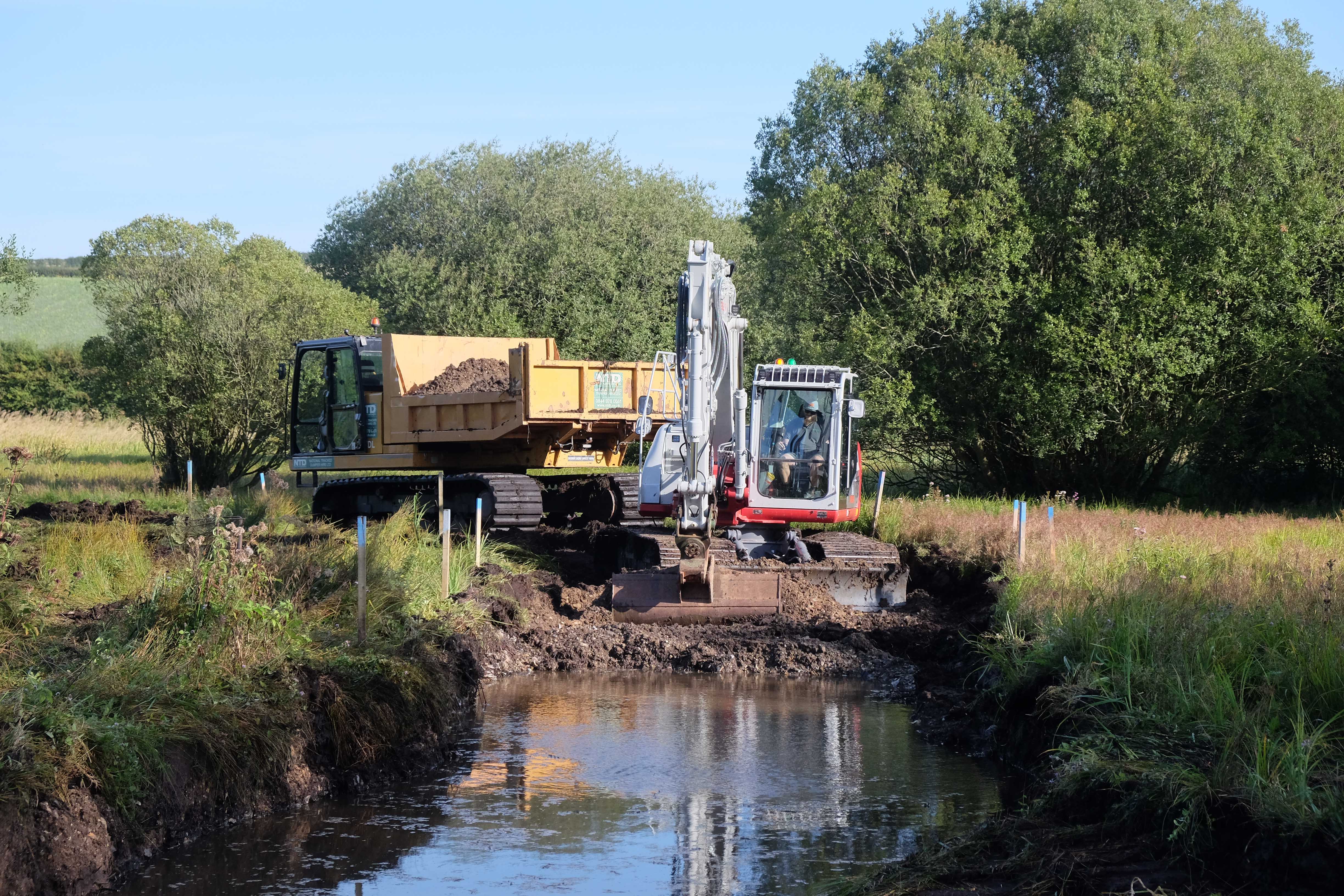
Right now we are half-way through a project designed to move the river from a higher-level impounded, dredged and unnaturally straight diversion back to the centre of the floodplain, to recover the “original” channel where we can find it and to re-create a meandering, relatively natural channel where we can’t and in both cases to recover the natural gradient of the valley. This is a Water Environment Grant (WEG) funded project on almost 2km of river.
An Accidental Stage Zero
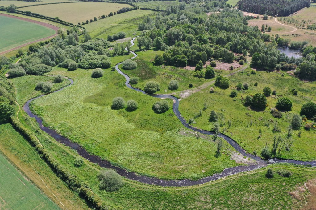
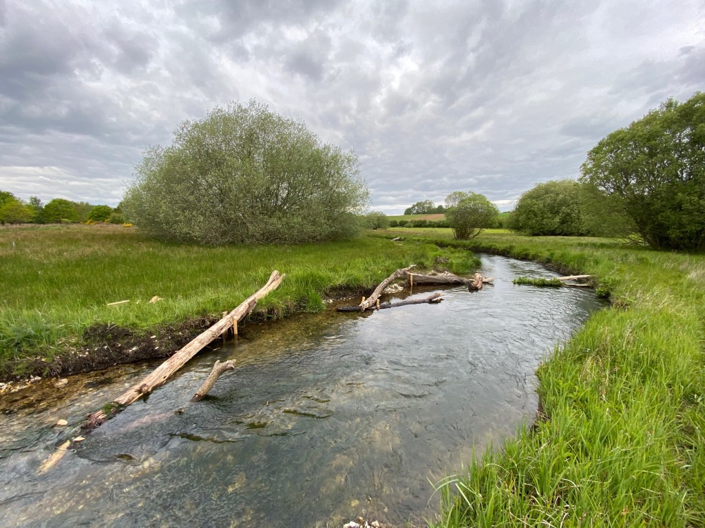
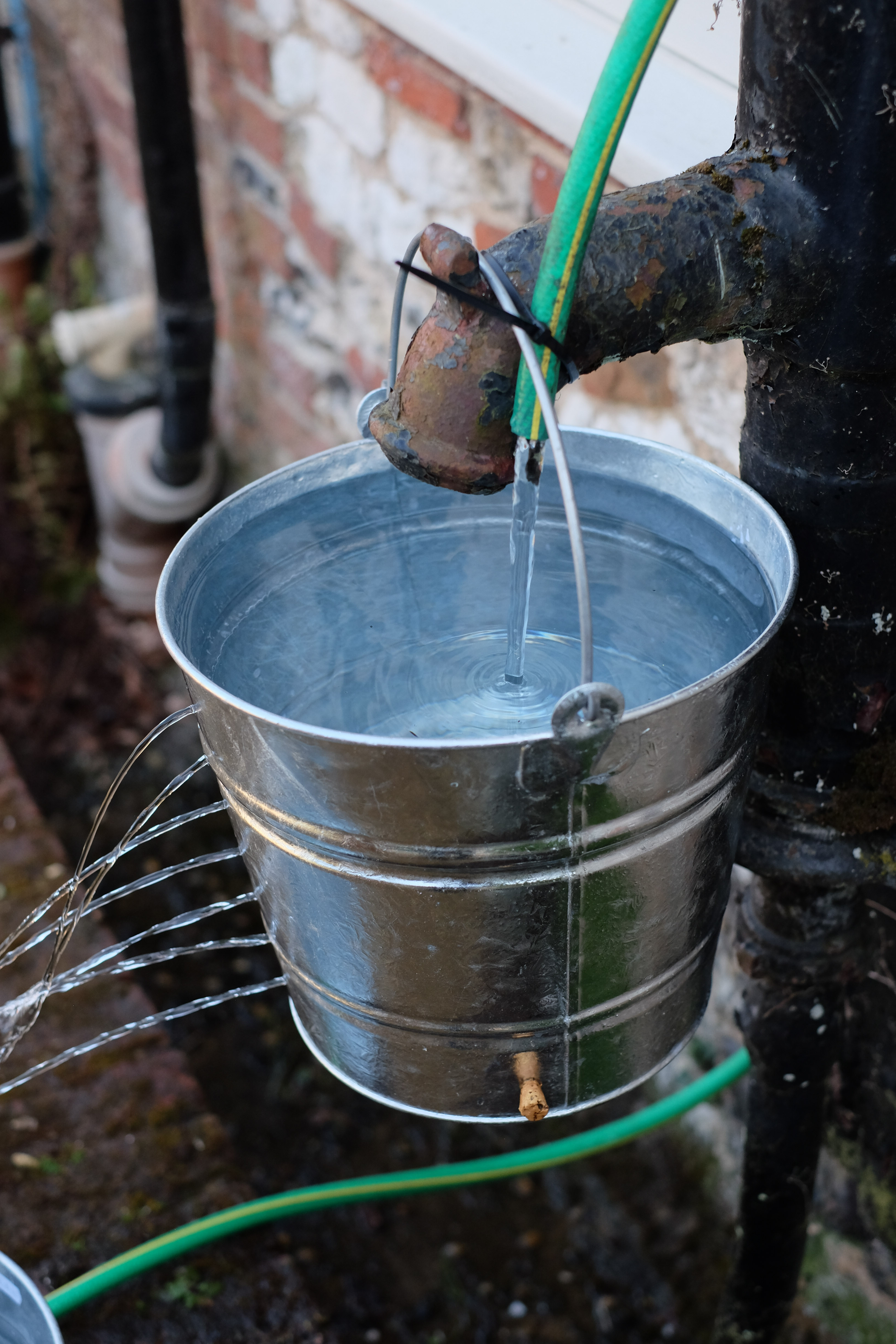
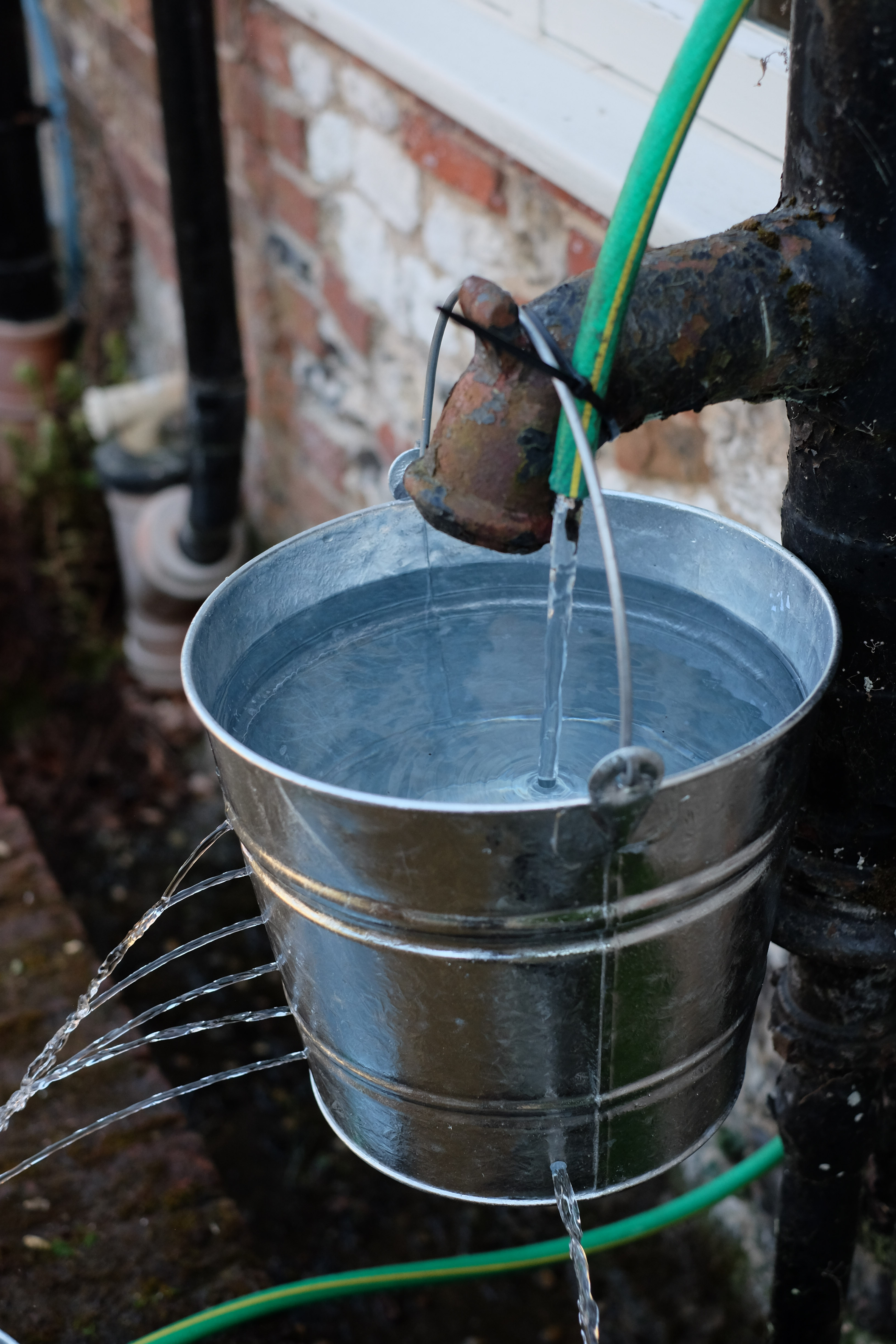
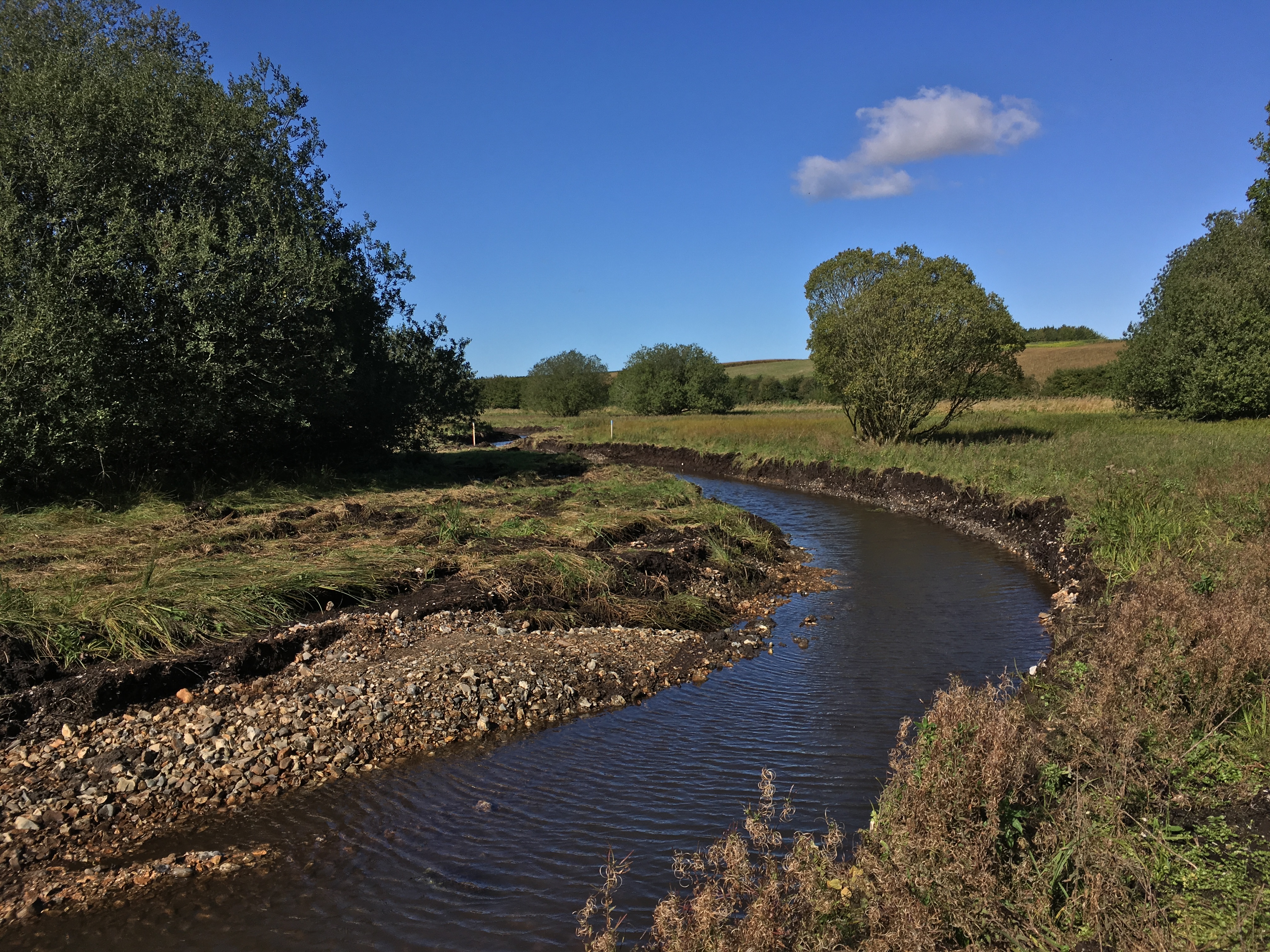
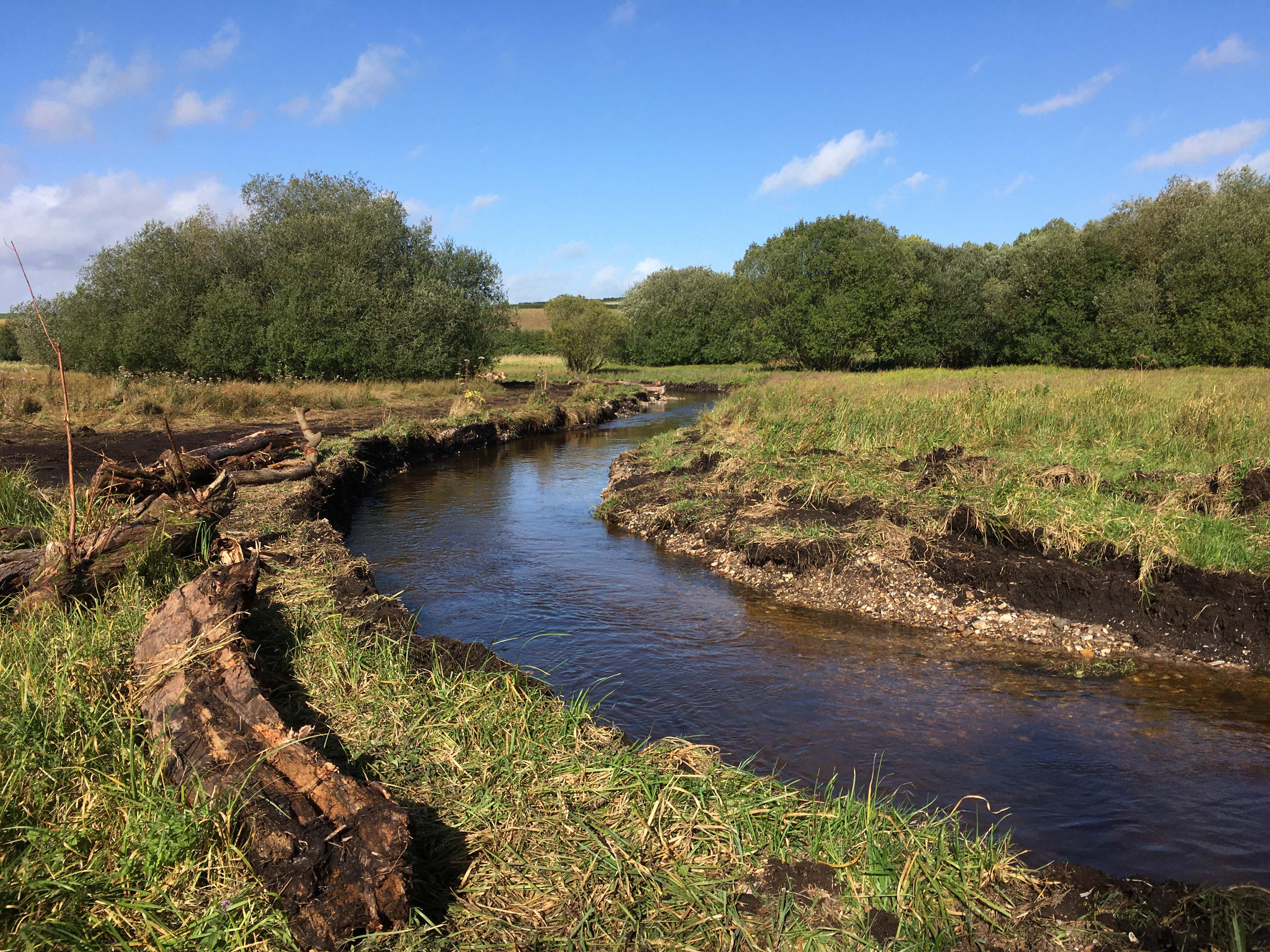
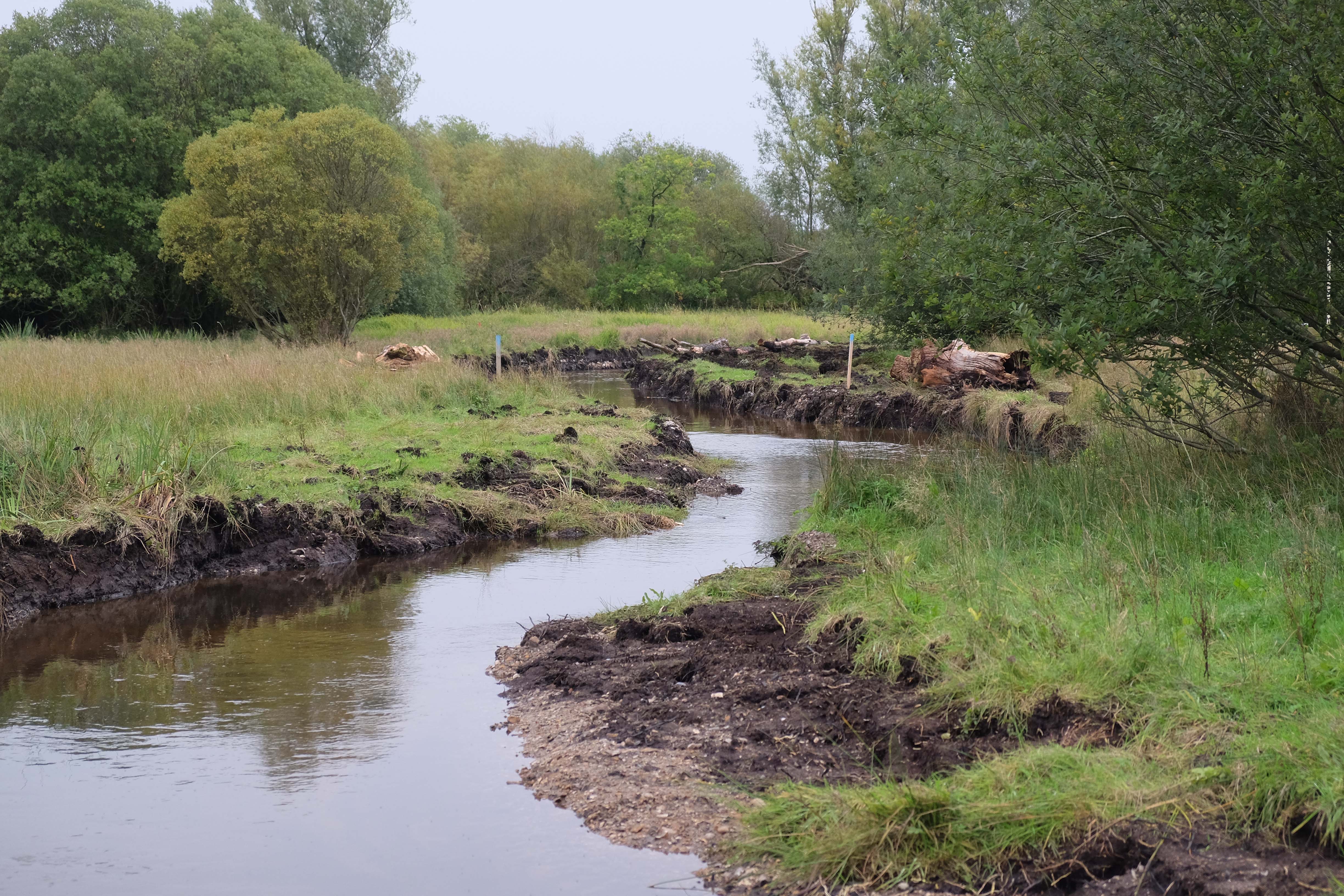
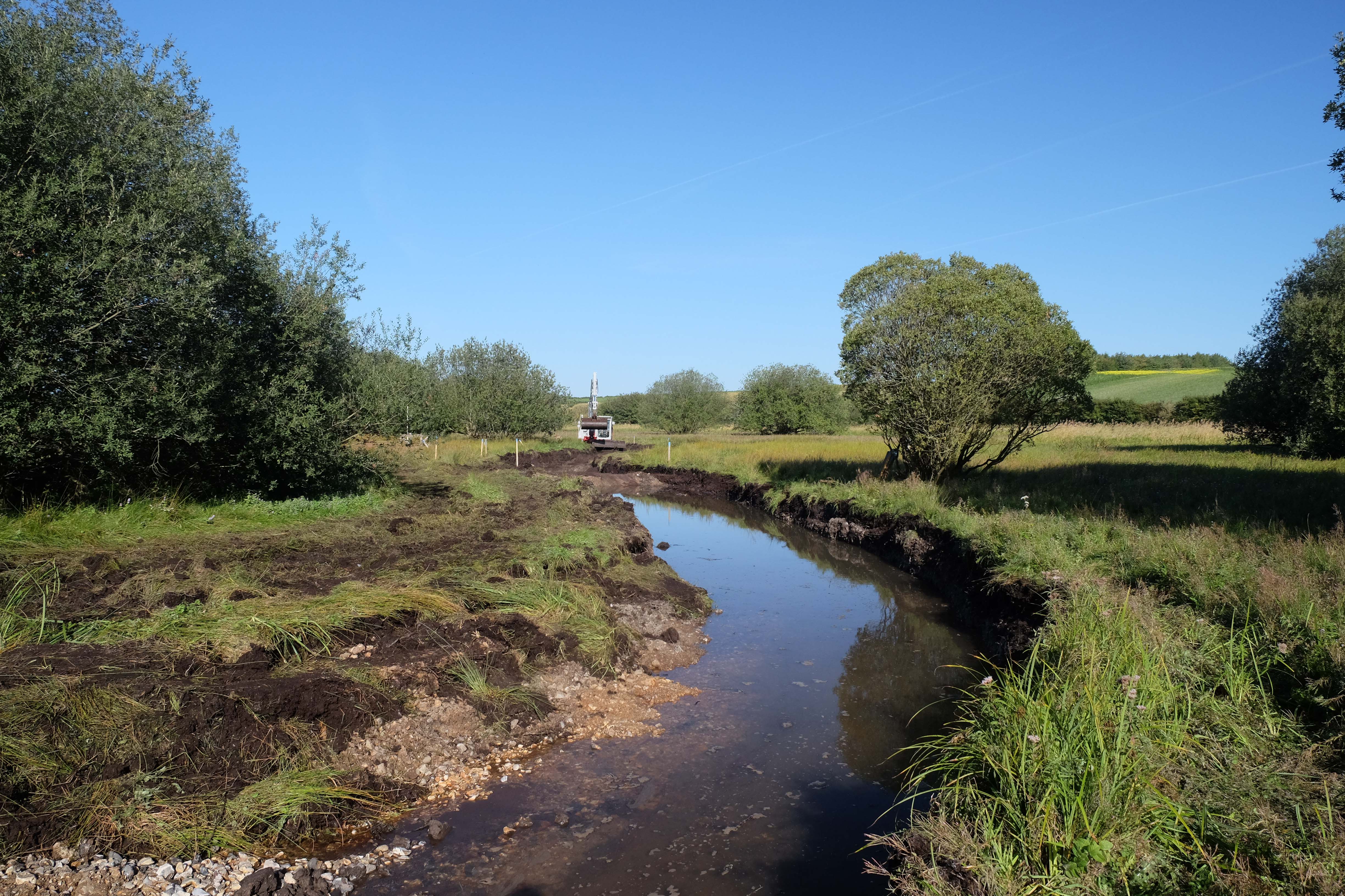
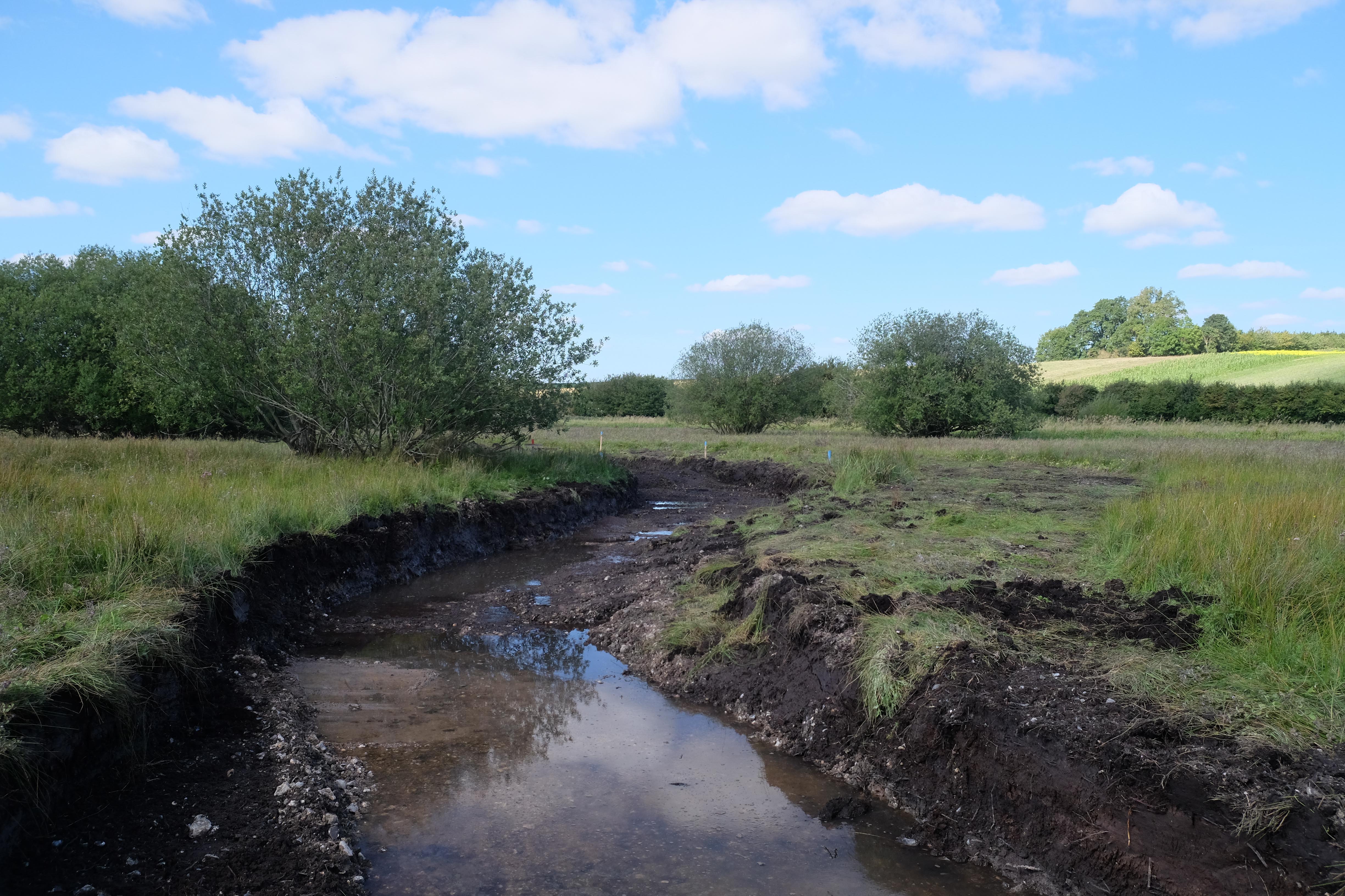
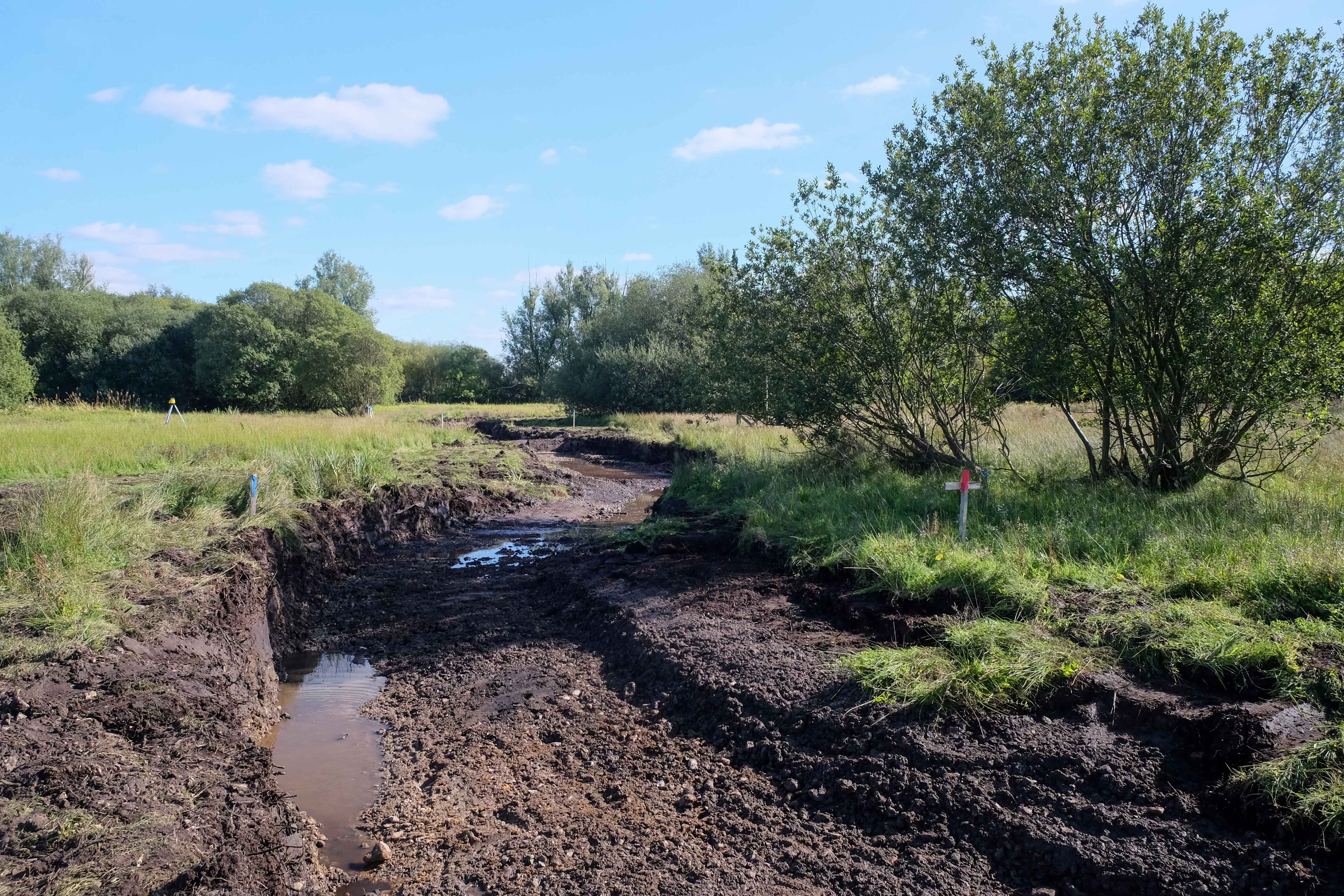
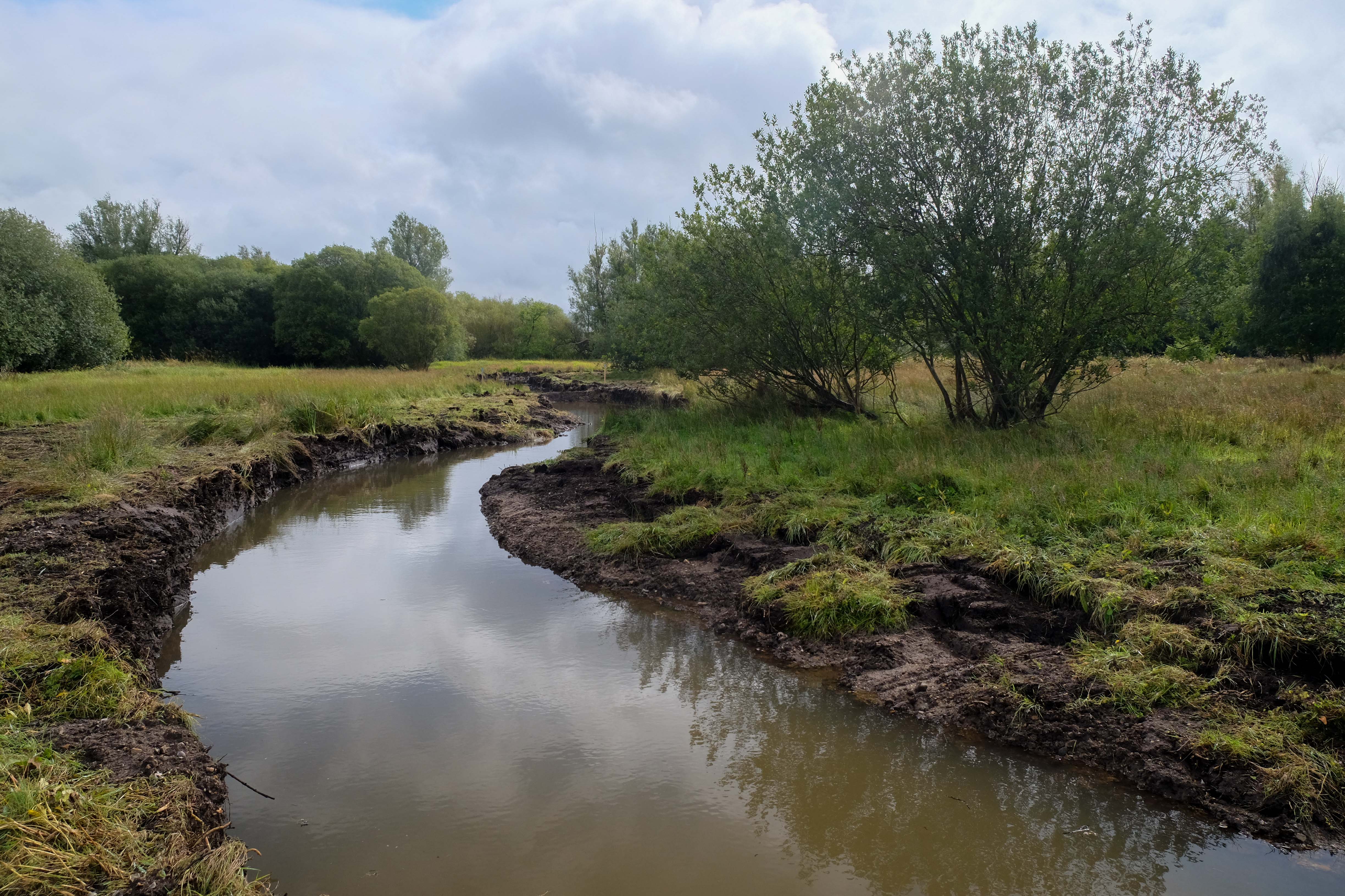
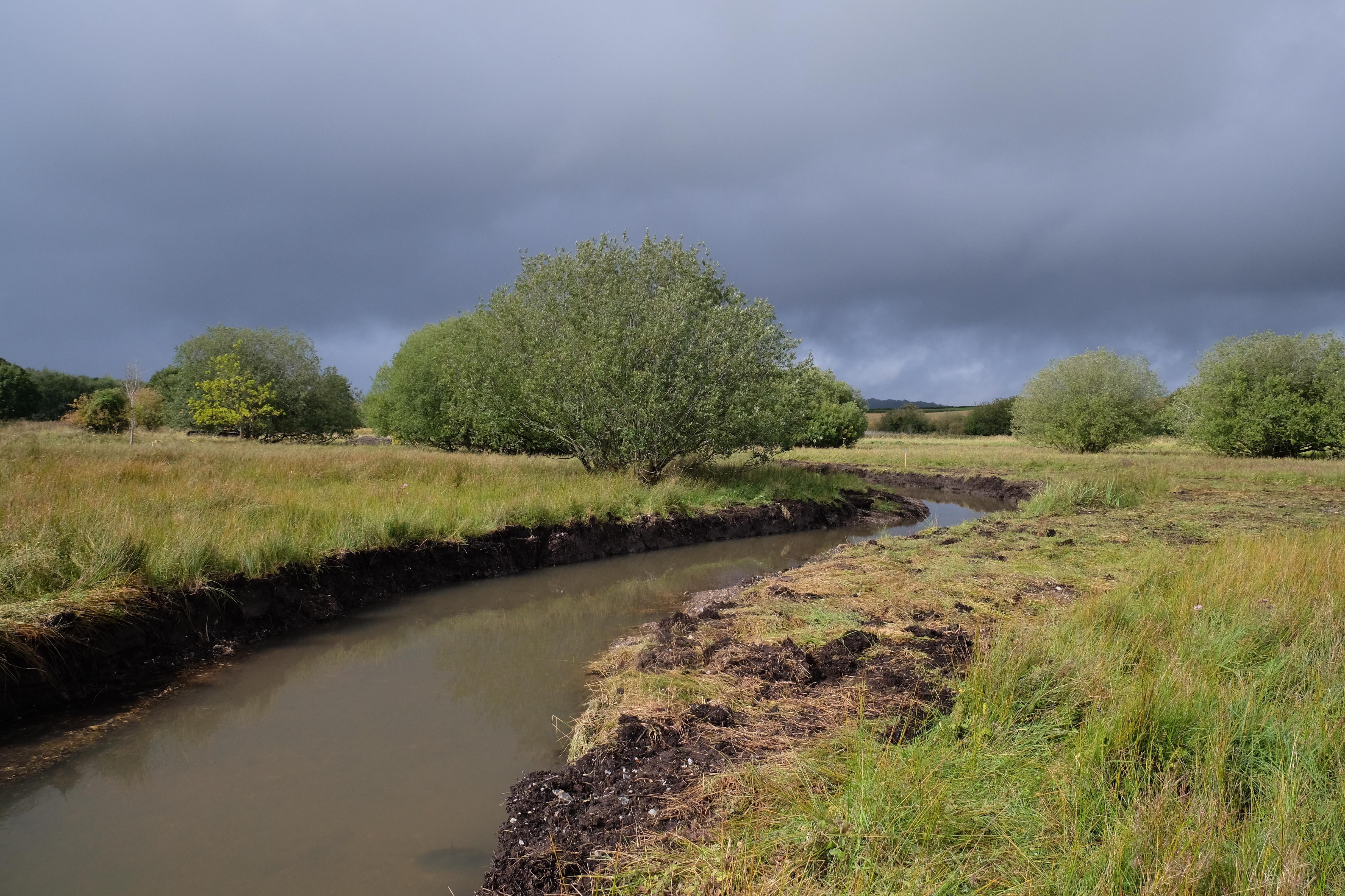
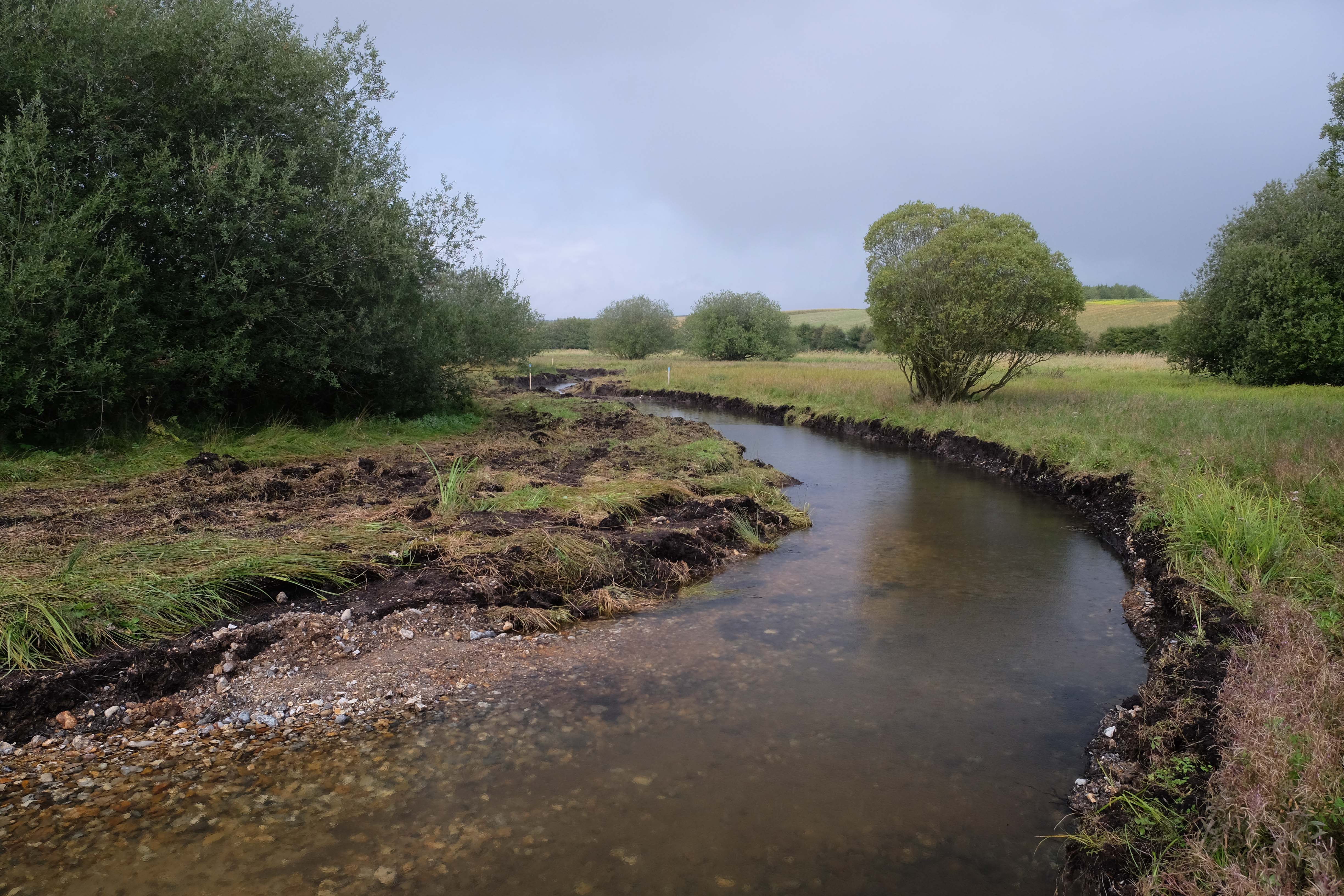
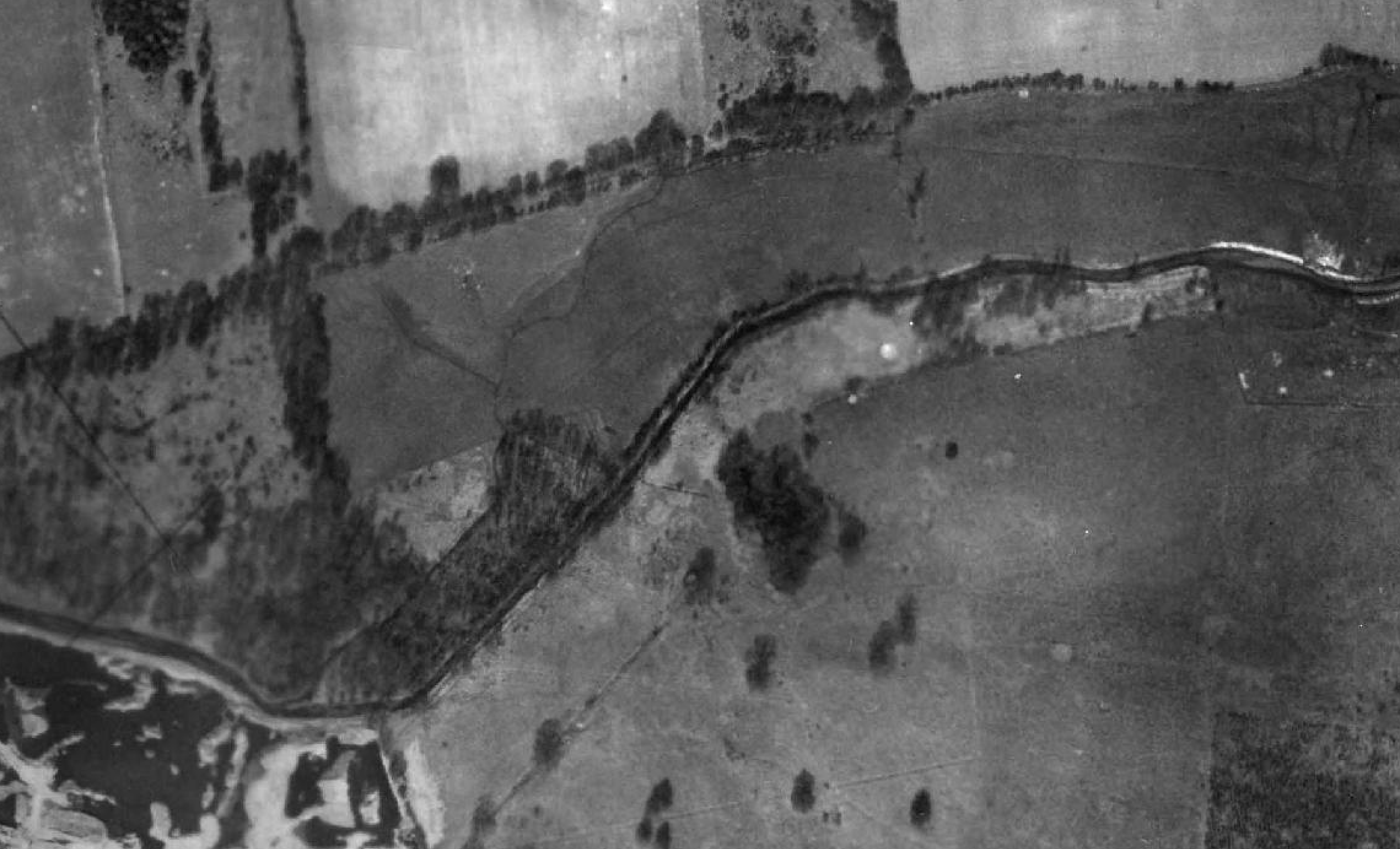
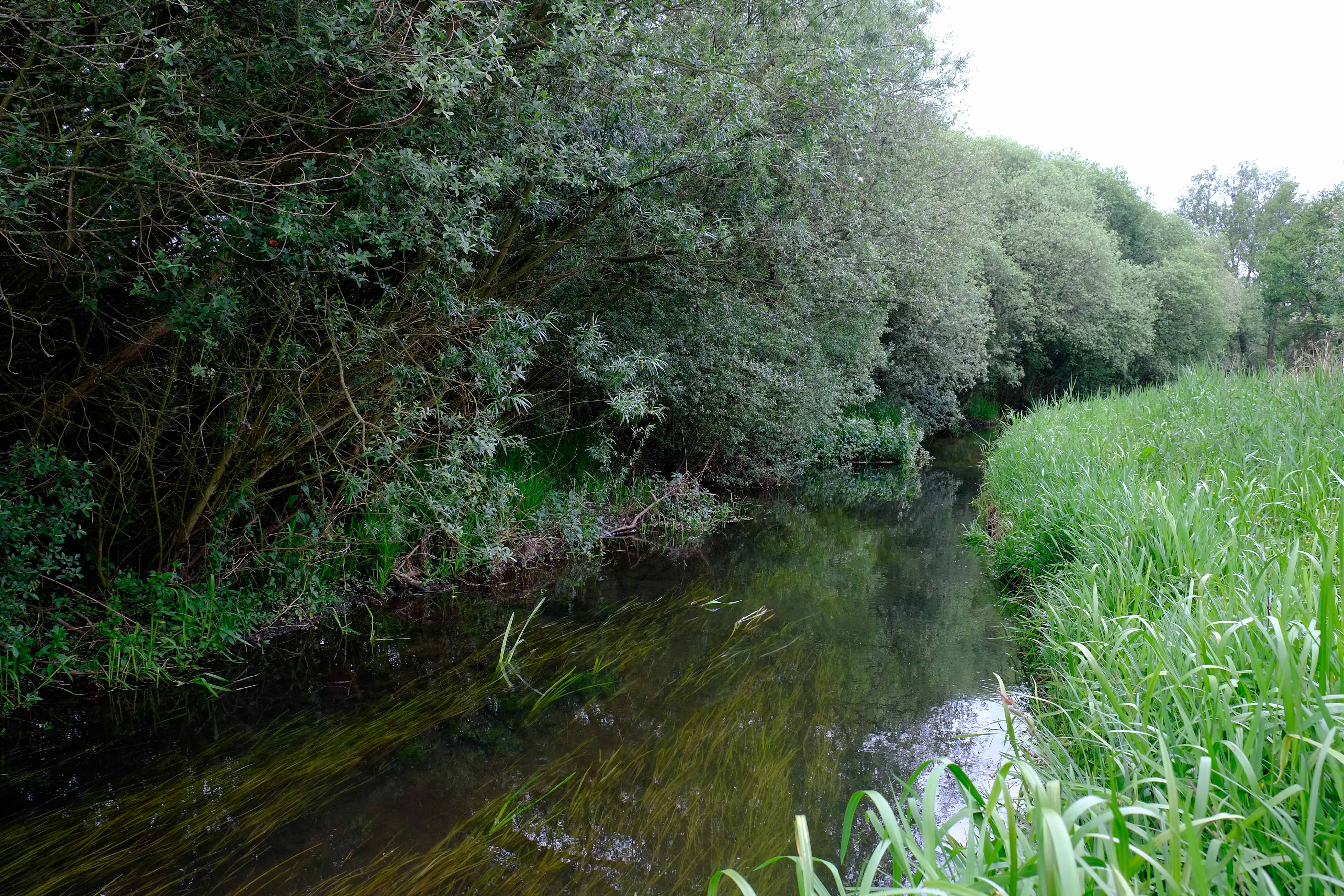
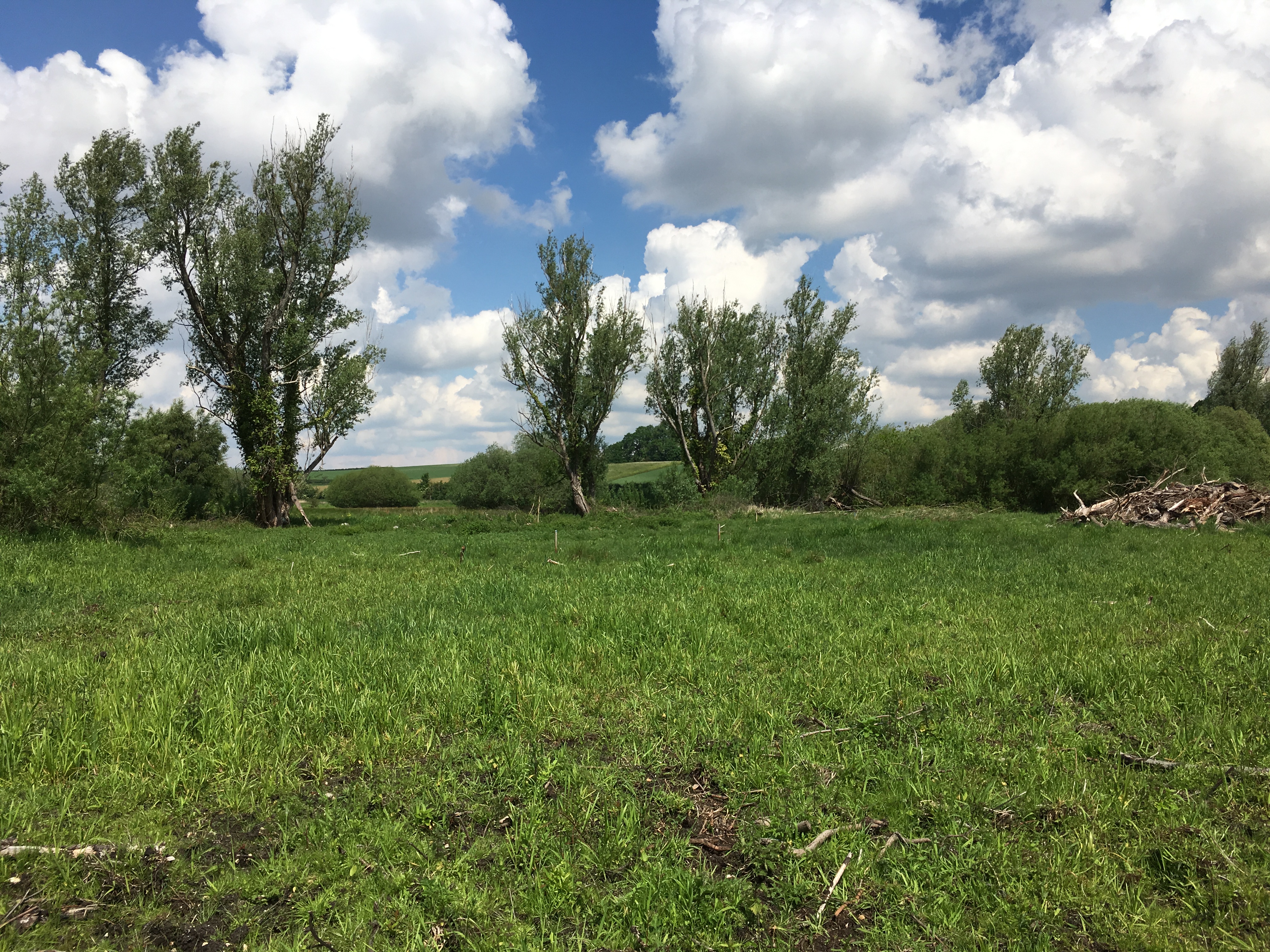
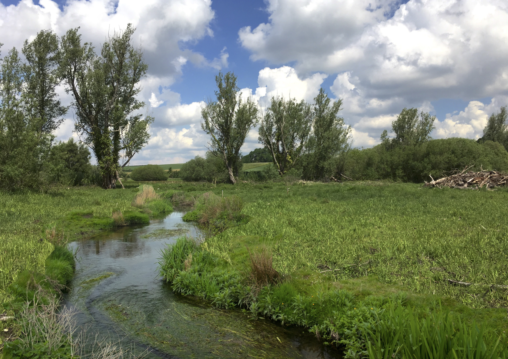
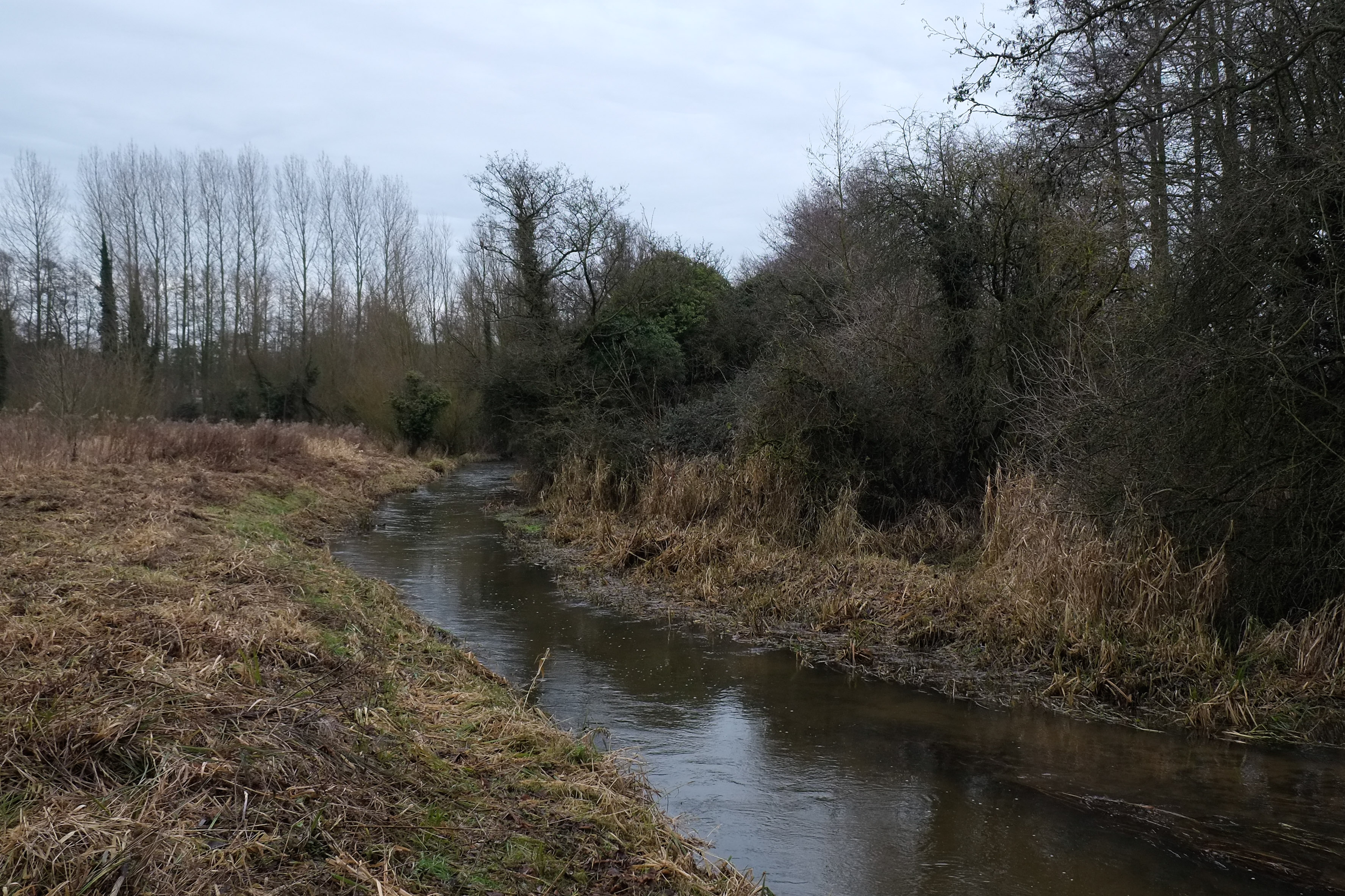
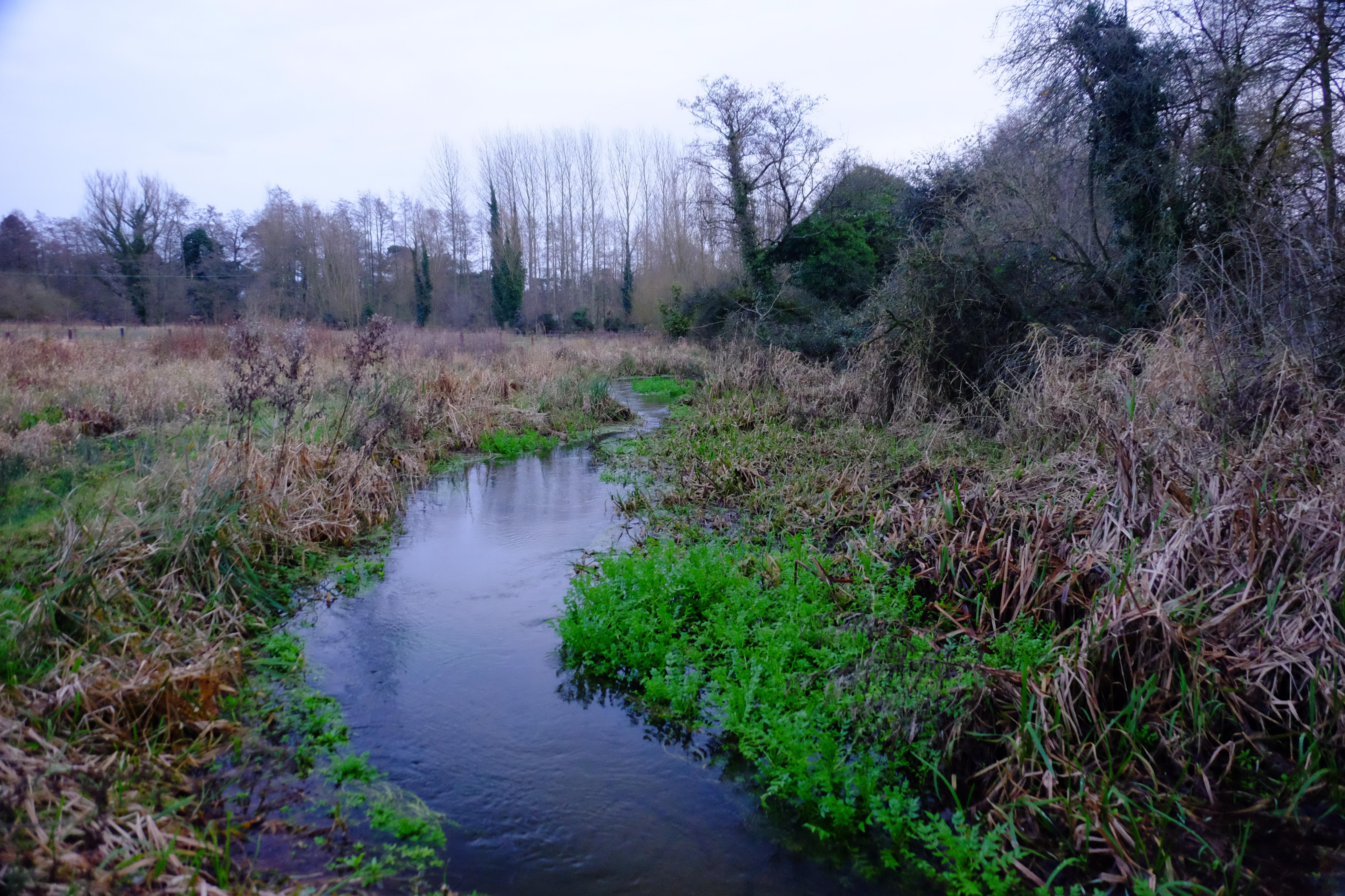
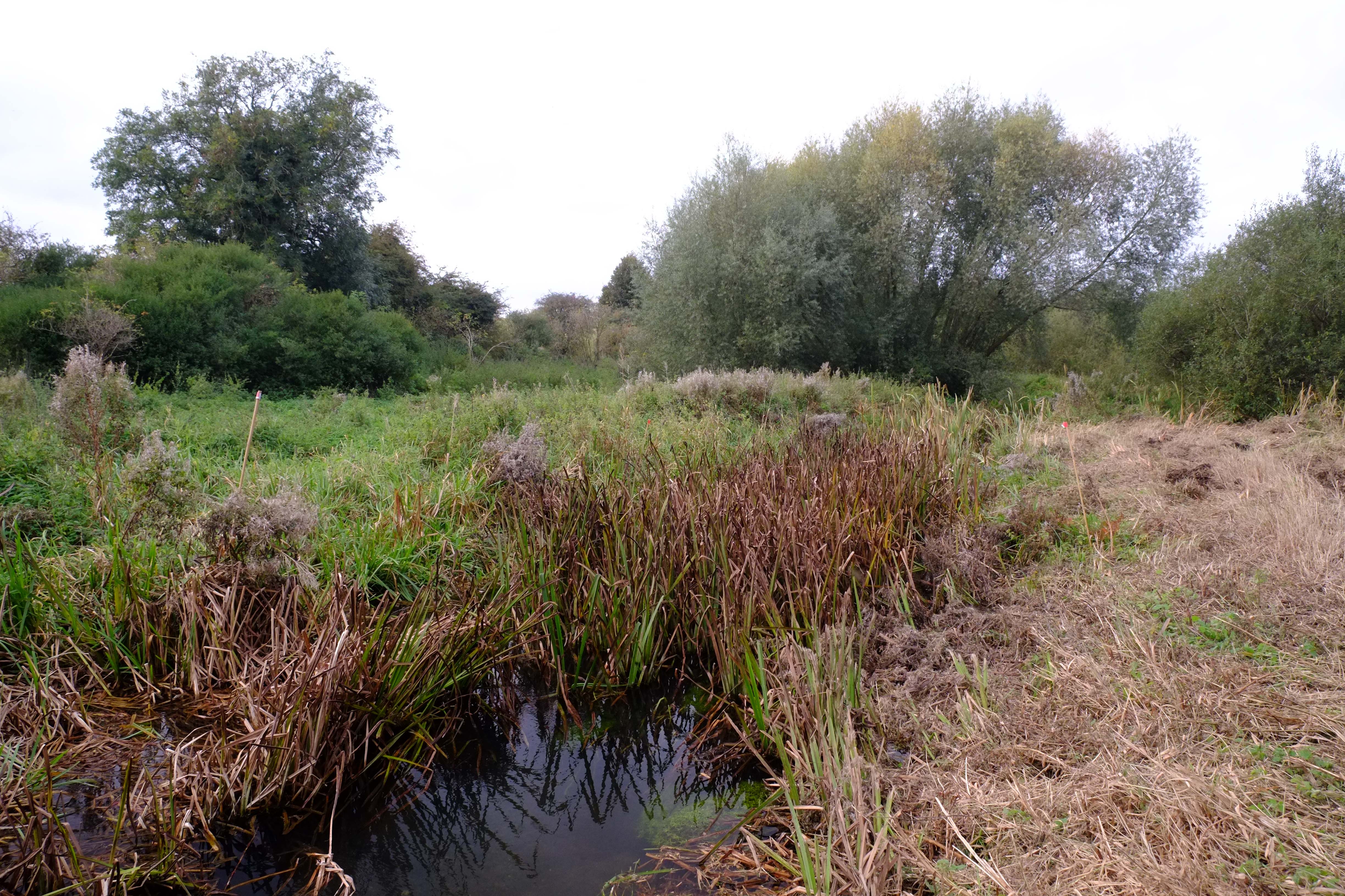
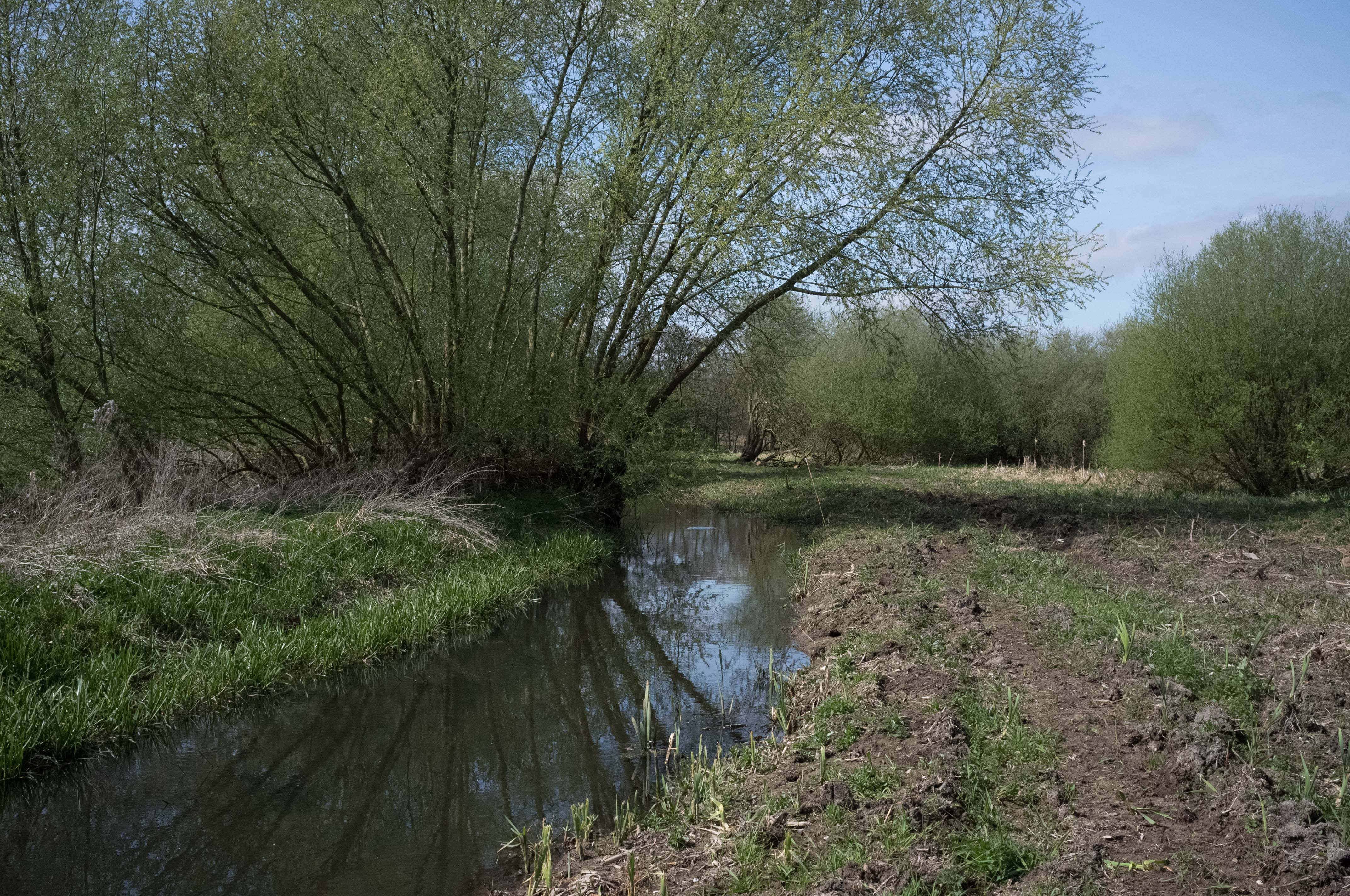
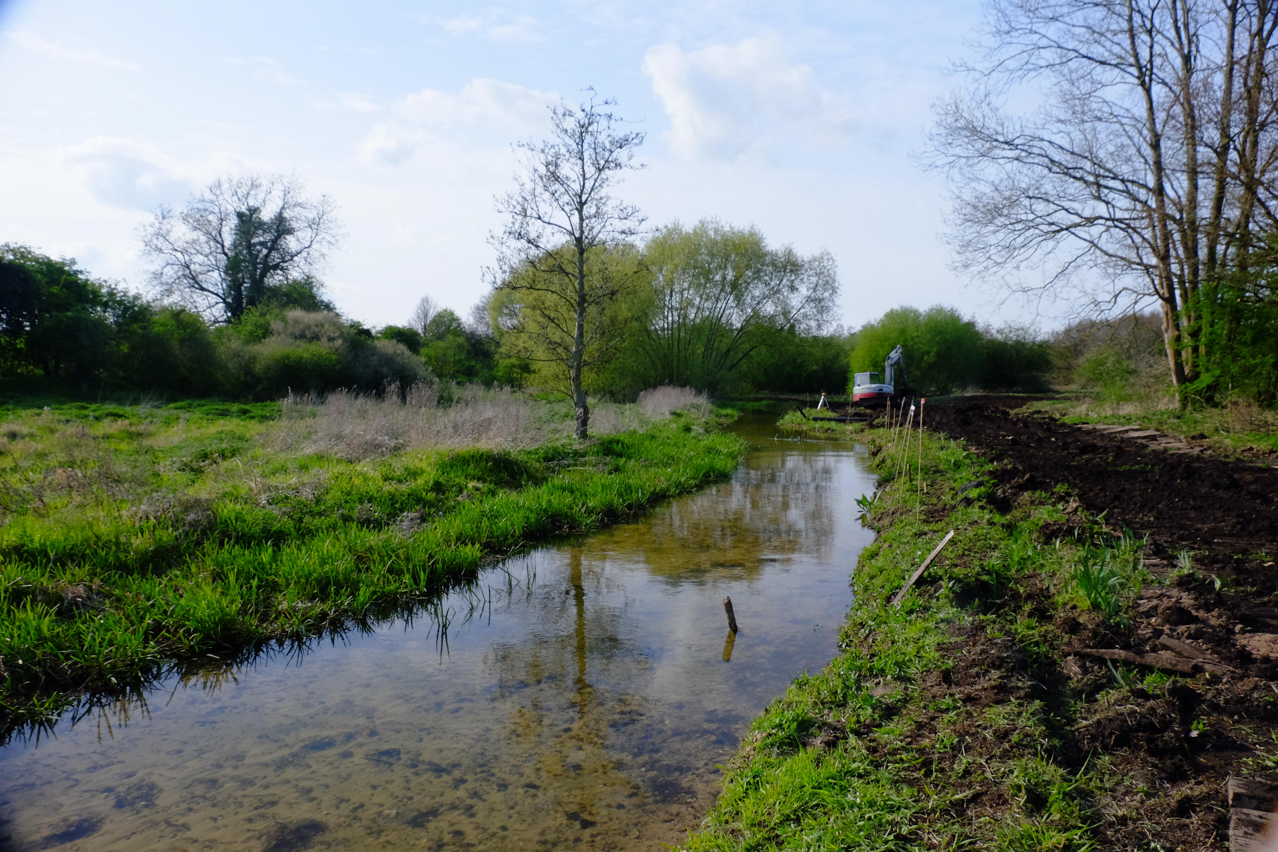
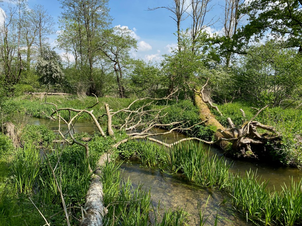
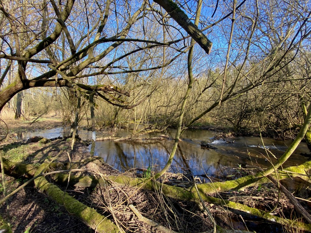
At the western end of our new project site, towards the lower end of the existing higher-level mill-leat, a breach formed in the man-made bank about five or six years ago. I didn’t think much about it at first, but recently I have been watching the results with some interest. The water is now pouring across the floodplain through a relatively feral patch of woodland from the higher level channel to the “original” channel (albeit this channel has also been heavily modified).
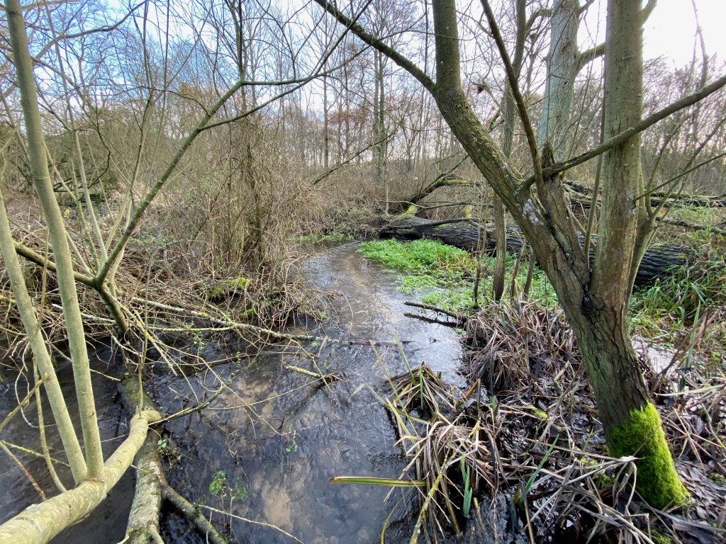
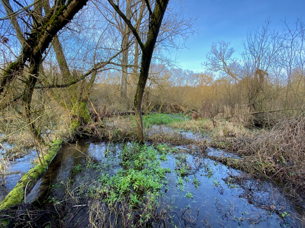
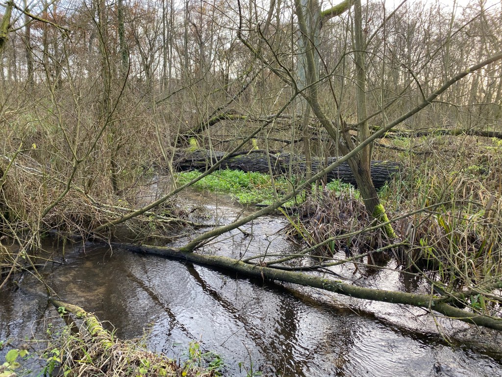
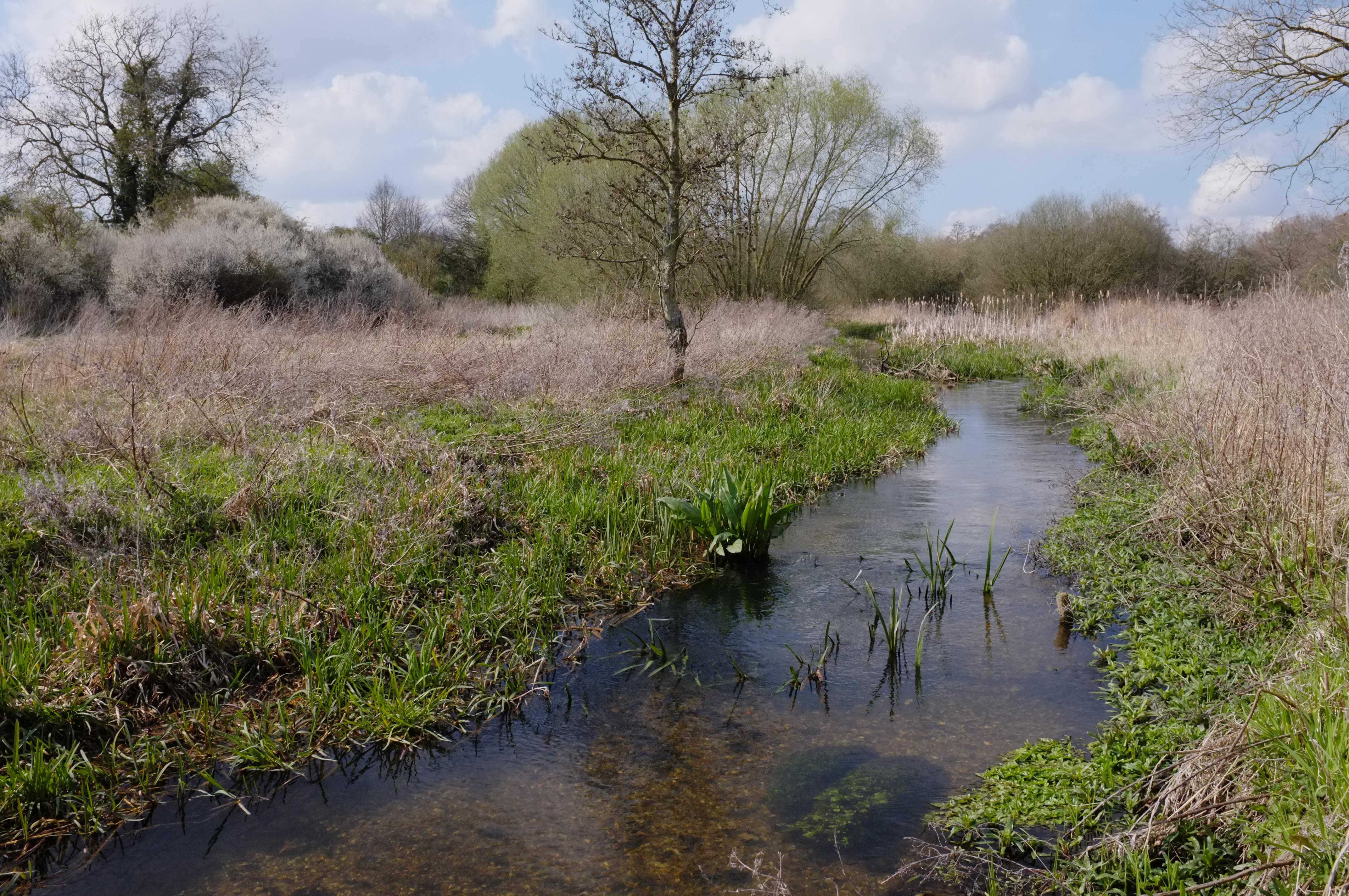
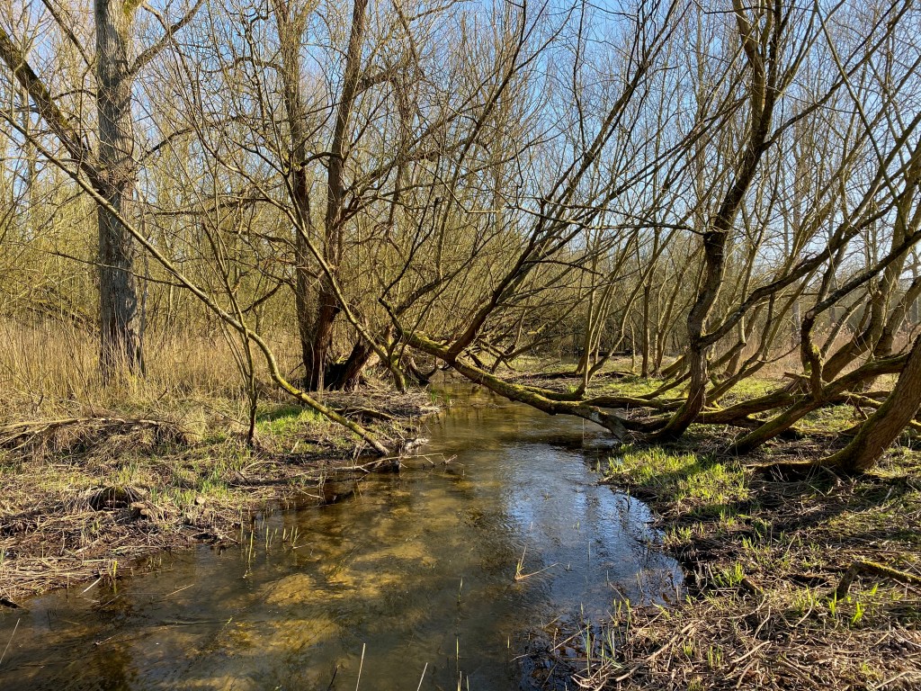
As you can see, it’s a miniature Stage Zero project self-generated as a result of the decay of the old leat embankment. Sadly, the process will stop when we divert the river back to the floodplain as the water will be taken away from the higher level leat. I was starting to think about how I could recreate the same thing as part of the new project when a morphologist with one of the contractors we are using suggested I look up Stage Zero and this lead me discover to Colin’s work.
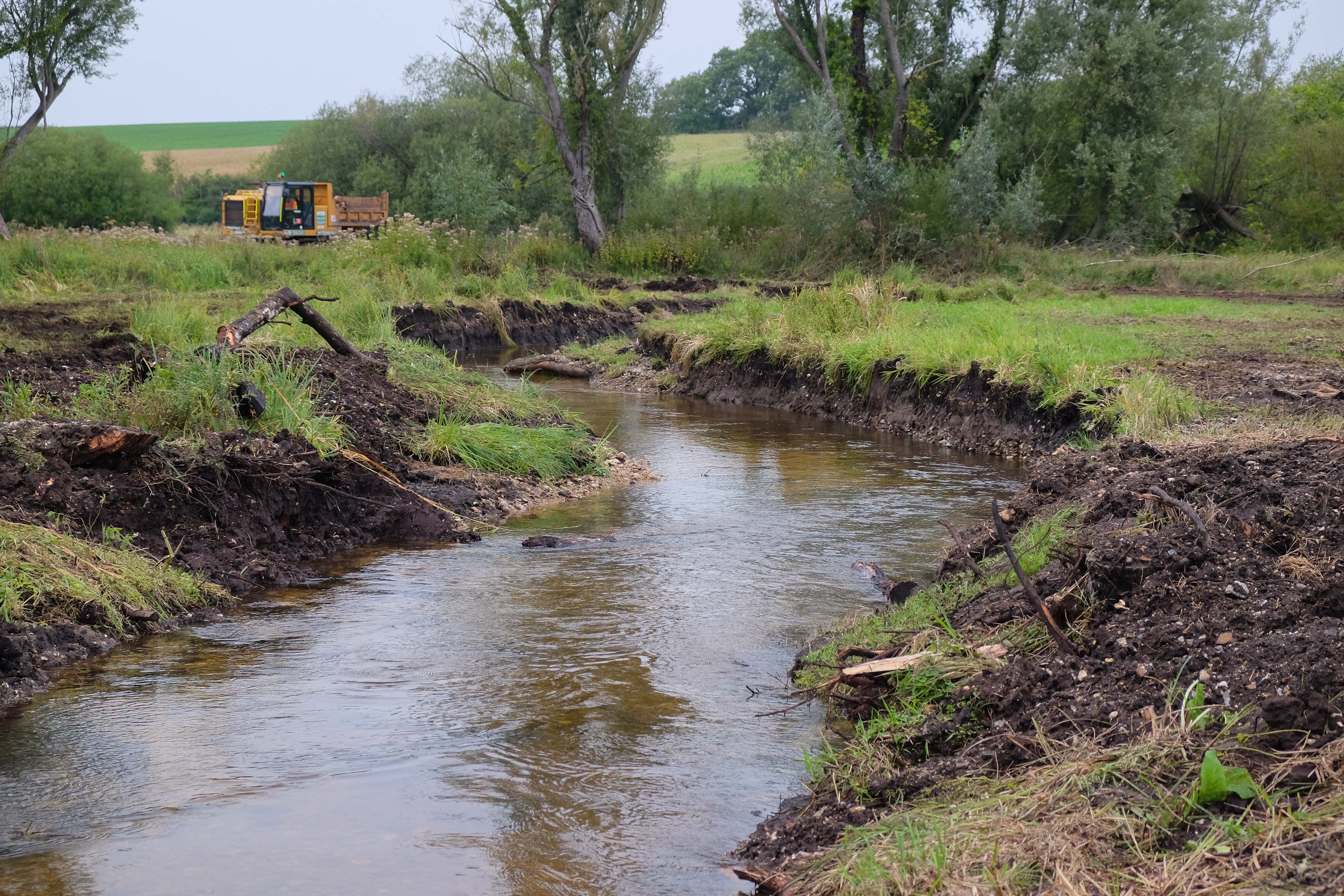
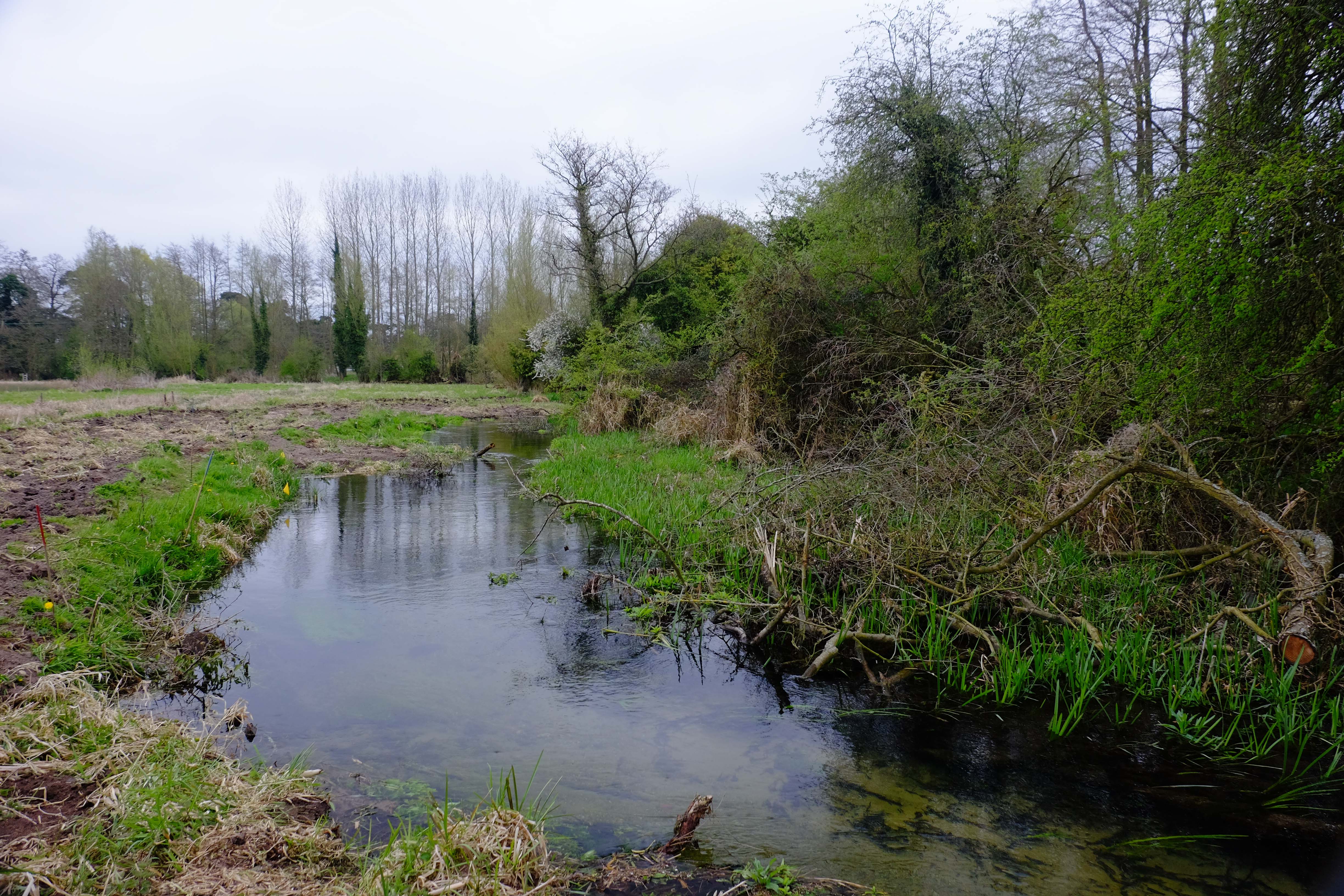
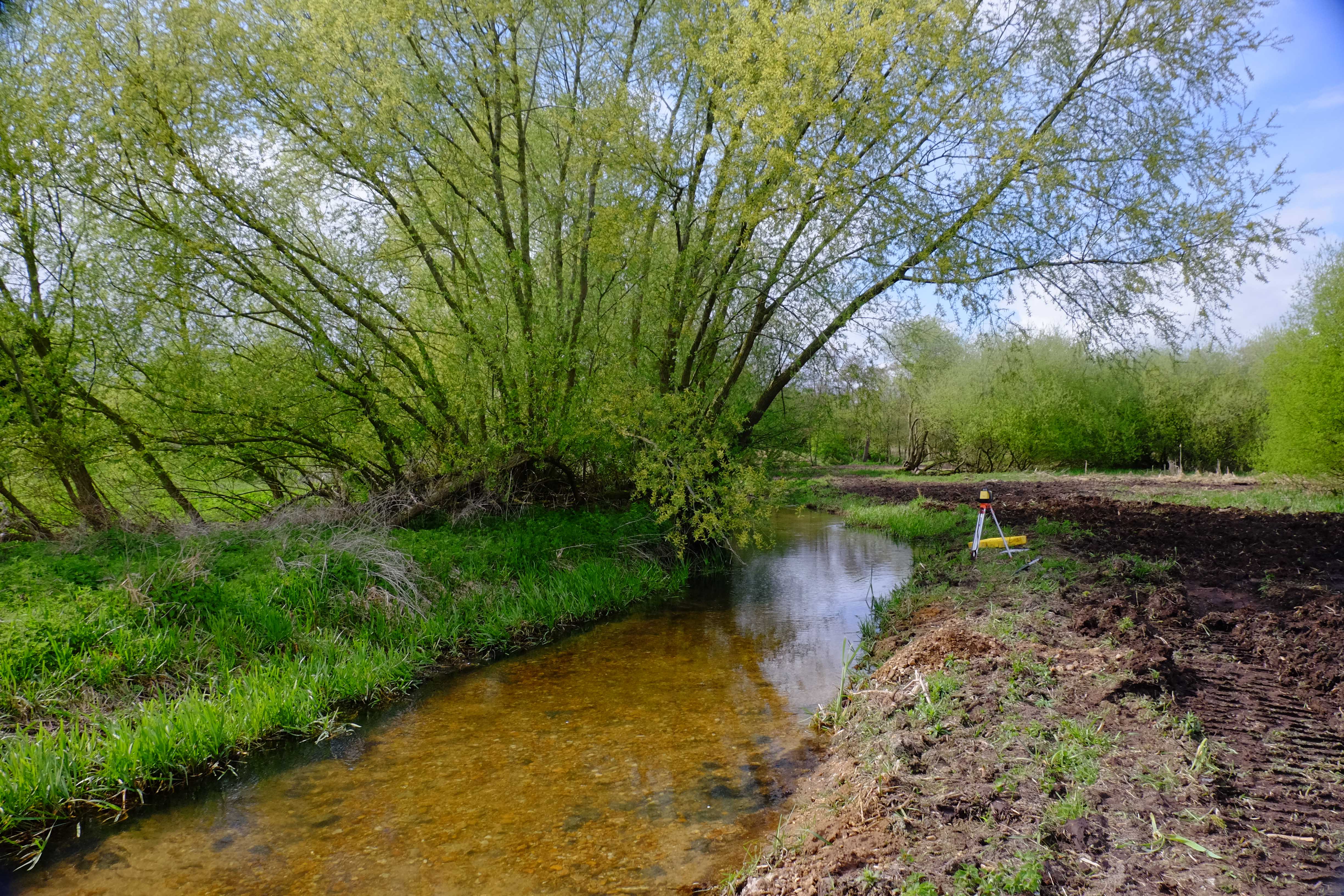
I got in touch with Colin and he in turn put me in touch with Paul Powers who works on large-scale river projects in Oregon. Together they have helped me to plan the incorporation of a new Stage Zero reach within our overall project, where I will try to recreate what you see in the photo above.
The Geomorphic Gradient Line & The Evolution of the Post-Glacial Chalk-Stream
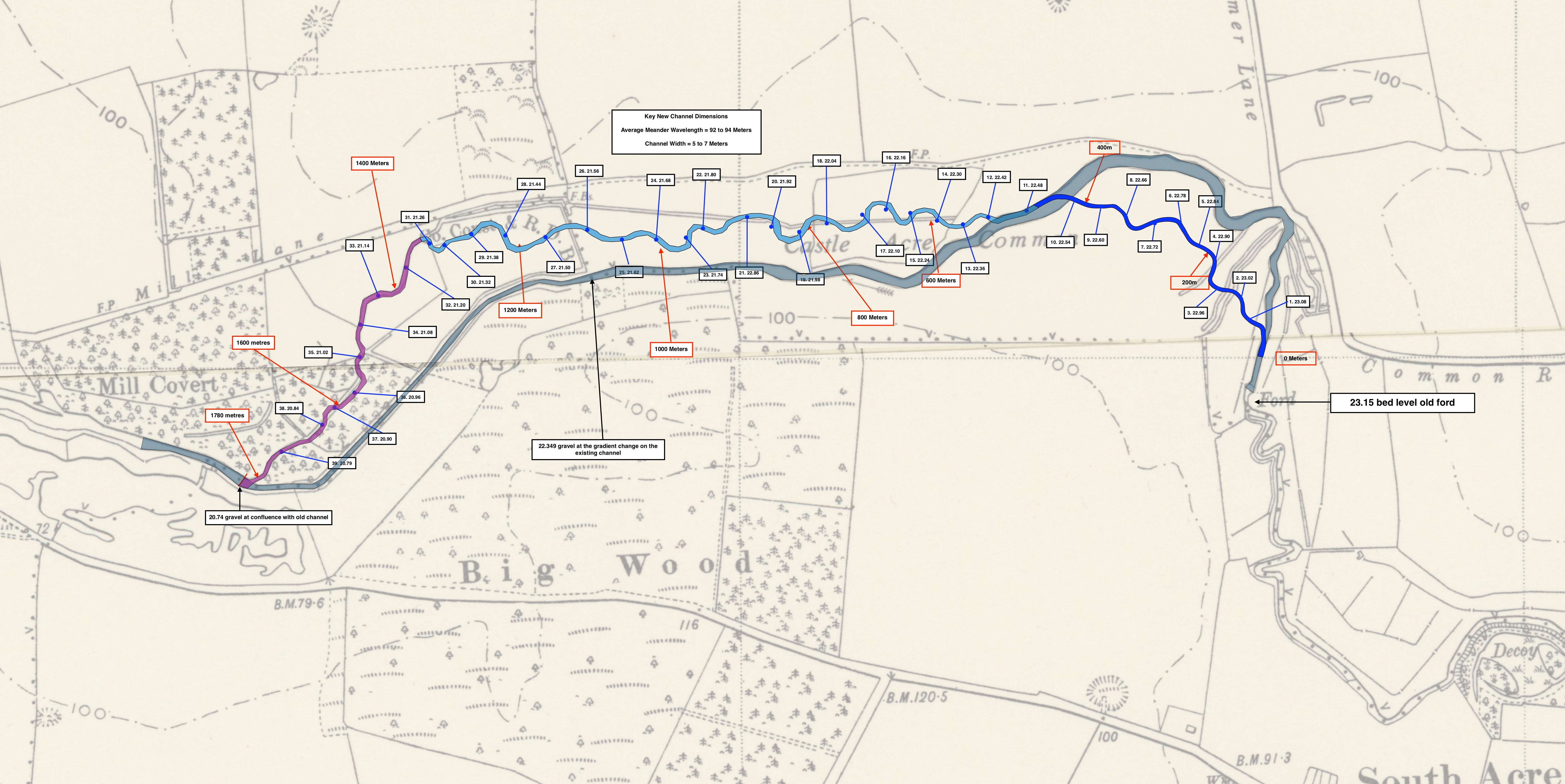
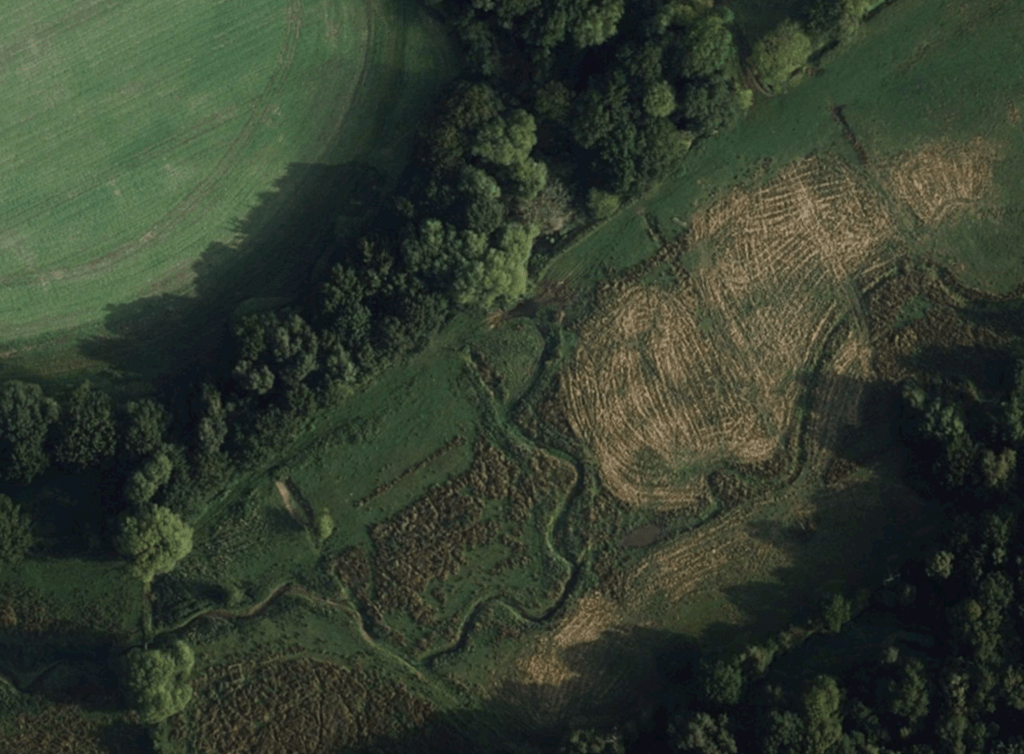
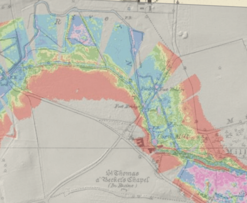
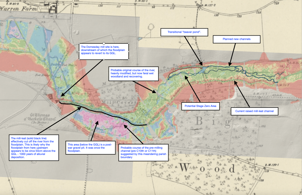
During that process Paul introduced me to the concept of the Geomorphic Gradient Line (GGL) and produced for me a GGL set of LIDAR tiles for the valley around the location of our project.
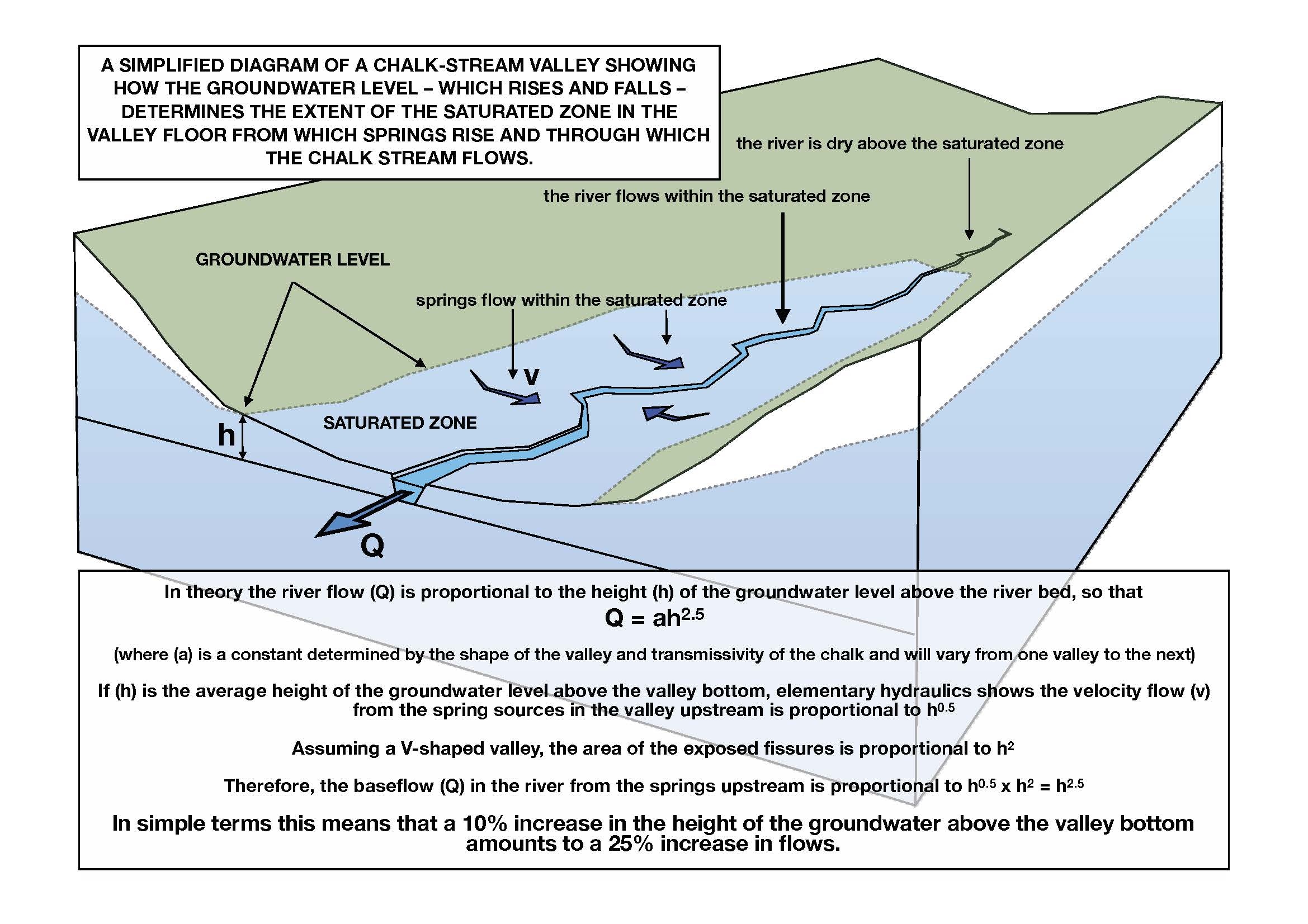
The “GGL” is the fundamental gradient of the valley along the theoretical surface of the pre-disturbance floodplain: it can be deduced by observing the surface level of the disturbed floodplain – which will be full of man-made interruptions and irregularities – and averaging all the high and lows and in betweens, to arrive at a steady slope. In Paul’s Stage Zero work in Oregon he has literally re-graded or “re-set” floodplains by cutting down the highs and filling in the lows – including the entrenched river channels: the river is then left to begin the process of drawing itself from scratch across the newly stretched canvas of the floodplain.
As soon as Paul sent that document through for the River Nar near Castle Acre I saw an explanation for something that had been bothering me on countless field surveys, and it is this that I particularly want to share as I feel it is very relevant to the question of site selection for similar projects on many, if not most, English chalk-streams.
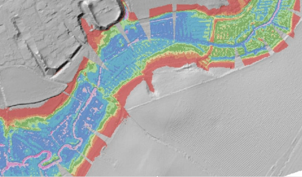
The GGL tiles showed a really distinct set of steps in the valley surface. Paul had noticed them and pointed them out, but from Oregon he could only guess at their origins. I knew right away: the steps were caused by Domesday Mills and water-meadow structures. They explained why, as I had walked back and forth across the floodplain planning the next phase of our project, I had failed in some locations to find gravel at the expected depth under the floodplain surface, whereas in other places the gravel was exactly where I thought it should be.
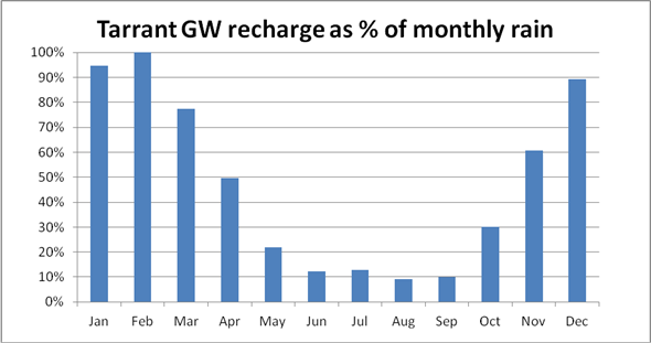
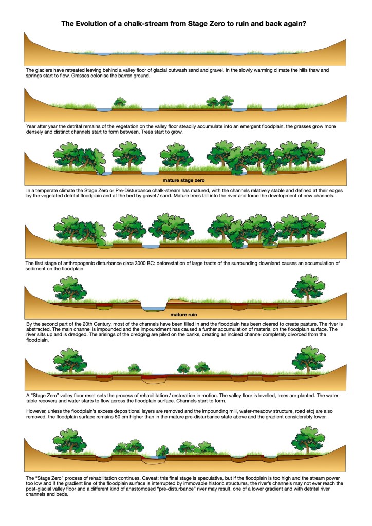
What do I mean by “expected depth”? Imagine the phases of evolution of a chalk-stream since the last glacial maximum: we must start with a canvas of bare and recently defrosted chalk downland and in the valley floors a barren glacial outwash of sand and gravel with springs oozing up more or less all over the place, the water slowly accreting into channels: like the channels mazing across a coarse, sandy beach when the tide goes out. The powerful forces that carved the valleys have retreated from the landscape, leaving behind ultra-low energy river systems, fed by aquifers draining the absorbent hillsides. In a warming climate vegetation becomes the defining force shaping the floodplain surface and the maze of channels flowing across it: the valley floor accretes, not so much because material is washed down onto it from the hillsides, as because vegetation is growing and dying, year after year, on the floodplain itself. This would explain the distinct layering common to chalk-stream floodplains of pure peat with some sand but a very low gravel content, above a hard valley floor of almost pure gravel and sand, with very little detrital content.
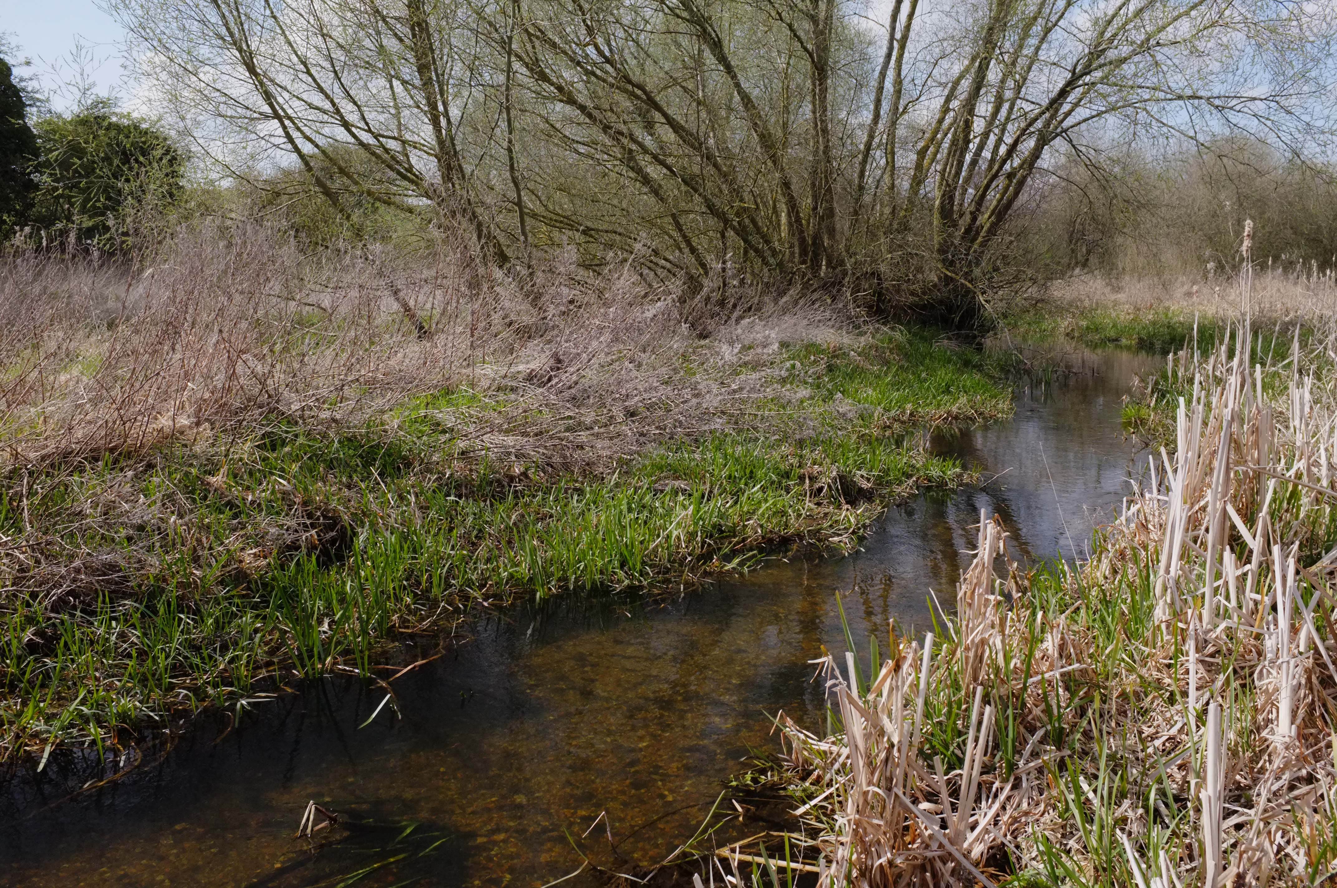
Of course, no two valleys are the same and no two parts of the same valley are quite the same either. The peat depth will vary and the slumping outwash of sand and gravel underneath is marbled and furrowed. I know this is true on the Nar at least because in order to plan the routes of the recreated meandering channels we have cut I have surveyed the valley floor with – at one end of the sophistication curve – a mobile GPS surveying station, and – at the other – a road-pin, with a hazel handle wired across the top of it, which I used to the probe the depth of the gravel. I use these to make a record of the floodplain level and the depth of the gravel beneath it in order to build up some kind of underground map of the post-glacial valley floor.
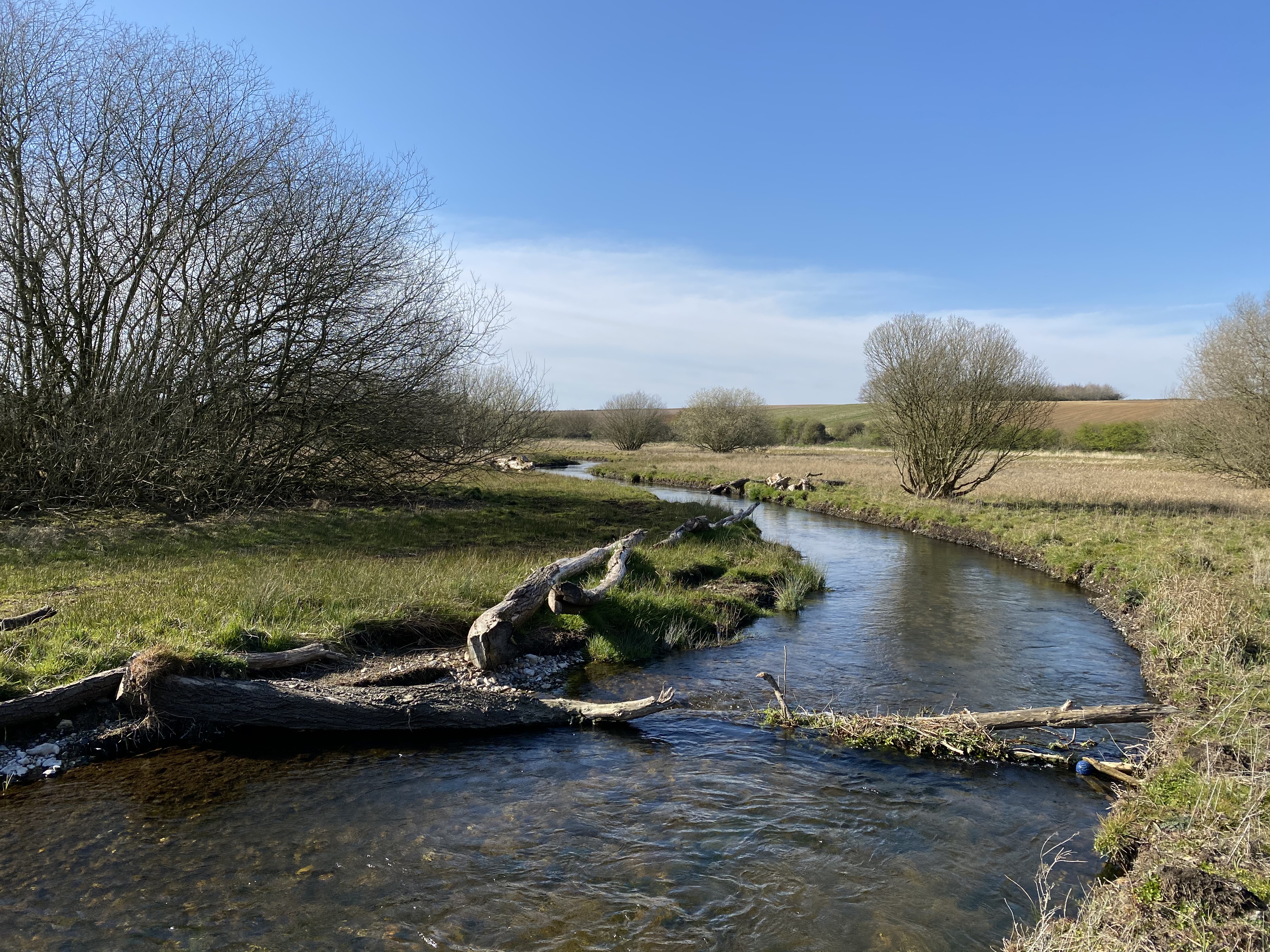
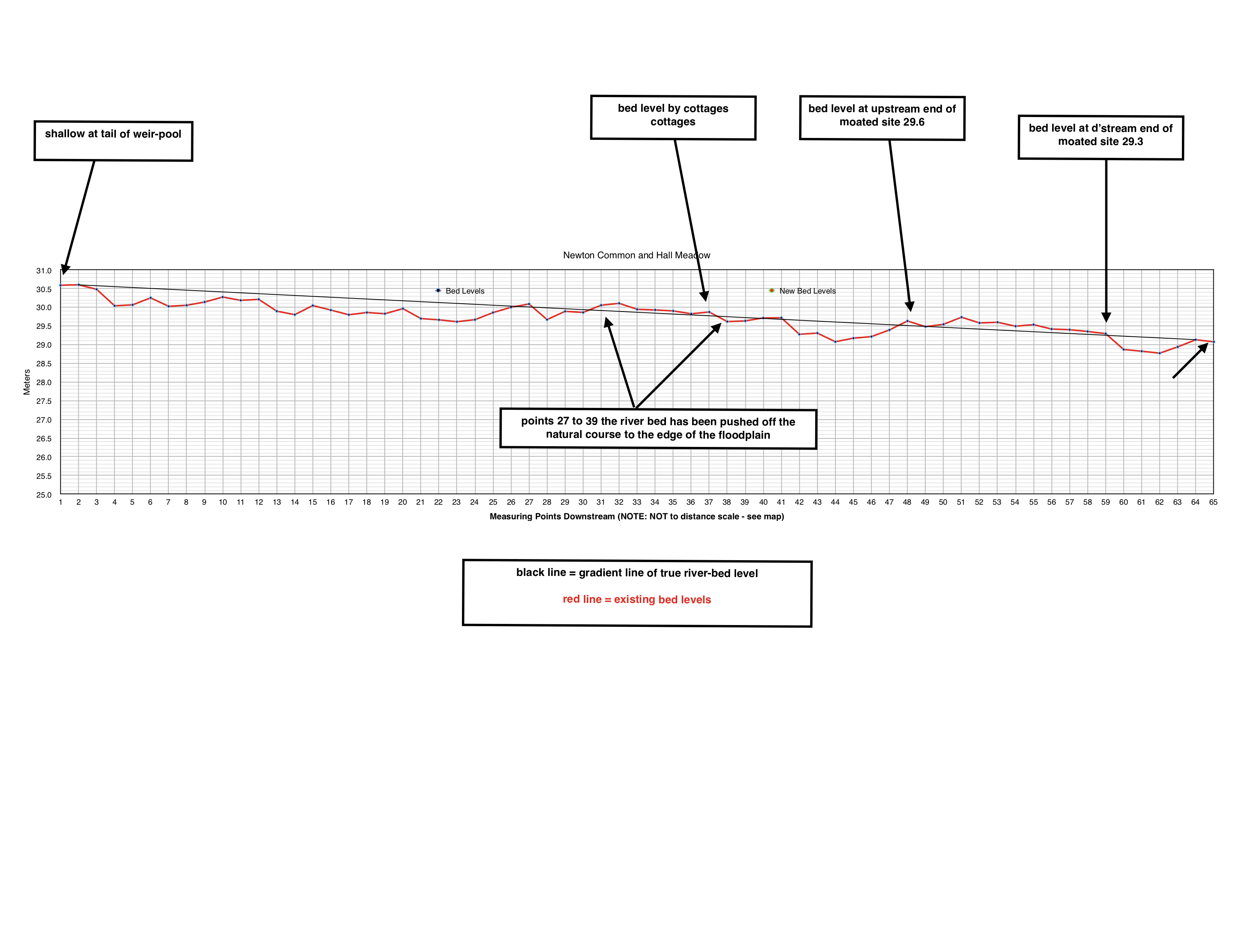
In other parts of the valley and at the upper reaches of this latest project site I have tended to find that the road-pin drives easily through the peat until it hits a hard gravel surface about 75 to 90 cm underneath the floodplain surface. This matches up with the measurements I have taken off a few reference reaches of relatively unmodified river channel, including a set of meanders a mile or so up the valley which were cut off by another mill-leat several hundred years ago and otherwise have not been modified, straightened or dredged. These relic meanders revealed a channel that was shallow and wide: 5 to 6 meters and only 75 to 90 cm deep from floodplain surface to gravel river-bed.
A Domesday Legacy
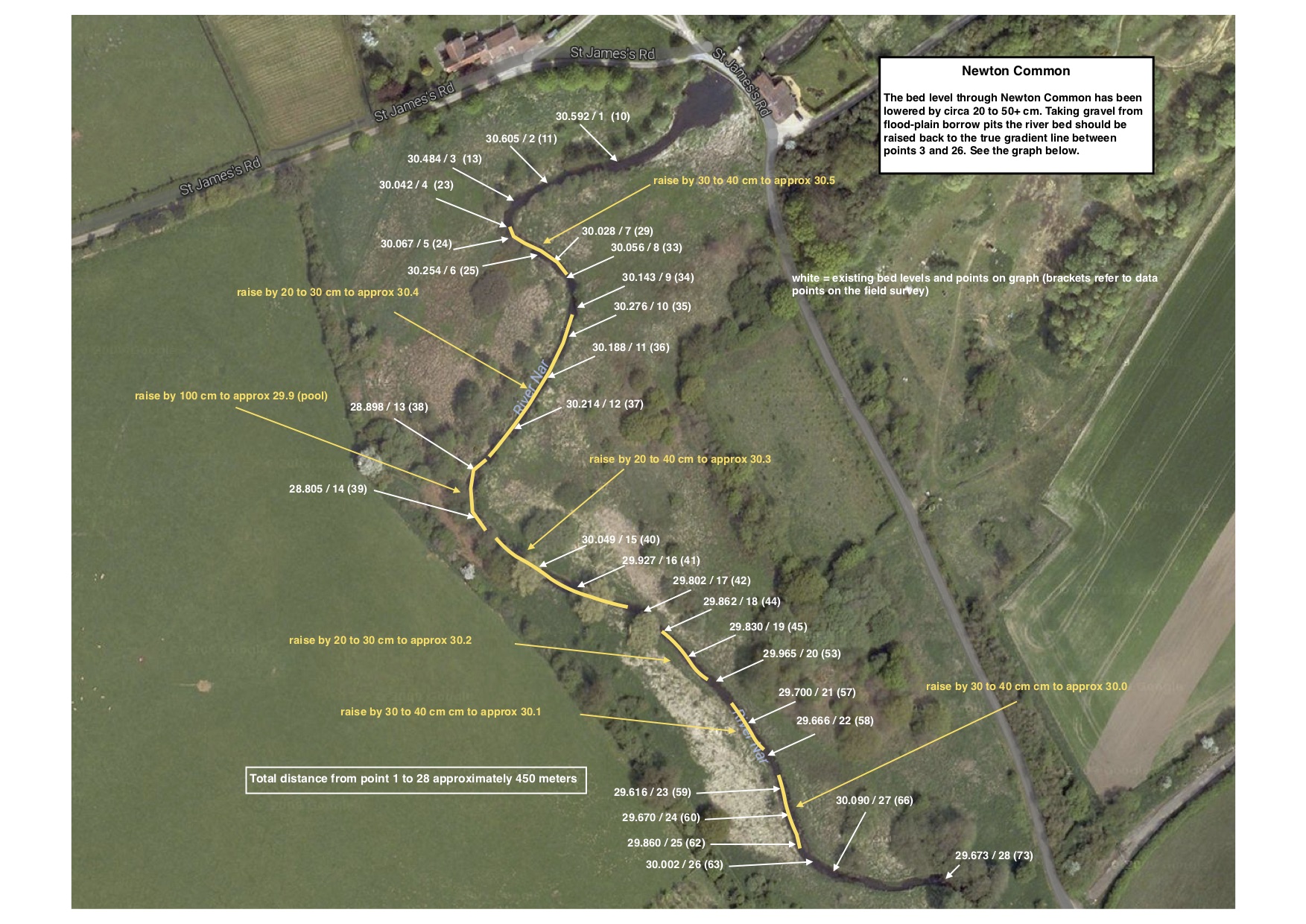
However, as I moved downstream surveying the reach of floodplain where we will build the new project, I found that the gravel floor in the centre of the floodplain (where I was almost certain the river had once been situated) was more like 1.4 to 1.5 meters beneath the floodplain surface, and in places too deep to find with my 1.5 meter road-pin.
This gave me a problem for locating our new channel: I had either to cut a channel of the reference dimensions (5 to 8 m wide and 75 to 90cm deep) that would have a soft, detrital bed, or I had to cut a channel down to the gravel, but that would be unnaturally deep and incised.
It wasn’t a problem that went away with Paul’s GGL map, but at least I had a solid explanation. My working theory had been that neolithic forest clearances dumped a whole load of silt in the valley which had built up at pinch points to create swampy lagoons. In fact Paul’s GGL showed a more startlingly recent anthropogenic explanation, a watermill. But could that much material (50 cm) have accreted since mills were built? Maybe. Most of the mill-sites on the Nar are Domesday sites, which means that mills have been in those places since at least 1086, but probably a century or two longer than that. Call it 1200 years. Or a third to half millimetre of accretion per year, which seems plausible and long enough to have caused an uplift in the floodplain surface of about 40 to 50 cm, across the full width of the valley and for some distance – 1 to 2km – upstream of each mill site.
Unfortunately as far as Stage Zero or any other channel restoration project goes that gives us two diverging surfaces to think about: the steadily sloping surface of the hard, gravel/sand valley floor and the stepped surface of the floodplain that “should be” 75 to 90cm above it, but is actually up to 50cm “too high” in the anthropogenically-enhanced depositional reaches upstream of ancient water-mills and others structures.
Most English chalk-streams will be similar to this, as they share the same basic geological and glacial building blocks (although there will be local variations depending on geology and glacial processes, the depth and type of the peri-glacial drift and the base-flow index of the river) and the same history of modifications and milling. But it won’t just be mills that complicate the picture: navigation and water-meadow modifications, common to almost all chalk-streams, will have added a similar layer of impoundment and stepped disconnections between the surface gradient and the valley-floor gradient.
How can we make Stage Zero work in our densely archeological mosaic of a landscape?
Stage Zero offers hugely exciting possibilities, but not exactly straightforward ones given the likelihood that the average chalk-stream floodplain is not only out of step with the post-glacial valley floor, but immovably so given how densely archaeological our chalk-streams really are.
Certainly on the Nar we cannot even think about re-setting GGL of the floodplain in a way that would unite it with the GGL of the sand / gravel valley floor: we’d have to knock down mills that are now expensive houses, not to mention move millions of tons of material from designated Sites of Special Scientific Interest, and fill in an enormous gravel pit.
In working out how to make this kind of project a success it seems that there are two interlinked issues to consider carefully: the process of channel evolution and the way in which site location will influence that process.
To what degree will the Stage Zero prescription – in any given location – mimic the way the chalk-streams were formed and thus recreate their original pre-disturbance state? How long it will take, given that chalk-streams are low-energy systems? Where do you locate a project site in our densely archaeological chalk-stream landscapes? How will the choice of location impact on the success or otherwise of the process?
The Stage Zero projects in Oregon have addressed issues of incision and channelisation where the river has become divorced from the floodplain by regrading that upper, floodplain surface over quite large areas, allowing the now freely flowing water to start a process of channel incision, creating eventually an anatomised plan-form across the width of the floodplain, resembling the original “pre-disturbance” state of the river. The Powers et al paper cited above lists the various Oregon projects all but one of which are rain or snowmelt systems and all but one of which are sited on steeper valley slopes than is typical of an English chalk-stream (0.2 to 0.1%). One is partially spring-fed, but that appears to be on a very steep stream (Three Mile Creek, with a 7% valley slope). One project carried out on open meadow on Whychus Creek, looks from photographs to have a lot to teach us about the possibilities for similar work on an English chalk-stream, but even so Whychus Creek has a 0.9% slope and is a glacial and snow/rain-fed system.
As far as I know, therefore, we have yet to see this kind of project carried out to maturity on a spring-creek like system of comparable slope, base-flow and geological underpinnings to English chalk-streams.
It must be fundamental to their formation, for example, that chalk-streams were not so much etched into a pre-existing floodplain, but rather they ‘grew’ from their glacial outwash foundations upwards, with the emergent vegetation shaping and defining the boundaries of the flowing water and vice versa.
Of course beaver dams and fallen trees will have forced water to take new pathways, creating channels that were indeed ‘etched’ down through the surrounding peaty floodplain, but even then, in a pre-disturbance state, that post-glacial gravel floor would have been within reach of the emergent channels, flows were not denuded by abstraction, the gradient of the floodplain was not interrupted by mills and the floodplain was likely an open matrix of trees and tussocky grass.
The speed of the evolution of a project today and its results will be heavily influenced by these kinds of factors.
For example, a hypothetical Stage Zero project in an impounded part of the valley where the gravel floor is beyond the reach of the emergent channels, where there is a fundamental and immovable obstruction to the gradient across the width of the floodplain (as appears to be the case with ancient mills), where there aren’t any trees and where the land surface is grass pasture, will likely evolve into a wetland bog for a long time before it looks anything like a braided river system. Stepping the water up onto the floodplain surface will also most likely cause an impoundment to flows upstream of the project site too.
Whereas the same kind of hypothetical project downstream of an ancient mill, or where the gradient of the valley floor and floodplain are in sync, where there is a wooded and tussocky floodplain, would – I imagine – evolve into a matrix of emergent channels much more quickly: there, with the maximum possible gradient, a mosaic of shade and the structures of tree-roots, fallen timber and tussock grass to coral the currents, the emergent channels will not only etch into the floodplain more quickly, they will find gravel when they do so.
If Stage Zero is an exciting prospect for some reaches of our English chalk-streams, we still need to go at it quite carefully, because the difference between one set of results and another – even if they might look equally attractive to someone zoned in on bio-diversity alone – could well be the difference between carrying the support of the wider range of stakeholder interests, or losing it.
In the end site location will be best achieved through a good knowledge of the river valley, its landowners and the various stakeholder interests, and then careful detective work into the history of a given site, and the gradient line not only of the floodplain surface but also of the post-glacial valley floor. Some places will be better than others and the ability of the river to work its magic will – I suspect – vary considerably in terms of speed of process and the type of river channel(s) that will result.
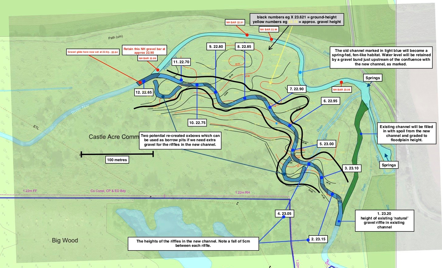
As for the project on the River Nar, In Norfolk, where we are working on that kind of problematic reach where the floodplain surface is too high, and somewhat disconnected from the gravel floor, I have designed a project that incorporates elements of Stage Zero throughout and one 250m experimental section where we will push the water out of the channel and across the floodplain through a wet-woodland area. I’m curious see what happens and how long it takes.
With Colin and Paul’s help I have sketched out a way of stepping the flow up on to the floodplain surface without impounding the upstream flow too much – I hope. We will actually cut a single thread channel (or in fact rehabilitate a ditch that is part of an ancient drainage / water-meadow system) and then block it with a pseudo beaver-dam by felling several large trees. This will back the water up into a pseudo beaver-pond area, the low point of which will feed the flow across a wide sill into the woodland that will be the locus of the Stage Zero and is the likely route of the pre-disturbance channel area. The flow will gather at the downstream end into the remnant of the original channel, which is in itself an interesting, once modified but now feral channel full of overgrown willows.
Upstream of this Stage Zero section we will be running a new, meandering singe-thread channel just off to the side of the centre-line of the floodplain, where the gravel is at the correct depth for the reference dimensions, but we will then use the turfs which we cut from the path of the new channel to patch out the low-lying points of the floodplain surface to create a series of ephemeral channels. The intention is then to dress out all these channels with Large Woody Debris to force the water to take multiple pathways, certainly in high flows, but to an extent in all flows – remembering that in chalk-streams with good gradient and dense ranunculus bed, summer flows are often “higher” than winter: higher relative to the floodplain surface.
Effectively then, we will have a mix of main and secondary channels. All this work will be carried out this summer. I’ll post updates here. I’ll be happy to show anyone the site, if that would be interesting to those planning their own similar projects.