One can’t help but be concerned at the news this morning that the new-look government is planning a review of ELMS, the UK farm subsidy scheme which will replace the EU’s CAP, “given the pressures on farmers, and the government’s aims of boosting food security and economic growth”.
Although a lot of good work has gone into ELMs nothing is beyond review, so this may not be the de facto existential disaster many conservationists are predicting. What is frustrating however, is the endless framing of this conversation about farming and nature as a binary choice between economic growth and ecological protection.
Both sides – if I can put it that way – are to blame for this. Conservationists too often make excellent the enemy of the good. Threatened by what they see as impractical, idealistic environmentalism, farmers can be reactionary and unwilling to take on new (in fact, old) and practical ideas about land husbandry.
It doesn’t have to be one or the other!
It is in fact perfectly possible to farm in a way that leaves space for nature, or to put it the other way round, it is perfectly possible to make space for nature whilst farming profitably and providing an invaluable service to society. (Jake Fiennes’ new book Land Healer is all about this pragmatic, conservation-minded farming: exactly why I was very pleased when the NFU asked Jake to represent farming on the CaBA Chalk stream restoration strategy panel: in fact his book wasn’t out when we developed the strategy, but I had met Jake and our ideas clicked.)
That’s also why we’ve been trying to develop / evolve, from the CaBA chalk stream group, a simple set of recommended rules for farming in chalk landscapes which we will put to Defra in mid November when we launch the implementation plan for the chalk strategy. With a review on the horizon, this could be timely.
Background
The CaBA chalk stream restoration strategy, published in October 2021, included a number of recommendations for simple rules for farming in chalk catchments.
The idea was to propose to the teams developing ELMs a small number of rules and incentives that would be:
• easy to follow
• effective
• practicable
• and would not adversely affecting the profitability of the farm business
The reasoning was that a good combination of the above would generate much higher take up and could be easily be regulated. I live in the countryside. I know many farmers. I know many chalk streams and I have practical experience of the impacts farming has on those chalk streams. I am sure that most farmers would be more than amenable to simple, practical ideas that help chalk stream to flourish, so long as these ideas are grounded in the practicalities of farming and of trying to make a living against the headwind of all the bureaucracy and diverse pressures farmers are under.
As chair of CaBA chalk group I was recently invited to sit on Defra EEG+ working group meetings and the Water theme for SFI and ELM. So, I decided to try and improve the first set of ideas via a series of meetings but with farmers and land managers driving the discussion. My plan was to take these ideas to the Defra meetings, backed with the expertise of the farming community.
Thus far we have had one meeting with a number of farmers in Norfolk and I now have two more booked: in Wessex on the 12th October and in the Chilterns on the 26th October (organised with the help of the Wessex Rivers Trust and Chilterns AONB respectively). I’d also be very keen to hear from other farmers and would be happy, if time permits, to hold an online meeting as part of this process. Get in touch if you’re interested. Although I can’t say how influential the ideas will be, the more that farmers contribute to and shape them the better.

Focussing on sediment run-off and chalk streams.
The impact of farming on water quality in streams is a potentially complex area but I want to focus on sediment in chalk streams because sedimentation has a very big impact that could be largely addressed with some very simple interventions.
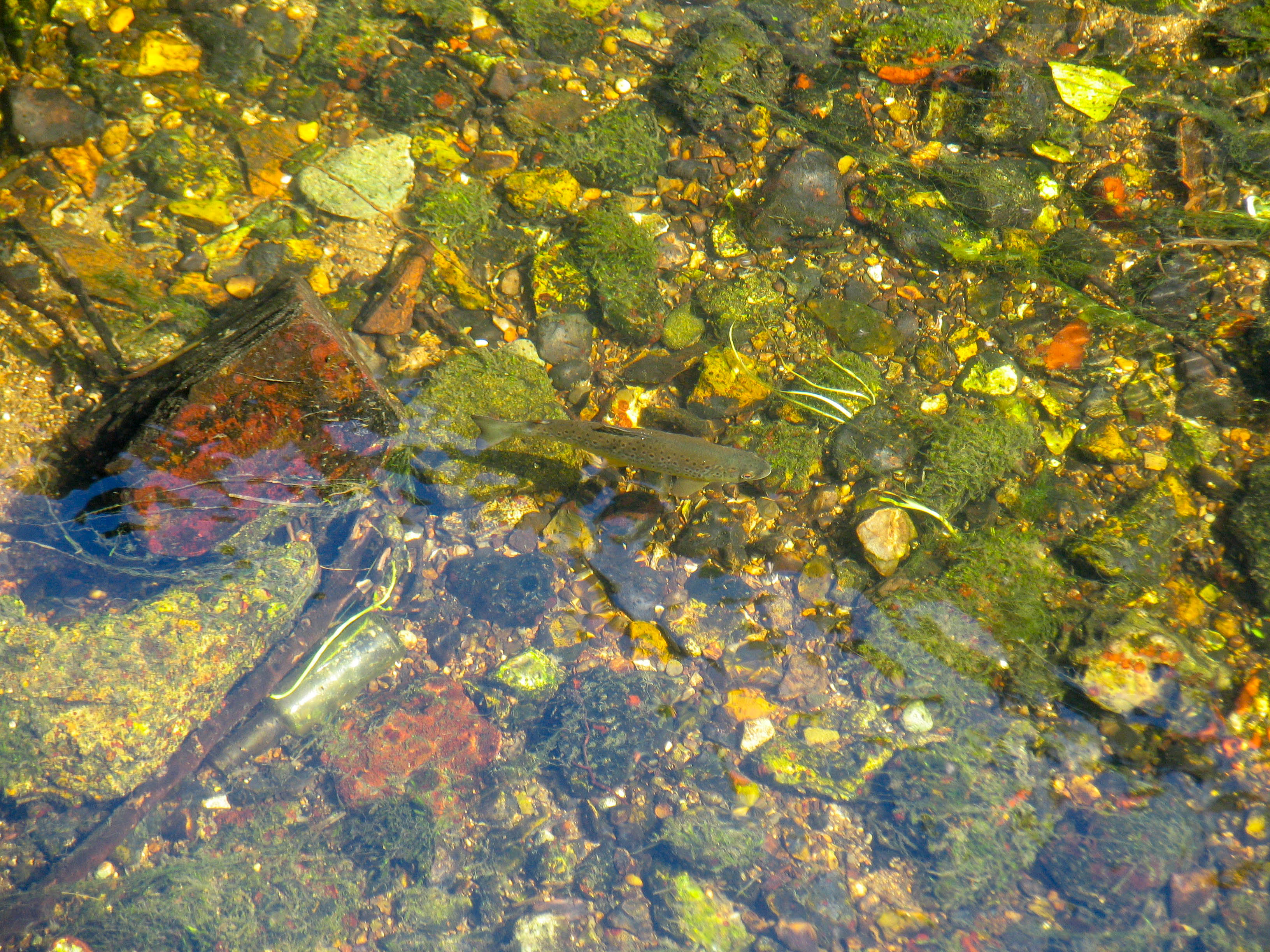
Chalk streams in their natural state are ‘gin clear’ with very little sediment, clean river gravels and low nutrient levels: all of which is important for the ecological health and abundance of the species of plants, invertebrates and fish typical of chalk streams.
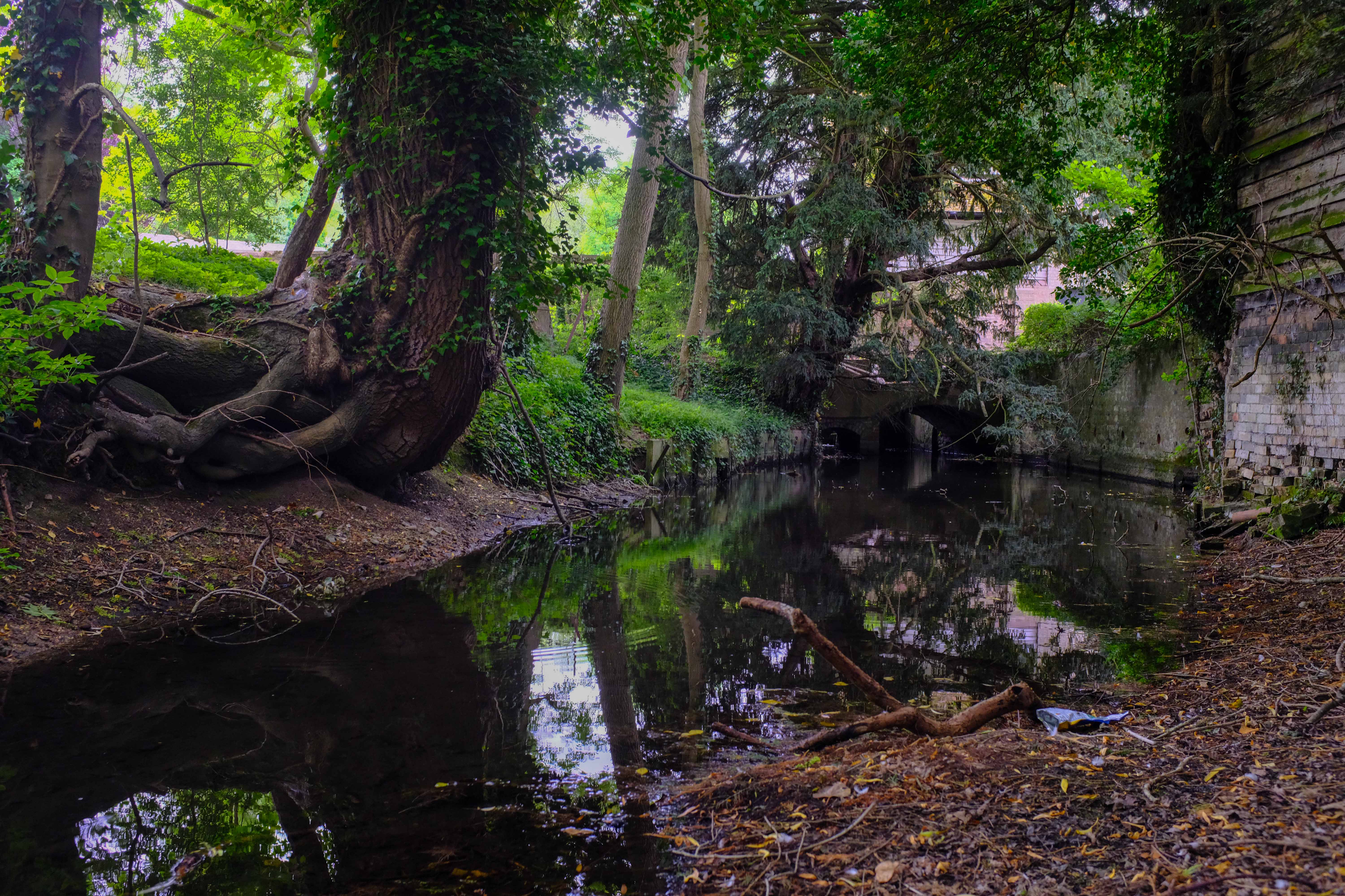
Our modern landscape, however, and the way it is farmed and developed, generates a lot of sediment run-off. And chalk streams being such gentle rivers have very limited flushing capacity. Many of them are modified by weirs and mills and denuded by abstraction which only makes all of this worse. In short, sediment gets into the river and it can’t get out, causing a significant negative impact on the ecology, by swamping out and homogenising habitat, filling the spaces in the gravel bed, or cloaking the bed of the river in particulate matter to which are attached phosphorus and all sorts of other toxic chemicals.
A 2005 English Nature Geomorphological Appraisal of the River Nar included a really good study of the ways sediment runs from farmland into a chalk stream. The report showed that fine sediment comes from:
• Arable fields – especially when they are recently ploughed.
• Pig units – there were increasing numbers in the valley, at the time (there are still many) some on steep land, close to the river.
• Road-side verges – especially when they are crushed each winter by farm vehicles too large for the roads they are driven down: this is a worsening problem.
• Dirt tracks – especially where these join up with the road network or run directly to the river.
• Aggregate works – from the exposed landscape around the works and from the road network servicing the works.
And that sediment enters the river via:
• Road crossings – where road drains discharge into the river.
• Footpaths, tracks and fords – where they cross the river.
• Intersections – of the dry valley network with the main river.
• Drains and ditches.
• IDB pumping stations and drains.
• Tributaries.
The important thing is this: in a chalk landscape points of sediment ingress are quite localised, but the area of origin can be broad. This is the case on most chalk streams, though the mixed geology chalk streams do get more surface run-off and chalk streams with livestock which graze to the river’s edge will also acquire sediment from damaged river banks. Urbanised chalk streams will also receive more diffuse surface run-off.
CaBA CSRG recommendations for farming rules in chalk catchments – DRAFT
Based on the above we have developed a set of simple rules / recommendations that could make a massive difference and which wouldn’t have to negatively impact the farming business. Sure, they’re are bit more bother than no bother at all, but there’s no real reason why these ideas couldn’t be adopted.
It’s also worth saying that there is an enthusiasm amongst the farmers I have spoken to for a level playing field: there is real concern and frustration expressed by farmers who go to extra effort to do the right thing only to find a neighbour not bothering. Therefore the idea of some very basic but compulsory rules appears to be well supported.
These ideas, as said, will be refined over two further meetings before being submitted by CaBA CSRG to Defra.
Basic rules
Compulsory basic standards for all farms in chalk catchments (could be trialled in the first instance via the CaBA CSRG flagship catchment restoration projects?)
• A farm-based site-specific soil and run-off audit and risk map, focussing on topography, gateways, and pathways from field to stream
• Compulsory buffer strips at high-risk leakage points (lateral width based on scale of risk according to the audit) designed to minimise escape of sediment on to pathways that lead to a chalk stream
SFI
As above plus …
• potentially higher impact farming such as outdoor pigs, carrots, parsnips, beet, maize, asparagus and potatoes: a 10-metre buffer around the full the perimeter of the field, but wider (up to 25 meters, say) at high-risk egress points (based on scale of risk according to the audit, while the areas of greater width can by offset by a commensurate area reduction along the low-risk boundaries)
• cover crops on maize fields (especially on sloped land)
• for outdoor pig units, a grass ley should be established before pigs are turned onto the land. Pig units should also not be sited on sloped fields or where the topography might increase the risk of run-off
• for other arable crops a 5-metre buffer where cultivated land runs alongside any ditch which leads to a stream, widening to 10-meters where cultivated land runs alongside any chalk stream itself (note that buffer strips preclude fertilisers, manures, pesticides, livestock)
• noting that later versions of SFI will include capital grants, recommend capital support for the relocation of gateways and crop pads from the high-risk locations as identified in the audit to lower risk sites
• adapt plough or cultivation patterns to minimise run-off in the infield high-risk areas as identified in the audit
• cover crops over all infield high-risk areas (based on levels of risk not just % of coverage)
• permitted crop-lifting and muck spreading periods set by a red / green traffic-light system based on localised 5-day weather forecasts? This system is used in Canada.
Local and Landscape Nature Recovery
Ideas to be developed could include:
Infield
• cover crops 75 – 100%
• zero or minimal till 75 – 100%
• infield grass buffer strips running perpendicular to slope
• green swales runnings through field dips
• restoration of hedges, especially those running perpendicular to slope
• restoration of woodland
• restoration of ponds
Riparian and in-river for higher level offers
• restoration of lateral connectivity between the chalk stream and floodplain designed to allow riparian & floodplain inundation above Q10 flows (for example): this should be achieved by restoring natural river bed to floodplain ratios (ie by infilling dredged stream beds) and NOT by impounding the stream
• restoration or recreation of lost or relic meanders patterns
• restoration of spring-line calcareous fens and flushes including infilling or blocking historic drainage and ditching networks
• restoration of wet woodland and riparian meadow by stepping back farming – except extensive grazing by suitable livestock – from the edge of stream
Note: throughout the discussion the group returned again and again to the need for chalk stream farming advisors to work with farmers on everything from the run-off risk mapping to the development of restoration ideas / opportunities. This is something that could be rolled out via the CaBA flagship restoration projects via the river trust network?
Incentivising hard to reach growers to support Local and Landscape Nature Recovery:
It was recognised that for proposals to have greatest impact they must be widely taken up across catchments. Collaboration was a common theme during the meeting, and farm clusters were identified as a potential mechanism to drive collaboration and engagement. A suggestion was put forward that payments for carrying out the proposed actions could attract a premium if they were obtained via a cluster group or similar (or standalone) initiative. However, this might not be feasible in areas where no cluster groups exist, putting some farmers at a disadvantage. It could also present new problems / cost / administrative burden?