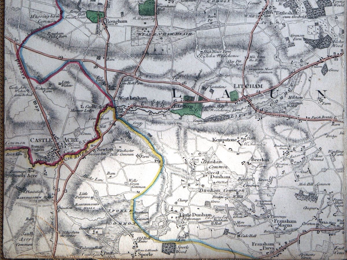
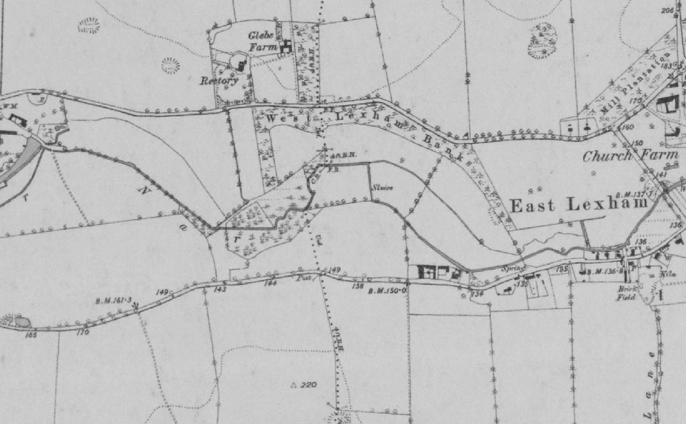
The second in my mini-series on our (Norfolk Rivers Trust) 2014 river restoration projects begins in the headwaters of the River Nar. You have to go back to Faden’s map of Norfolk to find the upper River Nar drawn with a wiggly line. It seems as if the river meandered in 1797, but was dead straight within fifty years, when the first OS series was drawn. The straight channel was progressively made deeper by maintenance dredging through the 20th Century until the upper quarter of this Norfolk chalk-stream had become more of a drainage ditch than a stream.
So, this project, like the one I described in my previous blog, was also aimed at re-meandering a much canalised river, this time in the headwaters. Only here we had no relic channel to restore, and not much in the way of reference reaches to use as a model. The entire upper river has been straightened and only in a very few places can relic meander sequences can be found:
These, however, give an idea of the meander pattern the river once had. More indicative were the more continuous meanders on the nearby Upper Tat, an almost identical size and type of stream.

But we had to dig deeper than maps to find out what the river may once have looked like and also where it once flowed. LIDAR (a satellite derived map of land level) revealed a bit more information: in the image below you can see a darker line meandering down the valley, sometimes north, sometimes south of the straight ditched course of the river. This darker area marks the true low point of the valley. The river would have meandered along this course. But in the upper reaches of the project LIDAR asked more questions than it answered. In the triangle of land in the upper right corner of the image the course of the river is invisible. There is only is a low-lying, almost marshy area furrowed with drains. This area is also marked by strange channels on the Faden map.

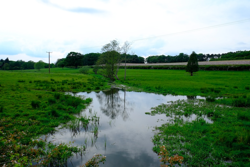
When I went to explore this patch of land, instead of finding gravel 50 cm below the level of the peat, as we normally do on the Nar, my steel pin sank time and again into the peat without once touching anything solid. I began to suspect that the very upper river was once more a series of marshy ponds than a distinct channel, kind of like the landscape I saw out of a helicopter once when crossing a wilderness landscape in Canada.

And not unlike some parts of the river as they are today:
It would have been great to peel back the edges of the ditch and create a similar landscape, but our budget and consenting authority permissions allowed only for the creation of a new channel. We decided to leave that strange corner of the river to become another project sometime in the future.
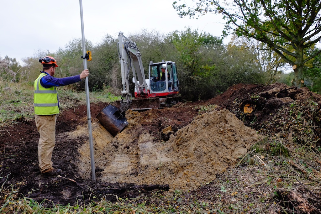
Instead, basing the meander pattern on those reference sections of the Tat, I started to plan a new meandering channel starting where the gravel came towards the surface of the floodplain … as you can see on the sketches below.
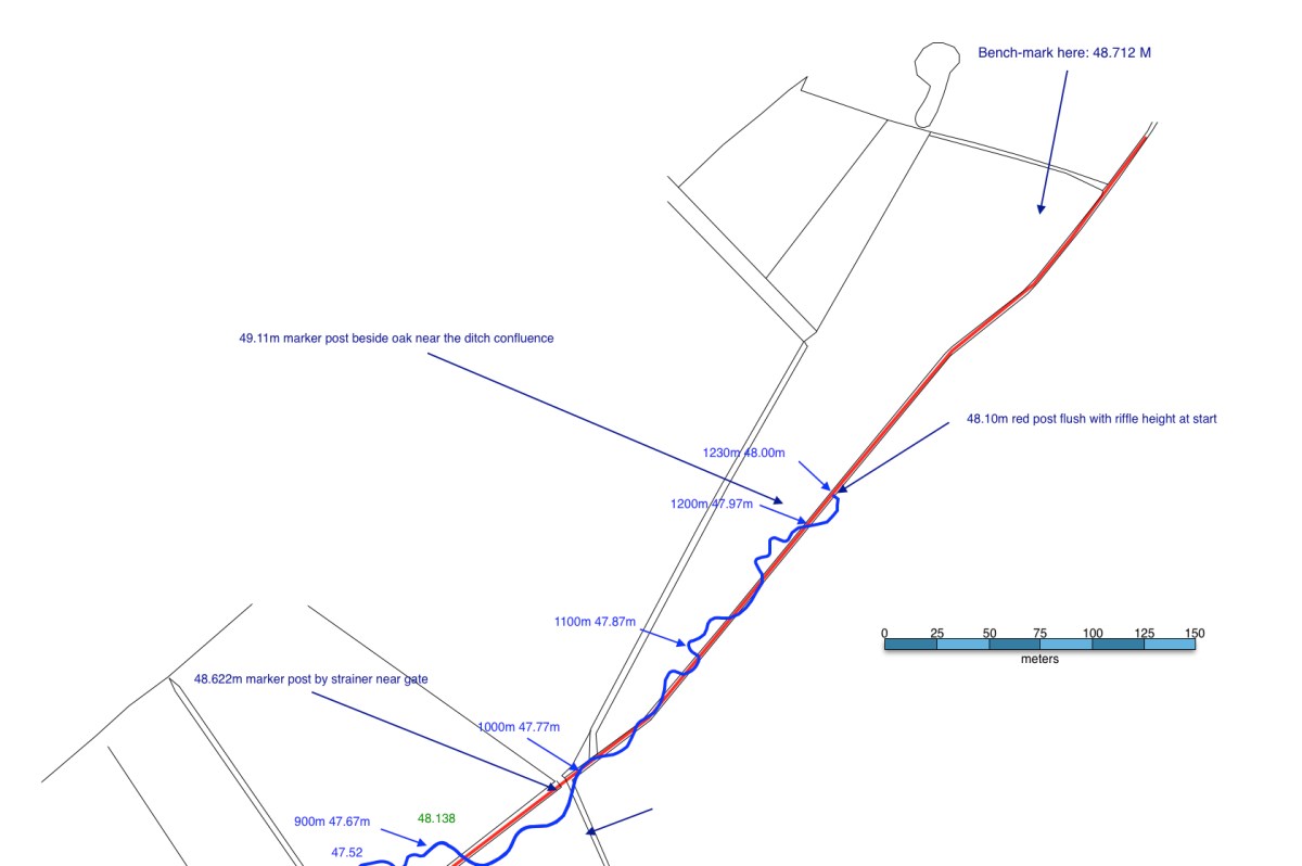

Gradient was the real issue: in spite of this reach being the headwaters of the river the landscape is very flat. Our new river had approx. 1 meter of fall in 1000 meters of distance run. In part, this was also because the new meanders made the stream much longer: 1200 meters of stream replaced 800 of ditch; and also because we kept the river bed about 50 to 60 cm below the floodplain when the bed of the ditch was as much as 1.5 meters lower. It would have helped to steal those extra centimeters of fall and return the river seamlessly into the bed of the ditch at the lower end. But that would have been cheating. As it is the lower end of our new channel will flow easily into an extension of this new “natural” channel – should the Government ever fund this scale of landscape restoration again – and in the meanwhile the river returns to the bed level of the ditch through a series of shallow (so fish can get up them) steps which we constructed using buried limbs from a fallen oak tree.
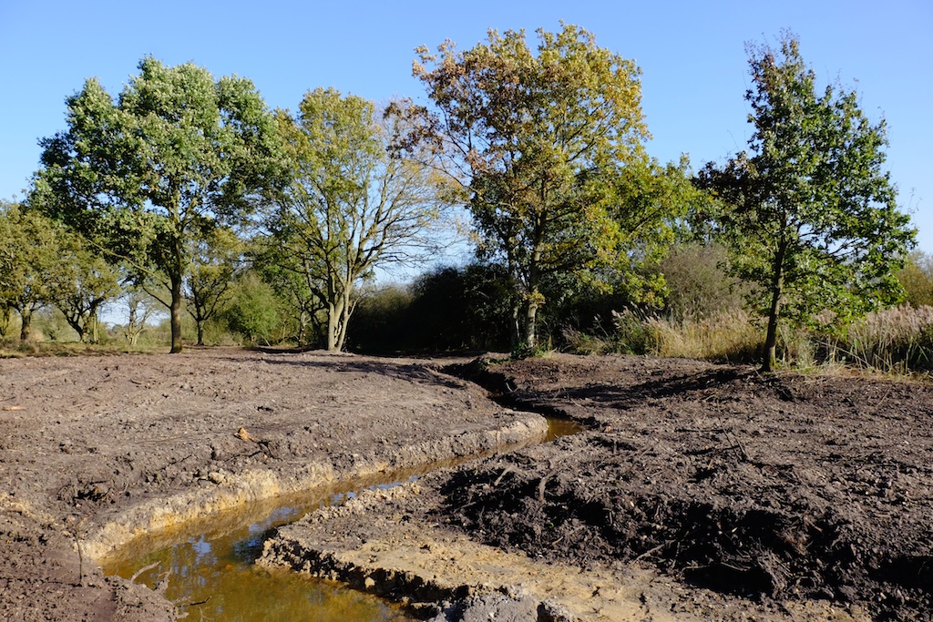
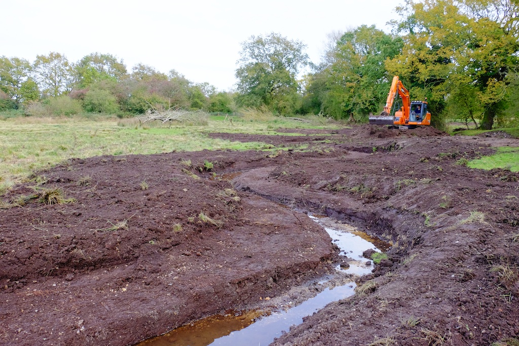
The basic river is now cut and is flowing. The rain has come and the landscape is suddenly sodden and the whole project needs to consolidate and settle. When it has we’ll add gravel to the bed of the channel to create shallow riffles and we’ll deepen some of the pools. We’ll harrow the ground and sow with an appropriate seed-mix. We’ll plant alders and oaks. Within a year I hope the place will be a new kind of watery paradise for the wildlife of the upper Nar: a meandering river with the planform and cross-sections I like to think it once had, in touch with its water-meadows. A better way entirely for a chalk-stream to start its journey to the sea.
Thanks to all those involved: the land-owners and the Common Trustees, the Norfolk Rivers Trust, WWF and Coca Cola, Natural England, Norfolk Rivers Drainage Board, Richard Hey, Tom Moore, Acorn Tree Services and of course Jason Lovering and Jonah from Five Rivers Environmental Consultancy who worked long days for four weeks to get it all done before the rain arrived.