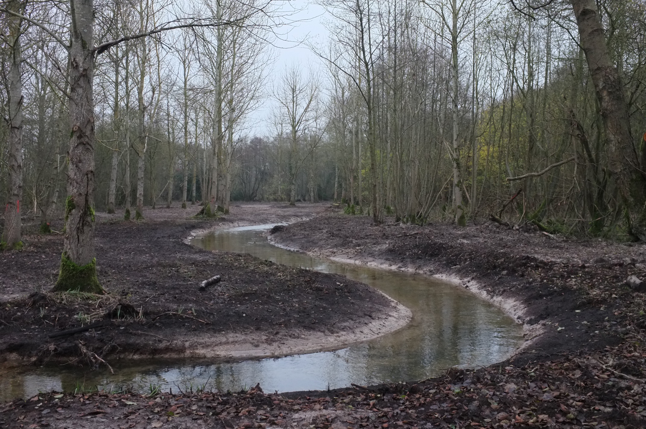
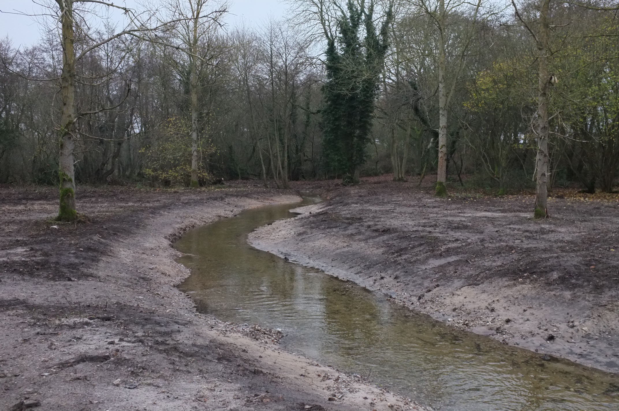
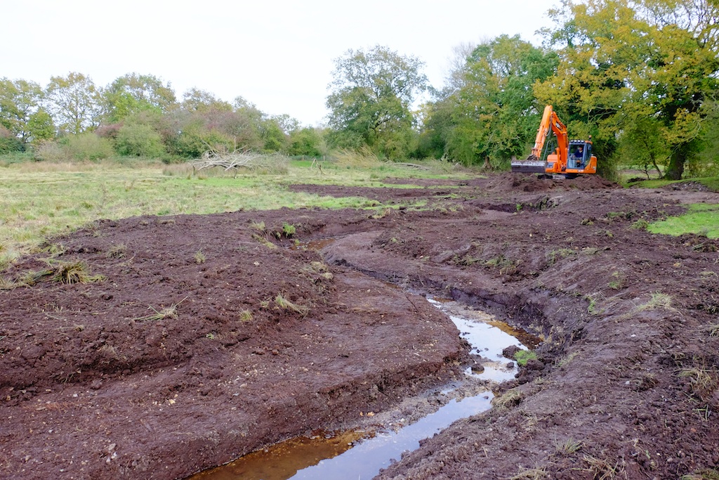
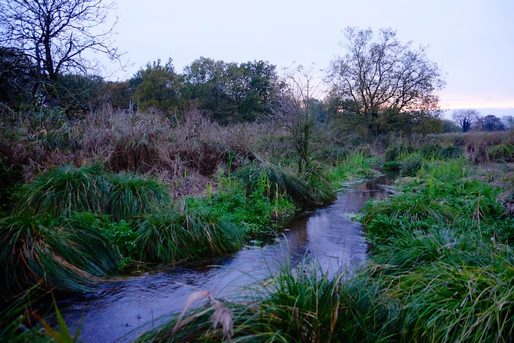
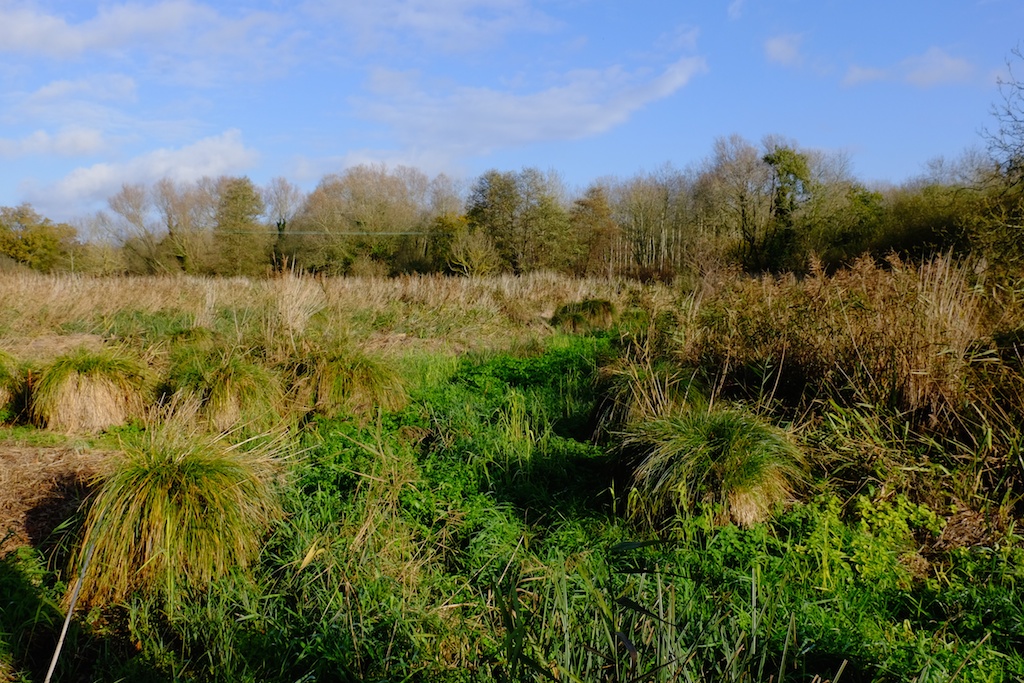
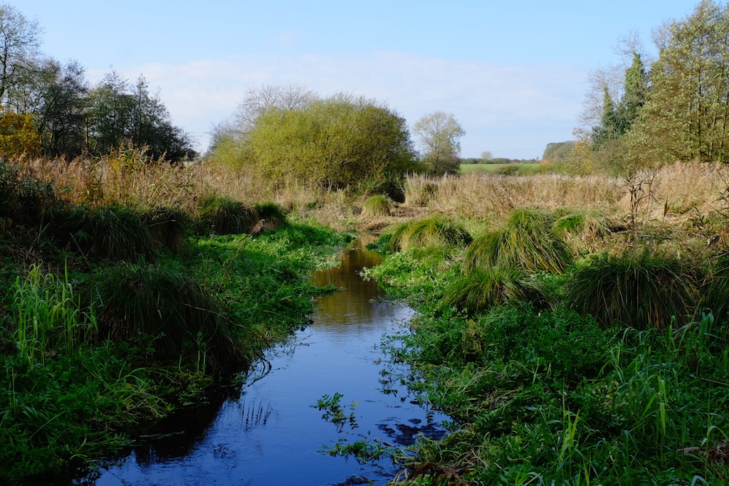
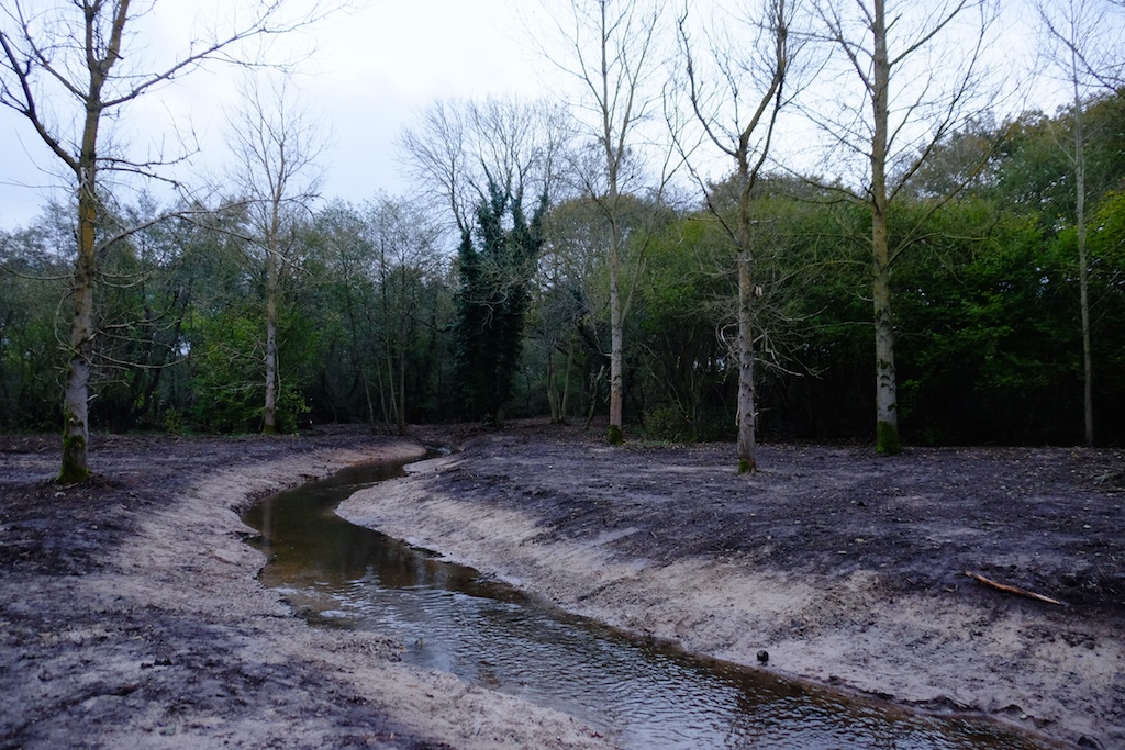
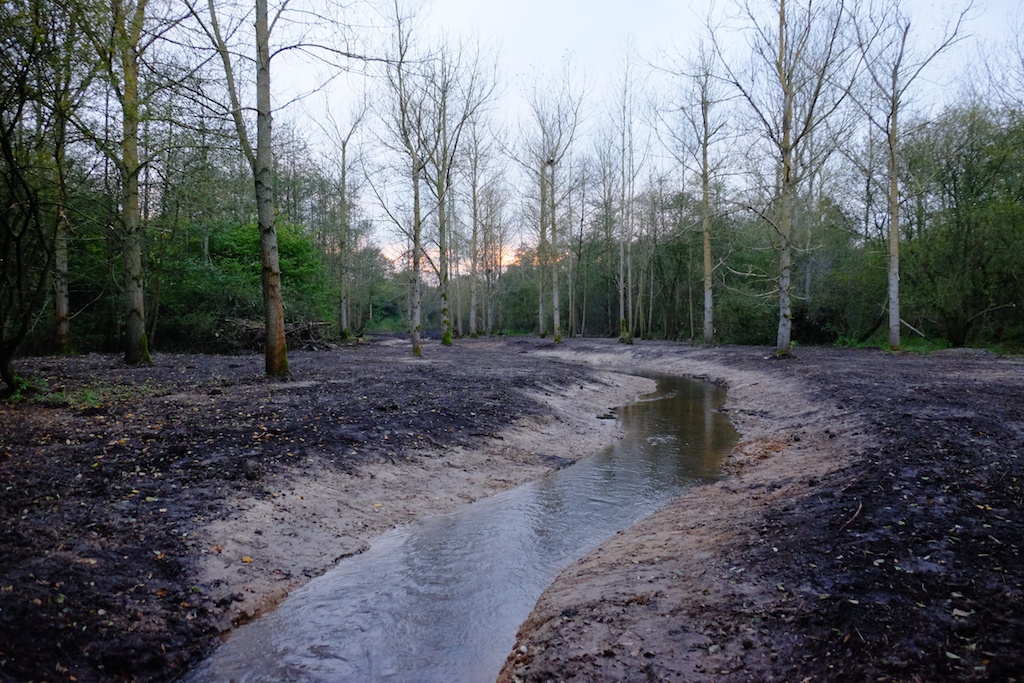
This is a set of before-and-after images from a river recreation project at Emmanuel’s Common on the River Nar.
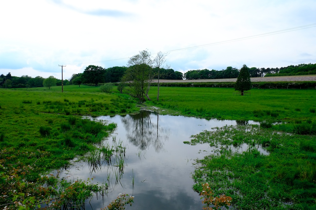
This is a brand-new river channel cut to connect a restored set of natural meanders (pictured above) with the main river. These pictures are taken more or less one year apart, immediately after the project was finished last winter and on 26th December 2015.
The new channel is full of brown trout and all the in-stream and riparian plants – including good stands of ranunculus and starwort – are self-sown. For more details see the link at the foot of the page.
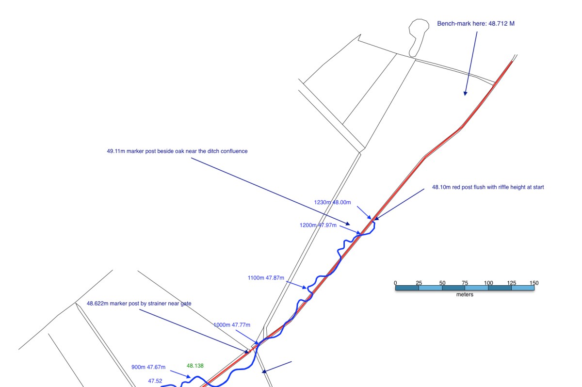
I recently compiled my best attempt at a complete index of all the English chalk-streams, partly to satisfy my own cataloguing obsession, partly because it was needed for WWF’s new report State of England’s Chalk-Streams 2014.
I’m often asked “What is a chalk-stream?” It is a difficult question to answer quickly. Chalk-streams are created by geology, the geology of England is complex and chalk-streams vary so much in character.
I worked on this index with Dr Haydon Bailey, a geologist with a keen interest in chalk, and we have started to sketch out some geological categorisations that help to shed light on those differences and show that what we have, in reality, is a spectrum of pure chalk-streams and chalk-influenced rivers.
In time I will work this index into a series of catchment-based maps, which will include those geological sub-categorisations on which Haydon and I will do more work.
The index is certainly not complete. Already I have been promised updates for Buckinghamshire! Please send feedback to me at the contact email on this blog and I will include corrections and additions and credit the contributors.
In the meanwhile, I hope this index proves a useful resource for those who are interested in the conservation of English chalk-streams.
To make sense of the lay-out, please read the notes on the lay-out at the head of the index.
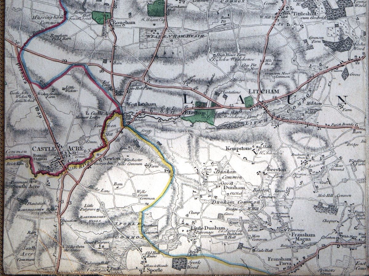
From Faden’s 1797 map of Norfolk showing a meandering upper River Nar
The second in my mini-series on our (Norfolk Rivers Trust) 2014 river restoration projects begins in the headwaters of the River Nar. You have to go back to Faden’s map of Norfolk to find the upper River Nar drawn with a wiggly line. It seems as if the river meandered in 1797, but was dead straight within fifty years, when the first OS series was drawn. The straight channel was progressively made deeper by maintenance dredging through the 20th Century until the upper quarter of this Norfolk chalk-stream had become more of a drainage ditch than a stream.
So, this project, like the one I described in my previous blog, was also aimed at re-meandering a much canalised river, this time in the headwaters. Only here we had no relic channel to restore, and not much in the way of reference reaches to use as a model. The entire upper river has been straightened and only in a very few places can relic meander sequences can be found:
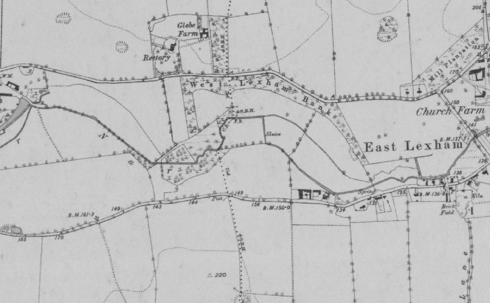
There’s a relic meander in the wood in the centre of the map: only a handful of these exist on the entire upper river.
These, however, give an idea of the meander pattern the river once had. More indicative were the more continuous meanders on the nearby Upper Tat, an almost identical size and type of stream.
Natural meanders on the River Tat
But we had to dig deeper than maps to find out what the river may once have looked like and also where it once flowed. LIDAR (a satellite derived map of land level) revealed a bit more information: in the image below you can see a darker line meandering down the valley, sometimes north, sometimes south of the straight ditched course of the river. This darker area marks the true low point of the valley. The river would have meandered along this course. But in the upper reaches of the project LIDAR asked more questions than it answered. In the triangle of land in the upper right corner of the image the course of the river is invisible. There is only is a low-lying, almost marshy area furrowed with drains. This area is also marked by strange channels on the Faden map.
When I went to explore this patch of land, instead of finding gravel 50 cm below the level of the peat, as we normally do on the Nar, my steel pin sank time and again into the peat without once touching anything solid. I began to suspect that the very upper river was once more a series of marshy ponds than a distinct channel, kind of like the landscape I saw out of a helicopter once when crossing a wilderness landscape in Canada.
Not a chalky landscape, but swap the fir trees for alders, oak and willow and perhaps parts of the upper River Nar looked a little like this: a series of marshy ponds with a stream meandering through them.
And not unlike some parts of the river as they are today:
The River Nar morphing from a stream to a pond to a stream again
It would have been great to peel back the edges of the ditch and create a similar landscape, but our budget and consenting authority permissions allowed only for the creation of a new channel. We decided to leave that strange corner of the river to become another project sometime in the future.
Instead, basing the meander pattern on those reference sections of the Tat, I started to plan a new meandering channel starting where the gravel came towards the surface of the floodplain … as you can see on the sketches below.
Re-meander Plan1: the direction of flow is from north-east to south-west. The channel starts where the gravel came back towards the surface of the floodplain.Re-meander Plan2: a continuation of the river from Plan1.
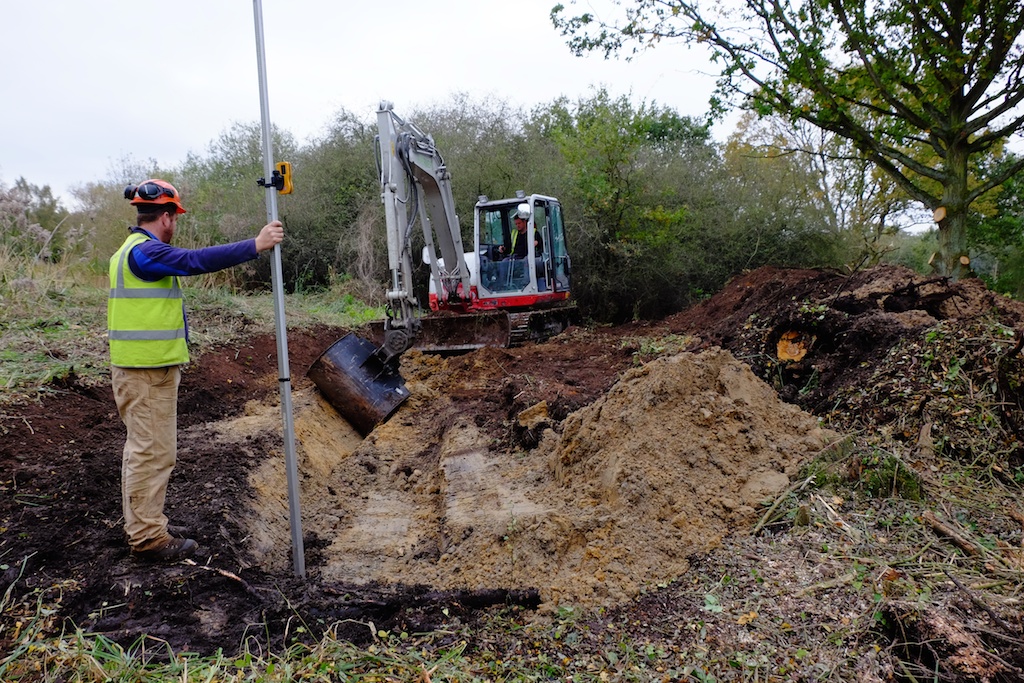
Gradient was the real issue: in spite of this reach being the headwaters of the river the landscape is very flat. Our new river had approx. 1 meter of fall in 1000 meters of distance run. In part, this was also because the new meanders made the stream much longer: 1200 meters of stream replaced 800 of ditch; and also because we kept the river bed about 50 to 60 cm below the floodplain when the bed of the ditch was as much as 1.5 meters lower. It would have helped to steal those extra centimeters of fall and return the river seamlessly into the bed of the ditch at the lower end. But that would have been cheating. As it is the lower end of our new channel will flow easily into an extension of this new “natural” channel – should the Government ever fund this scale of landscape restoration again – and in the meanwhile the river returns to the bed level of the ditch through a series of shallow (so fish can get up them) steps which we constructed using buried limbs from a fallen oak tree.
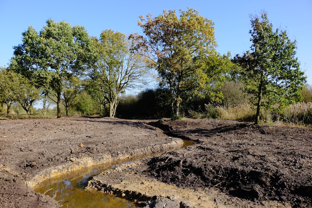
The basic river is now cut and is flowing. The rain has come and the landscape is suddenly sodden and the whole project needs to consolidate and settle. When it has we’ll add gravel to the bed of the channel to create shallow riffles and we’ll deepen some of the pools. We’ll harrow the ground and sow with an appropriate seed-mix. We’ll plant alders and oaks. Within a year I hope the place will be a new kind of watery paradise for the wildlife of the upper Nar: a meandering river with the planform and cross-sections I like to think it once had, in touch with its water-meadows. A better way entirely for a chalk-stream to start its journey to the sea.
Thanks to all those involved: the land-owners and the Common Trustees, the Norfolk Rivers Trust, WWF and Coca Cola, Natural England, Norfolk Rivers Drainage Board, Richard Hey, Tom Moore, Acorn Tree Services and of course Jason Lovering and Jonah from Five Rivers Environmental Consultancy who worked long days for four weeks to get it all done before the rain arrived.
The old ditch which formed, until recently, the headwaters of the River Nar. It was arrow straight and divorced the river from the flood-plain.Another image of the upper River Nar in its 19th Century ditch.It was hard to find reference sections on the old ditch, but Richard Hey showed me how the slightest of bends will create an emergent shelf within a dredged channel, which can then be used to estimate the ‘bank-full’ cross section of the natural river.The project begins: the ditch is to the right (temporarily backed up by the works) the first turn on the new meandering course is to the left. That’s Jason Lovering of Five Rivers at the controls.Setting the level: 48 AOD at the start, 46.5 approx 1200 meters downstream. In the upper reaches the channel is approx. 1m wide and 30 to 40 cm deep. Lower down 1.25 to 1.4m wide and 40 to 50 cm deep.The new channel starting to take shape: the ditch is to the left.Another view of the emerging channel.The line of the ditch is to the left, the old course of the channel runs through this meadow ahead just about discernible in the low ground.The same view a few days later: it looks drastic (and waterless) right now, but should look fabulous in 12 months time!The same view looking back upstreamThe new channel with water in it a few days later.The lower reaches of the new channel, over 1km downstream from the starting point. The grassy tussocks in the meadow were a good indication of where the original channel had once been.The old ditch has now become a series of linear ponds backed up by each crossing point of the restored river channel, and these ponds will become a habitat feature in their own right.
The first in a series of blogs for river restorationists. The reason why nothing has appeared on here for the past four months: I’ve been a bit busy helping the Norfolk Rivers Trust deliver a handful of river restoration projects on the River Nar. This one at a site near Castle Acre will start the series because today is the birthday, or rather the re-incarnation day of a lost river. The aerial photo (1946) below shows a part of the River Nar which was changed from its natural course hundreds of years ago when the mill-leat for the downstream mill was cut: the straight channel flowing down the west (left) side of the image. Look east a few yards however and you’ll see evidence in the ground of the abandoned river. In fact it was left there, unfilled and unchanged from the day it was cut off by the leat until today, the 11th of November 2014.
This relic channel is a true rarity on English chalk-streams. More or less every yard of every river has been modified for one reason or another. To find five hundred yards left more or less as the Ice-Age made them was the rivery equivalent of finding the tomb of Tutankhamun. The relic channel was cut off at its upper end and at the lower end was joined to the mill-leat by another straight, man-made channel. This project then was about re-instating the old channel by creating a short linking channel upstream and a longer more natural one re-connecting back to the meandering part of the main river downstream.
The lower channel accounted for 80% of the project time. The available route passed through a slightly raised part of the flood-plain and in the middle reaches it was a challenge to peel away enough ground to make the correct, naturally shallow cross-section. There was little fall to play with too and the main river to which the new channel returned has been dredged (a future project will be sorting that out) and so tuning the gradient proved very tricky. It was worth the effort though. When the flows finally broke through the new channel worked perfectly, with good velocity and no unintentional impoundments.
Restoring the relic channel was as close to actual river restoration as is possible: like peeling varnish off an old painting. A delicate job if the painting is not to be damaged. In practice we went so lightly that it was quite easy. Helen Mandley supervised with an eagle eye and Wayne on the digger performed with great sensitivity. See the photos below for the fuller picture. Amazingly there was very little sediment in the relic channel. Within an hour the flows had scoured their way to the gravel.
Some will know that Nigel Holmes sadly passed away a few weeks ago: it may well have been Nigel who first identified this as potential restoration project in a report (which he co-authored) commissioned by English Nature about ten years ago. This project has been a team effort over the years and Nigel’s early involvement is a reminder of that. I’m sure he would have been chuffed to see it come to fruition. The delivery team included WWF and Coca Cola as sponsors, the Norfolk Rivers Trust as planners and supervisors (Helen Mandley ran the project, and I was there to help fret about gradients, planforms and cross-sections), the Norfolk Rivers Drainage Board (machinery and delivery – thanks to Adrian, Wayne and Graham), Richard Hey, Holkham Estate, The Castle Acre Fishing Club, Natural England and others.
The red lines mark the new connecting channels. The blue lines mark the “lost” relic channel.The old mill leat. The channel is too wide and straight and has been dredged in places too: which is why it is over-run with burr-reed, while the river tries to establish a more appropriately-sized channel along one edge.This is the ground which the new connecting channel was cut through at the lower end of the project: an old poplar plantation and defunct pheasant pen.The relic channel under the trees. The water in this image is just flood-plain seepage, which amounted to just enough flow to keep the channel viable for the past two centuries. Note the shallow profile of the un-modified banks. The channel is shallow too, only 30 cm deep, with a bed of hard gravel under a thin layer of sediment.The relic channel in the open meadow. Here the old river is almost lost under vegetation, although in practice it was quite easy to uncover it. Note the shallow banks and the fabulous tussocks which the river meanders between. The bed is hard gravel in a shallow channel under a thin layer of sediment.The relic channel revealed. Without touching the bed or banks the weed was peeled aside and folded over onto the edges of the stream.Helen Mandley of the Norfolk Rivers Trust making sure the digger doesn’t damage the bed of the relic channel. The operation was a wetter version of peeling varnish of an old painting: just enough to reveal what’s underneath.The new channel flowing where the pheasant pen used to be. Still something of a moonscape it will be softened in due course by large woody debris and plants in and along the edges of the channel. The important thing was to replicate the dimensions and planform of the relic channel upstream. Establishing half-a-dozen subtle riffles when there was very little fall to play with was quite a challenge, as was creating shallow banks when the floodplain on the available route was slightly higher than ideal.Another view of the new channel.A wonderful moment: the relic channel flowing as the main River Nar for the first time in about two hundred years. It looks happy!The same wonderful moment upstream: the river looks almost pre-historic. This is a very special site now: a reference reach of an unmodified English chalk-stream. Hen’s teeth are more common.
Monday morning 4th August and the next phase in the restoration of a small Norfolk chalk-stream begins. 3.5 km in two months, all being well.
Last year we (the Norfolk Rivers Trust working with Cain BioEngineering) took on a similar length – 3.5 km of straight and over-wide channel and did our best to replicate in two months what would have taken hurricanes and beavers (if we had them) two hundred years. You’ll get the idea from these before and after pictures: we felled trees and used them to rebuild a more natural, meandering channel.
It sounds simple enough. But why bother? Over the centuries chalk streams have been straightened, deepened and widened: for milling, for navigation, to construct water-meadows (a 17th Century technique for boosting farm productivity by flooding the floodplain) or to make them into drains (a 20th century technique for boosting farm productivity by draining the floodplain). The cumulative impact of all this modification has been to change our chalk-streams from the naturally meandering rivers they once were into uniform, over-wide and over deep canals.
Using trees to rebuild the meandering, low-lying riverbanks that a chalk stream should flow within brings a host of improvements to the habitat and eco-system. In the restored channel the water flows more quickly. The swifter flows scour the bed of stream so that there is clean gravel instead of deep mud. The faster flows favour weeds like ranunculus and starwort which help maintain a cleaner river, and provide better habitat for fish and insects. Along the shallow, wet margins reeds and grasses flourish and these also provide habitat for insects, birds and mammals. Selectively felling trees helps too, especially in the sort of semi-commercial forestry that borders a lot of our rivers: the ideal is the dappled sunlight and shade you’d find in a natural, mature flood-plain wood.
Altogether this carefully choreographed imitation of a small hurricane can absolutely transform a chalk stream, as these photographs show. The changes illustrated here have taken less than a year to evolve. In five or ten years the woody banks will have disappeared beneath trapped silt and vegetation and flowing through the middle will be a smaller and much healthier river.