Back in the summer we received a letter from Defra and Minister Hardy about the government’s plans for chalk streams, after they abandoned the long-promised chalk streams recovery pack. I wrote about that letter HERE.
Twice recently I’ve been asked to summarise what could be done that would be ecologically effective and cost-effective. As ever, it’s the cost of protecting nature that sets the pace. The answer is no more than I have written about before, because the ideas were always cost-effective. But perhaps if I express it all as a very simple, rounded package that could be started immediately in at least one – if not two – major catchments: London’s Rivers Colne and Lea. It goes like this:
Re-naturalise flows by relocating abstraction
Take the chalk streams off the sewage discharge system and repurpose the small sewage works as stormwater storage
Re-meander the rivers, especially in public spaces, and in so doing boost biodiversity, flood management and carbon sequestration.
In my view this would be a total no-brainer and I can’t understand why we’re banging on about water company bosses doing jail time, when we could actually get on with fixing things.
Recovery of healthy flows
It starts with Chalk Streams First. A very simple and cost-effective way to re-naturalise flows in those very heavily abstracted chalk streams around London and Cambridge. Chalk Streams First relocates abstraction from upper catchment groundwater to lower catchment surface flow and allows the chalk stream first use of the water, all without a significant loss to public water supply. It’s chalk stream cake-ism.
An ongoing process called the National Framework (NF) has identified the deficits to good ecological flow in all of England’s rivers. The water companies, NF regional groups and Ofwat RAPID are developing multi-decadal strategies for water supply, security and environmental protection and restoration, including addressing those deficits to good flows. The smorgasbord of options at their disposal includes reservoirs, pipelines, desalination plants, recycling etc. We should see Chalk Streams First as another major one of these “strategic options”.
Conceptually, CSF, works by greatly reducing groundwater abstraction in the upper reaches of chalk streams. This leads to flow recovery, as the groundwater bounces back up. Generally speaking around 85% of the reduction recovers to the river as surface flow (some is lost as aquifer throughflow and some as evapotranspiration). This re-naturalises the flow in the chalk stream and the extra flow can be taken as surface abstraction much lower down the river system from the reaches where the ecology is less flow dependent. The water is then stored in reservoirs and piped to the places formerly supplied by the groundwater abstraction.
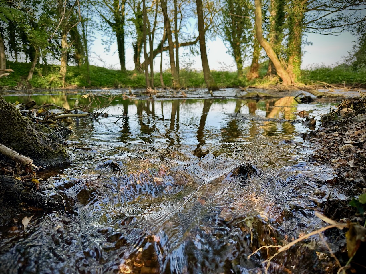
Dorset’s River Piddle is one shining example of what happens when flows are re-naturalised. This exact spot used to dry up regularly when abstraction was at its peak in the 1980s
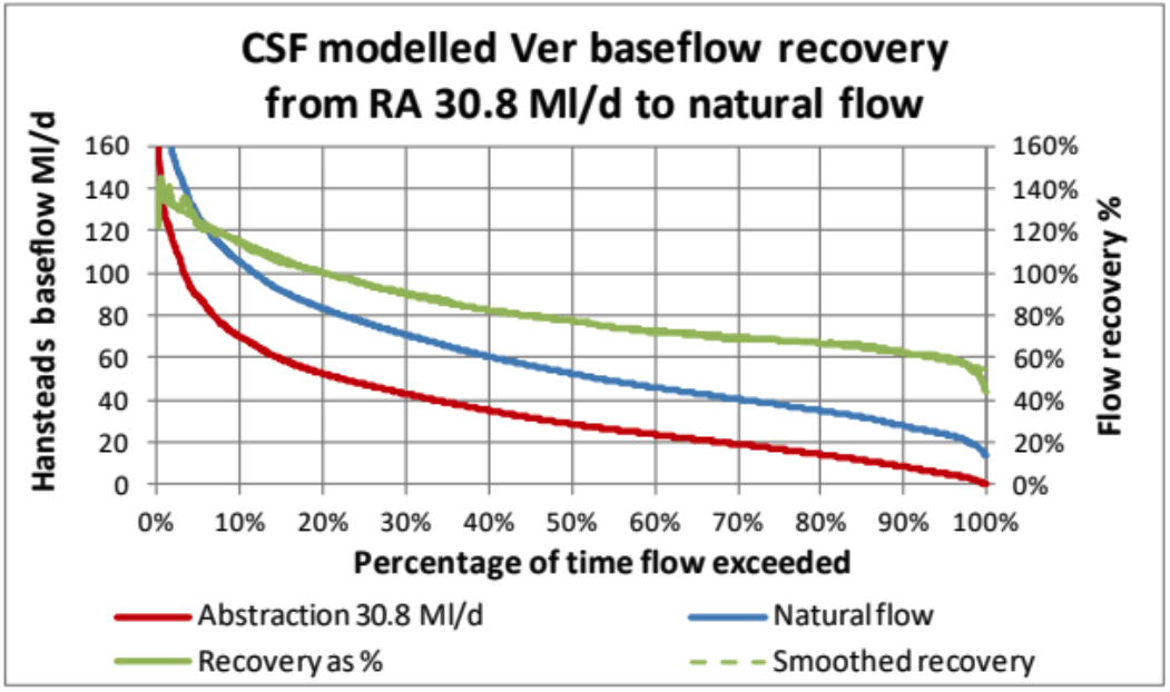
There is a caveat: the flow recovery is not evenly spread through the year. It is much higher in winter, well over 100%, and commensurately lower in the summer. This leaves you with a summer shortfall, hence the need for a reservoir. In times of extreme drought, the flow recovery would be minimal and public supply threatened.
Ensuring public water supply in droughts
This is where you bring in the concept of a public supply groundwater back-up. Counter intuitively, it is during the drought that you draw on groundwater abstraction to make up the shortfall. Essentially you temporarily mine the aquifer (taking water from aquifer storage in the midst of the drought) and use the chalk streams as the means of delivery from the point of groundwater abstraction to the point of surface water abstraction. The scheme runs for just long enough to get you through the drought.
This actually protects the chalk streams with boosted flows in the drought, though this protection is a bi-product, not the purpose. It leads to slower aquifer recovery in the following winter and perhaps lower than normal flows the following year. In spite of that, the chalk streams flows throughout are still much better than they would be under our existing, chronic abstraction scenarios. A scheme like this already exists: the West Berkshire Groundwater Scheme run by Thames Water. It has been needed only a couple of times in the past 25 years and even then only briefly.
Essentially, Chalk Streams First allows us to re-naturalise flows in chalk streams without a significant loss to public water supply.
Using Chalk Streams First to solve our sewage crisis

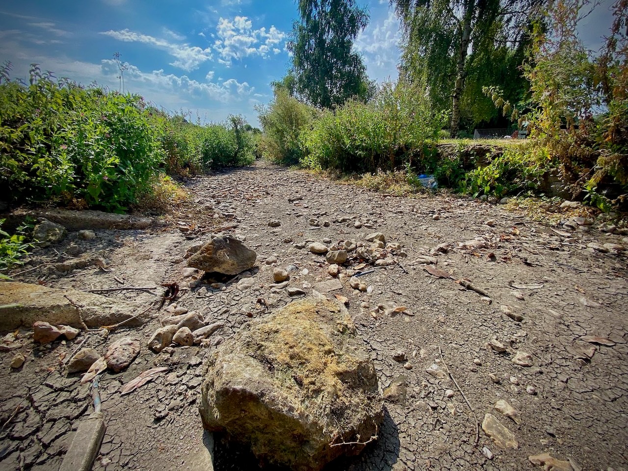
Isaac Walton’s beloved River Lea doesn’t really exist upstream of Luton sewage works. Is there a future world where it meanders healthily through Leagrave Park, while the sewage is piped down the valley to much more technically advanced treatment works?
There’s ANOTHER dimension to the Chalk Streams First idea that has been unsung thus far, but which could be THE answer to the 24/7 inflow of nutrient rich and scantily treated sewage water to the upper reaches of our chalk streams from sewage works that are otherwise very expensive to upgrade. The brutal truth at the moment is that many to most of the chalk streams in heavily developed catchments actually need sewage discharges to meet flow targets. The Lea doesn’t really start life until the Luton works outfall. But re-naturalised flows driven by the aquifer would mean our streams are no longer dependent on sewage discharges for flow.
This will give us a solution to the thus far impossible issue of getting cost-effective phosphorus stripping to small-scale sewage works in the upper reaches of rivers. The water industry has actually done a lot to reduce phosphorus discharges, but the laws and incentives have been constructed in such a way as to drive all the investment to very large treatment works. The smaller works get left behind, even though they create the greatest problem in the most ecologically sensitive places.
Chalk Streams First means we could take our chalk streams off the water supply AND discharge circuit altogether. If we no longer need discharges for flow, the small sewage works that currently exist can all be connected and piped down the valley to larger works. Each STW that comes off-line as a treatment works can then be repurposed as storm storage facility, providing a series of buffers in the system.

If flows were re-naturalised we would no longer need sewage discharges to meet flow targets in our chalk stream headwaters and upper reaches. We could take our chalk streams off-line and treat all the water in larger works further down the valleys. Small sewage works could be re-purposed as stormwater storage areas, placing buffers in a daisy chain down the system.
Re-meander the streams, increase biodiversity and store carbon
Finally, you add to the above the comparatively cost effective physical restoration of streams that have been greatly modified over the centuries. Natural chalk stream floodplains are potentially vast carbon sinks, but we’ve dried them out and corralled our chalk streams into canalised straitjackets. I’ve just completed a raft of proposals along these lines for chalk streams in Norfolk and as part of that process reviewed the costs per mile of large-scale re-meandering and floodplain restoration. The numbers – £100 to £350K per mile – seem high, until you compare them to other numbers and reflect on the way in which restoration on this scale adds up to genuine and massive gains in biodiversity, natural flood management and carbon capture. By comparison, it costs well over £2 million to resource a 1-megalitre per day water supply.
Put those three measures together and you have the chalk streams of the future, once we get a government sensible enough to see the potential.
We live in hope.
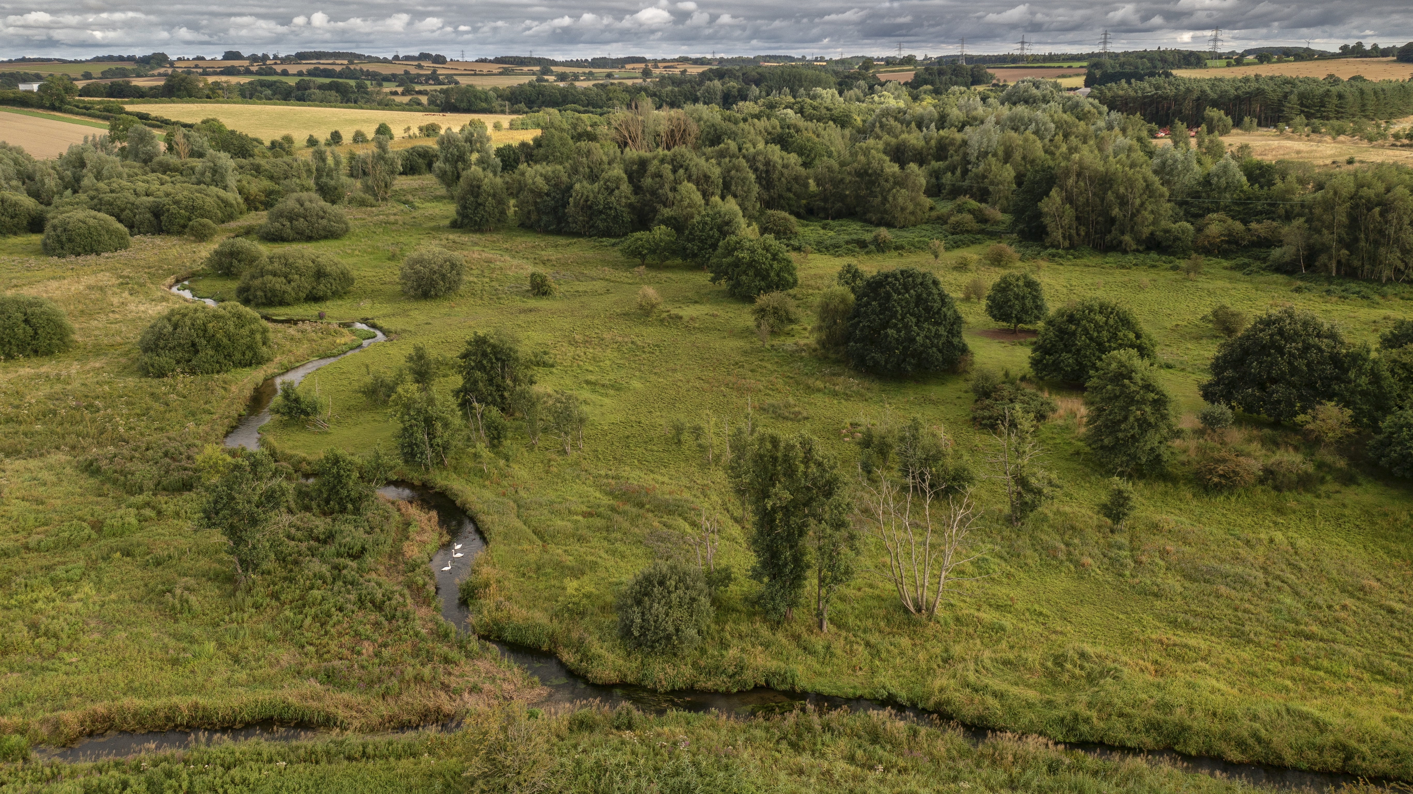
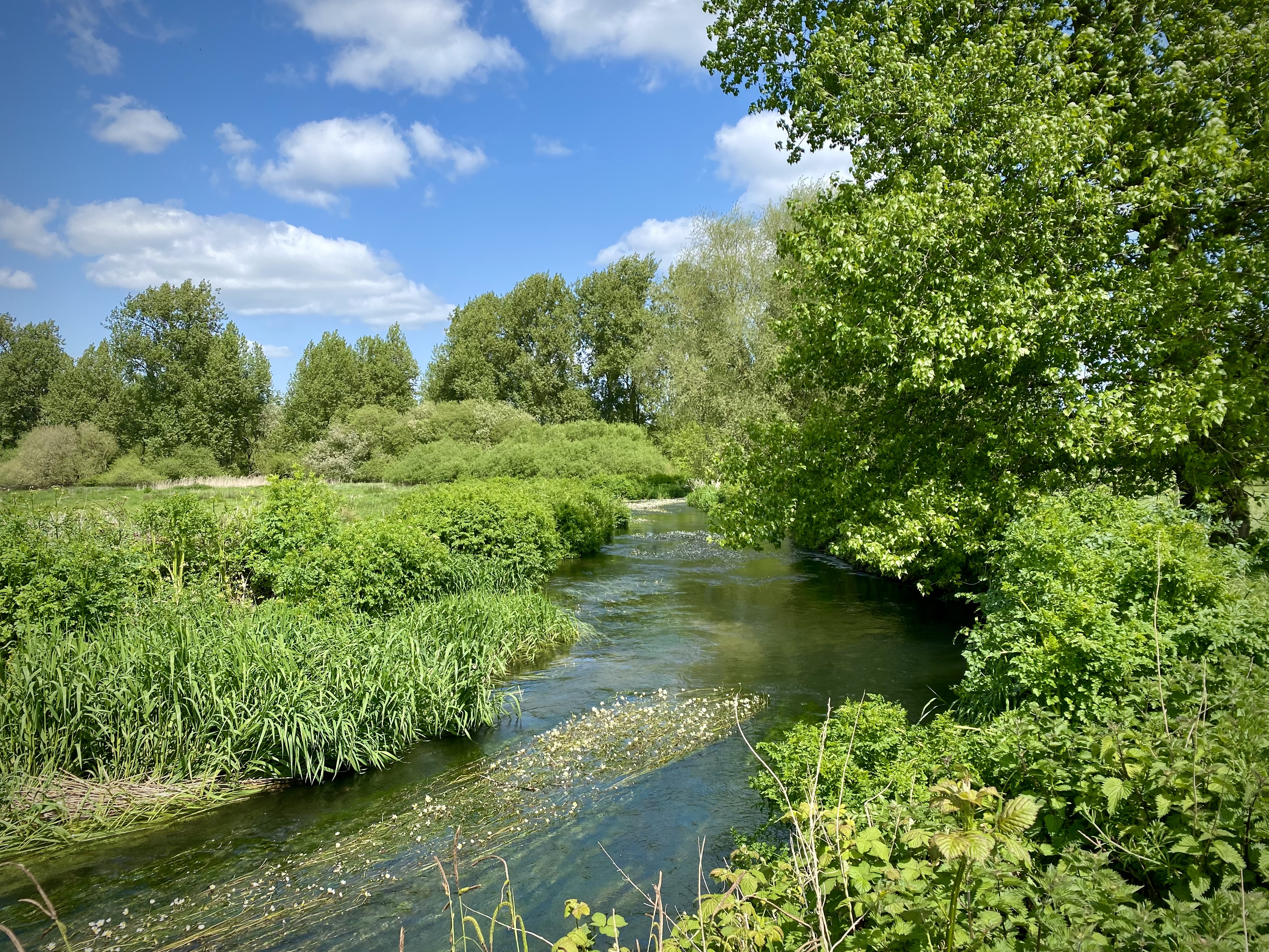
This lovely image by photographer Charlie Hamilton-James is of a re-meandered chalk stream in Norfolk. There’s no reason why we shouldn’t roll out this sort of stream and floodplain recovery in public spaces and parks in the chalk landscapes all round the Chilterns and London, boosting biodiversity, flood resilience and carbon sequestration.