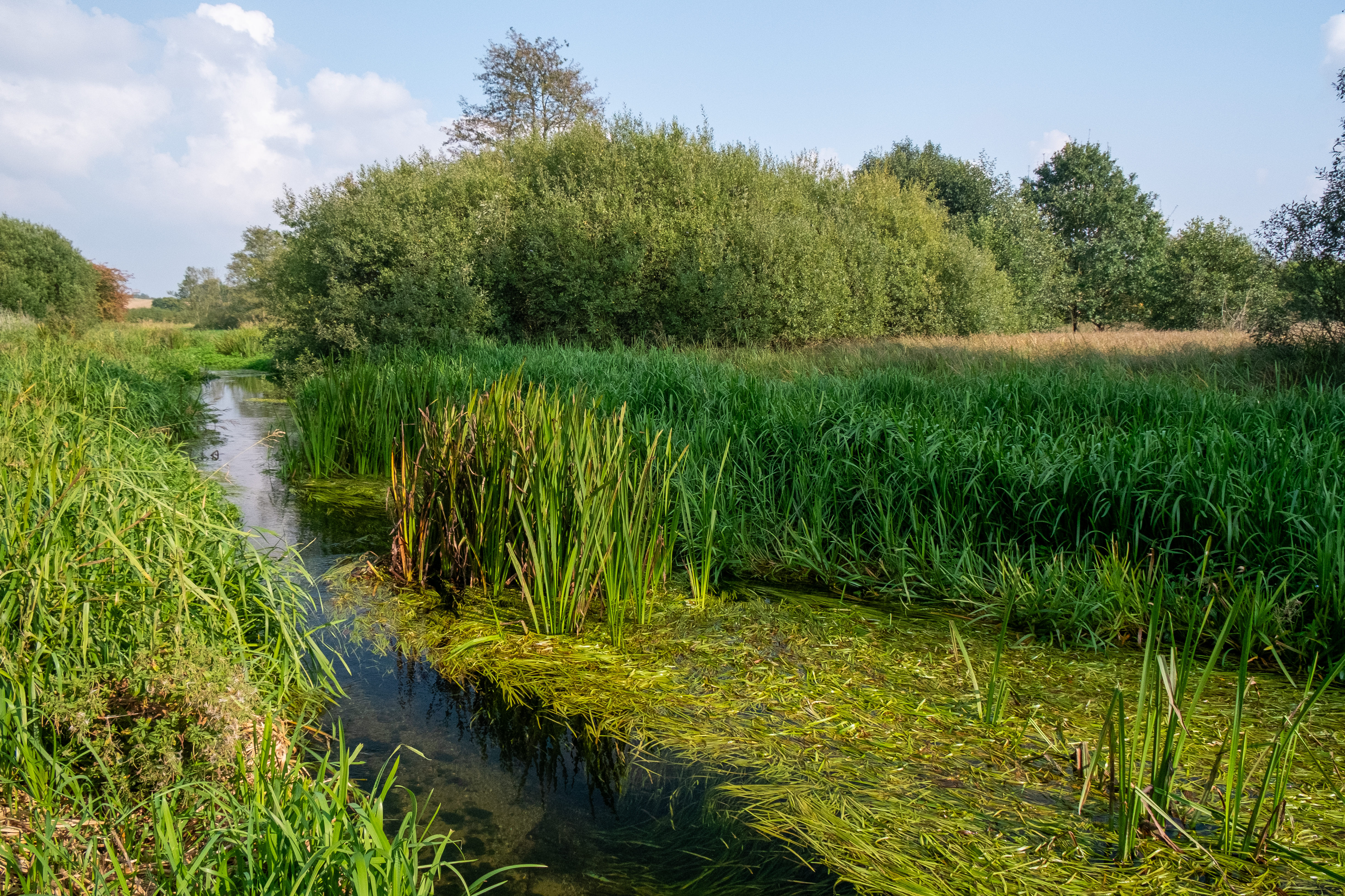
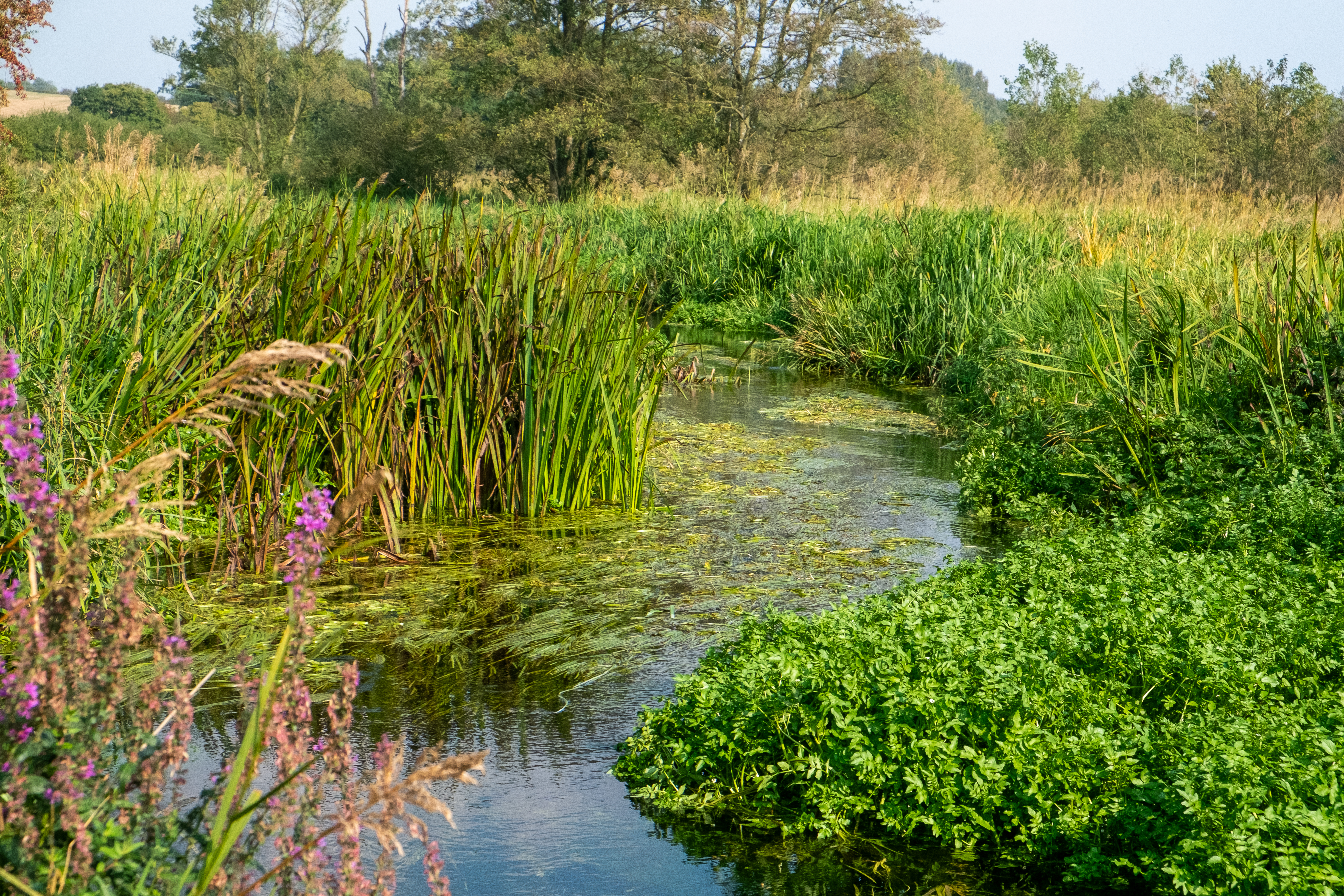
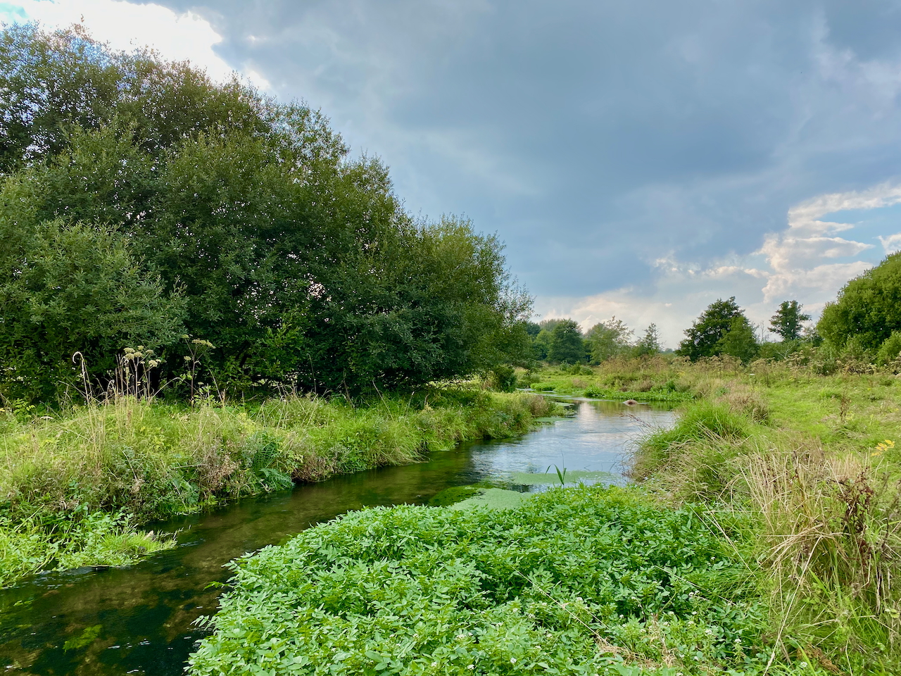
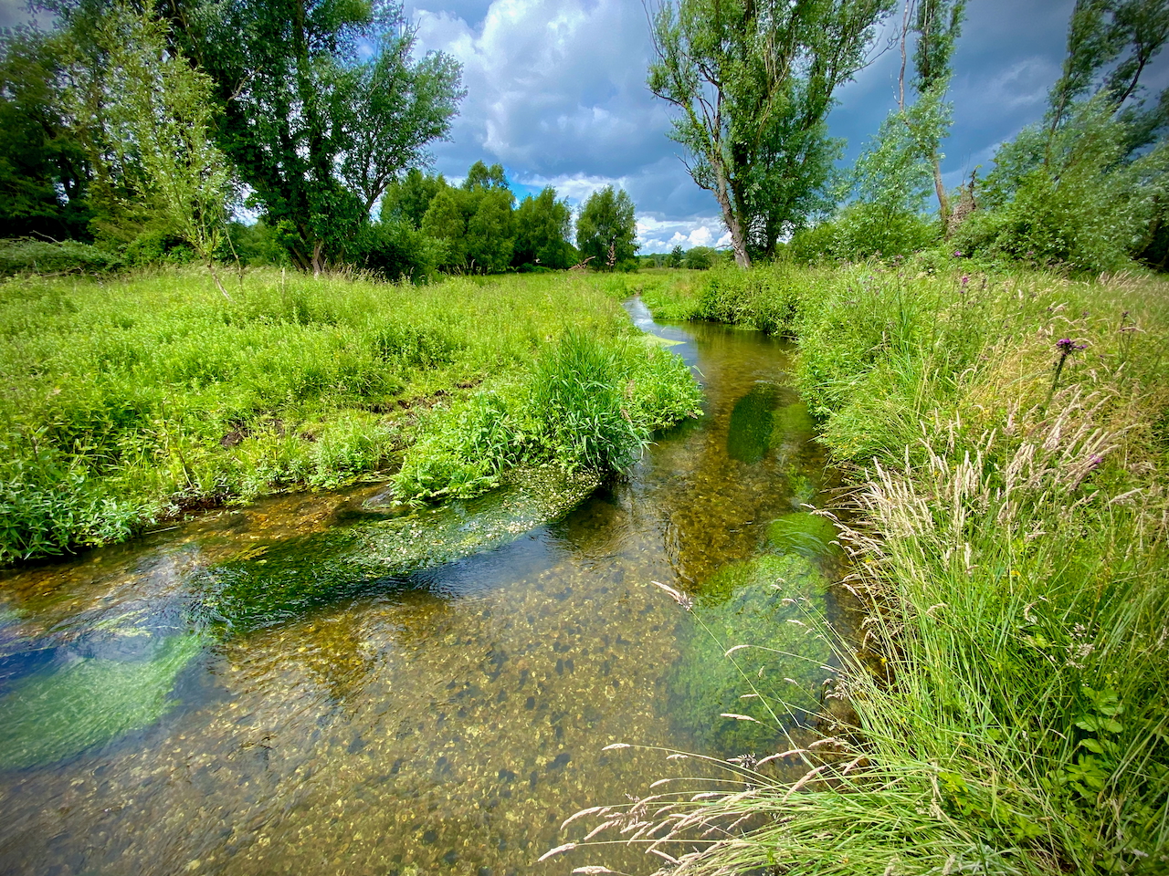
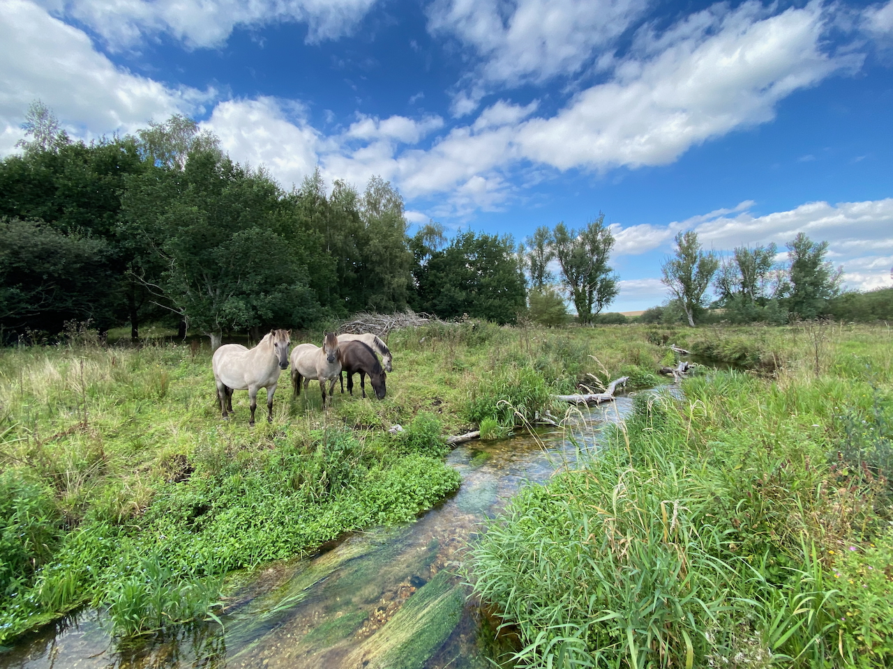
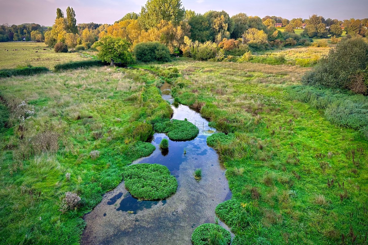
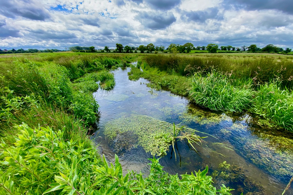
XYZ

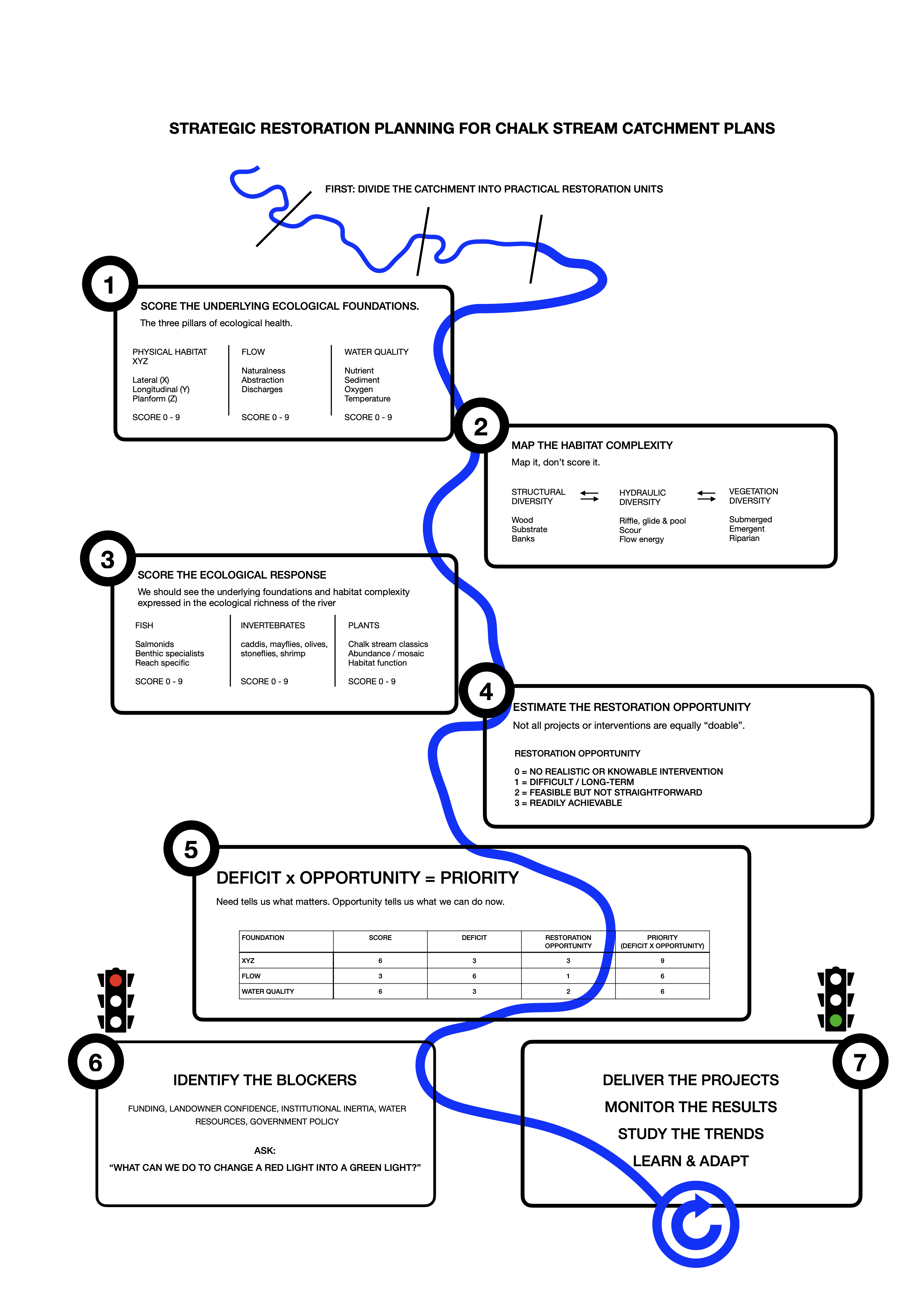
In the last post I outlined a simple way of trying put together a sensibly ordered catchment restoration strategy by scoring the underlying foundations at a reach scale – habitat, flow and water quality – working out where the deficits are, working out the feasibility of addressing each of them, multiplying one by the other and arriving at a strategic order of projects.

A few of the other slides I showed to the Test and Itchen group outlined in broad-brush terms how it might look at a catchment level with a look at the River Anton as an example. I’ll put those slides in the next post.

The first thing to look at in a little more detail, however, is the underlying foundation of physical habitat, that can be broken down into three physical dimensions that I call the XYZ. Lateral (X) and longitudinal (Y) connectivity and planform (Z). In my view, these foundational elements are THE most important thing of all, because they very largely determine whether and to what extent a dynamic, varied habitat can form (all the pools, riffles, undercuts etc).

Most chalk streams have been modified in ways that remove or undermine the XYZ.

X

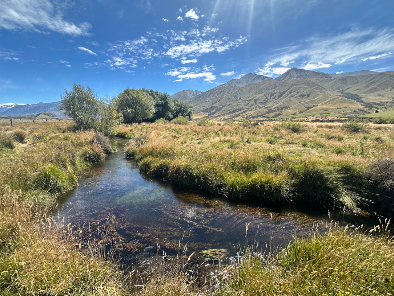
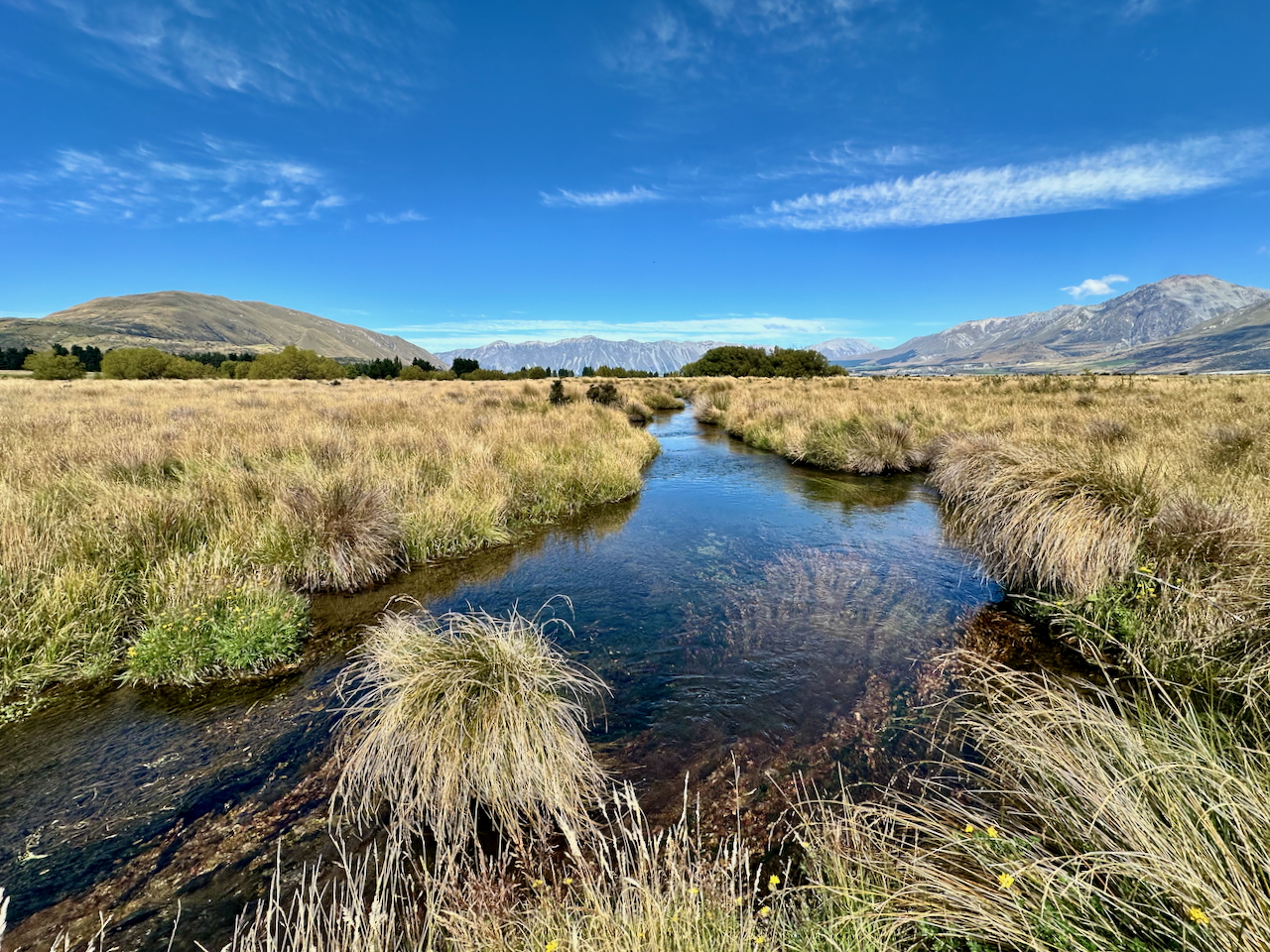
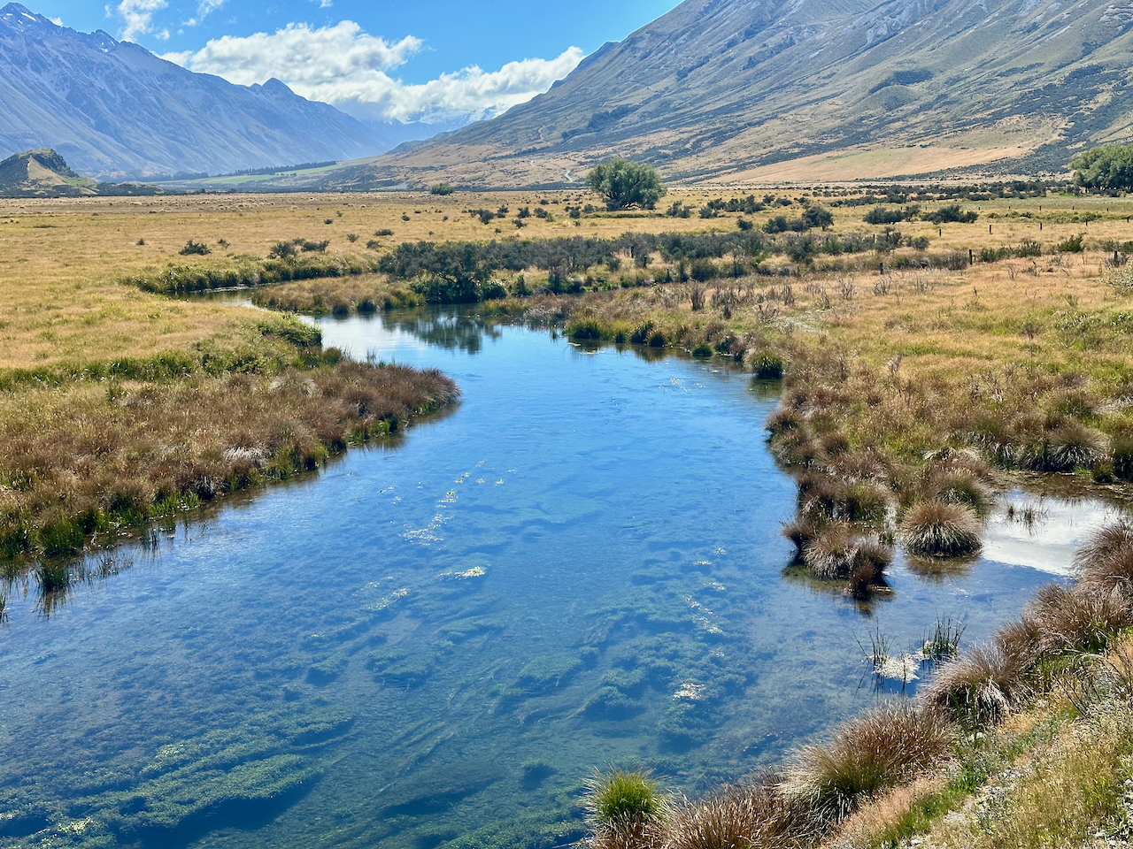
X is the lateral connectivity with the riparian edge and the wider floodplain. A consistent feature of natural (unmodified) spring-creek (groundwater dominated) streams is the close relationship between the stream bed and the floodplain surface. Chalk streams are the same, or should be. Simply put, when you stand on the hypothetical unmodified banks of a spring-fed creek your feet won’t be that much higher than the water surface (summer or winter) and the river bed is not that far down below that water surface either, at least not compared to a surface-fed system with a much wider range between low flows and high flows.

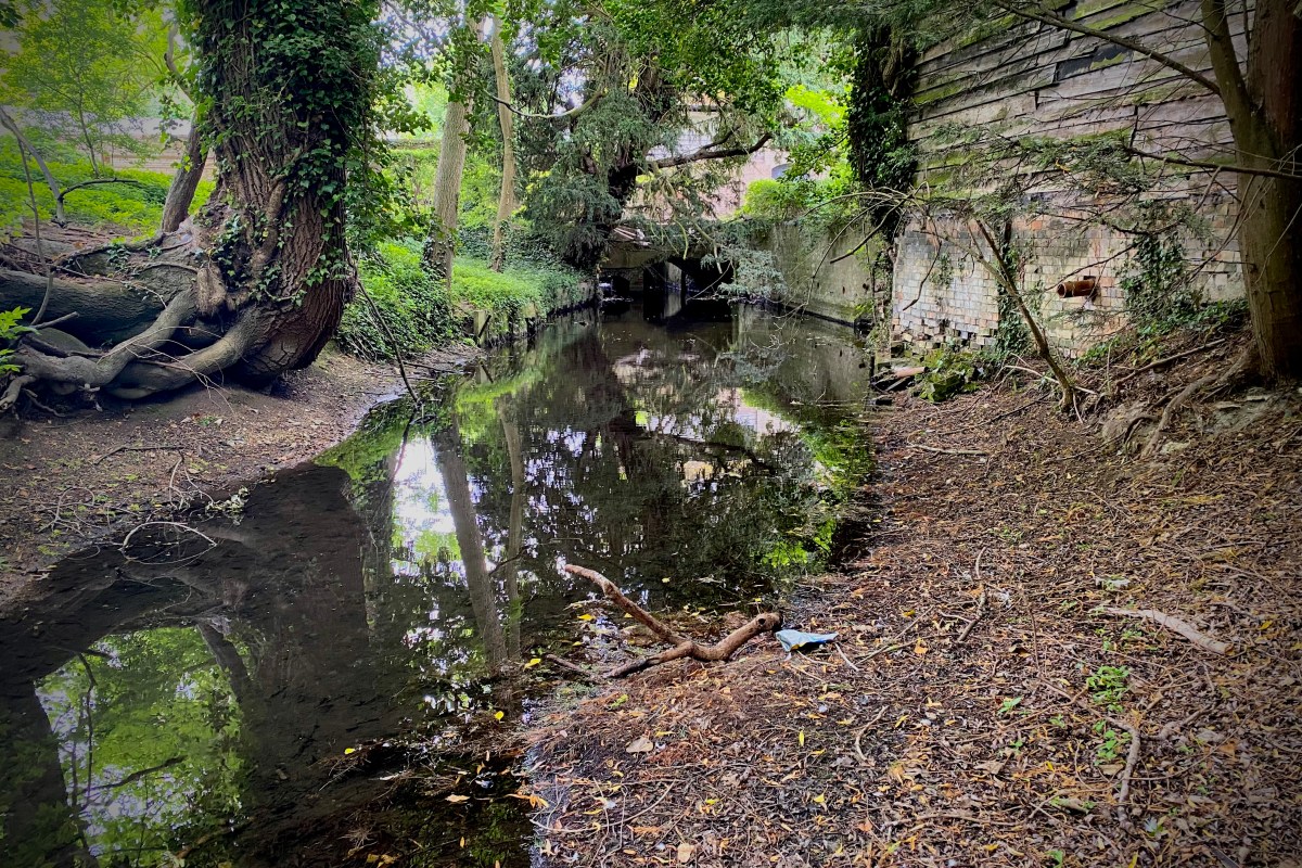
To illustrate what I mean, here are some pictures of relatively unmodified spring-creeks, in Wyoming, Montana and New Zealand. You can see how these streams are flush full and in touch with their floodplains, and that they are free-flowing too: the flushness is not because they’ve been backed up in any way. They tend to be quite wide and shallow (lacking the energy to erode downwards) and they flow from and through a high-water table. Generally speaking chalk streams should look like that, but many to most don’t because they have been diverted and / or dredged.

Y

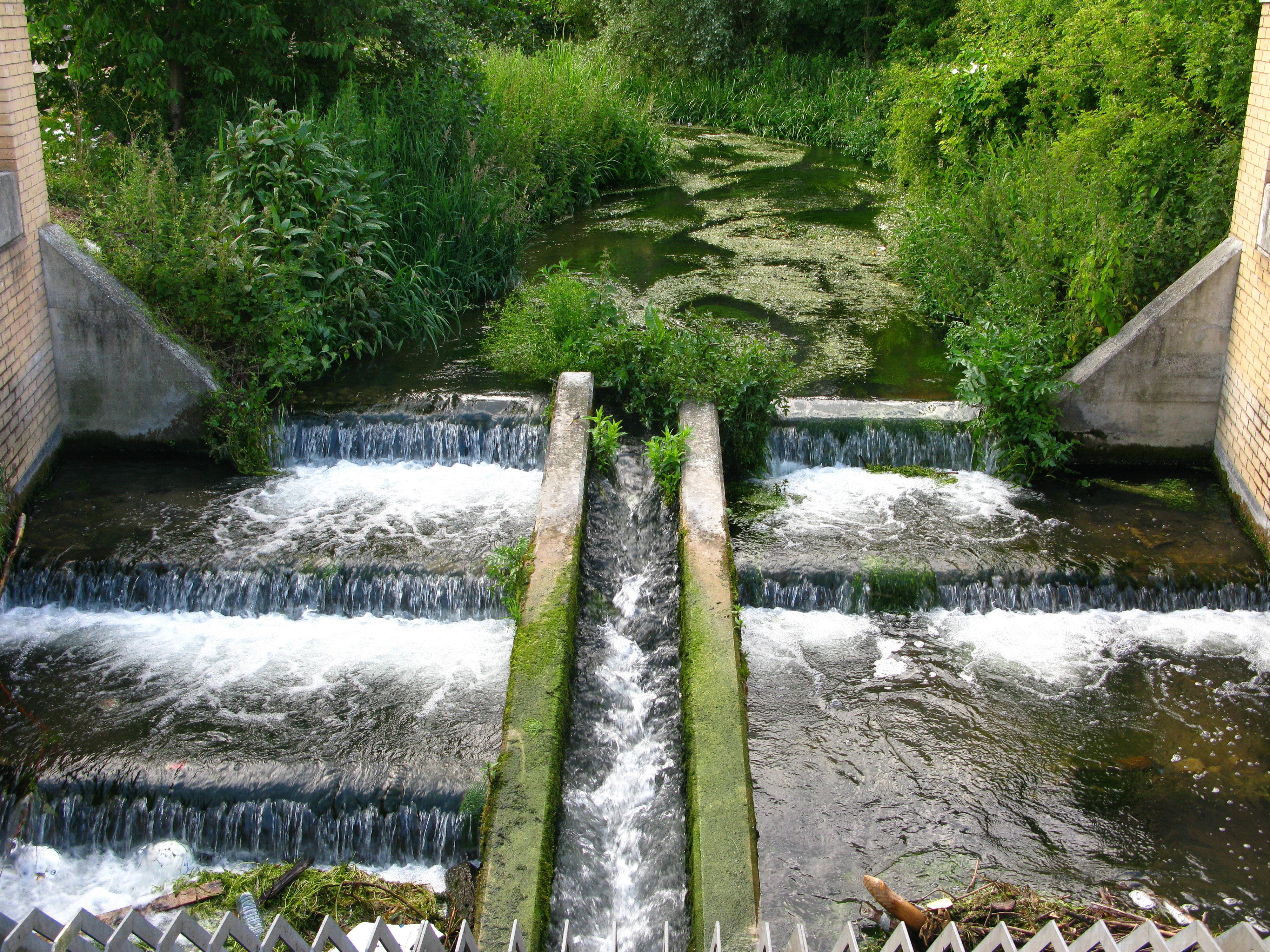
Y is the longitudinal connectivity – along the line of the channel. A natural chalk stream would likely feature hardly any major steps or interruptions in its longitudinal profile. Maybe beaver dams would create some steps, but in a undeveloped floodplain these would cause break-outs of flow around the sides, and one way or another the stream would travel unimpeded by large steps from the source to the sea.

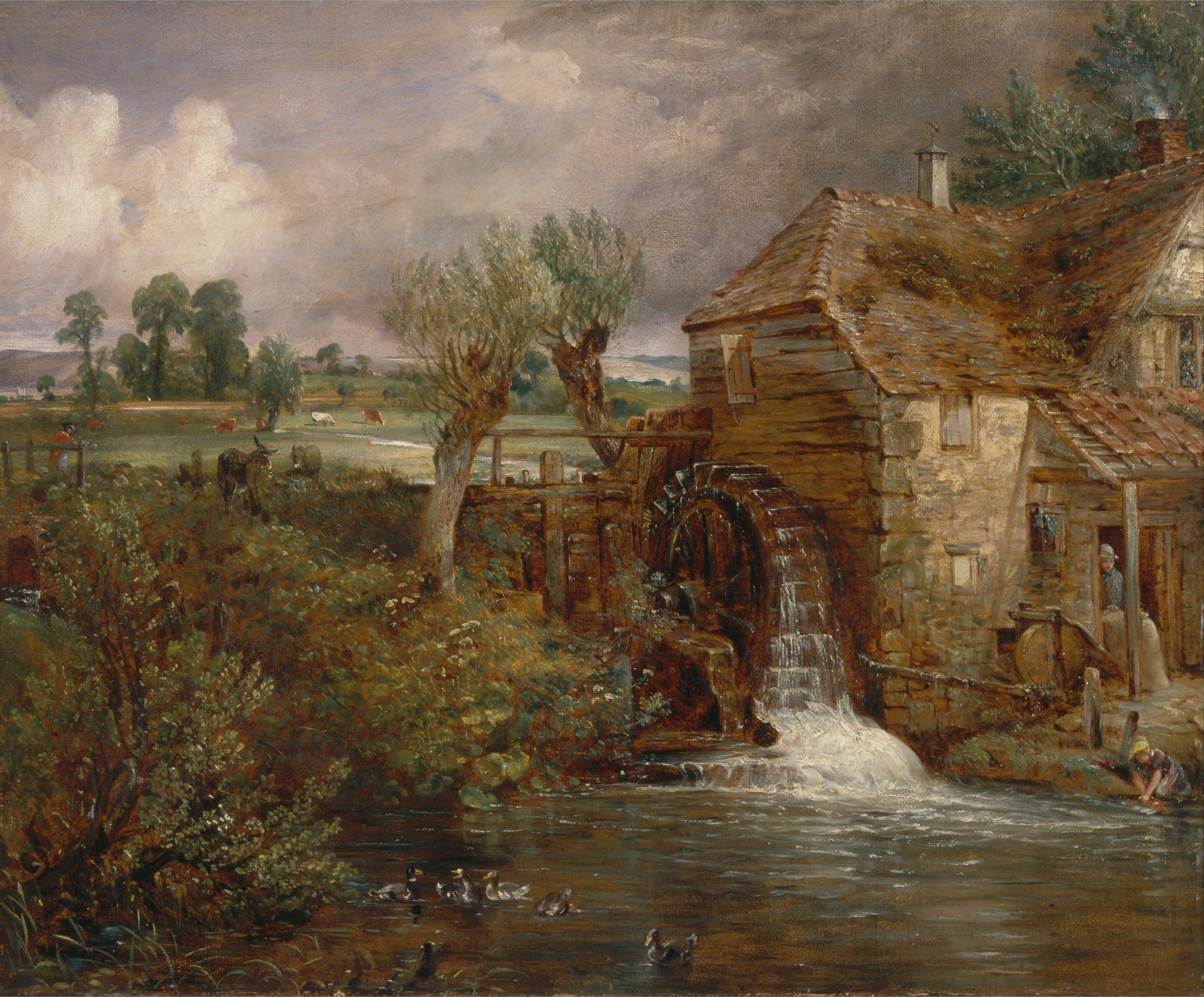
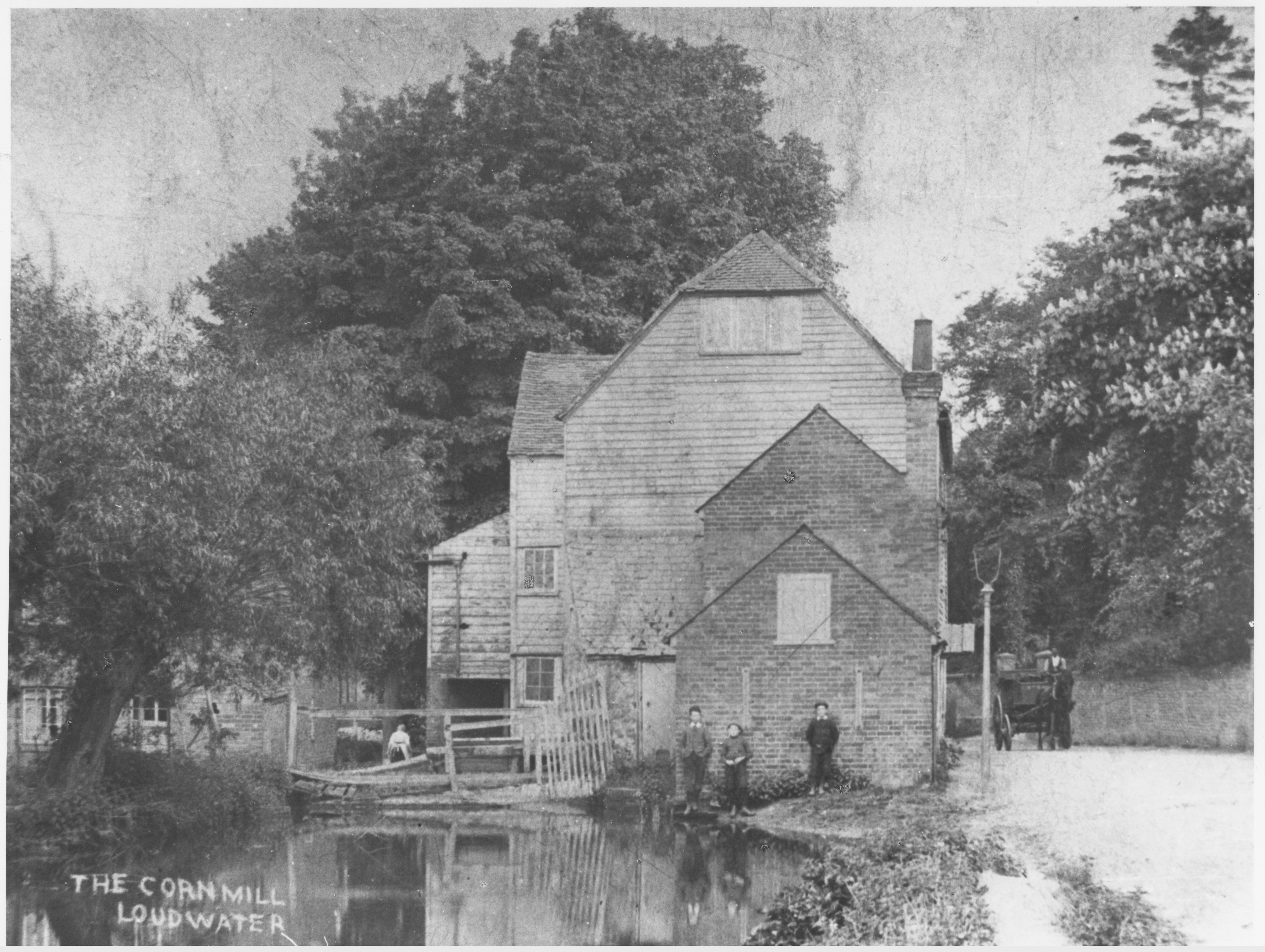
Humans radically changed all that when we invented milling. The Romans will have blocked and impounded some of our chalk streams but we really went to town on them after the 8th century, so much so that by the time William the Conqueror invaded, we had over 5000 watermills in England and most were on lowland streams, including chalk streams, which are very easy to manipulate and dam.

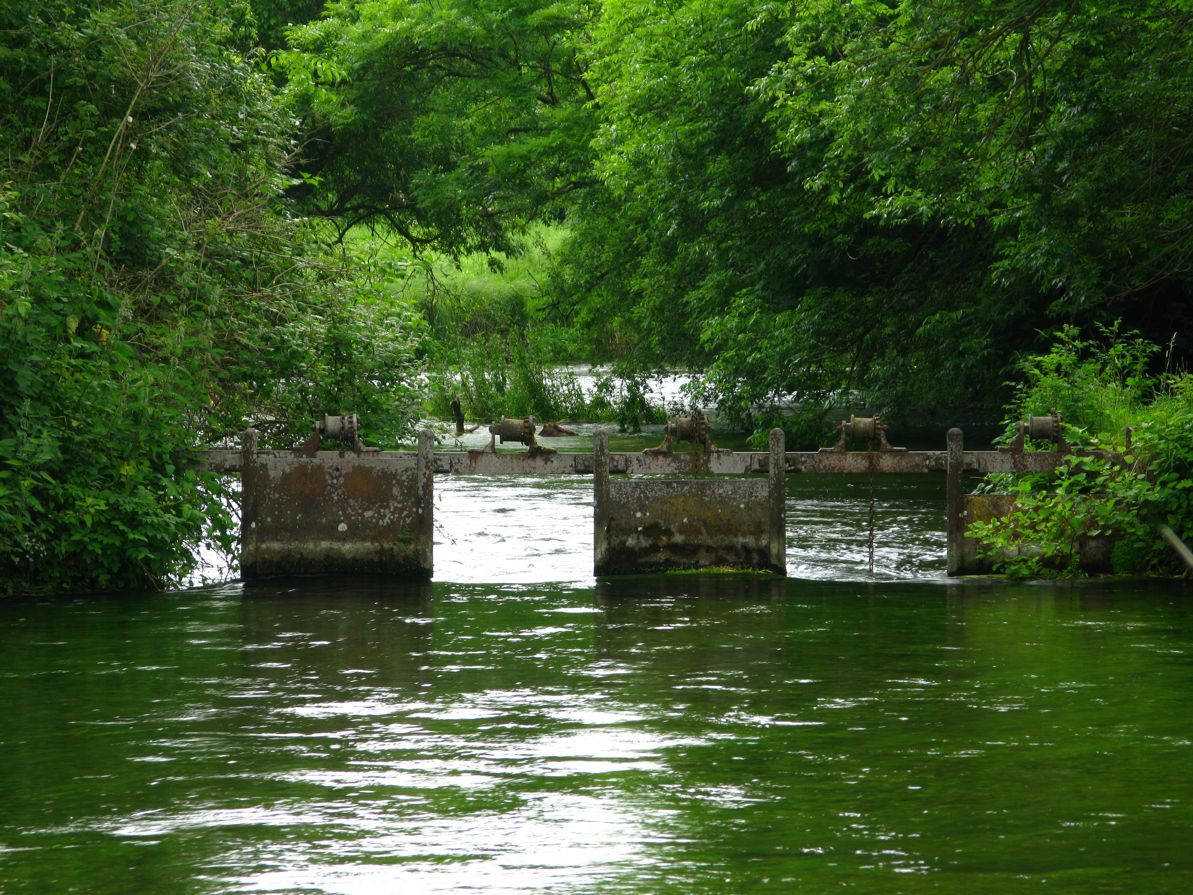
To make a mill work on a lowland stream these early water engineers diverted the channel to the edge of the floodplain and ran it along a much shallower gradient than the natural valley. This built up the head of water required to turn the mill-wheel. If the valley gradient is 1:600, say, it takes 600 meters to build up a meter of head. Many chalk streams had reached mill saturation point by 1066. This is when you can’t fit any more in: the entire stream had been made into a staircase. For example, most of the natural gradient of the River Wensum, in Norfolk, is taken up by mills. This – and the legacy of dredging – is by far the most significant ecological stress on the river, even today.

To the mill diversions have been added many other forms of channel manipulation over history: navigational channels, locks, and the intricate system of hatches, carriers and catch-drains of the Jacobean to early Victorian water-meadow revolution. All of these modifications interrupt the natural slope of the stream.

Z

Z is the planform of the river, its shape seen from above. The natural, meandering planform of our chalk streams was radically modified as part and parcel of the many and various ways in which the streams were changed over the centuries, whether they were diverted to make mill leats or watermeadow carriers or ornamental lakes.

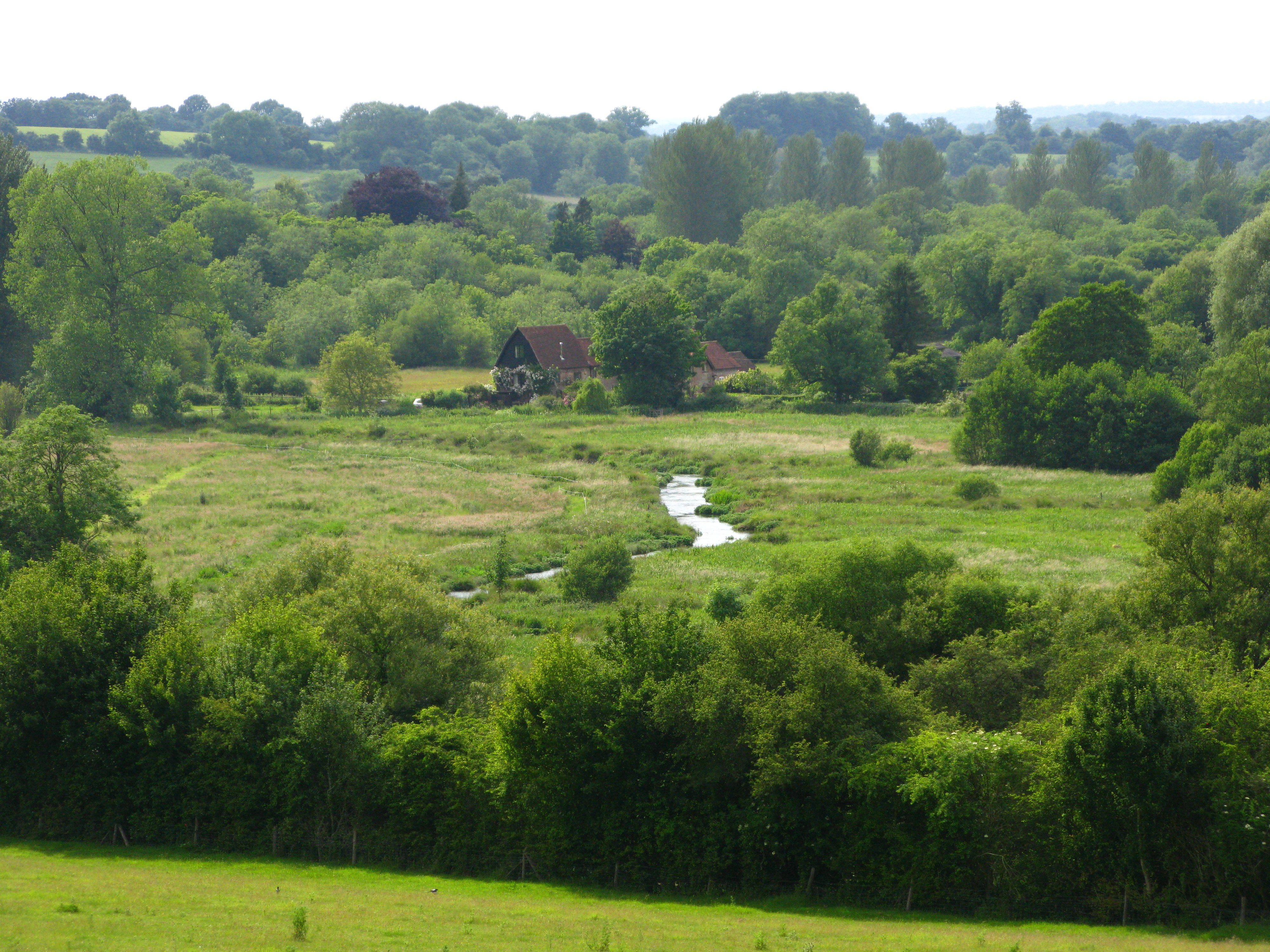
Almost everywhere chalk streams have been moved to the edges of their floodplains. If you look closely at modern stream pathways and the associated ditches and drains in the floodplain, you will see the main modern river running along one edge of the floodplain and then the other, while down the middle of the floodplain run a series of ditches that drain down to the crossing point. This was a widely practiced way of moving the river off the floodplain to make space for grazing and to lower the water-table too. In some settings it’s part of the milling and watermeadow pattern and in others, a feature in its own right.

But even when the modern river still more or less occupies the middle of the floodplain (which is rare) you will find that meanders have been straightened out, because for one reason or another the landowners wanted to get the stream out of the way and / or lower the bed of the river and improve drainage.

XYZ and the impacts of changing them

Generally speaking any of the significant ways in which chalk stream channels have been altered (mills, watermeadows, farm drainage, urban development and dredging) will have changed all the X,Y and Z dimensions in one go and the thus damaging impacts are layered and interwoven.

Take milling: to make a mill leat the channel has to be progressively raised above the natural fall-line of the valley. This robs the river of gradient and energy, isolates the river from the floodplain, divorces the channel from the water-table, and erases natural meanders. Essentially it takes a naturally dynamic, heterogenous physical structure where the river supports a mosaic of habitat niches and homogenises it in a more stagnant and imprisoned state, from which a chalk stream cannot escape.

People may wonder what the big difference is between a meandering channel and a straight channel. All the difference in the world! Meandering channels are so much more physically complex: flow spirals around a river bend, sorting sediment and substrate, depositing fines in the insides of the bends, scouring the outsides, crafting the river bed into a complex matrix of glides, pools and riffles. If the river bed and planform are intact, undercut shelves will form on the outsides of meanders at the junction between the more motile bed substrate and the more cohesive floodplain soils. These undercuts are incredibly valuable habitat for fish, especially large salmonids. The loosely triangular river bed section that evolves in a meandering channel maintains water velocities as flows lessen through the summer, whereas the uniform bed of a modified channel does not. The natural meanders therefore support plants like ranunculus and in tandem this promotes a healthy scour of the river bed, keeping fines on the move whilst creating a wide variety of habitat niches for invertebrates, benthic (eg. bullheads and minnows) and rheophilic (eg. trout, and dace) fish.

But I’ve also noticed how grazing animals like ponies interact differently with a meandering channel. The River Nar through Castle Acre was a typical straightened, modified, perched and dredged channel. Like all chalk streams subjected to these modifications it had evolved a monoculture of phragmites and bur reed along the edges (in the worst cases right across the channel) which – because they are silty death traps – grazing animals tend to avoid, nibbling only the edges, which they can reach from the safety of solid ground.

After we restored the meandering channel with river bed much closer to floodplain level, the Konik ponies that graze the common started to graze the point-bars on the insides of the bends in a different way from the more cliff-like edges on the outsides of the bends. The planform created a diversity of grazing pressure which in itself will have been beneficial to biodiversity.

It is obvious, also, that if you take the gradient out of an already low gradient stream and then massively increase the sediment loading – as we have done in the modern landscape – you will turn the stream into a silty grow-bag. When passionate river-kin types rail at the state of a chalk stream, at the gloopy silt, filamentous algae, opaque water and feeble flows, they are railing much more at its physical state than any abstraction or water quality pressure. Not to diminish the impacts of these pressures, which can be over-riding in some settings, but where there is tolerable flow (even if there is some abstraction) and water quality (even if there is some eutrophication and sediment load) the XYZ is by far the most important part of the chalk stream health. It is certainly the the foundational layer and oftentimes the easiest to sort out.

Deficit x opportunity = strategy priority. A tool for planning chalk stream catchment restoration

I’m honoured to have been asked to chair the Test and Itchen Catchment Partnership (Strategic Leadership Group) and help efforts to create a re-booted catchment restoration strategy spearheaded by the Wessex Rivers Trust and Hampshire and Isle of Wight Wildlife Trusts in partnership with all the key stakeholders, landowners, fisheries interests, water company, regulators and local groups.

These two rivers are the jewels in the English chalk stream crown (and I say that as a Norfolk lad) of iconic national and international importance. Collectively the partnership has formulated a restoration vision that is to:

“to restore these rivers to a state where natural processes, ecology and biodiversity are maximised and human impacts minimised: to create rivers and floodplains that are havens for abundant wildlife, that help manage floods, store carbon and intercept sediment, that retain their extraordinary cultural value, and that are resilient to the pressures that lie ahead”

That’s a high ambition and to use a cliché … words are cheap. Turning it into reality is the hard part. What I have learned from trying to do exactly the above (albeit at a smaller scale) on chalk streams in Norfolk is the immense value of a really good plan, one that is simple, doable and relentlessly correlated to reality.

Without a plan there are a zillion rabbit holes one can vanish down. A great deal of money can be spent doing the wrong things well, or doing the right things badly, or fixing an enormously expensive minor issue at the expense of a much more resolvable major issue. And so on.

So, I’ve been working on a methodology for constructing a restoration strategy that is simple, objective, repeatable, that makes use of existing datasets and assessments but reassembles the information in such a way as to clear signals about what to fix, where and in what order. A catchment restoration planning tool, if you like.

I sketched out the idea at the inaugural meeting of the Test and Itchen Strategic Leadership Group last week, to an exacting audience of river restoration experts, ecologists, regulators and various other key decision makers and was very pleasantly surprised by the positive reception.

I’ve set out the concept below: a) as a simple graphic and b) as a longer text explainer. I’d be very happy to incorporate feedback to help make it as useable and useful as possible.

Update on the River Stiffkey

I’ve been back to the River Stiffkey a few times over the past few weeks to see how the newly created “natural” channel is evolving.

This is a section of a Norfolk chalk streams that curls around the edge of an Iron Age hill-fort. It was radically straightened several hundred years ago and subsequently dredged into a deep culvert.

The Norfolk Rivers Trust and Holkham Estate asked me to design a restored, natural channel to take the river back to where it used to flow. All sorts of good things should follow a project like this: a restored channel will be good for bird-life, for trout and sea trout, for invertebrates and for the diversity of plant species. It should be good for flood management and carbon sequestration too.


This is a simplified overview of the design I produced, about 2km of river from top to bottom (the flow direction is up the page!)

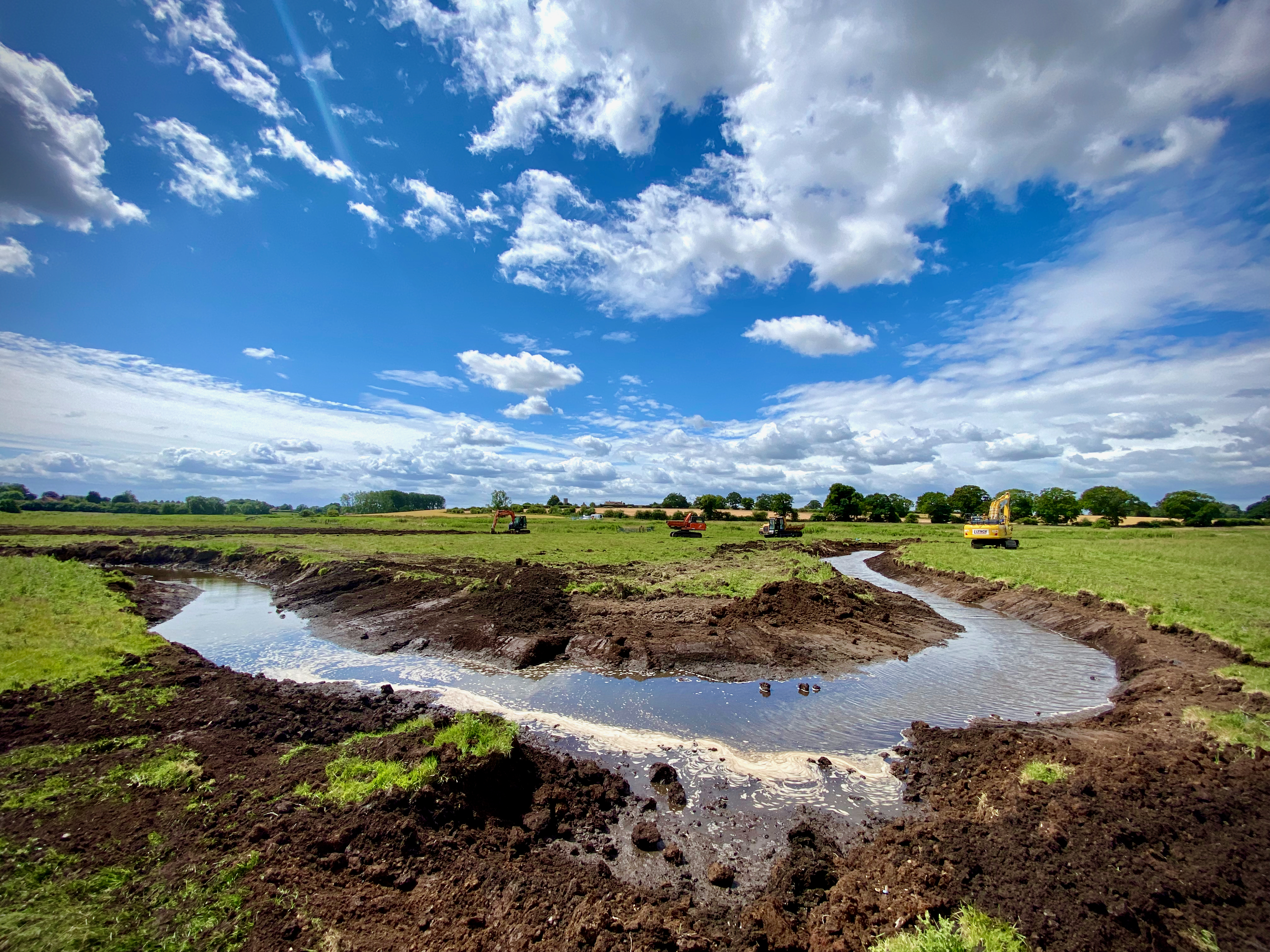
We executed the work in two phases in 2023 and 24. Here the diggers start work:

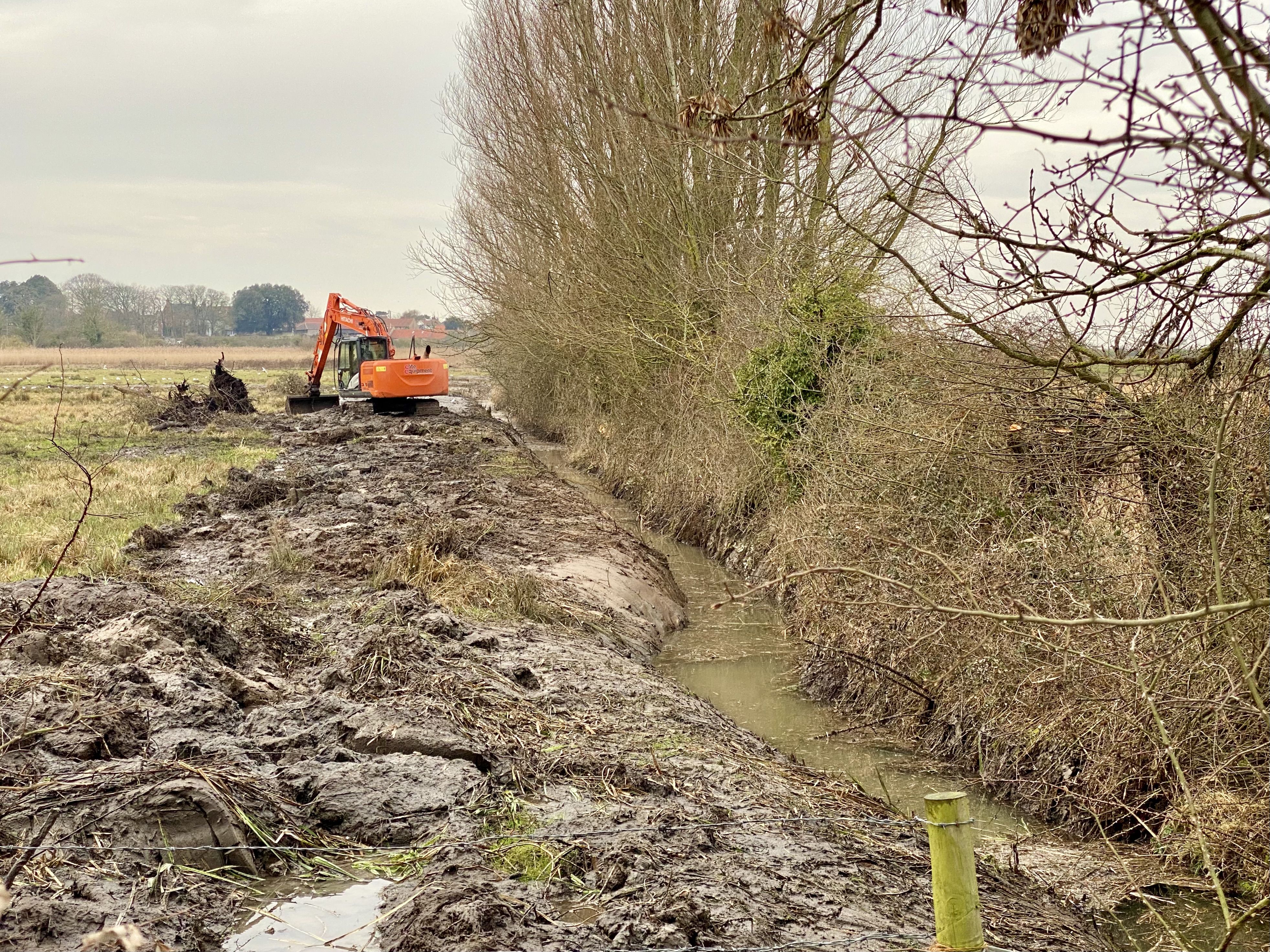
The excavators at work in 2023.

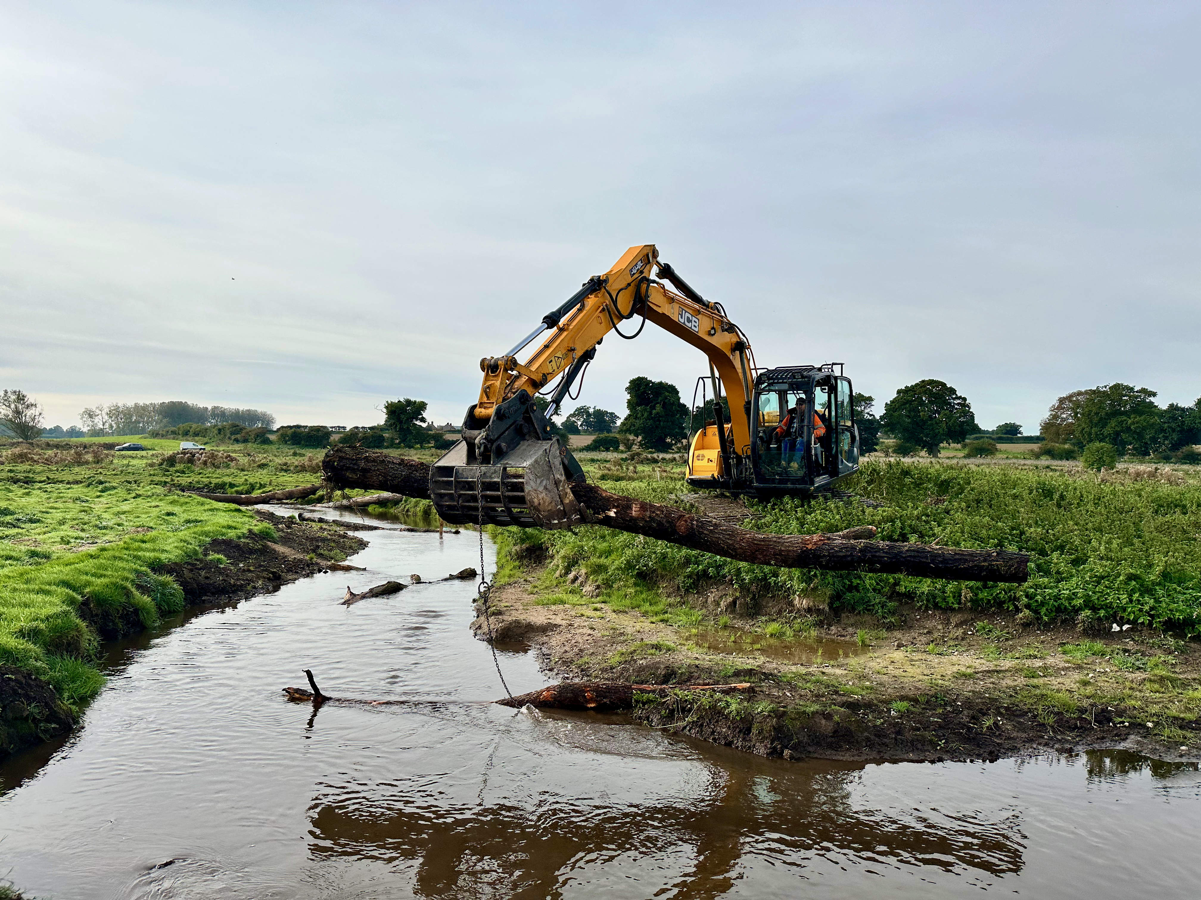
And here we place out “large woody debris” to give a bit of structure to the new channel:

Adding LWD to the channel.

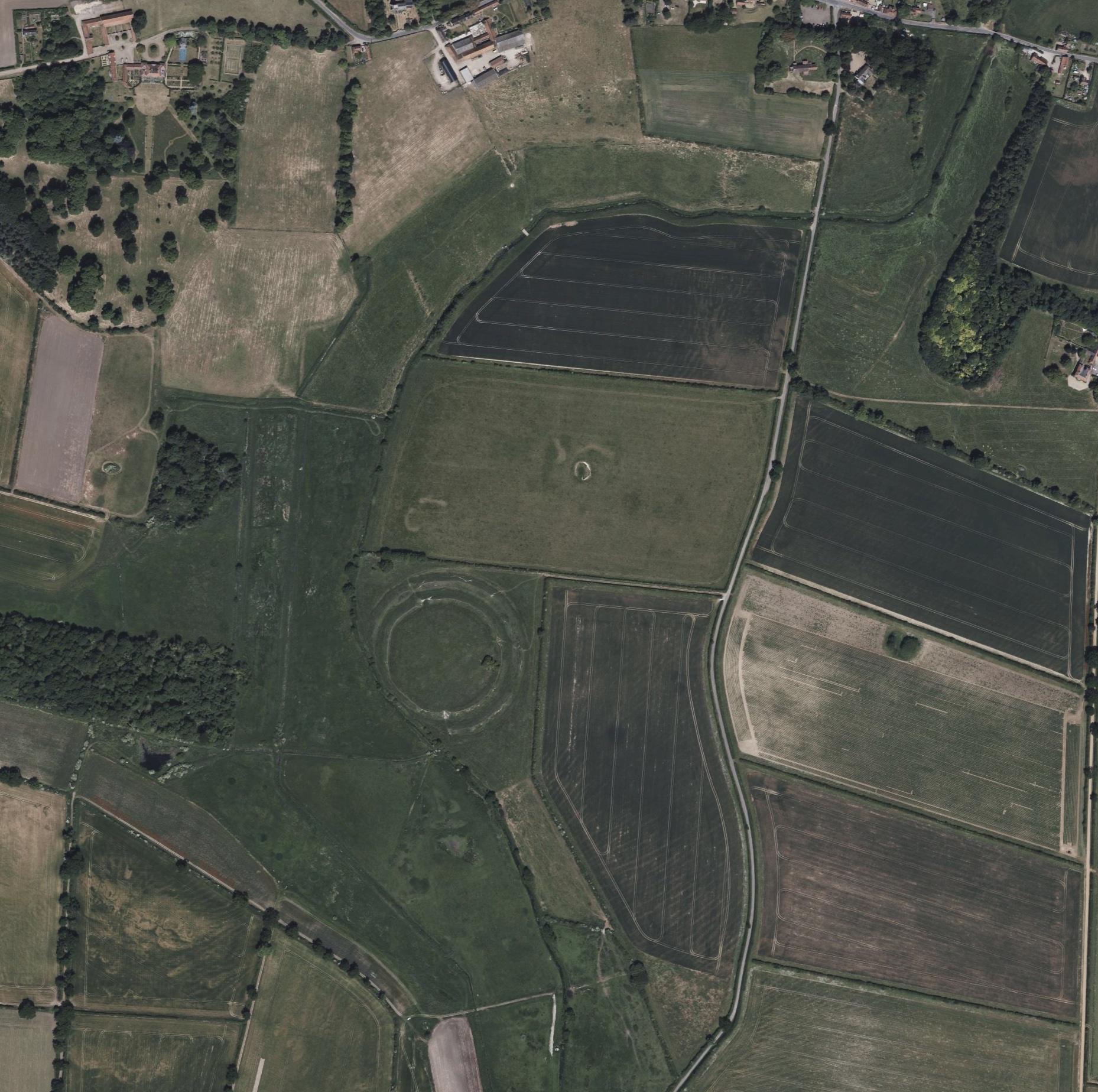
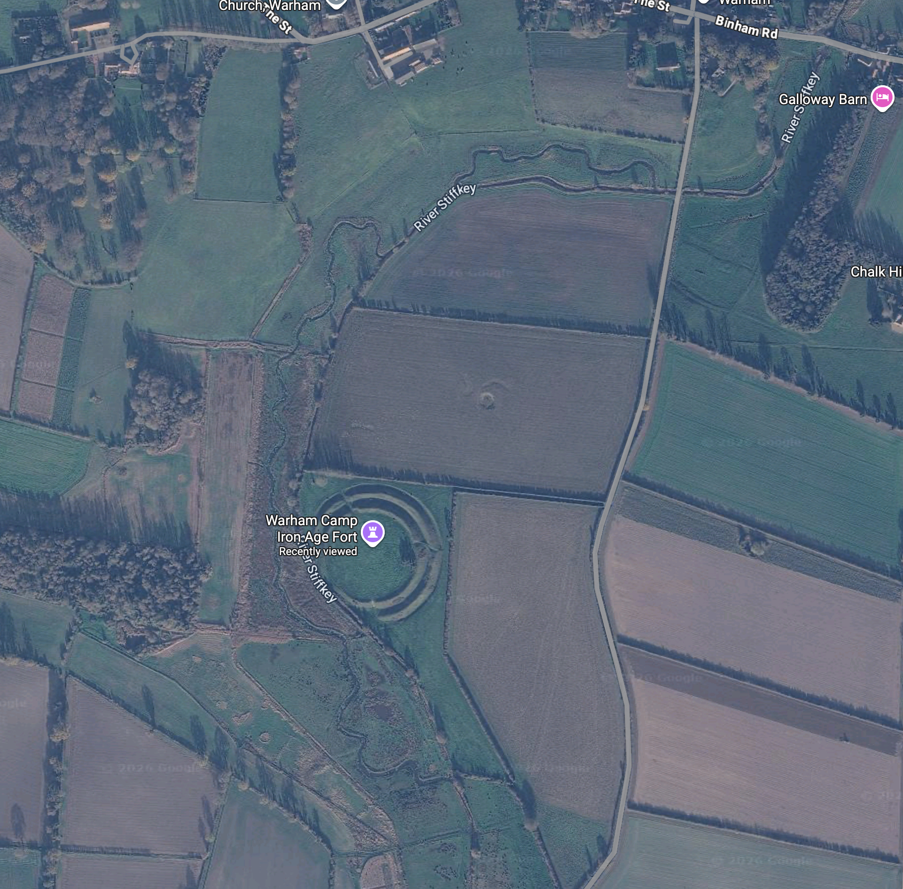
Already the changes are visible on google maps: below is a before and after of the satellite imagery. The keen-eyed will see the clues in the floodplain as to where parts of the natural channel once flowed. And now flow again.

The Stiffkey floodplain around Warham before we started work
The Stiffkey floodplain around Warham after the new channels were finished in 2024

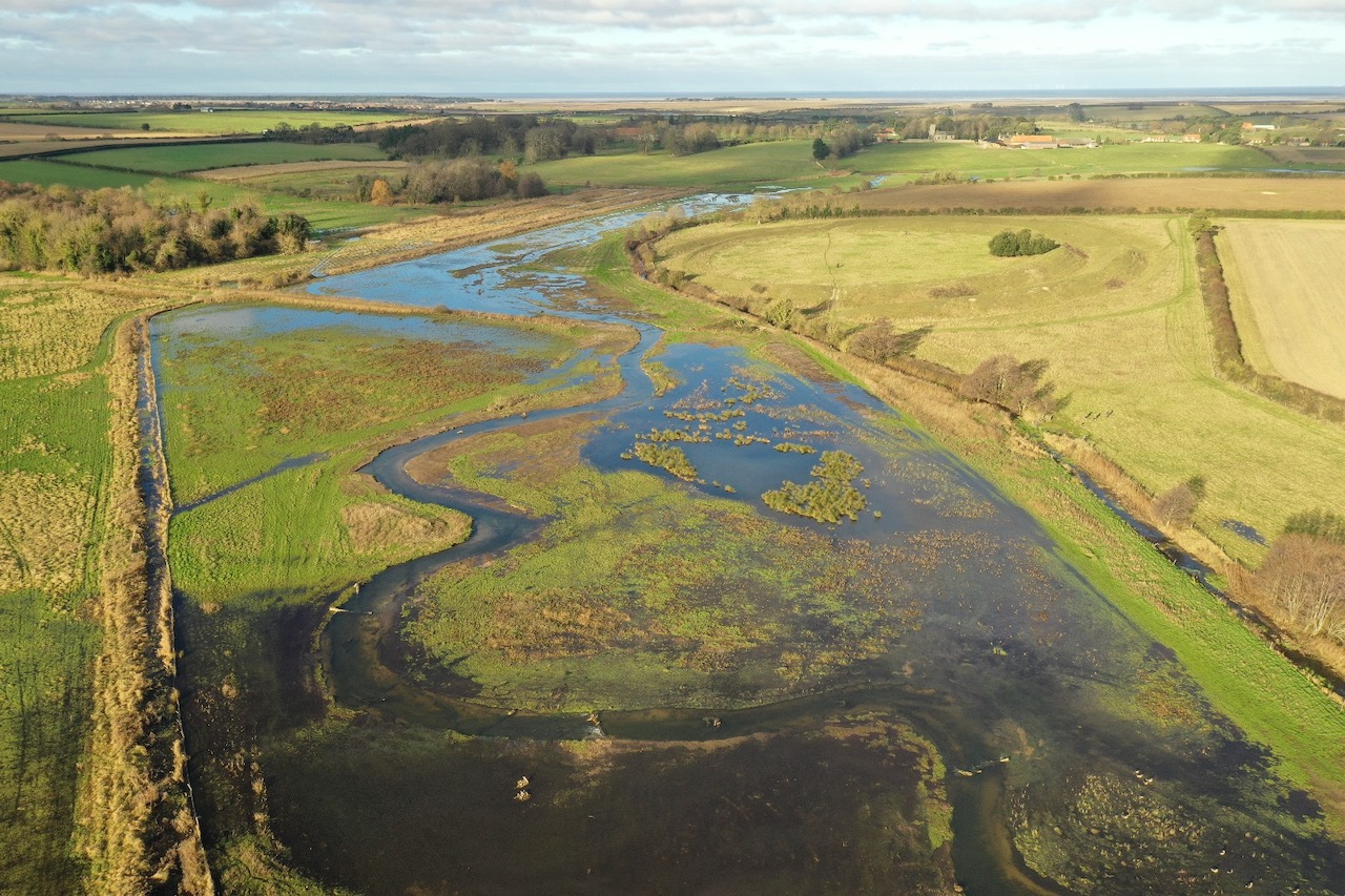
We were lucky in that the winter flows that followed the 2023 phase were very strong and this gave the river a chance to self-adjust. It also showed the river working naturally and that vital relationship between the river and its riparian space: just fantastic for wading birds.

Winter flows and a working floodplain in the spring of 2024.

By the summer of 2024 the first phase looked radically different than the weed-choked channel it had replaced:

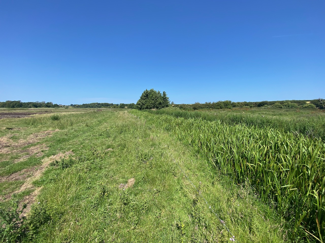
Summer 2023: the is the ditch-like channel choked with burr-reed that the River Stiffkey had become where it “flowed” past the Warham fort.
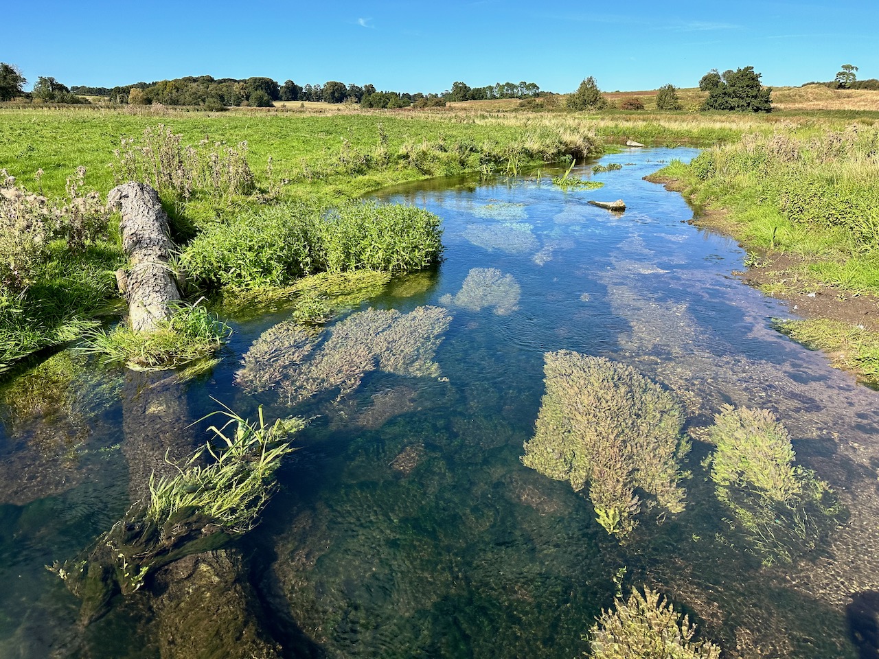
September 2024 a year after the channel was excavated. None of these in-stream macrophytes were planted. It’s amazing how quickly habitat develops if you restore the correct physical state.

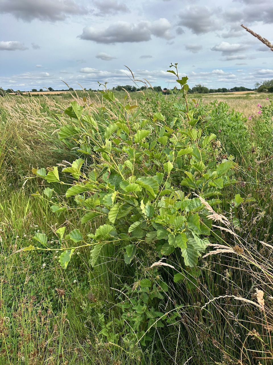
But these restoration projects must also be seen in terms of longer time-lines and here it is really interesting to see whether trees come back to the site and if so, which species. A mosaic of tree cover and open grassland / fen will be the secret to the long-term resilience of the project. So, it is really encouraging to see some trees springing up and fascinating to discover that they are mostly … hazel.

2025 and now 2026 have seen lower flows and I have been interested to see how the habitat has developed. Unsurprisingly, the riparian vegetation has crept out over the channel but even so, there is no choking of burr-reed, because the bed of the river is a constant gradient: there are no sumps.

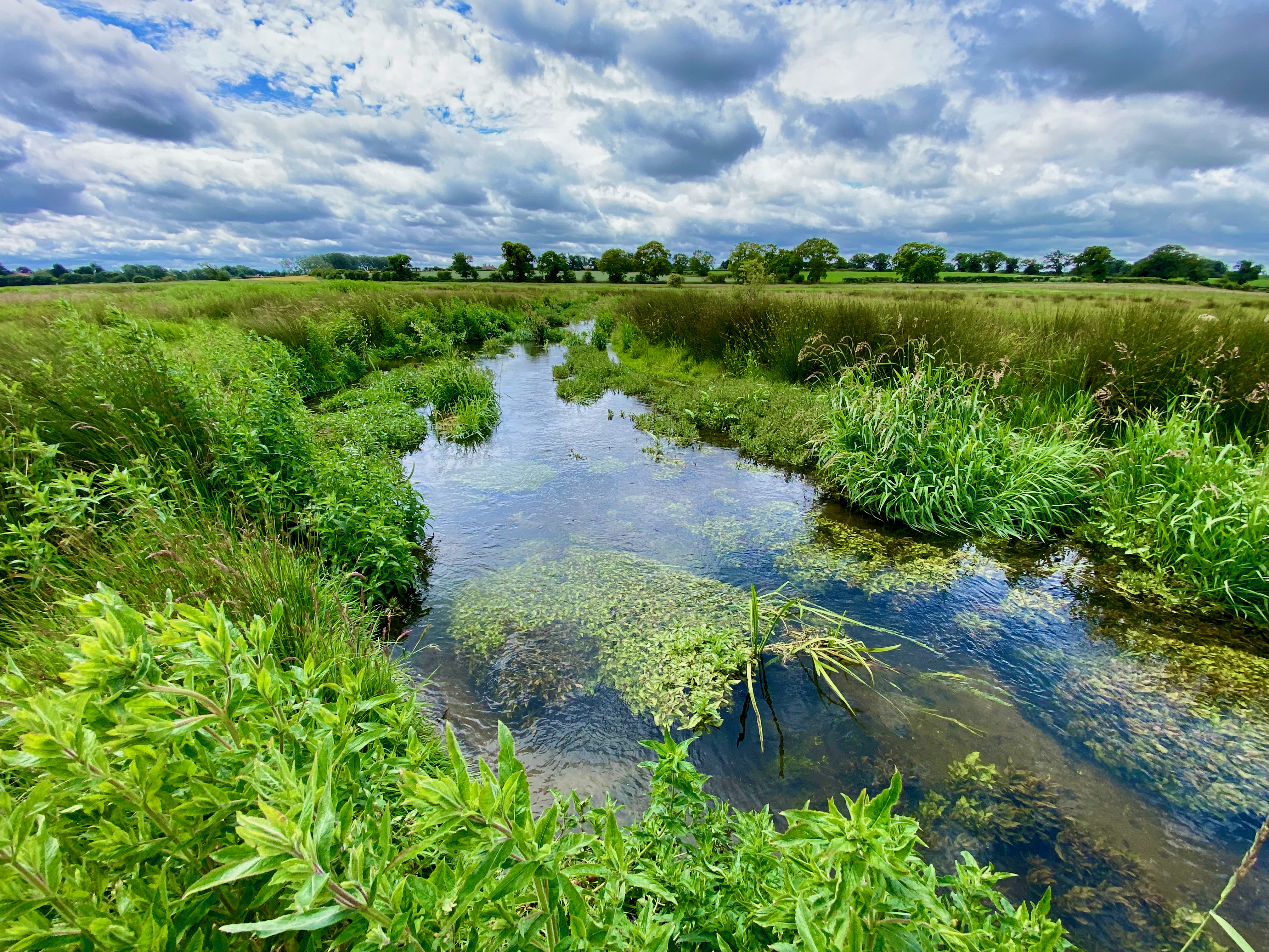
This photo was taken in June 26: the river looking verdant and lively in spite of the dry weather.
This photo was taken a few weeks later, as the drought deepened. We desperately need rain, but the habitat is still holding out.

Tarrant update 3 – Known knowns, known unknowns and unknown unknowns.

A fascinating comment was recently added to my post The Slow Death of a Chalk Stream. Nick Walton – a hydrogeologist with 50 years experience – wrote: 

Given the above, said Nick, historical evidence, empirical data, local knowledge and some hydrological common sense are worth a lot and shouldn’t be dismissed. 

Those four things are exactly what the River Tarrant Protection Society report contains. The RTPS is saying that when all the evidence is taken in the round the case is strong enough to justify further, detailed and truly independent investigation. 

This shouldn’t be a debate about whether the Wessex Basin Model is more sophisticated than the CSF modelling. It clearly is. 

The issue is whether the confidence placed in the Wessex reports conclusions is justified, given the limitations of the underlying data, the acknowledged uncertainties in conceptual understanding, and the internal inconsistencies in model performance across the Pimperne and Tarrant catchments and beyond to the edge of the Stour. 

Data from an impacted system

All models are limited by the quality of the data that is fed into them — and here the data are limited and impacted. The Wessex model is built on:

  • groundwater level records (largely post-1970),
  • short-term stream flow gauging with spot meters (primarily 2015–2017)
  • short-term targeted pumping and switch-off tests,
  • a system that has been subject to decades of abstraction.

In other words, the model is based on data extracted from a system that is already altered from its natural state. 

Without continuous flow records prior to the 1970s, and without direct measurements of groundwater–surface water interactions before large-scale abstraction, surely historical and qualitative evidence becomes more, not less, important? And yet it is largely excluded from the formal assessment.

Of course, Jane Dottridge wasn’t commissioned to comment on this other evidence. She nevertheless described it as “anecdotal”. I don’t think that’s fair. Anecdotal refers to an account or short narrative that is subjective, unreliable, or hearsay. Mapped Domesday mills are not anecdotal evidence.

Pimperne calibration

As to the models: Jane critiqued the one-dimensional simplicity of the CSF conceptual model. However, in spite of its attempts to capture the more complex reality, there is still uncertainty and assumption in the Wessex model, especially around the Pimperne–Tarrant interfluve. 

Jane does highlight this: “the Pimperne calibration is not very good, with a very smooth modelled recession in contrast to the marked break in slope of the observations. Some of the gauges on the middle Tarrant (Rushton, Preston Farm) also show the same feature” 

But she makes little of it. In the next paragraph Jane writes: “The conclusions appear to be justified based on the evidence presented in the report”

I don’t follow that logic. To recap, the conclusions of the report are:

  • Tarrant: only the abstraction pump in the valley (Stubhampton) is relevant to flows in the Tarrant. The stream is negligibly impacted by this abstraction “along the perennial reach” * and the ecology is not adversely impacted.
  • Pimperne: the abstraction at Black Lane does not impact flows in the Pimperne.

That is a very clear no impact statement given: 

  • The calibration is poor in the Pimperne and the lower Tarrant. 
  • The Black Lane abstraction is a high % of the catchment recharge. 
  • The groundwater boundary is modelled as fixed with no impact on the neighbouring Tarrant.

Surely the mismatch between the strength of no impact conclusions and the poor calibration warrants a furrowed brow. 

* This is a variation on a rhetorical ploy I’ve seen before: if a stream is dry then abstraction is ipso facto not impacting the stream. It’s also evidence of my point about how the impacted state can become the new baseline. The RTPS contends that the lower river is naturally perennial.

Known knowns, known unknowns and unknown unknowns.

The Wessex report presents a conceptual model strategically refined by fieldwork that included stream-bed surveys, weekly observations and spot-flow measurements, new boreholes to investigate the interfluve, switch-off and pumping tests. 

Accordingly, the model was refined to simulate lower transmissivity beneath interfluves, higher transmissivity in valley bottoms and the introduction of “unmapped faults” in the chalk – horizontal flow barriers – to improve calibration.

Surely these iterative refinements highlight, rather than resolve, the uncertainty? The interfluve behaviour was not predicted by earlier model versions, new borehole data required significant reinterpretation of the system and the fault-line is partly imposed through model structure, inferred  – because the river dries – rather than directly observed in the geology.

The cornerstone conclusion ref the Tarrant — that abstractions outside the catchment have no impact — depends on the assumption of limited cross-interfluve connectivity. And yet groundwater catchments are known to shift with hydraulic gradients and Jane’s review confirms that groundwater boundaries can and often do vary over time and with rising and falling groundwater levels. If they do this, they can also vary because of abstraction pressure. 

A central element of the Wessex argument is that switch-off and pumping tests define what they call “zones of influence” of abstractions and that impacts are therefore spatially limited.

This interpretation is not supported by general hydrogeological principles. Why does it pass, unchallenged?

Short-duration tests reveal immediate, local drawdown responses but do not capture longer-term system adjustment. They don’t capture the delayed propagation of pressure changes, the redistribution of groundwater flow paths, or slowly accreting capture from inter-connected water bodies. 

The absence of observed drawdown at a location during a short test simply cannot be taken as evidence of no long-term hydrological impact.

Pick’n’mix

There is also evidence of expedient selectivity in the Wessex report and even Jane points this out. Where the Wessex model performs reasonably well – the Tarrant – it is used to support conclusions. Where it performs poorly – the Pimperne – then alternative methods are used: pump tests and empirical observations.

This pick’n’mix kind of undermines confidence in the whole thing surely? The analytical method is not consistent across the whole piece. 

John’s CSF model may be pilloried for its simplicity, but at least it treats the whole study area in the same way. The Wessex Water approach ought to weaken the Environment Agency’s confidence in the system-wide conclusions, particularly those relating to this cross-catchment impacts we insist are plausible but which Wessex Water hotly denies.

What about 2017?

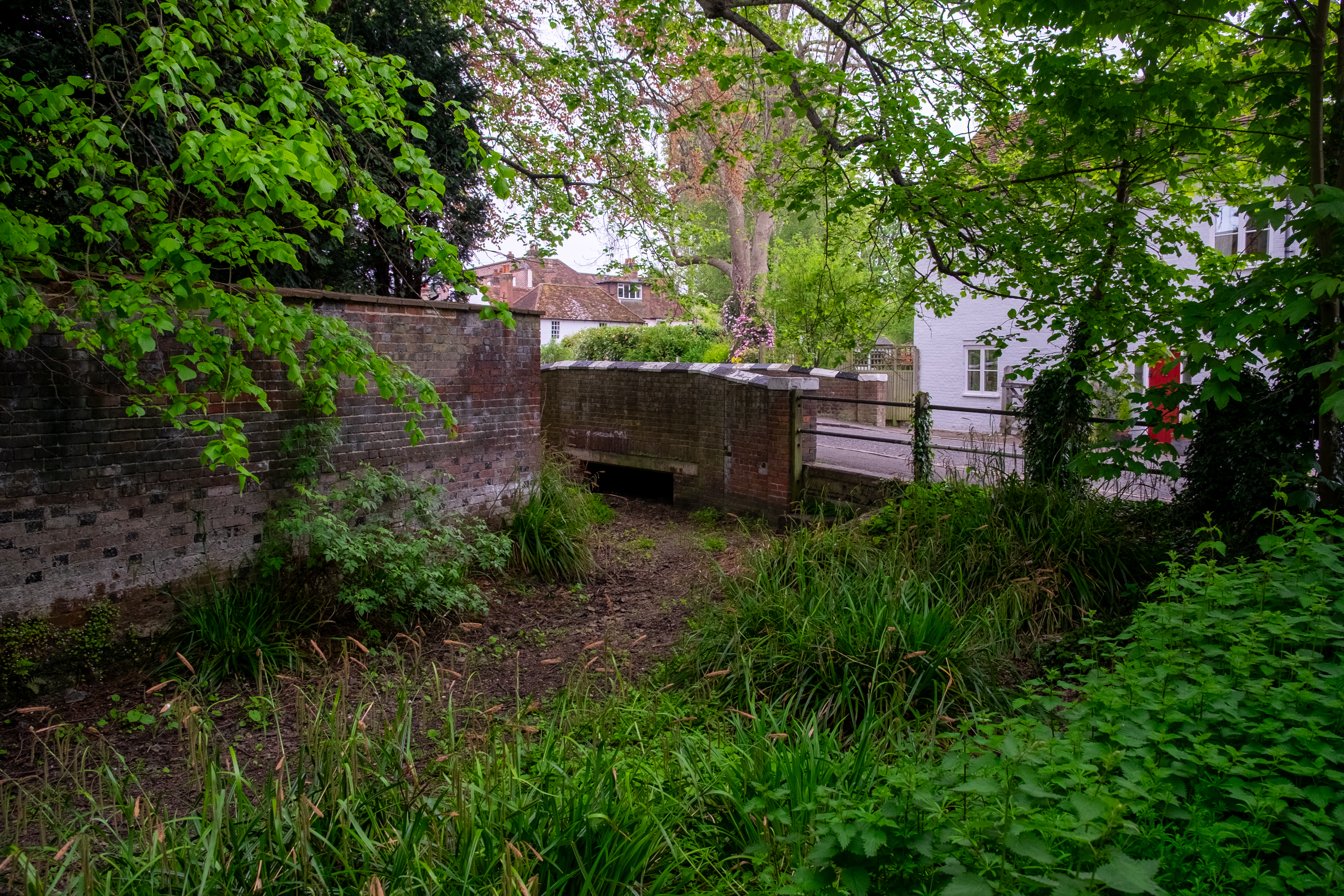
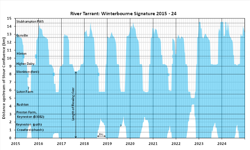
I’ve already underlined the coincidence between a long-term shut down 2016 to 2017 of the Black Lane pump in the neighbouring Pimperne valley and the fact that the summer of 2017 was the one year in the past ten that the lower Tarrant did not dry. This is such good evidence that the Black Lane pump may well be having an impact on the Tarrant, or the Black Lane and Shapwick pumps in tandem, especially when one remembers that the spring of 2017 was bad for chalk streams. That was the year that I took photographs of drying streams all round London, the Ver, Chess, Misbourne, Beane, Rib, Ash and others.

The year the Chess looked like this, the River Tarrant kept flowing.

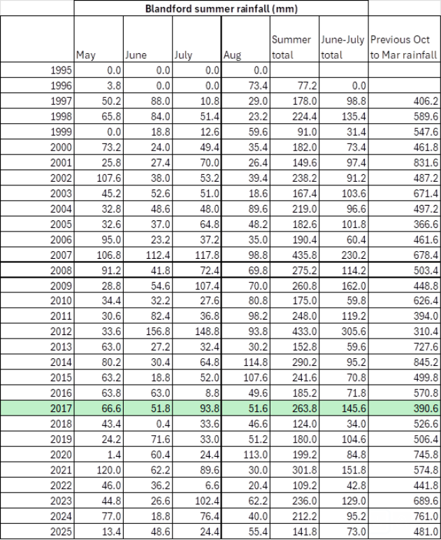
Wessex Water has an answer: they claim that late summer rain prevented the Tarrant from drying when it was otherwise on course to. I put this to John Lawson and he went away to look at the rainfall figures over a longer time-series, to see if this late summer rain was an anomaly that plausibly did make the difference.

As you can see, the summers of 2015, 2021 and 2023 were similarly wet or wetter than 2017, but the river still dried. Whereas the the preceding October 2016 to March 2017 was unusually dry and that’s what usually determines flows in the following summer.

In summary

There is a mismatch between limited range of data (no consistent, long-term flow gauging), incomplete understanding of the aquifer, poor calibration in the modelling and confidence in the conclusions.

The purpose of highlighting these issues is not to suggest that “we are right and Wessex Water and the Environment Agency are wrong”. Instead it is to demonstrate that:

  • alternative models produce plausible results which do suggest an abstraction impact,
  • key assumptions (e.g. fixed catchment boundaries, limited zones of influence) are not definitively proven,
  • the current evidence base does not support a strong “no impact” conclusion.

Given all the above surely it would be prudent to treat the current findings as provisional rather than definitive and look for a more robust truly independent investigation, with scope not limited to model comparison.

Let’s not forget, this stream is used for spawning by Atlantic salmon. The stream may not be as protected as the Bourne and Wylye, but the salmon is. These fish are genetically unique to chalk streams and the Stour’s population of these fish must be the most endangered stock of all.

Oh and just one more thing …

Underlining the mismatch between what we know and confidence in conclusions, it is worth addicting that recent research into the Chalk aquifer by Andy Farrant and others at the BGS has highlighted the greater-than-previously-recognised role of karstic dissolution features and preferential flow pathways in chalk. These can provide localised areas of enhanced permeability that are not necessarily captured in regional groundwater models. Hydraulic connectivity may well occur along pathways that are not predicted by averaged aquifer properties or detected by limited observation boreholes. This must be relevant where abstraction alters hydraulic gradients, potentially activating or enhancing flow along such pathways?

Sure, this does not demonstrate that such connections exist between the Pimperne and Tarrant catchments, it does underline the uncertainty associated with assuming that lower-transmissivity interfluves act as hard hydraulic boundaries.

Just saying …

Tarrant update 2 – In defence of simplicity

In my last post I questioned why the Environment Agency confined its review of the River Tarrant Protection Society (RTPS) report to a comparison between two modelling approaches.

I argued that the Chalk Streams First (CSF) model—a simple, lumped parameter model—was never intended to replace the more complex 3-D model used by Wessex Water, but rather to highlight uncertainty. Several hydrogeologists, including the independent reviewer, have previously suggested that such approaches can be used in a complementary, tiered way, with monitoring data providing essential context.

In that light, it makes little sense to treat this as a modelling contest in which the limitations of one approach invalidate its findings. Model outputs should be interpreted alongside other lines of evidence.

The independent review compared:

  • the Wessex Water Middle Stour report (the official position), and
  • the RTPS report on low flows and drying

with a focus on hydrogeological data and modelling.

In this post I consider that comparison in the light of Jane Dottridge’s review (attached to my previous post), focusing specifically on the conceptual and methodological validity of the CSF model.

Assessment versus indicator

Jane was asked to comment on the validity of the RTPS findings on abstraction impacts, and to consider the Wessex report by comparison. She concluded that the CSF model does not “provide a more reliable assessment of abstraction impacts than the Wessex model”.

However, the RTPS report did not claim to provide a more reliable assessment, but rather a more reliable indicator. That distinction matters. An assessment implies a definitive evaluation; an indicator signals a relationship or pattern without claiming certainty.

The CSF model was presented as part of a broader evidential framework. Its outputs, taken together with other observations, were used to question the certainty of Wessex Water’s conclusions. Judging it as if it were intended to deliver a standalone assessment risks setting up a straw-man comparison.

The conceptual model

Jane states that the CSF model is highly simplified and suggests first of all that it has no conceptual basis, then later that it lacks a sound conceptual basis. There is some ambiguity here: whether no conceptual model exists, or whether the one used is considered inadequate.

In practice, the CSF model is based on a clearly defined—if simple—conceptual model. It assumes:

  • a fixed groundwater catchment based on topography
  • uniform transmissivity
  • a broadly synchronous rise and fall in groundwater levels
  • a distributed pattern of spring discharge across the valley

These are simplifications of a complex system. In reality, groundwater catchments shift, transmissivity varies, and flow processes are spatially heterogeneous. But the question is not whether the model captures every detail—it does not—but whether it is appropriate for its intended purpose.

There is ample precedent in groundwater science for simplified conceptual models, particularly where the aim is to identify dominant controls or test the plausibility of observed relationships. 

Model complexity should be proportionate to the question being asked.

Empirical relationship between groundwater and flow

The CSF approach is grounded in an empirical observation: that groundwater level and streamflow are closely correlated in chalk streams.

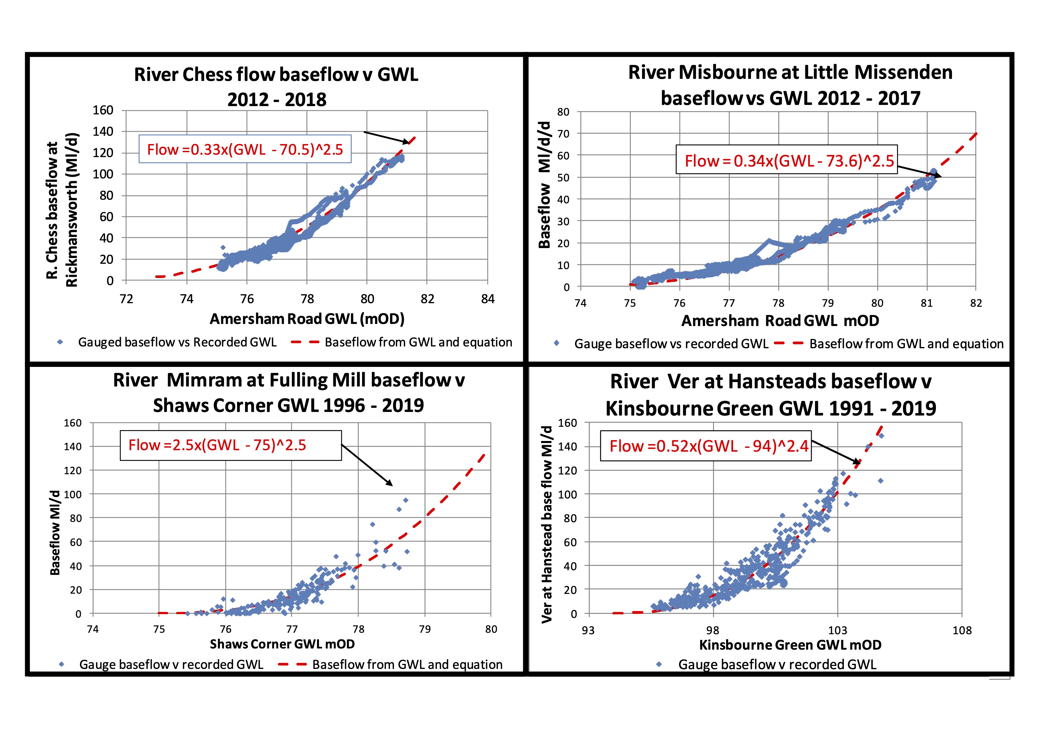
John Lawson has shown – using historical data – that, within relatively tight bounds, when groundwater levels are at a given elevation, streamflows fall within a given range. This close relationship appears to hold across long time series and across multiple different chalk stream catchments. John has looked in detail at the Rivers Kennet, Og, Misbourne, Chess, Ver, Mimram, Beane, Ivel and Darent, with some examples shown below.

Note. 1. baseflows derived from gauged flows using baseflow separation software. 2. Plotted baseflows usually lead GWLs by 2-3 weeks

And, of the course the River Tarrant.

The implication is that groundwater level is the dominant control on flow, with abstraction largely affecting flows indirectly by lowering groundwater levels relative to their natural state.

This is not a theoretical construct imposed on the system, but a pattern observed in the data and then represented mathematically.

The CSF equation and non-linearity

The CSF model expresses this relationship in the form:

Q = a(GWL – b)^c

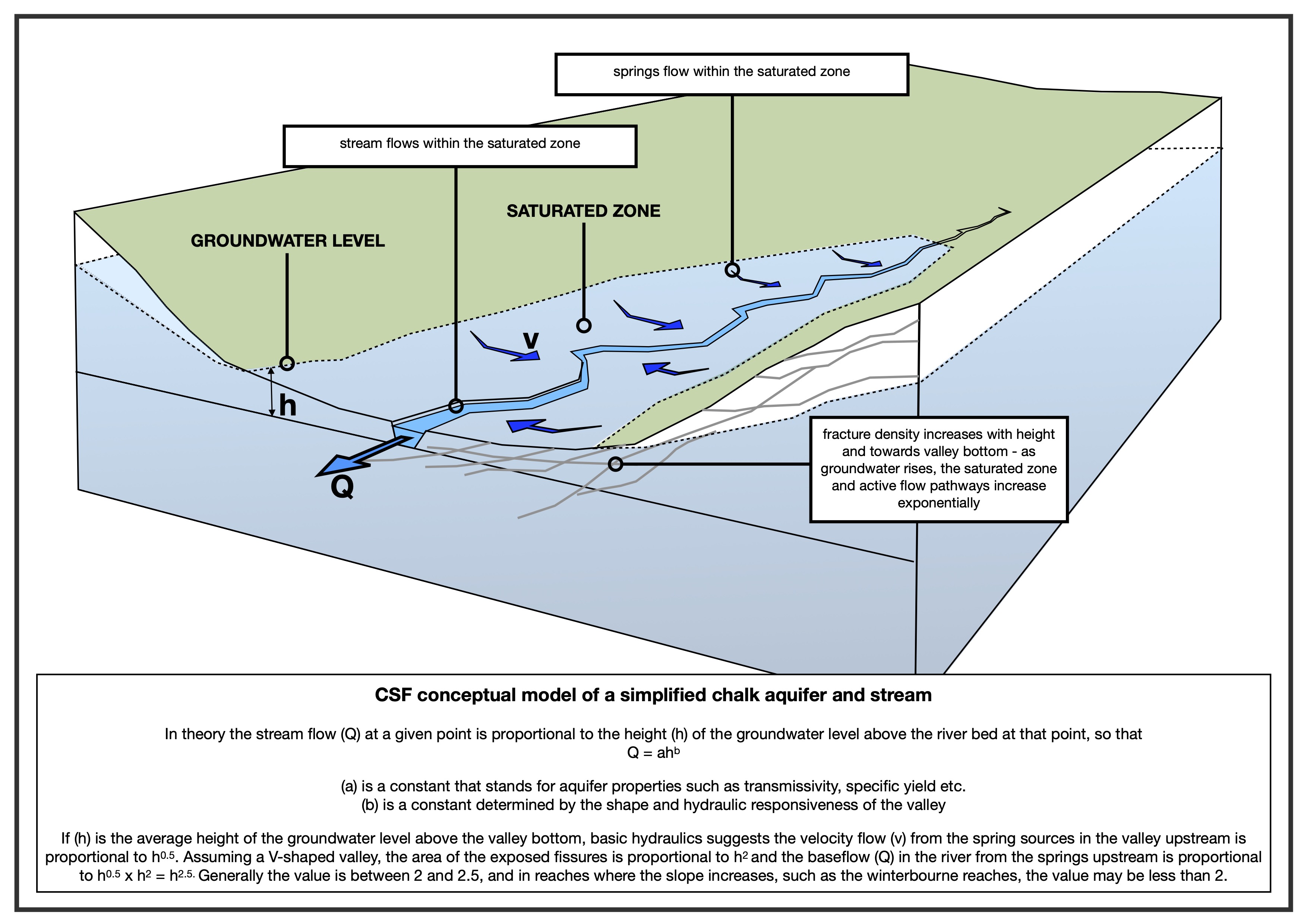
where the constants are calibrated to fit observed data, where the constants are calibrated to fit observed data. Q is flow and (GWL – b), is the height (h) of the groundwater at the observation point over the stream bed at the discharge point.

As shown on the above plots for the Rivers Chess, Misbourne, Mimram and Ver. The relationships between GWLs and baseflows is very strong for “pure” chalk streams with baseflow indices over 90%, like the Chess and Misbourne in the above plots. In rivers like the Darent, with mixed geology including some tertiary deposits, the baseflow indices are below 80% and the relationships show more scatter, but are still plain to see.

A key feature of the relationship is that it is non-linear: increases in groundwater level produce disproportionately larger increases in flow. The model captures this behaviour through the exponent (c), which typically lies between 2 and 2.5 as seen on the plus above.

This non-linearity can be understood heuristically. As groundwater levels rise:

  • the area of saturated ground contributing to spring flow increases, and
  • the hydraulic response of the system becomes more pronounced

Together these effects produce a more-than-linear increase in discharge. While the precise physical mechanisms are debated — ranging from valley geometry to fracture density—the existence of non-linear behaviour is widely observed in the data.

The CSF model does not claim to resolve all underlying processes, but it does provide a consistent way of representing this empirical relationship.

Calibration and transparency

Jane raises concerns about how model parameters — such as subsurface flow and specific yield— are derived.

In the CSF model, these parameters are obtained through calibration: the constants are adjusted until the model reproduces the observed relationship between groundwater levels and streamflows over historic records.

This is a standard empirical approach. The parameters effectively encapsulate the combined influence of aquifer properties such as permeability, transmissivity and storage (a) and valley shape combined with other components of the non-linearity, such as fracture density rising with altitude (b).

The method is described in the RTPS report (page 22), including the treatment of throughflow and specific yield. While simple, it is transparent: the model is designed to reproduce observed system behaviour rather than simulate all underlying processes explicitly.

The key question is therefore not how the parameters are derived in isolation, but whether the calibrated model reproduces reality with sufficient fidelity. On that measure, the fits to historic data are strong.

Is simplicity a weakness?

Prior to the Affinity Water conference in 2022, the CSF model was reviewed by several hydrogeologists. While they noted its simplicity and raised questions about parameter estimation, they did not dismiss the approach. On the contrary, they regarded the results as promising and worthy of further consideration.

Andy Binley wrote: “I must say that the modelling results and analysis of historic data appear convincing to me. You have modelled a substantial set of historic records using a simple lumped approach – the fits to data are impressive and appear to outperform the EA model.”

Jonathan Paul wrote “The reports showcase an interesting, if highly simplified, analytical relationship between groundwater level and river discharge. Initial results look very promising, but greater clarity in how your exponents a and b were obtained would be welcome.”

Jane herself noted in earlier correspondence that the model was “a neat little model” and more satisfactory than some alternatives, albeit highly simplified.

This highlights a tension in the review. The same simplicity that was previously seen as acceptable — within a defined scope — is later treated as a fundamental weakness.

Yet simplified models have a recognised role. They are often used in early-stage assessment, to identify key controls and sense-check more complex analyses. If they can reproduce observed behaviour reliably, they can provide a valuable benchmark against which more elaborate models can be tested.

Conclusion

The CSF model is not a replacement for detailed 3-D modelling, nor does it claim to be. It is a simplified, empirically calibrated tool designed to capture the dominant relationship between groundwater levels and streamflow.

Its conceptual basis is explicit, if simplified. Its parameters are derived transparently through calibration. And its outputs align closely with observed data across multiple catchments.

In that context, the key issue is not whether the model is simple, but whether it is useful. If it consistently reproduces observed behaviour, then it has a legitimate role — particularly in testing the robustness of conclusions drawn from more complex models.

To dismiss it on the basis of its simplicity alone risks overlooking precisely the kind of evidence that can help identify uncertainty in groundwater impact assessments.

Tarrant update 1 – the Environment Agency’s modelling contest

With uncanny timing (following my post Tuesday last week), on Friday the Environment Agency forwarded to the River Tarrant Protection Society the adjudicatory report of their independent expert. (I’ve posted a copy at the foot of the page but have redacted a few personal details)

I received a lot of interested feedback from last week’s post. My intention had partly been to help inform other groups facing similar struggles in other parts of the Chalk, so I was very pleased that I seemed to have done that and to have catalysed a conversation about the uneven, David versus Goliath contests we face.

I’m uneasy about the EA’s approach to this case. Why take so long to respond? Why be so apparently reluctant to engage with the proactive, positive suggestions in the River Tarrant Protection Society (RTPS) report? Why not agree to a meeting? Why set out with an adjudicatory contest between models – which is almost bound to find in favour of the status quo – instead of addressing the full package of evidence?

A quick bit of background. 

Please read my previous post for the fuller picture, but in short:

  • The River Tarrant is a chalk stream in Dorset where locals have long been concerned (50+ years) about the impact of abstraction.
  • It is a breeding stream for critically endangered Atlantic salmon.
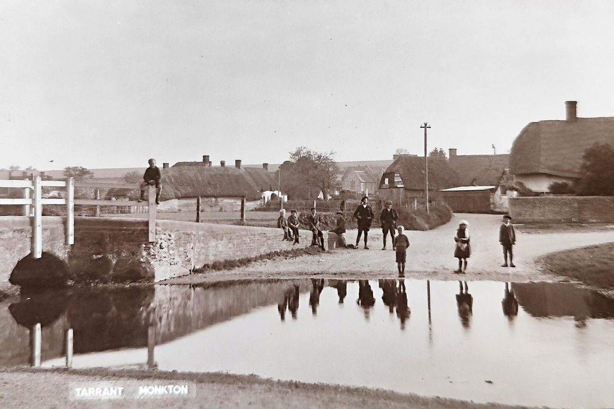
  • The lower stream is drying far more frequently now than it did in the past. We don’t know for certain the flow patterns before the era of abstraction but there are no records of lower river drying before the 1950s (by contrast, there are records of natural upper river drying, for example in 1929) and there are five Domesday mill sites on the middle and lower river, which suggests the stream was reliably perennial.
  • As abstraction has increased from the 1970s to today the drying frequency has climbed from about once per decade (1976, 1989, 1995) to every year (2015, 2016, 2018, 2019, 2020, 2021, 2022, 2023, 2024, 2025).
  • In 2018 Wessex Water was obligated to lower public water abstraction in the Bourne and Wylye catchments. To achieve this they constructed a grid to move water north from “under-utilised sources” in the Stour valley. 
  • As part of this process the Environment Agency asked Wessex Water to produce an environmental impacts report into any possible impacts on the chalk streams of the Middle Stour, specifically the River Tarrant, the Pimperne Brook and the North Winterbourne.
  • The review concluded that: 
    • only a single, small and long-running pump impacted flows in the Tarrant and by only a negligible amount.
    • a single, much larger pump had no impact on flows in the Pimperne winterbourne (nor the neighbouring Tarrant)
    • impacts on the North Winterbourne were negligible.
  • The grid went ahead, since when the Tarrant has dried every year.
  • In 2024 the River Tarrant Protection Society sent an independent report authored by John Lawson to the Environment Agency which questioned the Wessex Water assertion that the abstractions were having no impact on either the Tarrant or Pimperne. The report used the results of relatively simple “lumped parameter” modelling to show that there may indeed be an impact, and added a considerable weight of historical and recent empirical evidence to back up its claims
  • In the face of this uncertainty the RTPS has asked for more detailed investigations and has also proposed a scheme of abstraction realignment that would alleviate the drying in the Tarrant. 

The Environment Agency has taken a long time to respond and thus far the terms of reference for their investigation have been very limited. 

Independent review

Jane Dottridge, an expert hydrogeologist with Mott McDonald, was asked to compare the two modelling approaches: Wessex Water’s modelling (developed with the EA) compared with John Lawson’s modelling. To quote Christopher Greenwell, the EA Water Resources Lead, “I wanted to focus on the two modelling approaches first, since this formed one of the most fundamental challenges within the RTPS report … What Jane has done is not simply to consider John Lawson’s alternative approach but also to reassess the approach undertaken by Wessex Water during their investigation of the impacts of the Middle Stour sources.”

The RTPS was not consulted on the scope, terms of reference or the choice of reviewer.

Jane Dottridge previously reviewed the Wessex Water Middle Stour report in 2018. She has stated in her letter / report that she draws on her prior work as external reviewer to the Wessex Basin Model and her knowledge of that model. 

More than that, Jane has encountered John’s work before, in another context. In preparation for a meeting convened by Affinity Water about the River Ivel in 2022, Jane was recommended to me as someone who might take an independent, helpfully critical view of John’s work and modelling approach. She sent some very useful notes of quite a technical nature. Arguably, her in-a-nutshell verdict was summed up in her statement: “My problem with this model is that it is very 1-d and doesn’t report any water balances. But it is a neat little model and much more satisfactory than some of the others I’ve seen recently.”

This we thought fair enough. John’s modelling wasn’t intended to rival, let alone replace the more complex 3-D modelling used by water companies and the Environment Agency. Instead it is proposed as a solid sense check, especially when the claims of water companies seem questionable, a tool for grass-roots organisations that can be used to usefully question unjustified certainties around these oft repeated claims of “no impact”.

In the meeting itself Jane was more critical of John’s modelling than she had been in our correspondence, describing it as a circular argument with a fitted-up recession to make calibration look right and “pop out some numbers”. It took Rob Soley to propose that the lumped parameter model had its value as a “first pass” to identify potential issues. Another hydrogeologist who we had spoken with before the meeting – Andy Binley –  also defended John’s model for what it is, a simple, numerical model calibrated to predict flows, not all the other complexities of an aquifer system. Jane suggested the idea of a tiered approach to modelling – begin with simpler lumped parameter models, progressing to more complex physics-based models if simpler models don’t provide enough certainty. 

Finally she added – and I have related this discussion not only because the roles of different complexities of modelling were not judged as mutually exclusive by Jane, Rob or Andy, but also because of Jane’s final point: she said that “models should be backed up by data and monitoring“.

So, why limit the scope of the review?

Christopher Greenwell stated that he wanted to focus on a review of the modelling approaches since “this formed one of the most fundamental challenges in the RTPS report”. RTPS weren’t given an opportunity to influence this decision, or to argue that John’s modelling outputs were part of a rounded package of evidence that included historic testimony, news reports and empirical observations.

We can see in Jane’s letter that the scope of the review did indeed focus solely on hydrogeology and groundwater modelling and that it excluded ecological, historical and qualitative evidence. This has the effect of narrowing the debate to something more like “which model is better” instead of addressing the more appropriate question: “what does the the sum of the various strands of evidence say about possible or probable abstraction impacts?”

Clearly, hydrogeology is an inexact science, is inherently uncertain. Groundwater systems — especially chalk — are structurally very complex and models of them are really only crude approximations of the living entity, no matter how much refinement is built in. They are dependent on assumptions and do not constitute primary evidence. Good scientific practice, therefore, should integrate the modelling with the other evidence. Which is exactly what the RTPS report did.

The EA’s approach – at least thus far – is a sort of backwards hydrogeology. It excludes archaeology, geomorphology, ecology, historical records, empirical evidence, testimony and conflates modelled output with evidence in the real world.

Besides, the RTPS model was never intended to win a modelling contest. It was intended to demonstrate that an alternative conceptual model can reproduce the observed behaviour of the stream and suggest that therefore the Wessex Water conclusions may be unsafe.

WFD rules

It is also worth pointing out that WFD assessment rules specifically state that decisions should be made on the weight of evidence, not a single line of analysis. If there is credible uncertainty, plausible mechanisms of impact and observational evidence consistent with impact – all very clearly set out in the RTPS report – then a regulator cannot safely conclude “no impact”.

The legitimate role of historical and qualitative evidence

The RTPS report uses various strands of evidence to try and establish:

  • the baseline condition of the stream
  • changes in the flow regime over time
  • the timing of the changes relative to the advent and then increases in abstraction.

For example:

  • The lower river dried rarely, if at all, before 1950 when abstraction began.
  • Between 1970 and 2000 the lower river dried about once per decade.
  • In the last decade, when abstraction has increased yet further, it has dried almost every year.
  • The exception of 2017 coincided with a long-term shutdown of Black Lane pumping station

This is very solid evidential reasoning, layering historical, hydrological, circumstantial and mechanistic evidence. The RTPS report advances a very legitimate scientific hypothesis, of which the modelling is just one part.

Thus far the Environment Agency’s approach:

Places too much reliance on model supremacy. The review as framed thus far implies that a model provides a more reliable basis for conclusions than any other strand of evidence. Models are inherently uncertain.

Fails to apply “weight of evidence”. The EA review evaluates the models but does not integrate them with the unarguable flow-regime changes, the ecological evidence, the historical evidence, the observed anomalies (2017).

Narrows the focus to short-term datasets. Historical evidence, for example Domesday mills and the presence of Atlantic salmon, provide a legitimate long-term context and capture a picture of the system behaviour before any monitoring record. This is really valuable information and should not be ignored. If you exclude these you bias analysis to short-term datasets that are all influenced by abstraction. 

Misunderstands the RTPS objective. The RTPS model is criticised for its simplification of aquifer properties and structure and lack of conceptual detail. However, the RTPS model was not intended to outscore the Wessex Basin mode, rather to challenge and question its unjustified certainties.

Excludes the RTPS from dialogue. The RTPS sent their report 7-months ago and requested a meeting. Thus far the only meaningful engagement has been the receipt of this report.

By turning this into a modelling contest the EA – thus far – appears to have stacked the deck in favour of the status quo. The EA’s approach is at odds with the more inclusive way forward agreed in during the framing of the multi-lateral CaBA chalk streams restoration strategy. Recommendation 11 in the strategy advocated the importance of knowledge and model sharing and said it was important to “include stakeholders in the discussion and decision-making”.

**

In my next post I will take a look at the Wessex Basin Report, the RTPS report and Jane Dottridge’s adjudication and try to show why – even under the terms of the comparison – the RTPS case is strong and should not be dismissed.

A debate in parliament on “protecting and restoring river habitats”

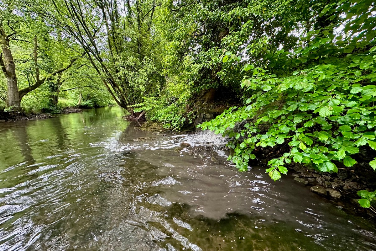
Pictured above: sewage? No. Road run-off from a mid-summer rain-shower. 

You may remember Sophia’s petition for the protection of chalk streams, which quite easily surpassed the 10,000 signatories needed to elicit a letter from Defra, if not enough to trigger a debate in Parliament. However, a debate on river health was had recently (29th January) and chalk streams were mentioned several times.

The text of that debate can be found by clicking this LINK

I probably ought to let you all judge for yourselves what it amounts to or signals.

Personally, I have reservations about how easy it is now to dump blame on the water companies. Not that they don’t deserve a great deal of blame, but the parlous state of our rivers is not only down to water company malpractice. Our laws are at fault. Our regulation is at fault. Our pricing of water is at fault. Cheap food is at fault. Highways maintenance is at fault. Flea treatments are at fault. How much water we all use is at fault. Wet wipes are at fault. The ever increasing size of modern tractors is at fault. Our historic inheritance of mills, canalisation and dredging is at fault. The last three, historically the most remote, are in combination with all the above present day ills, the most significant impacts of all and yet receive virtually zero attention. Having said that, Minister Hardy, did at least extol the virtues of re-wriggling rivers.

Capping water company director’s bonuses might well be one in the eye for some of the folk who should be held to account, but I’m not sure it’s going to really do much to restore our beleaguered rivers more generally or chalk streams in particular.

For that we need some forensically focussed realignment of environmental law, economic drivers and regulation aimed not just at the water industry but at all the pressures that hold our rivers back.

There’s much in Minister Hardy’s final statement to indicate a general commitment to the above.

“Restoring the health of our rivers is fundamental to safeguarding nature, supporting resilient communities and securing our water environment for generations to come. The Labour Government are committed to delivering the most comprehensive programme of reform ever undertaken. It involves strengthening regulation, boosting enforcement, investing in innovation, supporting local partnerships and empowering farmers, land managers and water companies to play their part. From national action on agricultural pollution and chalk stream protections, to ambitious local projects in South Dorset, we are driving real, long-term improvements. Together, those measures demonstrate our unwavering commitment to cleaner water, thriving habitats and a healthier natural environment across England.”

The devil is in the detail, however, and in the end it comes down to that which can be quantified. How much less water will be abstracted from our chalk aquifers? By what date? How will we prioritise abstraction reduction so that we don’t repeat the mistakes of the way we have prioritised phosphorus reduction (ie driven by economics rather than ecological benefit)? Where will the replacement water come from? Will we now, finally, incentivise phosphorus reduction from tiny sewage works in headwaters and tributaries? Exactly how will we do that? Will we persuade or incentivise farmers to adopt better ways to keep soil on their land? Exactly how? Will local authorities adopt less damaging practice in local road maintenance programmes? When by? Etc. Etc.

Specific actions. Specific numbers. Specific dates. These are the things we tried so very hard to get into a Chalk Stream Recovery Pack. Without them it’s all so much fish and chips wrapper.

Dumb, damaging and pointless drainage: one of the many things that impact chalk stream health.

A letter to Minister Hardy

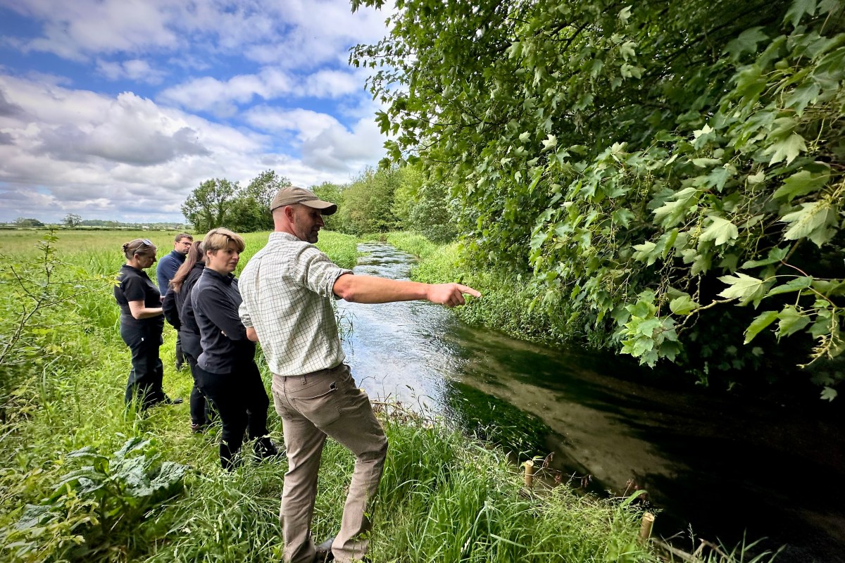
Ali Morse – chair of the CaBA chalk stream group – has written a letter (see PDF below) to Minister Emma Hardy (pictured above with the Yorkshire Wildlife Trust beside the Foston Beck) encouraging her to support measures to restore and protect chalk streams, but also expressing disappointment that the water White Paper and NPPF have not given us the promised assurances that chalk streams will get the “recognition and protection they deserve.”

Some time before the last election – and sensing, without any great gifts of foresight, a change of government – I spoke with Daniel Zeichner, the Cambridge Labour MP, about how important it would be to continue our chalk stream restoration work beyond the election, to harness the momentum gained from a strategy that had been signed up to by all sides. I might have been naive (though not as naive as those firebrands who correlated conservation nirvana with a change at Westminster) but Zeichner agreed wholeheartedly. He said that Feargal Sharkey – who was vigorously campaigning for Labour at the time – would hold them all to account if they didn’t do something.

And yet in spite of all that, the responses of the new(ish) government to repeated pleas for the greater protection of chalk streams have been underwhelming, to say the least. Having filibustered the progress of Minister Pow’s promised Chalk Stream Recovery Pack, Defra used the election as a means to nudge the pesky document under the carpet and finally to bury it altogether.

But when I met Minister Hardy last summer on the banks of Yorkshire’s Foston Beck, I met someone who I felt was motivated – as Minister Pow had been – to help chalk streams. She seemed genuinely keen to listen and help. Genuinely flabbergasted by some of the anomalies in existing environmental law that, for example, drive ever more expensive sewage treatments to works where the benefit to wildlife is minimal, while ignoring those places that need it most. But I also sensed a hesitancy to commit. Having worked for a year with Defra trying to midwife the Recovery Pack I knew why. Trying to persuade that unelected part of government to do anything differently is like pushing water uphill, whether you’re a Minister, an eNGO or individual citizen.

As Ali points out in her excellent letter, during the passage of the Planning and Infrastructure Bill we saw consistent and strong cross-party support for measures to protect chalk streams. We heard ministerial assurances from the despatch box that effective chalk stream measures would be included in upcoming policies.

But we haven’t seen much of substance, thus far.

No surprise, perhaps. There is no Damascene moment in conservation. I’ve been banging on about chalk stream protection since the dark days of the late 1980s when abstraction was at its peak, when cattle poached the riverbanks to bits, when land drainage engineers ruled the waterways, when zero phosphorus was removed from sewage and when “restoration” of rivers was an eccentric form of guerrilla resistance. Things are better than that now, though sometimes it may not feels as if they are.

To that end, Ali has extended to Defra the hand of continuing cooperation backed by the wealth of expertise now assembled under the umbrella of the CaBA chalk stream group, very ably managed by Alison Matthews. And I have invited Minister Hardy to come and visit the River Chess to meet with the River Chess Association and the Chilterns Chalk Stream Project and see first hand how collaboration and persistence can bring about the recovery of a chalk stream.

Fingers crossed. As ever.

Full text from the House of Lords debate ref the protection of chalk streams and the Bishop of Norwich’s amendment to the Planning and Infrastructure Bill.

Extracted from Hansard Report – Planning and Infrastructure Bill – Hansard – UK Parliament

Amendment 93

Moved by

Baroness Grender 

93: Clause 52, page 73, line 22, at end insert—

“(6A) Where a strategy area includes a chalk stream, the spatial development strategy must include policies on permissible activities within the area of the stream for the purposes of preventing harm or damage to the stream or its surrounding area.”Member’s explanatory statement

This amendment would ensure spatial development strategies include policies to protect chalk streams.

Baroness Grender 

My Lords, Amendment 93, in my name and that of the noble Baroness, Lady Jones of Moulsecoomb, aims to secure the future of England’s chalk streams by enshrining specific protections and standards into our planning regime. As we made clear in Committee, these globally rare ecosystems—there are only 200 in the world—are often referred to as our country’s rainforests in terms of biodiversity and they face genuine risk from piecemeal development and inadequate water management. These are risks that will only intensify without a robust and specific legislative lever.

Relatively recently, I went for a customary walk in a beautiful green space in south-west London, only to discover that the beautiful River Wandle, home to brown trout and kingfishers, had been destroyed by a devastating diesel leak. The Government intend to streamline housebuilding and environmental measures in tandem, but the practical reality is stark.

Chalk streams are uniquely vulnerable. Abstraction of water, chronic pollution and unchecked development have led to tangible declines in many local areas. In 2023, the Liberal Democrats collected data through freedom of information requests, which revealed that one in 10 chalk stream sewage monitors were faulty, with some water companies having much higher rates of broken or uninstalled equipment.

Amendment 93 delivers a targeted solution: a statutory driver for sustainable drainage standards before any development interfaces with public sewers, closing a loophole that currently exists and has allowed cumulative harm to chalk streams. This amendment would ensure that developers are compelled to apply national standards for drainage and water treatment ahead of any permissions, rather than leaving mitigation as an afterthought.

Amendment 94 in the name of the right reverend Prelate the Bishop of Norwich complements this approach, and I thank him for the work he has done on this issue and his environmental expertise, which he has brought to this debate. Amendment 94 tightens oversight and demands full transparency in environmental impact reviews on watercourses at risk, an essential safeguard for communities whose local rivers are too often treated as collateral damage by the planning system’s inertia.

None of us should accept that cleaner, safer waterways are an optional extra and a nice to have. By adopting an amendment on chalk streams and supporting, out of these two amendments, Amendment 94, this House will signal that nature restoration, water quality and sustainable infrastructure are not in competition but can be advanced through co-ordinated and legally binding steps. I urge noble Lords to support these amendments for the sake of our streams and the communities they sustain.

If the right reverend Prelate the Bishop of Norwich moves to a vote, these Benches will support him. It is right that, with something as crucial as our unique chalk streams, we ask our colleagues in the House of Commons to think again and strengthen and protect in law this ecosystem that is almost unique to England. I hope that this House will unite in voting for Amendment 94 and protecting this rare heritage for future generations.

Amendment 94

The Lord Bishop of Norwich 

My Lords, I shall speak to Amendment 94, and I thank the noble Earl, Lord Caithness, the noble Viscount, Lord Trenchard, and the noble Baroness, Lady Willis of Summertown, for their support. I am most grateful to follow the noble Baroness, Lady Grender, who has just spoken so powerfully about her amendment, as well as offering her support for this amendment. Amendment 94 would require a spatial development strategy to list chalk streams in the strategy area, outline measures to protect them from environmental harm and impose responsibility on strategic planning authorities to protect and enhance chalk stream environments.

Chalk streams, as we have heard, are a very special type of river. Some 85% of the world’s chalk streams are in England. They are fed primarily by spring water from the chalk aquifer, not rain, which means that they have clear, cold water and very stable flows. These globally rare habitats are found in a broad sweep from Yorkshire and the Lincolnshire Wolds through Norfolk, the Chilterns, Hampshire and Dorset. The Bure, Glaven, Wensum, Test, Itchen and Meon are river names that come to mind flowing, as they do, through the tapestry of English history and in our literature, such as the River Pang-based Wind in the Willows. They are rich in minerals, especially calcium, and this “base rich” environment supports a distinctive and rich ecology.

It is no wonder that this amendment and a similar one in the other place have received such positive support, including in your Lordships’ Committee. What it seeks to do is such an obvious thing, for what we love, we should desire to protect; what we value, we should safeguard; what is of global significance, we should be deeply proud of.

I am grateful that the Minister responded to my letter to her about my amendment. However, her response was far from reassuring in two ways. First, the Government have pointed to local nature recovery strategies as a way of protecting chalk streams. These could, of course, in future be capable of considering, avoiding and otherwise mitigating for direct damage to these habitats, such as occurs from the footprint of a development near a chalk stream. However, to do so, LNRSs will need more bite in the planning system than they currently have. We are still waiting for the regulations designed to do precisely that, placing a duty on local planning authorities to take account of the nature strategy when making planning decisions. 

We are still waiting for that to be commenced, and it is now a full two years after these regulations were promised in the Levelling-up and Regeneration Act 2023.

Even once the regulations are passed, LNRSs will not be well placed to map, quantify and avoid or mitigate for the offsite impacts of development such as downstream pollution or the additional water that will be abstracted from chalk streams or their aquifers to serve new homes. These very real threats to our chalk streams, over areas much larger than are covered by strategies, cannot be addressed by LNRSs.

Secondly, the Government have pointed to their plans to limit overabstraction by water companies through amending licences, but their target achievement date is 2030. This could take far, far too long and be far, far too late for many threatened chalk streams. The current abstraction situation is grave. Water companies are not sourcing their water from chalk streams within sustainable limits. The Catchment Based Approach’s chalk streams annual review 2024-2—a mouthful of a title—published last week, reports that a third of chalk streams do not have healthy flow regimes. This CaBA report also highlights additional water bodies where, despite flows being classed as compliant overall, abstraction can cause significant local impacts in parts of the watercourse. For example, in the River Loddon, upstream areas are impacted by abstraction but, because of wastewater discharge downstream of them, flows at the assessment point are classed as compliant. If overabstraction occurs for a sustained period upstream, the whole chalk stream could well dry out.

In light of the growing and urgent challenges facing our chalk streams, we cannot afford to wait for LNRSs to have more planning bite, or for 2030, when the abstraction licence amendments come into effect. We need Amendment 94 so that spatial development strategies are equipped to enable planning authorities to direct development away from areas where development footprints, pollution and overabstraction could sound the death knell for declining chalk streams. I will certainly listen to the Minister’s response with care. However, if this amendment continues to secure wide support, I will look to test the opinion of the House.

Baroness Willis of Summertown 

I am pleased to add my name to the important amendment tabled by the right reverend Prelate the Bishop of Norwich, and to Amendment 92 in this group, because, let us be honest, we are not starting from a good place with chalk streams. As mentioned by my noble friend, the current status of these unique and extremely rare habitats in the UK is poor, with more than three-quarters failing to meet good ecological health standards. This is precisely why the chalk streams became such an important issue for debate in the Levelling-up and Regeneration Bill. I remember only too well the same Front Bench colleagues debating long and hard for their protection.

The chalk stream recovery plan, announced by the previous Government, was seen by many, including me, as a good step in the right direction. But here we are again, with chalk streams back in the firing line and, despite the reassurance from the Minister on Report that local nature recovery strategies could propose priorities for their protection, the problem with our planning system is that it requires local authorities only to have regard to our LNRSs, which is not strong enough to protect these vulnerable habitats. We came across this a number of times in the Levelling-up and Regeneration Bill. Those words are etched in my memory.

Also, although the NPPF recognises the importance of irreplaceable habitats, chalk streams, much to my alarm—and, I am sure, to that of many in this House—are not specifically listed as protected habitats. Therefore, they do not have the overarching level of protection in the Bill, through the spatial development strategies, in the same way other protected habitats do. The only hope left, therefore, is the chalk stream nature recovery plan, launched by the previous Government. However, in reply to the question on this asked in Committee by the noble Viscount, Lord Trenchard, who sadly cannot be here today, the Minister stated that even this is now on hold because it is out of step with the ambitious programme of water reforms proposed by the Government. Perhaps the Minister can say for how long it will be on hold, as a result permitting further damage to occur in these unique freshwater habitats.

I say this because time is of the essence here. As an ecologist, I went back to look at the literature. Research on chalk streams has demonstrated that while removing pollution can result in the improvement of water quality within a month to a few years, ecological recovery can take between 10 and 20 years. The more damage we do, the longer it will take for them to recover.

Lastly, surely there must be some no-go habitats in some of our river catchments, and these chalk streams should be one of them. I therefore urge the Minister to agree to this amendment, within which the spatial development strategy would mandate the sort of responsibilities that lead to the protection and enhancement of these unique and rare chalk stream habitats.

Lord Bellingham 

My Lords, I support both amendments. I made a speech in Committee in which I laid out very similar arguments to those put by the right reverend Prelate and the noble Baroness, Lady Willis. I will not repeat them now, except to say that the right reverend Prelate referred to a number of chalk streams in my old constituency of North West Norfolk. These incredible assets—these unique and precious assets—are at risk as we speak. I say to the Minister that neither amendment is particularly demanding. They are quite modest in their overall fabric and intent. If the Government are serious about their environmental credentials, and about trying to do something for the countryside, I urge them, please, to accept these amendments.

The Earl of Caithness 

My Lords, I have put my name to the right reverend Prelate’s amendment. I am delighted to see him back in the Chamber; we missed him in Committee.

My noble friend Lord Roborough was absolutely right when he said in Committee that all rivers are important. Yes, that is true, but chalk streams are that bit more important. The reason for that is that we have 85% of the world’s chalk streams. We are custodians for that majority, but 83% of those chalk streams do not meet good ecological standards. We have handled the whole situation very badly. I think we have taken a retrograde step with this Government, who have dispensed with the chalk stream recovery pack, which the noble Baroness just referred to.

I have written to the Minister and told her that I will ask her a number of questions. I have given her forewarning, so I expect replies. In what respect did that chalk stream recovery pack fall short? It was nearly ready to go when the Labour Government took over after winning the election. They could have pressed the button; that chalk stream pack focused on some difficult questions that nobody had fully addressed before, so why have they torpedoed it? What do they propose to do that will be better than that pack had proposed?

Let us go down to some specifics of the pack. It had time-bound commitments to reduce groundwater abstraction on numerous chalk streams which, according to the Environment Agency’s own data, are unsustainably extracted: for example, the Darent in Kent, where over half the rainfall that feeds the river is taken away for public water supply. There was a timescale for getting that right. Will the Government stick with that timescale or will there be something longer? Do the Government have plans to move water abstraction further downstream, rather than at the headwaters of these rivers?

The chalk stream pack also had a timebound commitment to address the hundreds of small sewage works in chalk streams that do not remove phosphorus in the treatment process and where there is currently no policy or incentive to drive investment. What are the Government going to do better to give a good timescale to get all those water treatment plants in good order? The pack also addressed run-off from highways and local roads, which I have spoken about before in your Lordships’ House, and how damaging it can be to chalk streams in particular because of the added silt. The CaBA chalk stream strategy recommends revised best practice guidelines for local councils that give more protection to chalk streams. Do the Government have better plans than that? The pack also put forward solutions to reform the farming rules for water, which are currently ineffective. What are the Government going to do to replace that recommendation?

I did not mention this question when I wrote to the Minister, but I will add it now: how do the Government intend to address the physical dysfunctionality of many chalk streams moved, straightened, dredged or dammed over the centuries and put them back to their natural state? In destroying the hard work of some very good, able and committed people who produced the chalk stream pack, the Government have alienated some potential friends in their effort to improve the environment. How are they going to get friends back onside when, after all that work, they have just dismissed it as though it did not matter? What plans do they have to include such people in the future to try to improve the whole river system for chalk streams? It is no good taking just one little area in one district or county council, because chalk streams do not understand those borders; they flow through lot of different councils. The whole thing has to be tackled on a holistic basis, and the only way to do that is by supporting the right reverend Prelate’s amendment.

Lord Roborough 

My Lords, I shall speak to the amendments in the names of the noble Baroness, Lady Grender, and the right reverend Prelate the Bishop of Norwich. I am grateful for their excellent, informative introductions. We on these Benches tabled similar amendments in Committee. The amendments share a vital purpose: to ensure that our planning system gives proper recognition and protection to chalk streams, one of our most distinct and rarest natural habitats. These streams help define our landscapes, support unique biodiversity and supply water to many communities. The amendments would require spatial development strategies to identify and protect chalk streams, setting out the responsibilities for planning authorities in their stewardship.

These are sensible, constructive proposals and I am grateful to those who have tabled and supported them. We will support the right reverend Prelate the Bishop of Norwich if he divides on his amendment this evening. Will the Minister say whether she considers chalk streams to be irreplaceable habitats, like ancient woodlands, and therefore deserving of similar policy protection? The case for stronger recognition of chalk streams within our planning system is compelling. They are an irreplaceable part of our natural heritage and a globally important asset, and the way we plan for growth must reflect that.

I hope the Minister has heard the House and will be able to accept these amendments, and explain, as the noble Baroness, Lady Willis, and my noble friend Lord Caithness have asked, why our chalk stream restoration strategy is on hold.

Baroness Taylor of Stevenage 

My Lords, I thank the noble Baroness, Lady Grender, and the right reverend Prelate the Bishop of Norwich for Amendments 93 and 94, which propose additional statutory obligations for strategic planning authorities in relation to the identification and safeguarding of chalk streams. With 85% of the world’s chalk streams found in England, these unique water bodies are not just vital ecosystems but are indeed a symbol of our national heritage. The Government are committed to restoring them, which is why we are taking a strategic approach to restoring chalk streams. Working in partnership with water companies, investors and communities, the Government will introduce a new water reform Bill to modernise the entire system so that it is fit for purpose for decades to come. This is essential to restoring chalk streams to better ecological health and addressing the multiple pressures facing these habitats.

Alongside the programme of ambitious reforms, the Government are continuing to deliver vital improvements and investment for chalk streams, including £1.8 million through the water restoration fund and water environment improvement fund for locally led 

chalk stream projects. Over the next five years, water companies will spend over £2 billion on chalk stream restoration.

The Government remain firmly committed to the restoration and protection of chalk streams. Plan-makers and decision-makers should recognise these habitats as valued landscapes and areas of high biodiversity. They deliver essential ecosystem services, contribute significantly to natural capital, and should be identified and protected through local plans.

As I emphasised in Committee, local nature recovery strategies provide a tool for identifying and enhancing chalk stream habitats. These strategies map priority areas for nature and are informed by key environmental data, such as the assessments carried out under river basin management plans. Under Section 12D(11) of the Planning and Compulsory Purchase Act 2004, spatial development strategies must already take account of relevant local nature recovery strategies.

In answer to the points made by the right reverend Prelate, local nature recovery strategies are a legal requirement and are prepared by responsible authorities, typically county or combined authorities appointed by the Defra Secretary of State. There are 48 LNRS areas and lead authorities covering the whole of England; there are no gaps, and no overlaps. LNRS responsible authorities work closely with local partnerships, involving all local planning authorities, to identify and map proposed areas for habitat management, enhancement, restoration and creation for biodiversity and the wider natural environment. The West of England Combined Authority published the first LNRS in November 2024. Five more have since followed: North Northamptonshire Council, Cornwall, Isle of Wight, Essex and Leicestershire. The remaining 42 are expected to be published by the end of 2025, or shortly thereafter.

I will also address the right reverend Prelate’s point about the provisions in the LURA. The Act created a duty requiring plan-makers to take account of LNRS. This builds on the existing requirement on all public authorities to have regard to LNRS in complying with their duty to conserve and enhance biodiversity. This duty will be commenced as part of wider planning reforms later this year.

Where a strategic authority considers chalk stream protection to be of strategic importance, Section 12D(1) requires that spatial development strategies include policies on land use and development that address such strategic priorities. Authorities will therefore be able to include such policies where appropriate.

Furthermore, planning policy is clear that decisions should prevent new and existing development contributing to unacceptable levels of water pollution. Where water quality has the potential to be a significant planning concern, an applicant should explain how the proposed development would affect a relevant water body in a river basin management plan and how they propose to mitigate the impacts.

Fixing systemic issues is essential to addressing the multiple pressures facing these habitats, and restoring our chalk streams to better ecological health is part of our overall programme of ambitious reforms for the water sector.

I will respond to the points made by the noble Earl, Lord Caithness. I am more than willing to answer all his points—I will try to do so briefly. It might have been more helpful to have them in writing before today, but I will cover the points he has raised. First, on the time-bound commitments to reduce ground water abstraction, we are tackling one of the biggest threats to chalk streams by reducing harmful abstractions by an estimated 126 million litres daily by 2030, protecting vital water flows to these fragile ecosystems.

Companies covering chalk stream areas, such as Affinity Water and South Staffs Water, have made specific commitments to reduce abstraction from chalk streams. Affinity Water has committed to reducing abstraction by 34% by 2050. Portsmouth Water is building a new reservoir in Hampshire to protect the River Test and the River Itchen—this is the first new reservoir to be built since the 1970s. In June 2025, the Environment Agency updated its national framework for water resources, which set out the importance of chalk streams and how we will include their needs in water resources planning and decision-making.

On time-bound commitments to address hundreds of small sewage works in chalk streams that do not remove phosphorus, under the Environment Act, to achieve the 80% reduction in phosphorus load discharge, the phosphorus improvement driver prioritises action for catchments that meet one or more of the following criteria: catchments with water framework directive regulations—phosphorus standard failures; catchments with identified nutrification issues under the Urban Waste Water Treatment Regulations; and catchments where phosphorus targets set by conservation policy advisers are exceeded. That prioritisation ensures targeting to achieve the best environmental outcomes.

In addressing run-off from highways and local roads, the Defra Secretary of State has committed to including a regional element in the new water regulator. We are considering how road or highway run-off and urban diffuse pollution can be managed at a regional or local level as part of moving to a catchment-based approach.

Lastly, on the reform of farming rules for water—which the noble Lord said in his letter are currently ineffective—the levels of water pollution from agriculture are unacceptable. We are looking at reforming the regulations, including the farming rules for water, as a priority within a suite of broader interventions. We are also working with farmers, environmental groups and other parties to improve the farm pollution regulations to make sure that they are simple and effective. This will allow us to deliver pollution reductions and clean up our waters while supporting farm businesses to grow. I hope that is helpful to the noble Lord.

We need to continue to tackle the biggest impacts on chalk streams, including reducing the risk of harmful abstraction, and we are doing so, as I said, by 126 million litres through the amendment of water company abstraction licences, and rebuilding the water network with a record £104 billion investment to upgrade crumbling pipes and cut sewage spills. In light of all this, I hope noble Lords will not press their amendments.

Baroness Grender 

My Lords, I thank the Minister. It is very clear there is a strong feeling within this House that there is a need for something to shift and be enshrined in law. I beg leave to withdraw my amendment in order to hand over and support the right reverend Prelate the Bishop of Norwich if he decides to press his.

Amendment 93 withdrawn.

Amendment 94

Moved by

The Lord Bishop of Norwich 

Sharethis specific contribution

94: Clause 52, page 73, line 22, at end insert—

“(6A) A spatial development strategy must—(a) list any chalk streams identified in the strategy area;(b) identify the measures to be taken to protect any identified chalk streams from pollution, abstraction, encroachment and other forms of environmental damage; and(c) impose responsibilities on strategic planning authorities in relation to the protection and enhancement of chalk stream habitats.”Member’s explanatory statement

This amendment would require a spatial development strategy to list chalk streams in the strategy area, outline measures to protect them from environmental harm, and impose responsibility on strategic planning authorities to protect and enhance chalk stream environments.

The Lord Bishop of Norwich 

My Lords, I thank all who have contributed to this important debate and the Minister for her response. However, I am not convinced by her arguments; we cannot wait for a water reform Bill and have these arguments again at that stage. Amendment 94 seeks to protect chalk streams, this precious habitat which we are the custodians of. It aims to restore biodiversity and create a planning system that works with nature, not against it. At present, I am afraid, the Bill before us fails to do this for chalk streams. Thus, I seek to test the opinion of the House.
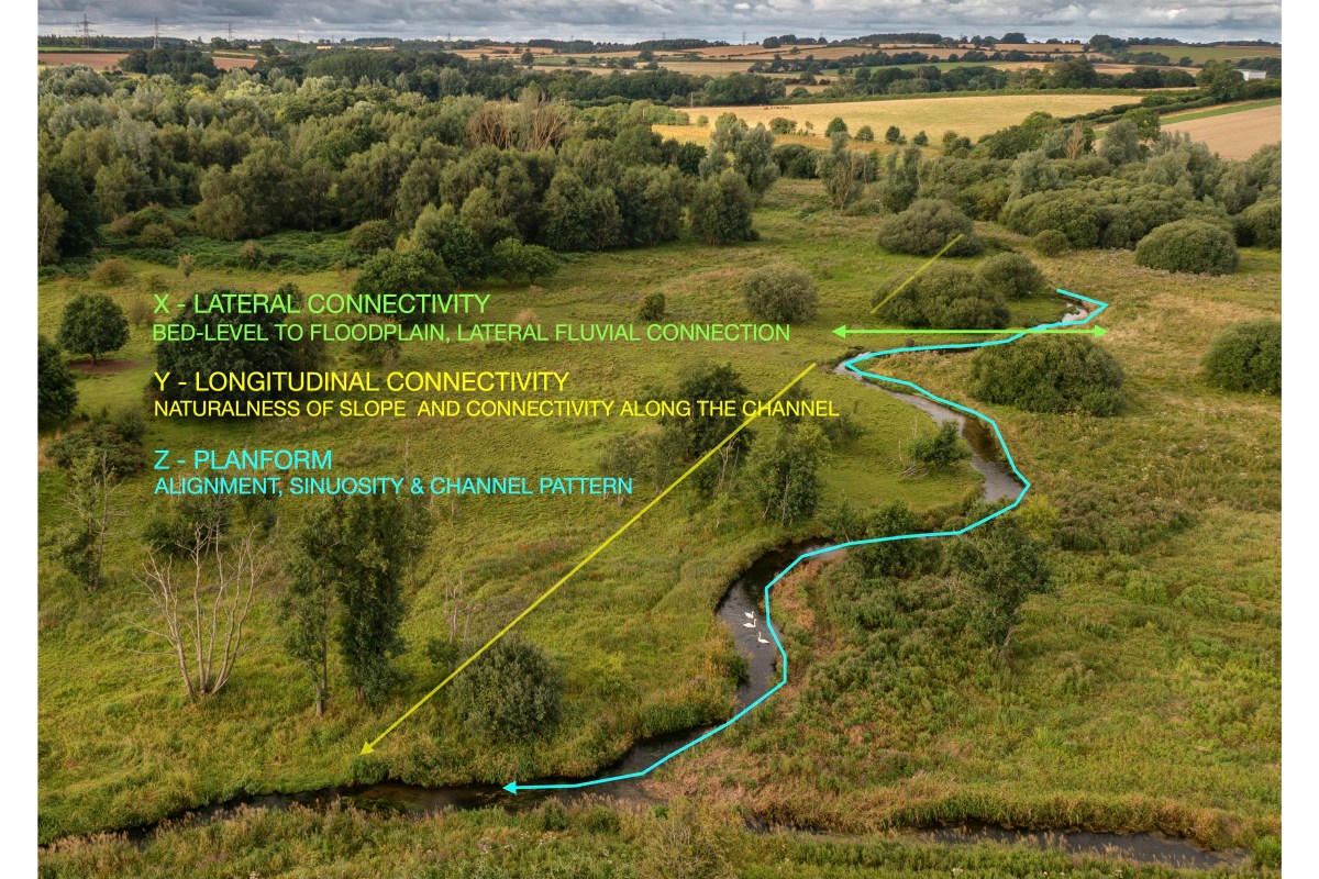
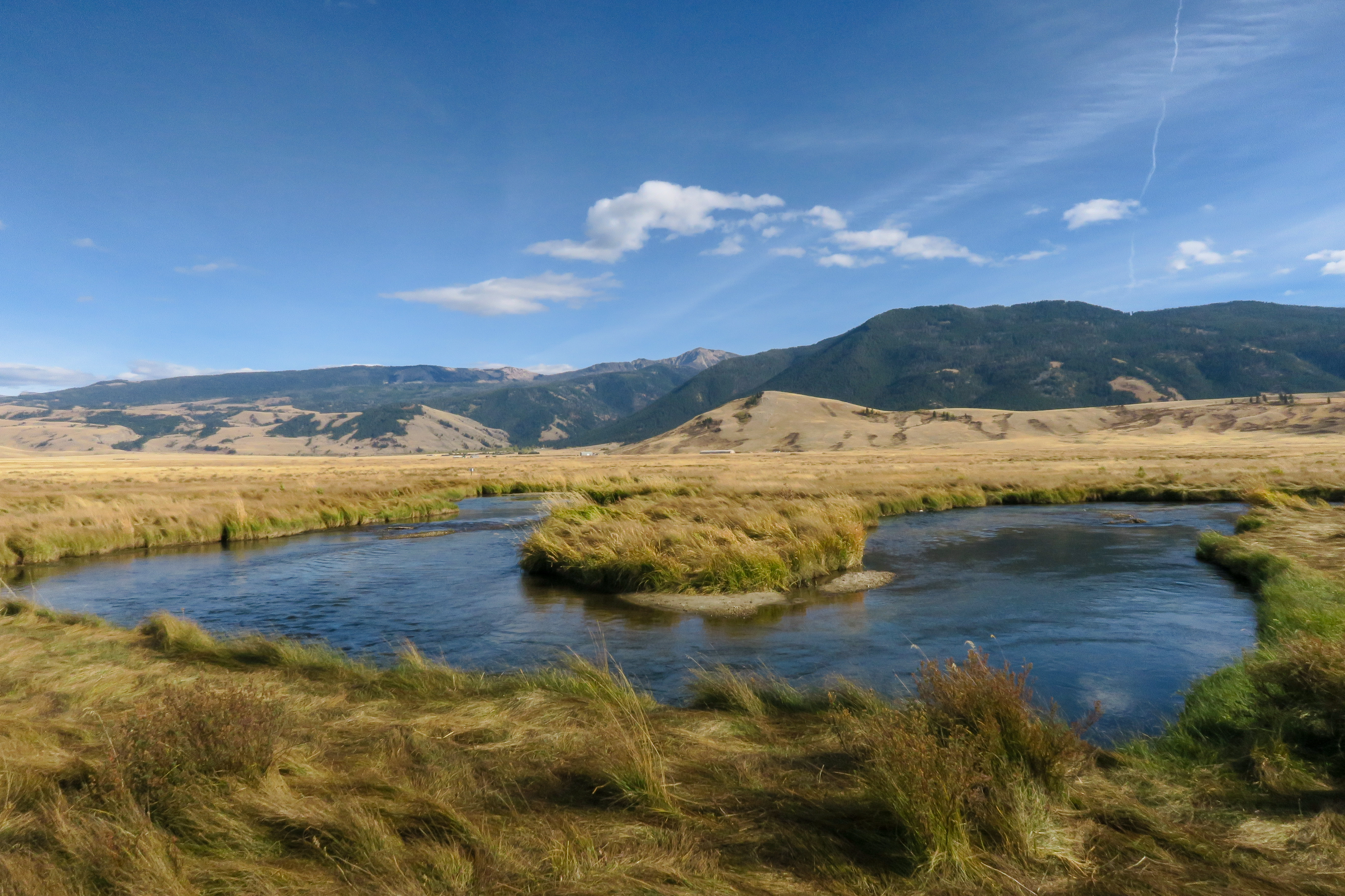
Sophia’s petition

Last Friday afternoon 30th May Sophia’s petition “please don’t abandon the chalk stream recovery pack” passed 10,000 names. By Monday almost another 1000 names had been added.

This is fantastic news. It means that the government must now respond.

And maybe they have, to a degree. On Monday I met Minister Emma Hardy by a Yorkshire chalk stream. Many thanks to our guide Matt Arnold from the East Yorkshire Rivers Trust.
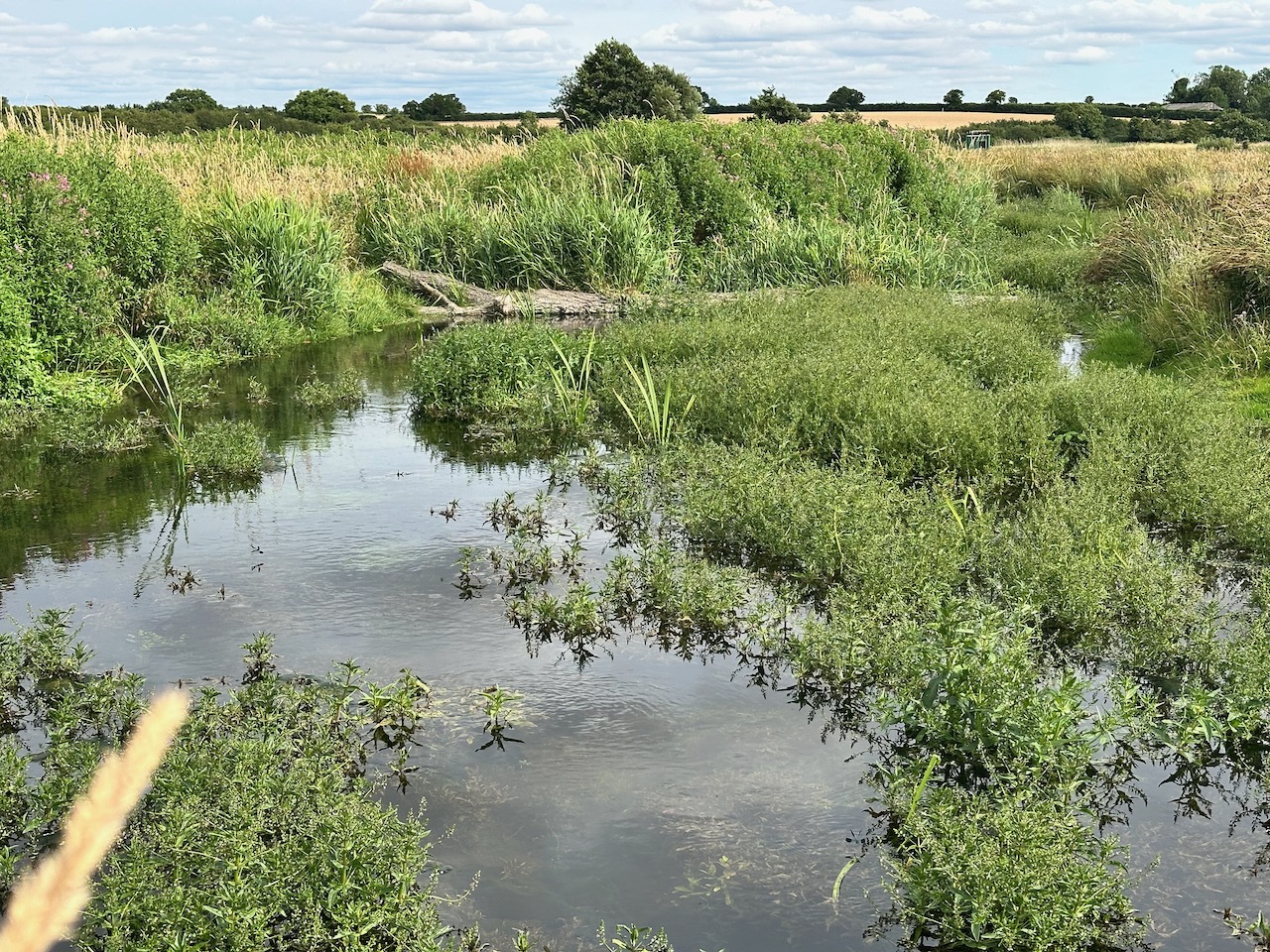
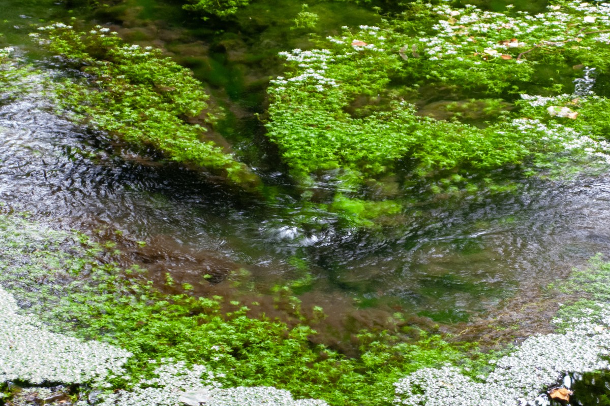
Though we were standing beside the Boston beck, perhaps one of the least pressured chalk streams in England, Minister Hardy was genuinely keen to know more about the multiple threats to chalk streams and what we should be doing to make things better.

We discussed the extreme levels of abstraction that exist on some chalk streams, especially those near London, and the suffocating nutrient pollution that comes from innumerable small sewage works where there is no phosphorous limit or where, if one exists, it is absurdly lax. We especially focussed on the lack of clarity in catchment level decision-making, something I feel the government could help with by unambiguously signalling the importance of chalk streams.

That signal should have taken the form of the Defra chalk stream recovery pack, of course, but I’m not holding my breath for a change of heart regarding its publication. Though you never know.

I will certainly continue to push, arguing why many of the measures in the pack were low-cost no-brainers: stuff that builds on existing policy with greater clarity and purpose, that would remove blockers in bureaucracy or give clear signals to water resource groups and water companies on where to prioritise abstraction reduction or target better water quality in vulnerable headwaters or that gives support to stakeholders.

My guess is that the treasury has put more or less everything on hold while it tries to prioritise growth through development.

This is worrying. Water efficiency through demand and leak reduction, for example – THE big plays in our national framework for water resources over the next two decades – means nothing for nature, unless accompanied by actual abstraction reduction. Of itself water efficiency simply makes headroom for development. And in the current climate this is almost certainly what it will be used to deliver.

Similarly, if the water industry is left to meet the previous government’s laudable nutrient reduction targets (as set out in the Environmental Improvement Plan) via “highest technical standards” at large works downstream of large population centres where highish standards exist already, then of course this will be the preferred “cost-effective” pathway for all parties.

All parties except fish and insects who might prefer those chemicals are removed upstream of where they live. The point is, you can create a great headline figure for phosphorus removal where it makes little ecological benefit, but why not direct the targets towards their purpose?

Without direction from government or its regulators on how to prioritise either abstraction or phosphorus reduction, economic efficiency of a decidedly anthropogenic kind will decide. River life will receive little benefit from initiatives intended to restore it.

Frustratingly, it’s all about economics – no matter who’s in charge – and so long as water is as cheap as it is, and so long as imaginative and economically-efficient ideas like Chalk Streams First or nutrient treatment wetlands or risk-based buffer strips (all measures a recovery pack might have given prominence to) are starved of oxygen, then nature will pick up the bill.

And thus the can is kicked down the road.

It doesn’t have to be this way. The chalk recovery pack would have been Defra’s first bespoke policy document for chalk streams. This government could yet dig it out, add some oomph to the stuff that got watered down, and defy my cynicism. No one would be happier to be proved wrong.

In the meanwhile, it was a pleasure to meet the Minister and I’m very much hoping we can meet again soon on one of the Flagship project sites, the Chess, for example where Kate Heppell is leading amazing citizen science research, or the Anton, where Simon Cain and Bob Wellard are concocting imaginative re-wilding schemes. And then perhaps the beleaguered Ivel which barely flows, or the Ver whose headwaters this winter have been constantly polluted with raw sewage.