In the last post I outlined a simple way of trying put together a sensibly ordered catchment restoration strategy by scoring the underlying foundations at a reach scale – habitat, flow and water quality – working out where the deficits are, working out the feasibility of addressing each of them, multiplying one by the other and arriving at a strategic order of projects.
A few of the other slides I showed to the Test and Itchen group outlined in broad-brush terms how it might look at a catchment level with a look at the River Anton as an example. I’ll put those slides in the next post.
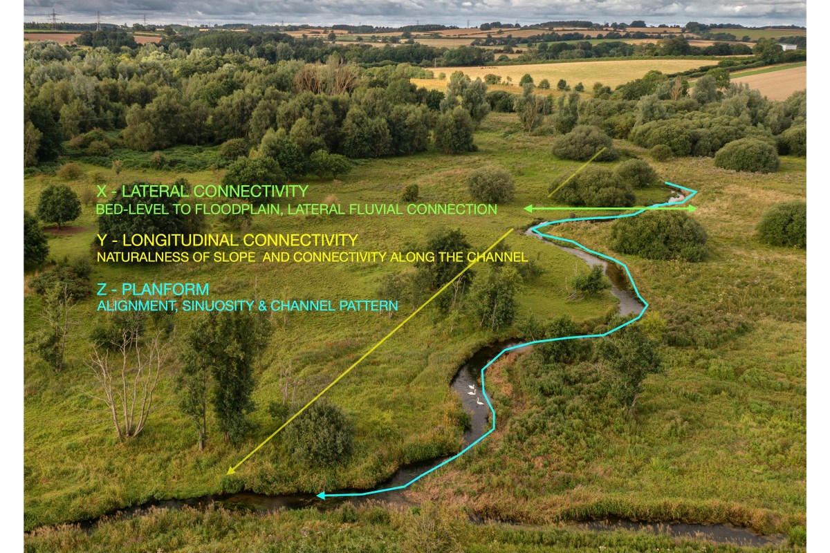
The first thing to look at in a little more detail, however, is the underlying foundation of physical habitat, that can be broken down into three physical dimensions that I call the XYZ. Lateral (X) and longitudinal (Y) connectivity and planform (Z). In my view, these foundational elements are THE most important thing of all, because they very largely determine whether and to what extent a dynamic, varied habitat can form (all the pools, riffles, undercuts etc).
Most chalk streams have been modified in ways that remove or undermine the XYZ.
X
X is the lateral connectivity with the riparian edge and the wider floodplain. A consistent feature of natural (unmodified) spring-creek (groundwater dominated) streams is the close relationship between the stream bed and the floodplain surface. Chalk streams are the same, or should be. Simply put, when you stand on the hypothetical unmodified banks of a spring-fed creek your feet won’t be that much higher than the water surface (summer or winter) and the river bed is not that far down below that water surface either, at least not compared to a surface-fed system with a much wider range between low flows and high flows.
To illustrate what I mean, here are some pictures of relatively unmodified spring-creeks, in Wyoming, Montana and New Zealand. You can see how these streams are flush full and in touch with their floodplains, and that they are free-flowing too: the flushness is not because they’ve been backed up in any way. They tend to be quite wide and shallow (lacking the energy to erode downwards) and they flow from and through a high-water table. Generally speaking chalk streams should look like that, but many to most don’t because they have been diverted and / or dredged.
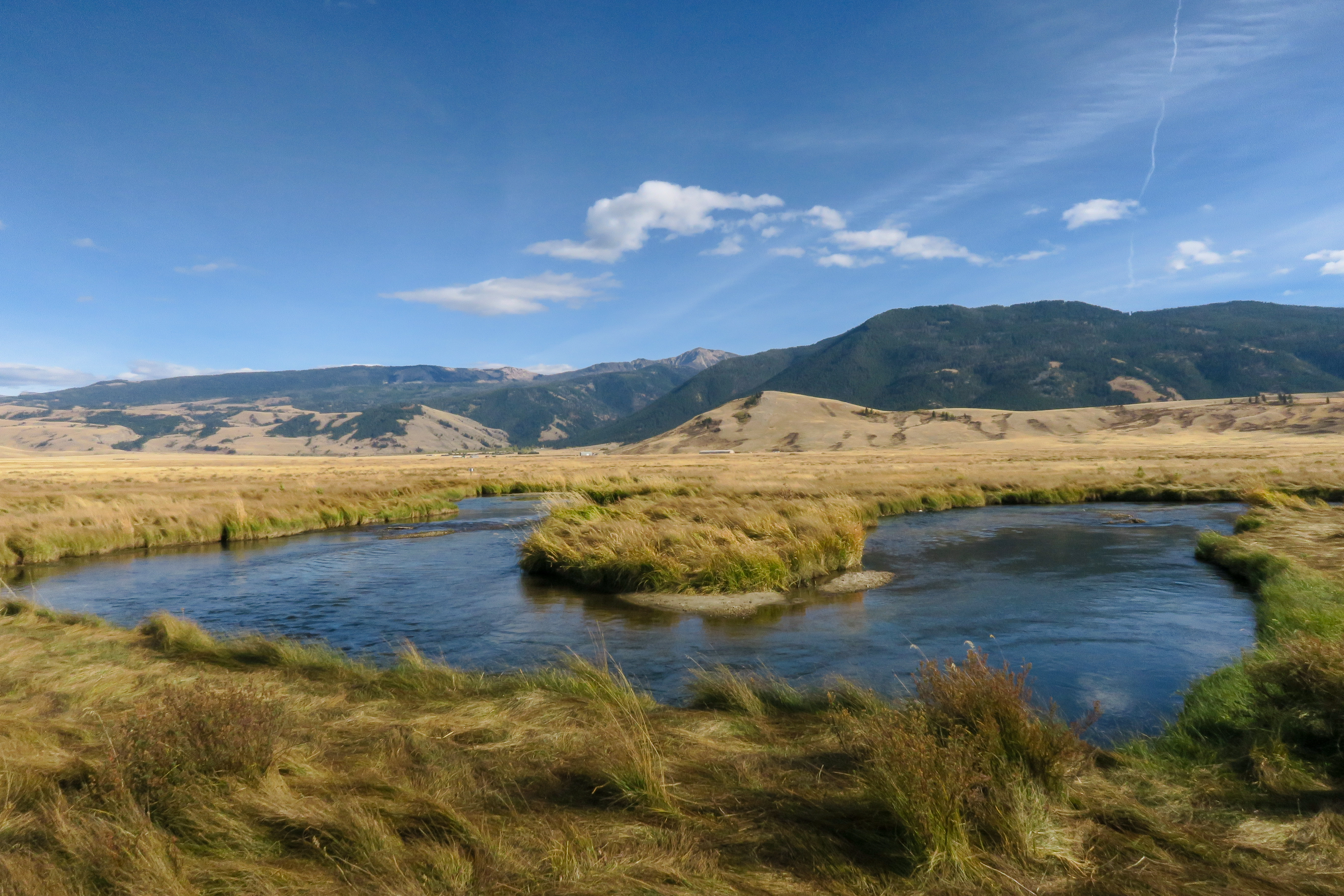
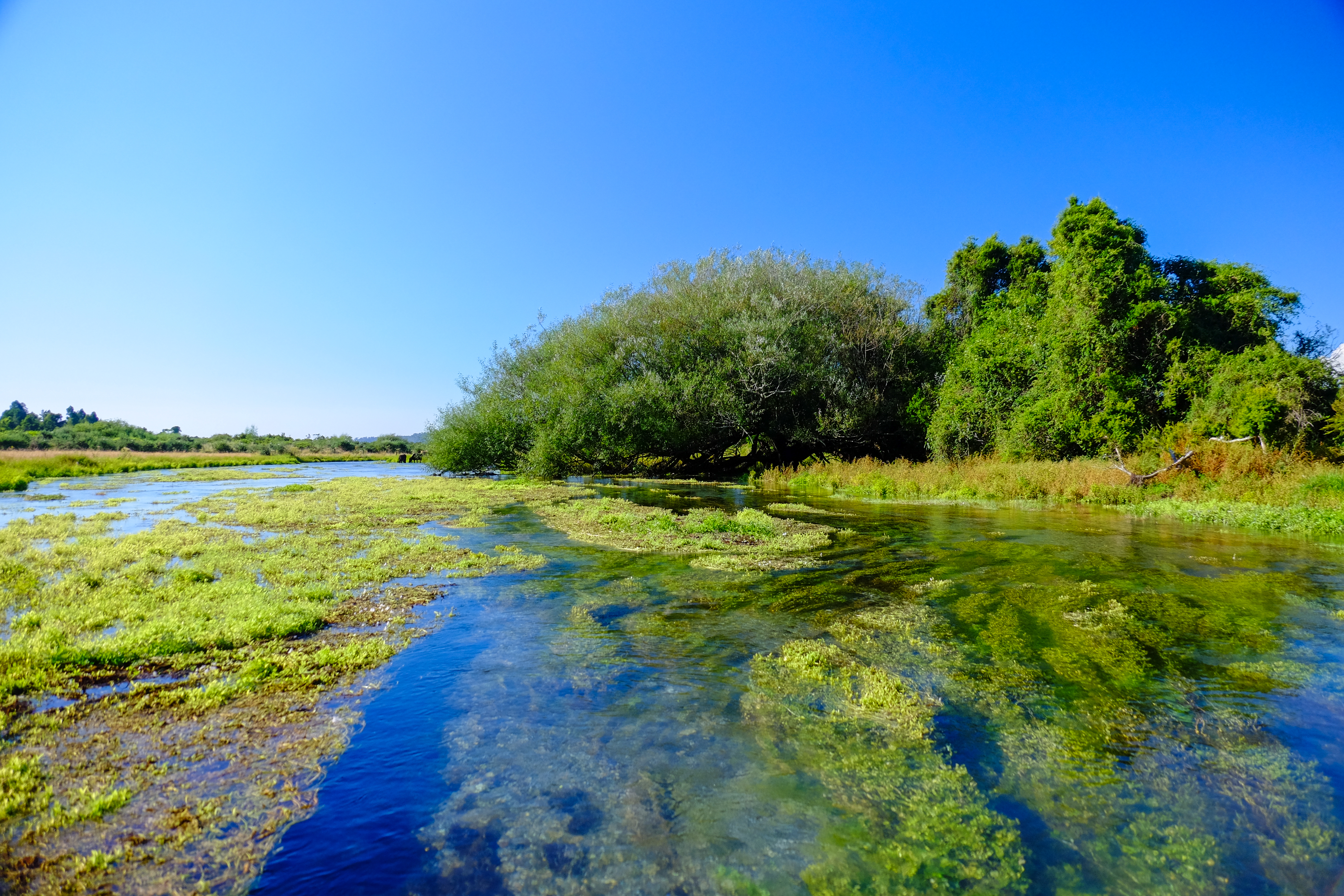
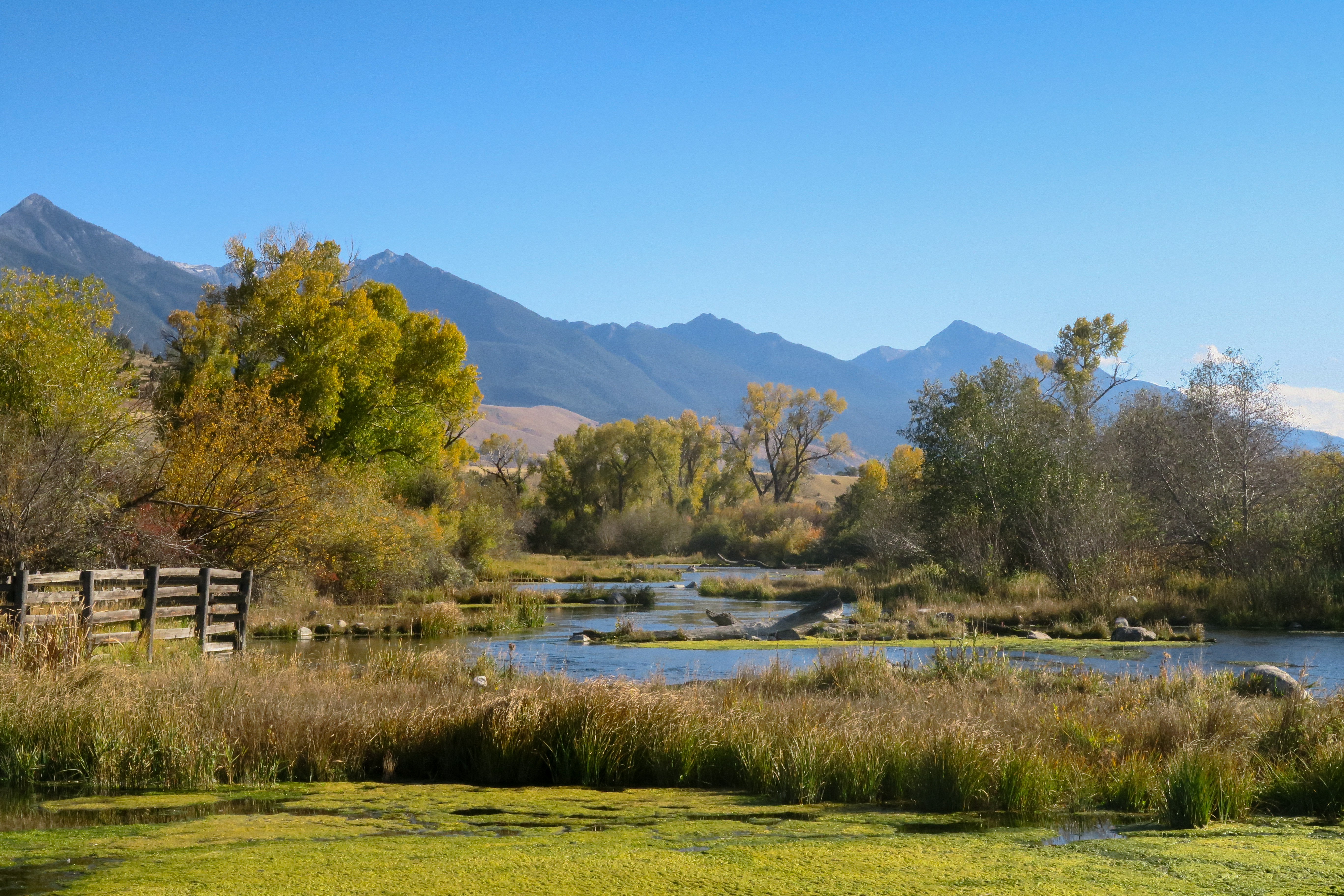
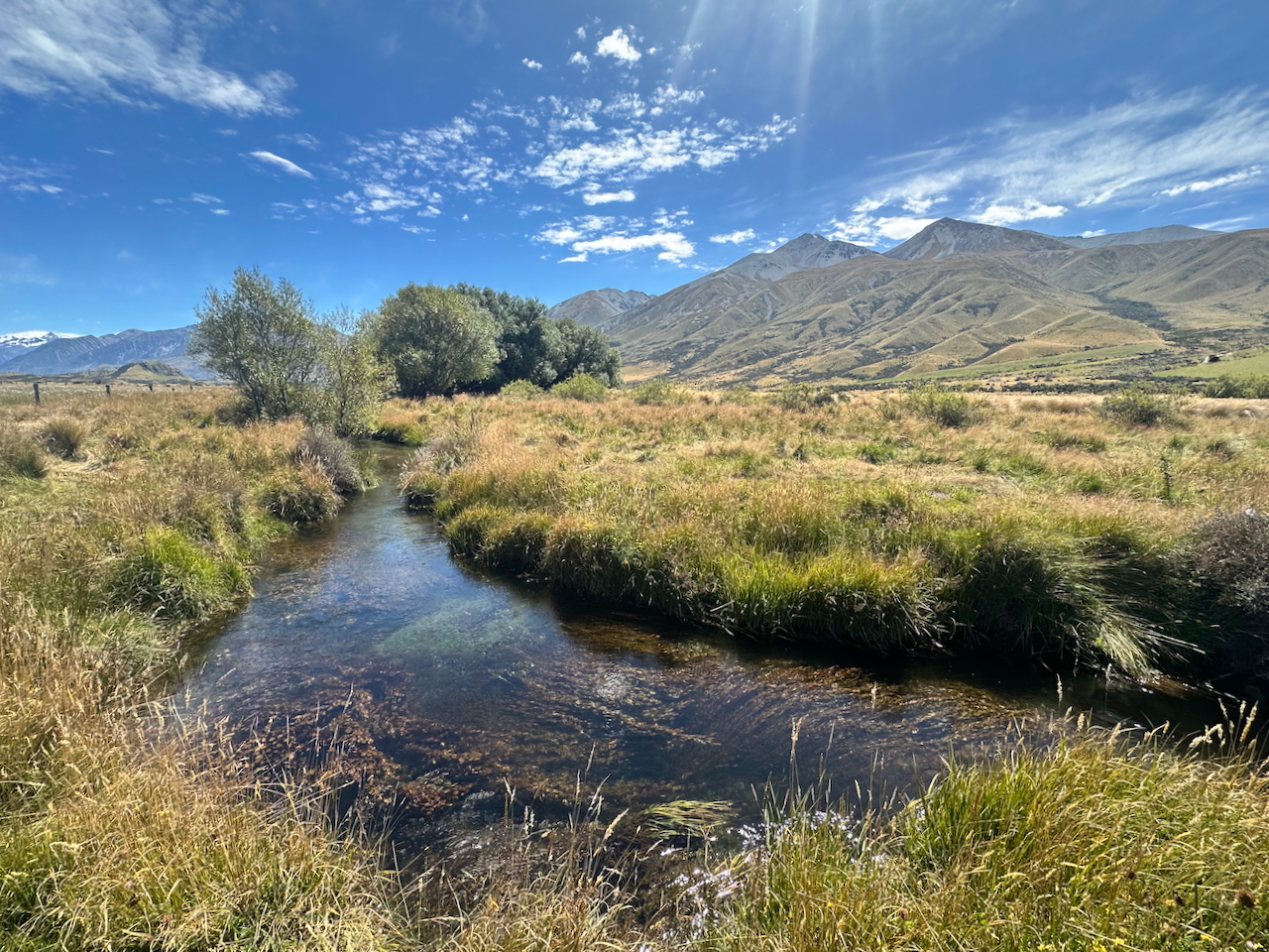
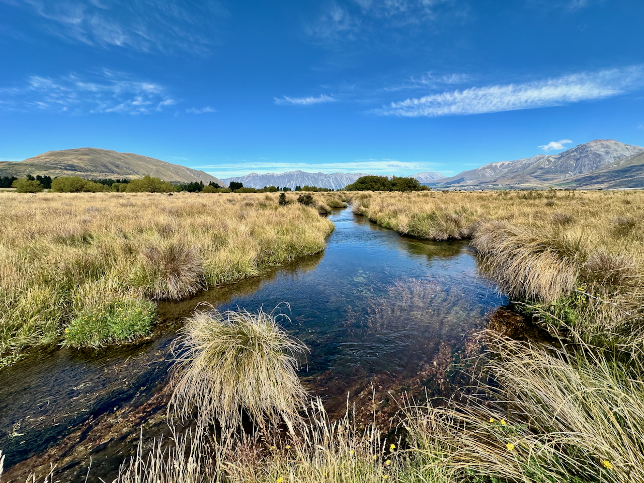
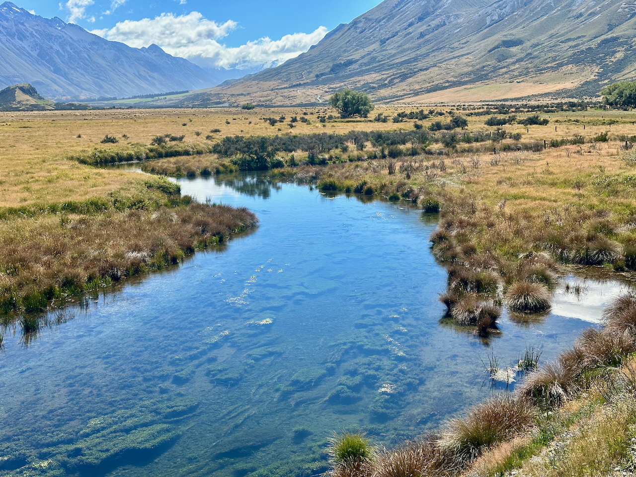
A feature of unmodified spring-fed streams – from Wyoming to New Zealand – is the close relationship between water level, riparian edge and wider floodplain: the X dimension.
Y
Y is the longitudinal connectivity – along the line of the channel. A natural chalk stream would likely feature hardly any major steps or interruptions in its longitudinal profile. Maybe beaver dams would create some steps, but in a undeveloped floodplain these would cause break-outs of flow around the sides, and one way or another the stream would travel unimpeded by large steps from the source to the sea.
Humans radically changed all that when we invented milling. The Romans will have blocked and impounded some of our chalk streams but we really went to town on them after the 8th century, so much so that by the time William the Conqueror invaded, we had over 5000 watermills in England and most were on lowland streams, including chalk streams, which are very easy to manipulate and dam.
To make a mill work on a lowland stream these early water engineers diverted the channel to the edge of the floodplain and ran it along a much shallower gradient than the natural valley. This built up the head of water required to turn the mill-wheel. If the valley gradient is 1:600, say, it takes 600 meters to build up a meter of head. Many chalk streams had reached mill saturation point by 1066. This is when you can’t fit any more in: the entire stream had been made into a staircase. For example, most of the natural gradient of the River Wensum, in Norfolk, is taken up by mills. This – and the legacy of dredging – is by far the most significant ecological stress on the river, even today.
To the mill diversions have been added many other forms of channel manipulation over history: navigational channels, locks, and the intricate system of hatches, carriers and catch-drains of the Jacobean to early Victorian water-meadow revolution. All of these modifications interrupt the natural slope of the stream.
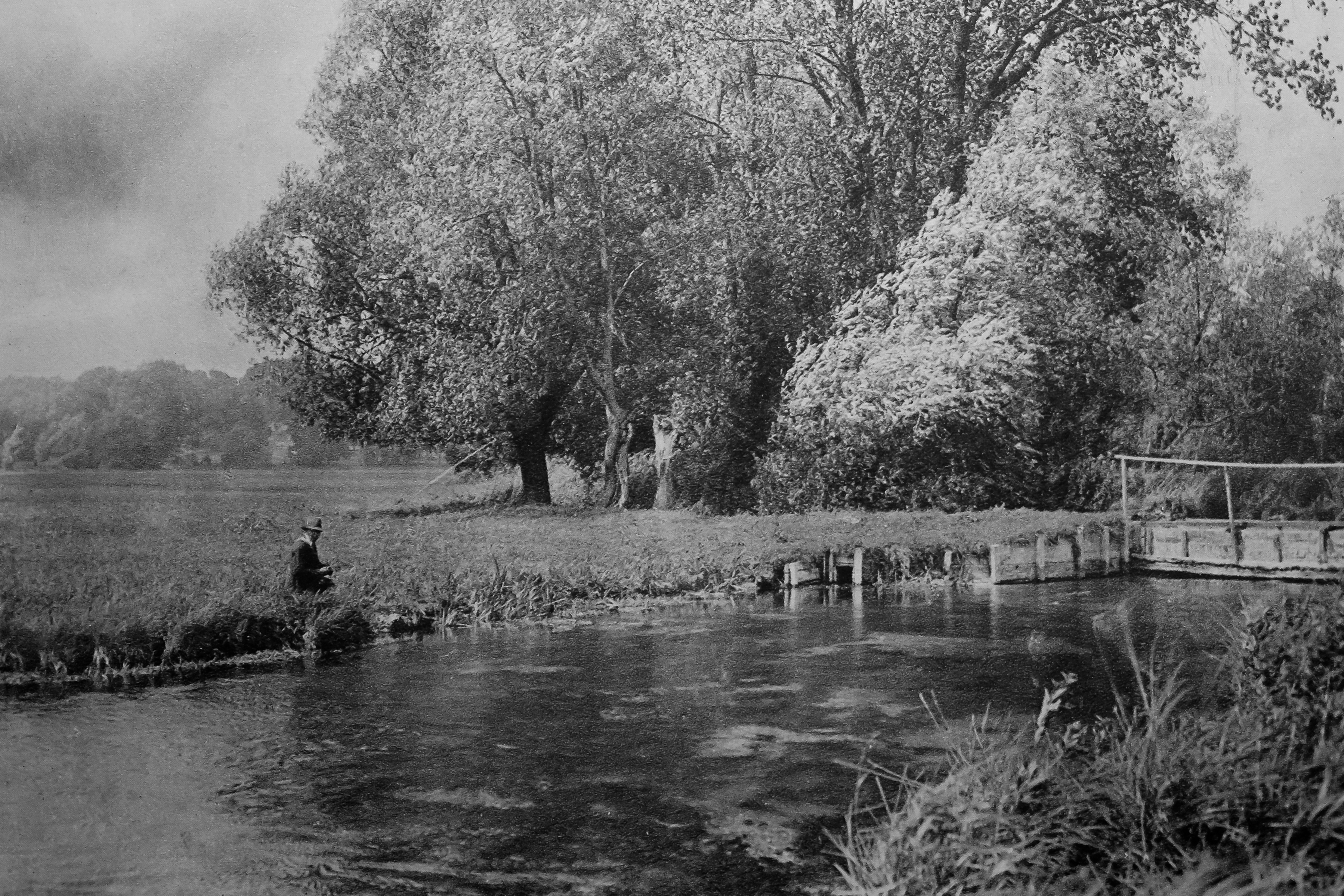
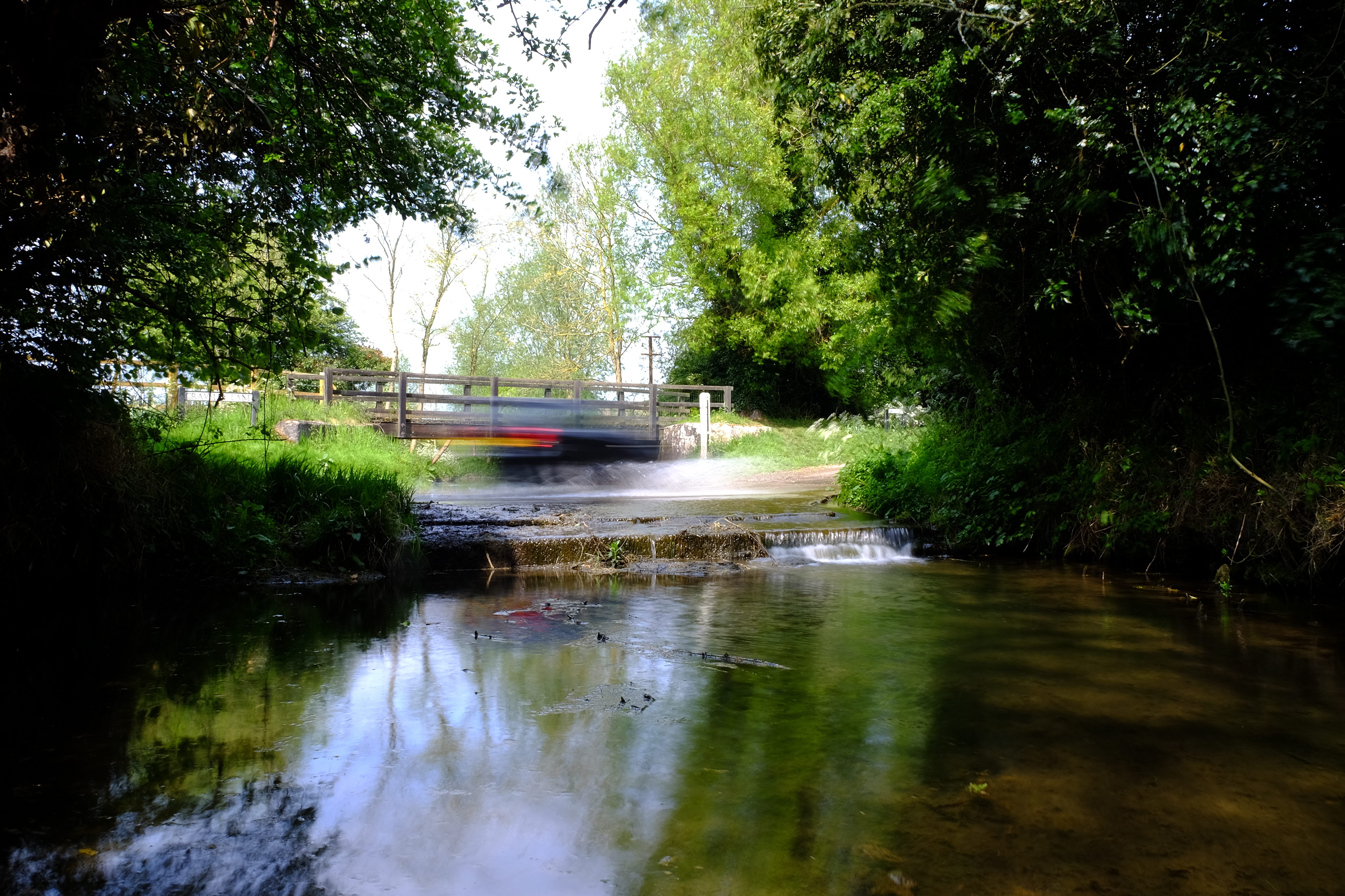
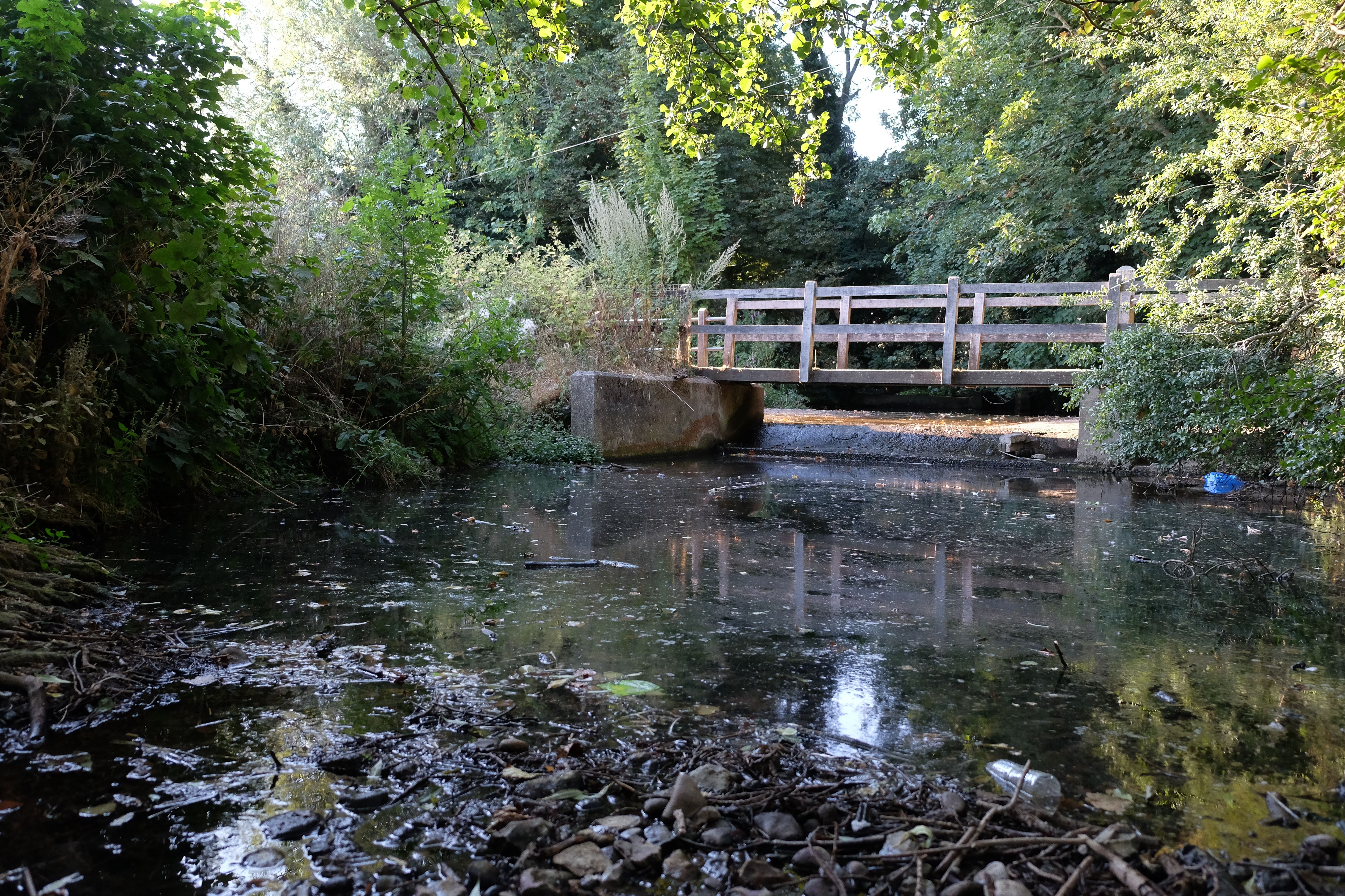
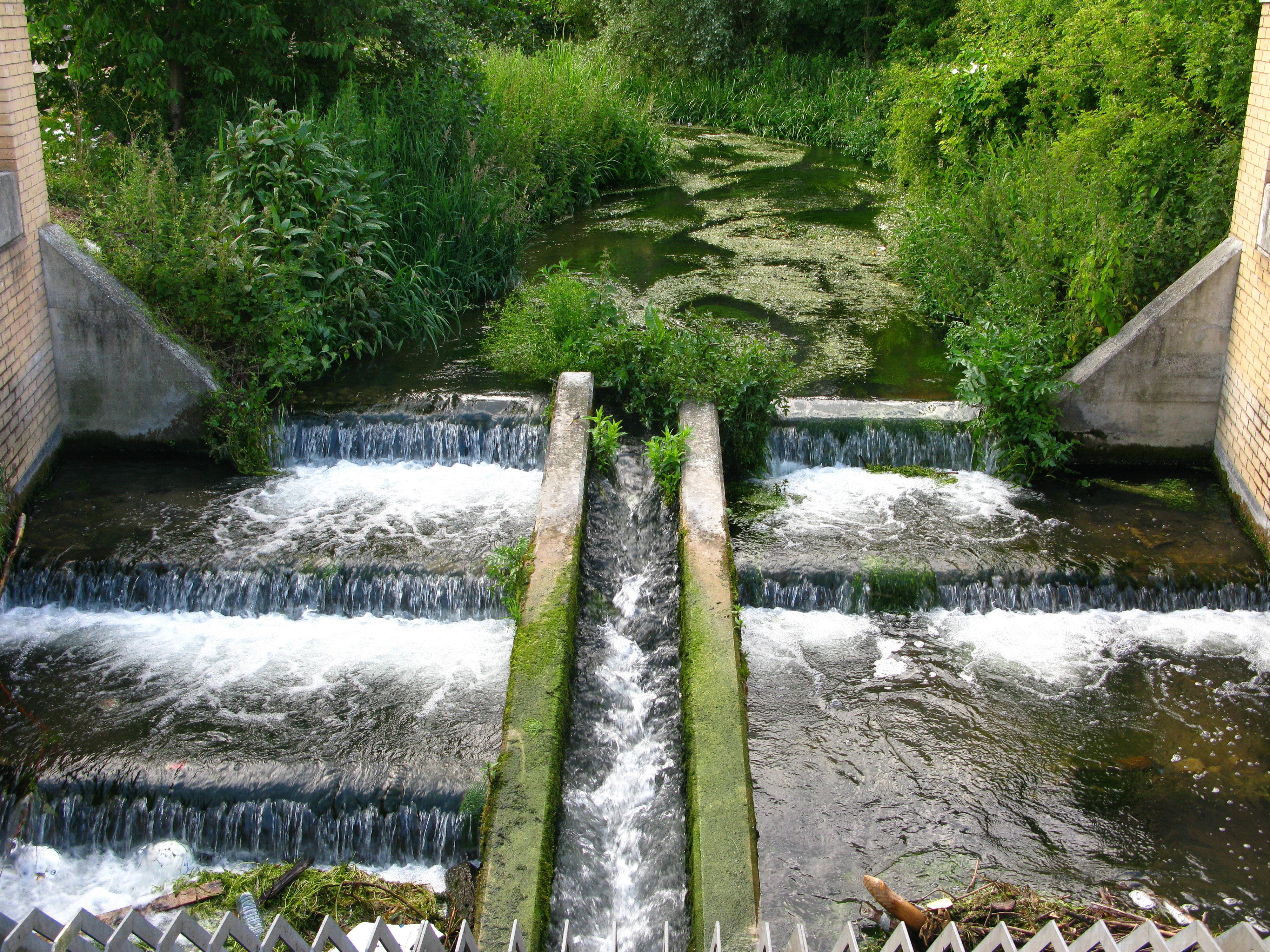
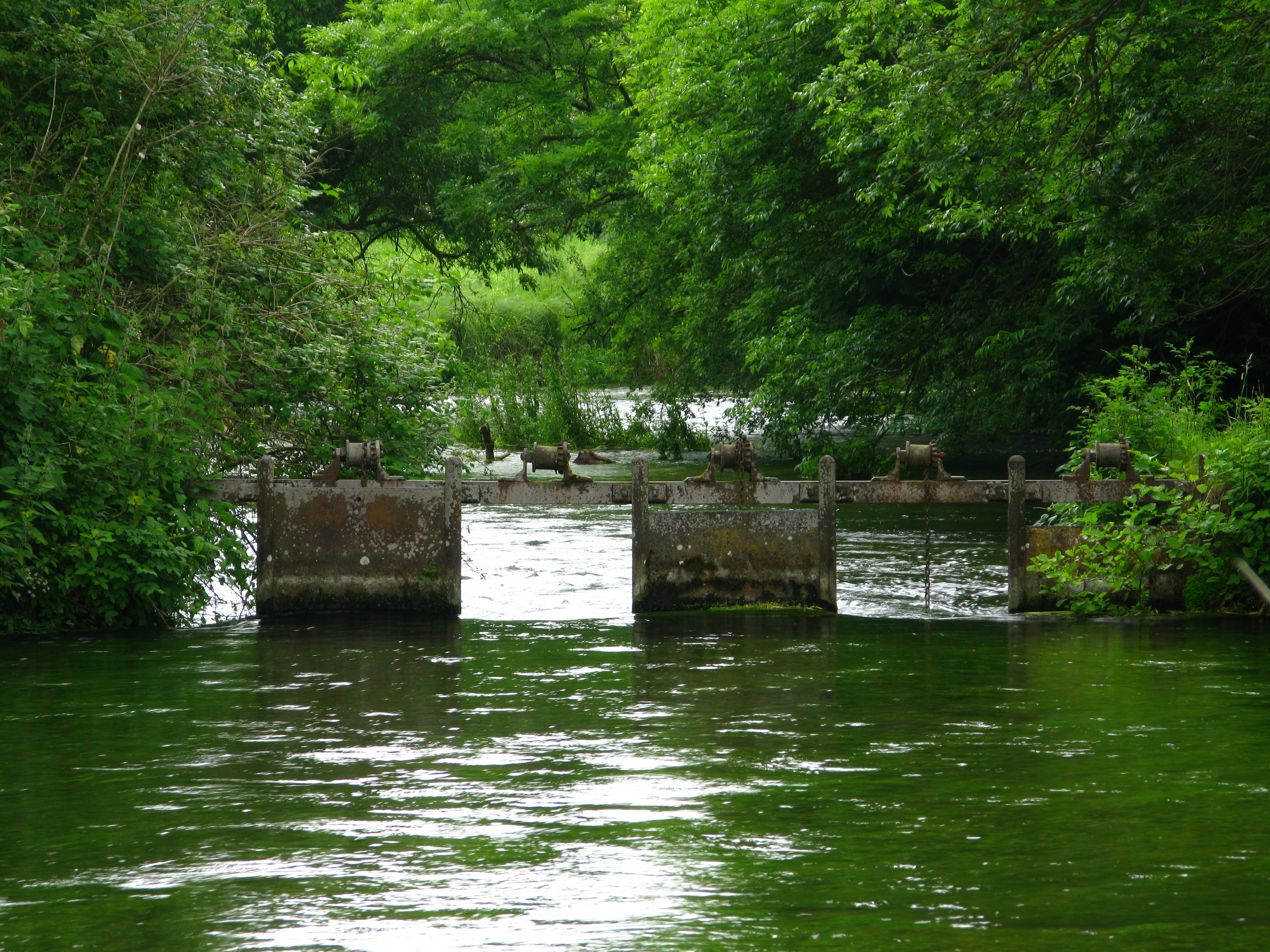
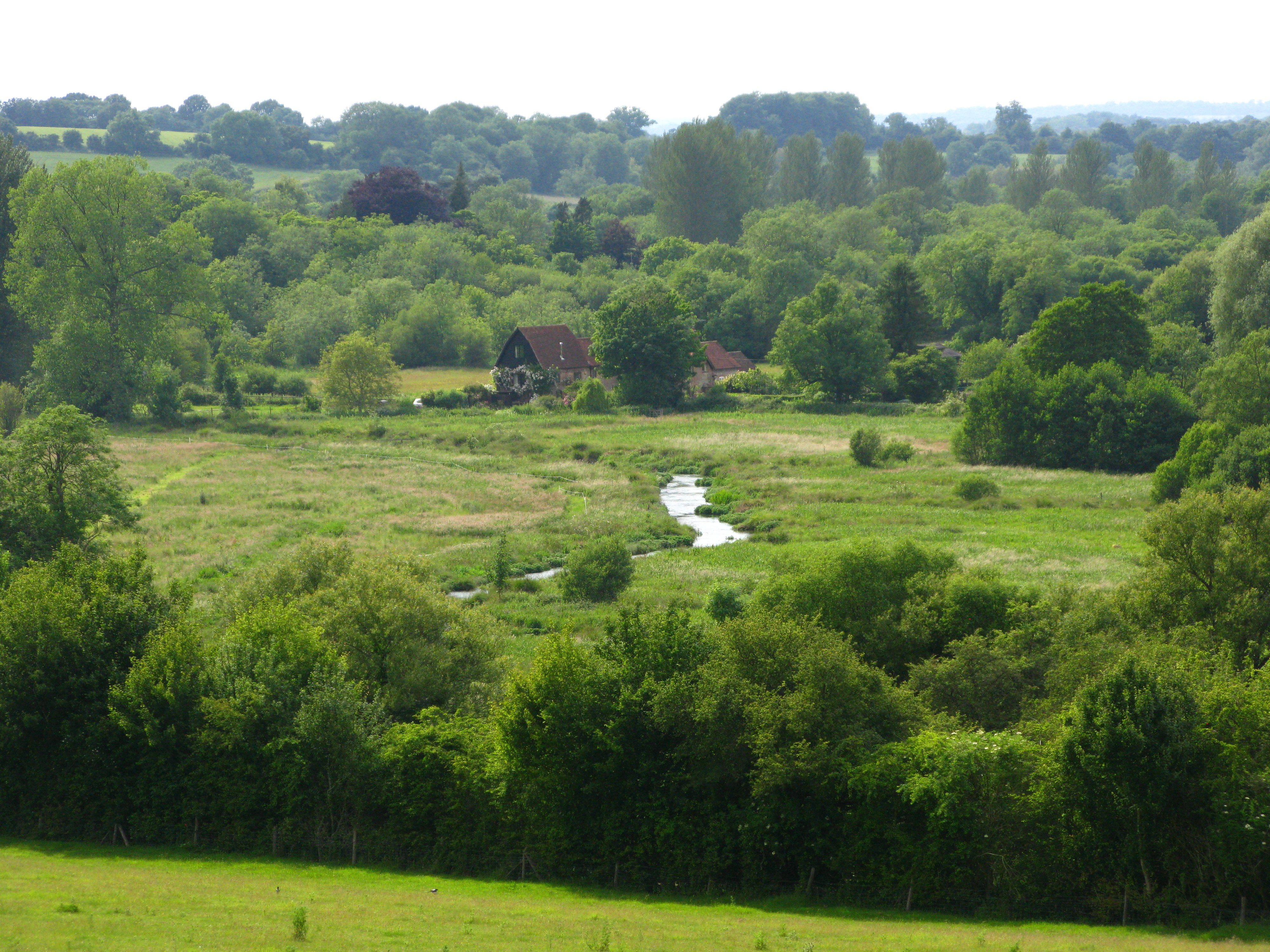
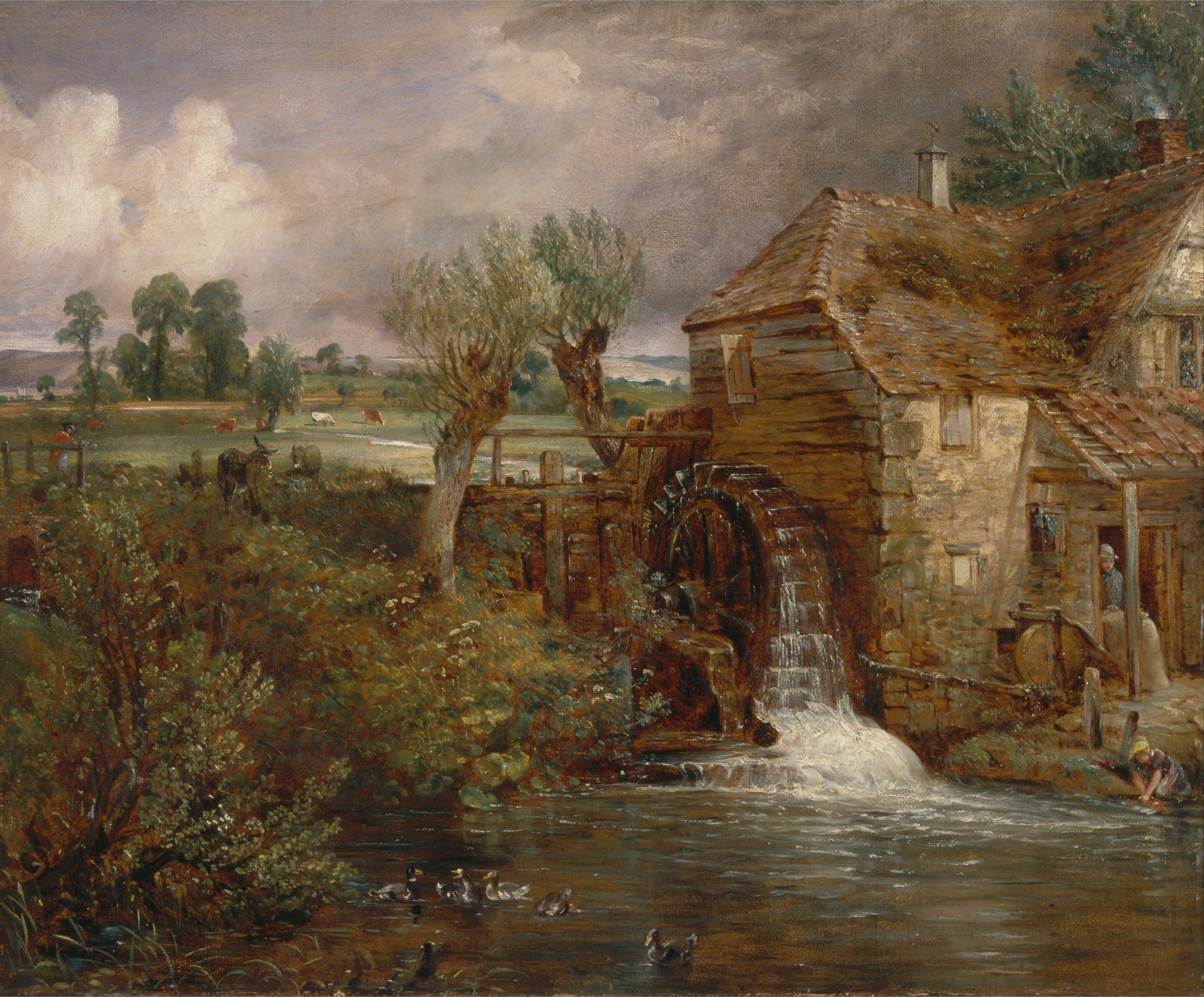
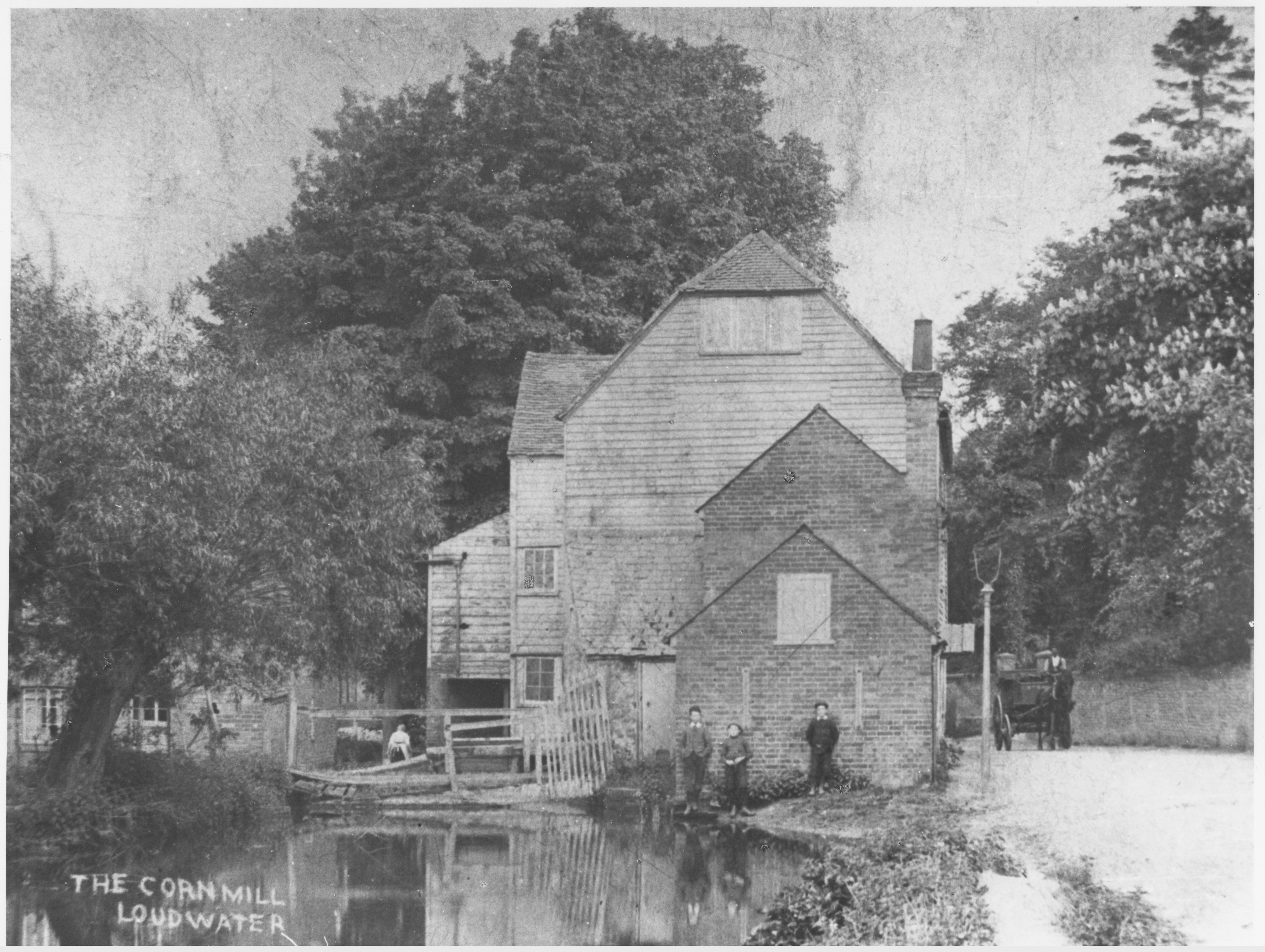
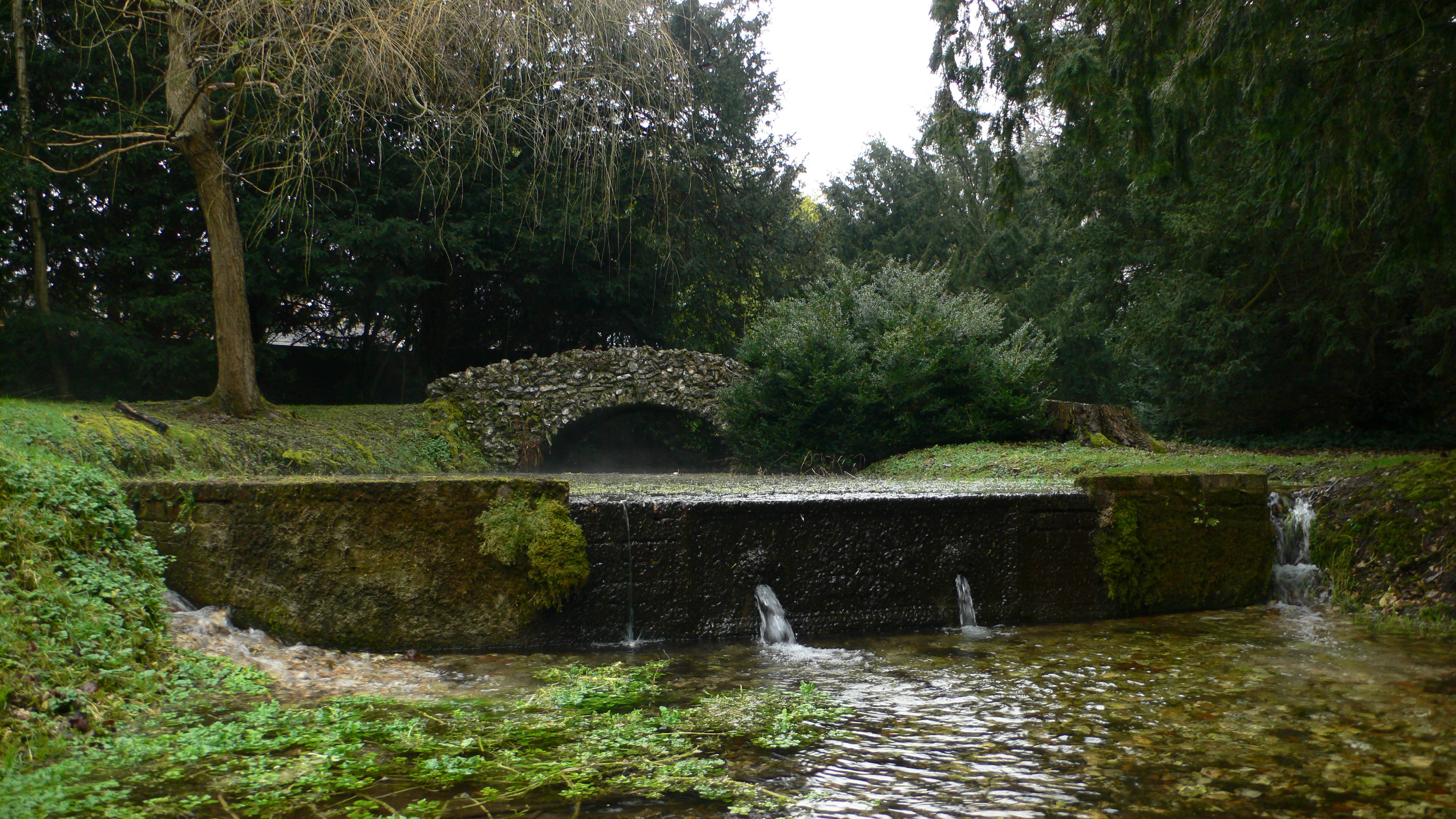
From urban to rural settings, our chalk streams are saturated with legacy structures that interrupt their natural gradient. The longitudinal connectivity is the Y dimension.
Z
Z is the planform of the river, its shape seen from above. The natural, meandering planform of our chalk streams was radically modified as part and parcel of the many and various ways in which the streams were changed over the centuries, whether they were diverted to make mill leats or watermeadow carriers or ornamental lakes.
Almost everywhere chalk streams have been moved to the edges of their floodplains. If you look closely at modern stream pathways and the associated ditches and drains in the floodplain, you will see the main modern river running along one edge of the floodplain and then the other, while down the middle of the floodplain run a series of ditches that drain down to the crossing point. This was a widely practiced way of moving the river off the floodplain to make space for grazing and to lower the water-table too. In some settings it’s part of the milling and watermeadow pattern and in others, a feature in its own right.
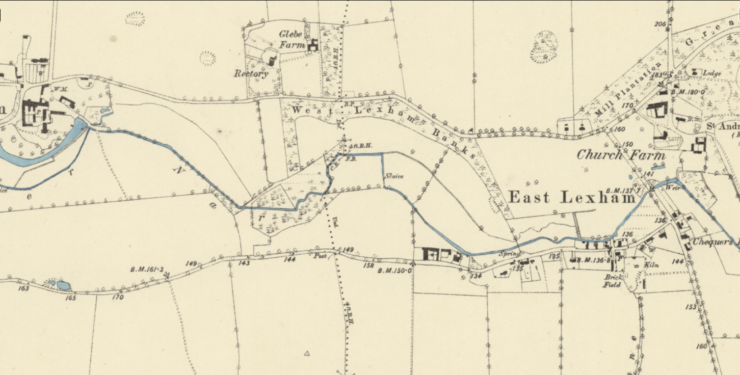
Look at the modern channel pattern of any chalk stream and you will see that the main river has been dragged to one side of the floodplain and then the other, while through the middle run ditches that drain to the crossing point. Here and there you may also see ghosts of the natural meanders.
But even when the modern river still more or less occupies the middle of the floodplain (which is rare) you will find that meanders have been straightened out, because for one reason or another the landowners wanted to get the stream out of the way and / or lower the bed of the river and improve drainage.
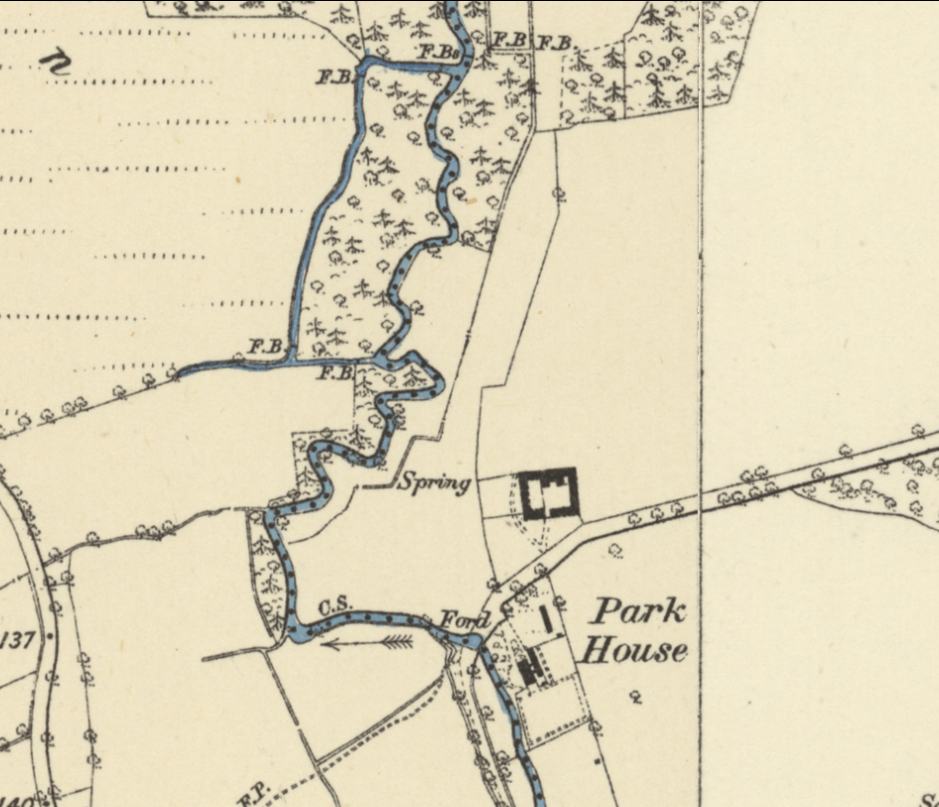
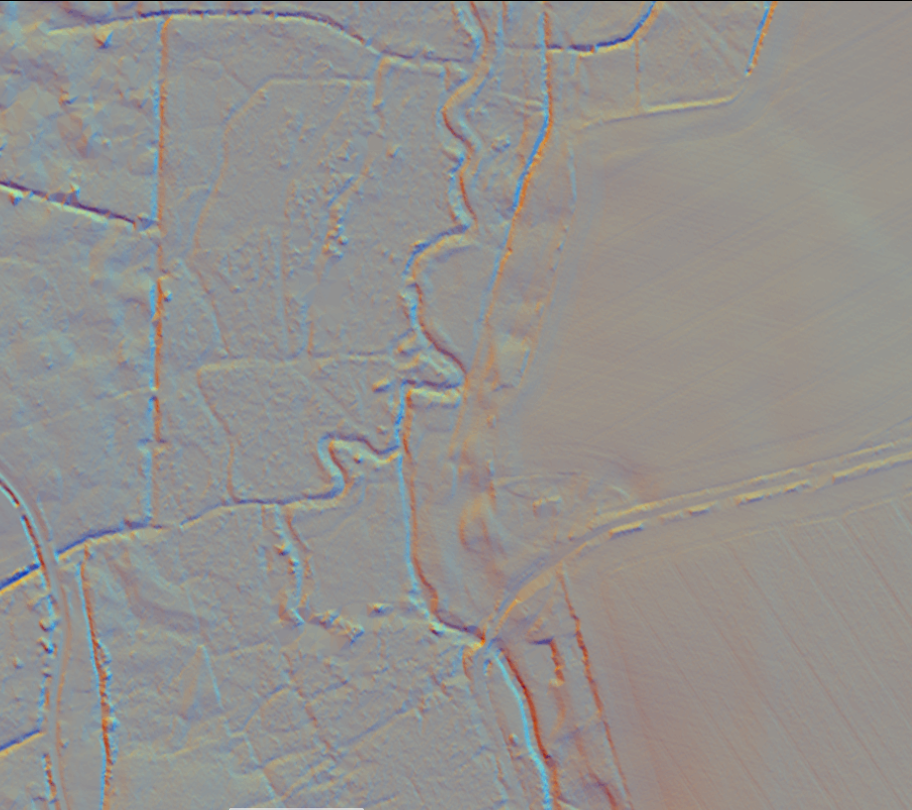
In this side by side of the River Wensum, you can see two meanders that have been straightened. The keen eyed will also see from the LiDAR that the river has been dredged to hell and back!
XYZ and the impacts of changing them
Generally speaking any of the significant ways in which chalk stream channels have been altered (mills, watermeadows, farm drainage, urban development and dredging) will have changed all the X,Y and Z dimensions in one go and the thus damaging impacts are layered and interwoven.
Take milling: to make a mill leat the channel has to be progressively raised above the natural fall-line of the valley. This robs the river of gradient and energy, isolates the river from the floodplain, divorces the channel from the water-table, and erases natural meanders. Essentially it takes a naturally dynamic, heterogenous physical structure where the river supports a mosaic of habitat niches and homogenises it in a more stagnant and imprisoned state, from which a chalk stream cannot escape.
People may wonder what the big difference is between a meandering channel and a straight channel. All the difference in the world! Meandering channels are so much more physically complex: flow spirals around a river bend, sorting sediment and substrate, depositing fines in the insides of the bends, scouring the outsides, crafting the river bed into a complex matrix of glides, pools and riffles. If the river bed and planform are intact, undercut shelves will form on the outsides of meanders at the junction between the more motile bed substrate and the more cohesive floodplain soils. These undercuts are incredibly valuable habitat for fish, especially large salmonids. The loosely triangular river bed section that evolves in a meandering channel maintains water velocities as flows lessen through the summer, whereas the uniform bed of a modified channel does not. The natural meanders therefore support plants like ranunculus and in tandem this promotes a healthy scour of the river bed, keeping fines on the move whilst creating a wide variety of habitat niches for invertebrates, benthic (eg. bullheads and minnows) and rheophilic (eg. trout, and dace) fish.
But I’ve also noticed how grazing animals like ponies interact differently with a meandering channel. The River Nar through Castle Acre was a typical straightened, modified, perched and dredged channel. Like all chalk streams subjected to these modifications it had evolved a monoculture of phragmites and bur reed along the edges (in the worst cases right across the channel) which – because they are silty death traps – grazing animals tend to avoid, nibbling only the edges, which they can reach from the safety of solid ground.
After we restored the meandering channel with river bed much closer to floodplain level, the Konik ponies that graze the common started to graze the point-bars on the insides of the bends in a different way from the more cliff-like edges on the outsides of the bends. The planform created a diversity of grazing pressure which in itself will have been beneficial to biodiversity.
It is obvious, also, that if you take the gradient out of an already low gradient stream and then massively increase the sediment loading – as we have done in the modern landscape – you will turn the stream into a silty grow-bag. When passionate river-kin types rail at the state of a chalk stream, at the gloopy silt, filamentous algae, opaque water and feeble flows, they are railing much more at its physical state than any abstraction or water quality pressure. Not to diminish the impacts of these pressures, which can be over-riding in some settings, but where there is tolerable flow (even if there is some abstraction) and water quality (even if there is some eutrophication and sediment load) the XYZ is by far the most important part of the chalk stream health. It is certainly the the foundational layer and oftentimes the easiest to sort out.
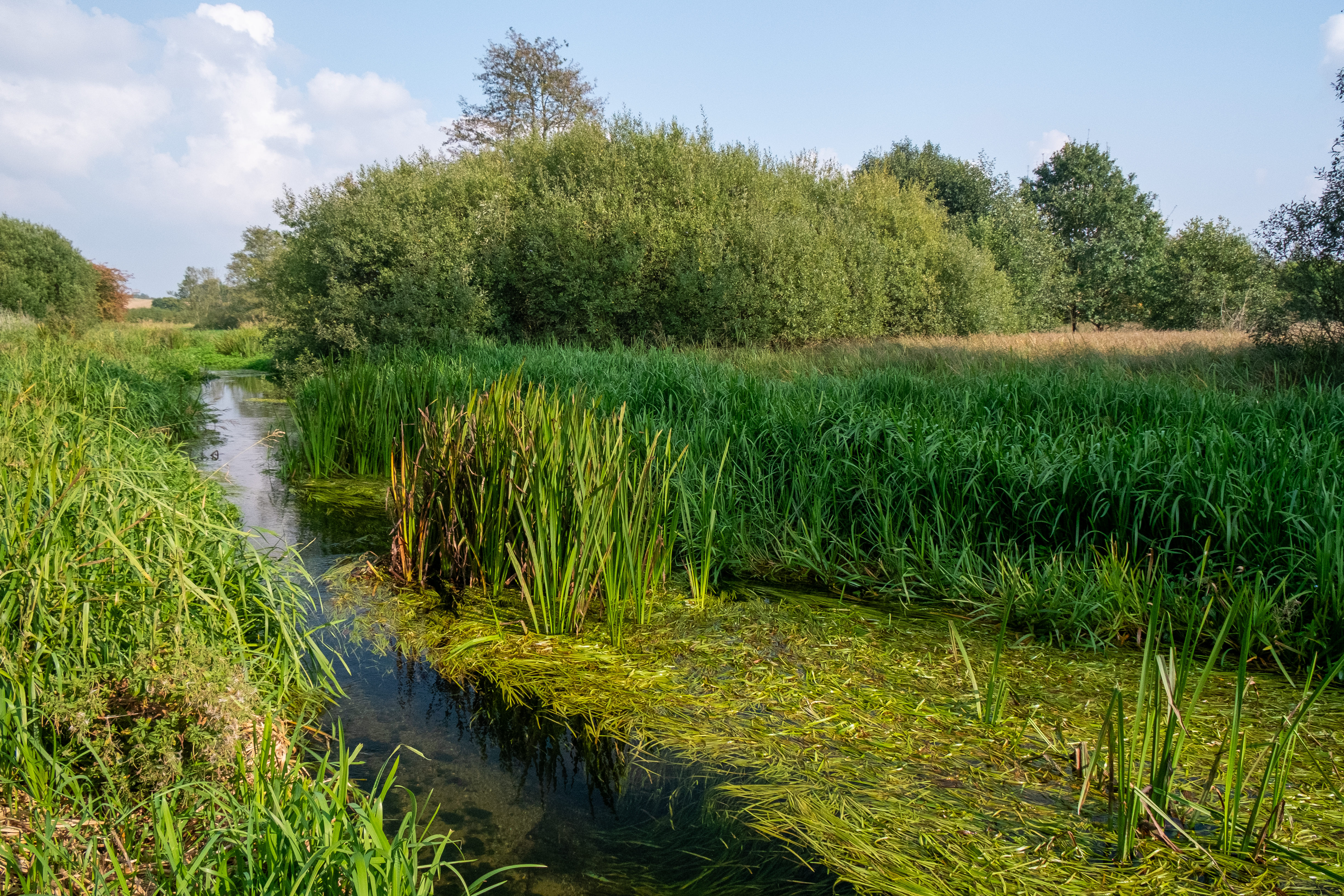
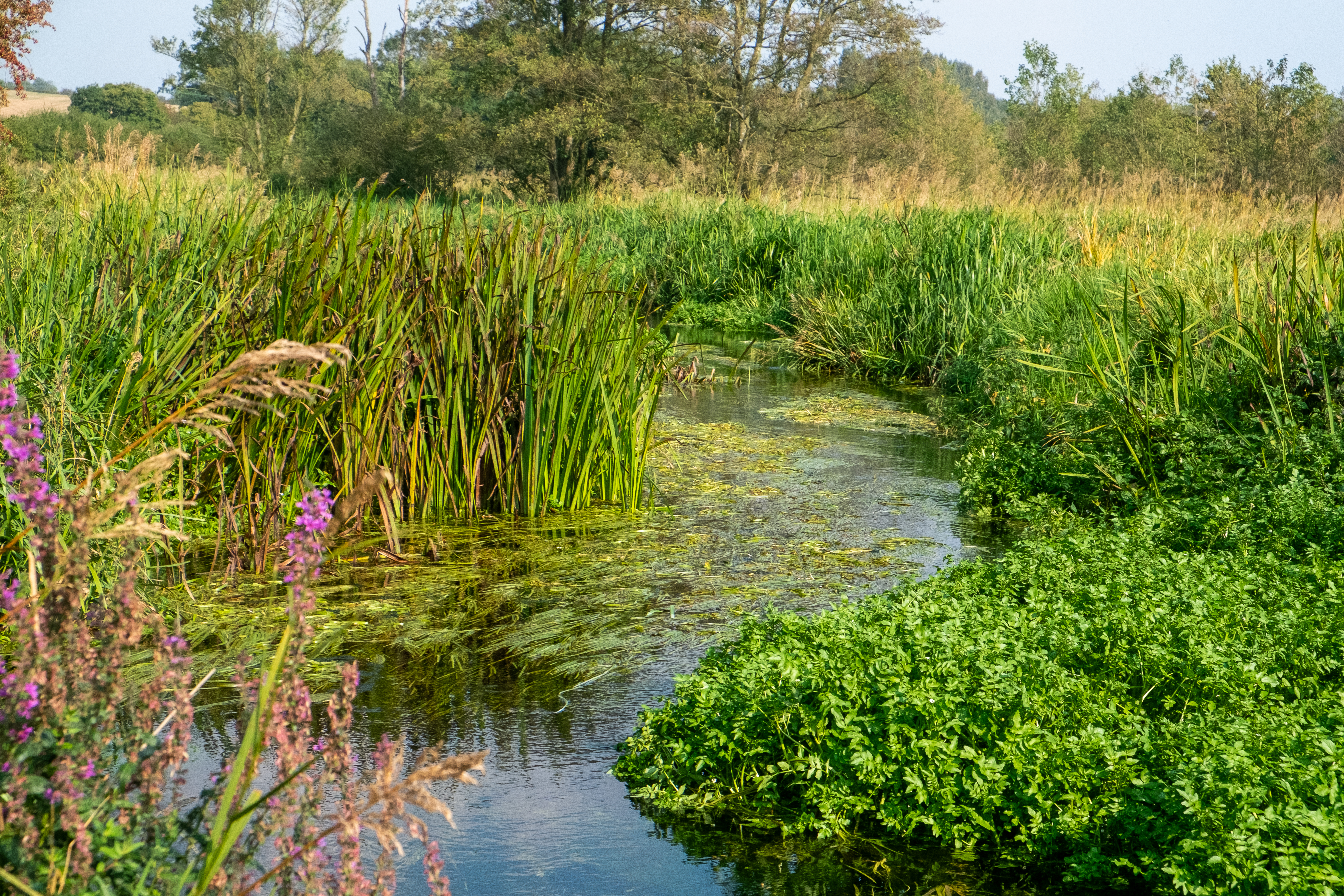
Diverted and dredged chalk streams tend to develop a monoculture of phragmites and bur-reed along the incised edges, where deep silt accumulates.
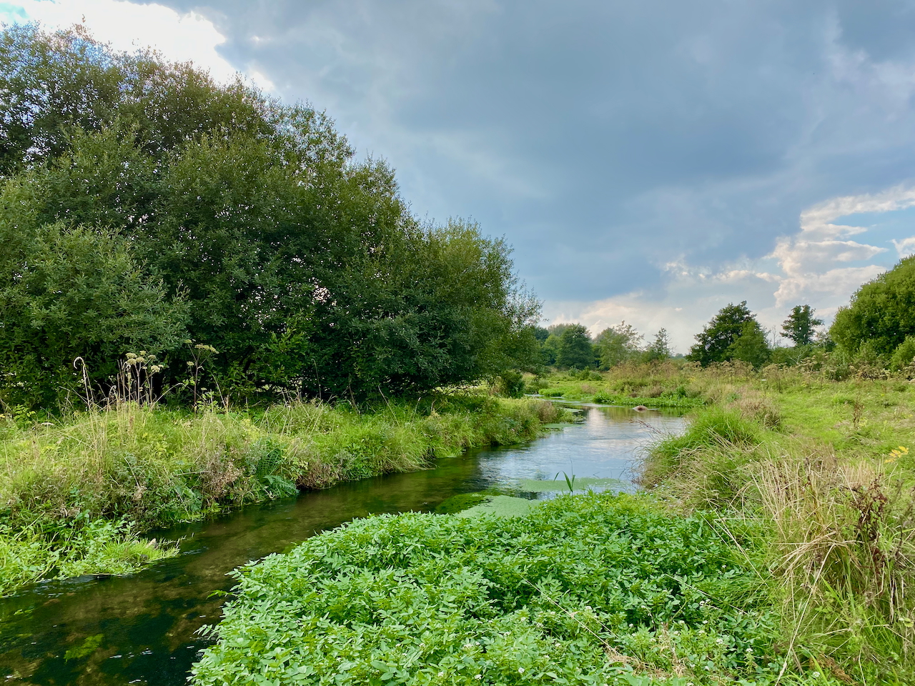
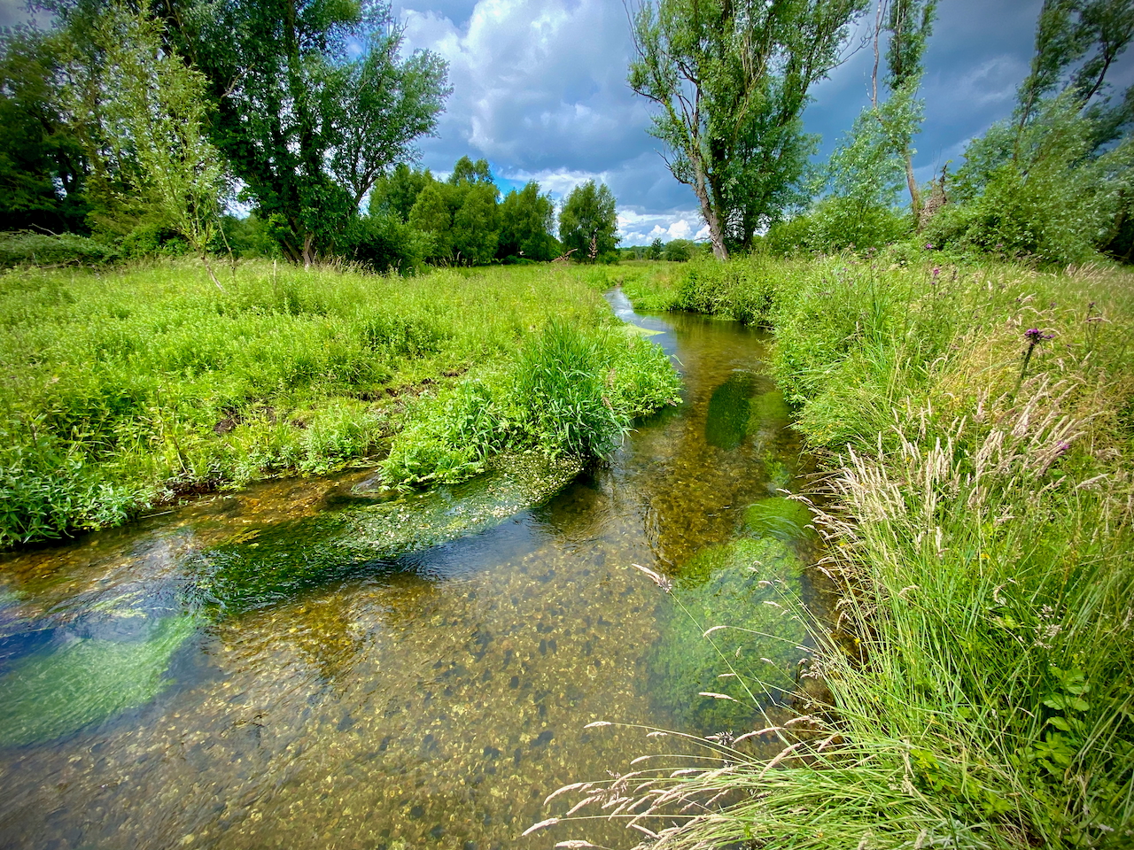
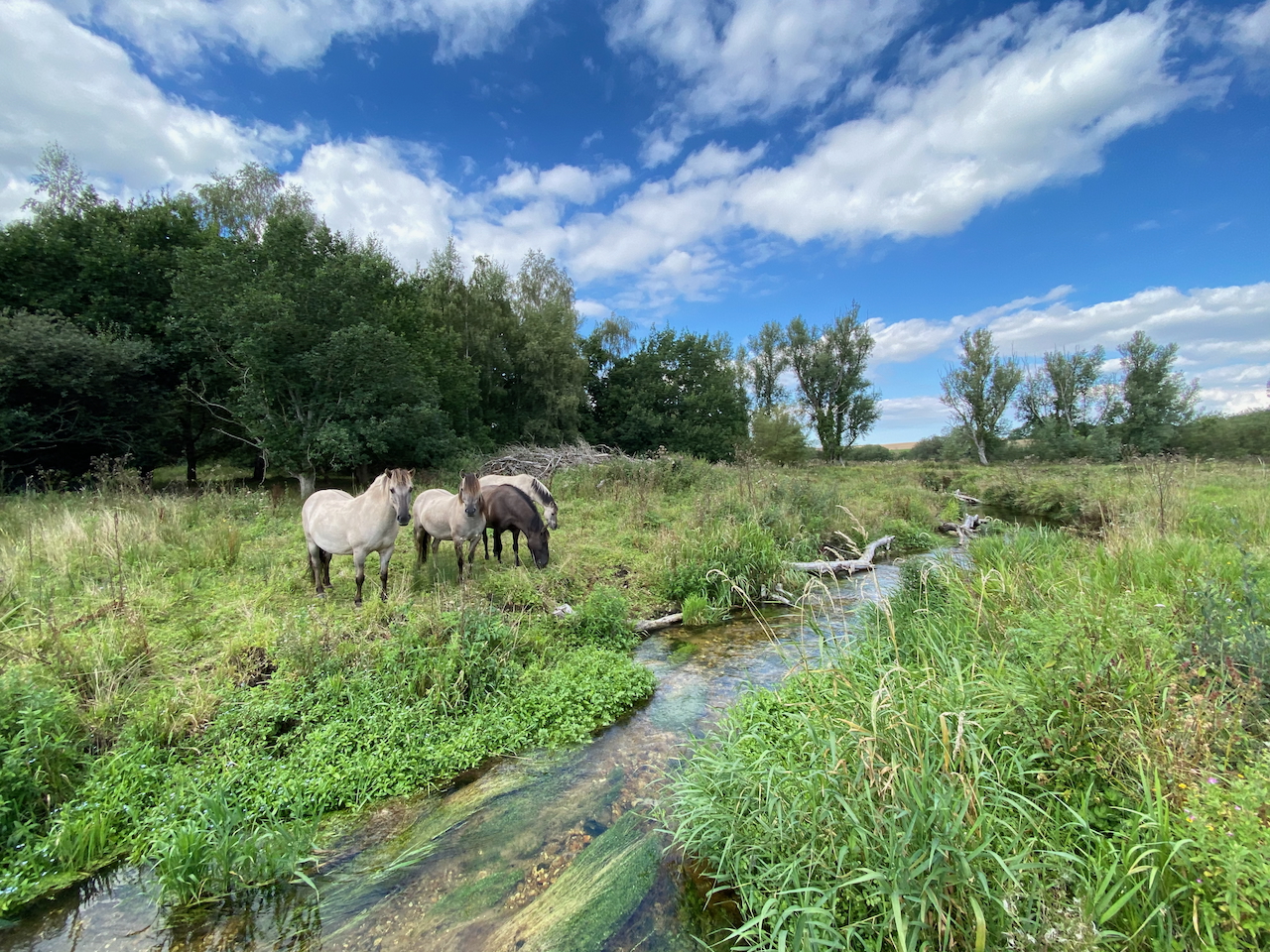
This the exact same reach after its natural gradient and planform were restored. The riparian edges feature a much more varied mosaic of habitat niches and plants.

