Newton Common – a new bed to lie on

Now that the project is two years old I thought I’d share a few before and after shots of the work. Newton Common is the next reach of river downstream of Emmanuel’s Common. You can see from the before photos that river here had been canalised and deepened and was as a result pretty much overrun with bur-reed.

I made a long-section survey of the river-bed which revealed the places where the bed had been lowered below the natural fall-line of the river. Each of these was effectively a sump. The resultant siltation was the river’s attempt over time to repair itself: we gave the stream a helping hand with as complete an infill of gravel as we could manage within the budget and the time.

NarNewtonC'n + Hall Meadow2 18:11:16 copy

A bed-level survey revealed the sump-like reaches where the river had been lowered beneath the fall line of the valley. The Newton Common project is marked by points 1 to 29.

NarNewtonC'n + Hall Meadow 18:11:16

DSCF6129

DSCF6575

DSCF0928

DSCF8537

The top image was taken in October 2016: the channel is covered with burr reed. The second image was taken before the project began and shows how deep and wide the dredged channel was. The third image was taken just after the gravel went in, April 2016 and the fourth was taken two years later in April 2019

DSCF6127

DSCF0980

DSCF8534

The top image was taken in October 2016, the middle image during the project and the bottom image in April 2019: note the presence of ranunculus and berula!

Notes on Large Woody Debris

_DSF5368Learn from nature: LWD is rarely better than when an old tree falls in.

Large Woody Debris (or in plain English ‘Trees in Rivers’) – if done well – is a very effective river restoration / rehabilitation technique.

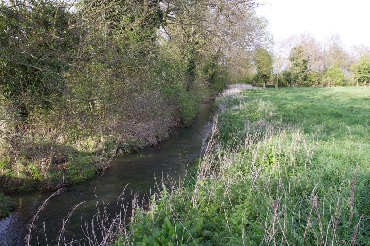
Until very recently we tended to tidy rivers up. In fact we still do. I often see pictures posted on Instagram and Twitter of tidying up exercises on chalk-streams masquerading as river restoration: “clearing out” a stream, or uniform and tidy constructions – faggot hurdles, bank edges – that would be more at home in a garden or golf course. 

Traditionally river-keepers tended to pull out trees and branches that had fallen into their streams: the aesthetic was one of a ‘tidy’ river, the practical intention was to make the river easier to fish, with fewer obstructions to casting, and no tangly obstructions to lose fish in. It was about creating an environment that suited anglers more than it suited the fish they were seeking.

State bodies like the Environment Agency have colluded with this mindset. When a tree falls in they remove it, motivated by the need to avoid ‘flood-risk’.

But slowly rivers-keepers and the Agency are changing how they look at this issue. That’s because in both fishing and habitat terms and in terms of flood risk, removing trees and large branches from rivers is self-defeating, the very opposite of what we should be doing.

IMG_1698Trout love cover: remove the cover, remove the trout.

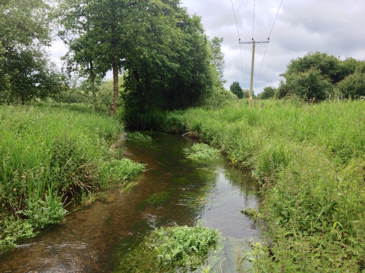
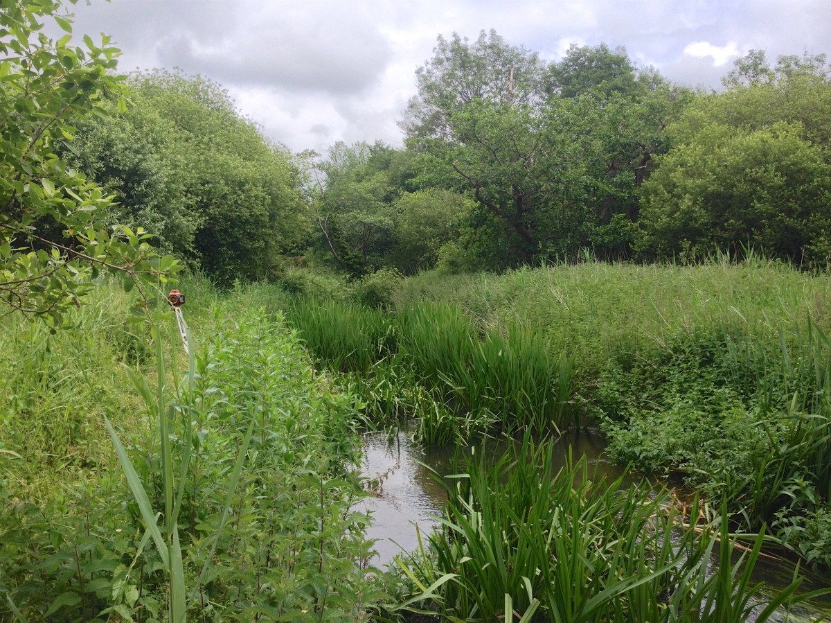
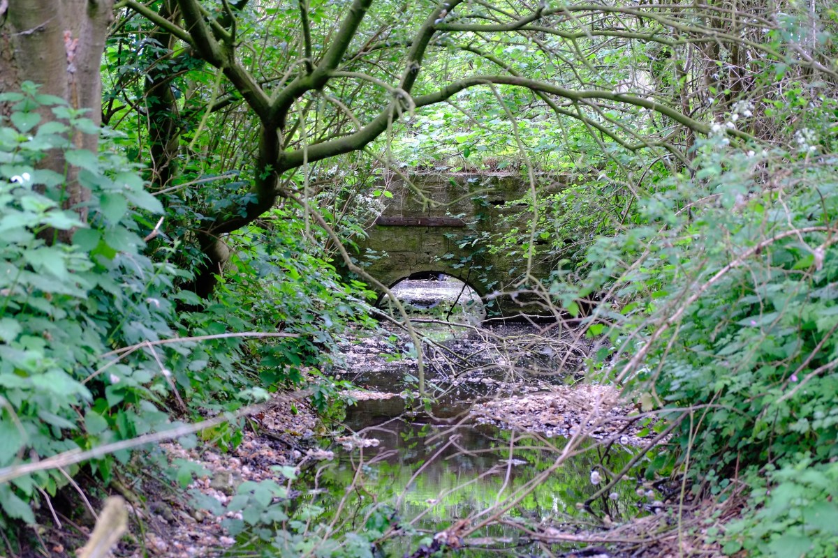
From the fish and habitat point of view it’s simple: fish love cover. A tree in a river provides fabulous refuge from predation. In New Zealand’s spring creeks which are not tidied up at all, the largest trout will always lie within bolting distance of a submerged tree, or some form of log-jam or snaggy overhead cover. This makes catching them tricky, but on the other hand they wouldn’t be there if the LWD wasn’t there too.

Research carried out by Dr Murray Thompson has also shown that LWD is also fabulous habitat for invertebrates, that invert numbers are far higher in rivers where there is plenty of submerged LWD.

LWD is also great from a morphological point of view, especially in chalk-streams.

Chalk-streams are very low energy rivers. The forces which shaped them (melting glaciers) have long since retreated from our landscape. We have since that time heavily modified their channels by straightening, dredging and impounding them. Chalk-streams very rarely achieve the flows needed to overcome these modifications and re-shape themselves to a more natural planform. Thus their shape and their habitat is locked in a man-made straight jacket and the rivers are effectively imprisoned.

But a fallen tree can make a huge difference, releasing gravel and stones into a system that lacks material (quick morphology lesson: when a river is modified, by dredging, say, the natural processes of the river work to erase that modification, depositing material into the enlarged space until the river reaches the correct dimensions again. To repair itself, therefore, a river needs material, but chalk-streams are too gentle to supply it, except in the form of fine particles like silt. When a tree falls in, however, this creates the material and energy that enables self repair). A single tree can kick-start a whole sequence of channel repair and re-meandering.

I own a fishery at Frampton in Dorset where the river once flowed through a stately park, impounded by ornamental weirs. All the bends had been taken out. When I bought the fishery the then owner removed fallen trees all the time. He even removed one “for me” after he had sold me the river. I had to explain that I really didn’t want him to.

DSCF5328
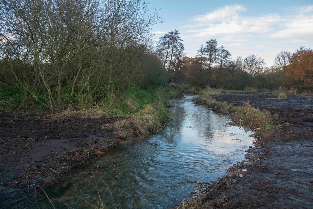
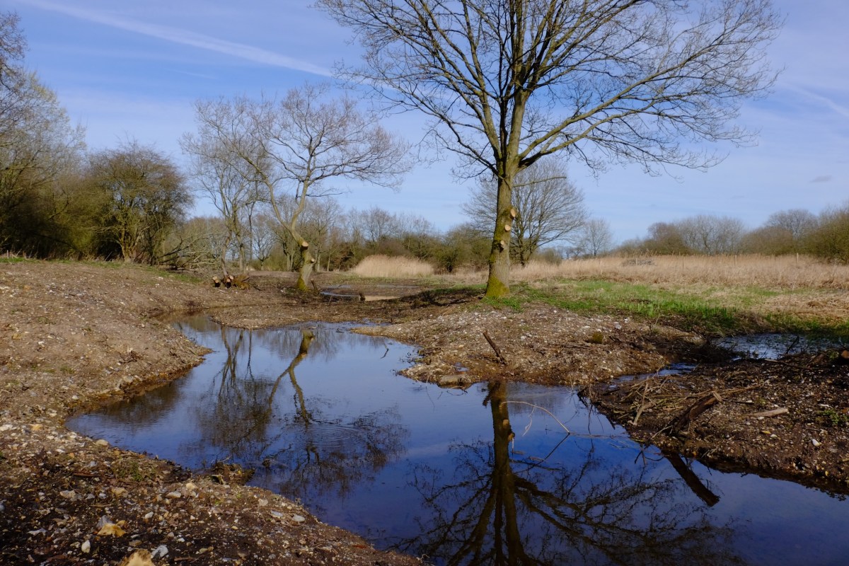
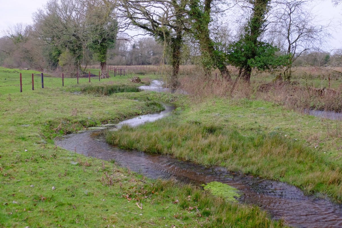
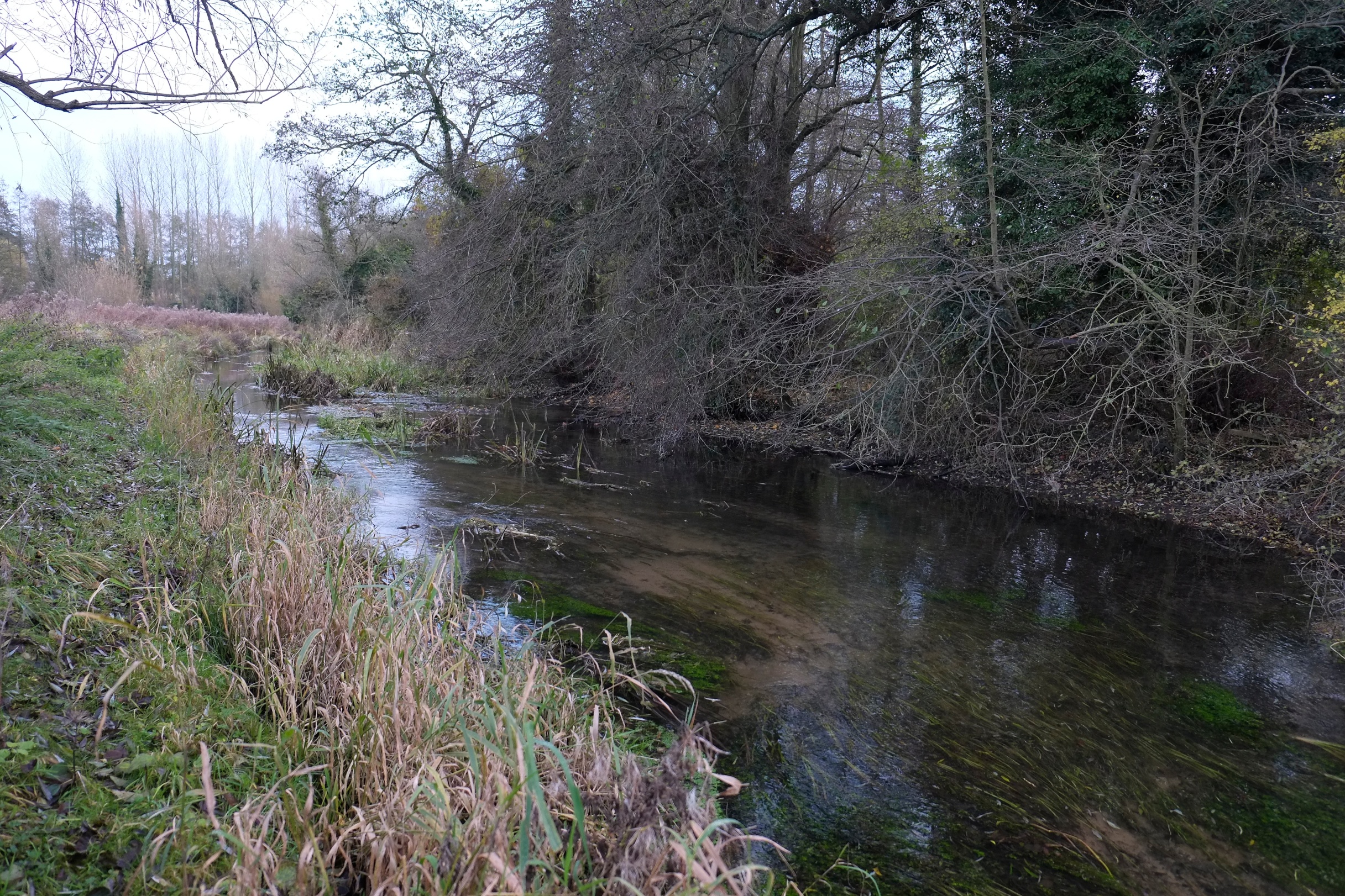
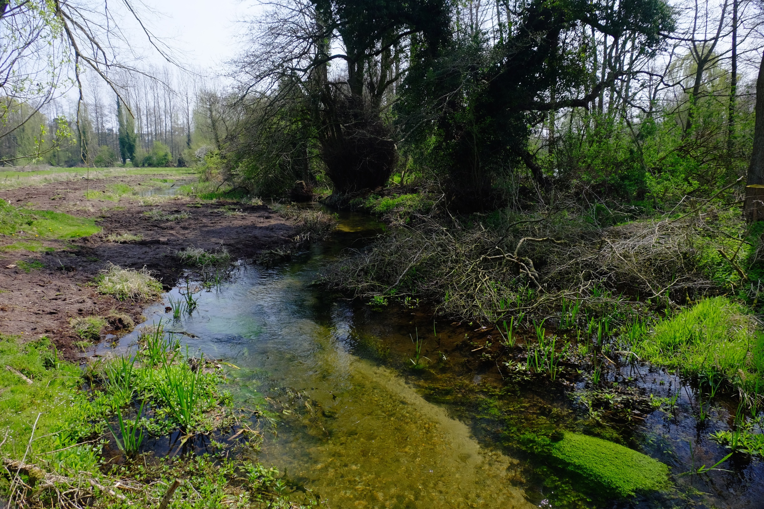
One large filled tree is visible in the distance, the other to the left of the shot. Ten years ago this reach was dead straight. The entire green bank on the left is new and the bend to the right is new. The same has happened in the opposite direction downstream of the lower tree.

DSCF5610
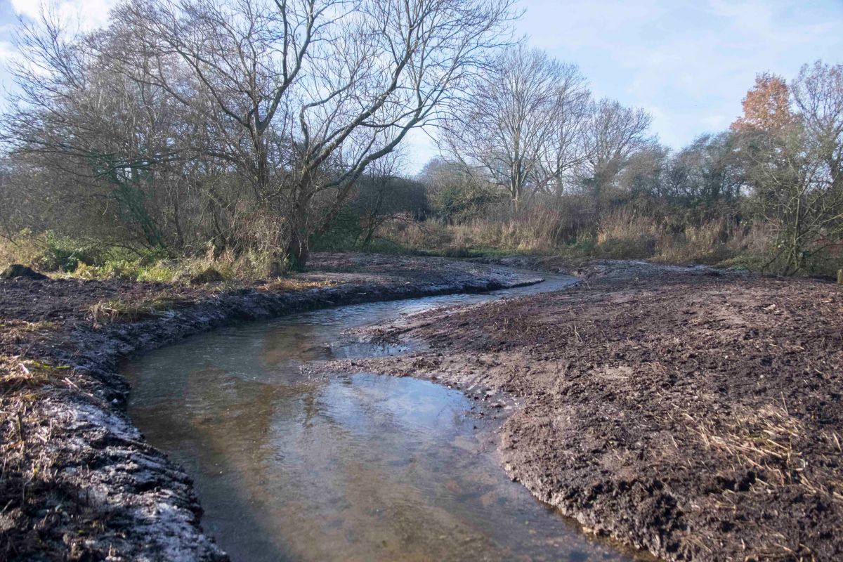
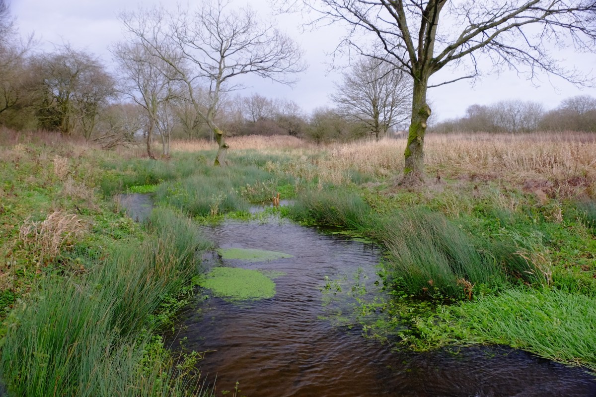
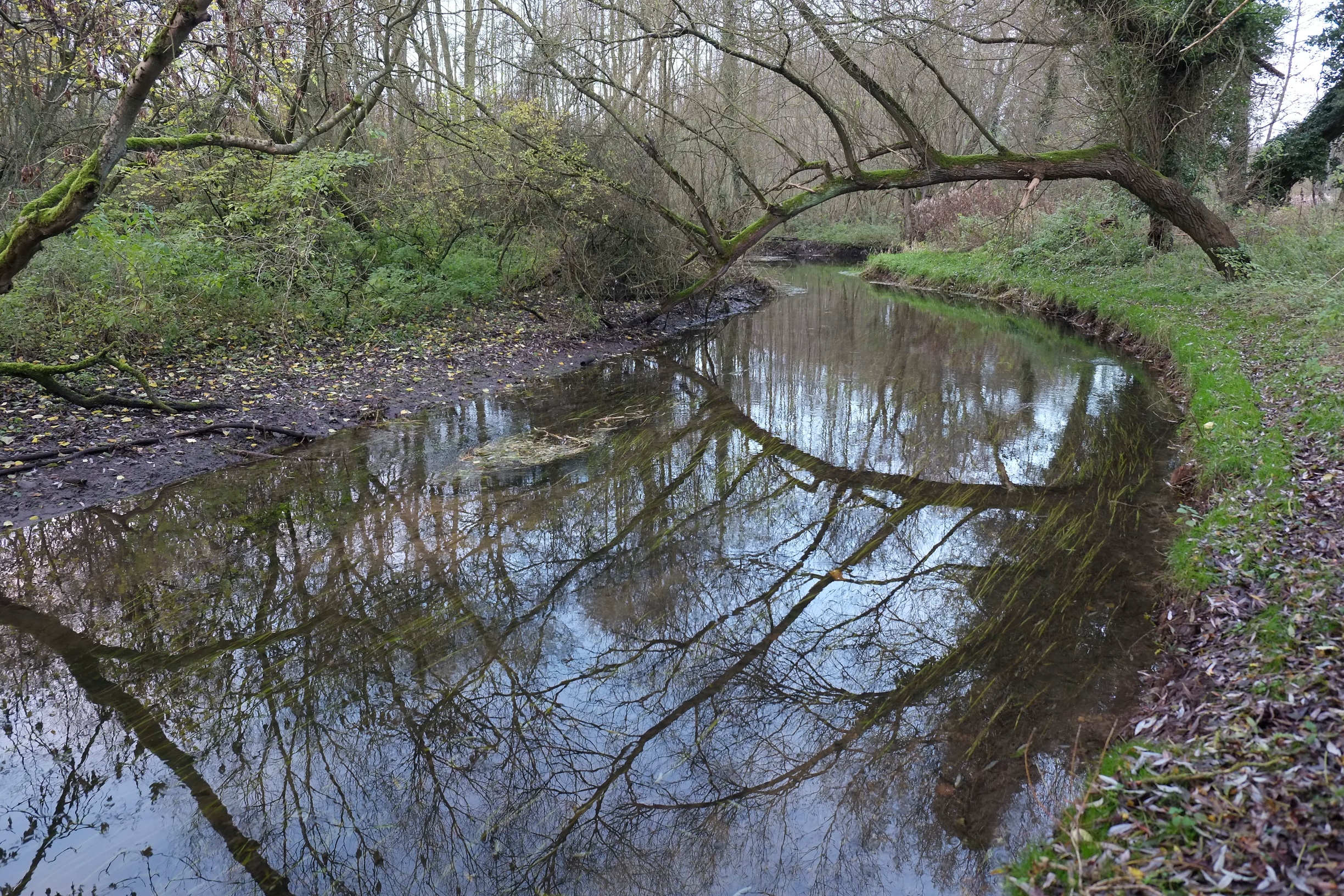
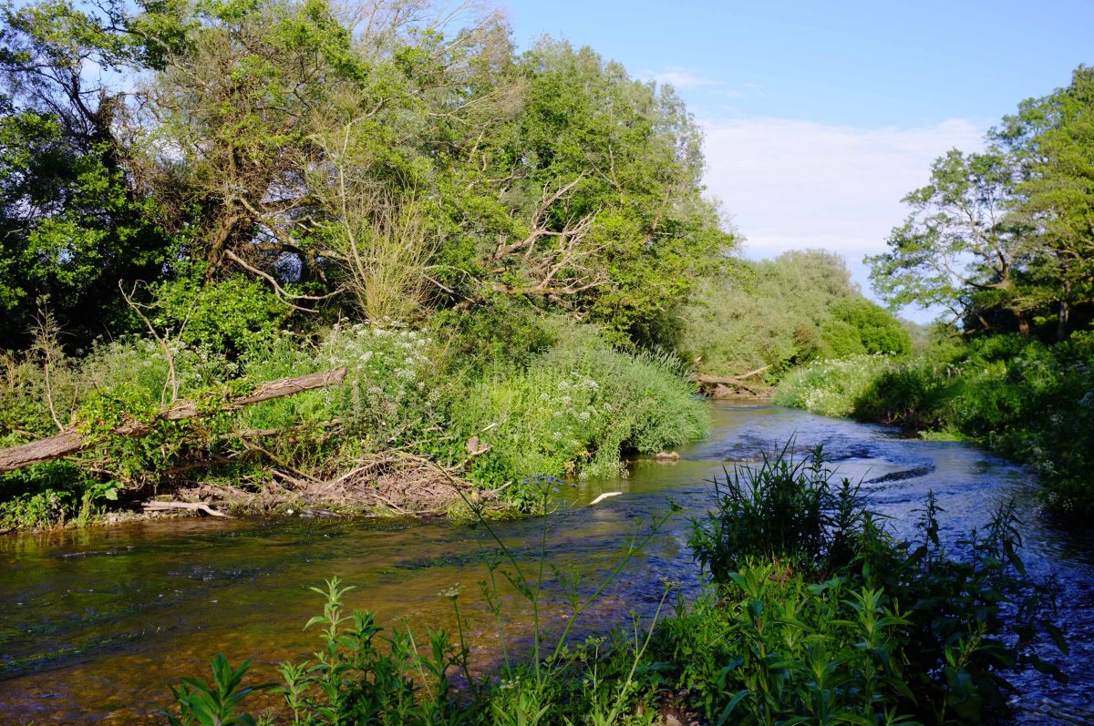
Looking upstream from the lower tree-fall. The vegetated island in the middle of the shot and the meander to the left were created by a single fallen tree upstream.

_DSF4388
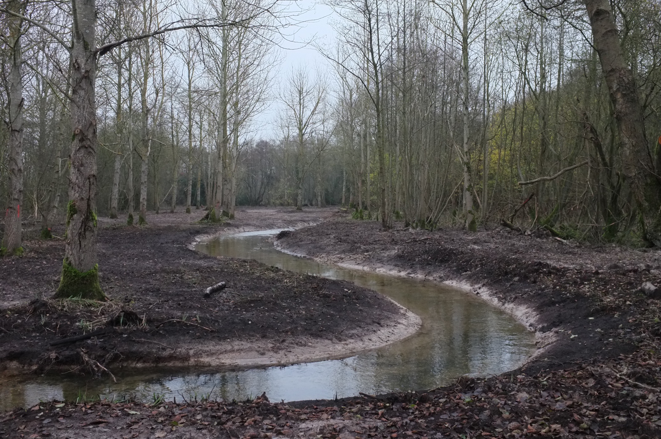
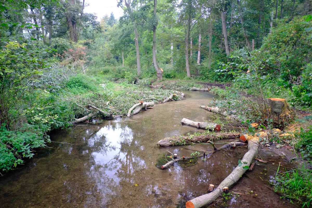
2013 when the lower tree fell in.

DSCF5327
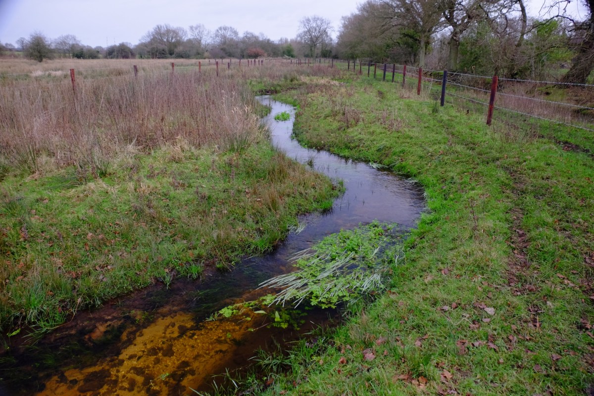
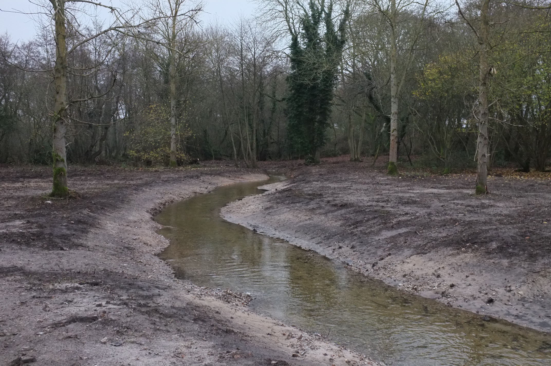
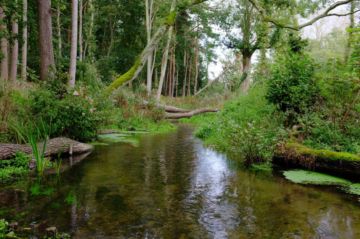
2014, one year later: we’re starting to see a braided channel, a deep pool, a meander.

DSCF6881
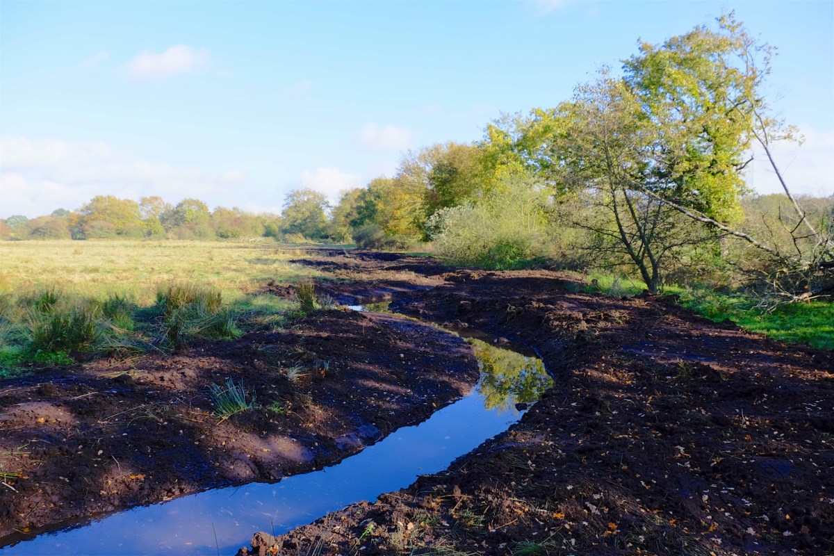
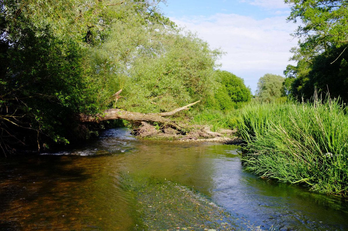
The third big fallen tree lies upstream of the island and gravel riffles which it created.

Since then three really big willows have fallen in. I have left them where they fell and watched what happened. Those willows have catalysed a whole sequence of channel repair, far better than any river restoration guru could ever have designed. The Frome is quite a powerful chalk-stream, so these changes have been on fast forward compared to gentler rivers, but even so they are extraordinary: hundreds of yards of re-meandered stream, of pool and riffle sequence, all catalysed by three fallen trees.

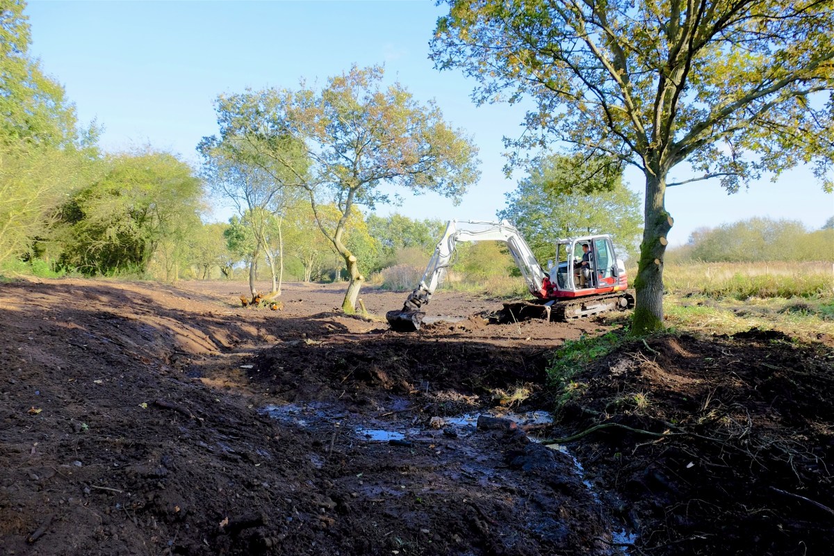
Those willows and many other instances where I have observed the aftermath of a natural tree fall, suggest to me that even now with LWD “restoration” we choreograph our work far too carefully. I’ve done it myself. In fact on the 7km LWD project I did with Simon Cain on the river Nar the work got more cost-effective, more natural and far, far more efficient as we progressed. To me good LWD imitates the impact of a fallen tree: it begins and ends with that.

_DSF4010Early phase of LWD work on the Nar: this was pretty good. It worked well but was quite intensive.

DSCF2512This was better! Less intensive, more natural, more cost-effective.

Another important learning curve has been where and when to use LWD. Basically there is a depth and gradient beyond which LWD doesn’t really work very well, at least from a morphological point of view.

LWD makes it best impact in relatively shallow, wide reaches, where the bed is more or less intact and where the river is not impounded. It is perfect for repairing an overwide river, but is not nearly so good at repairing a dredged river or an impounded river. In the latter two cases you need to resolve the river-bed and gradient issues first.

Do’s and Dont’s of LWD in chalk streams

• Don’t overly choreograph your LWD. Resist the desire to “build” something tidy or uniform.

• Look at and learn from natural tree fall and try to copy it.

• Use big timber, whole trees or very big branches.

• Work with the natural meander pattern of the river. Work out what the natural meander wavelength should be (see my other notes on this) and use LWD in sync with that, on the insides of bends or what will become bends.

• Think about daylight: the LWD will allow sediment to accrete in the slackened flow downstream. This sediment will only consolidate with vegetation and vegetation needs daylight.

• But don’t overdo the above. Rivers need shade too. Try to create a mosaic of light and shade.

• Be judicious about which trees you cut down. Alder is best. Willow can be great but is difficult to control later. Ideally you will have multi-stand alders and you can use some and leave others.

• Don’t expect LWD to do much in an impounded or overly deep river. Really you should remove the impoundment (weir or mill hatches) first. When you do you will have a fast flowing but overly wide and homogenous channel. That’s when LWD can work it’s magic.

Murray Creek. West Coast.
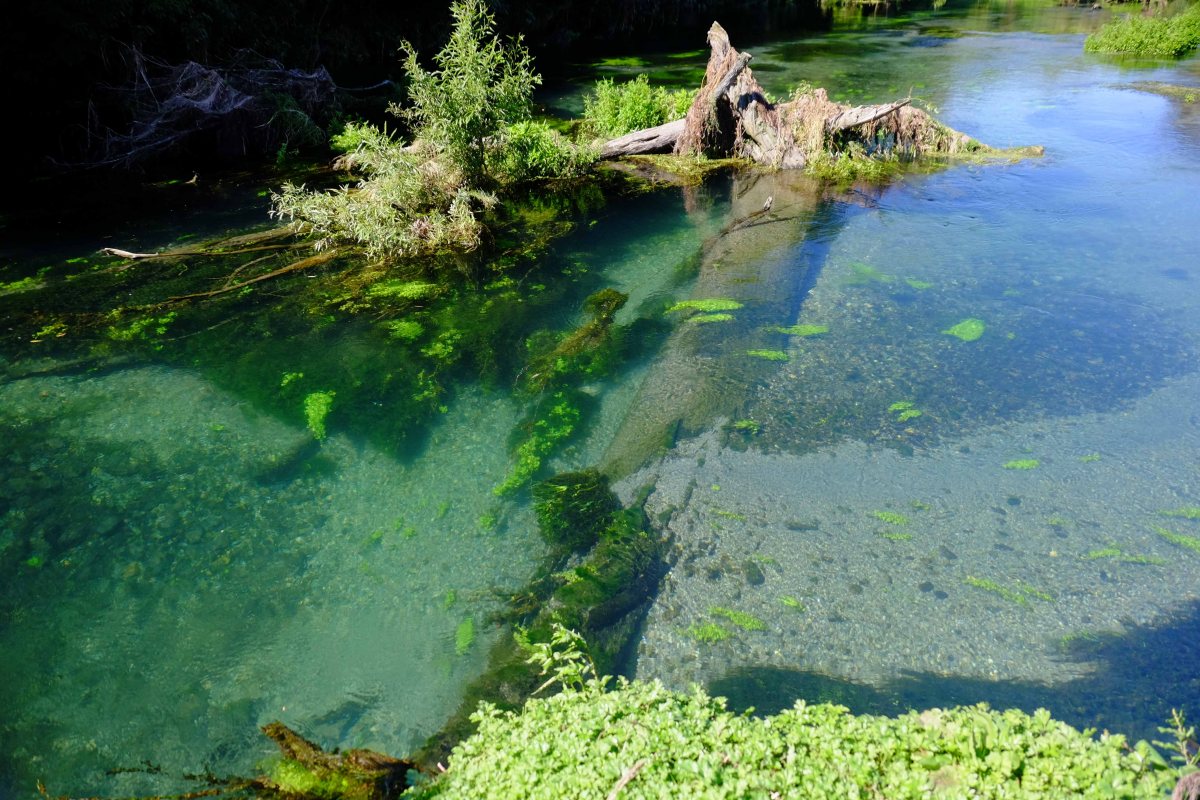
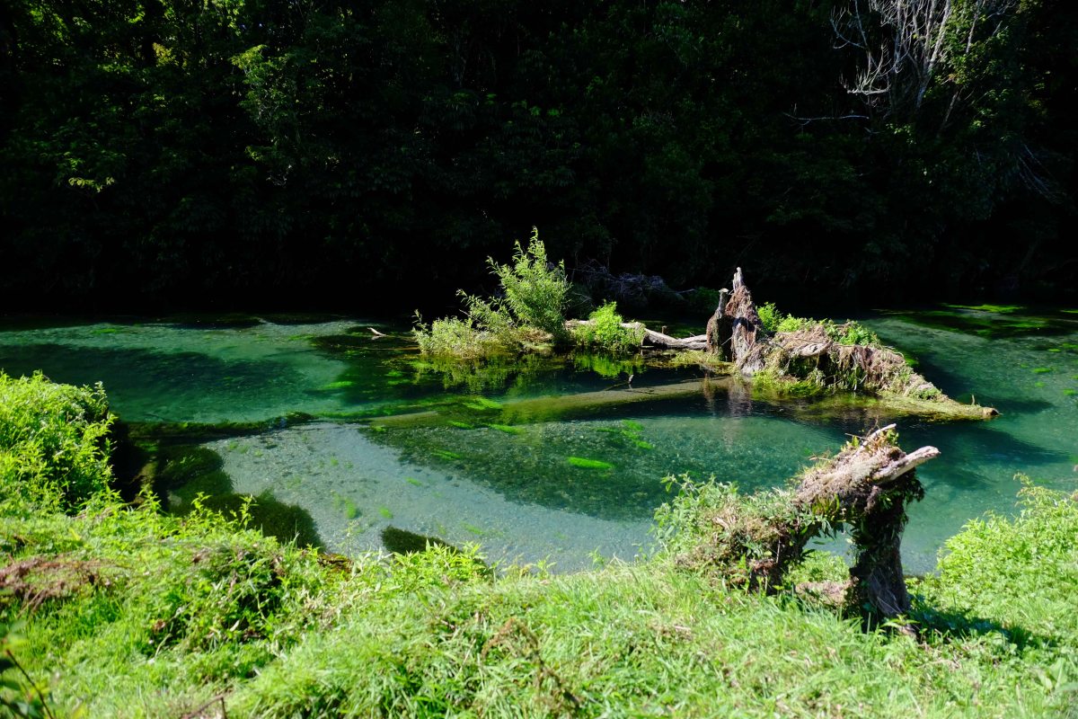
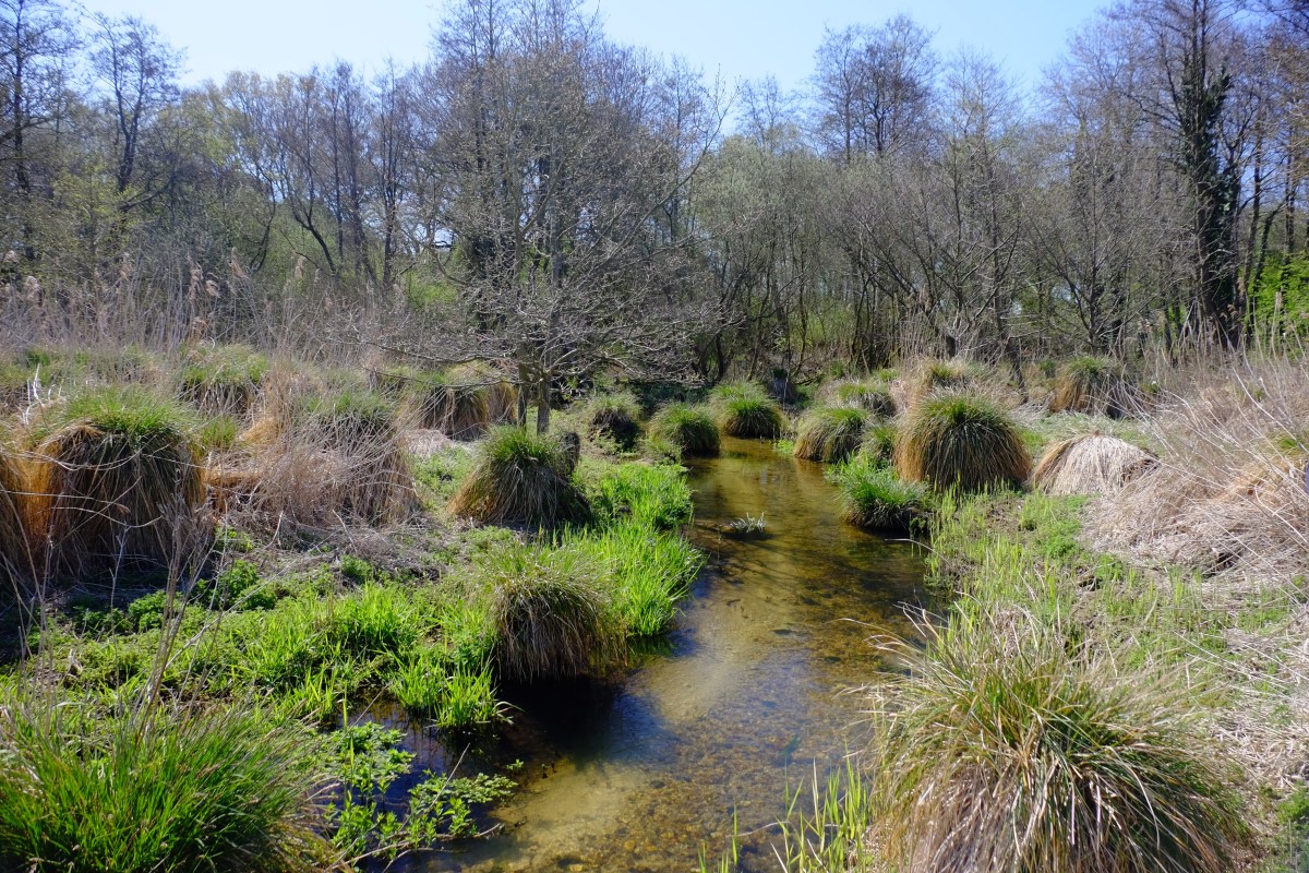
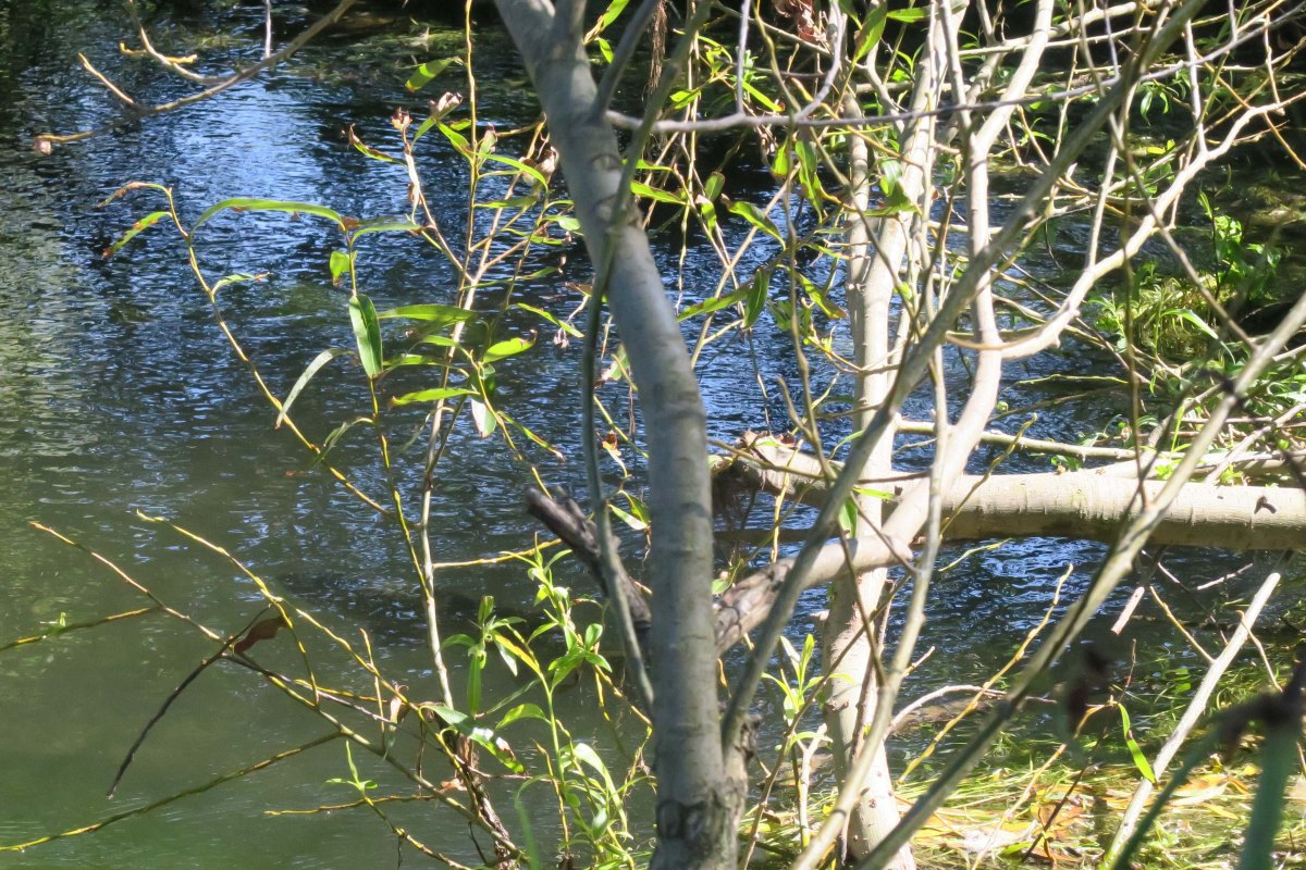
Natural LWD in a New Zealand spring creek: spot the trout within a fin-flick of tangled cover. Note in the pictures below how the really big LWD has shaped the channel. It’s like this the whole way up the river!

DSCF7140

DSCF7141

Minn’s Meadow – putting the gravel back

Minn’s Meadow was our attempt at finding a way of properly fixing the dredged parts of the river. Because dredging is the most fundamental and widespread way in which chalk-streams have been damaged, I’m really interested in what we can do about it.

Here we have taken the gravel from borrow-pits beside the river and restored long riffles in sync with the meander pattern of the river. The borrow pits were filled back in and have settled into flood-plain hollows that imitate old oxbows and have a nice side-benefit of wetland habitat. There were quite a few snipe hanging around them in the winter.

It was also nice to see that the riffles were used by spawning trout (and sea-trout) within a month of going in. I feel the fact that the gravel was ungraded and from the floodplain beside the river might well have influenced how readily it was adopted by spawning trout.

Here’s a few before, during and after photos. Before we started all the gradient in this meadow was lost over the first few yards, whereafter the river was deep and sluggish. Now we have spaced the gradient out of a series of riffles with natural shapes and spacings. It is great to see patches of ranunculus growing where there was only eel-grass.

_DSF5252
Here the channel is too wide and deep. The bed is silty and supports mostly eel-grass.
DSCF6193-2
We filled the channel in with a long riffle (half-a-meter depth of infill) and afterwards narrowed with plugs of canary sweet-grass taken from the meadow.
DSCF6935
Six months on, the banks are recovering, the gravel is clean and we have ranunculus and starwort.
_DSF5254
The same reach as above but looking from the top down. Total project length was 650 meters.
DSCF6196
Immediately after.
DSCF6937
Six months on.
DSCF2549
This was taken last autumn after we cut through the burr-reed to release the flow. Before that the channel was invisible!
DSCF2626
The same reach after the gravel went in. A large sea trout spawned here a few weeks later.
DSCF6951
The same reach in May this year. A much shallower and tighter channel will keep the burr reed to the edges and support ranunculus – which is starting to appear in patches.


Where Have All Our Rivers Gone?

DSCF1154

Two weeks ago WWF called and asked if I would get them some new pictures of drying chalk-streams. They wanted to update the campaign we started several years ago, “Rivers on the Edge”. The pressure exerted by people on our natural resources is well illustrated in the quiet and mostly ignored death of a chalk-stream. How we build our world to allow room for nature and people could not be more relevant. But memories are so short: if it’s raining outside there’s no point talking about a drought or drying rivers, just as if it’s not raining there’s no point in talking about upland land-management and flooding! Photographs are sometimes all you have the keep the argument alive. Here’s a link to the album of images.

I have in my bookcase a 1946 series of OS maps that show the open countryside, small market towns and blue ribbons of chalk-rivers around north and north-west London: rivers that were once famous for their trout fishing and wildlife. Now the landscape is very different: Hatfield, Stevenage, St Albans, Welwyn Garden City have grown like spots of mould on jam, merging at the edges to become one unbroken belt of semi-rural suburbia. The chalk-streams that thread through them are hardly there anymore. Almost everywhere I stopped on my Dante-esque tour trying to photograph an absence (of a river) the most palpably present thing was a pumping station. You wouldn’t notice them till you start looking. When you do they are everywhere: eyeless brick huts, with bolted iron gates and a water company sign warding off trespassers … which is ironic given how the tendrils beneath each apparently innocuous building are trespassing way beyond their surface boundaries.

DSCF1276

No-one realised in the 1940s and 50s, when these pumping licences were issued that the chalk aquifers were not infinite. Nor quite how far and how fast the population of south-east England would grow. People have to live and their water has to come from somewhere. Chalk aquifer water is pure and cheap …. so long as you don’t count the cost illustrated in the photographs I took.

DSCF1328

A few years ago when making a short film about these drying rivers for WWF, I asked everyone I could about what their local river meant to them and how they would feel if it dried up because of public water-supply abstraction. Universally the thought was an abhorrence. Rivers are cathartic and life-giving, places to relax and unwind and enjoy some peace and quiet or to play with the kids or the dog. Not around the Home Counties they’re not. To be clear: without abstraction chalks-streams like the Chess, Beane and Mimram would not dry up for mile after unbroken mile … even in a drought. They are not winterbornes, except in their very headwaters.

The only way out of this singularly silent natural disaster is to count the cost to nature of the water we take so cheaply from the ground. The government and OFWAT must allow / compel water-companies to develop alternative sources and we must stop using water without a thought for where it comes from.

DSCF1267

Emmanuel’s Common Phase 2

Here are a few pictures of the second phase of our Emmanuel’s Common project in Norfolk.

Just under two years ago we took the River Nar out of an old mill leat and reunited it with about 500 meters of relic meander that had been left, unfilled and unploughed, on the flood-plain. Over an additional 250 meters of that project, we created a replica ‘paleo’ channel based on the cross sections of the natural meander pattern upstream. I wrote all about that project here.

dscf7435
The uncovered natural channel from Phase 1.

This last three weeks we have been working on the second phase. The first 125 meters formed a continuation of that replica channel, alongside the old channel. In the lower 250 we re-filled the existing river with gravel (dug on site) up to the correct line of bed-level slope. The bed level was set to coincide with the river bed as I had set it at the tail of the first phase and two more undredged crests of gravel downstream.

In one spot half-way down some where power lines crossed the channel we had a useful reference section because no dredger had ever gone near it. Interestingly this was the one section of the river that never blocked with weeds. For 50 meters we had clear gravel and patches of starwort, ranunculus etc.. Upstream and downstream were an unbroken jungle of burr reed. Proof if ever it were needed that dredging does the exact opposite of what you think it is going to do!

img_2781
Under the power lines: never dredged and therefore an open, free-flowing channel.
img_2783
The same place but looking upstream at a dredged reach.

So the new channel came back in to the old just upstream of the undredged natural reach. Beyond the natural reach we brought the channel back up to the natural bed-level by filling in with about 30 to 40 (50 in places) cm of gravel which we took from borrow pits on the flood plain. We took the project down as far as a second undredged crest of natural bed level. I’ll post more pictures in a year’s time.

dscf6338
This reach required 30cm of infill.
dscf6290
The same reach looking downstream.
dscf0765
Replica ‘paleo’ channel.
dscf0755
This reach was severely dredged and required 50 cm of infill.

Before and after.

DSCF1349

Having finally uploaded a few recent shots of river restoration projects I’ve put together a small album of before and after photos of our work on the River Nar. I am endlessly amazed by how quickly a river can recover from ‘surgery’ and then respond to a few straightforward interventions.

Click here to see the album.

An alternative to dredging?

I’ve written about why dredging doesn’t work. Here’s a post about an alternative approach: a “re-wilding” project on the River Nar which I recently designed for the Norfolk Rivers Trust. For the installation work we worked with Five Rivers.

The River Nar is a chalk-stream, so it doesn’t flood with anything like the ferocity of those rivers now raging in the north of England. Even so, the principles of what we did here apply anywhere.

Back in the Napoleonic era French prisoners-of-war changed the upper River Nar from a meandering wetland, spring-creek into a drainage ditch. They straightened it and entrenched it deep into the land. They did this to drain what was a naturally wet, spring-soaked landscape and turn it into more useful agricultural meadow: to take water away more quickly.

IMG_9951
The Napoleonic ditch – arrow straight and entrenched by over a meter into the flood-plain. Flowing hard after rain …
_DSF5326
… and almost dry after a few weeks without rain: showing that, if you furrow a floodplain with ditches you make it less able to hold water.

Some time later the valley above the natural head of the river was also drained in much the same way. This time, instead of entrenching a river, the drainers cut a deep furrow into the wet ground in the hollow of the valley and created a few extra miles of running ditch.

IMG_9937
A headwater ditch, draining the landscape above the river.

Chalk-streams are naturally very equable: because the chalk hills that surround them are absorbent the rivers should not respond that quickly to rain and naturally take much longer to dry or run low when there’s no rain. But this drainage work turned the River Nar into a “flashier” stream, flowing off quickly when it rained and drying up quickly when it didn’t.

This is an example of what we have done to our landscape everywhere. Even relatively impervious catchments (with harder rocks than chalk) like the ones in northern England were once far more absorbent, capable of holding more rain than they can now, meaning that their rivers responded more slowly to high rainfall, with softer rises and falls, and with lower peaks and higher troughs of flow.

With the Norfolk Rivers Trust and sponsored by WWF UK and the Norfolk Rivers Drainage Board I have been working on a project to ‘re-wild’ parts of the upper River Nar, re-creating the lost, meandering channel, raising the water-table and reuniting the river with its flood-plain.

Untitled
Part of the plan for the re-wilded river: the old ditch is red, the new stream is blue.

The photos below cover only a 1.5 km section of the river … but if the water-table is now 1 meter higher than it once was and the flood-plain is a couple of hundred yards wide it doesn’t take a genius to appreciate how the aquifer is now capable of storing much more water.

To say nothing of how the river channel is now about 50% longer and has a channel shape that allows excess flows to spill over the lower banks into a wider high-flow channel and finally – when flows are really high – across the flood-plain itself.

The flood-plain is the natural relief valve for a flooding river. It is empty of water until the time it is needed, it can absorb a massive amount of extra water (thousands of times more volume than a dredged channel) and it drains slowly, taking the dangerous peaks off heavy flows downstream.

The answer to flood management is to re-discover our flood-plains, and incentivise farmers to facilitate a more enlightened approach system of flood-water management.

DSCF5546
The new “re-wilded” stream is dug.
DSCF7324
After rain in mid-winter.
DSCF9178
One year later. Looks like it’s been there for ever. Which it has, apart from a 200 year interlude in a ditch.
DSCF5597
Late autumn 2014. The old ditch runs along the tree-line to the right.
DSCF9173
Same view December 2015.
DSCF0377
After heavy rain winter 2014 – holding water the old ditch sent downstream in a hurry.
DSCF9182
Winter 2015. The new stream crosses the line of the old ditch, but one meter higher, looking like a stream again and re-united with a functioning flood-plain.

Emmanuel’s Common One Year On

This is a set of before-and-after images from a river recreation project at Emmanuel’s Common on the River Nar. 

This is a brand-new river channel cut to connect a restored set of natural meanders (pictured above) with the main river. These pictures are taken more or less one year apart, immediately after the project was finished last winter and on 26th December 2015.

The new channel is full of brown trout and all the in-stream and riparian plants – including good stands of ranunculus and starwort – are self-sown. For more details see the link at the foot of the page.

DSCF9204

DSCF0205

DSCF9193

DSCF5661

DSCF9196

DSCF5667

DSCF9202

DSCF0208

DSCF9200

See also: Emmanuel’s Common Project Report


7 km of woody debris

So far …

7km of re-meandering with woody berms, 2km of re-discovering and tracing again the course of the old river, and 500 meters of re-uniting the flow with a long-lost channel and in so doing re-creating a little bit of the post-glacial river all these works have been designed to imitate. The work (in catchment terms) is not over, but it is time for a brew perhaps.

_DSF4437
Before.
DSCF7403
After.

This final phase was a highlight because for a short reach (about 500 meters) we were able to re-shape those hideous levéed banks built up by years of dredging and re-create the flat riverside flood-plain and soft riparian margin that is the life-system of a ‘natural’ chalk-stream. Elsewhere the woody berms are accomplishing the same trick within the confines of a steeper-edged and relatively immovable modified channel. But here we had room to move. There were no gas-pipes, no ancient priories, no invaluable trees, no mill-leats or water-meadows. It was so satisfying to rebuild those meanders and to watch the landscape open up again.

The pictures below tell a better story than words can. Notice the steep, and soullessly straight near-side bank in the earlier images, the trough-like channel that has been dug far too deep and the extent of over-shading in a man-made woodland that had gone feral.

The three phases of the work therefore tackled each of these issues in turn. Selective felling and thinning opened holes in the leaf canopy above. The felled trees were arranged to create berms on one bank or the other, easing the river into the meander pattern that it would otherwise have spent the next few centuries re-creating, and finally the levées were regraded down into the berms along the near-side bank, leaving those on the far bank to work as sediment traps which will accrete over the next few years to become new river banks. 

This last phase was a Norfolk Rivers Trust project, sponsored by the Catchment Restoration Fund (now over – will it ever return?) with the works designed and installed by myself and Simon Cain, and the final re-grading efficiently delivered by Jason Lovering. Thanks also to the Helen Mandley, to Tom Moore, our vole monitor (BASEcology), Giles and the IDB, Hannah and Natural England, Jo and Holkham Estate, the Castle Acre Fishing Club.

_DSF4439
View 1 before
DSCF7407
View 1 after
_DSF4442
View 2 before
DSCF7411
View 2 after
_DSF4446
View 3 before
DSCF7414
View 3 after
_DSF4447
View 4 before
DSCF7378
View 4 after

Chalk-Stream Index 2014

I recently compiled my best attempt at a complete index of all the English chalk-streams, partly to satisfy my own cataloguing obsession, partly because it was needed for WWF’s new report State of England’s Chalk-Streams 2014.

I’m often asked “What is a chalk-stream?” It is a difficult question to answer quickly. Chalk-streams are created by geology, the geology of England is complex and chalk-streams vary so much in character.

I worked on this index with Dr Haydon Bailey, a geologist with a keen interest in chalk, and we have started to sketch out some geological categorisations that help to shed light on those differences and show that what we have, in reality, is a spectrum of pure chalk-streams and chalk-influenced rivers.

In time I will work this index into a series of catchment-based maps, which will include those geological sub-categorisations on which Haydon and I will do more work.

The index is certainly not complete. Already I have been promised updates for Buckinghamshire! Please send feedback to me at the contact email on this blog and I will include corrections and additions and credit the contributors.

In the meanwhile, I hope this index proves a useful resource for those who are interested in the conservation of English chalk-streams.

To make sense of the lay-out, please read the notes on the lay-out at the head of the index.

It is available to view here: